 
|
|||||||||||
This is a small selection of our inventory of antique Africa maps & prints. Additional inventory is available. Contact us with your request. 1-800-879-6277
|
|||||||||||
|---|---|---|---|---|---|---|---|---|---|---|---|
 000afrc: Caravan in North East Africa (Nubia) - This is a rare chromolithograph by Adolbert van Barnim showing the Hartmann's Expedition to the Nile. Image features dramatic scenery and camels racing. Fine condition. 18 x 12-1/2 in. $300 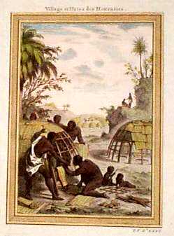 001afrc: 1754 Bellin Print of Africa Natives. This beautiful copper-engraved print of native Africans was published in 1754 by Jacques Nicolas Bellin. The print shows what Bellin considered to be a typical scene in African life. It is titled "Village et Hutes des Hottentots." It shows several men building a small house, with two small children playing nearby. The print is hand colored, and it is in excellent condition with no tears, stains or other blemishes. It would look fantastic in a frame! Size is 7"x10". $60  003afrc: 1862 Johnson Africa Map. Large scale hand colored antique map. Inset map of St. Helena, with inset engraved views of Cape Town and Port Natal. 18x26 $100 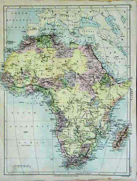 005afrc: 1878 Africa Map. Hand colored map from Britannica, 1878. Genuine antique. 10-1/2x14-1/2 in. $40 
007afrc: 1884 Bradley Africa Map. Excellent hand colored antique map, with inset maps of St. Helena Island, and the Nile Delta. 22x15 in. $80  009afrc: 1862 Johnson Africa Map. Large scale hand colored antique map. Inset map of St. Helena, with inset engraved views of Cape Town and Port Natal. 18x26 $100 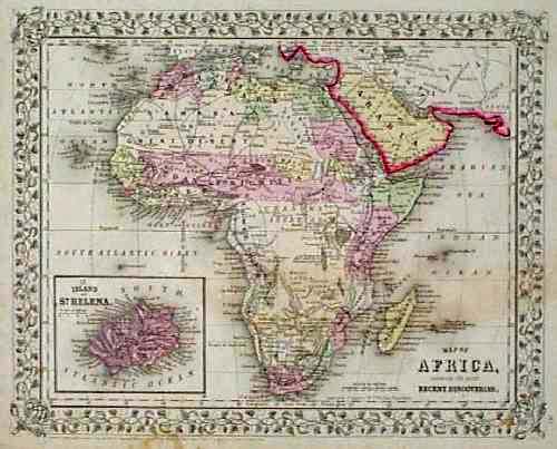 101afrc: 1866 Mitchell Map of Africa. Engraved, hand colored map of the African continent from S. Augustus Mitchells world atlas of 1866. Cities, major roads and geographical features are all shown. The interior of the continent is labeled as "Unknown Interior." A small inset map of the island of St. Helena is in the lower left corner. 12x15 in. $80 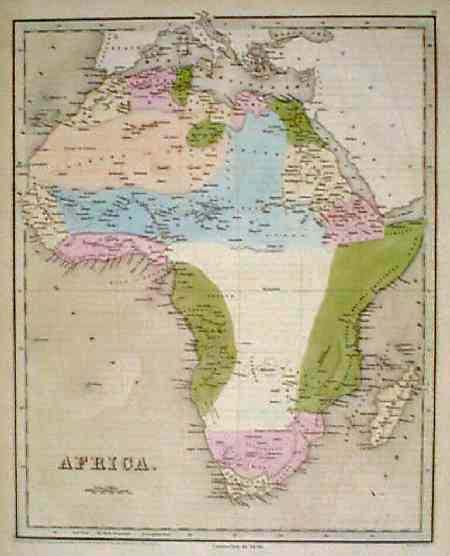 102afrc: 1838 Bradford Map of Africa. Fascinating map, with original hand coloring, from T.G. Bradfords famous world atlas of 1838. This map is from the 1846 printing of the atlas, and the phrase "corrected to 1846" appears below the bottom border. Regions throughout the continent are colored separately. Cities and geographical features are shown primarily along the coasts. The interior is almost completely blank, because Europeans had not yet explored those areas. $300  127rare: AFRICA. 1790 Bonne Le Canal de Mosambique , L'Isle de Madagascar. Watercolor copperplate engraving on handmade rag. Excellent condition. 14.5 x 10" plus margins. $150 |
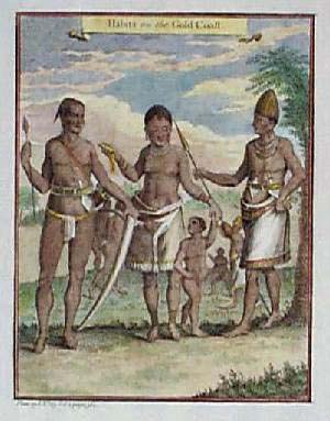 104afrc: 1753 Natives on Gold Coast of Africa. Hand colored copper engraving, printed on hand laid paper in 1753 as an illustration to a book. Title of the scene is "Habits on the Gold Coast." Four African natives are shown, wearing traditional dress. 9x15 in. $75  203afrc: Antique Africa Native Music Scene: 1746. Beautifully engraved image, printed on hand laid paper in 1746. Title is "Negros Playing Upon Kalabasses." On the left side, a man is playing music by rubbing a stick against a hollow gourd. A woman on the right is dancing, and playing a tambourine. This item is in excellent condition. The original mark from the copper printing plate can be seen around the image. 8x13 in. $120  207afrc: 1650 Views of West African Coastline, by Kip. Two hand-colored, engraved views by J. Kip, showing scenes on the Western coast of Africa. Location is not clear; probably in the vicinity of Ghana. Published circa 1650. Top view is titled "The Prospect of Little Comendo." Bottom is titled "The Prospect of the Town and Castle del Mina, Being at NNE about 2 Miles." Excellent condition. 13x15 in. $150  208afrc: 1650 West Africa Coast Scene, by Kip. Hand-colored, engraved scene by J. Kip, titled "The Prospect of the Fort St. Anthony at Axim." Shows a view of the fort as seen from the water, with small villages in the background. Location is on the Western coast of Africa, near Accra in Ghana. Excellent condition. 13x15 in. $200 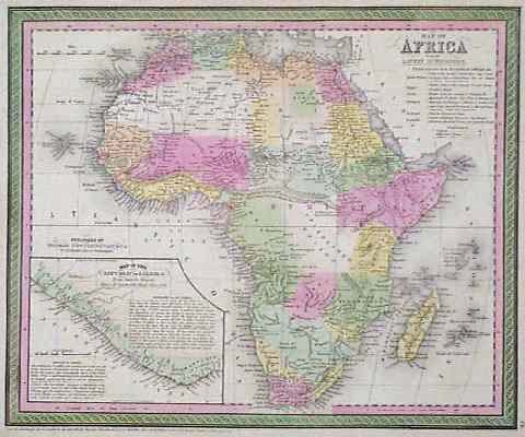 212afrc: 1850 Cowperthwait Map of Africa. Beautiful, engraved map, with original hand coloring, published in 1850 by Thomas, Cowperthwait & Co. The continent is divided into European colonies. A key in the upper right corner lists the names and African possessions of the European colonial powers. In the lower left corner, there is an inset map of Liberia with descriptions of its geography and history. Excellent condition. 13x17 in. $100 SOLD 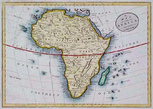 213afrc: Fascinating 1812 Map of Africa. Hand colored, engraved map of the African continent, published in 1812 by an English cartographer. Title is "A Map of Africa, from the Best Authorities." The continent is divided into five large regions: 1) Sarra or the Desert; 2) Negro Land; 3) Lower Ethiopia; 4) Upper Ethiopia; and 5) Cafreria. Smaller divisions within the region are also shown, as well as cities, rivers and mountains. 9x14 in. $150 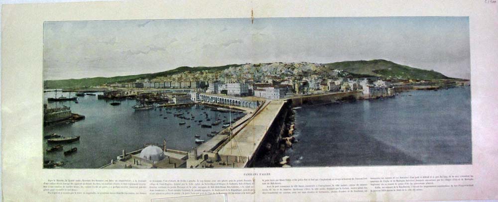 071mide: Algiers - Panrama City View featuring a lengthy description written in French. Fine condition. Hand colored half-tone engraving. C.1900. 23 x 9 in. $40  214afrc: Very nice hand colored lithograph from 1861. Plantations de Musa Ensete en Abyssinie. Very nice print of a Banana Plantation. 4.5x6.5 in. $30  215afrc: wo part map of Africa. Beautiful hand colored map, published in 1854 by A & C Black. Upper portion titled, Africa, North Part. Lower portion titled, Africa South Part. 12.5x17 in. $50 |
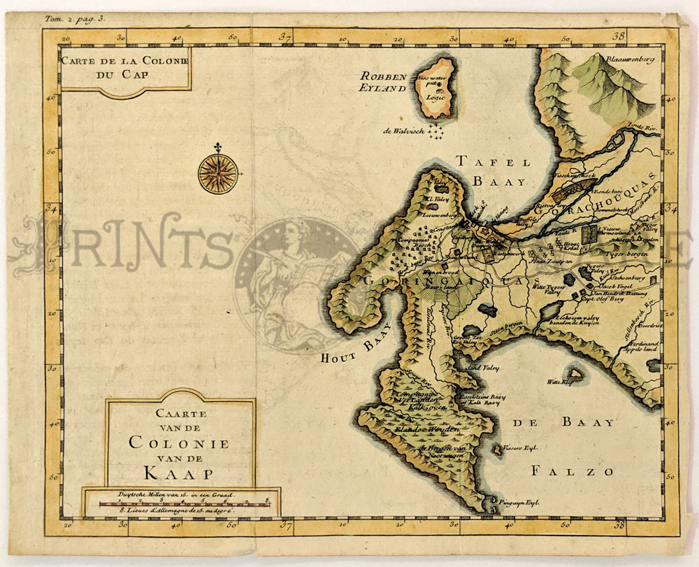 223afrc: South Africa, Cape of Good Hope, Kolbe 1727. A small and rare original hand colored engraved map of the Cape of Good Hope, noting early Dutch Settlements, Caarte Van de Colonie Van de Kaap, by Karl Kolbe. Finely detailed showing de Bay Falzo, Hout Baay, Tafel Baay and early houses of Cap. Olof Berg, Jacob Vogel, Jan Hattung along the Kuil River, and Robben Eyland. Good condition, some folds visible, slight tear on a bottom margin, small margins all around. 6.5 x 7.5 in. $400 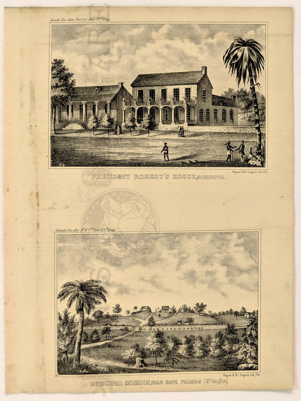 224afrc: 1854 Liberia – American Colonization Society. Mornovia. President Robert’s House and Episcopal Mission near Cape Palmas. Lithograph. 7 x 11 in. $60 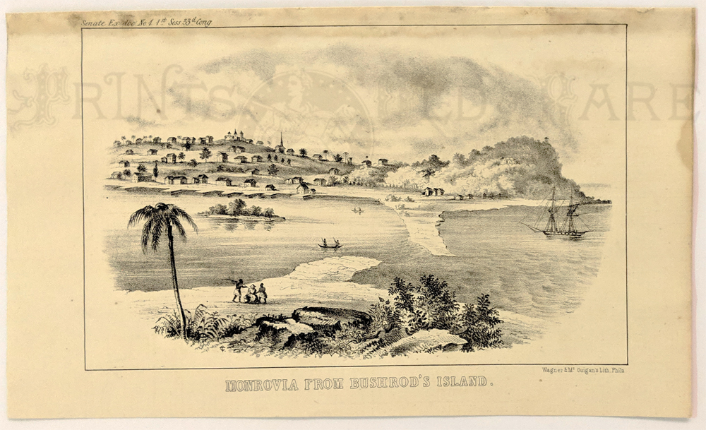 225afrc: 1854 Liberia – American Colonization Society. Monrovia from Bushrod's Island. Lithograph. 5 5/8 x 9 1/2 in. $60 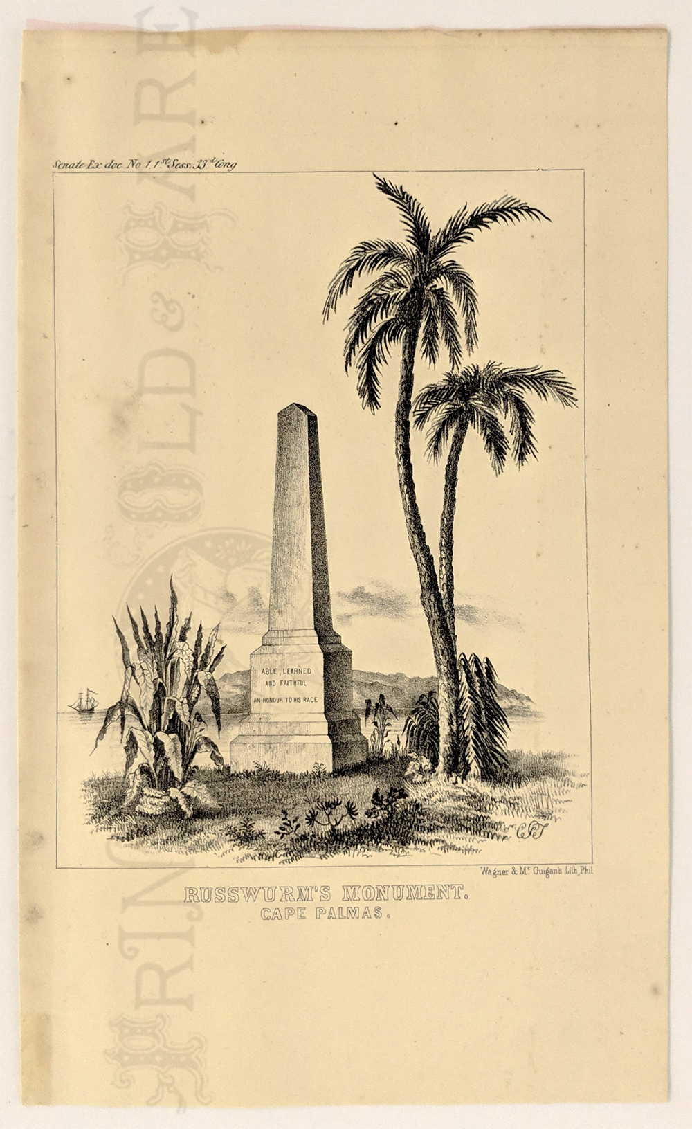 226afrc: 1854 Liberia – American Colonization Society. Russwurm's Monument. Cape Palmas. Lithograph. 6 1/4 x 10 1/4 in. $40 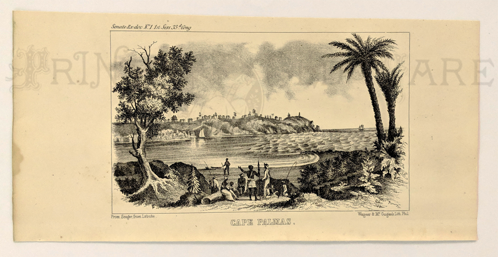 227afrc: 1854 Liberia – American Colonization Society. Cape Palmas. Lithograph. 5 x 10 1/4 in. $60 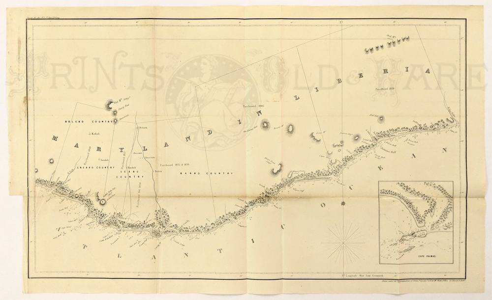 228afrc: 1854 Liberia – American Colonization Society. Cape Palmas. Lithograph. 5 x 10 1/4 in. $60 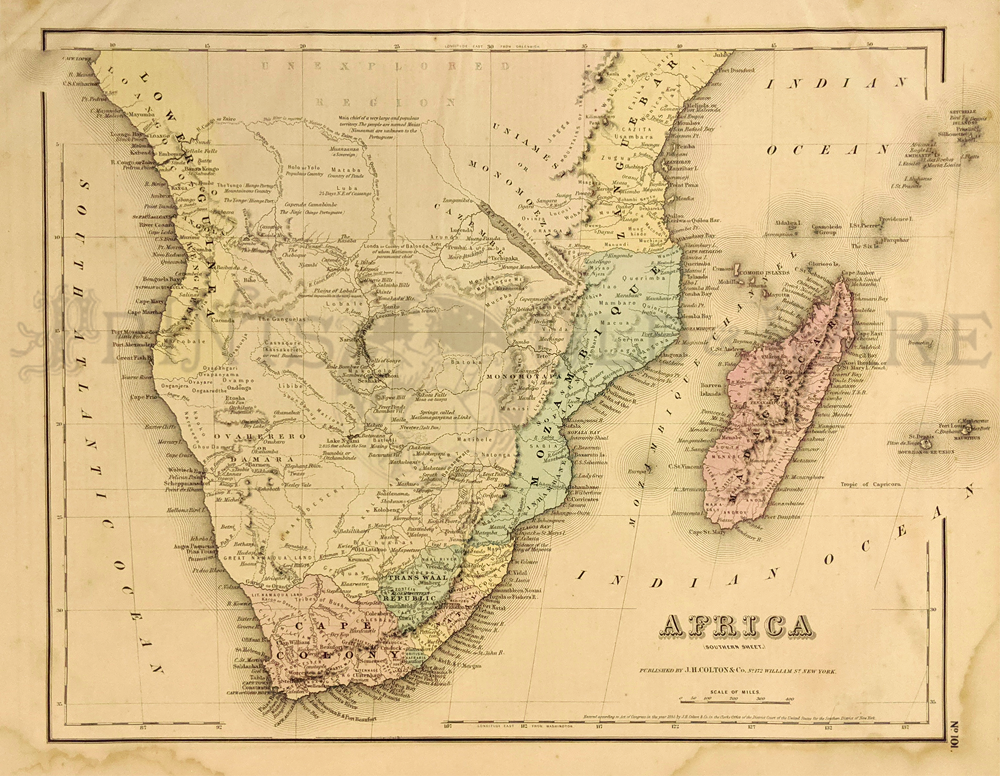 229afrc: Africa (Southern) 1855 Colton. Cape Colony, North to vast "unexplored region." Shows coastal regions of Langban, Mozambique, Lower Guiena, Ovaherero Damara. Fine condition. Hand colored, lithograph. 14 x 17 in. $60 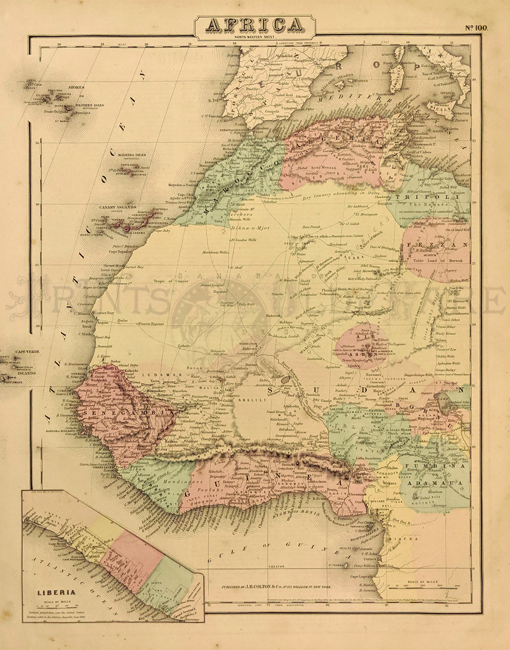 230afrc: Africa (Western) 1855 Colton - from Marocco, Algeria in North to Gulf of Guinea in the South. Inset of Liberia. Lots of detail. Fine condition. Hand colored, lithograph. 14 x 17 in. $60 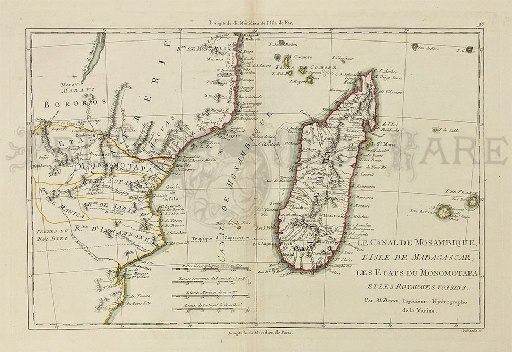 231afrc: 1790 Africa Map. Bonne Le Canal de Mosambique , L'Isle de Madagascar. Watercolor copperplate engraving on handmade rag.Excellent condition. 14.5 x 10" plus margins. $150 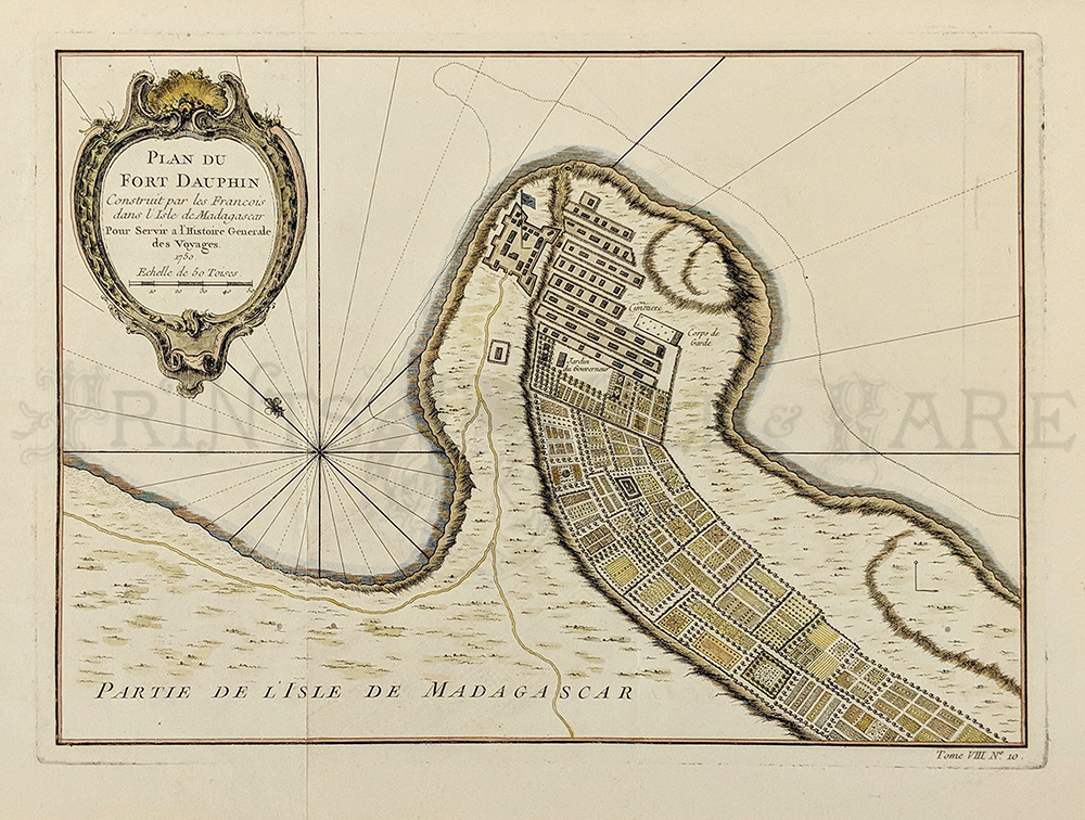 232afrc: 1750 Madagascar. PLAN DU FORT DAUPHIN, Construit par les Francois dans L' Isle de Madagascar, Pour Servir a l' Histoire Generale des Voyages. Partie De L' Isle De Madagascar. Tome VIII., No. 10. French hand colored copper-engraved antique map with a thin black and orange-lined border inexcellent condition. 10x15in. $150 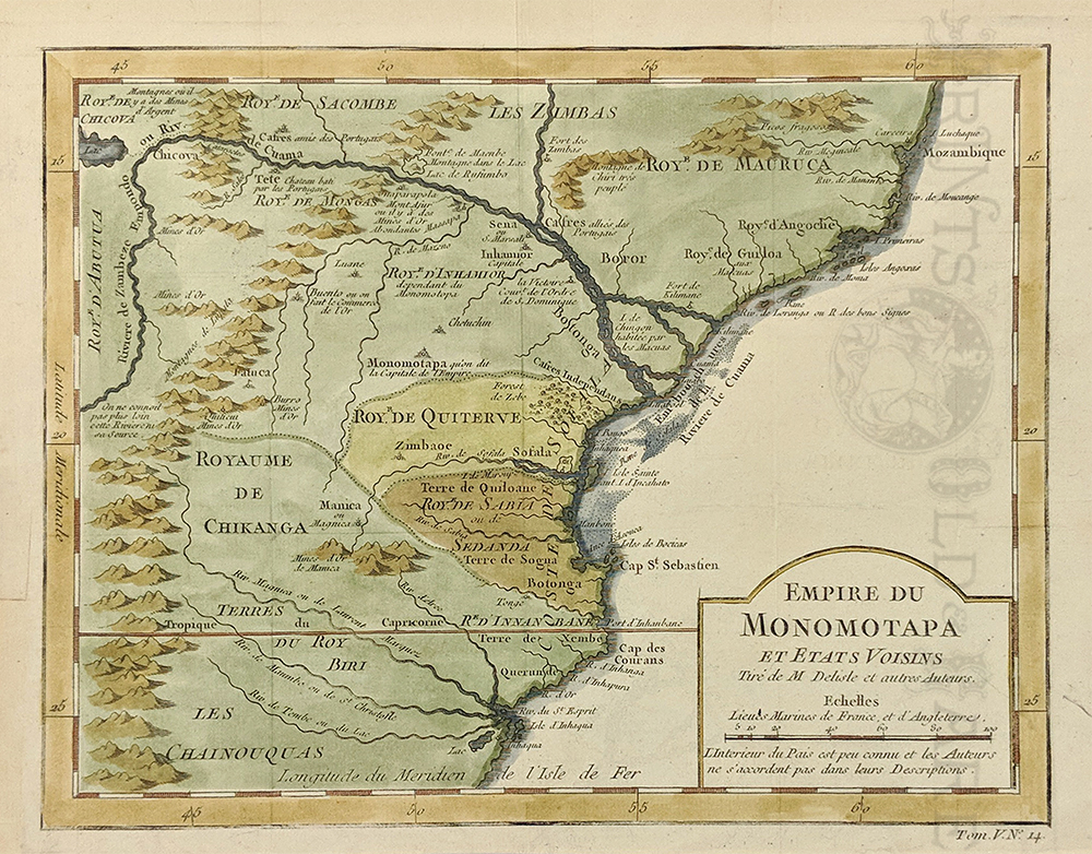 233afrc: 1754 Africa. Empire Du MONOMOTAPA Et Etats Voisins, Tire' de M Delisle et autres Auteurs. Tom. V. No. 14. French hand colored copper-engraved map in excellent condition with thick shaded border. 9x12 in. $150  234Africa: Madagascar, 1890. Market scene. Hand colored, wood engraving. 9 1/2" x 14" in. $80 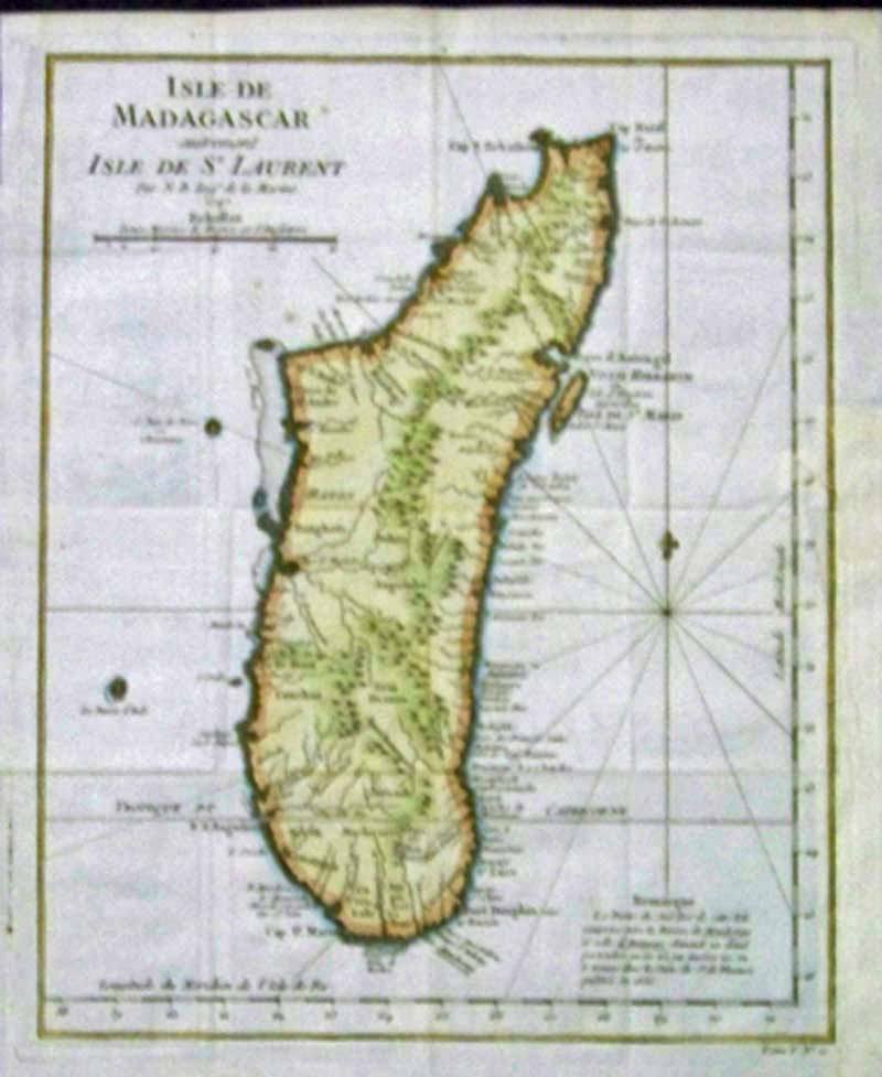 218afrc: 1747 Hand color copper engraved map of the Isle De Madagascar autrement Isle De St. Laurent, Par N.B. Ingr. de la Marine, 1747, Echelles. 12-1/2 x 10-1/4 in. $150 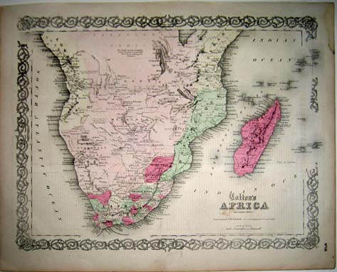
219afrc: 1855 Colton's AFRICA map - (Southern Sheet), published by J.H. Colton, No. 172. Hand colored antique map with very ornate border in excellent condition. 14.5x17.5in. $100 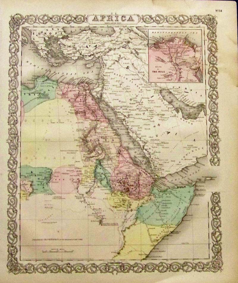
220Africa: 1855 J.H. Colton original hand colored engraved map of Africa with inset top right showing the Delta of the Nile. 17-1/2 x 14-1/2 in. $150 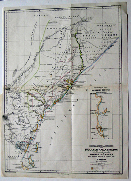
221afrc: 1868 Originalkarte des Gebietes der Sudlichen Calla & Waboni (Map showing Africa and Somali regions near the Indian Ocean) (German edition). 14.5x20.5in. $60 |
|||||||||
| Order Form | |||||||||||
| Back to Homepage | |||||||||||