 
|
|||||||||||
This is a small selection of our inventory of antique Alaska maps and prints. Additional inventory is available. Lowest Prices! Contact us with your request. 1-800-879-6277
|
|||||||||||
|---|---|---|---|---|---|---|---|---|---|---|---|
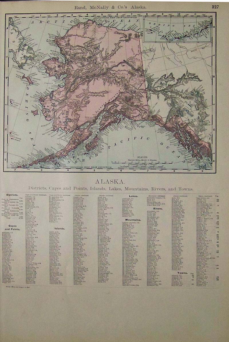 001Alaska: 1989 Rand, McNally & Co.'s Color Alaska Map with Districts, Capes,and Points, Islands, Lakes, Mountains, Rivers and Towns listed on bottom of page. 20-1/2 x 14 in. $90 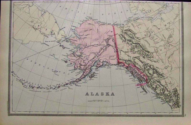
002Alaska: 1889 Bradley's Atlas of the World's hand colored map of Alaska as it meets British Columbia, Asia and the Aleutian Islands. 19 x 12-1/2 in. $80  007ak: 1891 Arbitration, Behring Sea Fisheries question. Color litho from Puck. Shows Blaine (from Maine) and Lord Salisbury for England. 10x13-1/2 in. $40 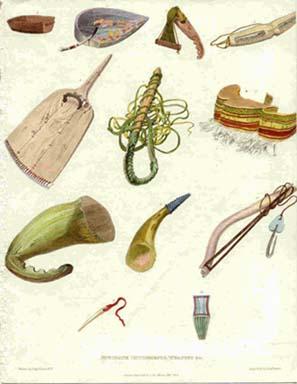
011ak: 1824 Rare Eskimo print. "Eskimaux Implements, Weapons." Impressive hand colored engraving. 8x10⁻¹/2 in. $80 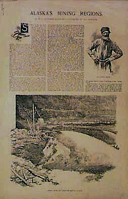 013ak: 1898 Alaska Mining Regions. Four page illustrated, with excellent text. Harper's. 1x16 in. $40 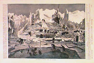 015ak: 1897 Scarce Arctic Panorama. Arctic Life & Scenery. Hand colored engraving from Scientific American, includes text. 11x16 in. $60 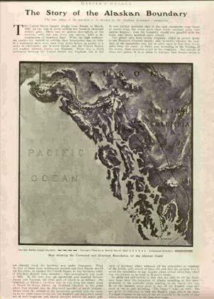
017ak: 1903 Alaska Boundary Story. With half-tone map. Harper's. 9-1/2x13 in. $40 
018ak: 1915 Alaska Paradise for Sportsmen. Three half-tone black & white views with text from Leslie's. 11x14 in. $40  019Alaska: Color Alaska map published by Geo. F. Cram, Chicago, Ill. Alaska Territories and Cities Key on right side of map. 22 x 14-1/2 in. $70 SOLD 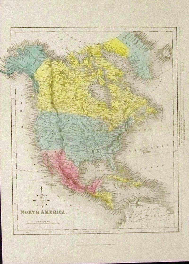
020Alaska: C.1850 Hand colored steel engraved map of North America. Published by H.G. Collins, London. 14-1/2 x 10-1/2 in. $180 SOLD 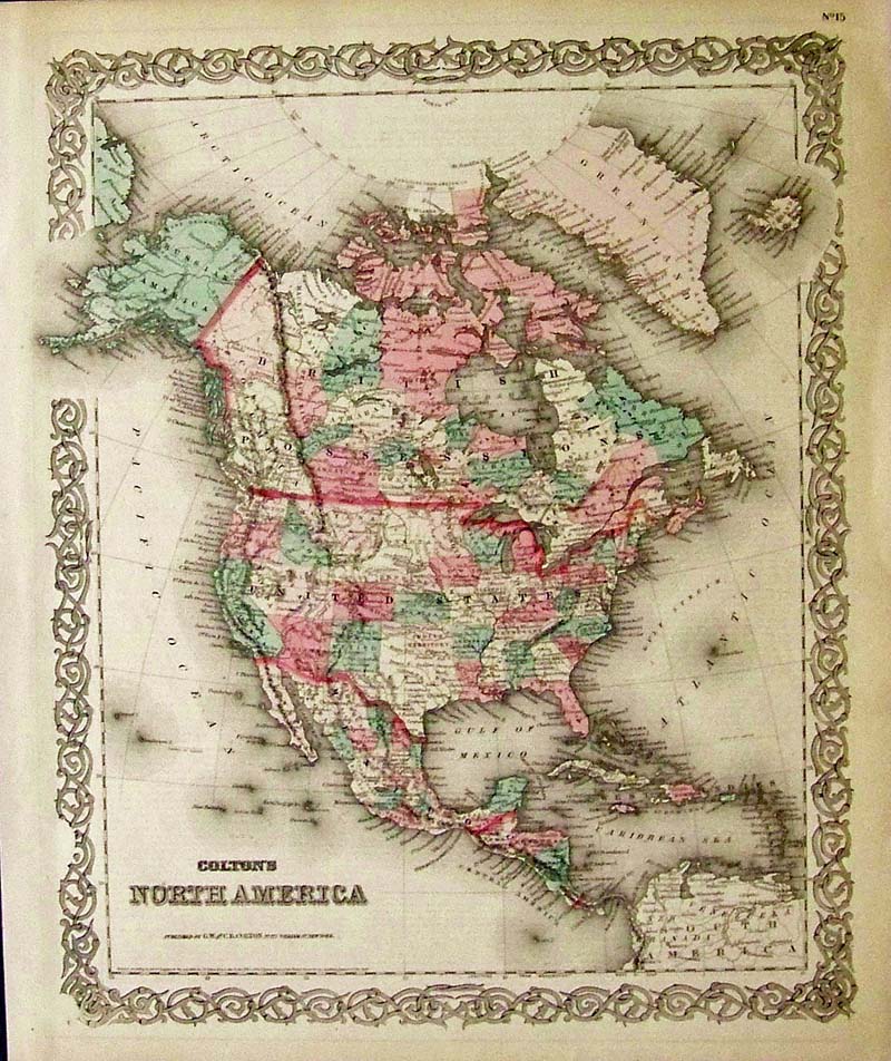
021Alaska: 1855 Hand colored engraved Colton's North America map, published by G.W. and C.B. Colton, New York. Alaska is labeled as part of the Russian Posessions. Entire map is surrounded by a decorative border. 17 x 14-1/2 in. $150 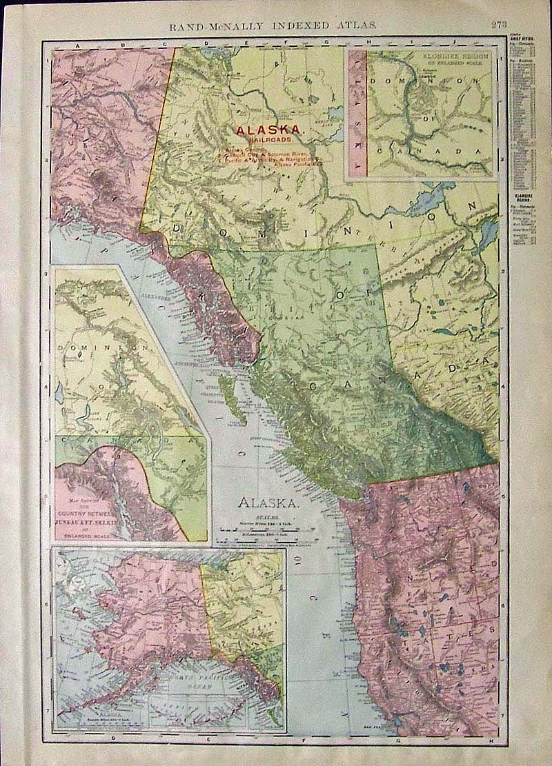
022Alaska: 1900 Census Colored Rand-McNally Indexed ATlas showing Alaskan Railroads with insets showing the map of the Country Between Juneau & Ft. Selkirk, the Klondike Region, and Alaska itself. 20-1/2 x 15 in. $60 SOLD 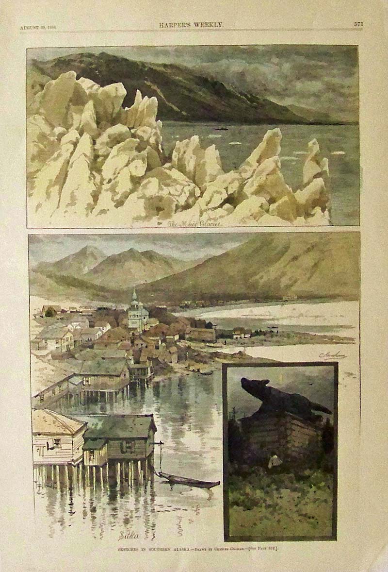
023Alaska: 1884 Harper's Weekly hand colored wood engraving showing Sketches in Southern Alaska. Drawn by Charles Graham. Separate text page included on Southern Alaska. 16 x 11 in. $60 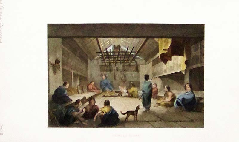
024Alaska: C.1830 Hand colored steel engraving titled, "Chinook Lodge," which shows the Chinookan Indian Tribes sitting around a lodge fire trying to stay warm. 11 x 7 in. $60 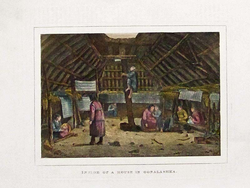
025Alaska: 1830 Hand colored steel engraving titled, "Inside Of A House In Oonalashka." 10-1/2 x 8 in. $60 |
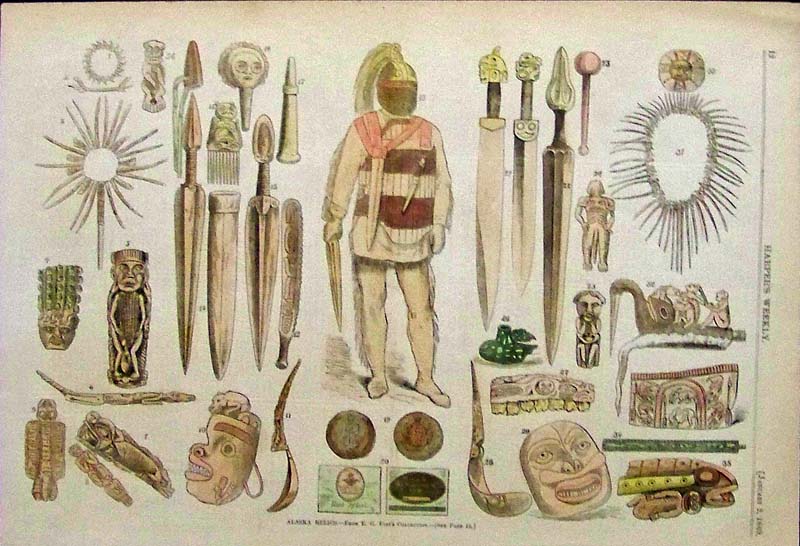
026Alaska: 1869 Harper's Weekly hand colored wood engraving showing Alaska Relics. From E.G. Fast's Collection. 15-1/2 x 10-1/2 in. $50  027Alaska: 1871 Hand colored wood engraving showing Pictures of Esquimaux Life, engraved from photographs collected by Mr. William Bradford During his Northern Expedition. Featured in Frank Leslie's Illustrated Newspaper. 15-1/2 x 10-1/2 in. $50 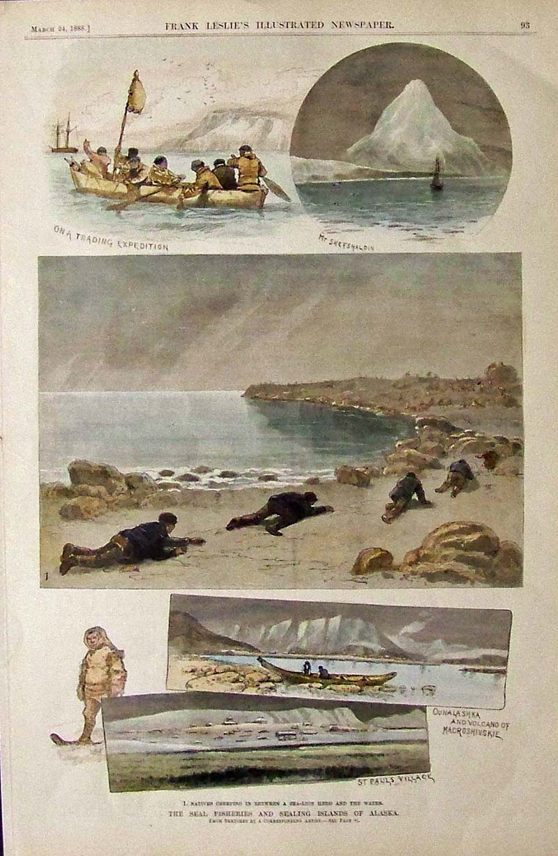
028Alaska: 1888 Hand colored wood engraving showing scenes of The Seal Fisheries and Sealing Islands of Alaska. Featured in Frank Leslie's Illustrated Newspaper. 16 x 11 in. $60 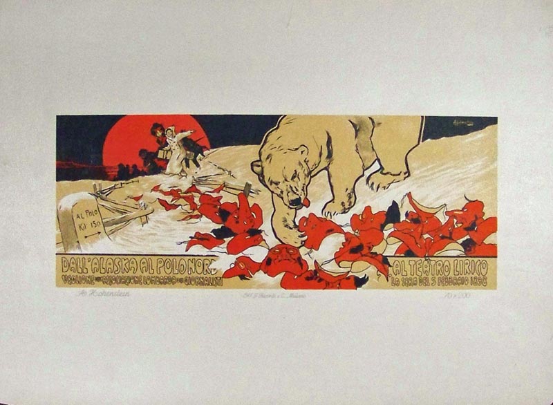
005post: 1914 Adolfo Hohenstein - Small Poster chromolithographic version of his 1898 theatrical poster Ricordi Portfolio. Wide margins and image measures: 10-1/2 x 4 in. $250 
029Alaska: 1899 Leslie's Weekly half-tone images showing Alaska's First Railroad on the snow-crowned summit of the perilous White Pass. Image also shows the first passenger train and Yukon Route to the summit. 16 x 11 in. $60 
030Alaska: Harper's Weekly hand colored half-tone titled, "Columbian Exposition -- The Esquimaux Village." Drawn by T. De Thulstrup. 15-1/2 x 11 in. $80 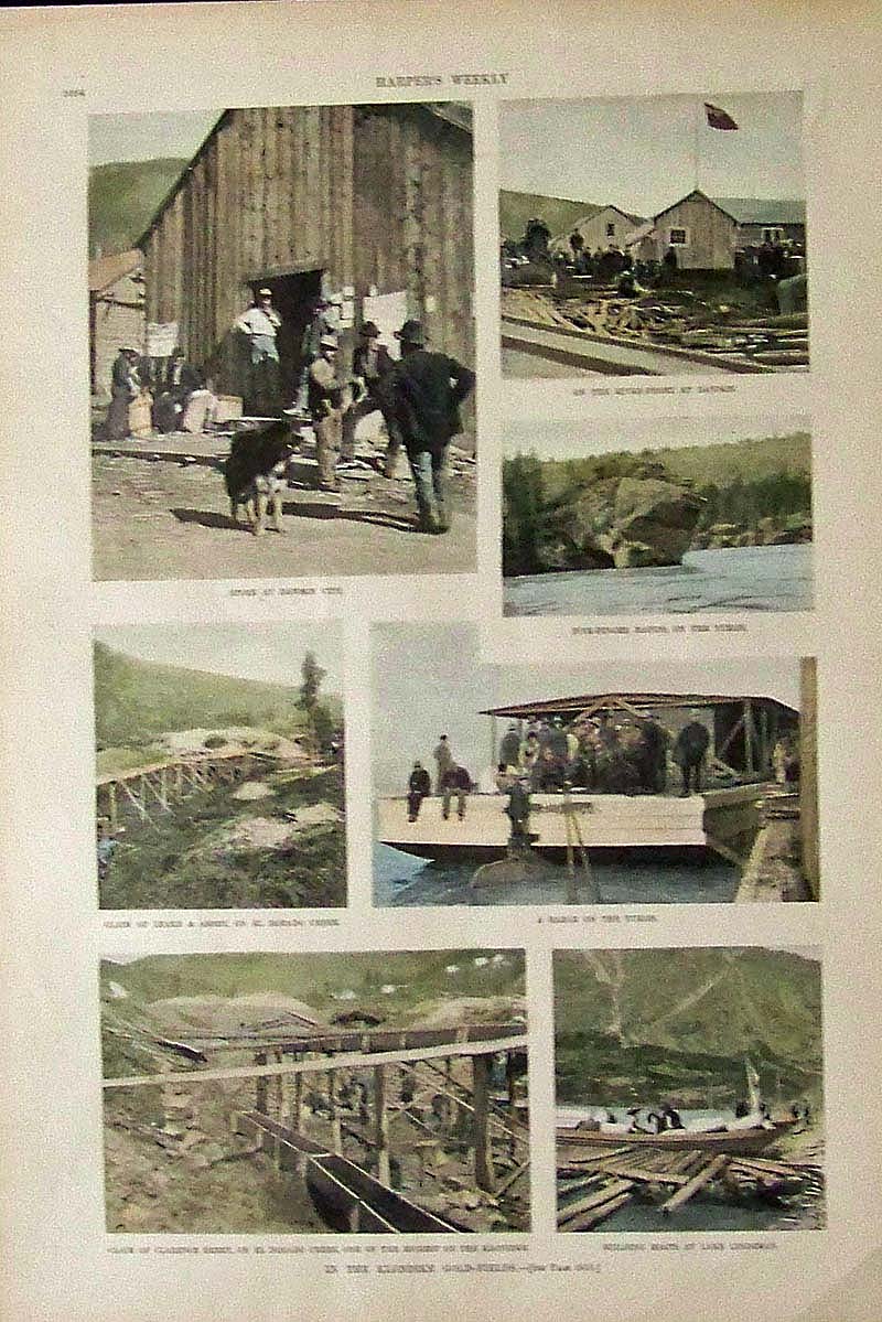
031Alaska: 1897 Harper's Weekly hand colored half-tone images titled, "In the Klondike Gold-Fields." Images show various places in the Yukon. 16 x 11 in. $60 
032Alaska: 1891 Hand colored half-tones showing Glimpses of Alaska, -- From Pictures by Frederick D. Shellabarger. Featured in Frank Leslie's Illustrated Newspaper. Featured images are totem poles, the Greek Church at Sitka, Indian Graves at Fort Wrangel, the Treadwell Gold Mine on Douglas Island, among other images. 16 x 10-1/2 in. $60 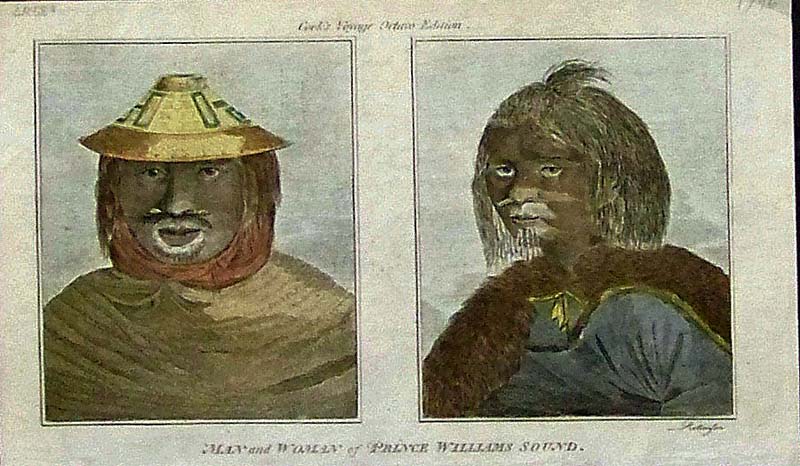
033Alaska: 1796 Hand colored copper engravings showing a Man and Woman of Prince Williams Sound. Featured in Cook's Voyage Octave Edition. 8 x 5 in. $60 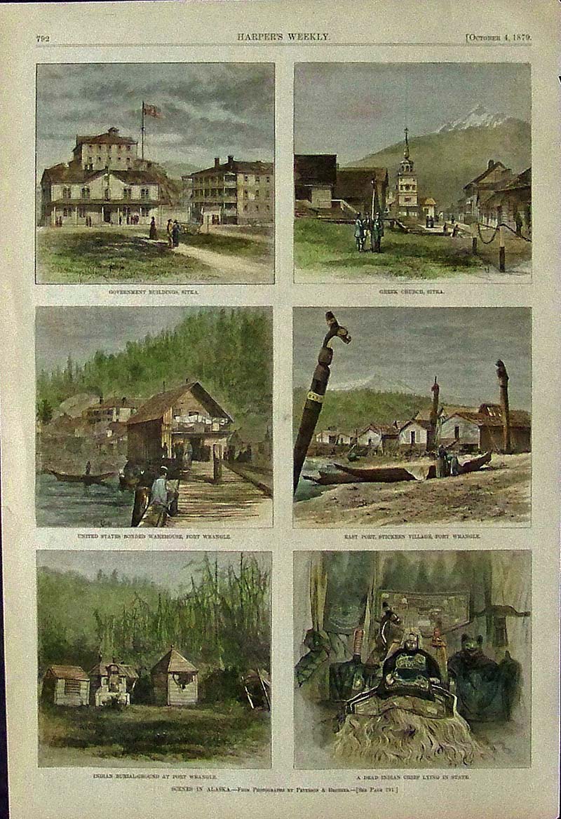
034Alaska: 1879 Harper's Weekly hand colored wood engravings showing Scenes in Alaska -- From Photographs by Peterson & Brother. Images shows buildings in Sitka and places in Fort Wrangle. 15-1/2 x 10-1/2 in. $60 
035Alaska: 1868 Harper's Weekly hand colored wood engravings showing Scenes in Alaska. Upper image shows the First View of the Yukon River and bottom image shows Unalachleet: Indians Fishing Through the Ice. Separate text page on Alaska Scenes included. 16 x 11 in. $60 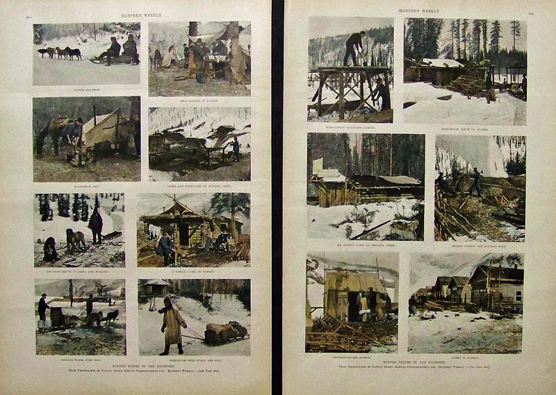
036Alaska: 1898 Harper's Weekly hand colored half-tone images showing Winter Scenes in the Klondike. Two pages sold as a set revealing snow-covered Alaskan scenes. Each page measures: 16 x 11 in. $80 
037Alaska: 1898 Harper's Weekly hand colored half-tone images showing Winter Scenes in the Klondike. 16 x 11 in. $60 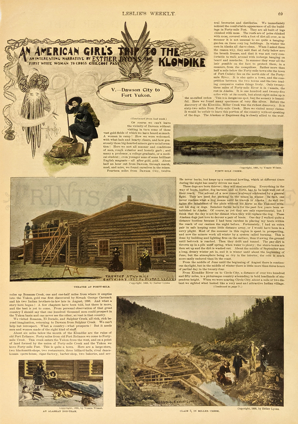 074can: An American Girl’s Trip to the Klondike. 1898. “Dawson City to Fort Yukon”. 4 Pictures. Hand colored, half-tone engraving. 10 3/4 x 16 in. $60 |
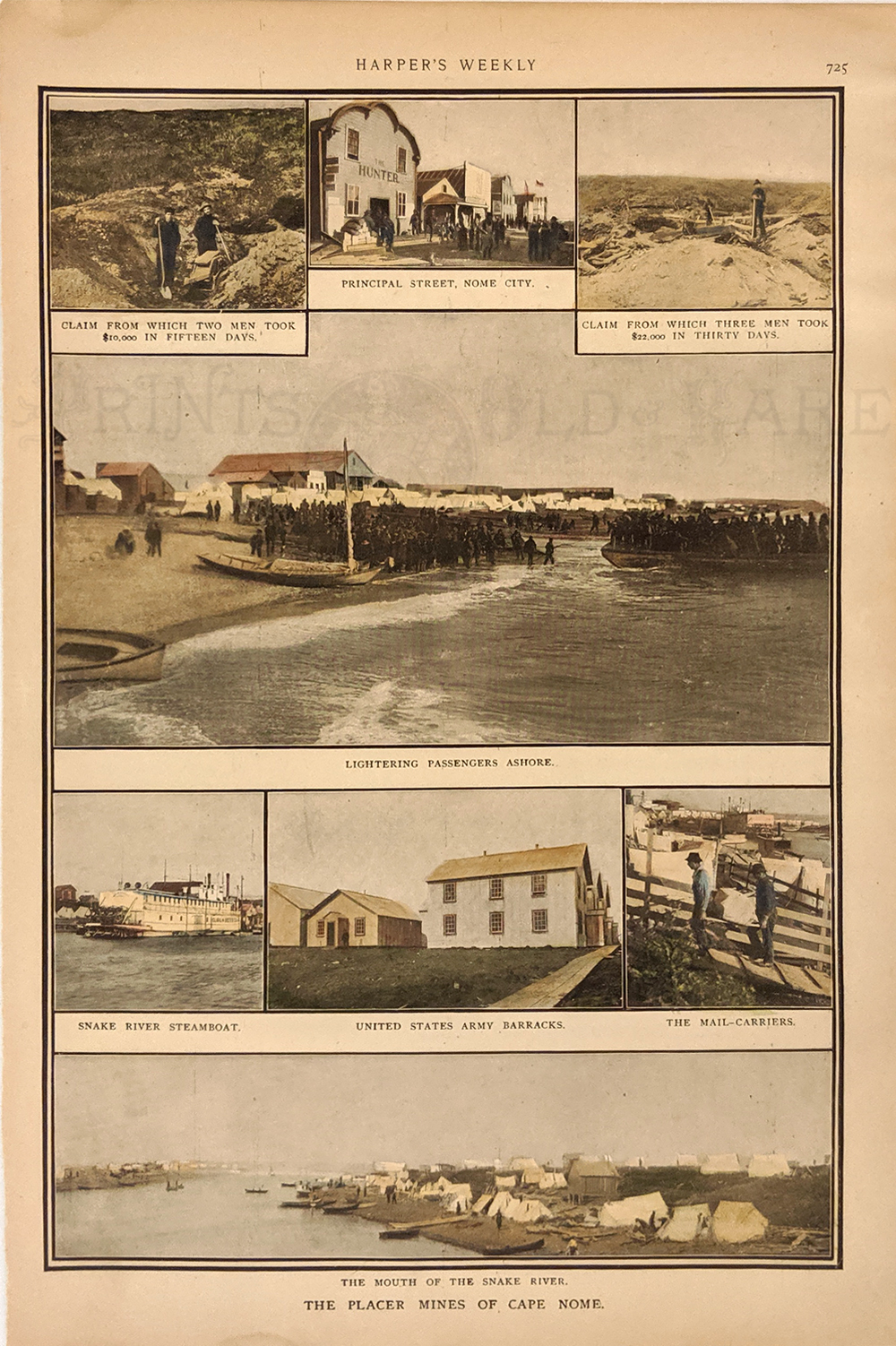
129ak: Nome 1900 – The Places Mines of Cape Nome. 8 views in and around Name and the Snake River. Hand colored, half-tone engraving. 10 1/2 x 15 5/8 in. $60  038Alaska: 1897 Harper's Weekly hand colored half-tone images titled, "On the Way to the Klondike Gold-Fields -- The White Pass Trail." Photographs by Tappan Adney, Special Correspondent to Harper's Weekly. 16 x 11 in. $50 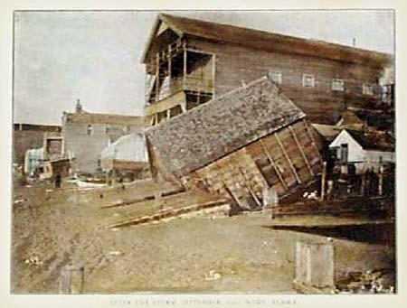 102ak: 1904 View: Wreckage in Nome, Alaska. Hand tinted photograph, titled "After the Storm, September 1900, Nome, Alaska. Shows buildings collapsed and damaged by the storm's powerful effects. Published in 1904 as an illustration to a book. 7x11 in. $40 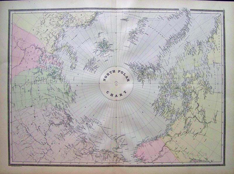
106ak: 1889 North Polar Projection Map. Interesting, hand colored map by Bradley, showing a polar projection of the Arctic world including northern Alaska. 9x26 in. $80 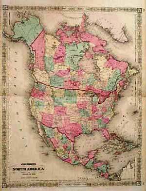 107ak: 1862 North America Map with Russian Alaska. Decorative, hand colored map of North America by Johnson and Ward, with Alaska labeled as "Russian Possessions." Names of Alaskan Indian tribes are shown in the areas where they lived. Territorial divisions within Western Canada and the Western USA are much different than today as well. 18x26 in. $120 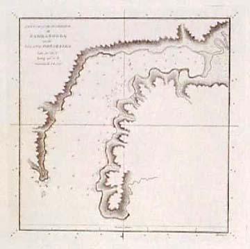 110ak: 1778 Cook Expedition Alaska Harbor Chart. Copper-engraved chart titled "Sketch of the Harbor of Samganooda on the Island Oonalaska." From the report of the expedition of Captain Cook. 9x12 in. $80  123ak: 1880 Chromolithograph by Bien titled, "Beluga Hunter and Dwellings -- Lower Kuskokvim, Alaska." Plate III. Fine condition. 11-1/2 x 9 in. $80 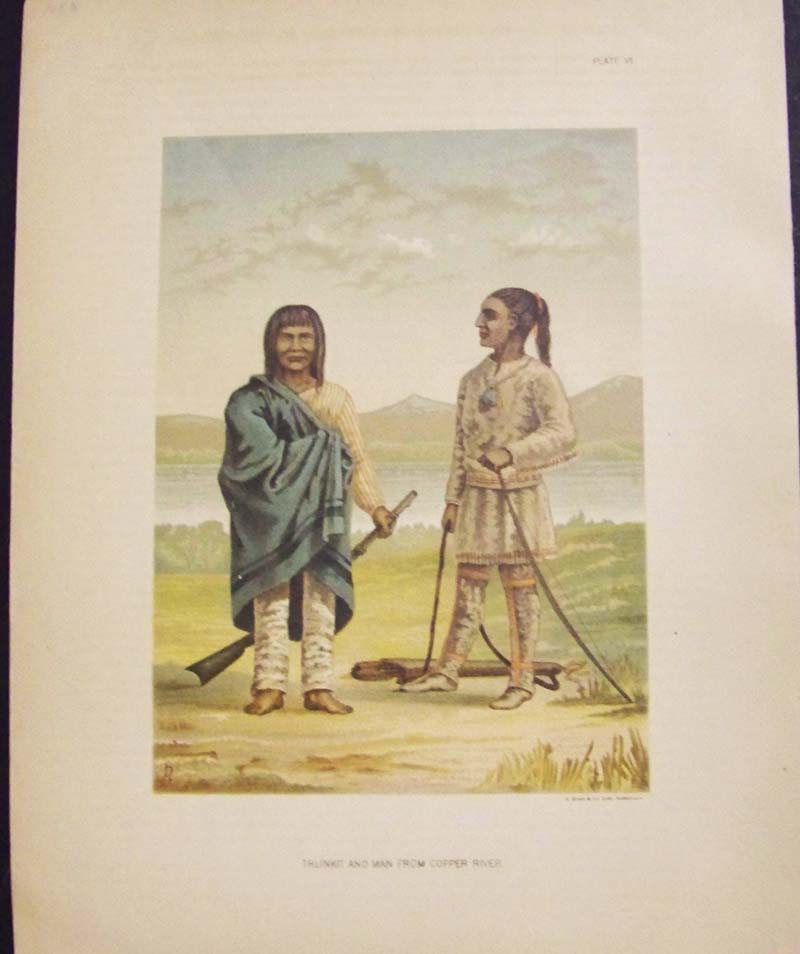
124ak: 1880 Chromolithograph by Bien titled, "Thlinkit and Man From Copper River." Plate VI. Fine condition. 11-1/2 x 9 in. $80 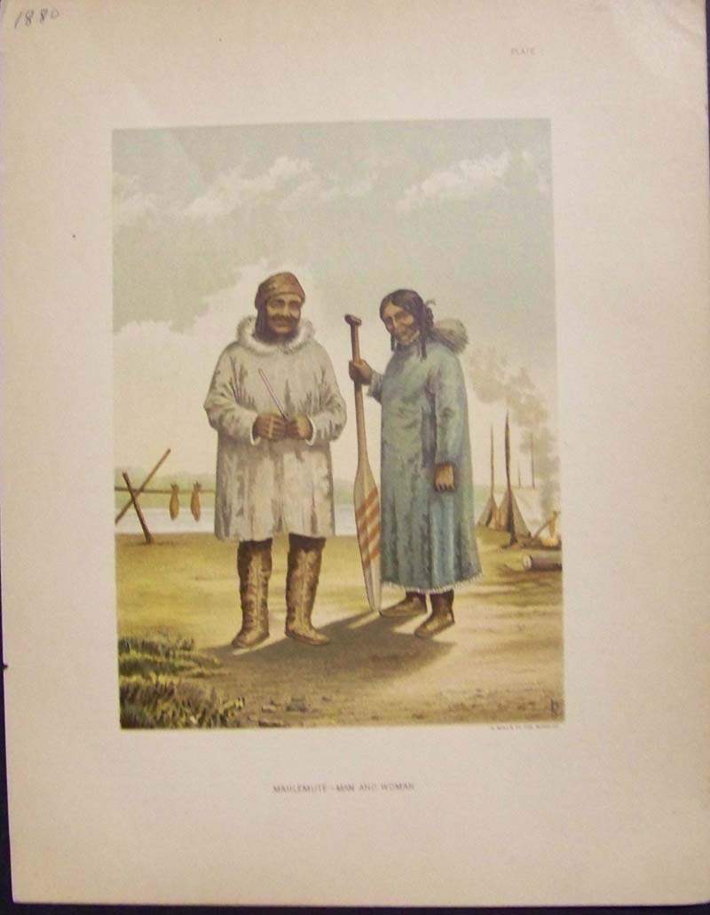
125ak: 1880 Chromolithograph by Bien titled, "Mahlemute -- Man and Woman." Plate I. Fine condition. 11-1/2 x 9 in. $80 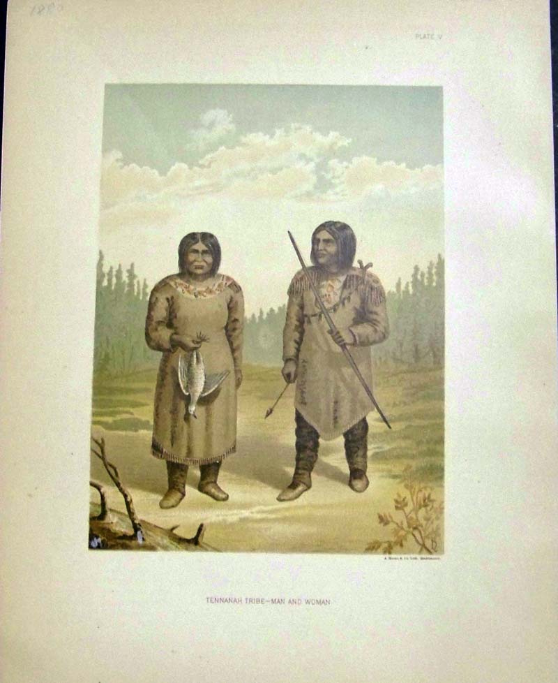
126ak: 1880 Chromolithograph by Bien titled, "Tennanah Tribe -- Man and Woman." Plate V. Fine condition. 11-1/2 x 9 in. $80 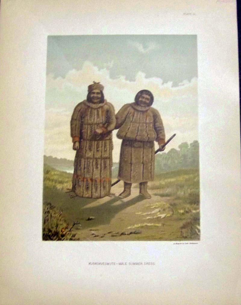
127ak: 1880 Chromolithograph by Bien titled, "Kuskokvegmute -- Male Summer Dress." Fine condition. 11-1/2 x 9 in. $80 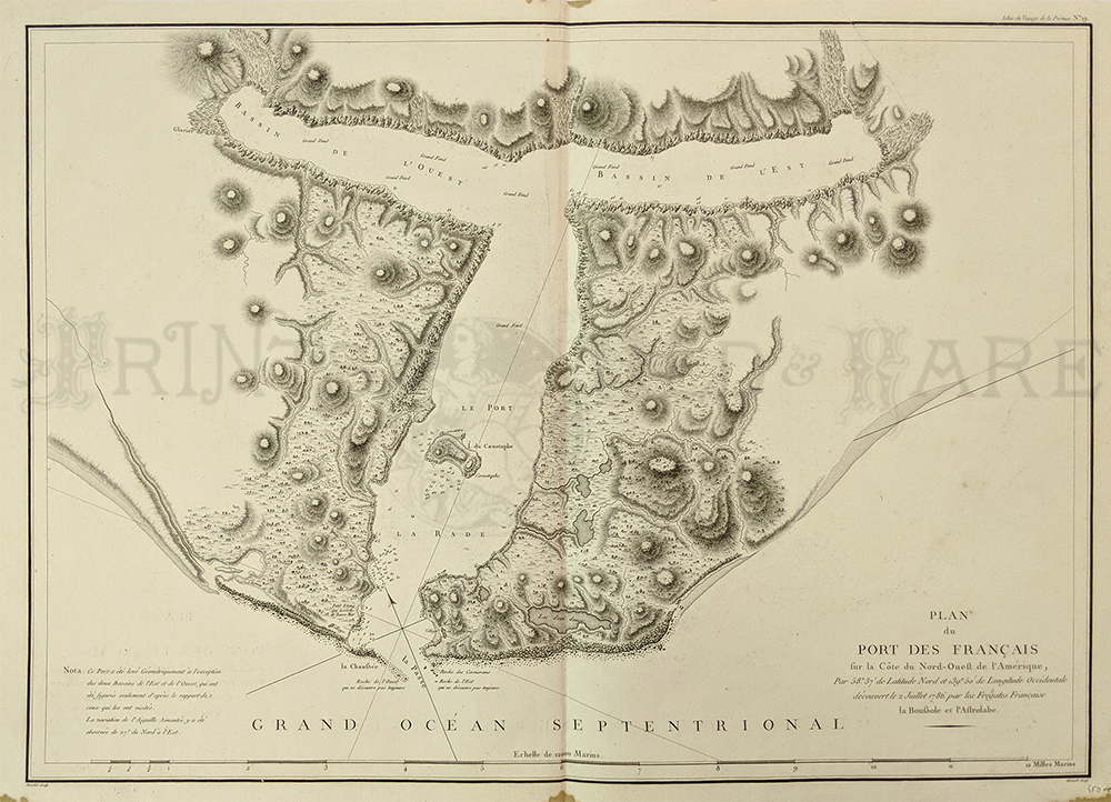 130ak: 1798 Alaska. La Perouse map titled "Plan du Port des Francais sur la Cote du Nord-Ouest de l'Amerique, Par 58 degrees 37 minutes de Latitude Nord et 139 degrees 50 minutes de Longitude Occidentale decouvert le Juillert 1786 par les Frigates Francaise la Bousole et l'Astrolabe." This map is a section of Alaska and is very detailed showing the topography of the area. There are three small stains in the bottom right border that will easily be hidden by matting. 21x29 in. $800 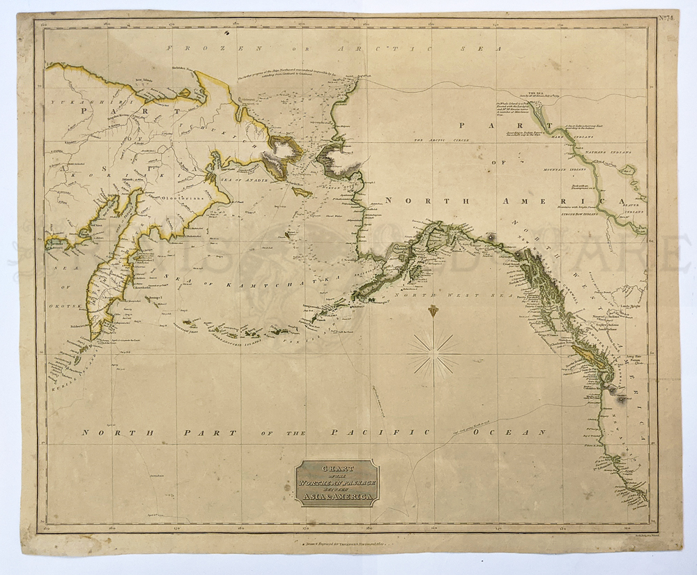 131ak: Chart of Northern Passage 1816 – between Russia and North America. This map by Thomson shows details of Coastlines, Kamchtka and Russian America and the West Coast of New Album. Copper engraved – colored in outline. 23 x 27 in. $250 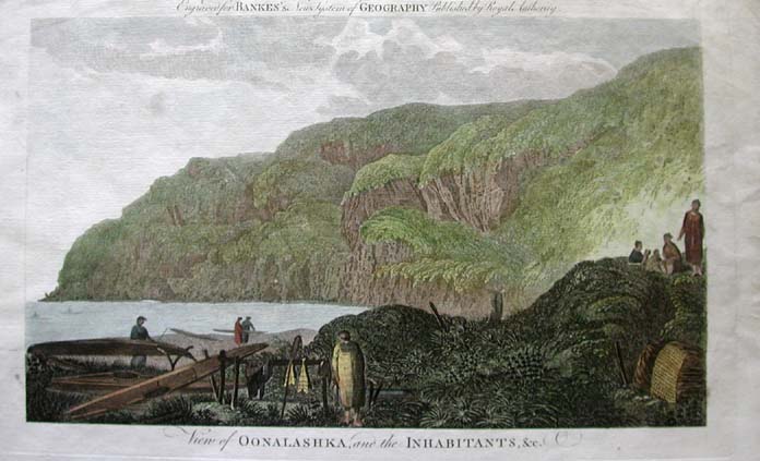 115ak: 1785 Scene: Alaska Natives, Kayaks. Hand colored copper engraving from the 1785 after Captain Cook edition of Banke's New System of Geography. Title is "View of Oonalashka and the Inabitants, etc." Native Alaskans are shown by the ocean shore. In the lower left corner, several kayaks are being repaired. Natives offshore are paddling kayaks in the bay. 9x15 in. $200  002Canada: Carte Particuliere De La Nord Quest Amerique, Herault 1786 - This large-scale map of British Columbia and the southeast coast of Alaska depicts the route of La Perouse's voyage with only those parts actually surveyed from Bay de Clonard (Graham Island) to Mt. St. Elias. Drawn by Herault and engraved by Bouclet. Special Note: La Perouse set sail from France in 1785 to continue the discoveries of Captain Cook. He was shipwrecked in 1788 but his narrative, maps, and views survived and were published in 1797. This copy consists of the Atlas only to the First French edition. It is an exceptional copy, with very strong impressions. It should be compared to the smaller English Atlas of 1799. Maps are without color and bound in half leather brown marbled paper covered boards with "La Perouse's Voyages. Atlas" Condition: Very Fine, large wide side margins, small tear on bottom margin with fold in middle, small hole at lower left margin corner. size 27.5 x 19.5 image $400 |
|||||||||
| Order Form | |||||||||||
| Back to Homepage | |||||||||||