 
|
|||||||||||
This is a small selection of our inventory of antique Arizona maps and prints. Additional inventory is available. Lowest Prices! Contact us with your request. 1-800-879-6277
|
|||||||||||
|---|---|---|---|---|---|---|---|---|---|---|---|
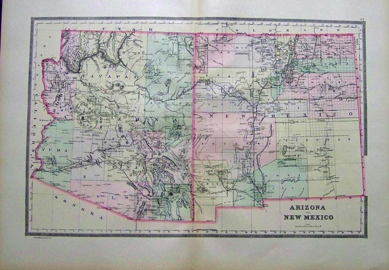
001Arizona: 1891 Bradley's color map of Arizona and New Mexico from Bradley's Atlas of the World which shows the mountain ranges, counties, and other geographical details. 26 x 19 in. $120 SOLD 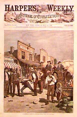
002az: OLD SOUTHWESTERN TOWN-1874 PRINT. Authentic professionally watercolored engraving from the front page of original Harper's Weekly, published July 25, 1874. Entitled "A Saturday Noon in a Southwestern Town." Drawn by Frenzeny & Tavernier, the great French artists who chronicled the west during the late 1800's. A genuine antique print produced in 1874, NOT a reproduction!. 11" x 16" $80 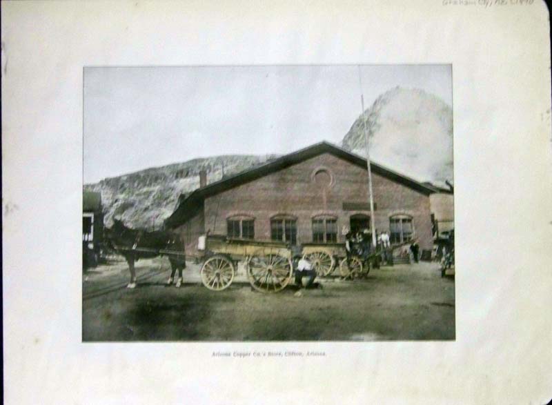 013az: 1890 Hand colored photogravure showing the "Arizona Copper Co.'s Store, Clifton, Arizona" in Graham County, Arizona. 12 x 9 in. $40 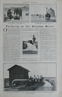 016az: 1902 Arizona Article. With pictures of Farming in the Arizona Desert. Harper's. 11x16 in. $30 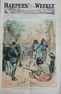 018az: 1883 Arizona Apache Surrender. To General Crook. Hand colored front page engraving from Harper's Weekly. 11x16 in. $60 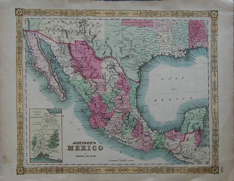 020az: 1864 Early Mexico Map. Early Johnson Map of Mexico and Southwestern Arizona. Arizona is below New Mexico Territory. Hand colored collector's map. 18x14 in. $100  021Arizona: 1850 Steel engraving featured in Colorado Exploring Exposition titled, "Big Canon." Big Canon is in the Grand Canyon. 11 x 8 in. $60 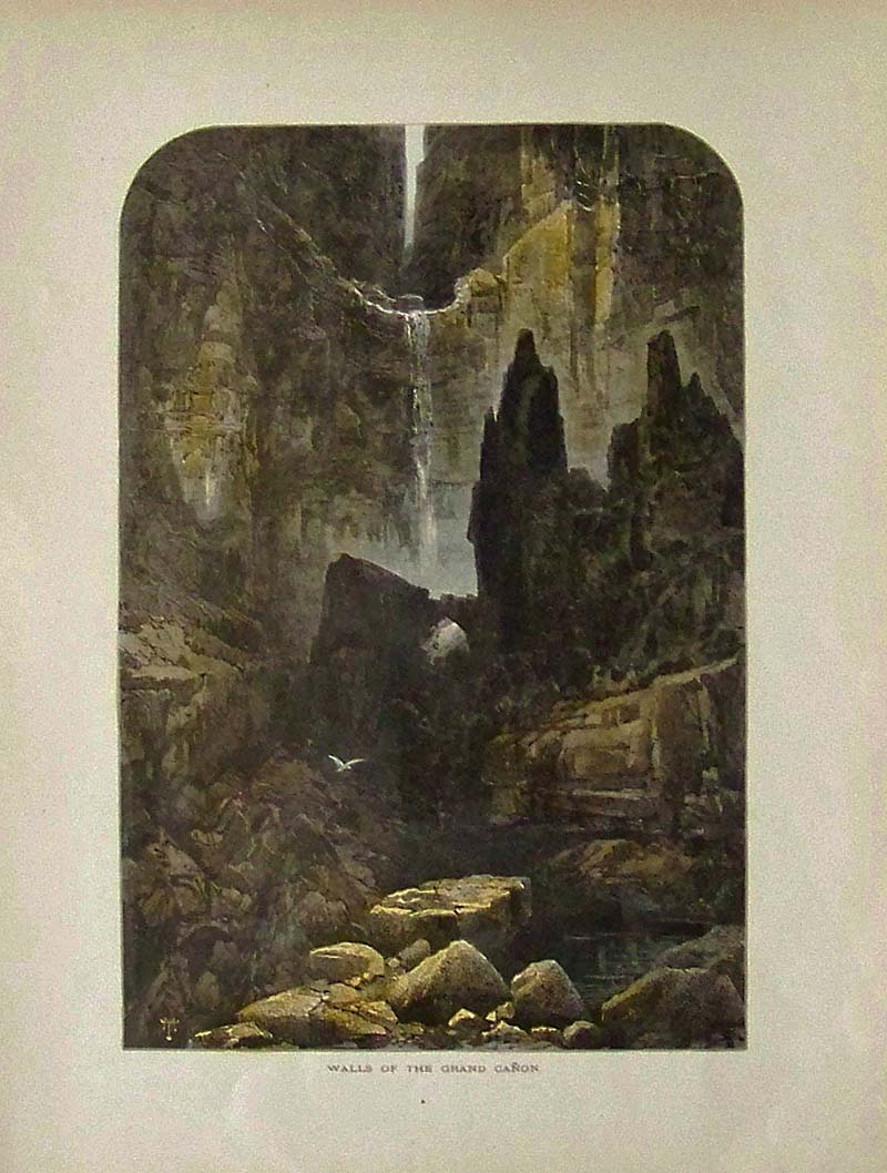
022Arizona: 1873 Thomas Moran hand colored wood engraving titled, "Walls of the Grand Canon." 12-1/2 x 9-1/2 in. $40 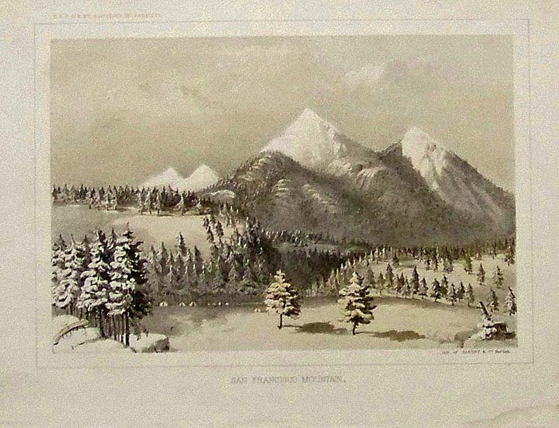
023Arizona: 1855 USRR Survey lithograph of Sarony & Co., NY titled, "San Francisco Mountain." Information sheet about the railroads is included with lithograph. 11-1/2 x 9 in. $50 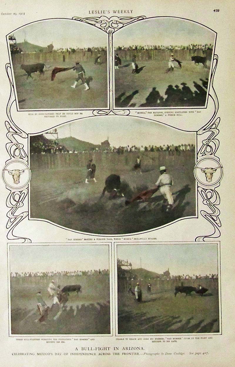
024Arizona: 1903 Hand colored half-tone images showing A Bull-Fight in Arizona, celebrating Mexico's day of Independence across the Frontier. 16 x 10-1/2 in. $40 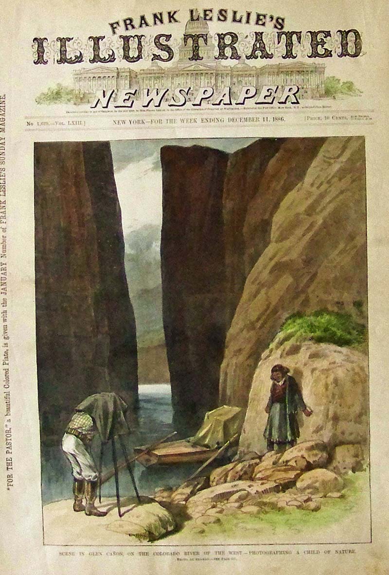
025Arizona: 1886 Hand colored wood engraving from Leslie's Illustrated showing a Scene in Glen Canon, on the Colorado River of the West of a photographer photographing a Child of Nature. 16 x 11 in. $50 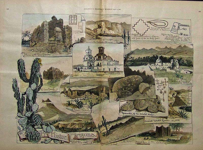
026Arizona: 1889 Harper's Weekly hand colored wood engraving showing Pre-Historic Arizona scenes, which include some specimens of the painted rocks, the Church of San Xavier, the Ruins of Casa Grande and more scenes. 22 x 16 in. $150 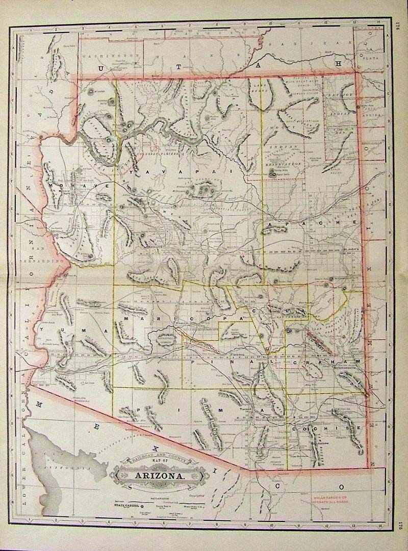
027Arizona: 1889 Color Railroad and County Map of Arizona. 23 x 17-1/2 in. $180 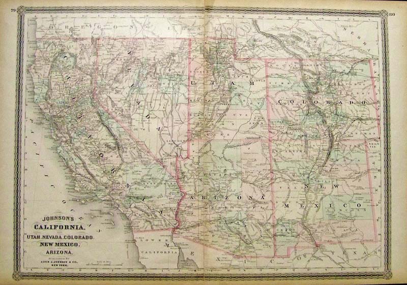
259ca: 1864 Hand colored engraved Johnson's California, also Utah, Nevada, Colorado, New Mexico, and Arizona. Published by Alvin J. Johnson & Co., New York. 26 x 18 in. $350 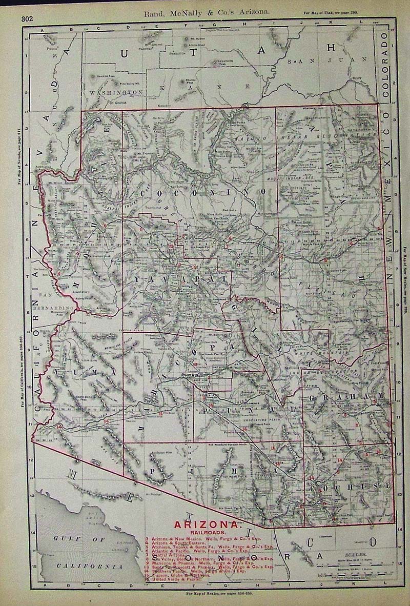
029Arizona: 1894 Rand, McNally & Co. Arizona Railroads Map with key on bottom of map detailing the names of the railroads and their locations. 21 x 14-1/2 in. $160 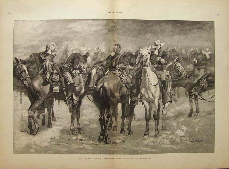 022frem: 1889 Hand colored wood engraved image showing Arizona Buffalo Soldiers titled, "Cavalry in an Arizona Sand-Storm." Showing his best of the black Cavalry in the middle of an Arizona sandstorm. 22 x 16in. $250 |
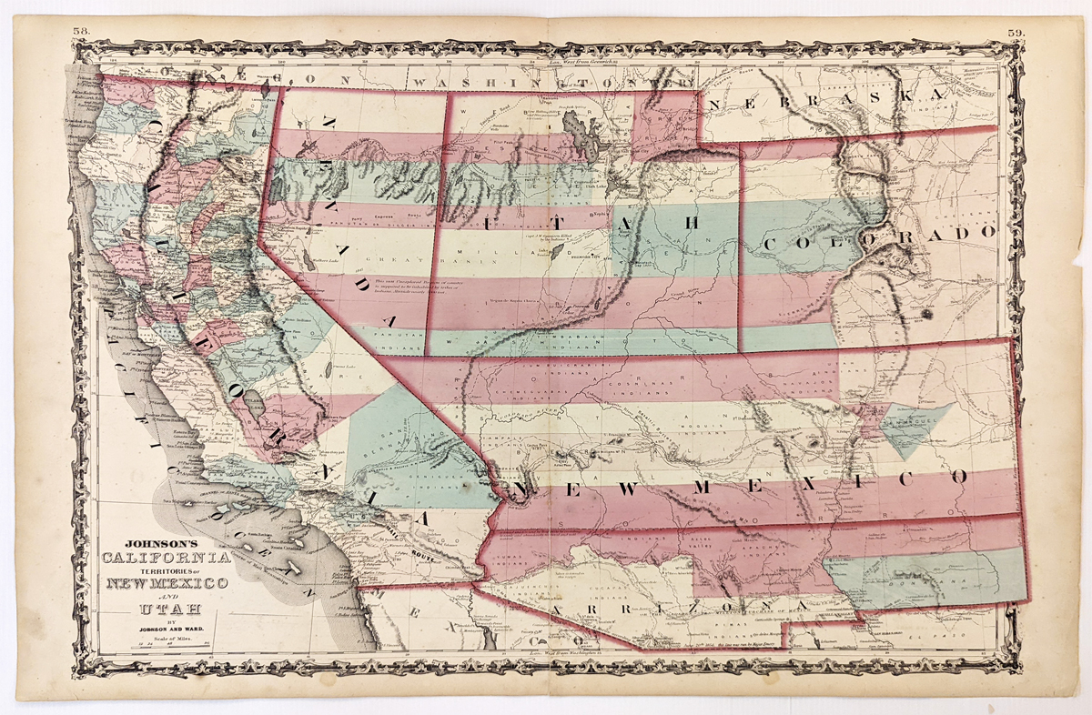 279California: Johnson’s California, Territories of New Mexico, Arizona, Colorado, Nevada and Utah 1863 - A large engraved and original hand colored map of California & the Southwest, the map has a very decorative border, pastel colored counties and shows a number of interesting territorial anomalies. Nevada has its lower corner truncated, leaving Las Vegas in Arizona. Utah extends approximately 1 degree too far to the west, prior to the last set of reductions undertaken by the US Government. Several counties still extend into both Arizona and New Mexico. In each of the states and territories, the county configurations are still largely incomplete. This is one of the most detailed accurate commercial maps of the era that includes the US Pony express route, explorer routes, the major routes of commerce, towns, forts, Indian Tribes, mountains, rivers, roads, mining districts, proposed railroad routes, important dates in the evolution of the US-Mexico Boundary, etc. Johnson's map of the West is one of the most interesting and collectable maps of the period. The maps were updated annually or more often, showing profound territorial boundary changes and county formations from year to year and even within a single year. Condition: Very good, fold in middle with some staining along the fold, water marks on margins and some light foxing inside image. size 23.5 15.5 image. $600 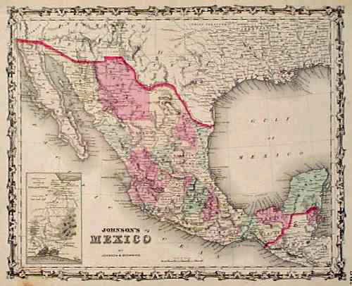
101az: 1861 Johnson Map of Mexico. Beautiful, hand colored map with a decorative border, published while Arizona and New Mexico were newly acquired US territories. Above Mexico's northern border, Arizona is shown SOUTH of New Mexico, covering an area from California to Texas. Much of it is labeled as "uninhabited" territory. 14x18 in. $130 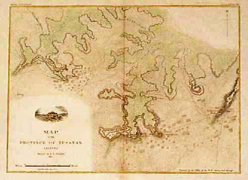
105az: 1881 Map of Tusayan Province, Northeastern Arizona. Lithographed, hand colored map published in 1881 by the US Geological Survey. Shows the locations of towns, roads, archeological ruins and gardens throughout the area. 11x14 in. $60 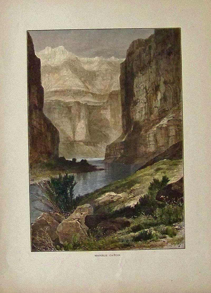
108az: 1873 Arizona Canyon Scene by Thomas Moran. Beautiful, hand colored engraving by Thomas Moran, titled "Marble Cañon." Shows a view from the bottom of the canyon. Published in Picturesque America, an 1873 book about American scenery. 9x12 in. $60 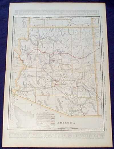
112az: Detailed 1901 Railroad Map of Arizona. Beautiful map from the 1901 first edition of George Cram's folio-size world atlas. Color coded lines on the map show the names and locations of railroads throughout the state. State and county borders are outlined in yellow. Cities, towns, Indian reservations and geographical features are all shown. This map would look great in a frame! 18x27 in. $100 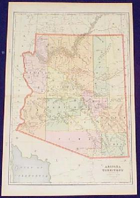
200az: Old, Antique Map of Arizona Territory, by Cram. Colorful map of Arizona Territory, published in 1901 by the George F. Cram Co. Each county in the territory is colored separately. Cities and towns are shown, as well as railroad lines and geographical features. In excellent condition, with no tears, stains or other blemishes. 15x22 in. $60 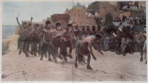 202az: 1895 Moki Indians Snake Dance Scene. Hand-colored, from Harper's Weekly, circa 1895. Title is "Among the Moki Indians: The Snake Dance." Dancers are shown in single file following a snake which is on the ground in front of them. A professional repair has been made to a long vertical tear near the center crease, and it is barely noticeable. Overall fine condition. 16x22 in. $80 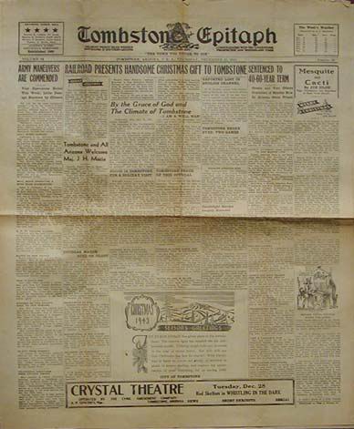 207az: Tombstone Epitaph dated December 23, 1943. Four page newspaper. "The most widely read weekly newspaper in Southern Arizona". Contains Christmas ads, news about army maneuvers, railroad's christmas present to Tombstone, etc. 17x22 in. $40 . 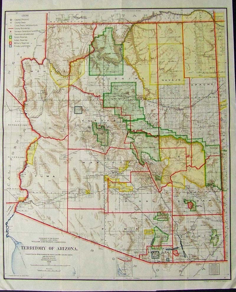
208az: Rare Colorful 1906 map of the Territory of Arizona. Map is titled "Department of the Interior, General Land Office, Territory of Arizona compiled from the official records of the General Land Office and other sources under the direction of Frank Bond, Chief of Drafting Division 1906" Map shows county borders, forest reserves, Indian reservaitons, military reserves and private land grants. 21-1/2 x 17-1/2 in. $220 |
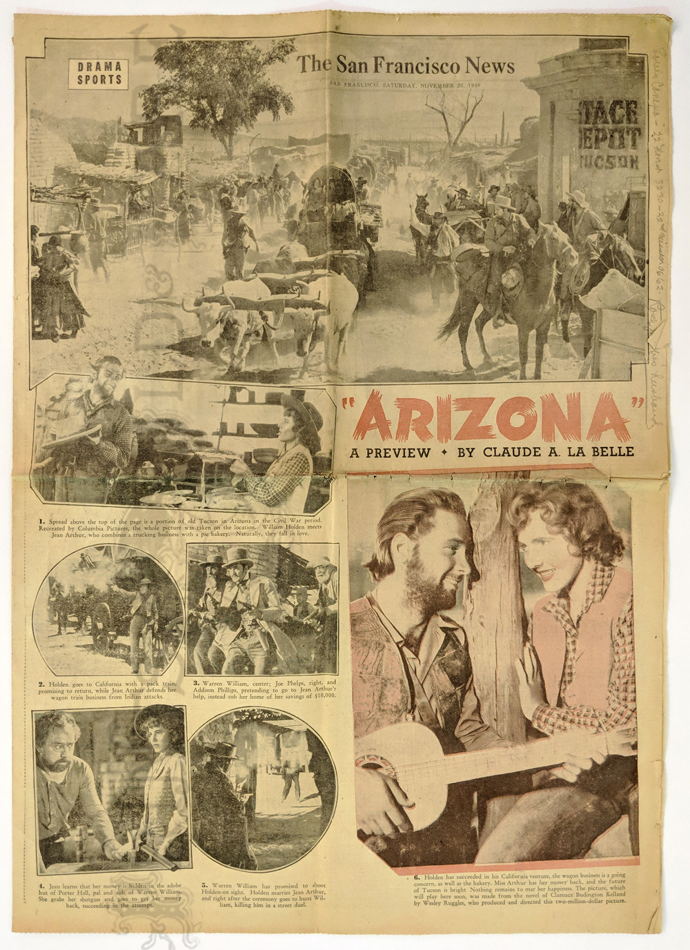 222Arizona: 1940 “Arizona – a Preview” Movie highlights by Claude La Belle. 7 photos of William Holden + SF Chronicle Drama and Sports sections. 8pp. Inside Jean Arthur, Betty Grable, Charlie Chaplain, etc. Back page comics. Dated 11/23/1940. 16 7/8 x 23 1/2 in. $25 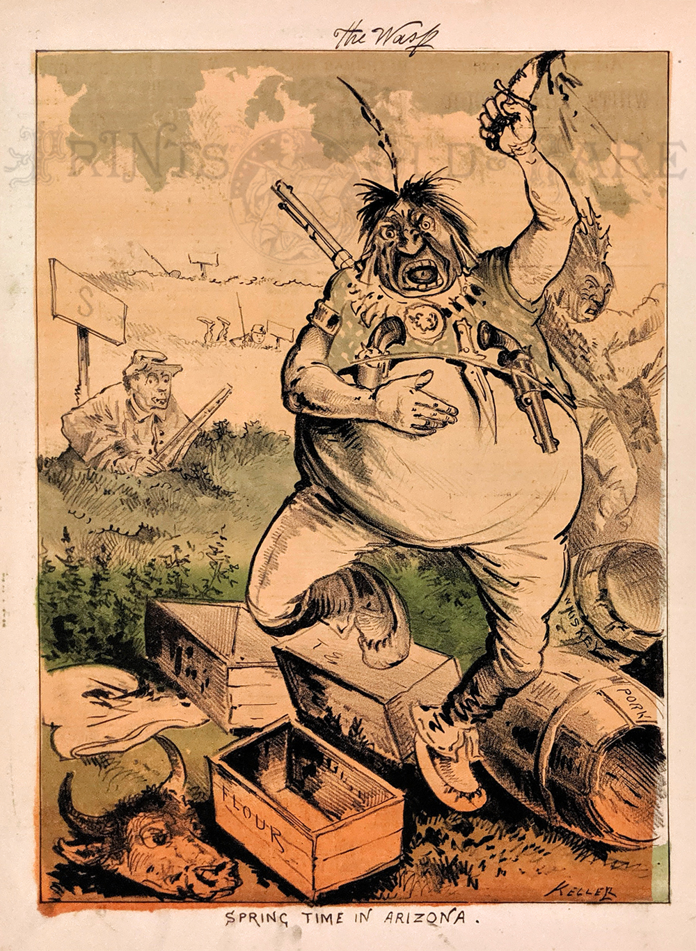 223Arizona: "Spring Time in Arizona." - c.1920 The Wasp Magazine. Depicting Indians attacking and plundering the Military Forts in Arizona. Chromolithograph. 10 x 13 1/4 in. $100 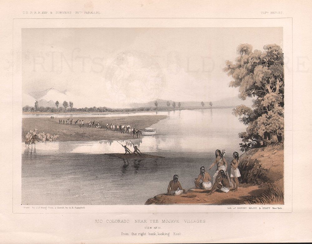 224Arizona: Rio Colorado Near The Mojave Villages. View No. 111. from the right bank, looking East. 1855. USPRR Survey. 8 1/4 x 11 1/2 in. $60 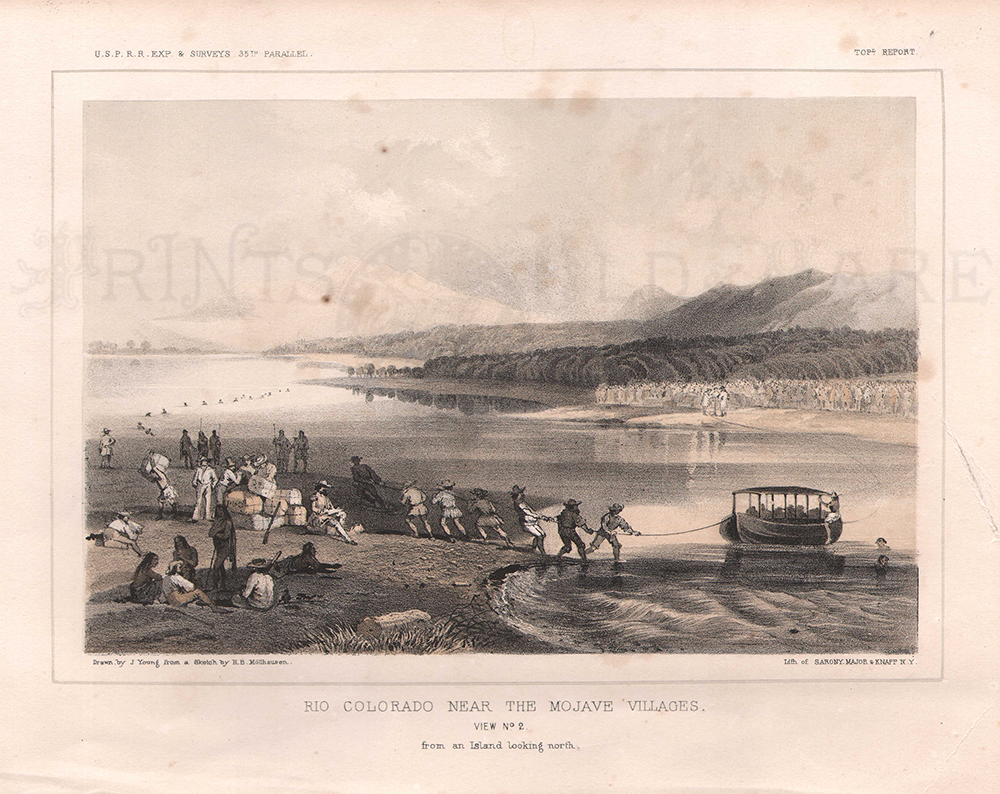 225Arizona: Rio Colorado Near The Mojave Villages. View No. 2 - from an Island looking North. 1855 USPRR Ex & Surveys. 8 1/2 x 11 in. $60 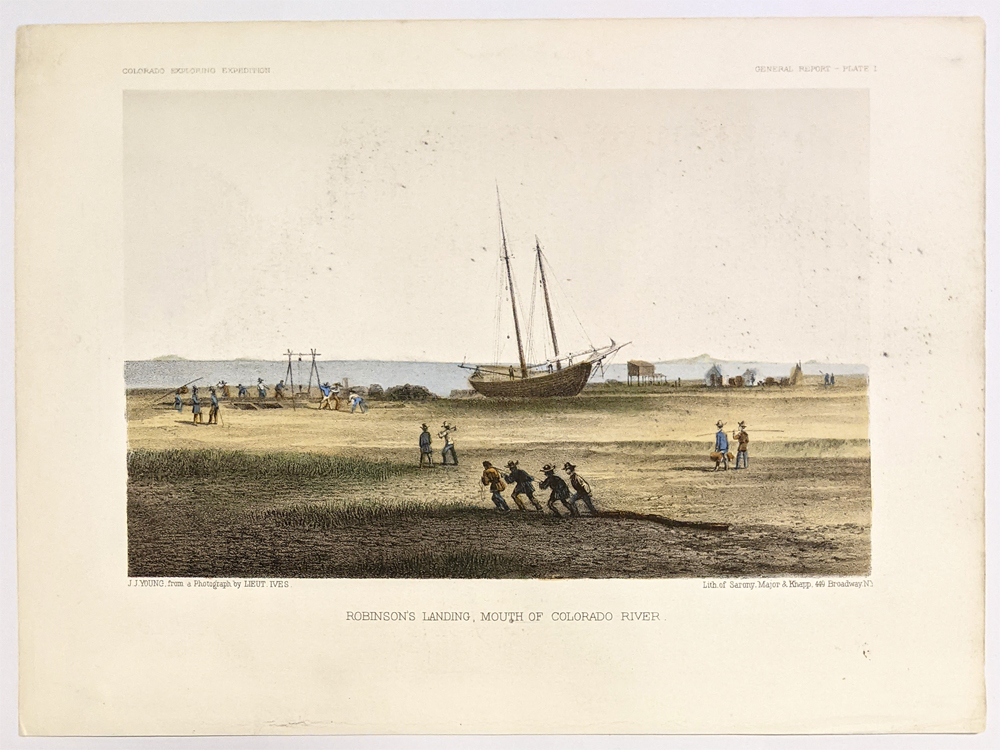 226Arizona: Mouth of Colorado River 1855. U.S. Railroad Service. Hand colored litograph. 8 1/2 x 11 in. $50 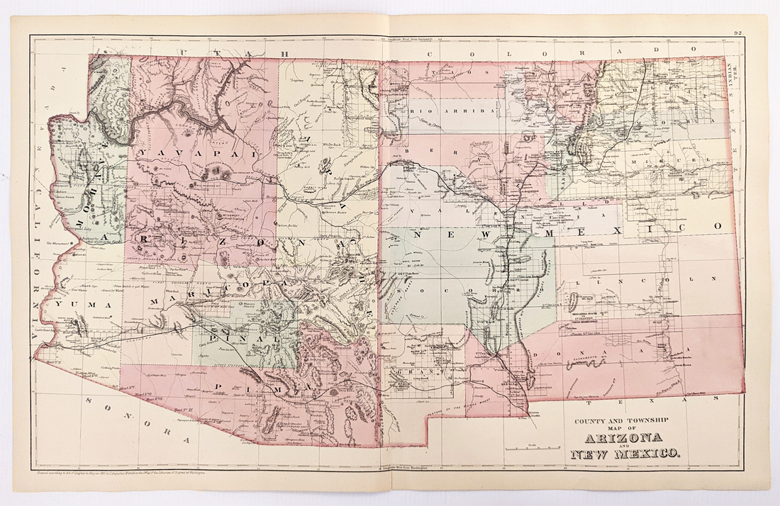 227Arizona: 1882 Mitchell's County and Township Map of Arizona and New Mexico. Showing roads, towns, railroads, rivers, lakes, mountains and topographical details. Hand colored, lithograph. 17 1/4 x 23 in. $180 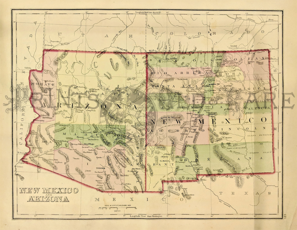 216NewMexico: Gray's New Mexico & Arizona Map. 1875. Detailed map showing a number of newly formed counties and transitional borders in both states. Also shows cities, mountains, plains areas, rivers and creeks. Hand colored, lithograph. 11 1/2 x 15 in. $220 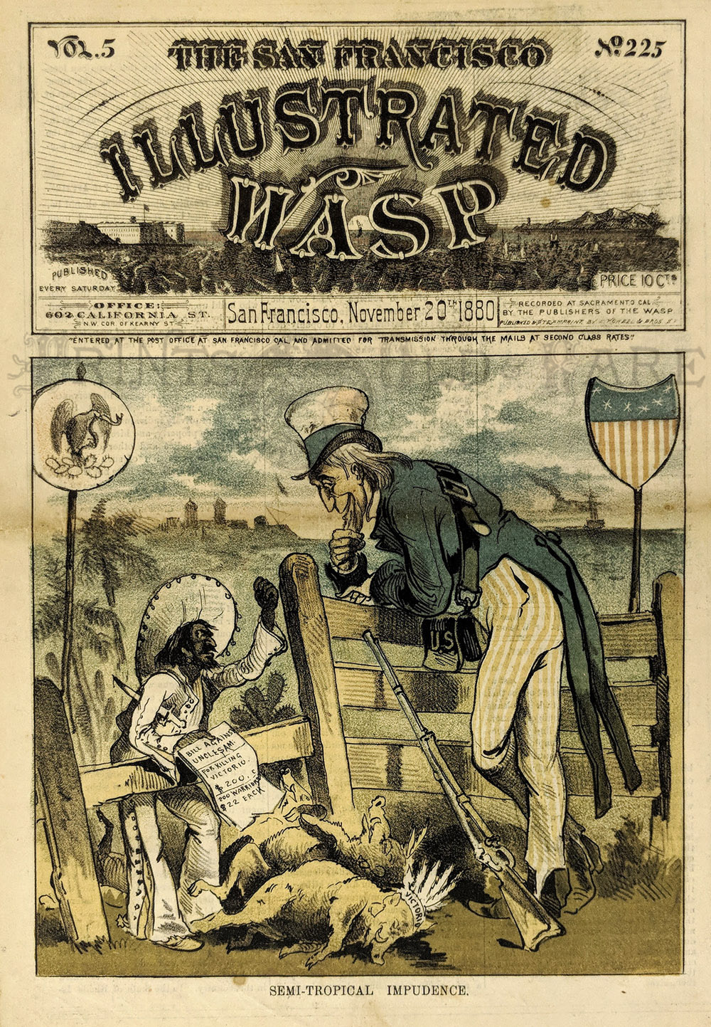 004SanFrancisco: Apache Warrior Victorio, died near border. 1880 San Francisco Illustrated Wasp "Semi-Tropical Impudence." An amused Uncle Sam leans over border fence as the Mexican Government asks for money to help defeat Victorio. Victorio pictured as a dead wild boar. Chromolithograph Wasp Cover. 14 x 10 1/4 $150 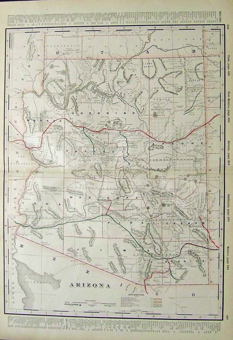 210az: 1892 Railroad survey map of Arizona. This pre-statehood map shows all of the township borders and meridian lines as well as mountains, rivers and Indian Reservations. The seven different railroads that pass throught the state are color coded and their routes shown with a key at the bottom of the map. 26x18 in. $150 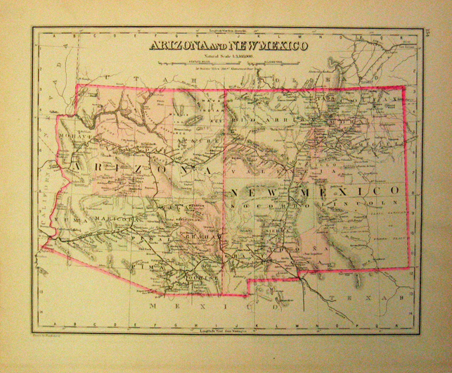 214az: 1880 Arizona & New Mexico published by Frank Gray in Gray's Atlas of the world. Original hand coloring makes this a very attractive early map suitable for framing. 17-1/2 x 14 1/2 in. $120 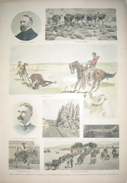 216az: 1894 Shall Arizona Be Admitted To Statehood? - Picturesque Bits Gathered By Our Representative in the Territory. Eight hand colored half-tones depicting Governor L.C. Hughes; gold-ore carriers; peculiar rock formation of the new railroad; C.M. Bruce, Secretary of the Territory; A Prospector's Outfit; A Gila Monster; On the Range; and a Train of Freighters. Published in Leslie's Weekly. 11x16in. $80 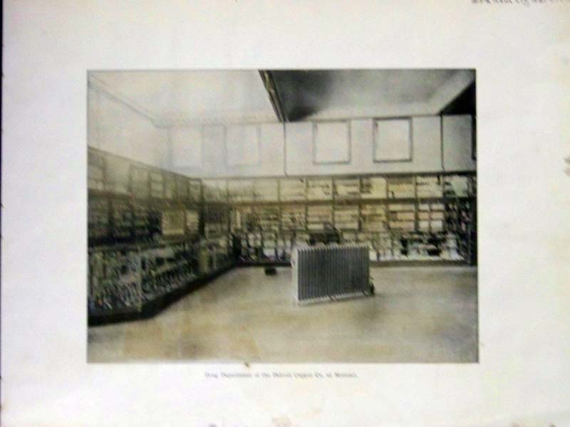 217az: C.1890 Hand colored photogravure showing the "Drug Department of the Detroit Copper Co. at Morenci" in Graham County, Arizona. 12 x 9 in. $30 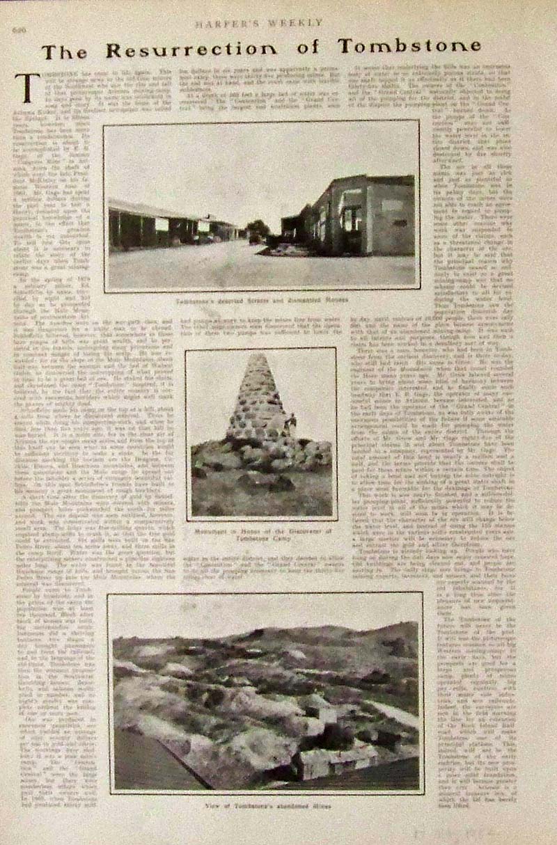 218az: 1902 Hand colored half-tones and article featured in Harper's Weekly titled, "The Resurrection of Tombstone," with images showing the old mining town of Tombstone's deserted Streets and dismantled Houses in top image, the Monument in Honor of the Discoverer of Tombstone Camp in middle image and on bottom, the View of Tombstone's adandoned Mines. 15-3/4 x 10 in. $40 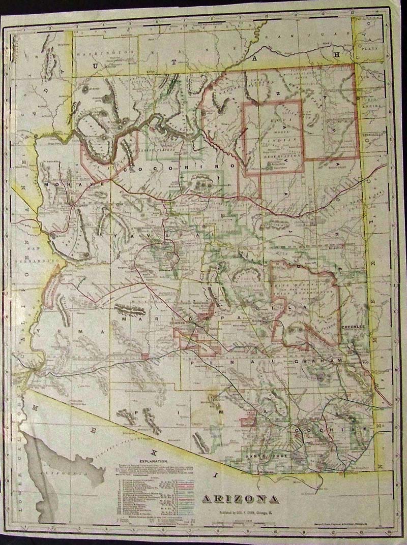 219az: 1900 George F. Cram hand colored, engraved Railroad Map of Arizona. 22 x 16-1/2 in. $200 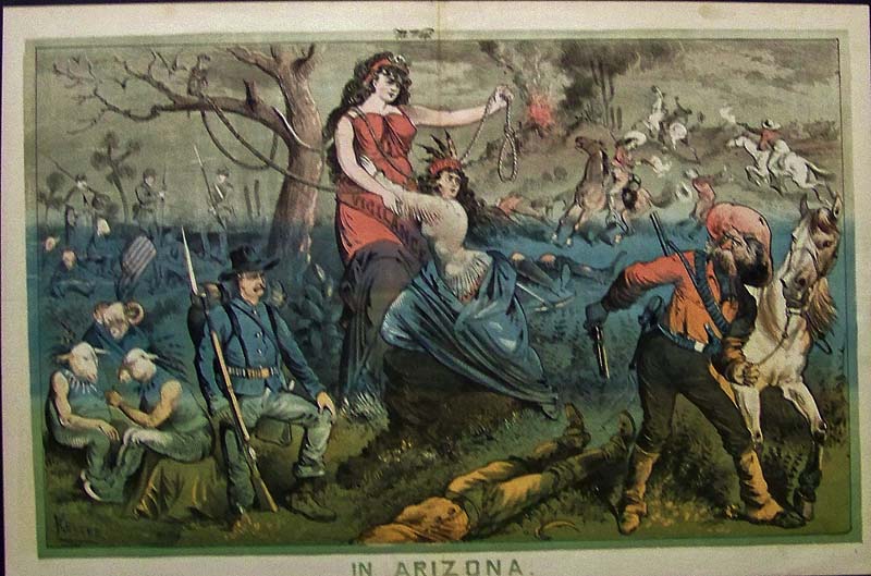
220Arizona: C.1882 Vigilantism in Arizona -- Very rare color lithograph by Keller from WASP (the San Francisco magazine) showing Arizona clinging to Vigilants who holds a noose as crime reigns rampant. 20 x 13-1/2 in. $250 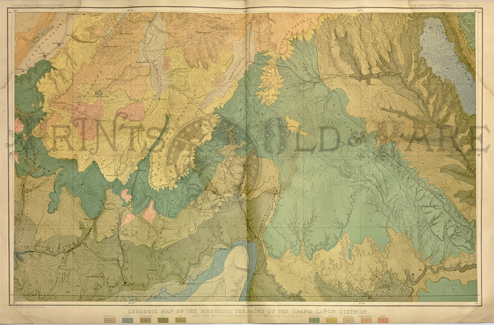 221Arizona: 1882 Grand Canyon District map in color by the U.S. Geological Survey. Very large and attractive map with colors indicating various soil types. 20 x 33 in. $150 |
|||||||||
| Order Form | |||||||||||
| Back to Homepage | |||||||||||