 
|
|||||||||||
This is a small selection of our inventory of antique Arkansas maps and prints. Additional inventory is available. Lowest Prices! Contact us with your request. 1-800-879-6277
|
|||||||||||
|---|---|---|---|---|---|---|---|---|---|---|---|
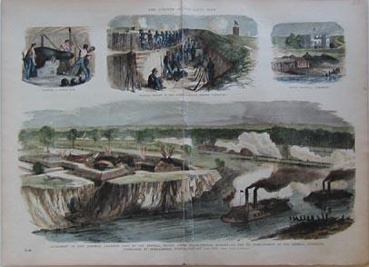 003ar: Antique Civil War views - Fort Hindman, Arkansas, plus three smaller views of Vicksburg on one page. Large 22x16-1/2 in. Handcolored. $60 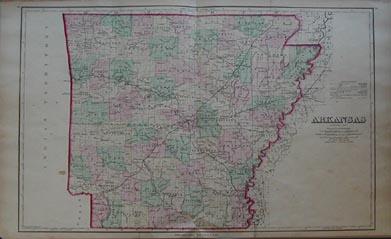 004ar: ANTIQUE ARKANSAS MAP - 1878. Large map of the State of Arkansas. This is an original hand colored engraving by O.W. Gray & Son of Philadelphia, 1878. Each county is individually hand colored. Old railroads, waterways and towns are shown, as are important Civil War battles. 24"x16". Very good condition. $180 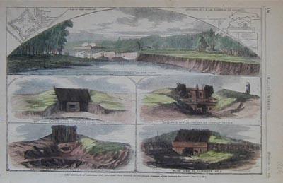 008ar: 1863 Fort Hindman Civil War views. Hand colored Harper's. 16x11 in. $50 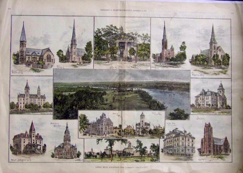 014ar: 1887 Hand colored double-page engraving which was featured as a Supplement to Harper's Weekly titled, "Little Rock, Arkansas -- From Photographs." Eleven views of historic buildings and various views are displayed. 22 x 16 in. $150 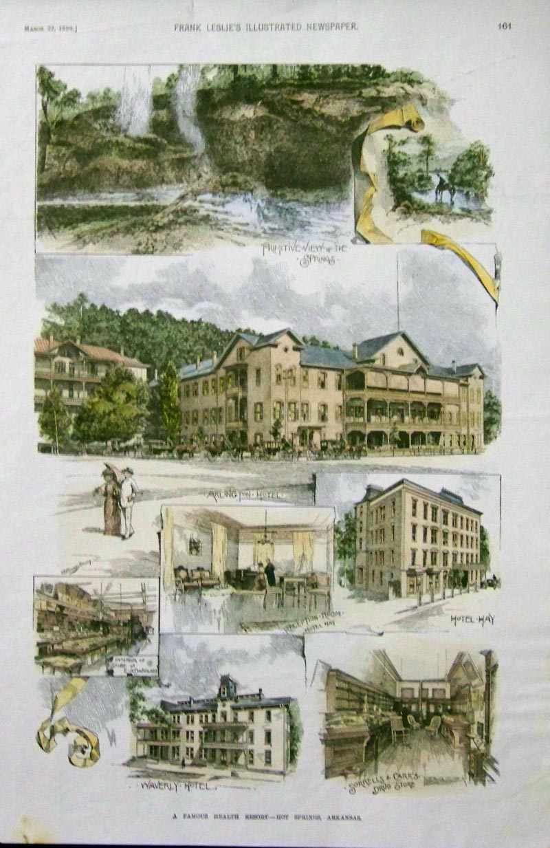 017ar: 1890 Hand colored antique wood engraving which was featured in Frank Leslie's Illustrated Newspaper showing several views of hotels in Hot Springs, AR. Title on bottom of page is, "A Famous Health Resort -- Hot Springs, Arkansas. 16 x 11 in. $80 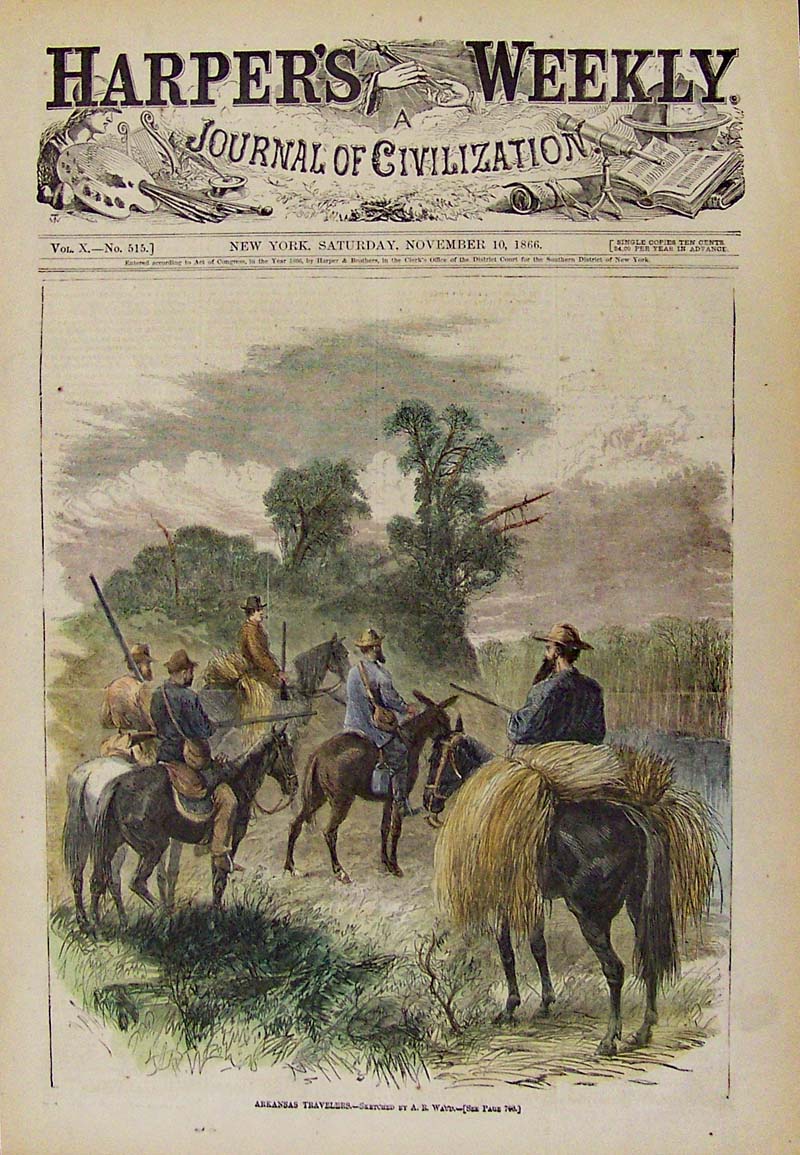 018Arkansas: "Arkansas Travelers" - View by A.R. Waud showing Squatters being forcibly moved. 1866 Hand colored wood engraving featured in Harper's Weekly. 16 x 11 in. $60 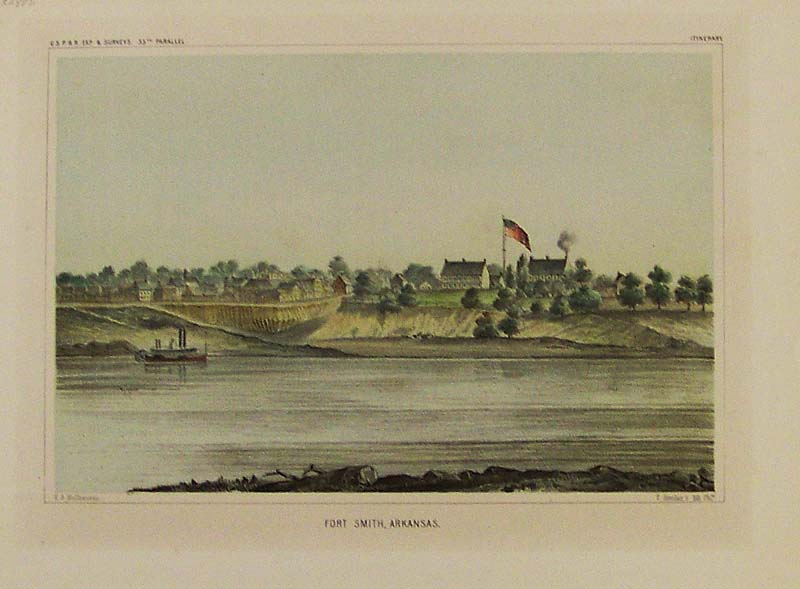
019Arkansas: Ft. Smith - 1855 - Rare and Important View. Original hand colored lithograph from the US Railroad Survey by H.B. Mollhausen. Shows Fort on the Arkansas River with a steamboat in view. This is featured in a Museum Mat. 15 x 12 with mat. $150 SOLD  102ar: Civil War Map: Arkansas, Mississippi. This is an old map from the Atlas to Accompany the Official Records of the Union and Confederate Armies, published by the United States government in 1895. It covers an area from central Arkansas to central Mississippi, with the Mississippi River in the middle. The map is extremely detailed, showing roads, railroad lines and even the smallest villages. Geographical features are shown in detail as well. 18x30 in. $100  103ar: Large 1917 Railroad Map of Arkansas. Color map from Rand McNally's 1917 Commercial Atlas of America. Shows the locations and names of each railroad line in the state. Locations of electric lines are shown as well. Also shows cities, towns and geographical features. 20x27 in. $80 |
 109ar: 1856 Colton's map of Arkansas. Railroads, towns, villages, rivers and mountians are all shown. There is a lovely engraved border surrounding the map. 14.5x17.5 in. $250 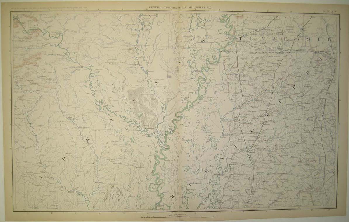 113ar: 1861-1865 Atlas to Accompany the Official Records of the Union and Confederate Armies, 1861-1865, which spans the areas of Arkansas, Tennessee and Mississippi - General Topographical Map Sheet XIX, Plate CLIV. 29x18in. $100 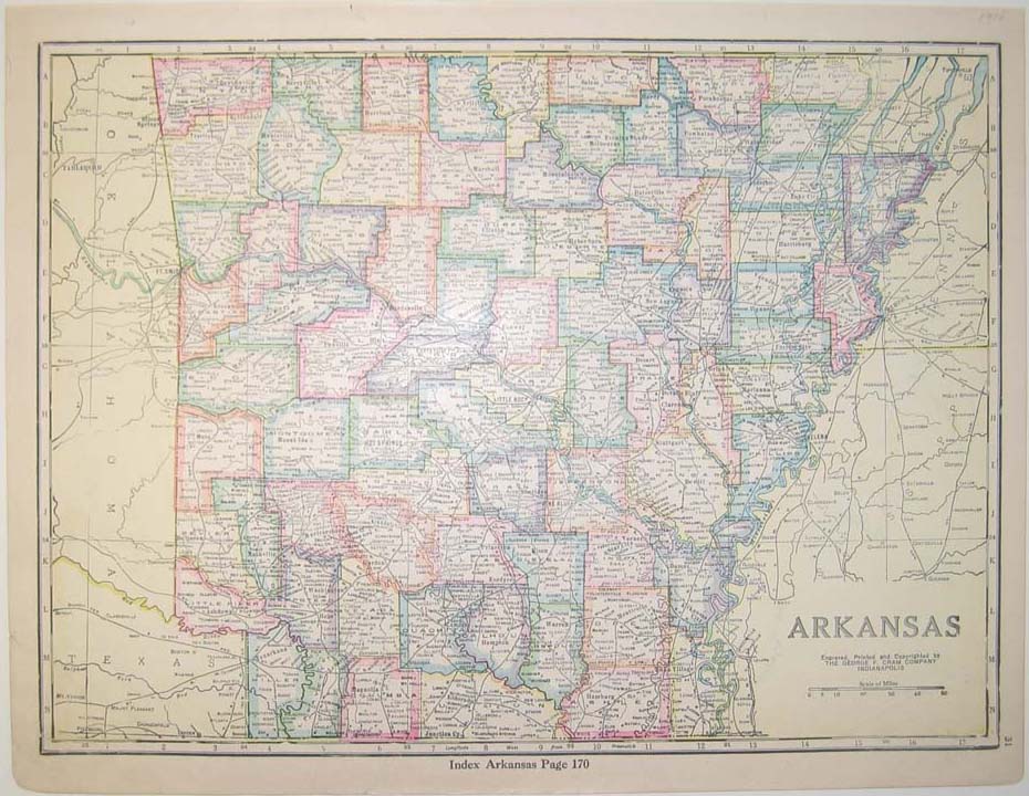
115ar: 1915 Arkansas map engraved, printed and copyrighted by The George F. Cram Company, Indianapolis 15x12in. $40  120ar: 1895, 1898 and 1900 Copyrighted, Rand, McNally & Co.'s Arkansas Railroads Map which includes key in bottom righthand side showing all the trains lines and names. 27-1/2 x 20-1/2 in. $90 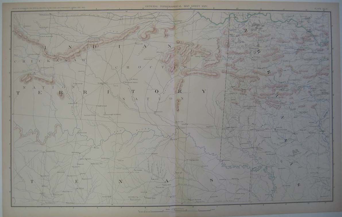
122ar: 1861-1865 Atlas to Accompany the Official Records of the Union and Confederate Armies, 1861-1865, which covers Arkansas and Native American Territories - General Topographical Map Sheet XXIV, Plate CLIX 29x18.5in. $100  126ar: 1886 Hand colored wood engraving featured in Harper's Weekly titled, "Eureka Springs, Arkansas -- Drawn by Charles Graham." Seven views in all showing various places within Eureka Springs, AR. 15-1/2 x 11 in. $60 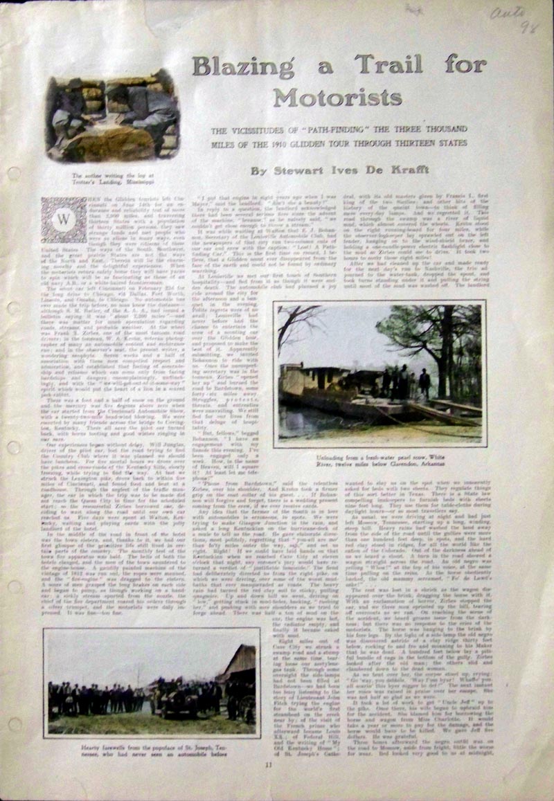 127ar: 1898 Article featured in Harper's Weekly titled, "Blazing a Trail for Motorists," with color halftones, the middle one captioned, "Unloading from a fresh-water pearl scow, White River, twelve miles below Clanendon, Arkansas." Article is about 'The Vicissitudes of "Path-Finding" the Three Thousand Miles of the Glidden Tour Through Thirteen States.' 16 x 11 in. $40 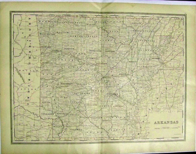 128ar: 1886 Lithographed Map of Arkansas, copyright secured. On the left side of map it shows the Indian Territory. 25 x 19 in. $80 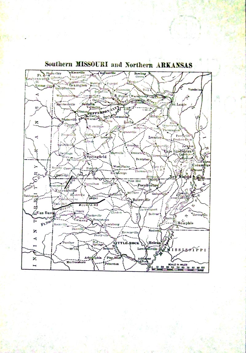
129ar: Book plate map of Southern Missouri and Northern Arkansas which shows the Indian Territory and a section of Kansas on far left side. 9-1/2 x 6-1/2 in. $15 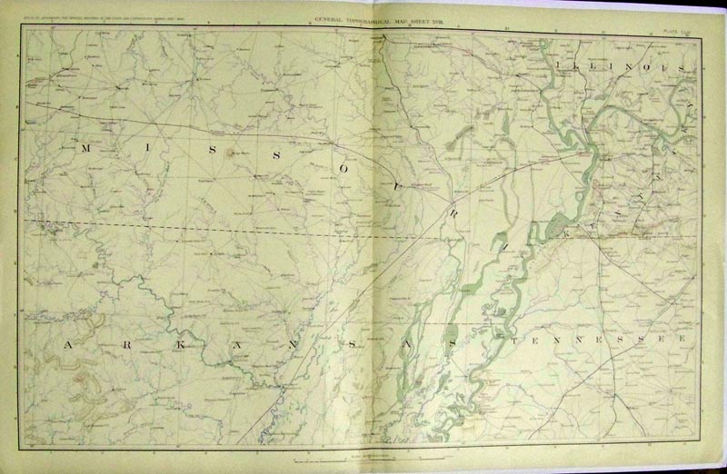
130ar: 1861-1865 Atlas to Accompany the Official Records of the Union and Confederate Armies. General Topographical Map, Sheet XVIII, Plate CLIII. Julius Bien & Co. Lithographed Map of Arkansas and surrounding states. 29 x 18-1/2 in. $80 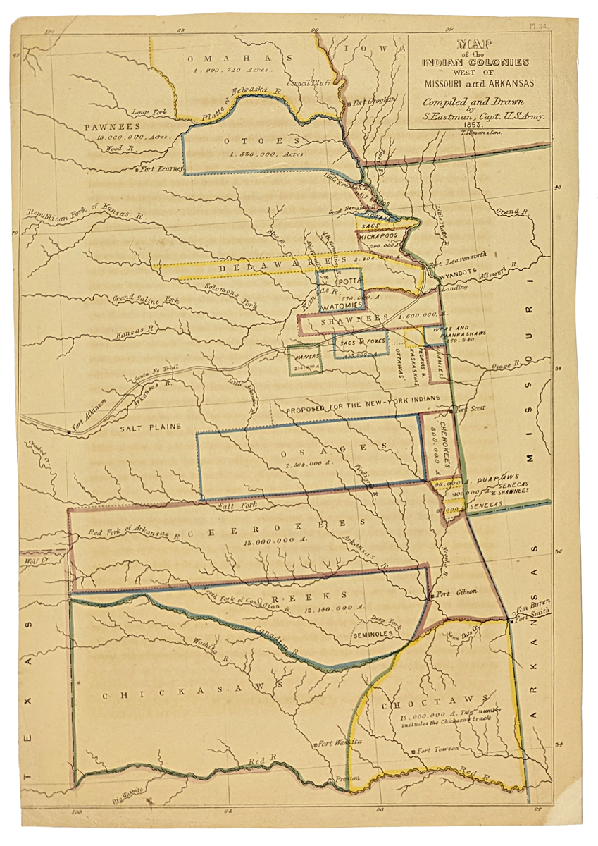 017mo: 1853 Eastman color Map of the Indian Colonies West of Missouri and Arkansas. 11-1/2 x 8 in. $250 |
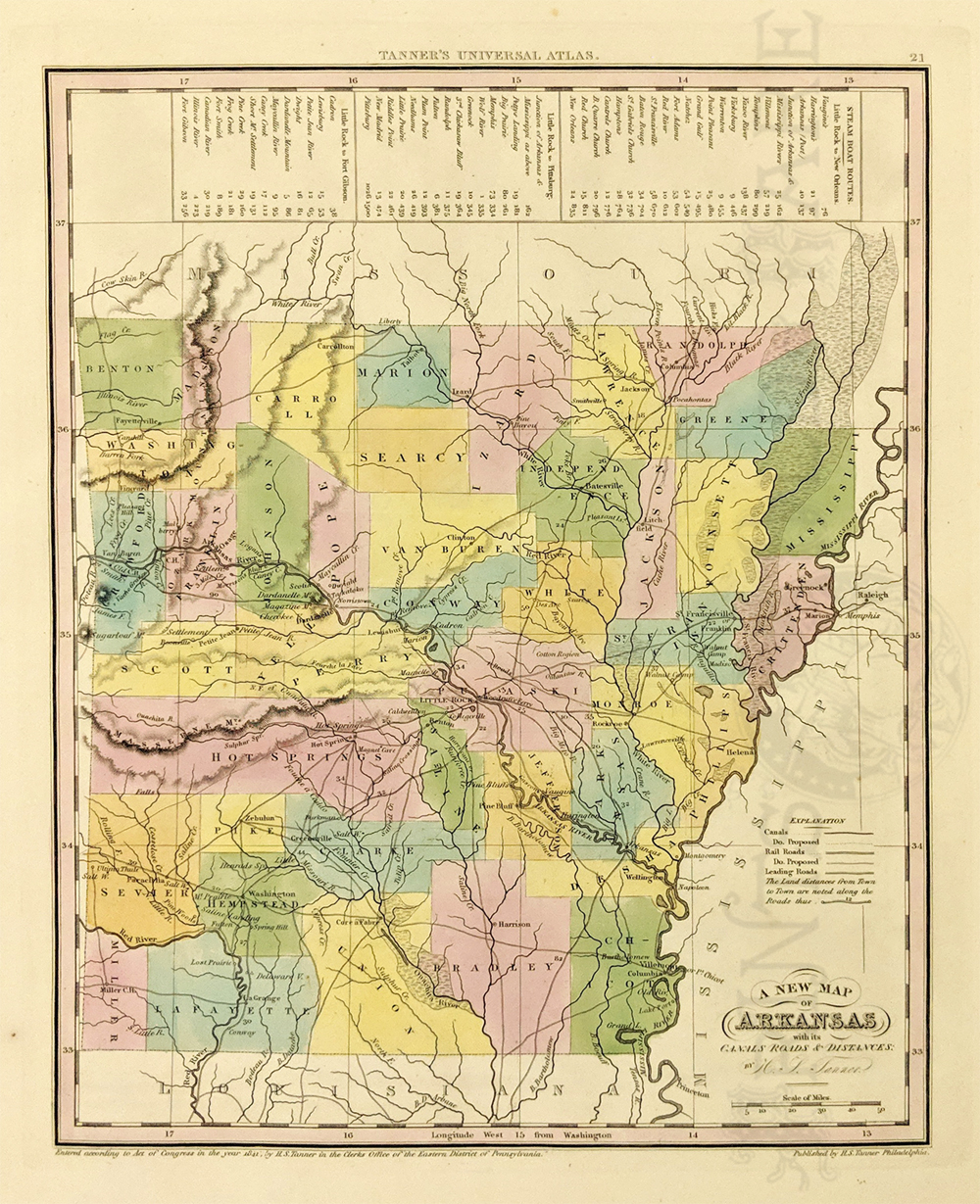 140Arkansas: A New Map of Arkansas with its canals, roads and distances. Rare 1841 Tanner Map. Railroads, proposed railroads, canals, proposed canals, leading roads, counties, cities, are shown along with some topography details. Index table shows the Steam Boat Route Distances to Little Rock to various cities and destinations. Original colored, copper engraving. 13 3/4 x 17 3/8 in. $480 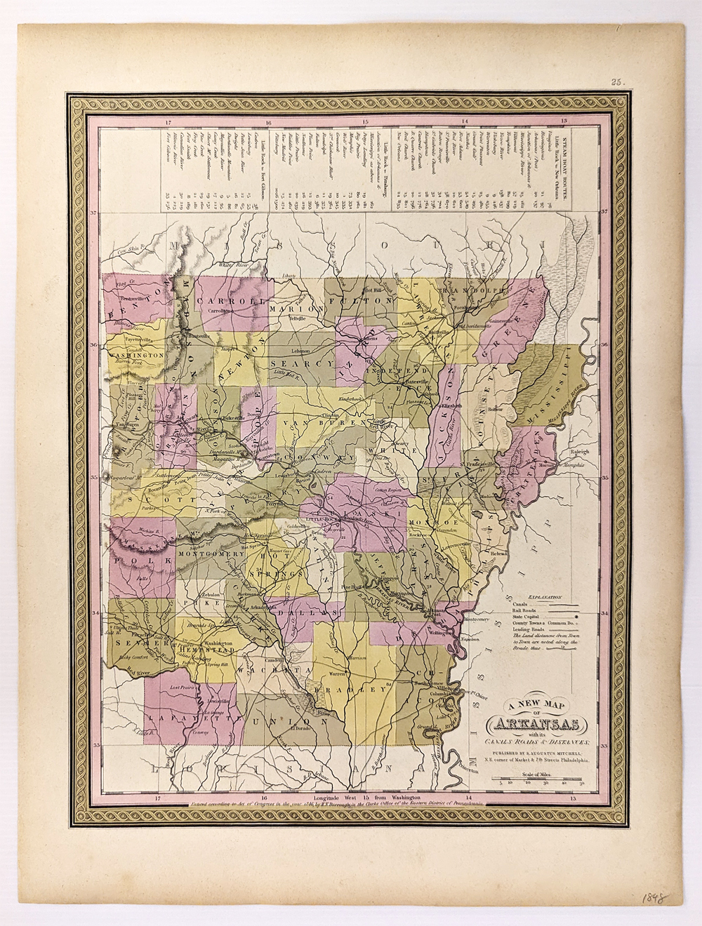 141Arkansas: A New Map of Arkansas with its Canals, Roads & Distances. 1848 Mitchell. Railroads, proposed railroads, canals, proposed canals, leading roads, counties, cities, are shown along with some topography details. Index table shows the Steam Boat Route Distances to Little Rock to various cities and destinations. Hand colored, lithograph. 13 5/8 x 17 3/8 in. $120 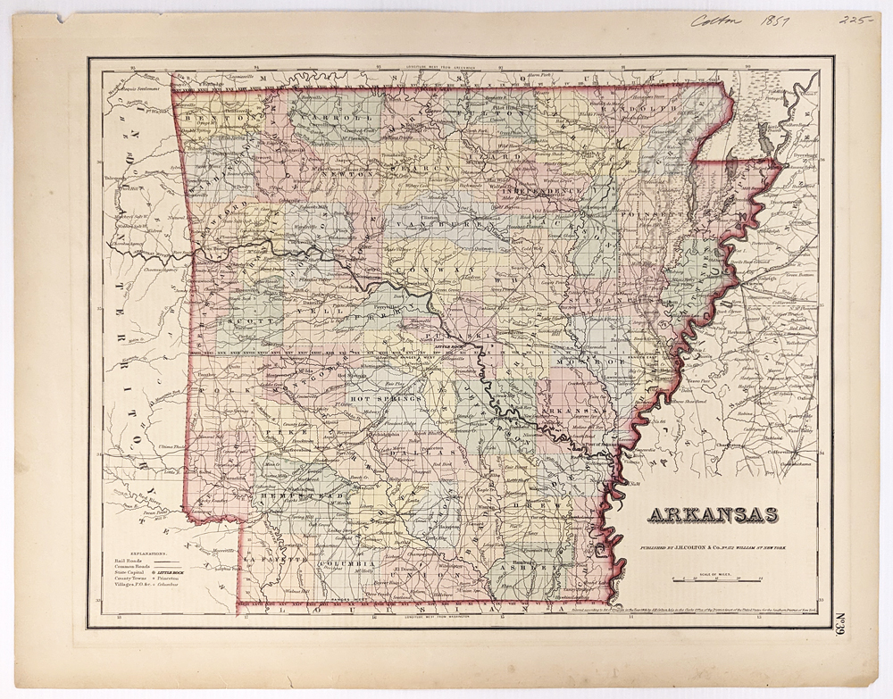 142Arkansas: Map of Arkansas. 1857 Colton. Railroads, roads, Capital, counties, towns, villages are shown. Hand colored, lithograph. 13 3/4 x 16 3/8 in. $80 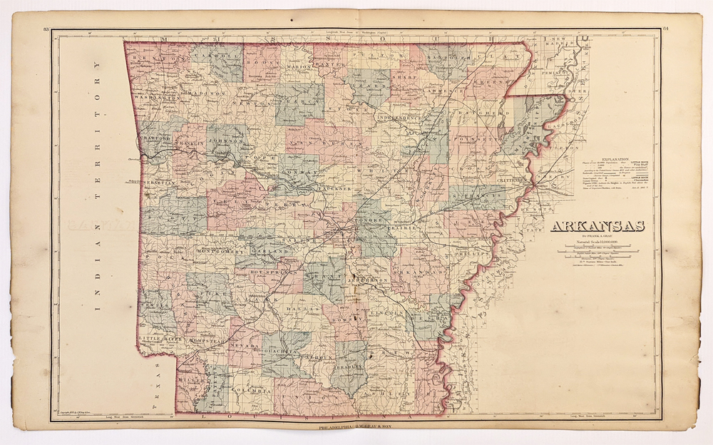 143Arkansas: Gray's Map of Arkansas. 1876. Shows county, towns, cities, land forms, rivers, bodies of water, and railroads. Also shows geographic conditions just after the end of the American Civil War. **light foxing, edges are rough. 14 x 27 in. $120 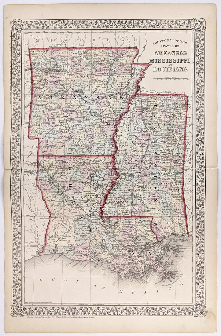 144Arkansas: 1872 Mitchell's County Map of Arkansas, Louisiana Mississippi. Showing various cities, towns, rivers, railroads, along with some topographical details. Hand colored, lithograph. 15 1/4 x 23 5/8 in. $150 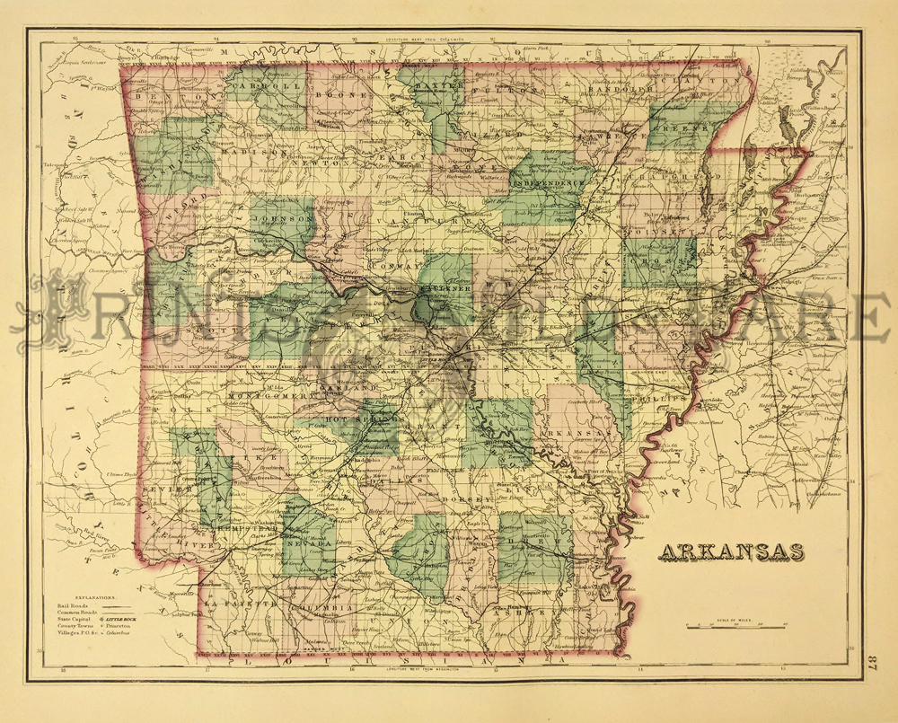
138Arkansas: Gray’s Map of Arkansas. Showing Railroads, Roads, Counties, Villages, and Waterways. 1875. Hand colored, Lithograph. 13 x 15 in. $120 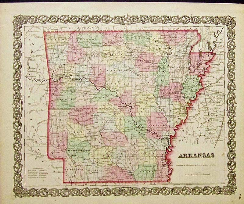
137Arkansas: 1855 J.H. Colton original hand colored engraved map of Arkansas. Colton was among the earliest map makers with very accurate maps of the United States. 17-1/2 x 14-1/2 in. $250 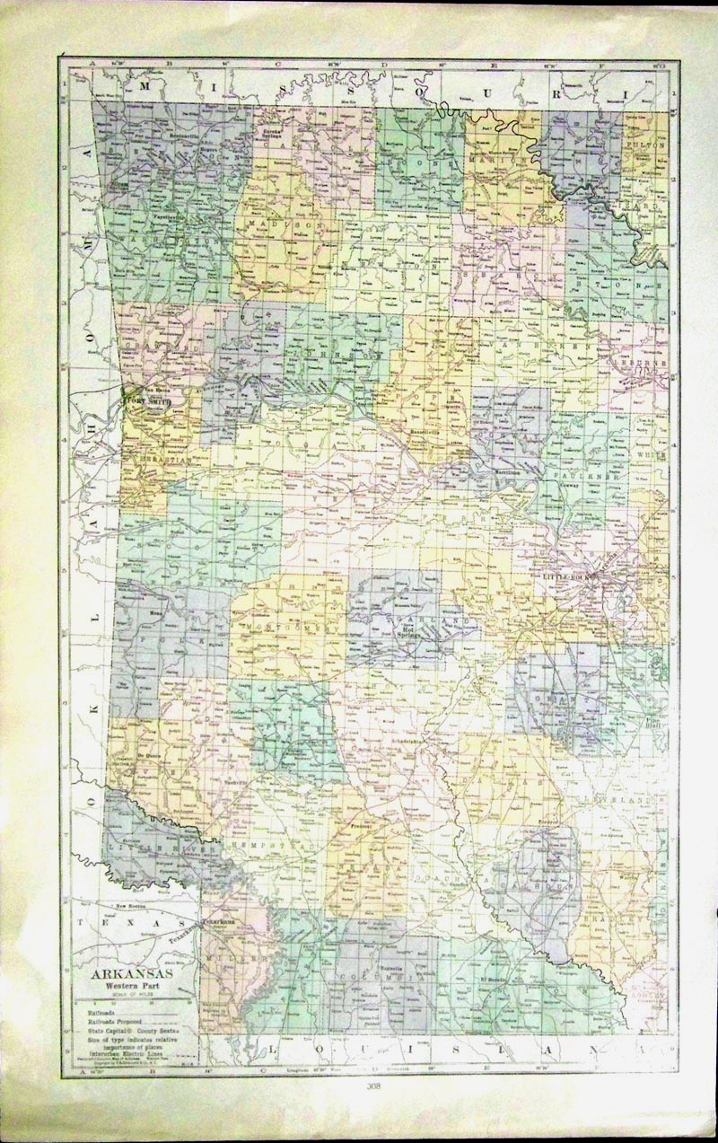 131ar: 1914 Hammond's Complete Map of Arkansas, Western Part, printed in color. Copyright by C.S. Hammond & Co., New York. 18 x 11 in. plus outside border. $50 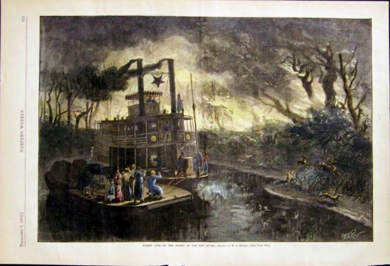 132ar: 1878 Hand colored wood engraving featured in Harper's Weekly showing, "Forest Fire on the Banks of the Red River -- Drawn by W.A. Rogers." Scene shows a steamboat and raft with people gasping in horror at the spreading wildfire on the shore nearby. 16 x 11 in. $50  134ar: 1888 Hand colored wood engraving featured in Frank Leslie's Illustrated Newspaper titled, "Arkansas -- Views in Hot Springs, The Famous Health and Pleasure Resort." Engravings show the Opera House, the Railroad Depot, the City Post-Office, Central Avenue and Whittington Avenue. Also a nice bird's-eye view of the town of Hot Springs as observed from the Mountain Observatory. 16 x 11 in. $60 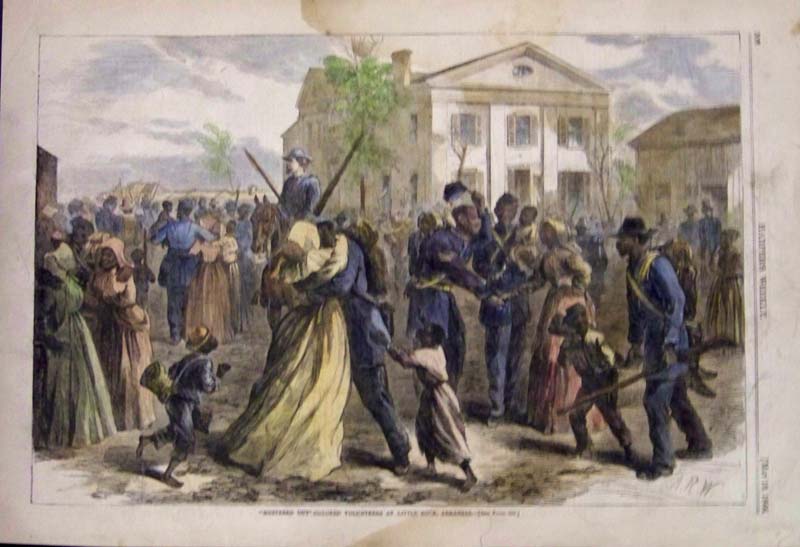 135ar: 1866 Hand colored wood engraving featured in Harper's Weekly titled, "Mustered Out" Colored Volunteers at Little Rock, Arkansas." The artist's initials, A.R.W. are shown on right bottom of image. Light discoloration just outside top center of border. 16 x 11 in. $80 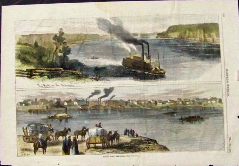 136ar: 1866 Hand colored wood engraving featured in Harper's Weekly showing Little Rock from the River in bottom engraving and top engraving shows a view of "Big Rock" on the Arkansas River. Title of images is, "Little Rock, Arkansas." 16 x 11 in. $75 |
|||||||||
| Order Form | |||||||||||
| Back to Homepage | |||||||||||