 
|
|||||||||||
This is a small selection of our inventory of antique Balkan region (Hungarian, Croatian, Bulgarian, Romanian, Albanian, Polish) maps and prints. Additional inventory is available. Contact us with your request. 1-800-879-6277
|
|||||||||||
|---|---|---|---|---|---|---|---|---|---|---|---|
 001bal: 1885 Prince Alexander I of Bulgaria. Genuine antique engraving from the London Illustrated at the time of the Revolution in eastern Roumelia. 11x16 in. $40 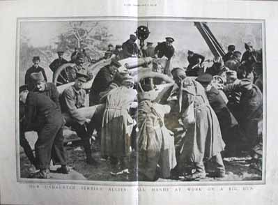 002bal: 915 'Serbian Allies' print. Old half tone photo from The Graphic titled "Our Undaunted Serbian Allies: All Hands at Work on a Big Gun." 15-1/2x22 in. $60 
003bal: 1920 Bulgaria, Romania. Six antique photo gravure pictures showing scenes in those countries shortly after WWI. 10-1/2x16 in. $40 
004bal: 1881 Albanian Entertainment view. Antique engraving of nighttime entertainment. Men are wearing traditional Albanian dress. 11x16 in. $60  005bal: 1854 Map of Balkan region. Authentic antique map with original outline color. Printed in Germany. Shows areas before they were divided into present states. 14x18 in. $60 
008bal: 1914 Archduke Ferdinand print. Half tone photo of the Archduke, whose assassination precipitated the start of WWI. 11x16 in. $60 |

009bal: 1877 Bulgaria views. Two engraved views of the distress in 1877. 12x16 in. $40 
010bal: 1885 War Between Bulgaria and Serbia. Two antique engraved war scenes on one page. 11x16 in. $60 
011bal: 1895 Dalmatian Coast. Four old half-tone photos on one page. 11x16 in. $60  012bal: 1861 Large Map of Balkans, Austria, Greece, Turkey. Beautiful original hand colored engraved map, published by Johnson and Browning. 18x27 in. $80 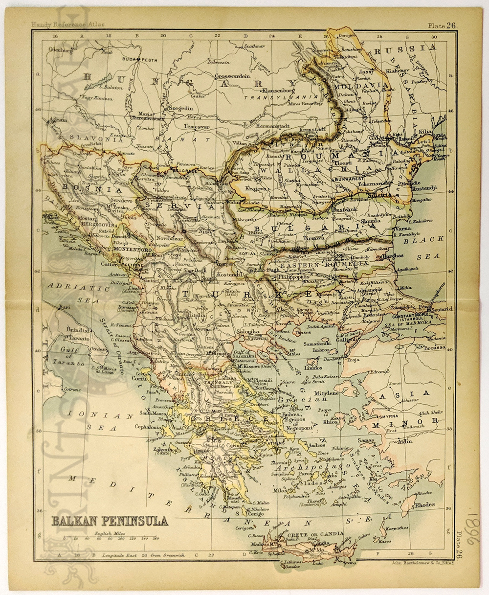 013bal: 1896 Balkan Peninsula antique map shows all countries in area and Greece. size: 7x8.5 in. $30 
014bal: 1890 Servia and Roumania (Balkans)map printed in color. size: 9x12 in. $40  015bal: Poland in 1861. Hand colored wood engraving from the front page of The Illustrated London News, April 27, 1861. The article is titled "Poland's Claim To Be A Nation". The middle view is captioned "Count Zamoyski's Palace, Warsaw". The bottom caption is, "The Market Place at Warsaw". This engraving is in excellent condition. 16x11 in. $60 |
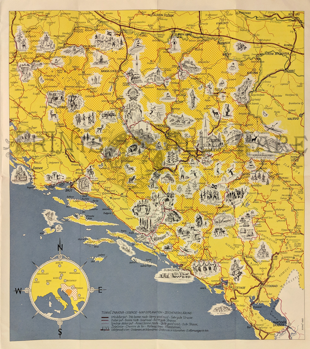 019bal: Bosnia Herzgovina (Jugoslavia – Bosnia Ihercegovina.) 1960 pictorial tourist map. Shows major roads & points of interest. x in. $125  020bal: 1856 Chart of the Baltic by Charles Desilver of Philadelphia. Shows the entire coastline of the Baltic Sea, Gulf of Findland, Bothnia, Skager Rack and part of the North Sea. Larger inset of Cronstadt and Saint Petersburg. Smaller 4 insets of Sveaborg, Port Baltic, Chart of Reval and Riga. Hand colored lithograph. *Water stain along the upper margin. 17 1/2 x 27 in. $200 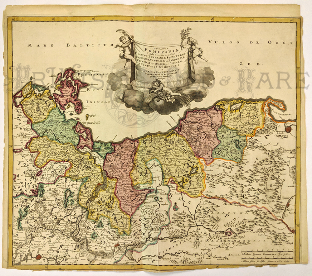 021bal: "Ducatus Pomeraniae Tabula Generalis in qua funt..." Rare issue of Theodorus Danckert's attractive map part of Pomerenia. Including Berlin, Dantzig, Stralsund, etcdone in Amsterdanm in 1700. Major cities, rivers and forests are shown. *Map has some damage to the bottom border. 21 x 23 1/2 in. $350  022bal: 1918 Map of Poland by the Geographical Publishing Company of Chicago. Shows Poland, Lithuania, Slovakia and part of the Baltic Sea. Major roads and rivers are shown as well as cities and towns. Countries are marked by a heavy dotted line highlighted in red. 4 1/2 x 10 in. $40 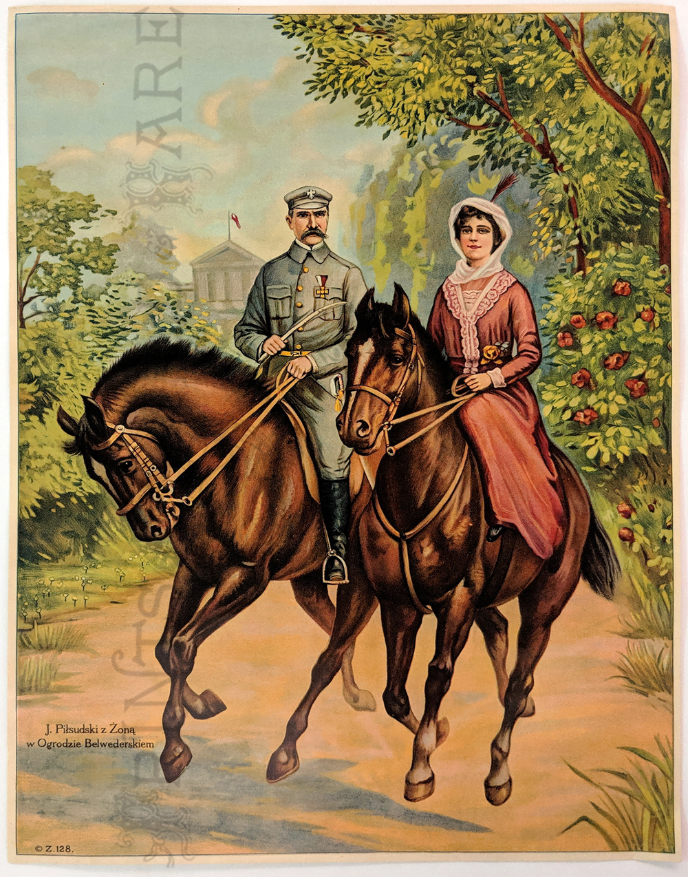 023bal: "J. Pilsudski z Zona with Ogrodzie Belwederskiem." Pulsudski was a revolutionary in Poland from 1918 to 1939 and became known as the "Father of Modern Poland." Features two riders with buildings in the background. 15 x 20 in. $60  Croatia") 024bal: Ragusa (Dubrovnik) Croatia 1892. Hand colored engraving “Ragusa on the Adriatic, Austria.” Dates to the Austrian Empire days. 8 3/8 x 11 in. $45 |
|||||||||
| Order Form | |||||||||||
| Back to Homepage | |||||||||||