 
|
|||||||||||
This is a small selection of our inventory of antique Buffalo & Niagara Falls, NY maps and prints. Additional inventory is available. Contact us with your request. 1-800-879-6277
|
|||||||||||
|---|---|---|---|---|---|---|---|---|---|---|---|
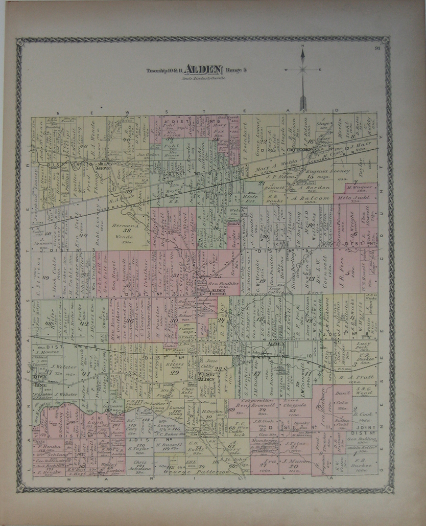
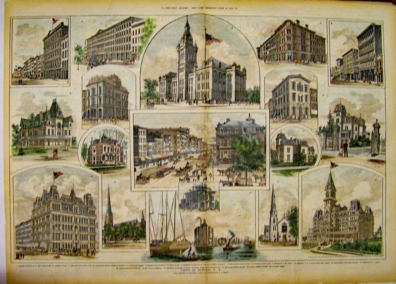 000bu: Views in Buffalo - 1879 Rare views from The Daily Graphic which featured 17 vignettes which include stores, Washington Block, banks and residences. Hand colored wood engraving. 28 x 20 in. $225 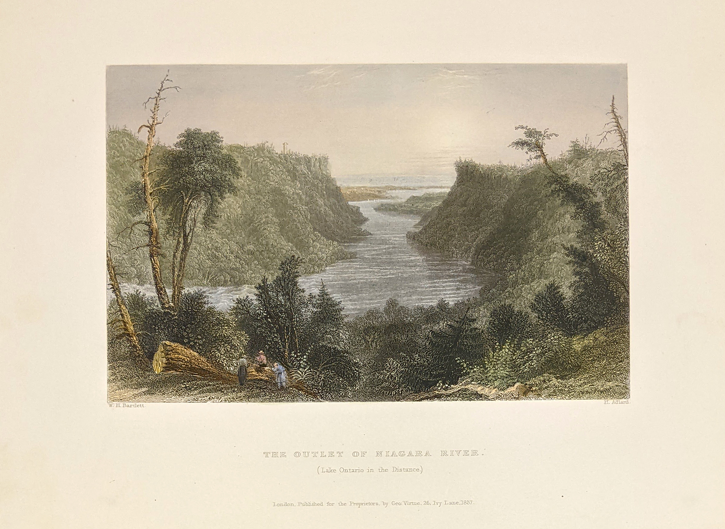 001bu: 1838 Outlet of Niagara River. Bartlett antique hand colored steel engraving. 10-1/2x8 in. $50 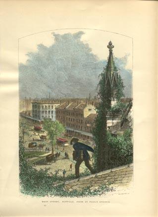 008bu: 1873 Buffalo New York Main Street view. Hand colored engraving from Picturesque America. 9x11-1/2 in. $40 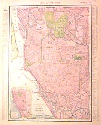 009bu: 1901 Buffalo map. Printed in color by Rand McNally. 11-1/2x14 in. $40 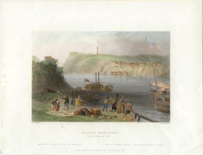 013bu: 1838 Brock's Monument from the American Side, Niagara River. Excellent hand colored Bartlett view of the river boats etc. Steel engraving. 10-1/2x8 in. $60 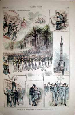 014bu: 1882 Buffalo New York views. Famous Seventh Regiment at Buffalo. Hand colored engravings from Harper's. 11x16 in. $50 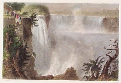 108bu: 1838 Bartlett: Niagara Falls American Side. Hand colored steel engraving by W.H. Bartlett, published in 1838. Title is "Niagara Falls (From the Top of the Ladder on the American Side)." Nice view of the falls, with figures in the background watching the scene. 8x10 in. $80  109bu: 1837 Bartlett: Niagara Horse Shoe Falls. Hand colored steel engraving by W.H. Bartlett, published in 1837. Title is "The Horse Shoe Fall, Niagara, With the Tower." A small wooden bridge is shown extending to the edge of the falls. 8x10 in. $80 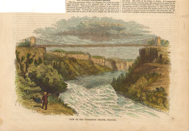 115bu: 1854 The Niagara Suspension Bridge, Niagara River. Handcolored engraving showing the expanse across the Niagara. 6.5x10 in. $50 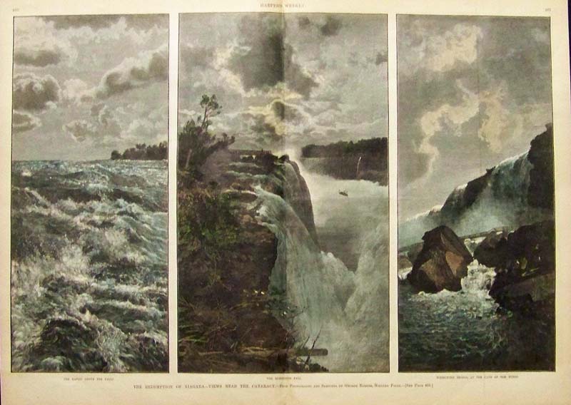 117bu: The Redemption of Niagara - Views Near the Cataract. Beautiful hand colored engraving with three panels. First showing, The Rapids above the Falls. Center of The Horseshoe Fall. Right image, Whirlwind Bridge, at the Cave of the Winds. 16x22 in. $120  121bu: 1873 Picture of the City of Buffalo. Gorgeous hand colored lithograph titled," City of Buffalo," by W. Wellstood. Shows view of the city of Buffalo. 12 1/2 x 9in. $60 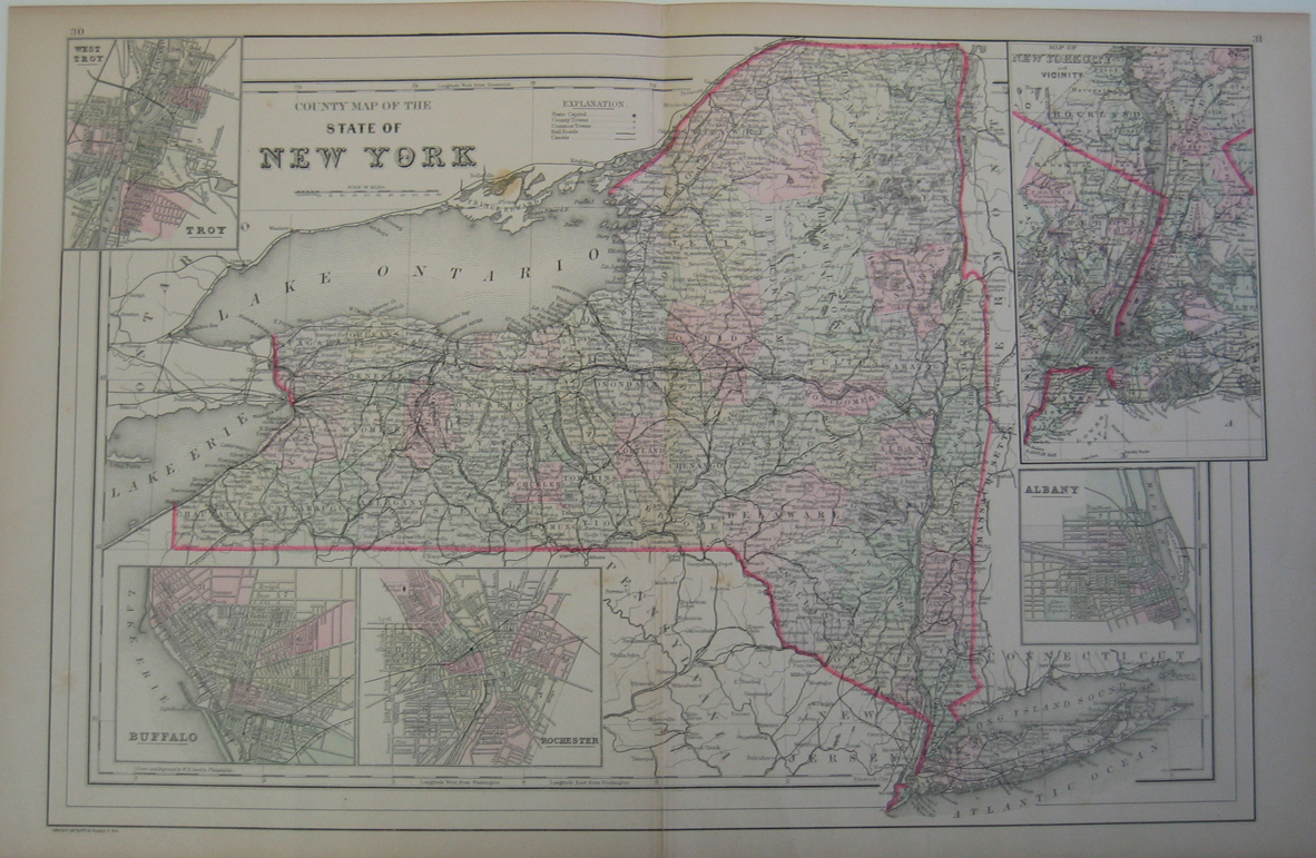 123bu: 1887 Map of New York State. Fine old color map of New York, with counties differentiated by color. Shows railroads and rivers, with insets of Buffalo, Rochester, Albany & New York City. 24 x 16in. $150 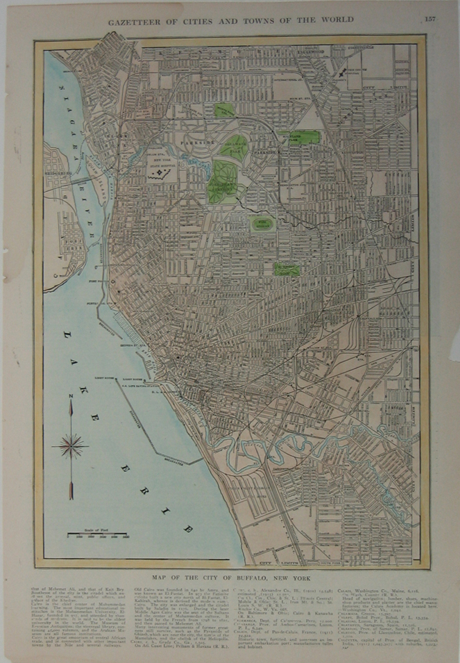 124bu: Map of Buffalo, New York. Colored map of the Buffalo NY metro area, published in the Gazetteer of Cities and Towns of the World. Streets, railroad lines, parks, cemeteries and major buildings are all shown. 15 x 10in. $60 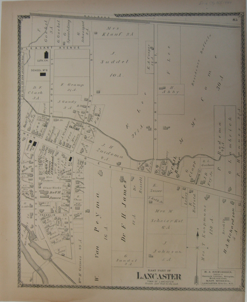 125bu: 1880 Map of the Town of Lancaster. This beautiful map shows the east part of Lancaster, including the town's streets, churches, schools and businesses. 17 x 14in. $40  127bu: 1880 Map of the Town of Alden, West Alden, Northern Lancaster, Crittenden and Mill Grove. This elegant colored map, with its decorative border shows different districts, schools, churches, cemetaries and streets. 27 x 17in. $80 |
 129bu: 1879 Map of the Town of Alden. This beautiful map, with its decorative border shows the Township of Alden, including the town's districts, streets, churches, schools and businesses. 17 x 14 in. $60 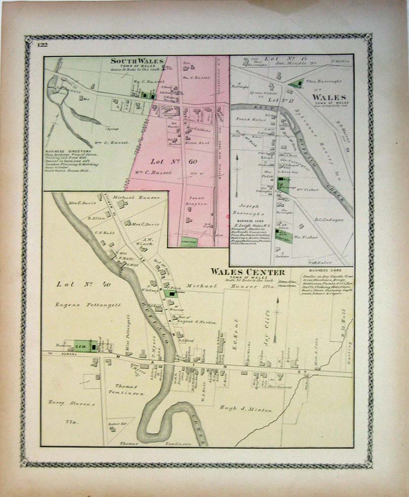
132bu: 1879 Map of Wales, South Wales, and Wales Center. This beautiful map, with its decorative border shows Wales, South Wales and Wales Center, including the town's districts, streets, churches, cemeteries, schools and businesses. 17 x 14 in. $60 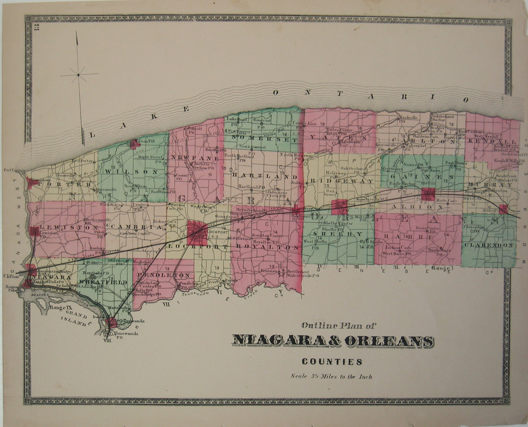 133bu: 1875 Plan of Niagara and Orleans. This beautiful map, with its decorative border shows Niagara and Orleans, including the town's districts, streets, churches, cemeteries, schools and businesses. 17 x 14in. $60 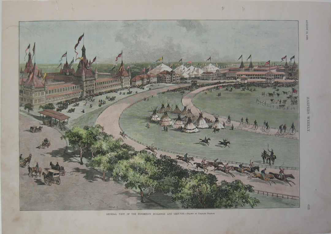 134bu: 1888 Picture of the general view of the exhibition buildings and grounds in Buffalo. Beautifully hand colored wood engraving titled, "General View of the Exhibition Buildings and Grounds," by Charles Graham from Harper's Weekly. Shows scene of the general view of the exhibition buildings and grounds in Buffalo. 11 x 16in. $60  136bu: 1907 Map of Erie County showing State and County System of Highways. Gorgeous map of Erie County showing State and County System of Highways. Map includes different counties, railroads, streets, beaches and highway improvement status. 33 1/2 x 23 1/2in. $90 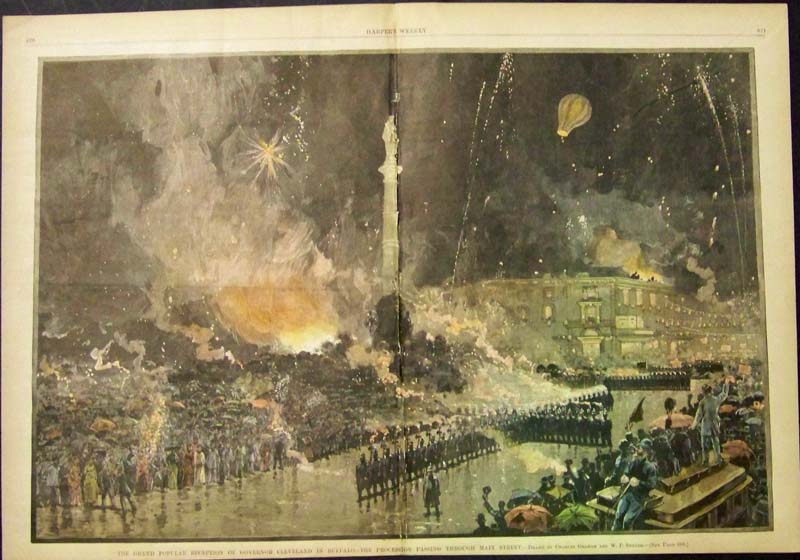 139bu: 1884 Hand colored wood engraving featured in Harper's Weekly titled, "The Grand Popular Reception of Governor Cleveland in Buffalo -- The Procession Passing Through Main Street." Drawn by Charles Graham and W.P.Snyder. 22 x 15-1/2 in. $125 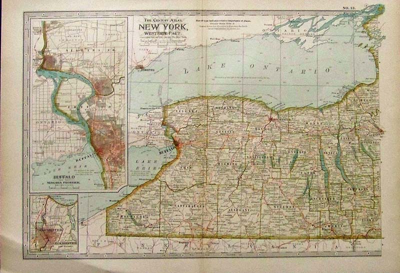
140Buffalo: 1897 Color entury Atlas, New York, Western Part by The Century Co., New York. Insets on left of Buffalo and Rochester. 17 x 12 in. $40 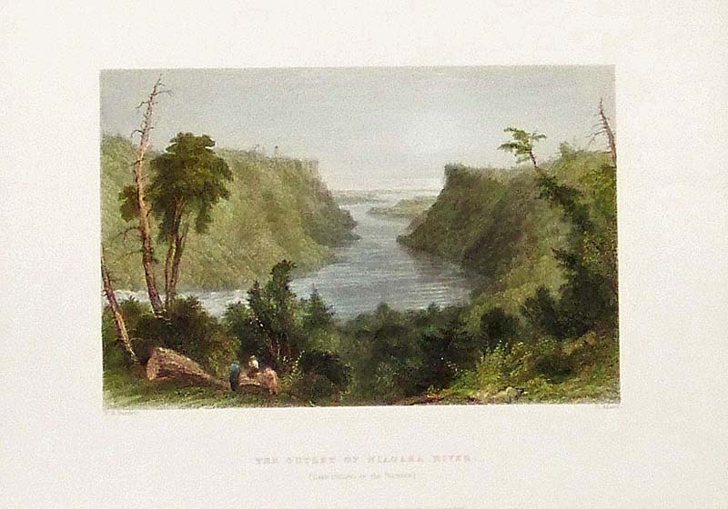
142Buffalo: 1837 W.H. Bartlett hand colored steel engraving titled, "The Outlet of Niagara River." (Lake Ontario in the Distance). Published for the Proprietors by Geo.Virtue, London. 10-1/2 x 8 in. $80 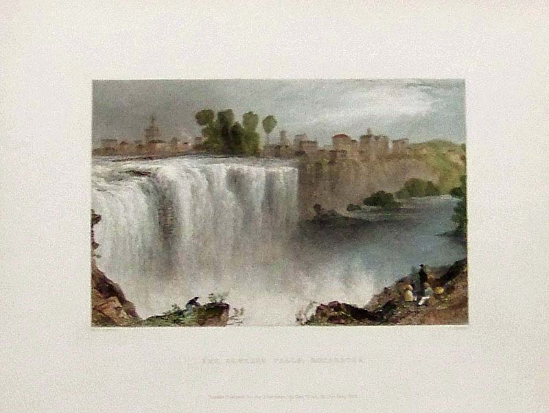
143Buffalo: 1838 W.H. Bartlett hand colored steel engraving titled, "The Genesse Falls, Rochester." Published for the Proprietors by Geo. Virtue, London. 10-1/2 x 8 in. $80 
144Buffalo: 1837 W.H. Bartlett hand colored steel engraving titled, "Niagara Falls From the Ferry." Published for the Proprietors by Geo. Virtue, London. 10-1/2 x 8 in. $80 
145Buffalo: 1837 Bartlett hand colored steel engraving titled, "View Below Table Rock." Published for the Proprietors by Geo. Virtue, London. 10-1/2 x 8 in. $60 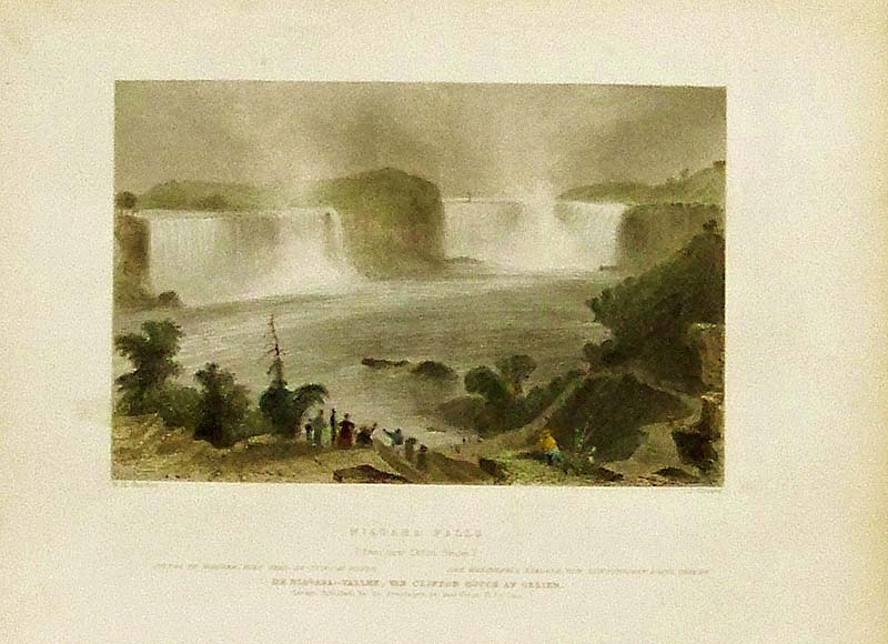
146Buffalo: C.1837 W.H. Bartlett hand colored steel engraving showing Niagara Falls (From Near Clifton House). Published for the Proprietors by Geo. Virtue, London. 10-1/2 x 8 in. $50 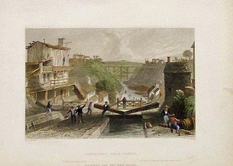 147Buffalo: C.1837 W.H. Bartlett hand colored steel engraving showing Lockport, Erie Canal. Published for the Proprietors by Geo. Virtue, London. 10-1/2 x 8 in. $50 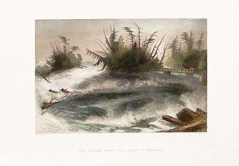
148Buffalo: 1837 W.H. Bartlett hand colored steel engraving showing "The Rapids Avove the Falls of Niagara." Published for the Proprietors by Geo. Virtue, London. 10-1/2 x 8 in. $50 |
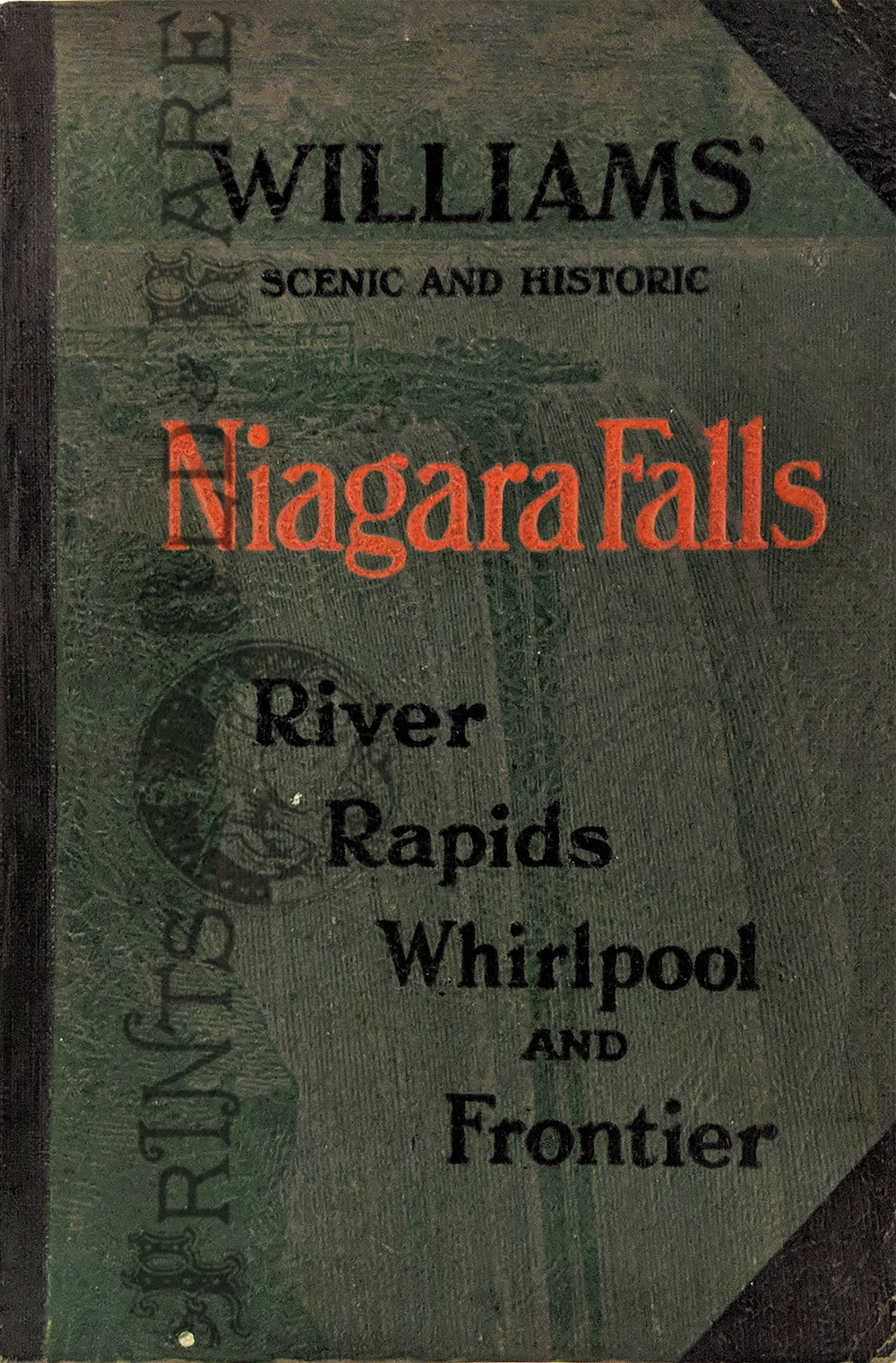 167Buffalo: Scenic and Historic Niagara Falls. 1925. 168pp Guidebook with every page containing sepia toned photos of important sites. 6 1/8 x 9 1/8 in. $35 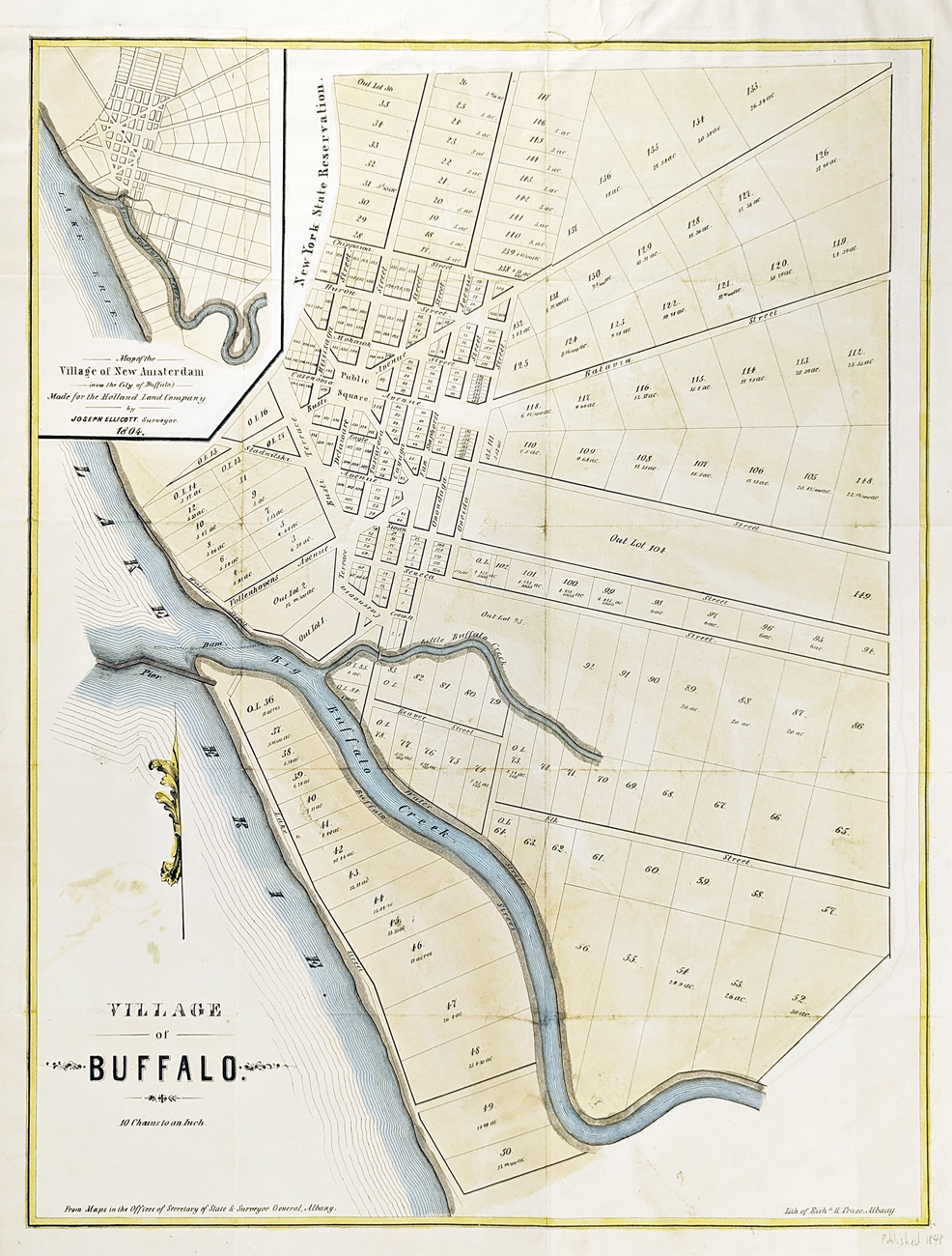 168Buffalo: Map of Buffalo. 1848. Hand colored lithograph by Richard H Pease. Shows Public Square and streets. Inset of Village of New Amsterdam. 17 1/4 x 21 3/4 in. $250  149Buffalo: 1837 W.H. Bartlett hand colored steel engraving titled, "The Horse Shoe Fall, Niagara, -- With the Tower." Published for the Proprietors by Geo. Virtue, London. 10-1/2 x 8 in. $50 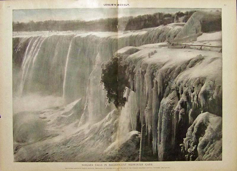 150Buffalo: Half-tone engraving from Leslie's Weekly titled, "Niagara Falls in Magnificent Midwinter Garb." Image shows the great falls in a semi-frozen state. 22 x 16 in. $120 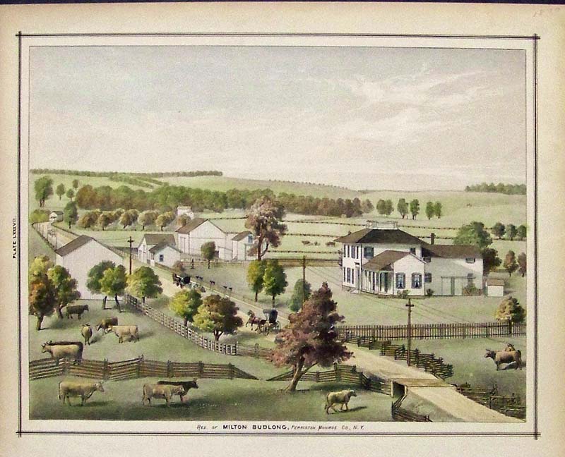
151Buffalo: 1877 Hand colored lithograph showing the Residence of Milton Budlong, Perrinton, Monroe Co., N.Y. 14 x 11 in. $50 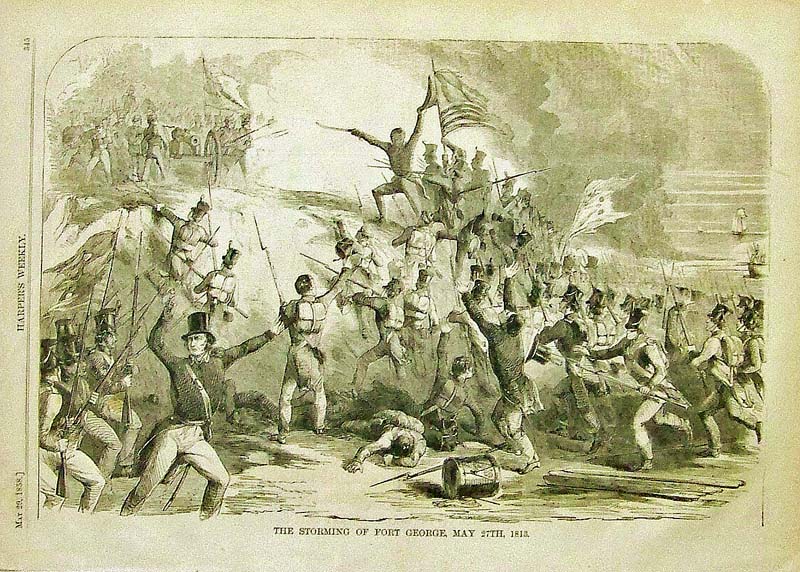
152Buffalo: 1858 Wood engraving from Harper's Weekly titled, "The Storming of Fort George, May 27th, 1813." 16 x 11 in. $40 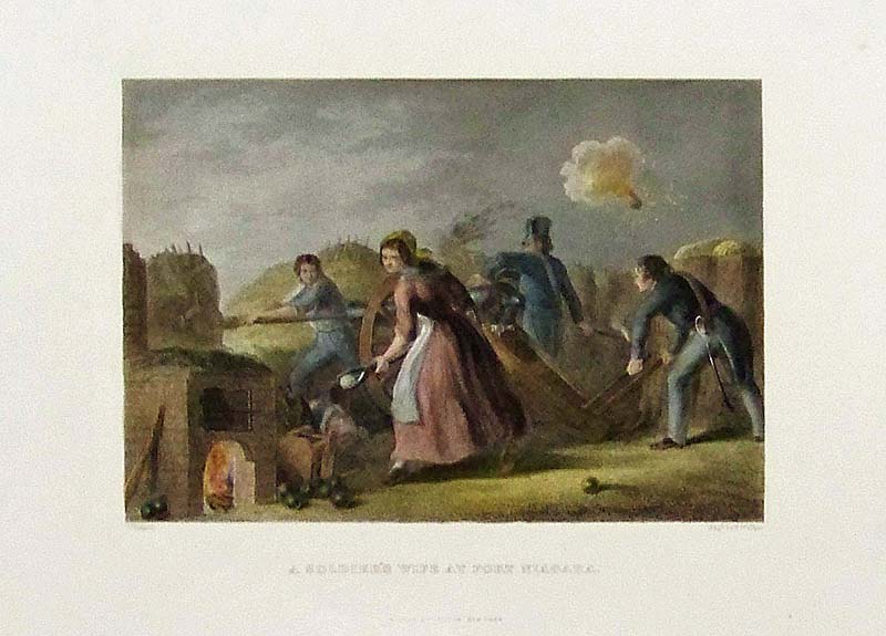
153Buffalo: Hand colored steel engraving titled, "A Soldier's Wife at Fort Niagara." Published by Virtue & Yorston, New York. 11 x 8-1/2 in. $40 
154Buffalo: C.1897 Color map of Buffalo, showing the State Insane Asylum and The Park. 14-1/2 x 11-1/2 in. $40 
156Buffalo: 1901 Leslie's Weekly Illustrated hand colored half-tone showing a procession parade of Geisha Girls in Jinrikshas entering the Midway at the Head of the Brilliant Throng Composed of all Nations at the Pan-American Exposition. Light college stamp near top right border. 16 x 11 in. $60 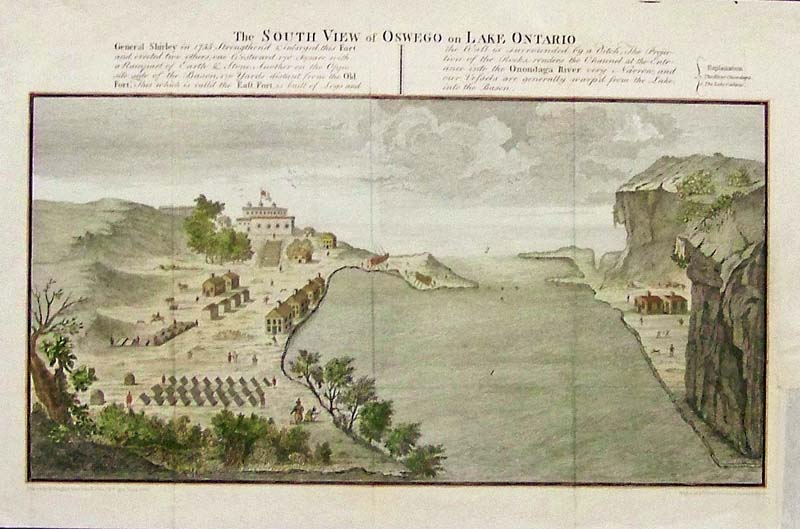
157Buffalo: C.1790 Rare hand colored copper engraving showing The South View of Oswego on Lake Ontario. 16 x 10 in. $180 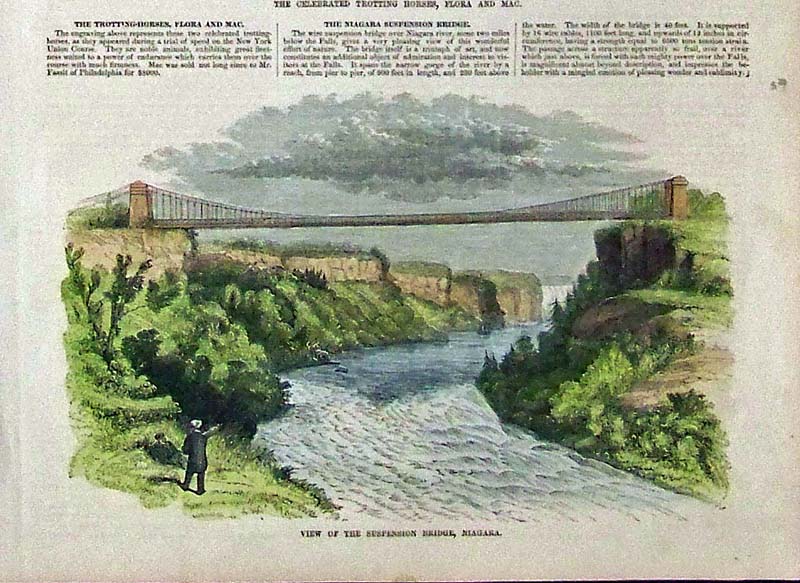
159Buffalo: 1854 Hand colored wood engraving showing a View of the Suspension Bridge, Niagara. Featured in Gleason's Pictorial Drawing-Room Companion. 11 x 8 in. $40 
163Buffalo: 1895 Hand colored lithographed map of Niagara and Erie Counties, showing Lake Erie and Lake Ontario, including part of Canada. 36 x 24 in. $100 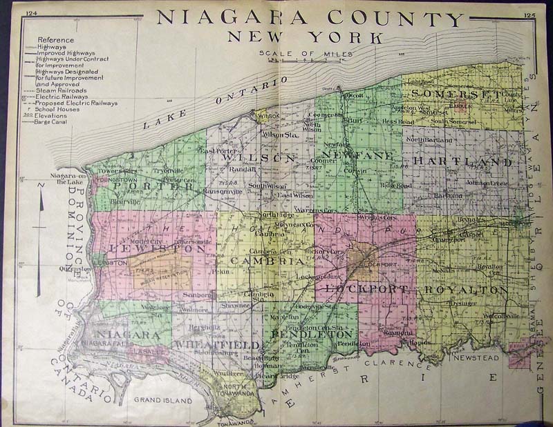
164Buffalo: 1900 Hand colored lithographed map of Niagara County, New York. 29-1/2 x 23-1/2 in. $100 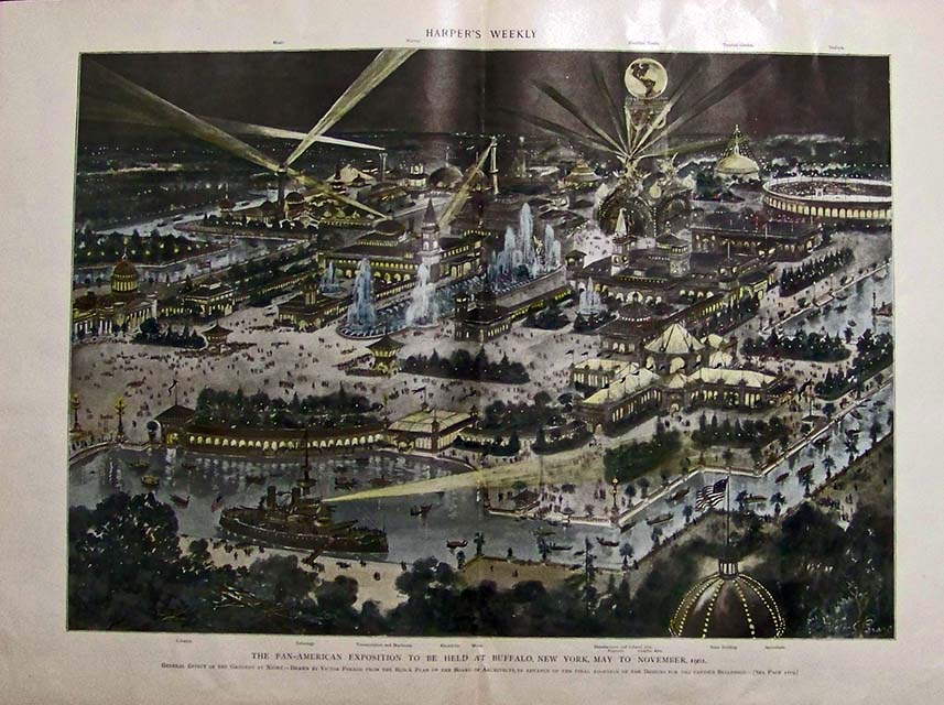
165Buffalo: Rare 1899 Harper's Weekly color half-tone showing the Pan-American Exposition to be Held at Buffalo, New York, May to November, 1901. This image shows all the exhibits on the grounds at night, showcased by strobe lights shining brightly in the dark night's sky. 22 x 16 in. $160 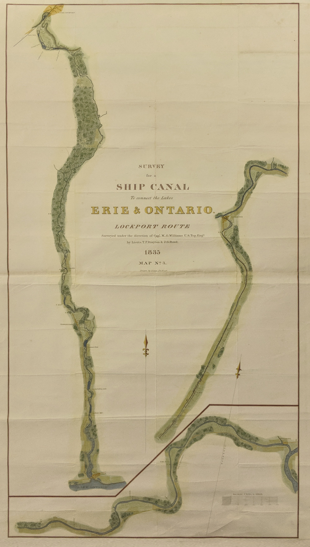 166Buffalo: 1835 Hand colored Survey Map for a proposed route to connect the Lakes Eire and Ontario Lockport Route. Surveyed under Cap. W.G. Williams. Drawn by Lieut. J.G. Reed. Size 50 x 30 in. $700 See also: New York City Saratoga, NY Albany, NY Rochester, NY NEW YORK Brooklyn, NY Long Island, NY |
|||||||||
| Order Form | |||||||||||
| Back to Homepage | |||||||||||