|
|||||||||||
This is a small selection of our inventory of antique Canadian prints and maps. Additional inventory is available. Contact us with your request. 1-800-879-6277
|
|||||||||||
|---|---|---|---|---|---|---|---|---|---|---|---|
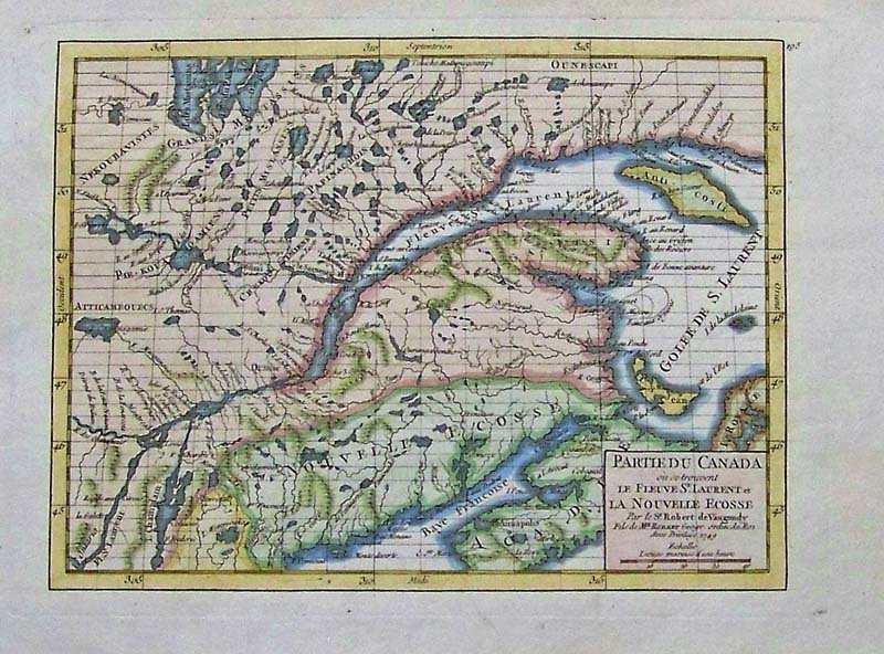 067Canada: Partie Du Canada, deVaugondy 1749 - early map with pastel hand coloring focusing on the Gulf of St. Lawrence and Great Lakes in North America. Quebec is named, as are a number of early French forts; the Bay of Fundy is named Bay of Francoise. size 8.5 x 6.5 image. $300 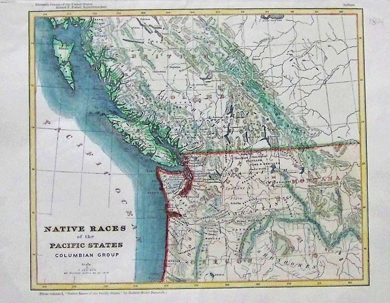
068Canada: Native Races of the Pacific States Columbian Group Bancroft 1882. Engraved with original Hhand coloring. size, 9.5 x 8 image $300 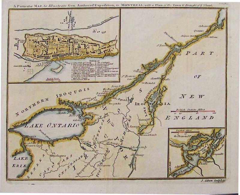
069Canada: General Amherst Expedition to Montreal with a Plan of Town & Draft of the Land 1760. size 8 .75 x 7 image $250 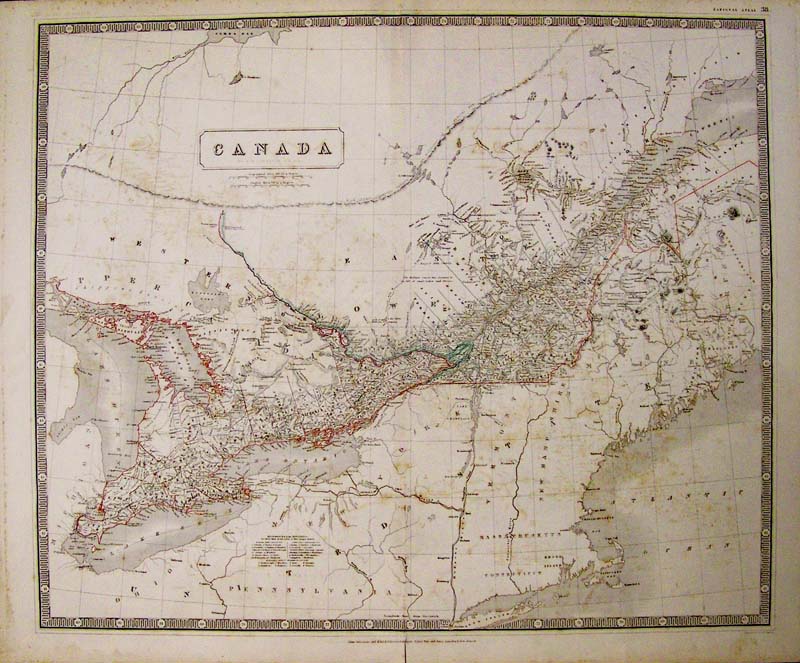
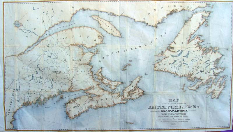
000Canada: Canada, Johnston 1875 - This is a large, steel engraved and detailed, original hand colored map of Eastern Canada and upper New England from Long Island north. Township references in the legend are numbered and all water way and tributaries including the Great lakes are described in great detail. The map extends west to Lake Huron, north to James Bay, east to Maine and south to Lake Erie, Pennsylvania, and Ohio. Light foxing. 23 x 19 in. $325 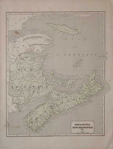 001can: 1843 map of Nova Scotia, New Brunswick etc. Original color. 13x18 in. $100 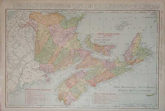 004can: 1895 railroad map of the Maritimes. Lists and shows the old routes of the many railroads that passed through the region. 13.5x20.5 in. $60 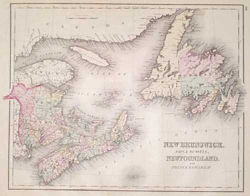 005can: 1875 Map of the Eastern Canada by Gray. Interesting map, with original hand coloring, from O.W. Gray's world atlas of 1875. Includes the provinces of New Brunswick, Nova Scotia, Newfoundland and Prince Edward Island. Every department within those provinces is separately colored. Cities, towns, railroad lines and geographical features are all shown. Very attractive map which would look great in a frame! 14x17 in. $80 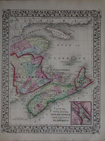 009can: 1867 Mitchell map of New Brunswick, Noca Scotia, and Prince Edward's Island. Attractive original hand color map with very nice borders. Inset of Halifax Harbor in the lower right corner. 11.5x15 in. $60 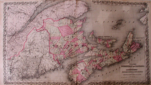 010can: 1855 Colton Map of Dominion of Canada, The Provinces of New Brunswick, Nova Scotia and Prince Edward Island. Beautifully engraved, hand-colored map from the first edition of Colton's world atlas, 1855. Cities, towns, major roads, railroad lines and geographical features are all shown. Individual areas are separately colored. The entire image is surrounded by a decorative border. Excellent condition. 17.5 x 28 in. $100 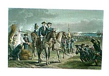 012can: 1878 Print: Pepperell-Siege Louisburg. Nova Scotia. General Pepperell at the Siege of Louisburg. Color: Water Color. Type: Steel Engraving. Size: 10x8 in. $50 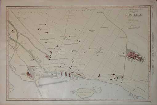 015can: 1926 Map of Montreal & vicinity. Hand colored. Shows public buildings and many other significant areas. 14x21 in. $60 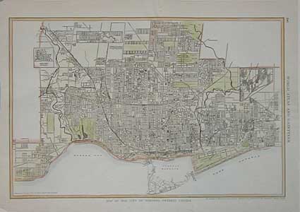 016can: 1923 Map of Toronto. Hand colored lithograph. 11x15 in. $30  017can: 1855 Colton map of Canada East, or Lower Canada and New Brunswick. Original hand color. 16x18.5 in. $90 
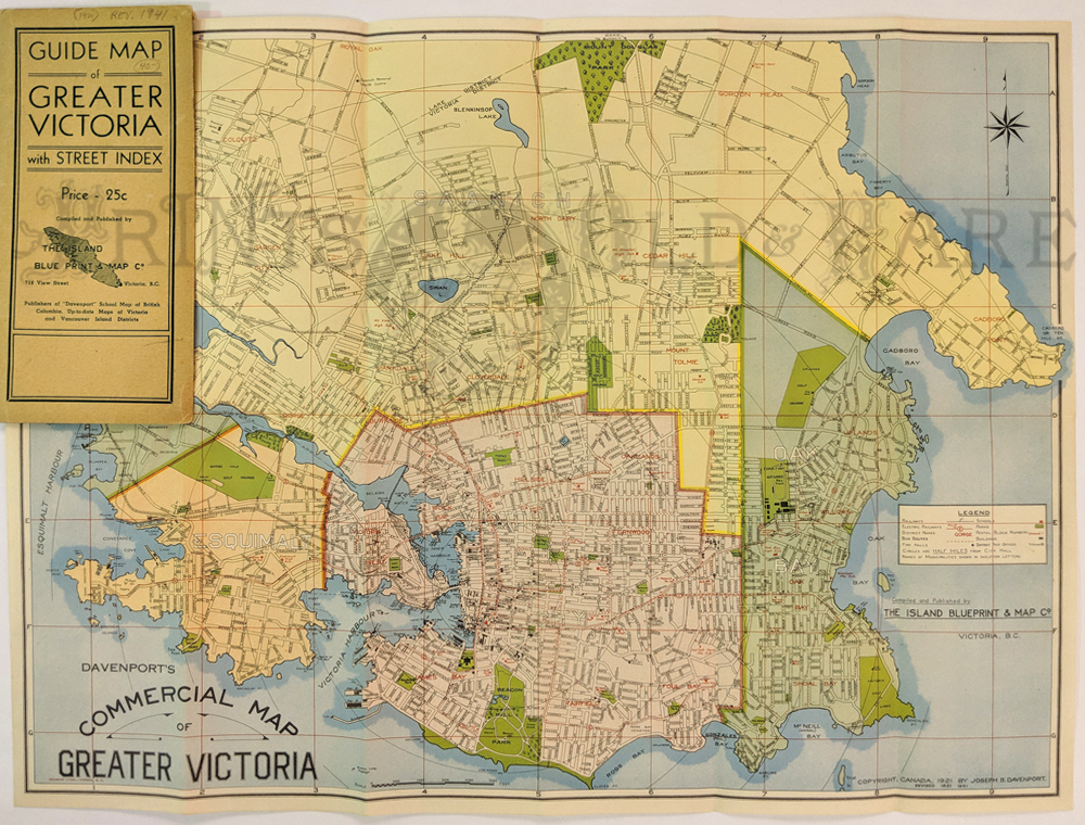
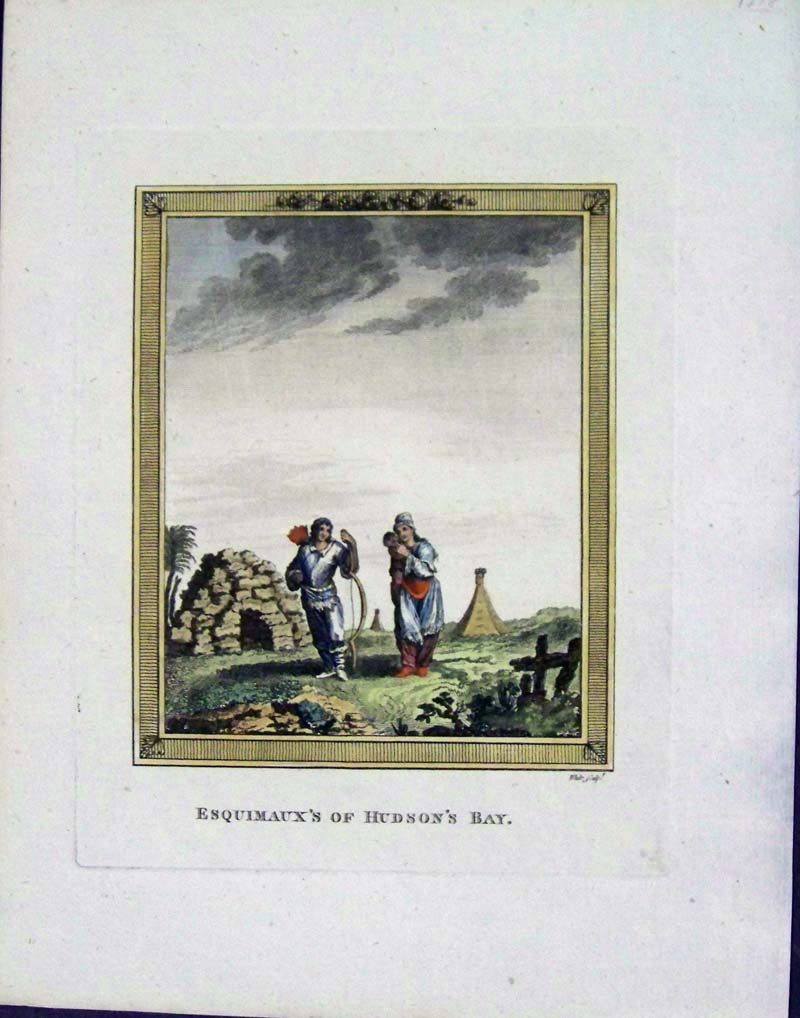
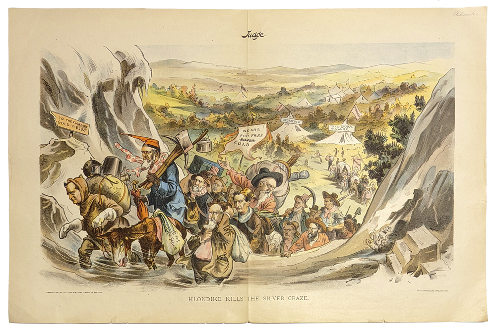
019can: 1875 Mitchell map of Quebec, divided into counties. Inset map of the environs of Montreal. Original hand color, decorative border. $60 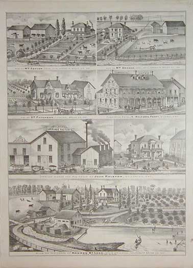 020can: 1880 Bruce County, Ontario. Uncolored lithographic views of farms and businesses. 13x17.5 in. $50 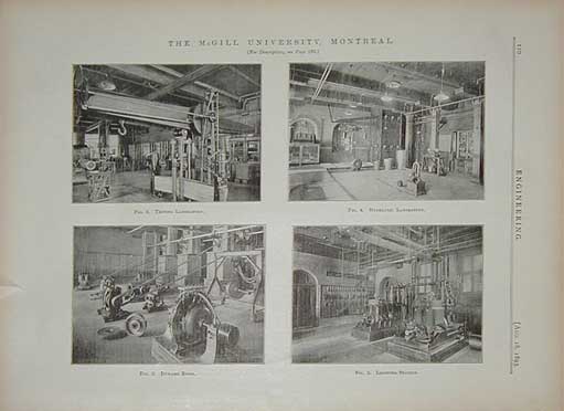 021can: 1891 McGill University. Four half-tone photos on one page, showing engineering laboratories. 10x13 in. $50 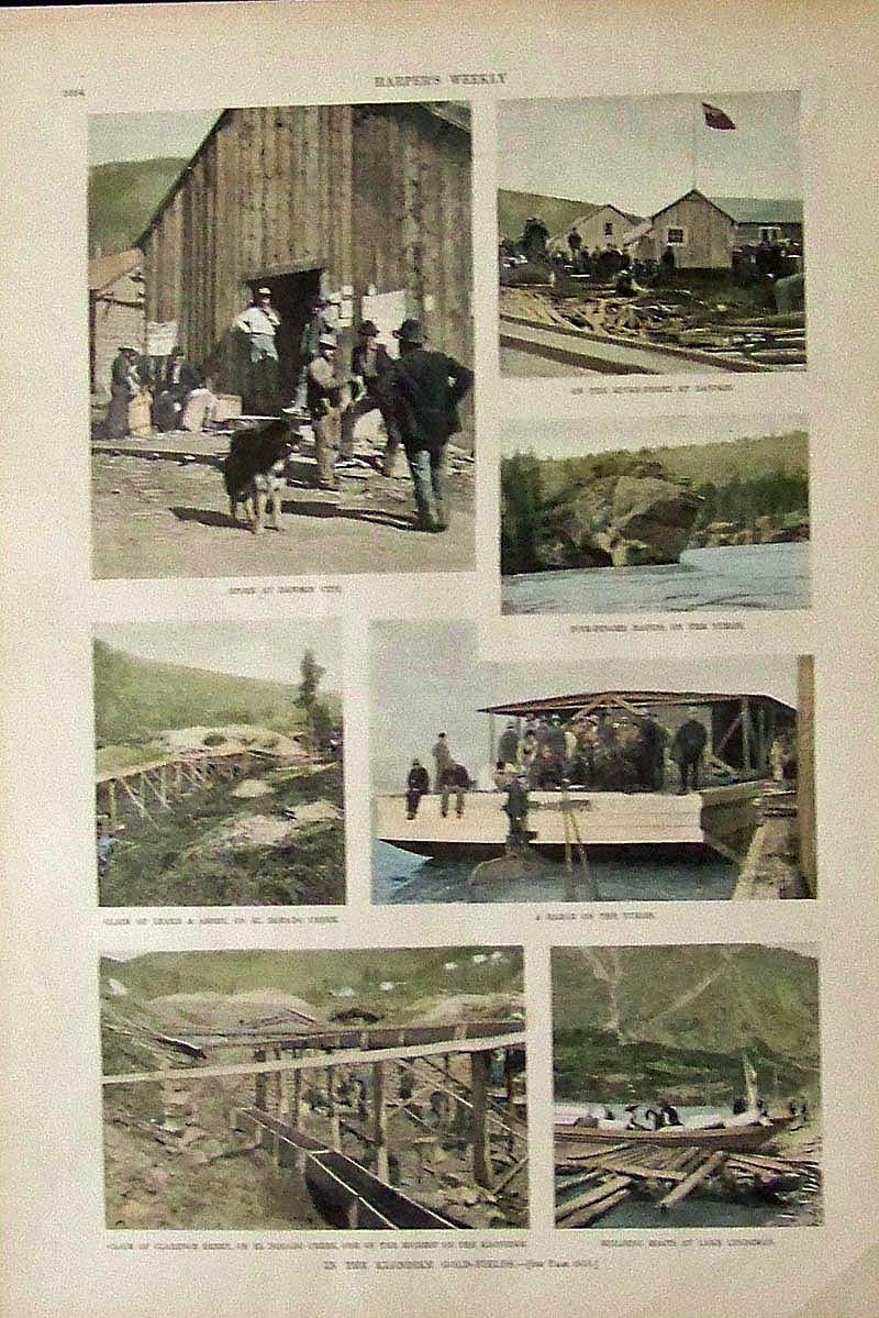 031Alaska: 1897 Harper's Weekly hand colored half-tone images titled, "In the Klondike Gold-Fields." Images show various places in the Yukon. 16 x 11 in. $60 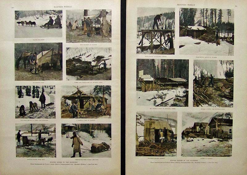 036Alaska: 1898 Harper's Weekly hand colored half-tone images showing Winter Scenes in the Klondike. Two pages sold as a set revealing snow-covered Alaskan scenes. Each page measures: 16 x 11 in. $80 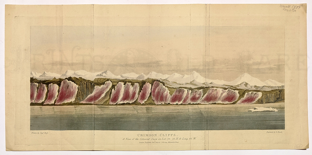 008arct: Crimson Cliffs “Colored Snow” Baffin Bay. 1819. Hand colored aquatint by Havell from the Ross Expedition – seeking a Northwest Passage. 8 3/4 x 18 5/8 in. $60 |
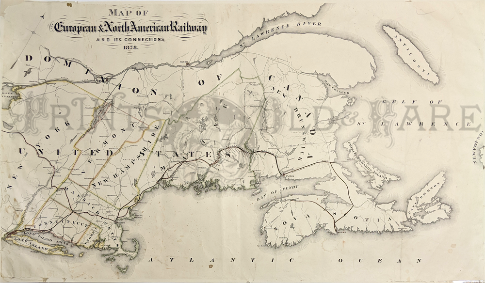
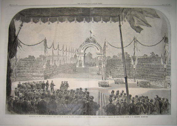
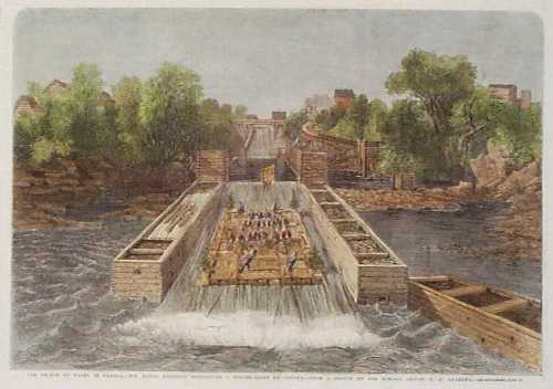 022can: 1860: Timber Slide at Ottawa Canada. Hand colored engraving from the Illustrated London News, titled "The Prince of Wales in Canada: His Royal Highness Descending a Timber Slide at Ottawa." The Prince and his entourage are shown seated on a large wooden raft, which is sliding quickly down a man-made waterway. 11x16 in. $50 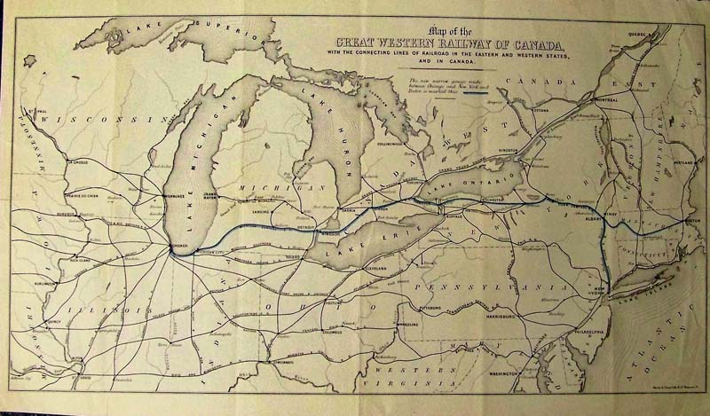 222rr: Map of the Great Western Railway of Canada. Lithographed map of railways of Western Canada including the Great Lakes. Condition: Very Good, slight tear on right margin folds barely noticeable. Size: 12.75 x 21.5 $300 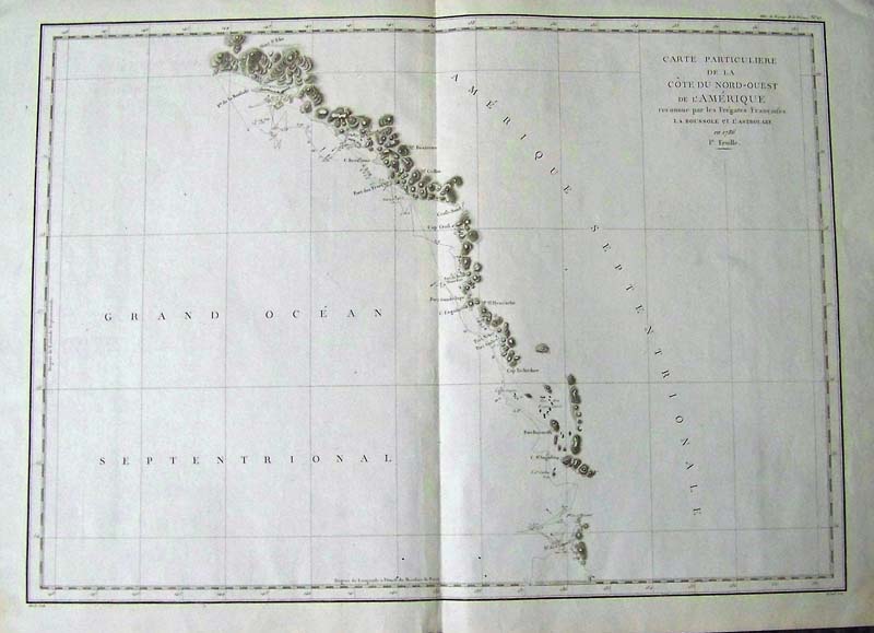
002Canada: Carte Particuliere De La Nord Quest Amerique, Herault 1786 - This large-scale map of British Columbia and the southeast coast of Alaska depicts the route of La Perouse's voyage. Condition: Very Fine, large wide side margins. size 27.5 x 19.5 image $400 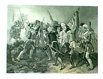
026can: 1857 Print: Death of Gen. Wolfe (British vs French Quebec (1857). Color: Black and White. Type: Steel Engraving. Size: 10x8 in. $24 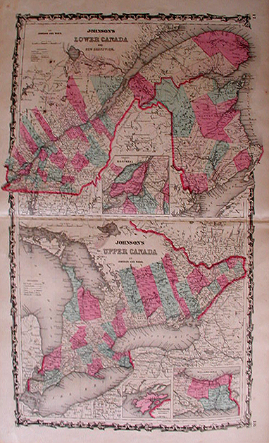 027can: 1862: Maps of Quebec, Ontario. Two fine Johnson maps of Quebec, Ontario (1862). Color: Original Water Color. Type: Wood Engraving. Size: 18x26 in. $60 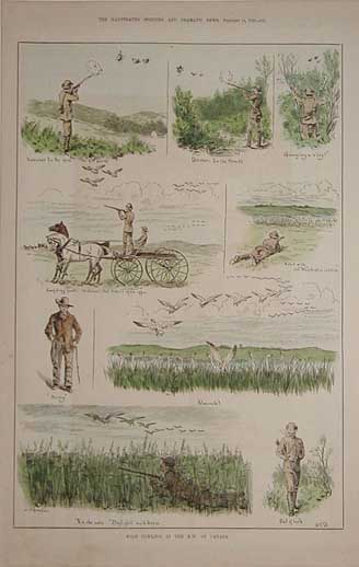
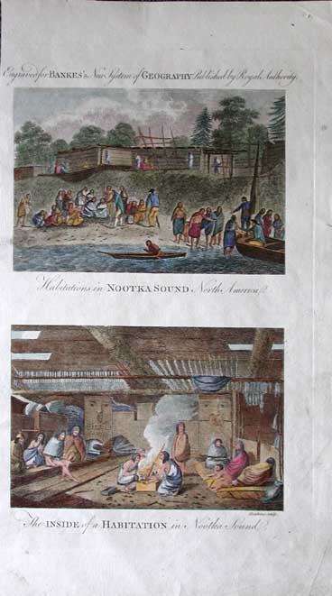
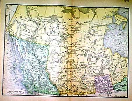
029can: 1883 "Wild Fowling" views in the Northwest of Canada. Hand colored engraving. 11x16 in. $50 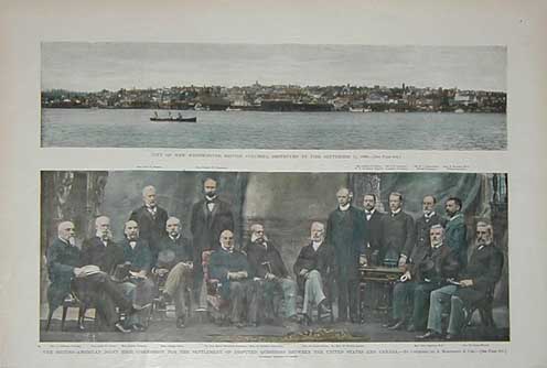 030can: 1895 British Columbia. Two hand colored photographic views: City of Westminster (top), and the British/American territorial disputes commission (bottom). 11x16 in. $50 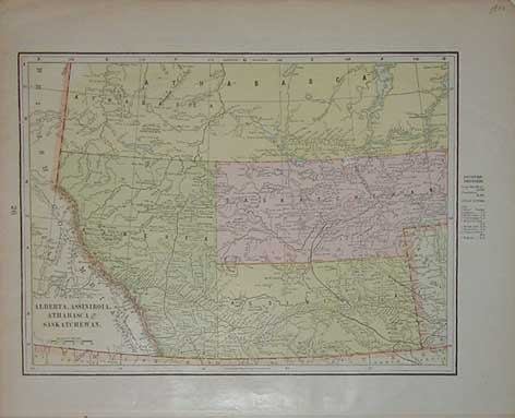 031can: 1900 map of Alberta, Assiniboia, Athabasca and Saskatchewan. Lithograph, printed in color. 11.5x14 in. $40 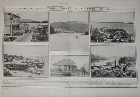 032can: 1908 photo series: Building the town of Prince Rupert in British Columbia. Six interesting photos. 15.5x22 in. $50 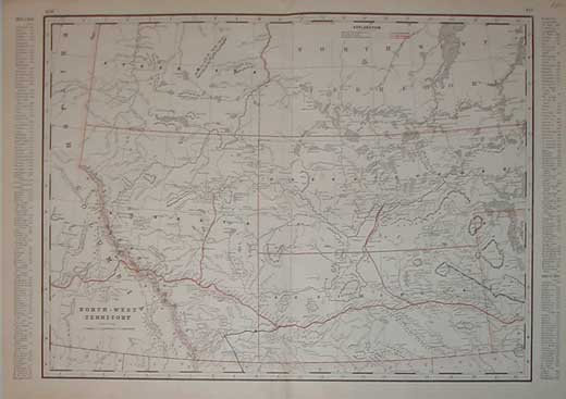 034can: 1891 map of Northwest Territory and early western provinces. Railroads are shown in various colors. 17.5x22.5 in. $60 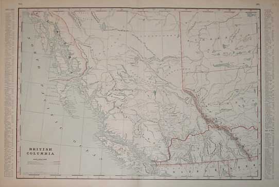 035can: 1891 map of British Columbia. Lithograph, printed in color. 17.5x22 in. $60 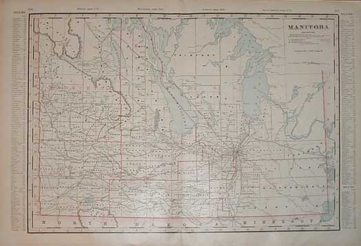 036can: 1891 map of Manitoba. Lithograph, printed in color. 17.5x22 in. $60 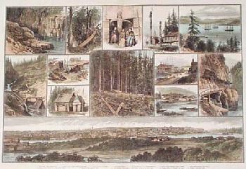 037can: 1882: Vancouver Island British Columbia. Large, hand colored engraving from the Illustrated London News, titled "Sketches of Vancouver Island and British Columbia." Page contains thirteen separate scenes, showing the scenery in the Vancouver Island area. At bottom is a panoramic view of the town of Victoria. 16x22 in. $120 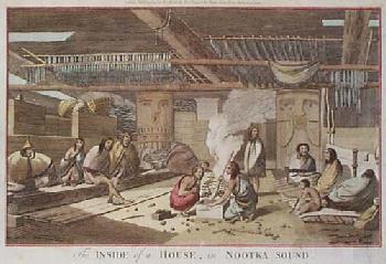 038can: 1795 Cook View: Nootka Sound Canada. Hand colored copper engraving, printed on hand laid paper, from Alexander Hogg's 1795 edition of Captain Cook's expedition to the Pacific Ocean. Title is "The Inside of a House in Nootka sound." Shows the interior of a typical native dwelling on the shore of what is now western Canada. 9x15 in. $100 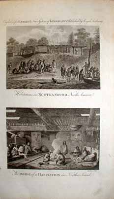 040can: Copper engravings of Nootka Sound, Canada. Upper picture titled, Habitations in Nootka Sound North America. Bottom picture is titled, The Inside of a Habitation in Nootka Sound. Engraved for Bankes's New System of Geography, Published by Royal Authority in 1775. 15x9 in. $100 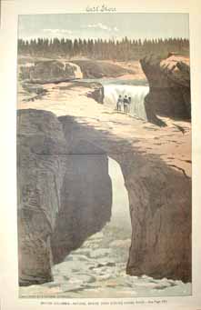 041can: Very nice color lithograph from the November 30, 1889 issue of West Shore. British Columbia - Natural Bridge over Kicking Horse River. 17x11 in. $80 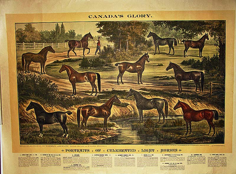 158hors: Canada's Glory -- Color lithograph showing Portraits of Celebrated Light Horses. Engraved and issued for the "Farmer's Advocate," London, Ontario, and Winnipeg, Manitoba. 34 x 24 in. $225 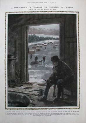 042can: Image from the 1908 issue of The Illustrated London News. Hand colored wood engraving of Ice Fishing. "A Compendium of Comfort for Fishermen in Canada." 16x11 in. $60 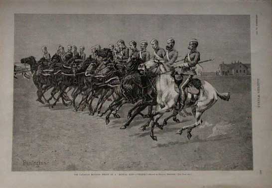 043can: 1887 Frederick Remington: Canadian Mounted Police. Uncolored, engraved image from the December 24, 1887 issue of Harper's Weekly. Drawn by 19th century artist Frederick Remington. Title is "The Canadian Mounted Police on a 'Musical Ride.' Charge!" Excellent Condition. 11x16 in. $80 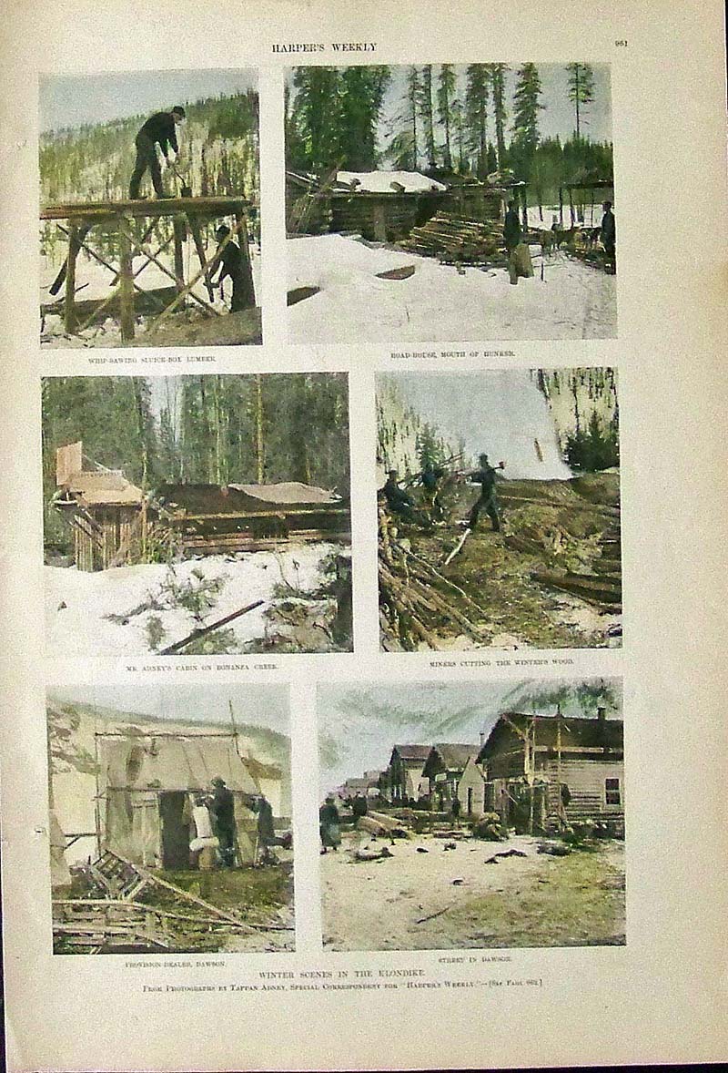 037Alaska: 1898 Harper's Weekly hand colored half-tone images showing Winter Scenes in the Klondike. 16 x 11 in. $60 |
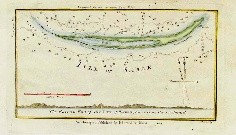
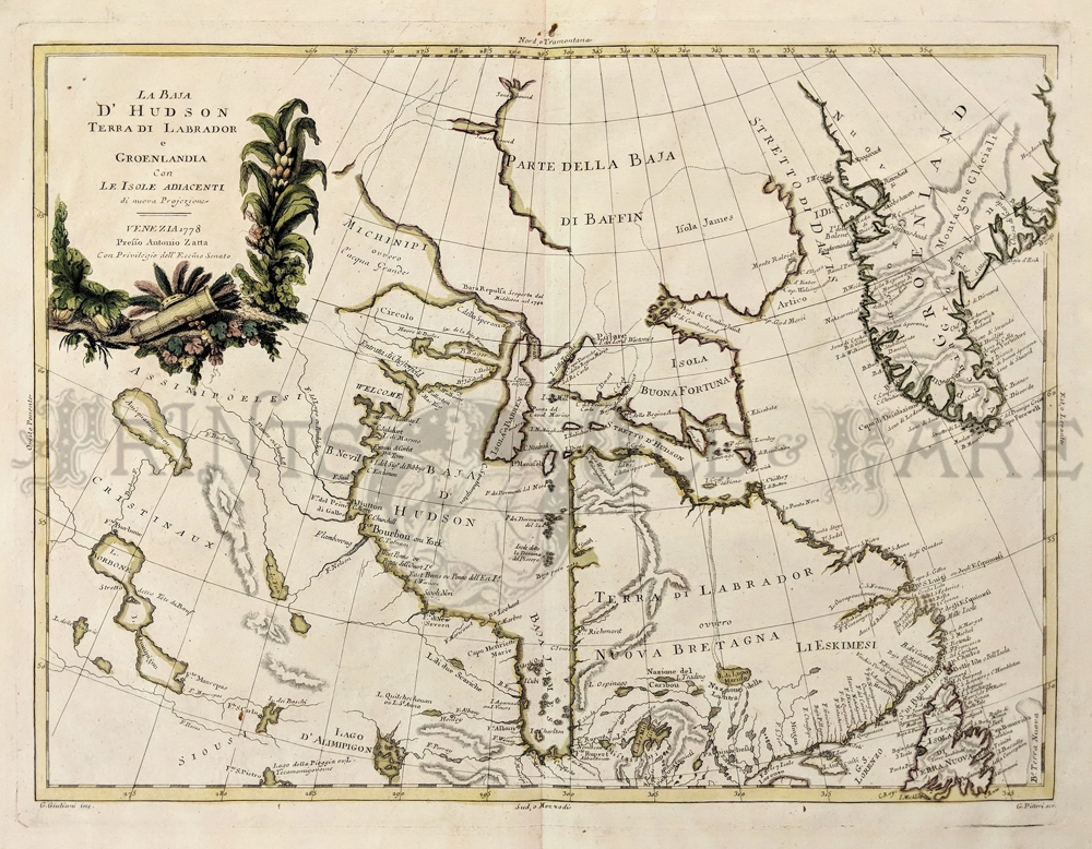 072can: Antonio Zatta: La Baja D'Hudson, Terra Di Labrador e Groenlandia. Venezia 1778. Copper Engraving outlined in color. Beautiful cartouche with Indian artifacts. Fine condition. 12 1/2 x 16 in. $350
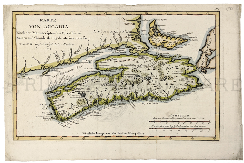 075can: Karte von Accadia 1744 (Nova Scotia) by Nicolas Bellin. Hand colored, copper engraving. Fine condition. 8 ½ x 13 in. $200
|
|||||||||
| Order Form | |||||||||||
| Back to Homepage | |||||||||||