|
001cari:
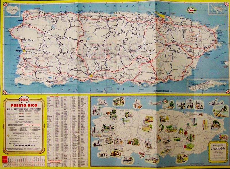
Puerto Rico Pictorial Road Map - C.1950 Color verso map of Puerto Rico
and San Juan which shows roads, railroads, canals, sugar centrals,
airports and other
places of interest.
23 x 16-1/2 in. $45
004cari:
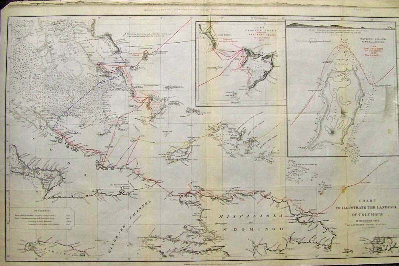
Chart to Illustrate the Landfall of Columbus, Becher 1856 An original
color lithograph and very detailed nineteenth-century chart with the
conjectured tracks, each marked in a different color, of Columbus
across the Caribbean according to Mr. Washington Irving, Senor
Navarrete and Captain A.B.Becher, a Royal Navy Captain and the author
of this chart. The chart was published for the Journal of the Royal
Geographical Society by John Murray. The geographical detail includes
Hispaniola, Cuba and the Great Bahama Bank with inset maps of The
Crooked Isles (Proposed Fragrant Isles of Columbus) and an inset of
Watling Island (The San Salvador of Columbus). Across the top of the
map is a coastal profile of Long Island. This is a very engaging
nineteenth-century summary of various expert’s interpretations of
Columbus' journey some 360 years earlier from a renowned geographical
journal. Condition: Good, fold in center, small foxing right side and
other rust colored lines along
folds; right margin missing.
size 24.5 x 16 image
$600
006cari:
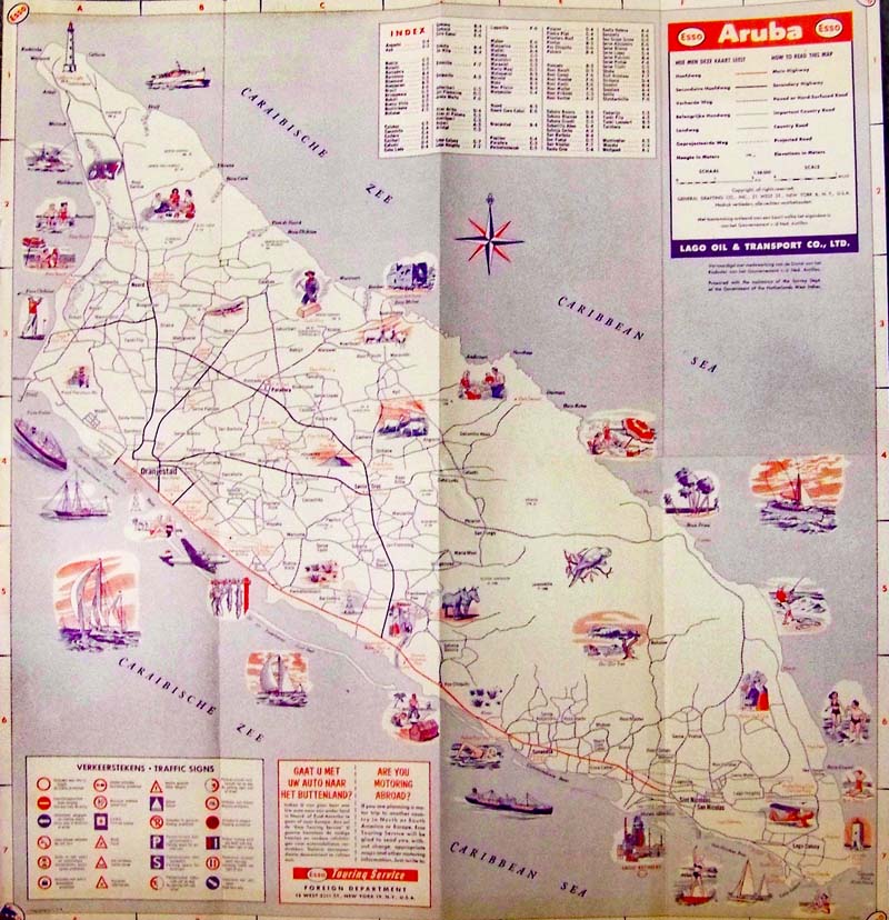
Aruba Pictorial Map - C.1950 Color early road map issued by Esso Corp.
and shows paved and unpaved roads, and projected roads.
36 x 25 in. $35
209cari:
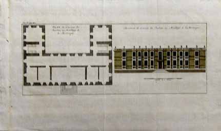
Published in 1698, this rare hand colored engraving is
of the Jacobins Convent. The image on the left shows the plan of the
convent, and is titled, Plan du Convent des Jacobins au Mouillage de la
Martinique. Right side image shows the Elevation du Convent des
Jacobins au Mouillage de la Martinique. 9.5x16 in. $150
210cari:
Hand colored engravings from 1821 of the French
Military. Writing in French, the pictures are titled, France Militaire.
Top picture captioned St. Domingue, Mole St. Nicholas. Lower image
captioned, Martinique, Fort Royal. 10.5x7 in. $45
214cari:
Carte Geographique, Statistique et Historique de la
Guadeloupe. Beautifully hand colored close up of the islands showing
settlements and regions. c.1824
by Carey and Lea.
19
1/2 x 25 in. $300
215cari:
Bermuda. 4 Scenes: View of Gibb's Hill, Floating
Dock, Walsingham House, North Rock. Hand colored, wood engraving. 1873
Harper's Weekly. Very good condition.
9 1/2 x 15 1/2 in. $60
219cari:
1880 Palacio Montserrat - Hand colored wood
engraving published in L'Illustration Horticole in 1880. PL. XVII.
Engraving depicts a beautiful palace surrounded by a
forest of evergreen trees.
10.5x14in. $40
128rare:
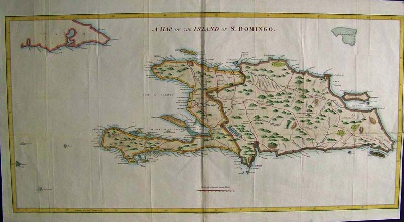
CARIBBEAN. 1800 J. Stockdale. English map of the island of Santa
Domingo showing modern Haiti and Dominican Republic, and the eastern
portion of Cuba. Beautiful steel plate engraving with expert water
coloring. 36" x 18" plus margins.
$400
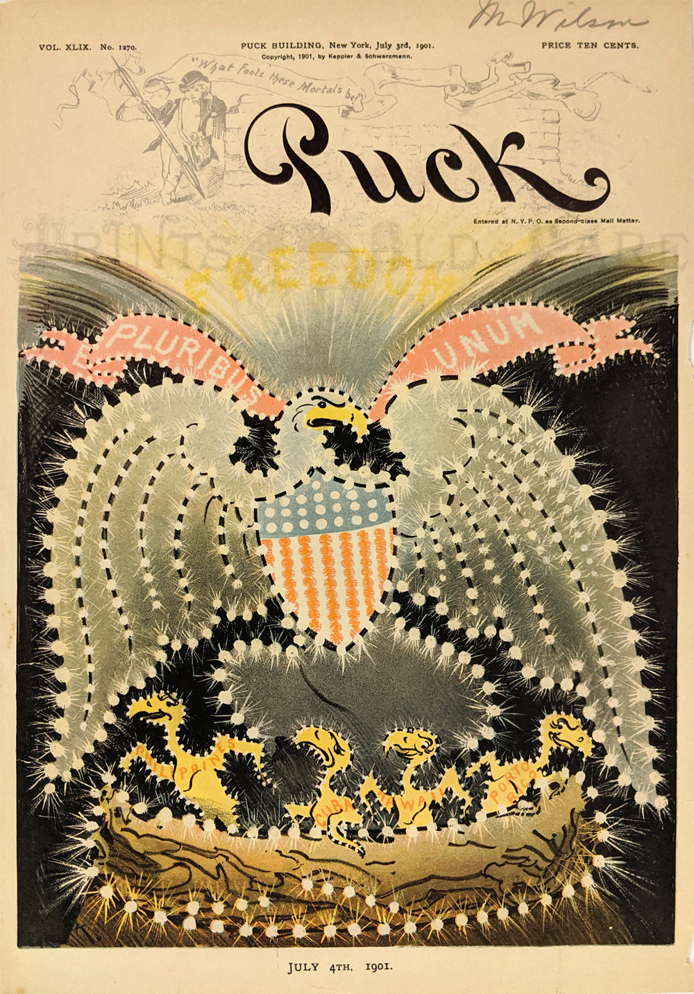
009pat: Imperial US Eagle
Spreading Wings over
Philippines, Cuba, Hawaii and Porto Rico as chicks in the nest.
Chromolithograph cartoon during Spanish American War era. 1901 Puck
Cover.
9 ½ x 13 3/8 in. $60
|
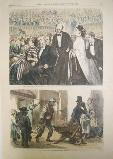
223cari:
1874
Two hand colored wood engravings published in Frank Leslie's
Illustrated Newspaper on November 14, 1874. Top picture shows the
opening of the dramatic season at the Academy of Music in New York;
Bottom picture reads: "Peddling Fresh Flying Fish - An Everyday Scene
in Bridgetown, Barbadoes. - Sketched by Alfred Trumbly. 11x16in. $30
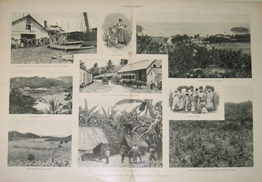
226cari:
1896
Banana Cultivation On the Island of Jamaica. Nine half-tones
publishedas a double-page spread in Harper's Weekly in 1896 which
depict banana cultivation and harvest and locations bananas are grown
on the Island of Jamaica. Small fingerprint stain near top center but
otherwise, great condition.
16x22in. $50
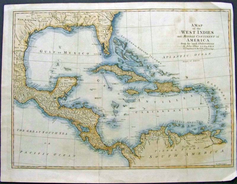
228cari:
1779 Hand colored copper engraved
Map of the West Indies and Middle Continent of America by John Blair.
This folio is engraved by Thomas Kitchin and shows Central America, the
Bahamas, Florida, the Gulf of Mexico. Texas is named, "New Kingdom of
Leon." Map was originally folded and there are a few darker spots near
the title but overall, map is in very good condition.
24 x 18-1/2 in. $475
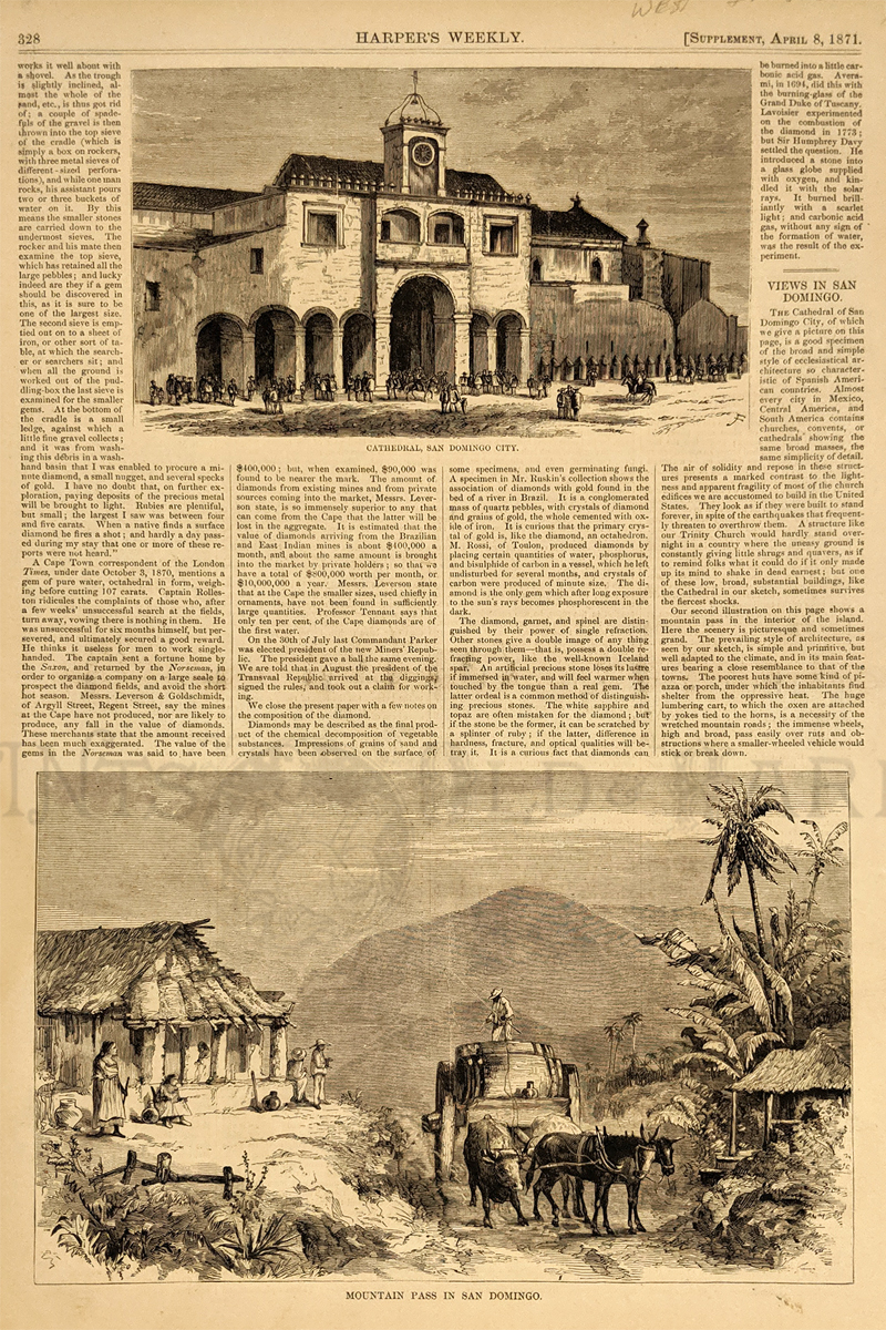
229cari:
1871
Two wood engravings with text published in Harper's Weekly
as a Supplement on April 8, 1871. Top engraving depicts the Cathedral,
San Domingo City; bottom engraving depicts the Mountain Pass in San
Domingo. 11x16in. $30
232cari:
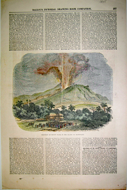
1855
Eruption Of Mount Pllee, in the Island of Martinique. Hand colored wood
engraving with text published in Ballou's Pictorial
Drawing-Room
Companion
in 1855. 11x16in. $40
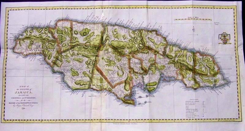
234cari:
1794
Hand colored copper engraved map of the Island of Jamaica divided into
counties and parishes. Title of map is, "A Map of the Island of Jamaica
Divided into Counties and Parishes, for the History of the British West
Indies by Bryan Edwards, Esqr. 1794."
25-1/2 x 12-1/2 in. $375
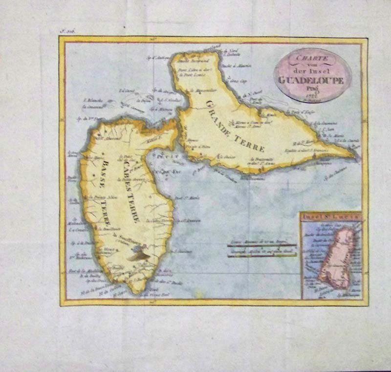
235cari:
1822
Hand colored copper engraved Charte von der Insel Guadeloupe Prag with
small inset of St. Lucia. Grande Terre and Cabes Terre and Basse Terre
are shown. These countried are in the
West Indies in the Caribbean.
10 x 9-1/2 in. $150
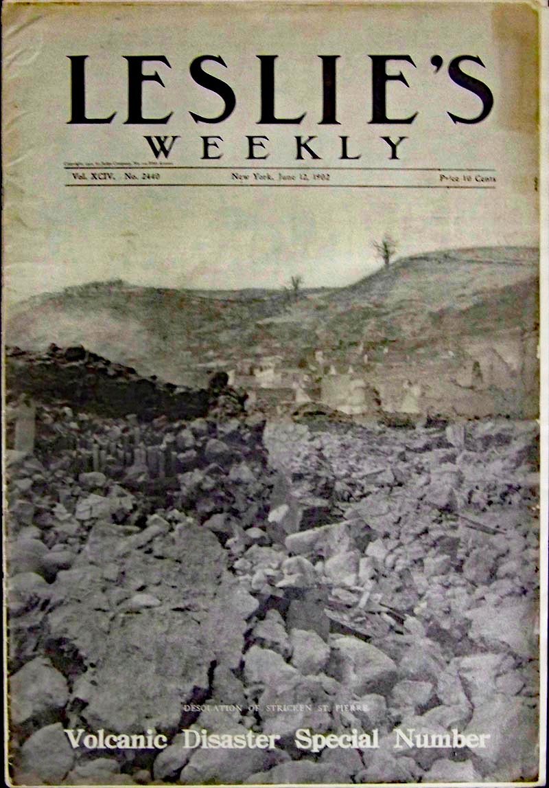
023ndis:
1902 Martinique, West Indies
Leslie's Weekly magazine showing the Desolation of Stricken St. Pierre,
featured in the Volcanic Disaster Special Number. This issue has 18
sheets (36 pages). Very good condition.
16 x 11 in. $40
|
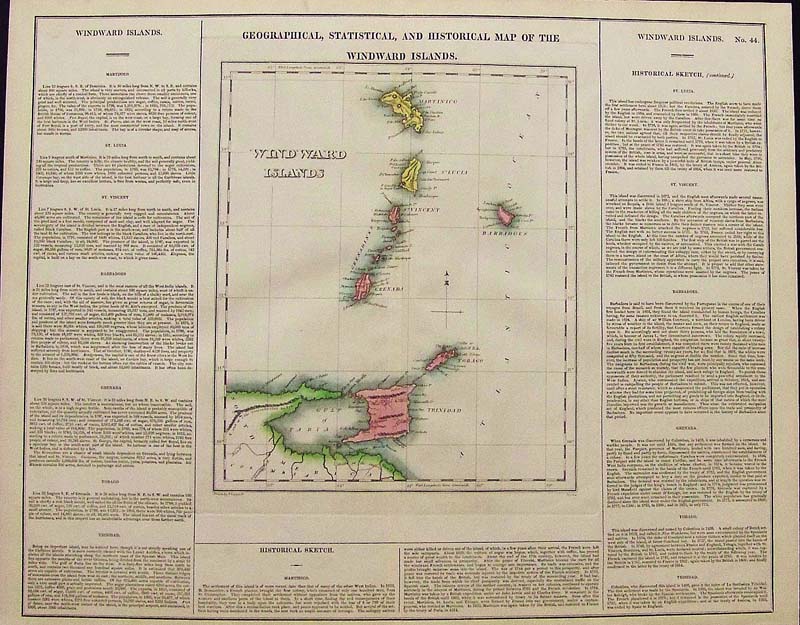
237cari:
Hand colored engraved Geographical, Statistical, and Historical Map of
the Windward Islands which include Trinidad, Martinico (Martinique),
St. Vincent, Barbadoes, St. Lucia, Grenada and Tobago. Published by
Carey & Lea and in fine condition.
Statistical text
surrounds map.
Plate 44.
22 x 17-1/2 in. $395
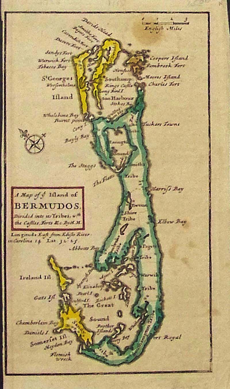
238cari:
1720 Hand colored copper engraved Map of the Island of Bermudos,
Divided into its Tribes showing castles, fortes, etc. Map has
a narrow left margin
and is by Herman Moll.
7 x 4 in. $245
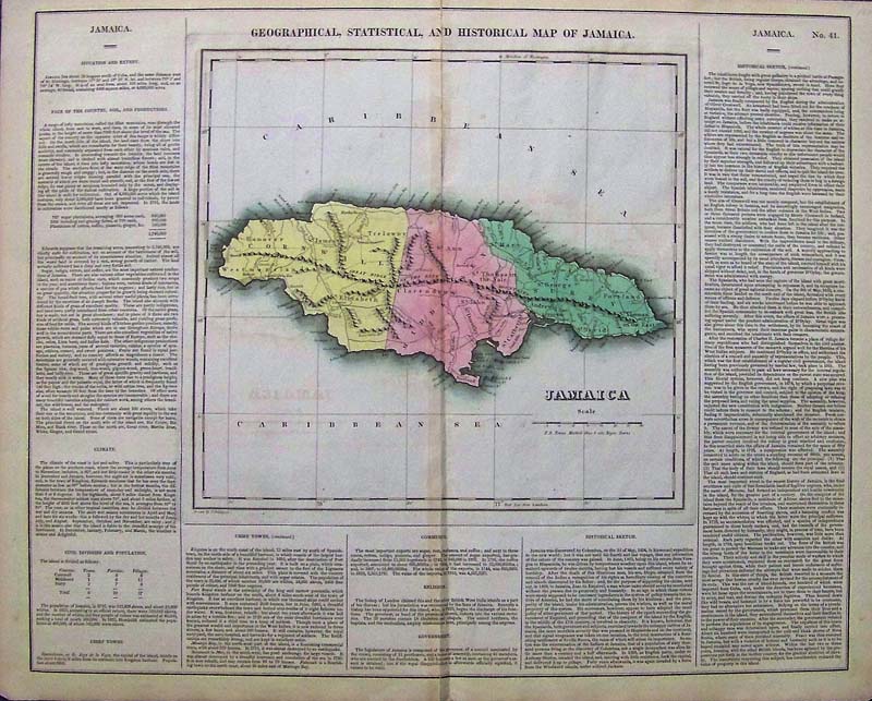
245cari:
Geographical, Statistical and Historical Map of Jamaica 1823 One of the
most highly prized and detailed maps of the Caribbean, (from the Atlas
of Clay and Lea,) this beautiful and very large engraved and original
colored map (in center of page) is surrounded by content sections
organized by economy (goods sold) climate, civil divisions and
populations, chief towns, commerce, religion, government, and a large
historical sketch. Towns on the map are shown as Negro towns with
special markings, nice shading depicts mountain ranges and the three
sections, Cornwall, Middlesex and Surry. The aim of Cornwall was to
establish an English colony on Jamaica, in 1791 there were 723 sugar
plantations, 100 breeding and grazing farms and a large number of
cotton, coffee, pimento and ginger plantations existed. Kingston is
shown on the south coast along with Port Royal and their respective
populations at that time. From: Henry Charles Clay and Isac Lea’s Atlas
drawn by J. Finlayson. Condition: Very good, increasingly rare, slight
fold on outside margin left and folded in the middle, some slight
discoloration around map itself from other side of printed page.
size 22 x 17.5 $300
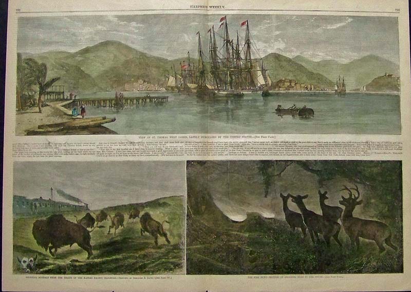
242cari:
1867 Harper's Weekly double-page hand colored wood engraving showing
the View of St. Thomas, West Indies, Lately Purchased by the United
States.
21-1/2 x 16 in. $180
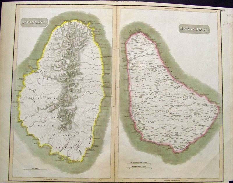
243cari:
C.1816 Hand colored engraved maps of St. Vincent on the left and
Barbadoes on the right. Engraved by Kirkwood & Son, Edinburgh.
26 x 20 in. $500
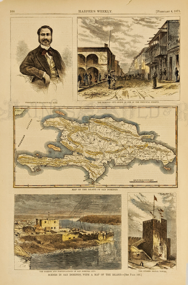
247cari:
Scenes in San Domingo, with Map of the Island. Harbor &
Fortifications, Citadel, Map of the Island, City scene in one of the
principal streets and a portrait of Pres. Buenaventura Baez. 1871
Harper's Weekly. Hand colored, wood engraving.
10 x 15 in. $50
SOLD
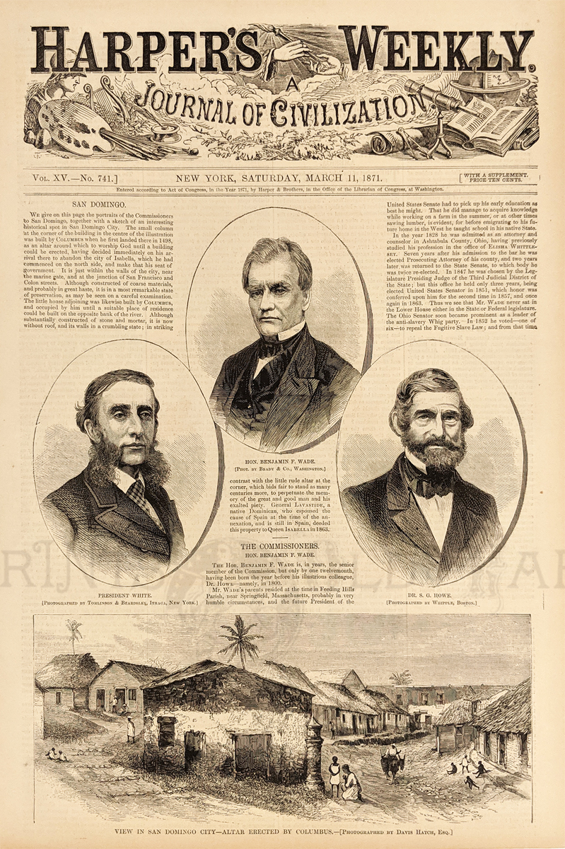
248cari:
View in San Domingo City - Altar erected by Columbus. 1871 Harper's
Weekly. Showing a historical view and portraits of the commissioners to
San Domingo; President White, Benjamin F. Wade and Dr. S.G. Howe. Wood
engraving.
10 1/2 x 15 1/2 in. $30
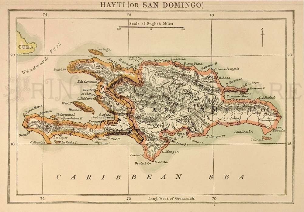
249cari:
Hayti (or San Domingo) - Haiti and Dominican Republic map 1890.
Published in the Encyclopedia Britannica 9th Edition.
6 7/8 x 9 5/8 in. $30
250cari:
Winward Islands. C.1794 – Map from Granada to St. Vincent with Tobago
and coast Trinidad. Copper engraving from the English Gentleman’s
Magazine. Along with article assuring the natives that they would be
provided with defense and title page panorama of London.
5 x 8 in. $75
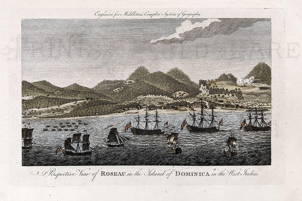
251cari:
Dominica 1779 Birdseye View of Roseau from the ship filled harbor
looking towards land. Hand colored, copper engraving.
59 1/8 x 14 ¼ in. $150
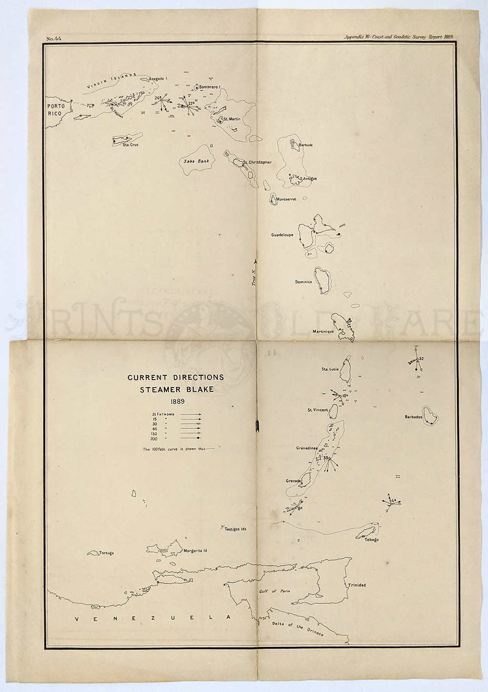
252cari:
Lesser Antilles 1889 from Puerto Rico to Venezuela “Current Directions
Steamer Blake” Islands are named, Fathoms shown. Map is in good
condition, some age toning but not brittle.
16 x 22 ¼ in. $100
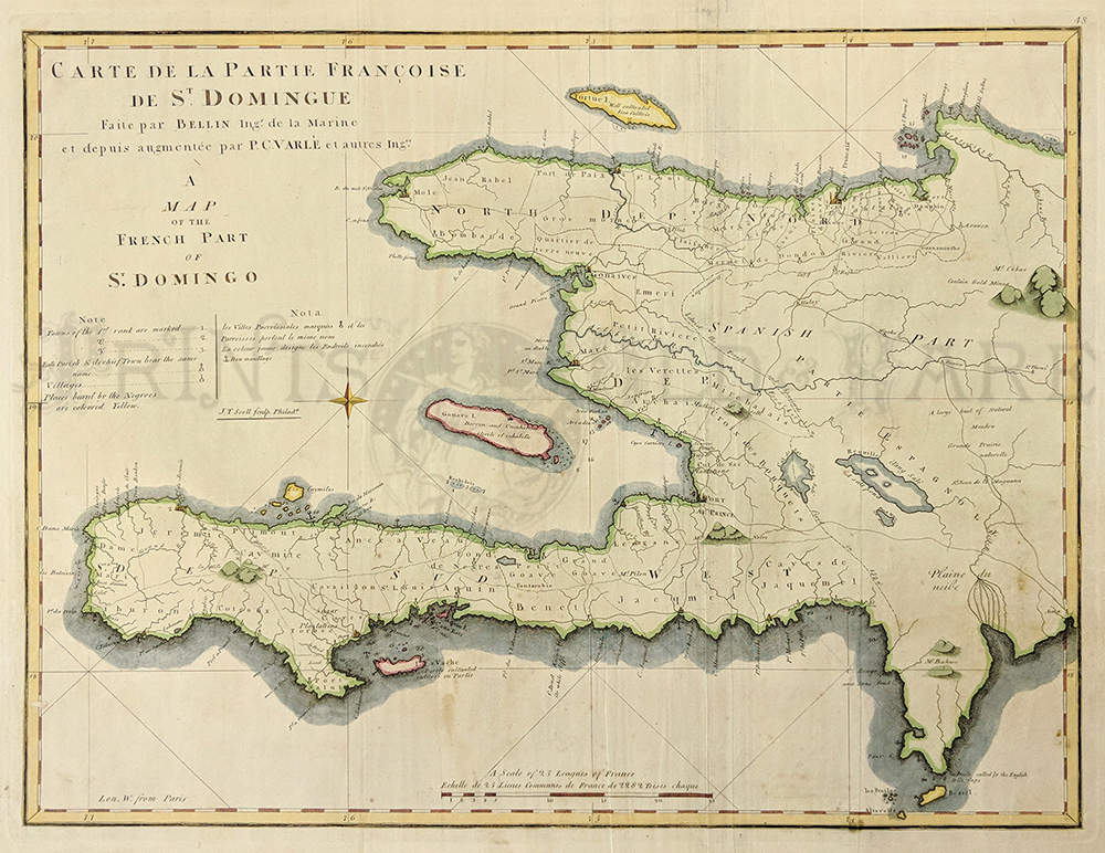
253cari:
c.1814 Santo Domingo. Beautiful map of the French part of Santo Domingo
by Varle titled in both French and English and reads "Carte de la
Partie Francoise de St. Domingue Faite par Bellin Ing. de la Marine et
depuis augmentee par P.C. Varle et autres." The all markings on the
map, including they key, are in both English and French. ivers, lakes,
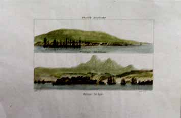
towns and borders are all marked.
17x20.5in $400
|
|