 
|
|||||||||||
This is a small selection of our inventory of antique Connecticut maps and prints. Additional inventory is available. Contact us with your request. 1-800-879-6277
|
|||||||||||
|---|---|---|---|---|---|---|---|---|---|---|---|
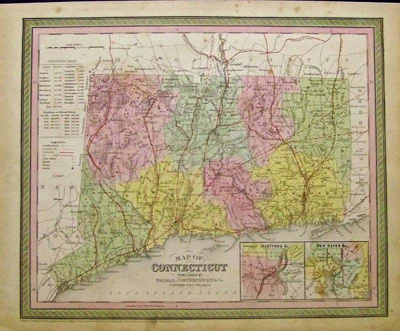
001Connecticut: 1856 Hand colored Cowperthwait Map of Connecticut which shows the Statistical Table, and insets of Hartford and New Haven, including the population. 17 x 13-1/2 in. $300 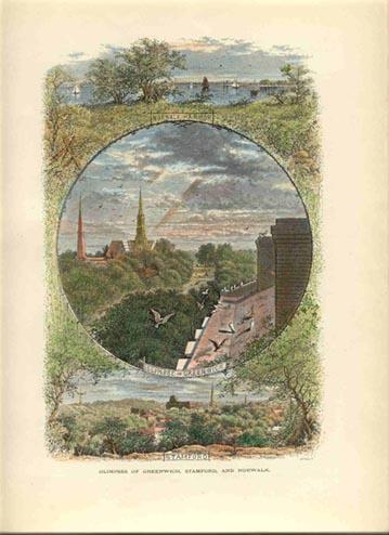 002ct: 1873 view of Greenwich, Stamford and Norwalk. Three hand colored scenes on one page from Picturesque America. 9x12 in. $40 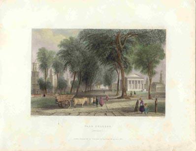 003ct: 1838 William Bartlett view of Yale College. Professionally hand watercolored steel engraving. 10x8 in. $80  006ct: 1884 Antique Railroad Map - Crams lithographic map shows Massachusetts and Rhode Island in addition to Connecticut. 12x13 in. $60 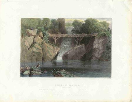 007ct: Bartlett "The Bridge at Norwich" 1838 hand colored steel engraving. 10-1/2x8 in. $50 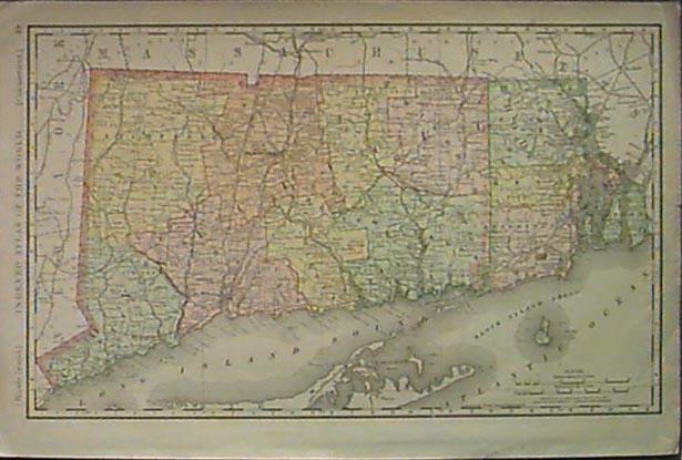 011ct: 1902 Large old Rand McNally map of Connecticut and Rhode Island. Lithograph color by counties. 20x14 in. $80 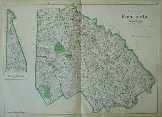 013ct: 1893 FAIRFIELD CONNECTICUT MAP. Genuine antique engraved map, copyright 1893, D.H. Hard & Co. Outline hand coloring. This large scale old map shows the north part of Fairfield County, CT. 31" x 19" A genuine antique map produced in 1893, NOT a reproduction! $100 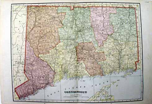 016ct: 1908 Crams Map of Connecticut. Color lithograph, good detail. 22x14 in. $40 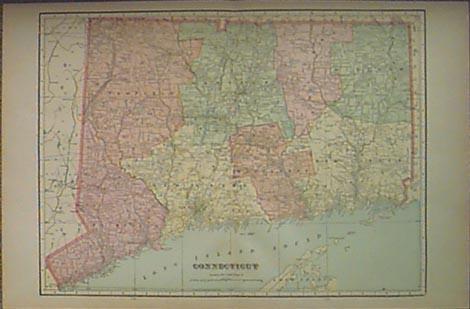 020ct: 1907 Connecticut Map. Good sized color antique map of the state, by Cram. 22-1/2x14-1/2 in. $40 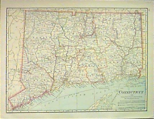 022ct: 1915 Map of Connecticut. Original color antique map by Cram, shows rail and electric lines. 5-1/2x12 in. $30 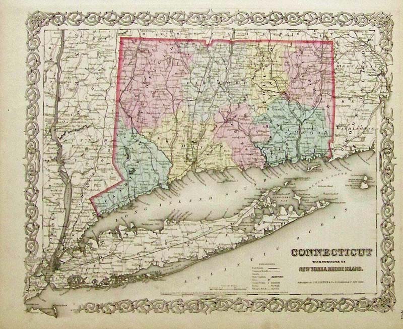
023Connecticut: 1855 J. H. Colton original hand colored engraved map showing Connecticut With Portions of New York & Rhode Island. Colton was among the earliest map makers with very accurate maps depicting cities and states in the United States. 17-1/2 x 14-1/2 in. $500 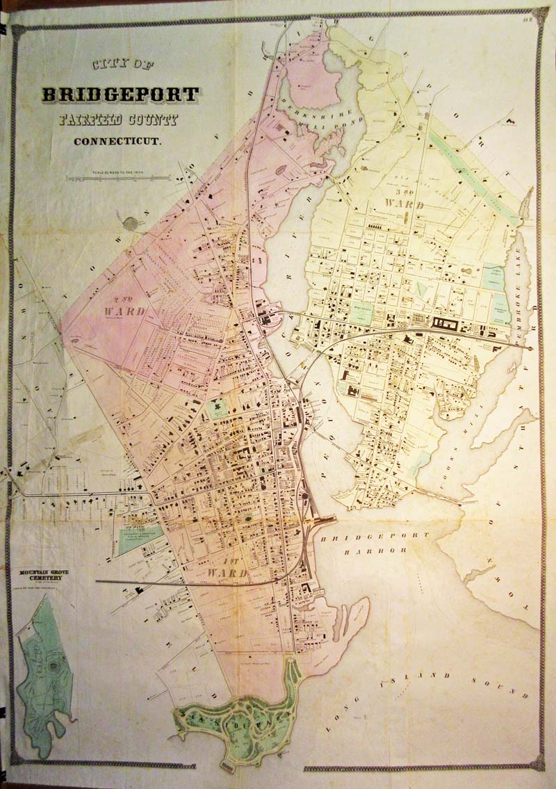 024Connecticut: City of Bridgeport, Fairfield County, Connecticut. Hand colored lithographed map with wards demarcated by different colors. Inset of the Mountain Grove cemetery. 31” w x 43”h $400 |
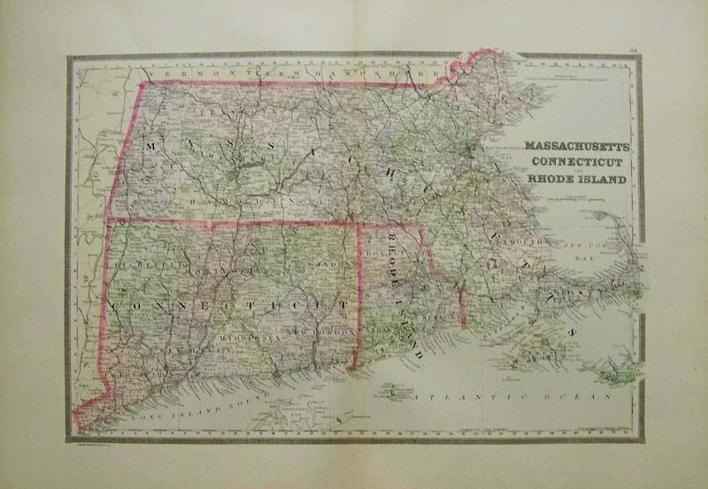 001Massachusetts: 1889 Bradley's color map of Massachusetts, Connecticut and Rhode Island. 26 x 19 in. $100 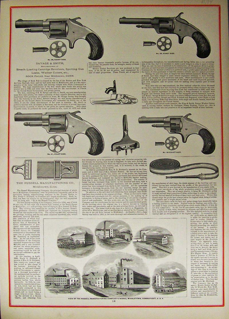
011guns: Revolvers - Savage & Smith, 1874. View of the Russell Manufacturing Company's works, Rochester Falls near Middletown, CT., U.S.A. Six vignette views of the company works. Wood engraving with color border. 17 x 24 in. $60 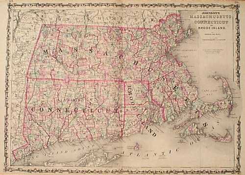 102ct: 1862 Johnson, Mass., Conn., Rhode Island Map. Beautiful, decorative map, with original hand coloring. Counties are outlined in red, and each township is colored separately. Cities, towns, geographical features, railroad lines and major roads are all shown. This map would look great in a frame!! 18x26 in. $100 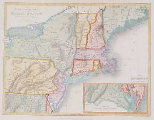 103ct: 1838 Map of Northeastern United States. Interesting map, drawn by W. Hughes and published as an illustration to N.P. Willis' American Scenery Illustrated. Covers an area from central Virginia to southern Maine. Cities, towns and railroad lines are shown. Each state is individually hand colored. 8x10 in. $100 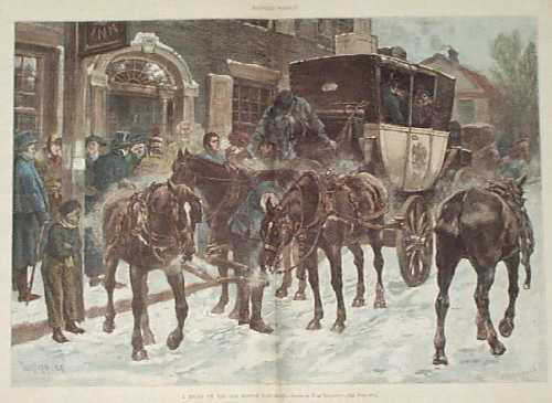 104ct: 1886 Boston Post Road Scene. Hand colored engraving from Harper's Weekly, titled "A Relay on the Boston Post Road." Shows the driver of a horse-drawn carriage picking up a package of mail. 16x22 in. $80  109ct: 1874 Glimpses of South Norwalk and Southport -- Hand colored wood engraving from Picturesque America depicts several scenes on one page of South Norwalk and Southport. 12-1/2 x 9-1/2 in. $40 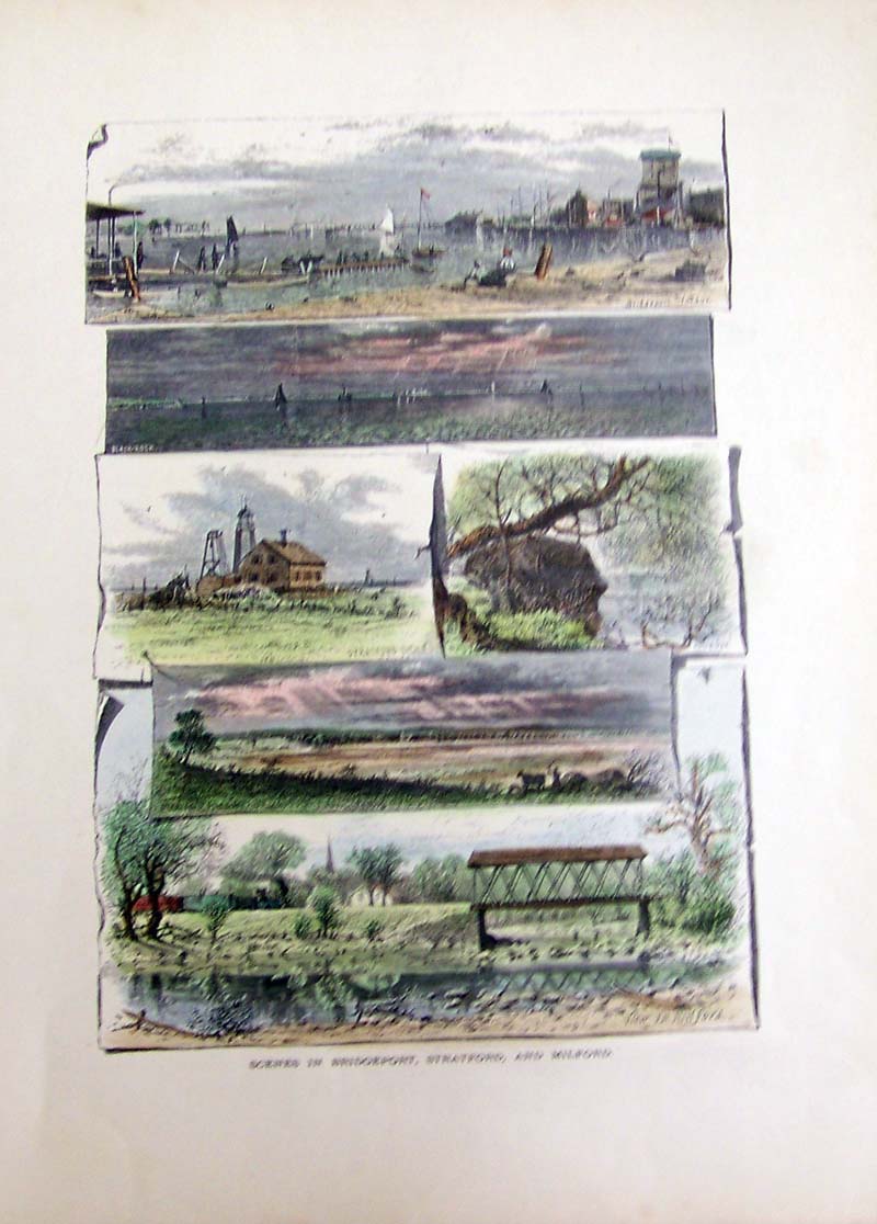 110ct: 1873 Scenes in Bridgeport, Stratford, and Milford -- Hand colored wood engraving from Picturesque America depicts rectangular scenes of each city. 12-1/2 x 9-1/2 in. $40 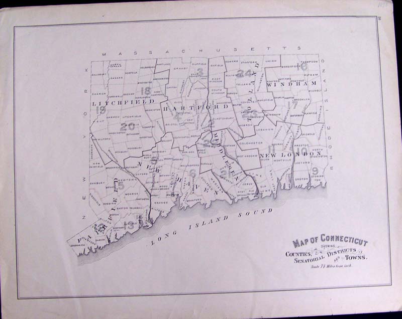 111ct: 1893 Map of Connecticut Showing Counties, Senatorial Districts and Towns. Scale is 7-1/2 Miles to an inch. 19-1/2 x 15-1/2 in.$80 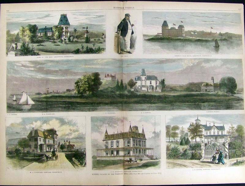 113ct: Greenwich and Norwalk. Summer palaces of Boss Tweed's Tammany Ring. 7 views of palatial shore front homes. 21-1/2 x 15-1/2 in. $120 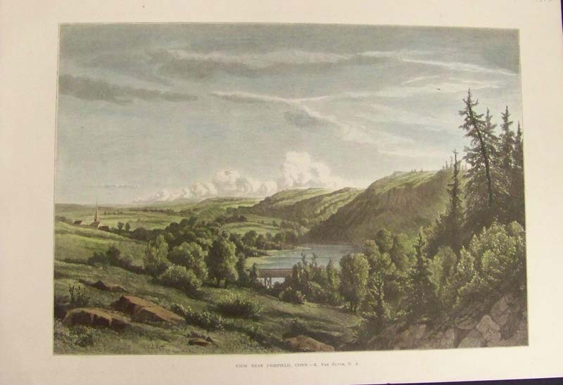 114ct.: 1873 View Near Fairfield, Conn. - K. Van Elten, N. A. Hand colored wood engraving depicting a panoramic view near Fairfield, CT. 16 x 10-1/2 in. $60 
000rare: 1834 New Bedford with large inset of its Vicinity. Very rare lithograph by J. Congdon, published by Pendleton's Lithography, Boston. Map includes Village of New Bedford with public buildings, roads, cemeteries, churches, plan and waterfront docks, population and more. Condition: Good. Browning and aging throughout with small margins, and foxing throughout. 34 x 21 in. $2,500 |
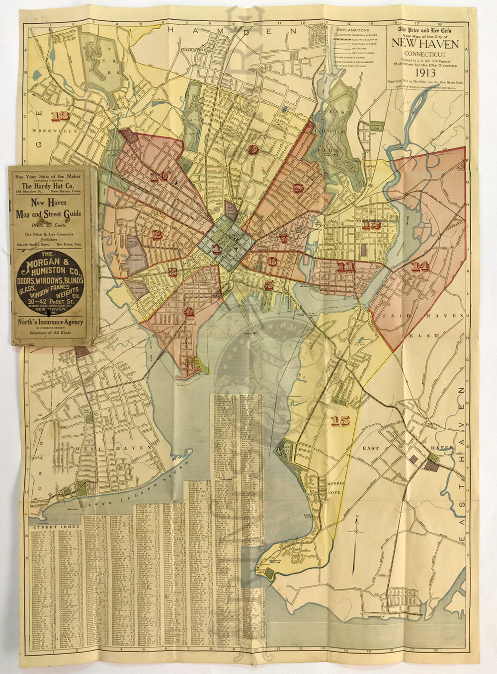 127ct.: 1913 New Haven Folded Street Map. Prepared by AB Hill for The Price and Lee Company. Shows streets, railways, proposed streets with colors indicating wards. Folded inside the street directory booklet. Very good condition with a few archival mends on verso. 20 x 30 in. $150 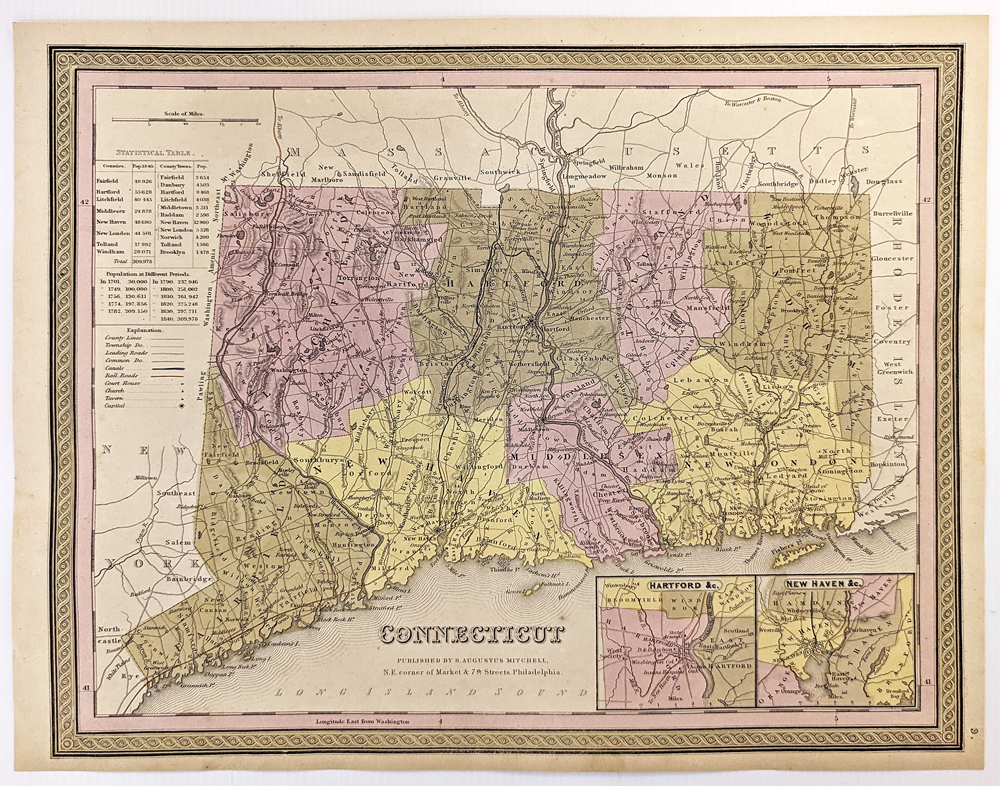 128ct.: 1849 Mitchell Map of Connecticut. Insets of Hartford and New Haven. Showing counties, townships, roads, canals, railroads, church, tavers and capitals. Statistical Table showing populations of various towns, counties and eras. Hand colored, lithograph. 13 1/8 x 15 7/8 in. $250 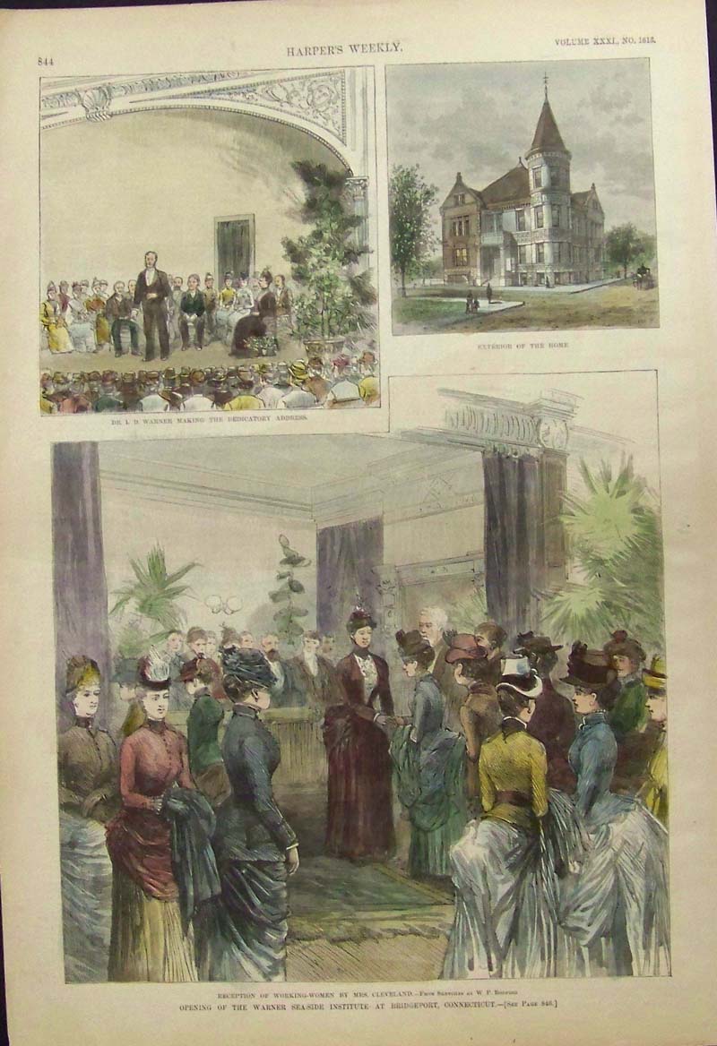 115ct: 1887 Harper's Weekly hand colored wood engraving depicting three scenes describing the Opening of the Warner Sea-Side Institute at Bridgeport, Connecticut. Bottom scene shows the Reception of Working-Women by Mrs. Cleveland -- From Sketches By W.P. Bodfish. Top left scene shows Dr. I.D. Warner Making the Dedicatory Address. Top right scene shows the front of the Home. Also enclosed with engraving is a short article describing the history of the Sea-Side Institute at Bridgeport. 16 x 11 in. $50 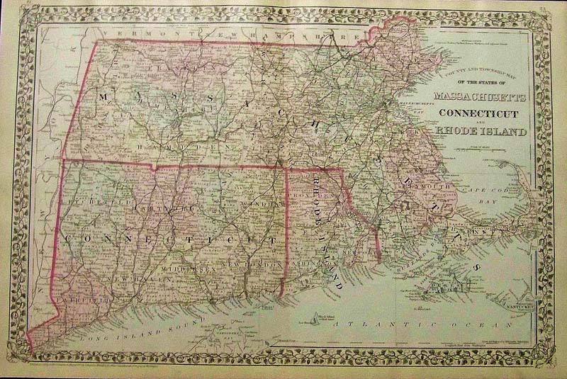 1196Massachusetts: 1879 Mitchell's original hand colored County and Township Map of the States of Massachusetts, Connecticut, and Rhode Island. Entered according to Act of congress in the Office of the Librarian of Congress at Washington. 23 x 15 in. $150 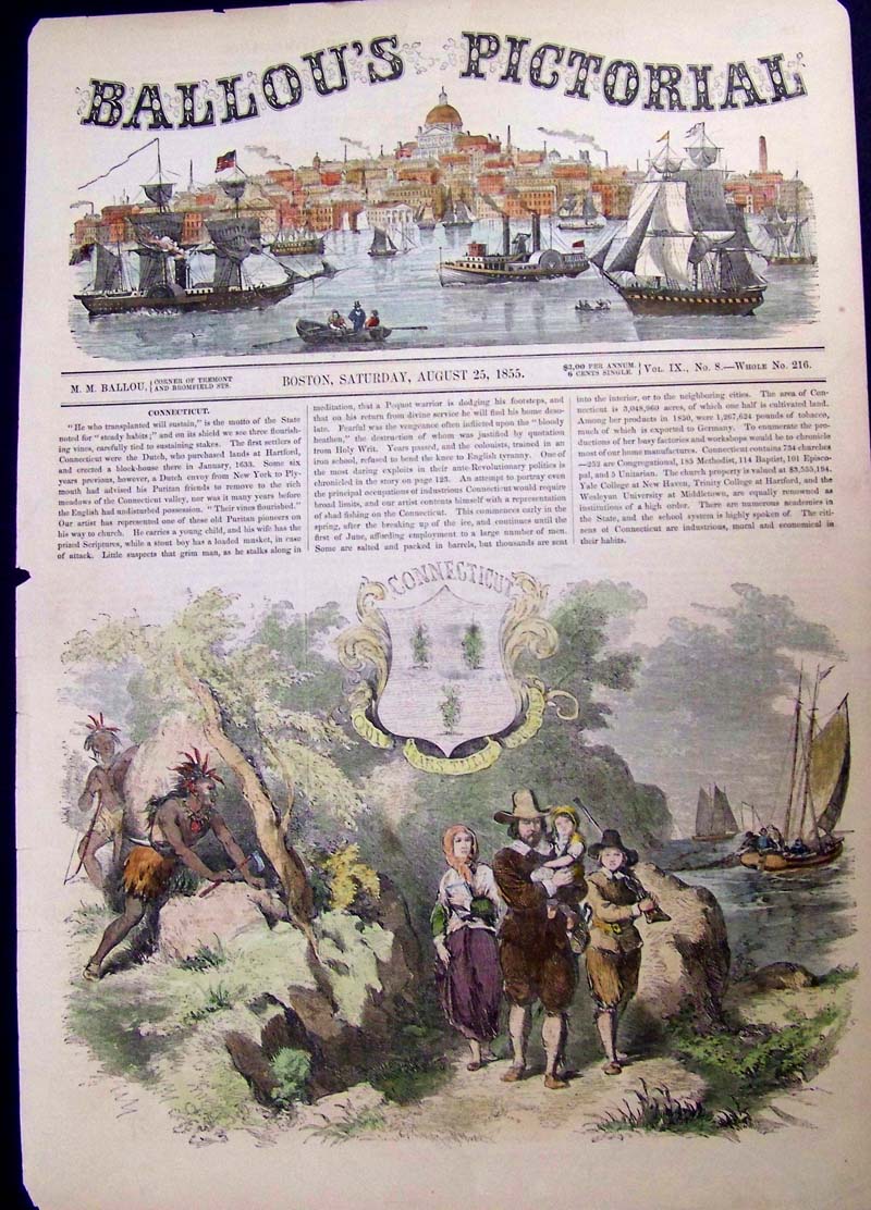 117ct: 1855 Ballou's Pictorial hand colored wood engraving depicting an old Puritan pioneer on his way to church as he carries a young child. His wife carries the prized Scriptures while a stout boy has a loaded musket, in case of attack. The seal of Connecticut is featured on engraving. 15 x 10-1/2 in. $40 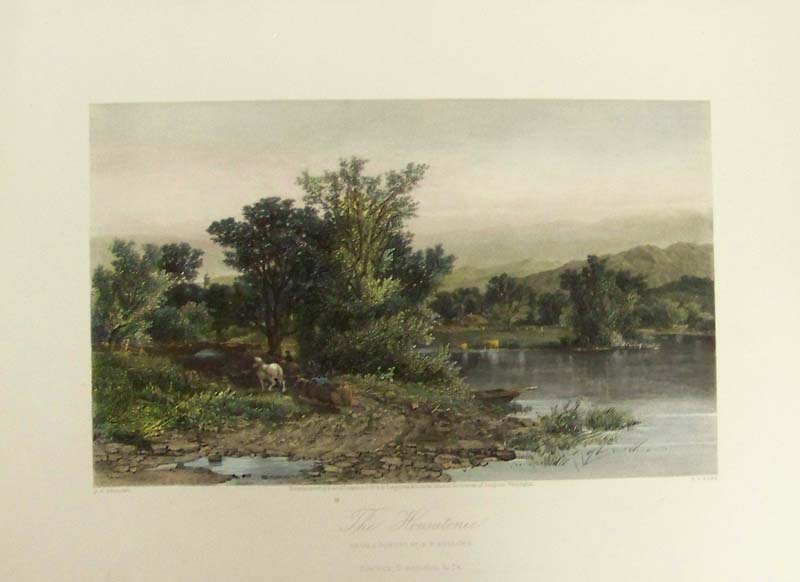 120ct: 1874 hand colored steel engraving titled, "The Housatonic," From a Painting by A.F. Bellows, New York, D. Appleton & Co. The Housatonic is a river in Connecticut. This engraving depicts a man and his horse resting under a shady tree as another horse grazes by the river's edge. 12 x 9 in. $40 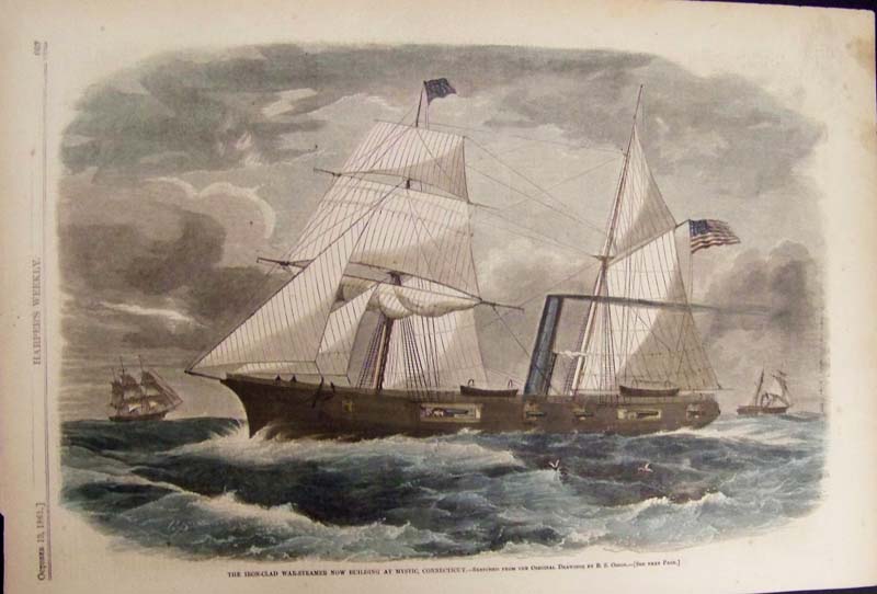 121ct: 1861 Harper's Weekly hand colored wood engraving titled, "The Iron-Clad War-Steamer Now Building at Mystic, Connecticut -- Sketched From the Original Drawings By B.S. Osbon." 16 x 11 in. $50 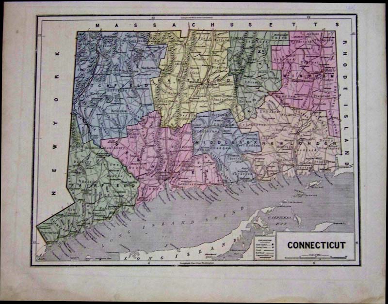 123ct: 1856 Hand colored wood engraved Connecticut map by Morse showing the counties in various colors, the Long Island Sound and part of Long Island. 16-1/2 x 13-1/2 in. $150 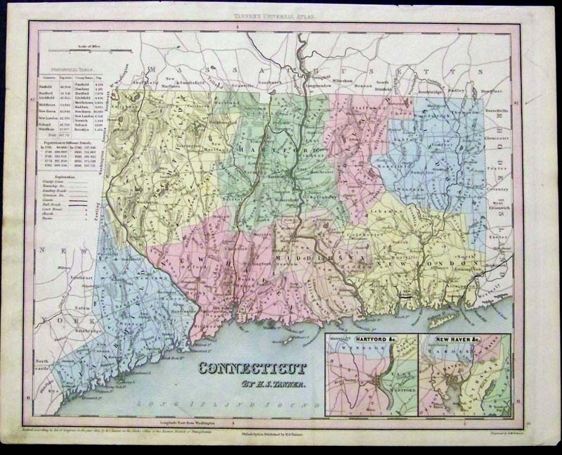
125ct: 1834 Very rare H.S. Tanner Map of Connecticut showing insets of Hartford and New Haven in bottom right corner and a Statistical Table on left side. Entered According to Act of Congress in the year 1834 by H.S. Tanner, in the Clerk's Office of the Eastern Dictrict of Philadelphia, Pennsylvania. Map was featured in Tanner's Universal Atlas. 15-1/2 x 12-1/2 in. $400 |
|||||||||
| Order Form | |||||||||||
| Back to Homepage | |||||||||||