|
|||||||||||
This is a small selection of our inventory of antique Delaware maps and prints. Additional inventory is available. Contact us with your request. 1-800-879-6277
|
|||||||||||
|---|---|---|---|---|---|---|---|---|---|---|---|
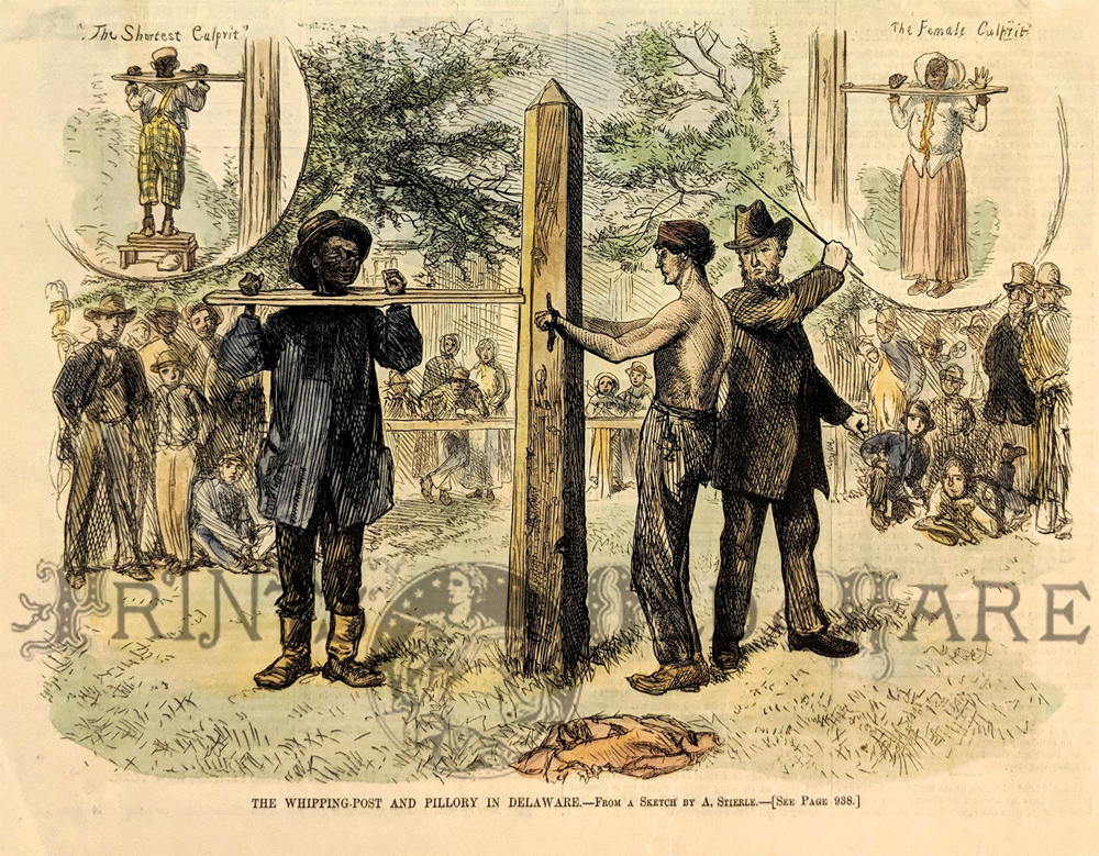
001Delaware: 1876 Harper's Weekly hand colored wood engraving titled, "The Whipping-Post and Pillory in Delaware." 11 x 8 in. $30 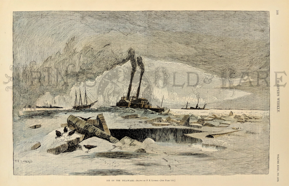
008Delaware: 1887 Ice on the Delaware. Hand colored engraving of ships navigating the icy waters. Harper's. 16x11 in. $60 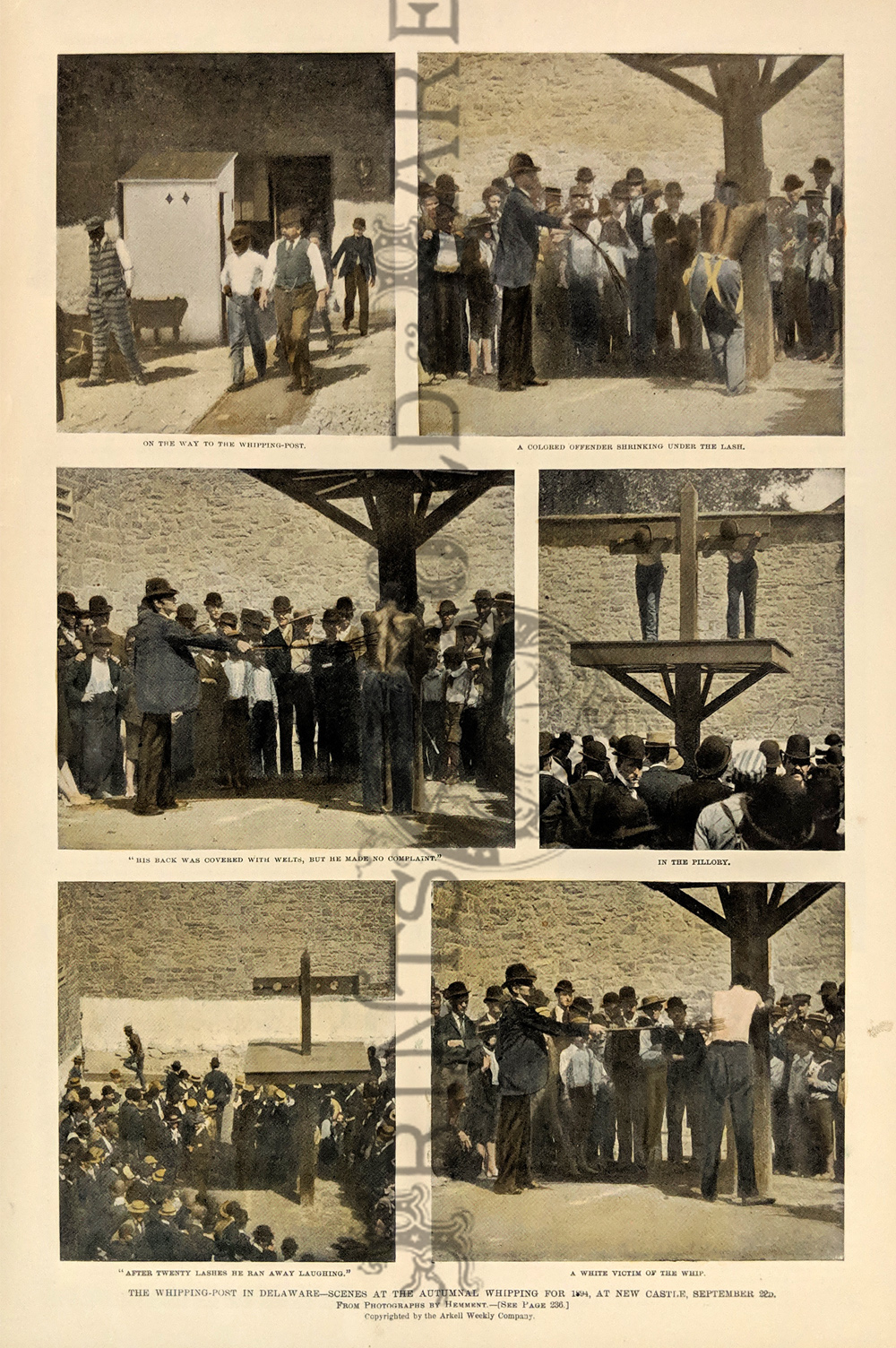
009Delaware: 1894 Hand colored half-tone from Leslie's Weekly showing scenes from The Whipping-Post in Delaware at New Castle. 16 x 11 in. $50 
010Delaware: 1868 Hand colored wood engraving showing the Whipping-Post and Pillory at New Castle, Delaware. Featured in Harper's Weekly, A Journal of Civilization. 16 x 11 in. $50 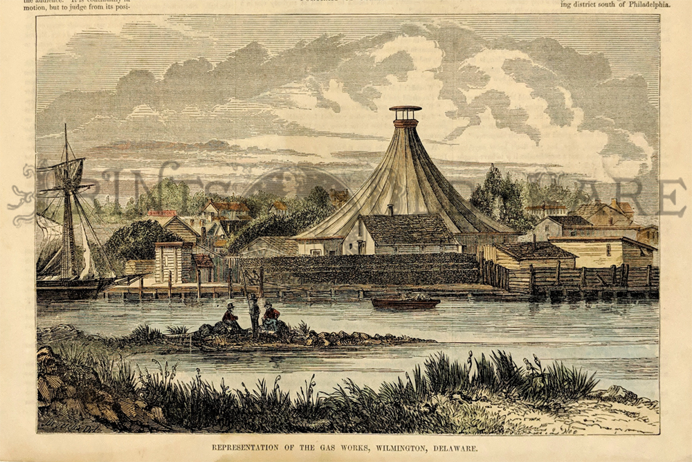
011Delaware: 1854 Hand colored wood engraving showing a Representation of the Gas Works, Wilmington, Delaware. Featured in Gleason's Pictorial Drawing-Room Companion. 15 x 11 in. $40 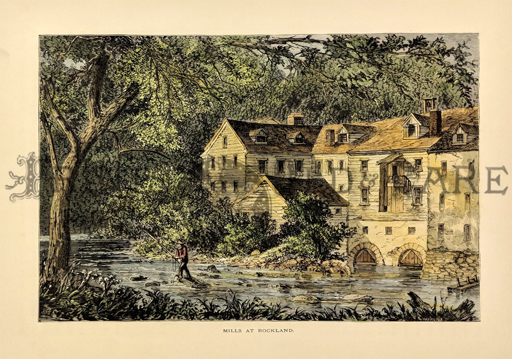
012Delaware: 1873 Brandywine Mills, Delaware. Hand colored wood engraving showing the Mills at Rockland. 12-1/2 x 9 in. $40 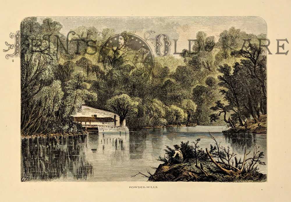
013Delaware: 1873 Hand colored wood engraving showing the Powder-Mills. Featured in Picturesque America. 12-1/2 x 9 in. $40 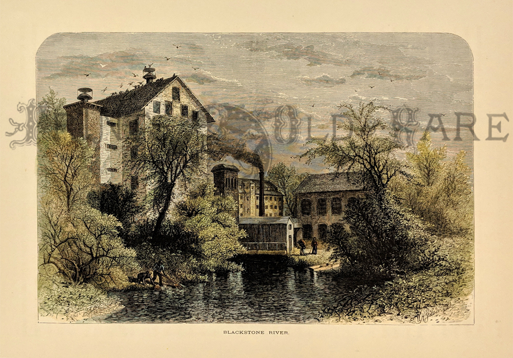 015Delaware: 1873 Hand colored wood engraving fromPicturesque America titled, "Blackstone River." 12-1/2 x 9-1/2 in. $40 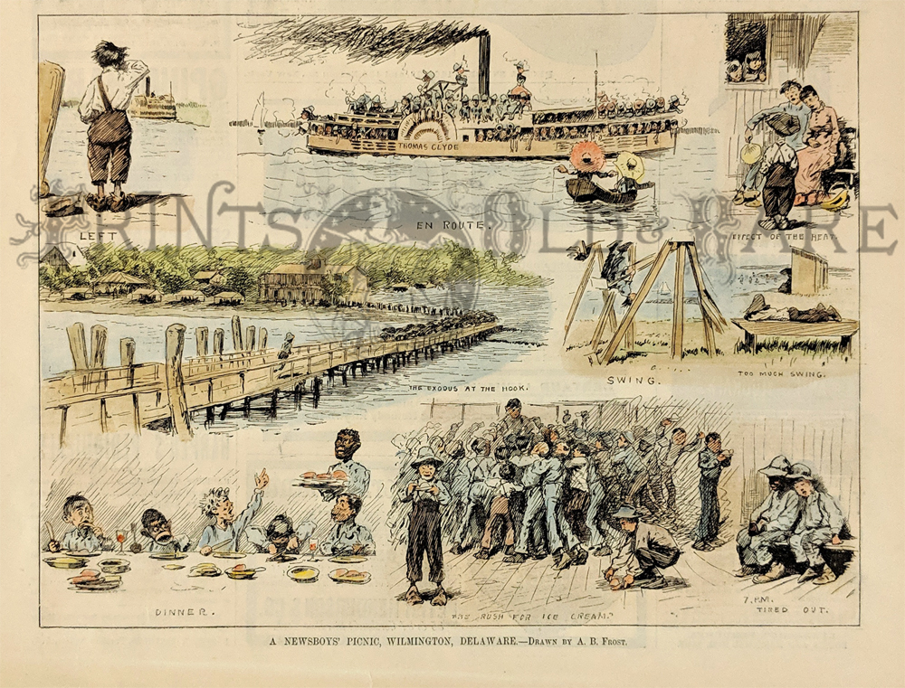 016Delaware: 1883 Hand colored wood engraving titled, "A Newsboys' Picnic, Wilmington, Delaware." Drawn by A.B. Frost. Featured in Harper's Weekly. 11 x 7 in. $30 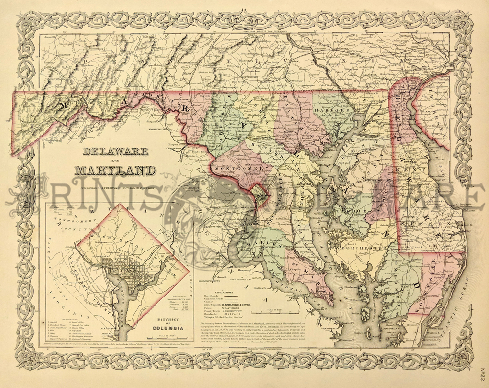 102Delaware: 1855 Colton map of Delaware, Maryland. Engraved map of the two states, with original hand coloring by county. Shows cities, towns, railroad lines, major roads and geographical features. A small inset map of Washington D.C. is in the lower left corner. 17-1/2 x 14-1/2 in. $150 |
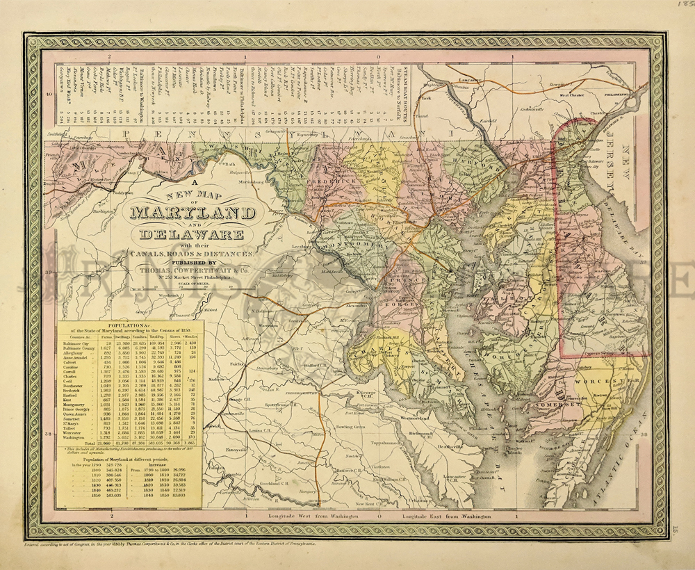
054Delaware: 1850 A New Map of Maryland and Delaware, Cowperthwait - An attractive map original hand colored and excellent example of S. A. Mitchell's 1850 map of Maryland and Delaware full of details of the times. Centered on Washington D.C., this map extends eastward from Maryland to New Jersey and the Delaware Bay. The Chesapeake Bay is rendered in full. In the upper left quadrant of the map, a table details various lists of steamboat routes. In the lower left quadrant data from the census of 1850 is presented in tabular form. The whole is engraved and colored in Mitchell's distinctive style with green border work and vivid pastels. Political and topographical features are noted and color coded with elevation rendered by hachure and main railway routes highlighted in orange. This map was prepared by S. A. Mitchell for publication by the Philadelphia firm of Thomas Cowperthwait & Co. as plate no. 15 in the 1854 edition of Mitchell's New General Atlas. Condition: Very Good, some yellowing on outside margins with minimal mottling. size 14.5 x 11.5 image. $150 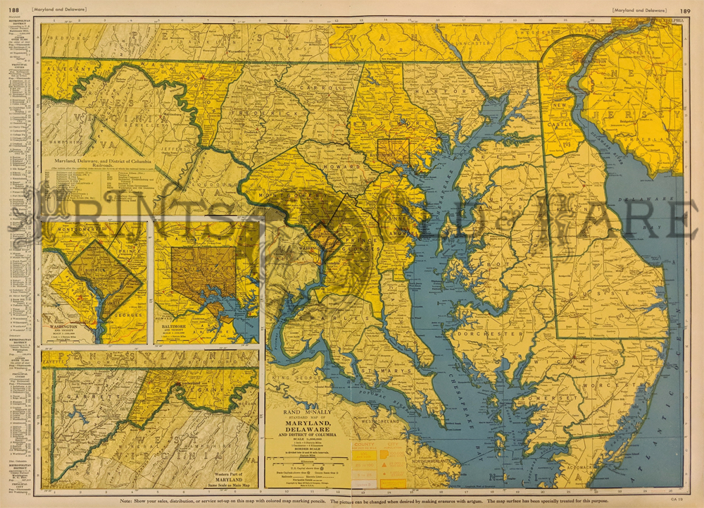
103Delaware: 1935 Delaware, Maryland Population Map. Interesting, brightly colored map from Rand McNally's 1935 Commercial Atlas. Population density of each county is shown in varying shades of orange. City populations are indicated by different shapes on the map. Also shows railroad lines and electric power lines throughout the state. 20x27 in. $80 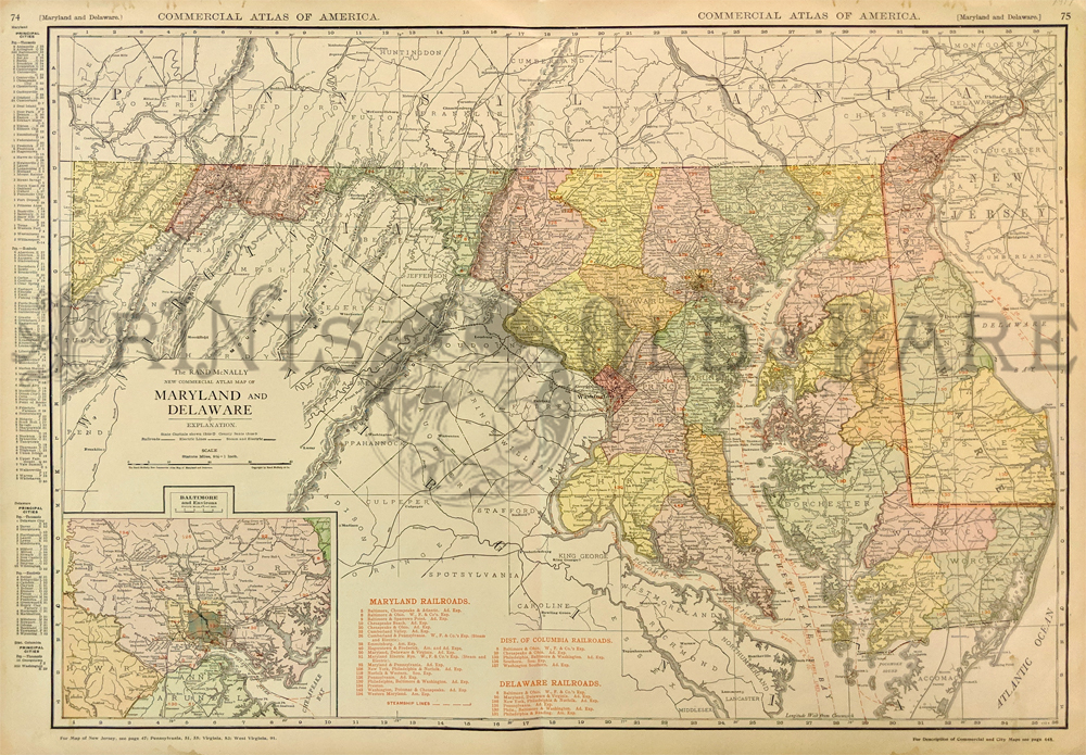 107Delaware: 1917 Delaware, Maryland Railroad Map. Color map from Rand McNally's 1917 Commercial Atlas of America. Shows the locations and names of each railroad line in both states. Also shows cities, towns and geographical features. An inset map of the Baltimore metro area is in the lower left corner. 20x27 in. $80  108Delaware: 1889 Bradley color lithograhed map showing Delaware, Maryland, Virginia and West Virginia. Featured in Bradley's Atlas of the World for Commercial and Library Reference. Entered according to Act of Congress in the Clerk's Office of the Librarian Congress at Washington. 26 x 19 in. $150 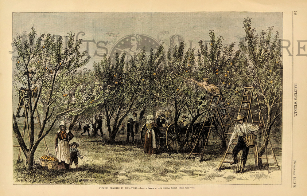 109Delaware: 1878 Picking Peaches in Delaware - From a Sketch By Our Special Artist. Hand colored wood engraving published in Harper's Weekly on September 14, 1878. Scene depicts a grove of peach trees and women and men plucking the peaches from the tree's limbs. 11x16in. $60 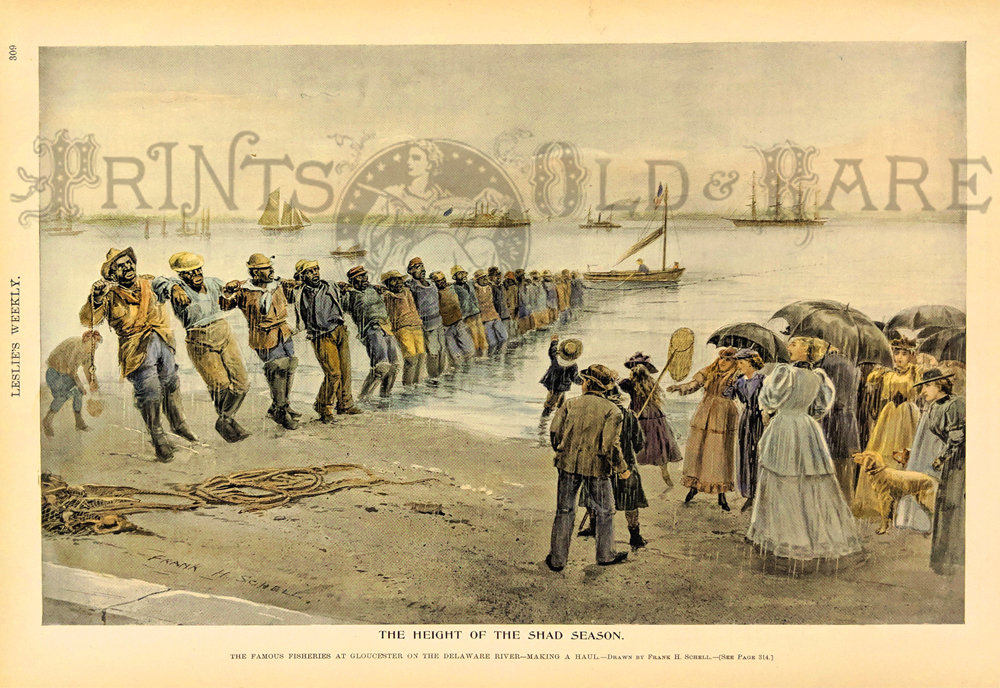 112Delaware: "The Height of the Shad Season." - The Famous Fisheries at Glouchester on the Delaware River - Making a Haul. Published in the 1894 Leslie's Weekly. Drawn by Frank H. Schell. from the tree's limbs. 11x16 in. $60 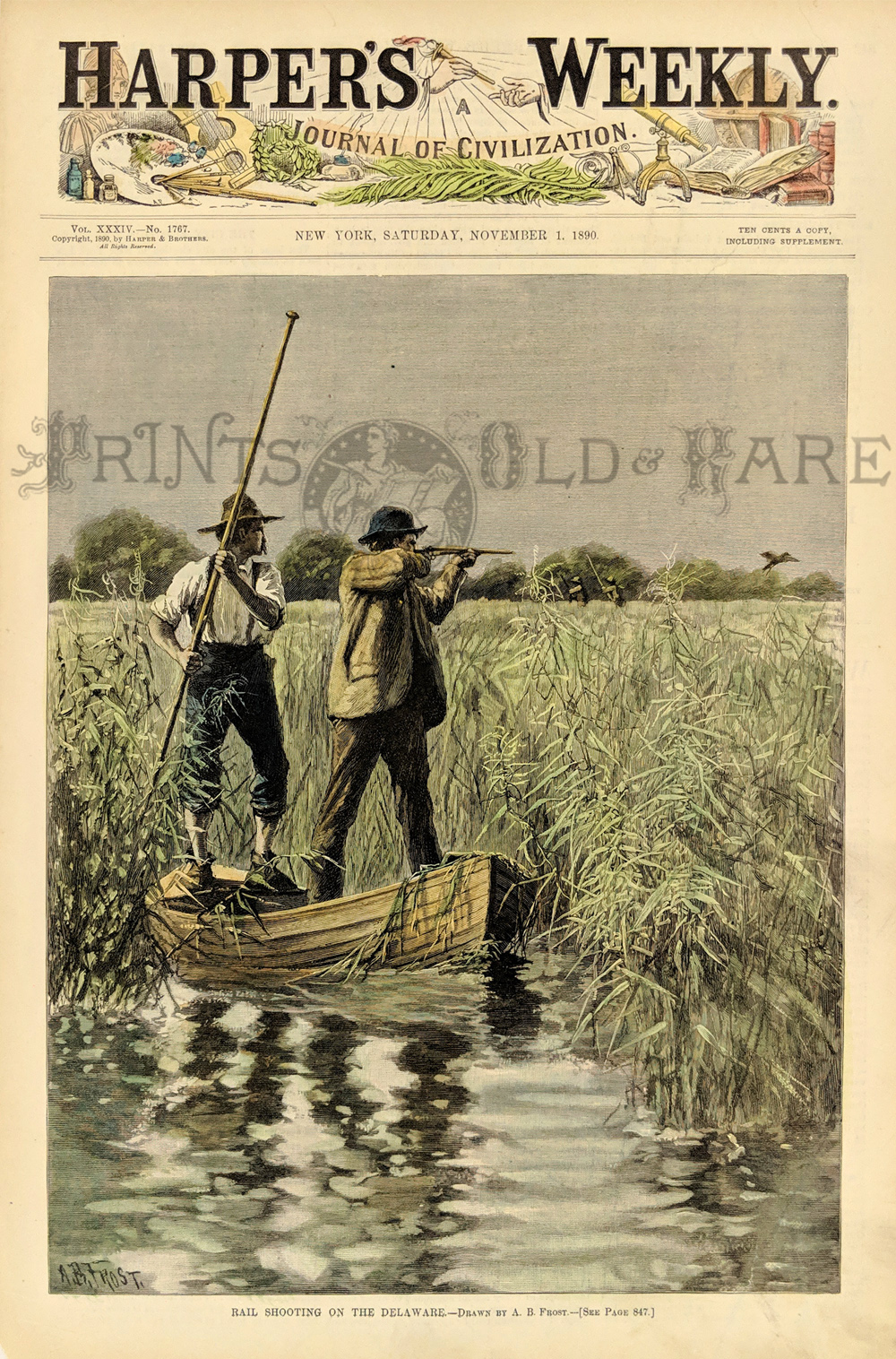 113Delaware: "Rail Shooting on the Delaware." - Drawn by A.B. Frost. 1890 Harper's Weekly. Hand colored, Wood engraving. 11 x 16 in. $80 |
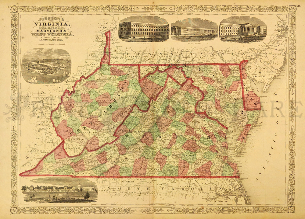 252va: Johnson's 1866 Virginia, Delaware, Maryland and West Virgina Map. Shows various cities, towns, rivers and assortment of additional topographical details. 5 Vignettes showing Fortress Monore, University of Virgina, General Post Office, Treasury Buildings and a Patent Office. 16 x 26 1/2 in. $100 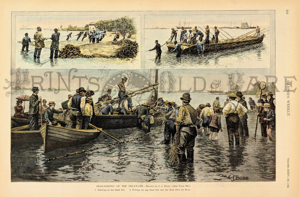 114Delaware: "Shad-Fishing on the Delaware." Pictures: 1. Drawing in the Shad Net. 2. Putting the big Shad net into the Boat after the Haul. Drawn by C.J. Budd. 1890 Harper's Weekly. Hand colored, wood engraving. 11 x 16 in. $60 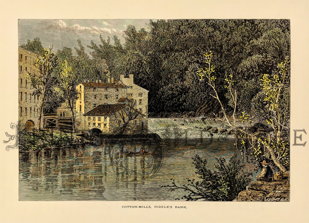 115Delaware: "Cotton-Mills, Ridele's Bank." published by Picturesque America. 1873. Hand colored, wood engraving. 12 x 9 in. $40 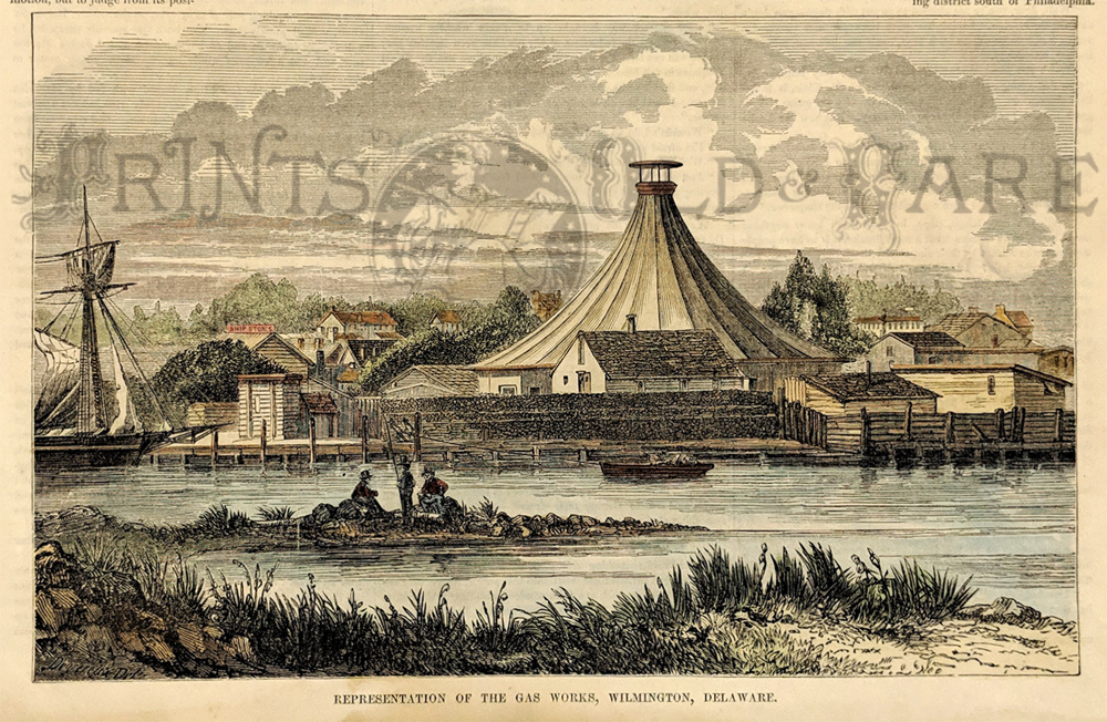 116Delaware: "Representation of the Gas Works, Wilmington, Delware." Published in the 1853 Gleason's Pictorial Drawing-room Companion. Hand colored, wood engraved. 6 1/2 x 9 1/2 in. $40 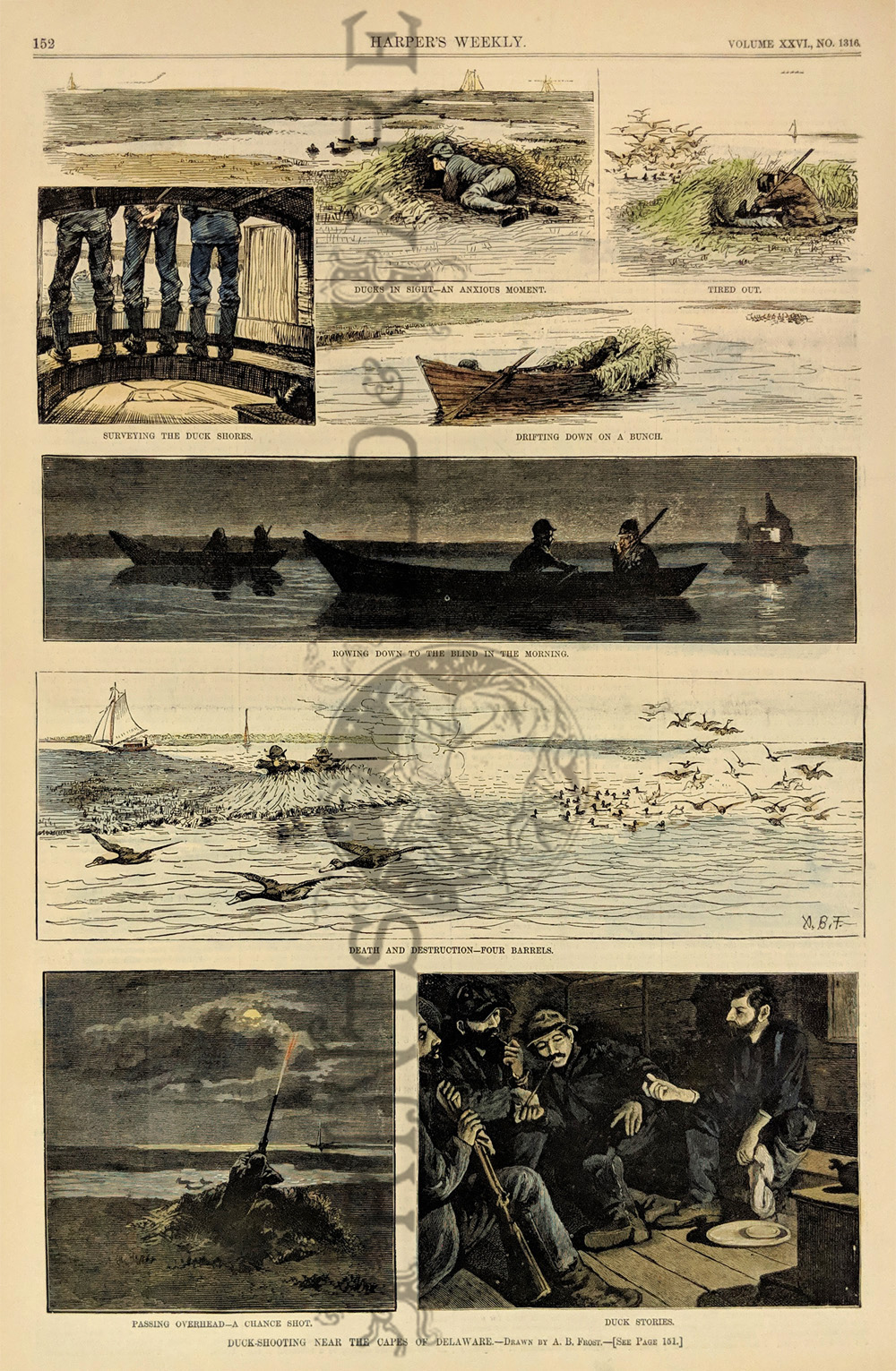 117Delaware: "Duck-Shooting near the Capes of Delaware." 8 vignette's showing the many processes of hunting ducks. 1882 Harper's Weekly. Hand colored, wood engraved. 11 x 16 1/2 in. $50 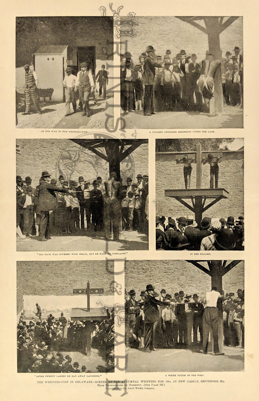 118Delaware: "The Whipping-post in Delaware - Scenes at the Autumnal Whipping for 1894, at New Castle, September 22d. From Photographs by Hemment. Published in the 1894 Leslie's Weekly. Half-tone print. 11 x 16 in. $50 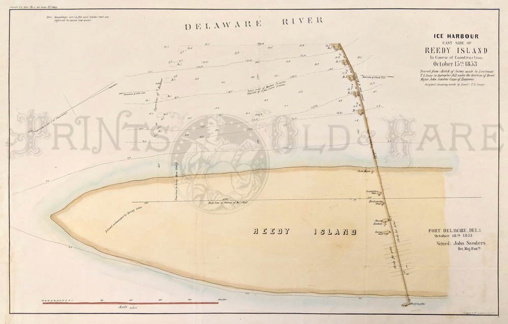 119Delaware: U.S.G. State Survey Map of Ice Harbour - East Side of Reedy Island. In Course of Construction. October 15th 1853. Hand colored, lithograph. 13 x 20 in. $100
|
|||||||||
| Order Form | |||||||||||
| Back to Homepage | |||||||||||