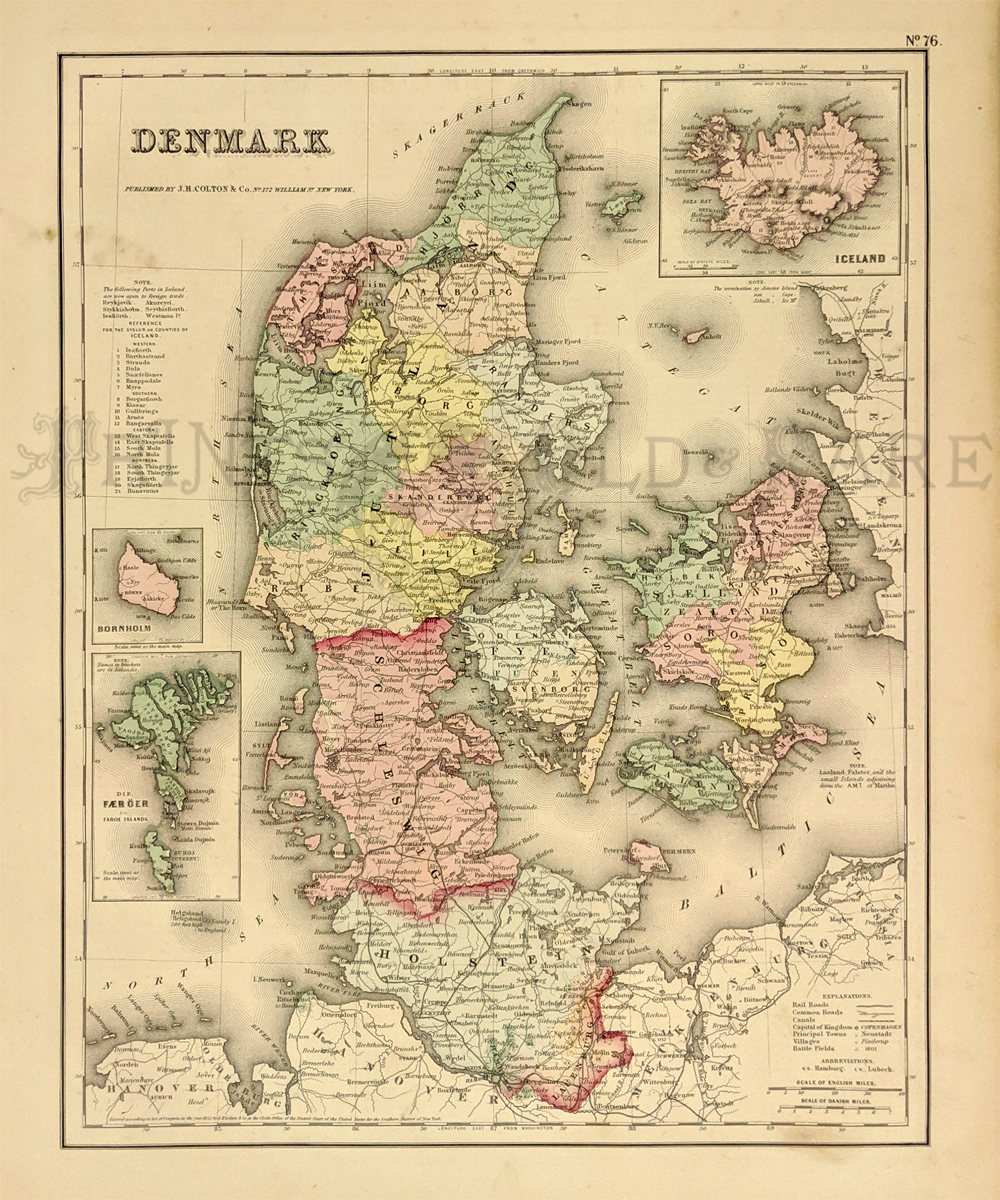
001den: 1855 Colton Map of
Denmark. Original old hand-colored map by Colton and Company was
published in 1855. It shows geographical details and railroad lines,
common roads, canals, towns, villages and battlefields. Map shows three
smaller inset maps of Iceland, Bornholm, and Faroe Islands. 14x17 in.
$40

002den: 1860 View of
Fredericksborg Palace. Beautiful antique steel engraving published in
1860 as an illustration to a book shows an exterior view of the
Fredericksborg Palace in Denmark. 9x12 in. $40
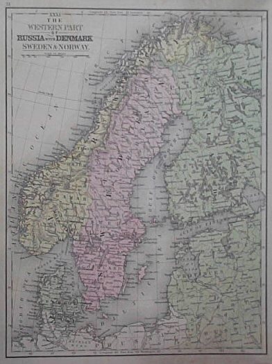
003den: 1886 Antique Map of
Russia with Denmark, Sweden and Norway. Today's Finland. 9x12 in. $40
|
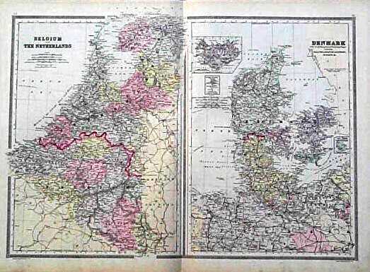
004den: 1884 Maps of Denmark,
Belgium and the Netherlands. Original hand-colored maps published by
William Bradley and Brothers in 1884 shows a map of Denmark on the
right and a map of Belgium and the Netherlands on the left. Both maps
show geographical details, capitals, towns, waterways and provinces.
Denmark map shows smaller inset map of Iceland. 17x26 in. $80
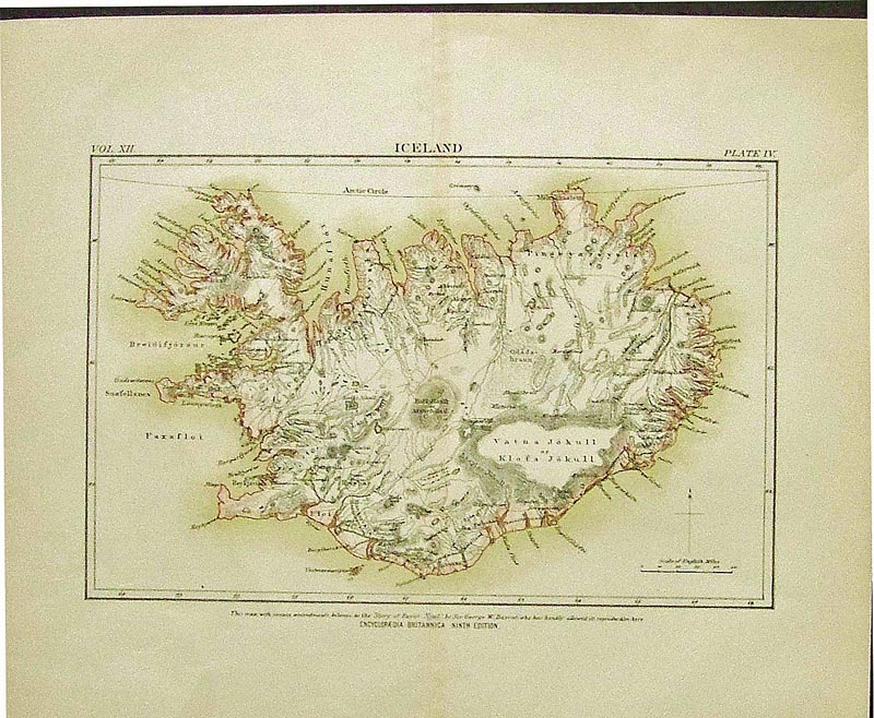
005den:
Iceland c.1880. Published in the Encyclopedia Britannica, Ninth
Edition, Scholar's Edition.
10 1/2 x 12 in. $30
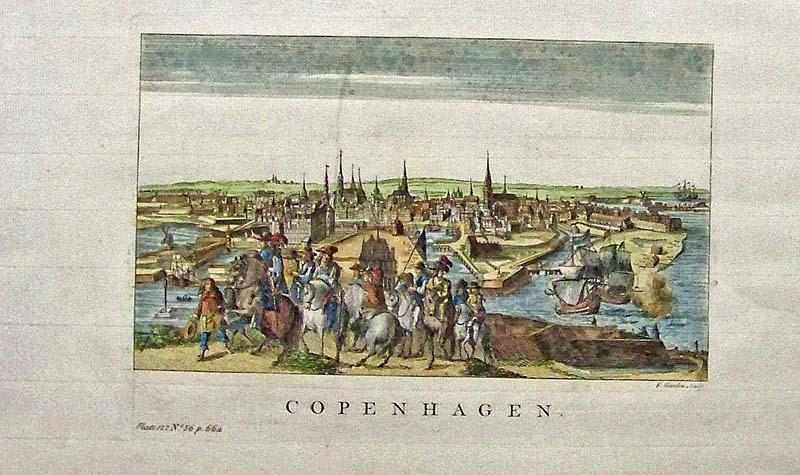
006den:
1752 Hand colored antique copper engraving showing Copenhagen in Plate
122, No. 56, p. 664.
15 x 8-1/2 in. $150

201den:
1837 Lightly hand colored steel engraved map of Copenhagen
(Kiobenhaven) in fine condition which is embellished with a panorama of
this city in Denmark on bottom of map. Published under the
Superintendence of the Society for the Diffusion of Useful Knowledge
(S.D.U.K.) and published in London by Chapman & Hall.
16 x 13-1/2 in. $95
|
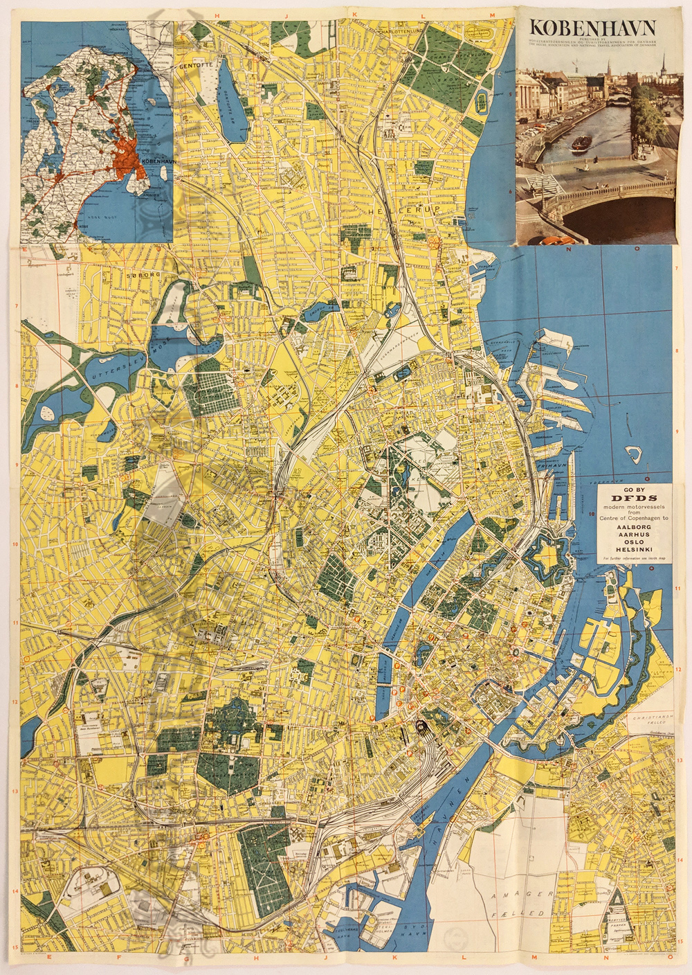
007den:
Copenhagen (Kobenhaun) Colorful and detailed 1960s city map. Inset of
area. Verso: Ads and maps to city businesses.
30 x 21 in. $35
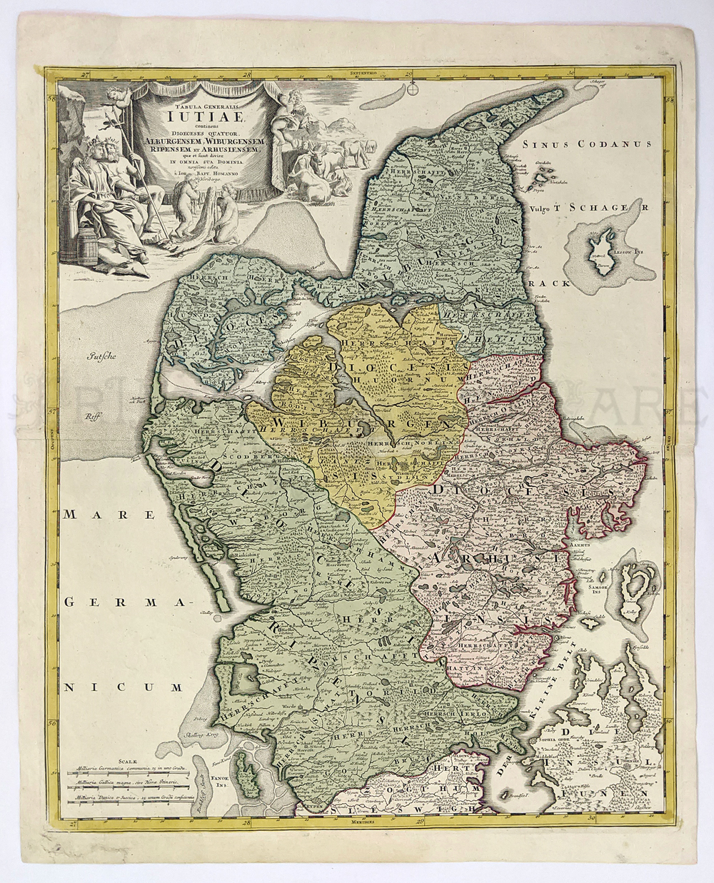
202den:
Jutland - c.1720 "Tabrela Generalis Iutaie" Northern part of Denmark by
J.B. Homann. Hand colored copper engraving.
22.4 x 19.9 in. $295
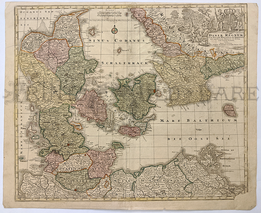
008den:
Daniae Regnum cum Ducatu Holsatia. M. Seutteri c.1730. Hand colored
copper engraved map of Demark and Southern Sweden, esp Germany. *Bottom
corner patched.
20 3/4 x 24 3/4 in. $350
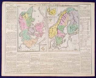
200den: Old, RARE Map: Denmark,
Norway, Sweden. Beautiful, engraved map of Denmark and Sweden, drawn by
C. Gross and published in the 1821 edition of Lavoisne's Geographical
and Historical Atlas. Norway and Finland are included as provinces of
Sweden. Each province on the map is separately colored with original
hand coloring. Cities are shown, as well as geographical features
throughout the region. The map image is surrounded on three sides by
text, which describes the geography, government, religion and politics
of the Scandinavian countries. This map is in excellent condition.
17x22 in. $150
|
|