|
|||||||||||
This is a small selection of our inventory of antique Egyptian & North Africa maps & prints. Additional inventory is available. Contact us with your request. 1-800-879-6277
|
|||||||||||
|---|---|---|---|---|---|---|---|---|---|---|---|
 001egyp: 1885 Map of Ancient Egypt. Engraved map of Egypt as it looked in ancient times, published as an illustration to a book in 1885. Printed on thin paper, with original outline hand coloring. Excellent condition. 10x11 in. $30 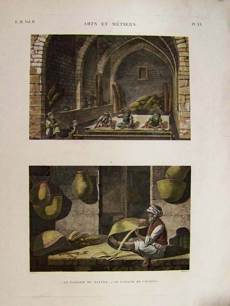 000sew: c.1809-1829 Description de L'Egypte - Hand colored copper engravings showing rug making in top image and basket weaving in bottom image. Pl. XX. Title on top is Arts Et Metiers. 25 x 19 in. $300 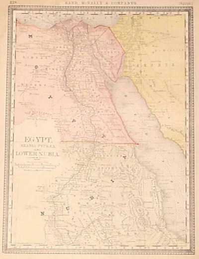
002egyp: 1887 Map of Egypt, Arabia Petraea, Nubia. Interesting color map, published circa 1887 by the Rand McNally company. Title is "Egypt, Arabia Petraea, and Lower Nubia." Each country is colored separately. Cities, towns and locations of ancient ruins are shown. 11x15 in. $60 
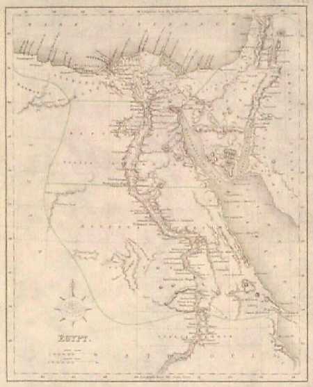
004egyp: 1845 Engraved Map of Egypt. Hand colored map of Upper and Lower Egypt, published circa 1845 as an illustration to a book. Shows cities, towns and geographical features, mainly along the Nile River and in the Nile Delta region. 10x13 in. $50 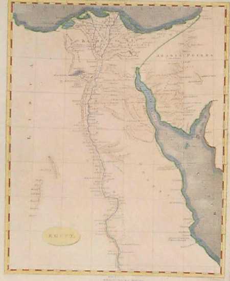
005egyp: 1805 Arrowsmith Map of Egypt. Hand colored map of Egypt, published in Arrowsmith's General Atlas of 1805. Shows cities and towns along the Nile river and delta. Most of the areas on either side of the Nile are shown as uninhabited desert. 9x11 in. $80 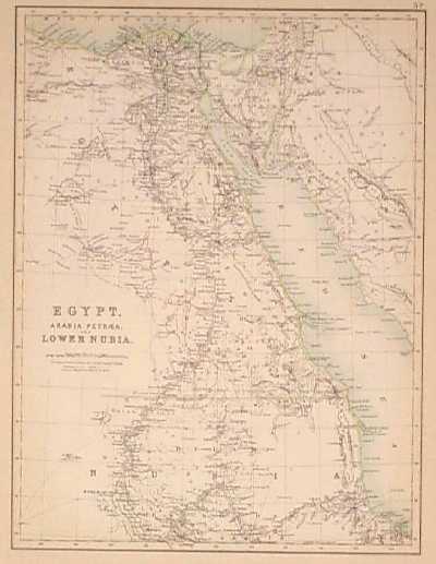 006egyp: 1890 Map of Egypt, Arabian States. Detailed color map of Egypt, Arabia Petraea and Lower Nubia, from an 1890 world atlas. Shows cities, towns, railroad lines, canals and geographical features throughout the region. 13x18 in. $40  007egyp: 1802 Map of Egypt and Arabia. Beautiful, hand colored engraved map showing Upper and Lower Egypt, as well as most of the Arabian peninsula. Published in 1802 as an illustration to a book. Cartographer's name is not given, but it may have been drawn by Arrowsmith. Contains informational comments on the peoples who lived in the region. Major roads are shown, as well as the route of pilgrims to Mecca. 11x16 in. $100 |
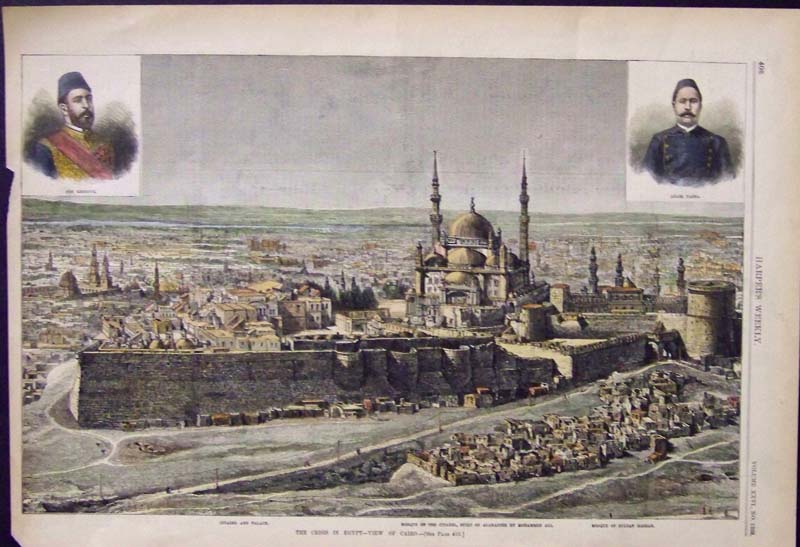
(Also visit our Jacotin & Blondeau page)  008egyp: 1894 Map of Egypt, Nubia, Abyssinia. Color map from an 1894 world atlas. Map title is "Egypt, Arabia, Upper Nubia and Abyssinia." Shows cities, towns and major roads throughout the region. Names of nomadic tribes are shown in the areas where they lived. 12x14 in. $20 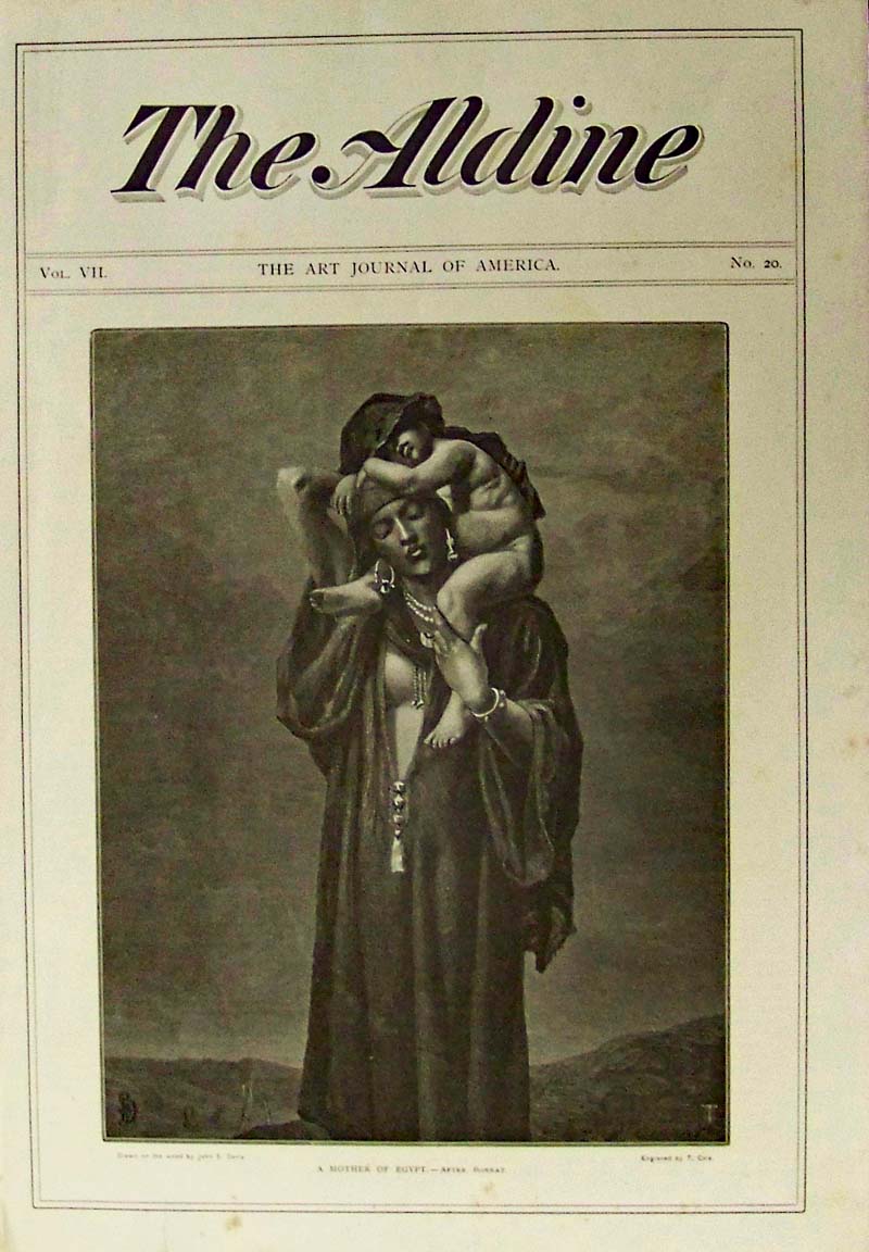 002bh: A Mother of Egypt by John S. Davis. This 1875 wood engraving was featured as the cover of The Aldine, The Art Journal of America. 16 x 10-1/2 in. $60 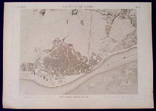 200egyp: VERY RARE Old Cairo Egypt View: Boulaq. This item is a beautifully engraved aerial view of Boulaq, in the vicinity of Cairo Egypt. It was printed by the French government in 1822, and titled "Environs du Kaire. Plan Particulier de Boulaq." During Napoleon's invasion of Egypt in the early 1800s, artists in his army made drawings of many Egyptian scenes. In addition to documenting the tombs and ancient monuments that they found, they also drew maps and aerial views of places throughout the country. This item is one of the scenes from that series of drawings. It is in excellent condition. There are no tears or stains on the image, and only a few light spots of foxing in the margins. 19x26 in. $500 
201egyp: 1800 Homann Heirs Map of Egypt. Beautiful map of Egypt, with original hand coloring, drawn by F.L. Gussefeld and published in 1801 by Homann Heirs. Detailed depiction of the Nile valley, from the Mediterranean Sea to Aswan. The valley is colored green to indicate that it was a fertile region. Map shows caravan routes across the desert to the west and south. Map image is in very good condition, with no significant blemishes. Margins are slightly scuffed, but could easily be covered by matting and framing. 23x27 in. $400
|
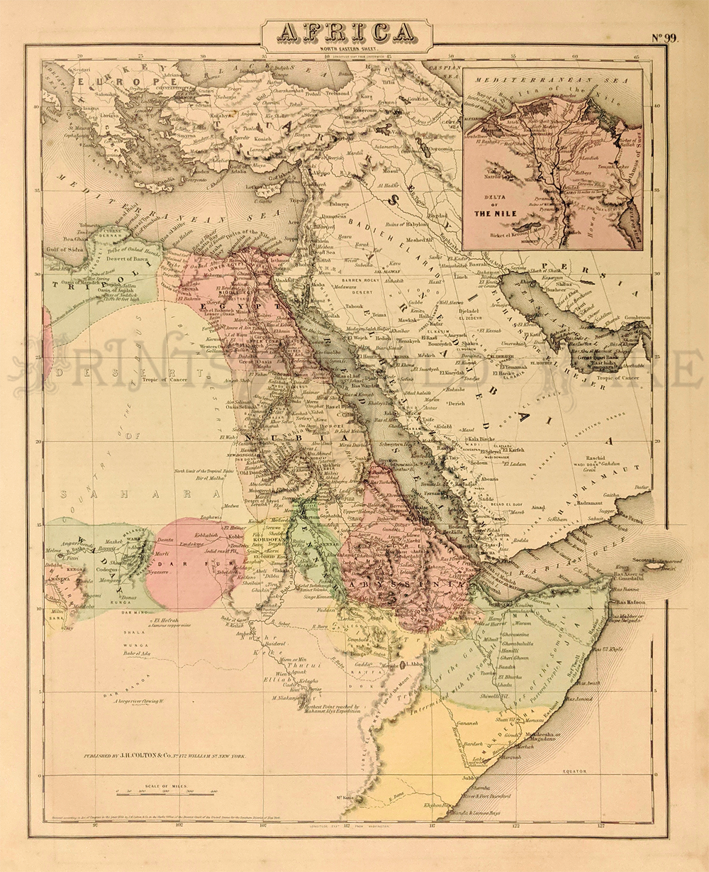
214egyp: 1855 Colton Africa (North East) - Area of Egypt along the Red Sea and Nile River. Shows Tripole, Waday and Dar Fur. Inset of Delta of the Nile. Fine condition. 14 x 17 in. $35 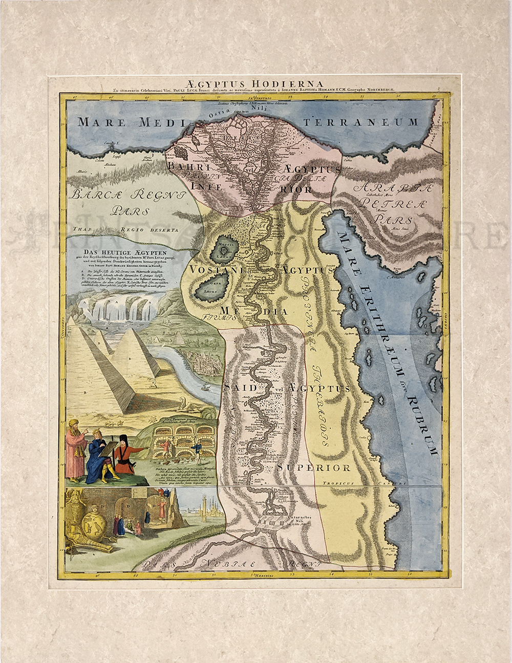 215egyp: Egypt – “Aegyptus Hodierna” 1720 by Homann. Hand colored, copper engraving. 20 5/8 x 24 5/8 in. $425 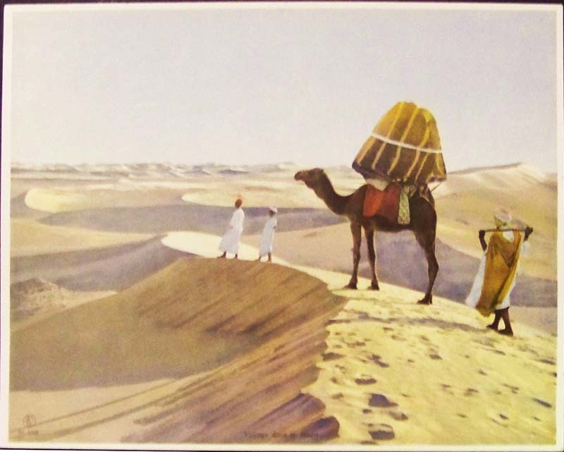
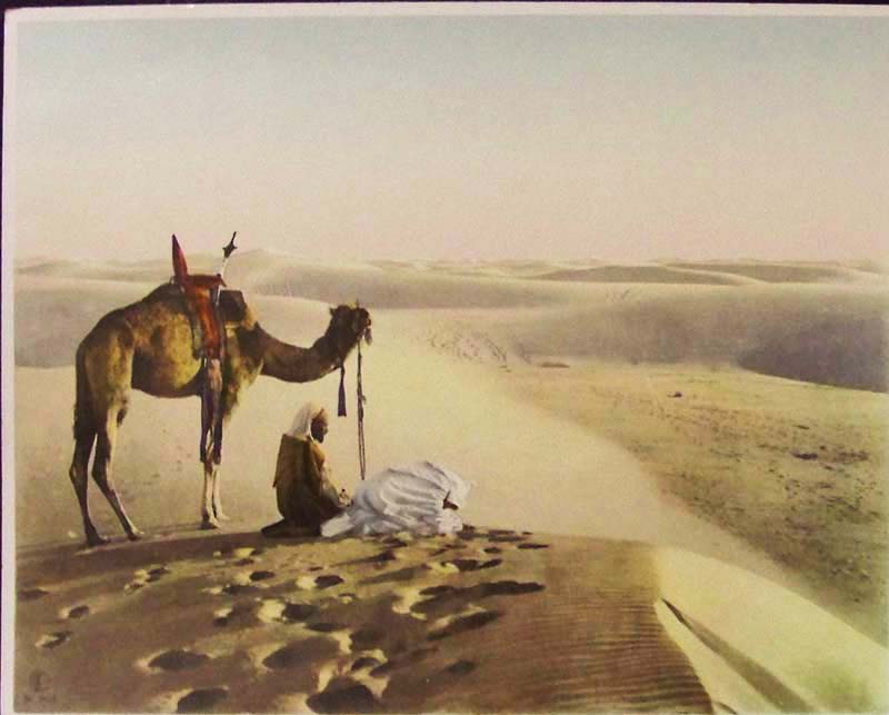
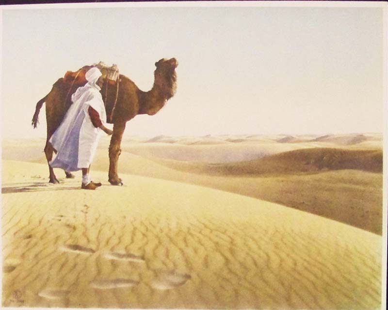
207egyp: C.1940s Beautiful color photos of Bedouins in North Africa. 12 x 9-1/2 in. $30 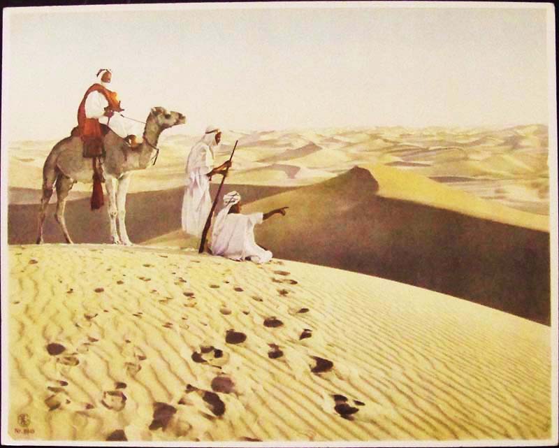
208egyp: C.1940s Beautiful color photos of Bedouins in North Africa. 12 x 9-1/2 in. $30 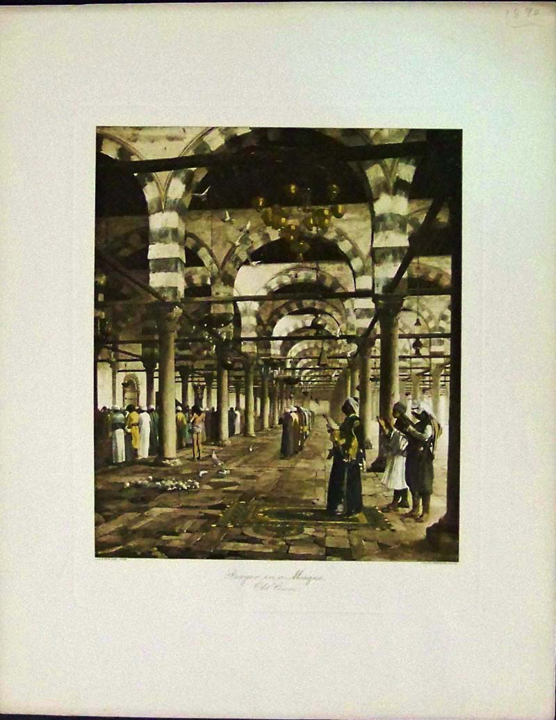
209egyp: 1890 Hand tinted photo engraving after Gerome showing, "Prayer in a Mosque, Old Cairo." 13-1/2 x 11 in. $50 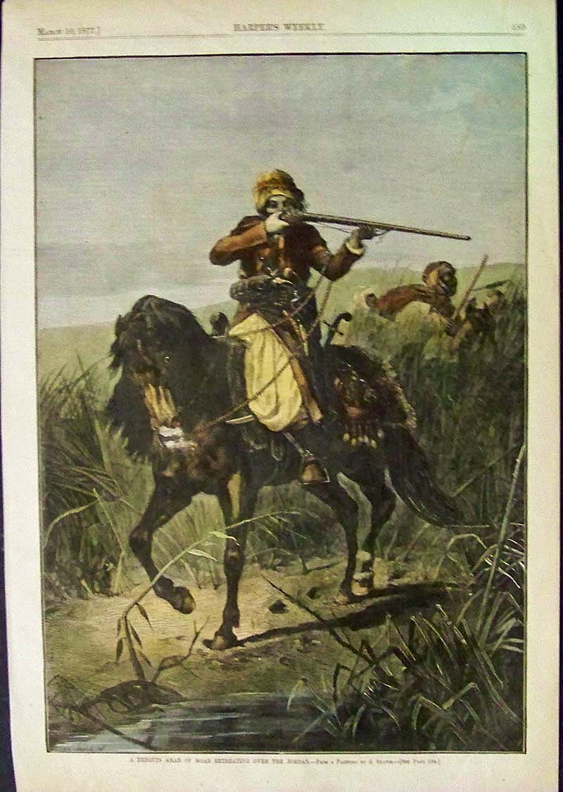
210egyp: 1877 Hand colored wood engraving featured in Harper's Weekly titled, "A Bedouin Arab of Moab Retreating Over the Jordan." From a Painting by R. Beavis. Engraving is in fine condition. 15-1/2 x 11 in. $60 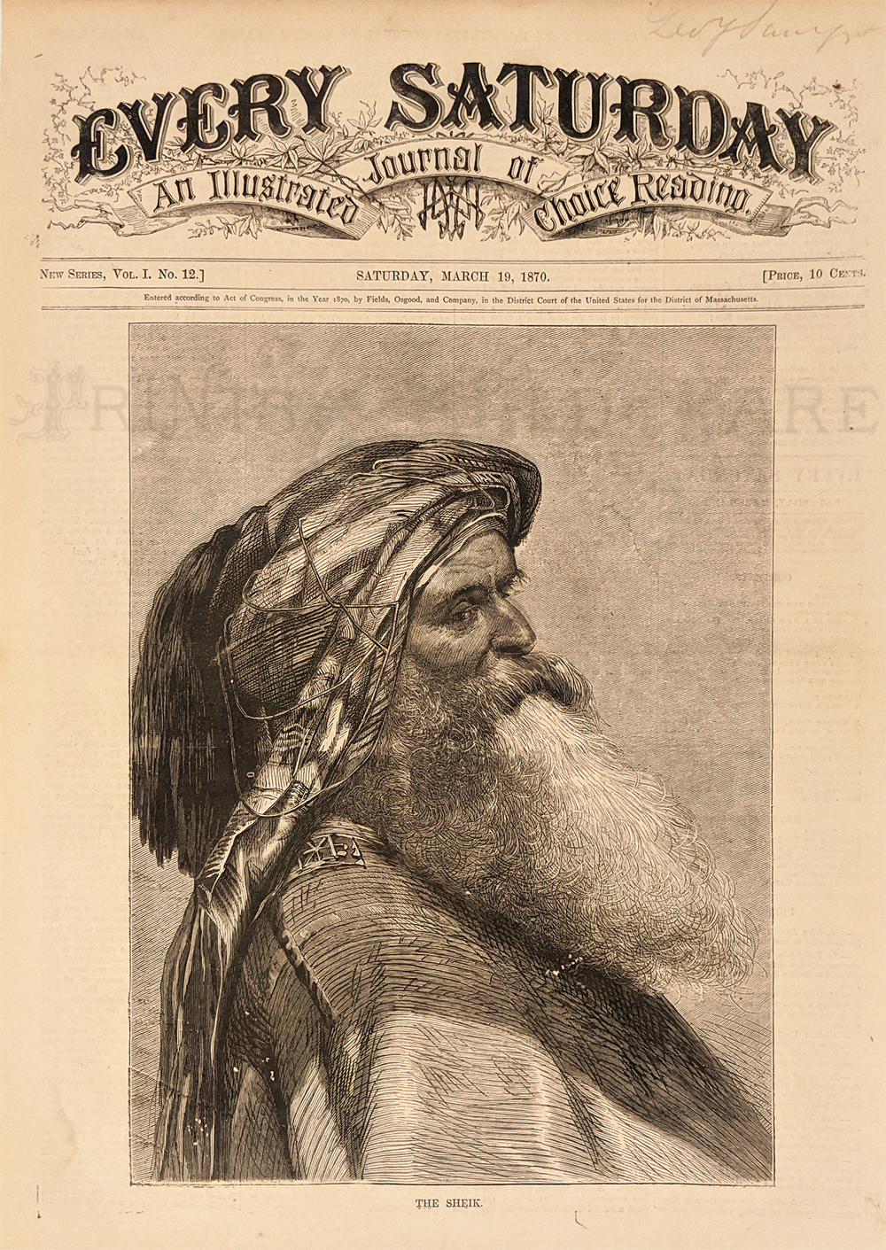 211egyp: 1870 Antique wood engraving showing, "The Sheik," which was featured in Every Saturday, An Illustrated Journal of Choice Reading. Fine condition. 14-1/2 x 11 in. $80 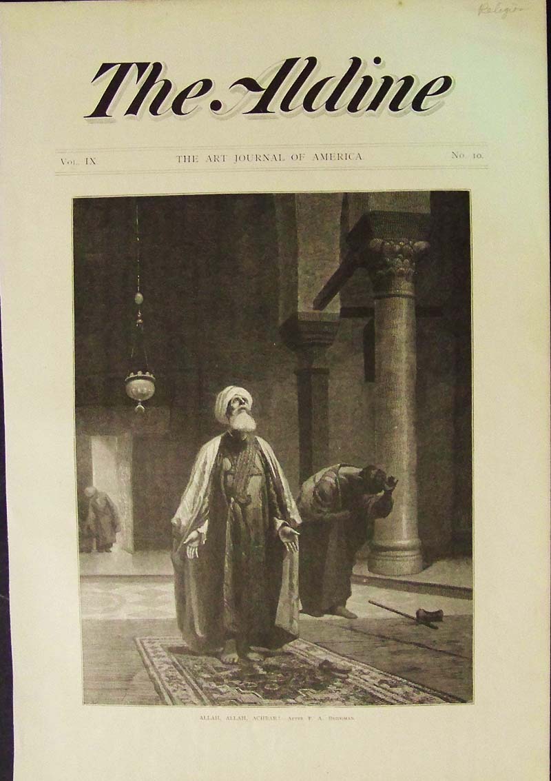
212egyp: C.1870 In a Mosque -- Antique wood engraving titled, "Allah, allah, Achbar!" -- After F.A. Bridgman.Featured in The Aldine, The Art Journal of America. 16 x 11 in. $40 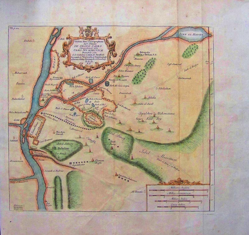
213egyp: 1740 De Grand Cairo by Richard Pococke hand colored copper engraved antique map showing the ancient city of Memphis, Plate VII and many other areas. 17 x 16 in. $150 See Also: Holy Land
|
|||||||||
| Order Form | |||||||||||
| Back to Homepage | |||||||||||