|
|||||||||||
This is a small selection of our inventory of antique Germany maps and prints. Additional inventory is available. Contact us with your request. 1-800-879-6277
|
|||||||||||
|---|---|---|---|---|---|---|---|---|---|---|---|
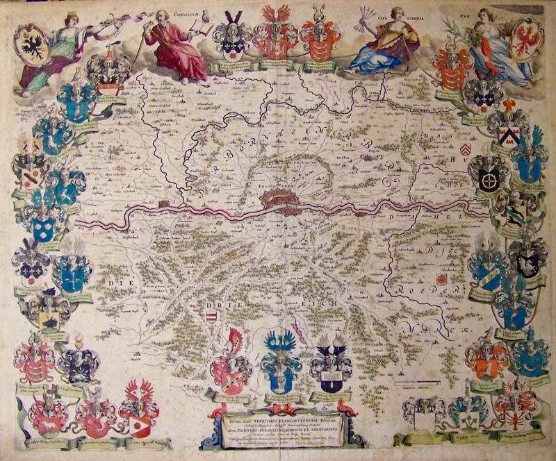 000ger: 1649 Decorative Blaeu Map mof Frankfurt, Germany Region titled, "Novam Hanc Territorii Francofurtensis Tabulam. It was drawn by Joan and Cornelius Blaeu. It is known as one of the most ornate and beautiful maps ever published by the Blaeu firm. Frankfurt, Germany is the city that stands out the most, appearing as a miniature city plan surrounded by protective walls. Surrounding the map are crests and coats of arms of local nobility. Four hman figures named Pax, Concordia, Consilium, and Iustatia appear on top. A decorative cartouche surrounds the title at the bottom of map. Original hand coloring and in very good condition. 22 x 18 in. $2,000 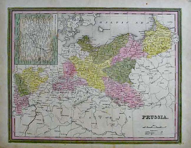 001ger: 1845 Mitchell map of Prussia. With original hand color. Very detailed. Inset map of the environs of Berlin. 14x17 in. $110  005ger: 1920 Post-WWI German Territory Map. Showing territorial losses of Germany after WWI. Includes text. 11x16 in. $30  006ger: 1866 Johnson's Map of Prussia. Original hand coloring and decorative border. 12x15 in. $80 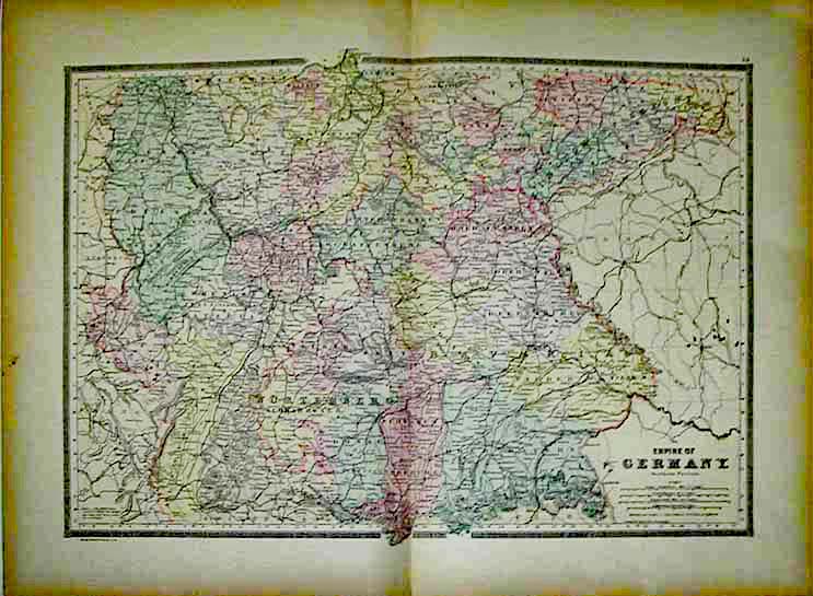 007ger: 1884 Southern Germany Map. Original lithograph.This large scale map of the Southern part of the German Empire was pulbished by Bradley. size: 25x18 in. $80  008ger: 1884 Map of Northern Germany. Original color, attractive border. Published by Bradley. 18x25 in. $80 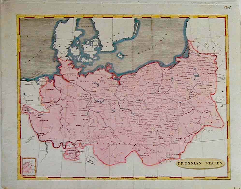 009ger: 1805 Arrowsmith Map of the Prussian States. Copper Engraving on handlaid paper. Hand colored. size: 11x9 in. $100 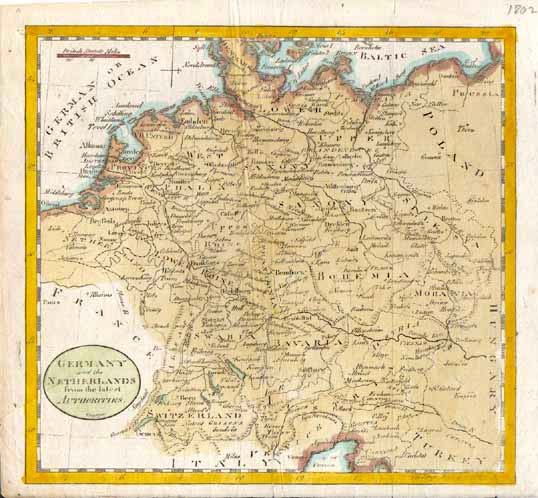 010ger: 1802 Map of Germany and the Netherlands. Gibson's copper engraved map on hand laid paper. 8-1/2x8-1/2 in. $90 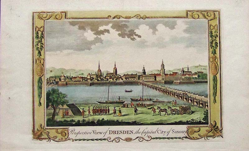 015Germany: 1782 Hand colored copper engraving showing a bird's-eye View of Dresden, the Capitol City of Saxony. Artist is Alex Hogg. 15 x 10 in. $150 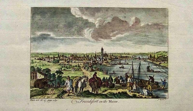
016Germany: 1752 Hand colored copper engraving showing a bird's-eye View of Frankfort on the Maine by James Mynde. 15 x 8-1/2 in. $125 
017Germany: 1752 Hand colored copper engraving showing a bird's-eye View of Mentz. 15 x 9 in. $125 
018Germany: 1752 Hand colored copper engraving showing a bird's-eye View of Triers. 15 x 8-1/2 in. $125 
019Germany: 1752 Hand colored copper engraving showing a bird's-eye View of Augsburg. 14-1/2 x 9-1/2 in. $150 
020Germany: 1752 Hand colored copper engraving showing a bird's-eye view of Nuremburg. 15 x 9 in. $125 
021Germany: 1752 Hand colored copper engraving showing a bird's-eye view of Munster. 15 x 9 in. $125 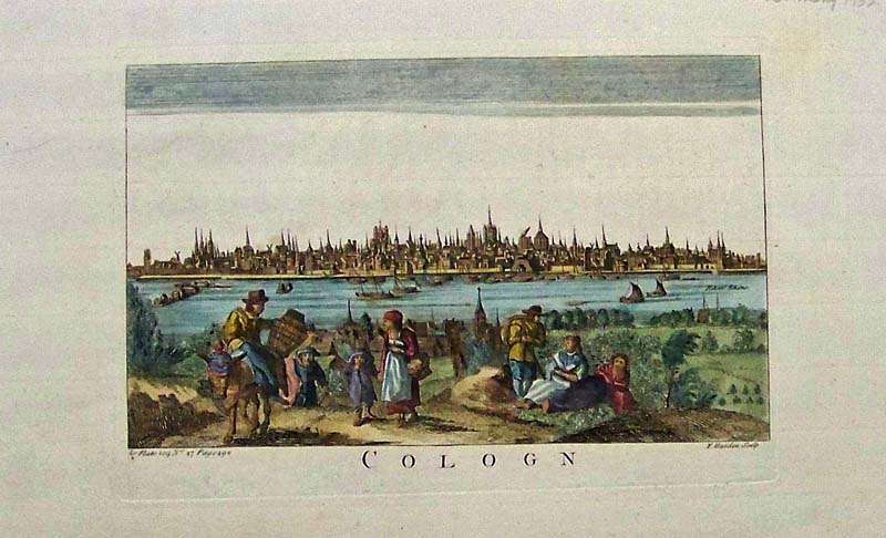
022Germany: 1752 Hand colored copper engraving showing a bird's-eye view of Cologn(e). 15 x 9 in. $150 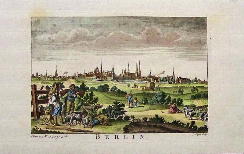
023Germany: 1752 Hand colored copper engraving showing a bird's-eye view of Berlin. 14-1/2 x 9 in. $150 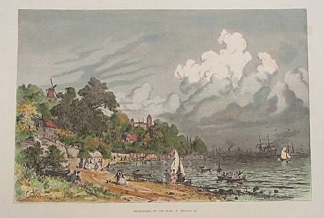 100ger: 1884 German Beach Scene. Hand-colored engraving shows a beach scene at Neumuehlen on the Elbe. Published in The Aldine, a late 19th century art journal. 12x16 in. $40 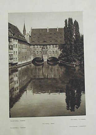 101ger: 1930 View of Nuremberg Hospital. Print shows a photograph of Nuremberg Hospital published circa 1930. 9x12 in. $20 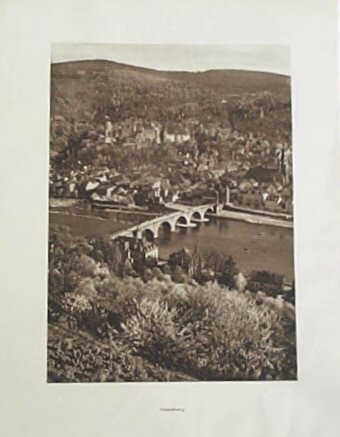 102ger: 1930 View of Heidelberg. Print is a 1930 photograph showing a bird's eye view of Heidelberg. 9x12 in. $20  103ger: 1871 Spa Scene in Hamburg. Beautiful, wood-engraving shows crowds gathered at the Trinkhalle and spa at Hamburg. Published in an 1871 issue of Harper's Weekly. Slight staining on edges does not affect image quality. 16x22 in. $50 
106ger: 1875 Scene of a Bavarian Salt Mine. Richly colored wood engraving shows salt mine workers. The title is, "A Bavarian Salt Mine--Crossing the Lake." Print is accompanied by unrelated text. Published in an 1875 issue of Harper's Weekly. 11x16 in. $40 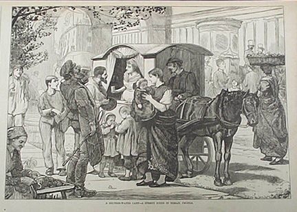 108ger: 1875 Street scene in Berlin. Wood engraving shows crowds gathered around a seltzer water cart on a Berlin street. Published in an 1875 issue of Harper's Weekly. 11x16 in. $30  109ger: 1888 Berlin Scenes. Prints shows several wood engravings of scenes in and around Berlin. A detailed Berlin coat-of-arms appears on the top left. Engravings are accompanied by text. Published in an 1888 issue of Harper's Weekly. 11x16 in. $30 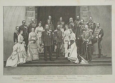 110ger: 1883 Portrait of the Emperor of Germany and His Royal Guests. Richly detailed wood engraving shows the Emperor of Germany and other royalty from Europe, including the Kings of Servia and Spain. From an 1883 issue of Harper's Weekly. 11x16 in. $30 |
 114ger: RARE Old 1680 Map of Bavaria Germany. Extremely detailed, engraved map of Bavaria, drawn by J. Jansonius of Amsterdam, and printed circa 1680. Title is "Bavariae Superioris et Inferioris, nova descriptio." The title is in a decorative frame in the upper right corner, and a coat of arms is in the upper left corner. In the lower right, there is a mileage scale surrounded by a decorative design. Nice original hand coloring, mostly in green and yellow. In the margins, there is unusual red line framing which was drawn by hand around the printed border. Anyone with an interest in 17th century Germany would love this map, because of its incredible detail as well as its age. 21x25 in. $500 
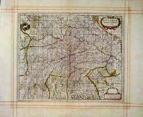
112ger: 1899 German Military Uniforms by Werner. Handsome color lithograph by Werner, showing the uniforms worn by Hessian dragoons in the late 1800s. Printed in 1899 as an illustration to a book. 13x17 in. $60 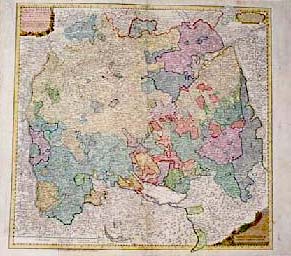 200ger: Very Old, RARE Map: Southwest Germany. Extremely detailed, engraved map of the Baden-Wirtemberg, Upper Bavaria region in SW Germany, printed in 1745 by Homann Heirs. Title of the map is "Circuli Sueviae." This map illustrates the large quantity of miniature states into which Upper Bavaria was divided during the mid 18th century. Each state is hand colored with outline and wash coloring. Fortified cities, towns and even small villages are shown. The map title is surrounded by a decorative cartouche. A small portion (approx. 4 inches) of the bottom margin and border were missing, but they have been replaced by a restoration professional. The border has been expertly re-drawn in that area, and the repair does not detract from the map's beauty at all. Besides those repairs, condition is very good. 22x25 in. $400 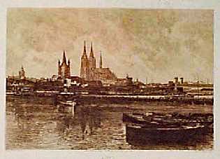 202ger: RARE Antique View of Cologne Germany. Beautiful etching of the city of Cologne, as seen from the river. The cathedral is standing prominently in the distance, and boats are shown moored along the edge of the water. Printed in 1880. There are some very light spots of foxing on the paper, but they are barely noticeable. Overall condition is excellent. 14x21 in. $150 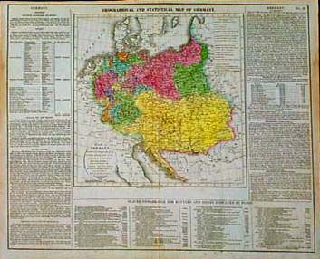 203ger: 1821 Lavoisne Map of Germany. Beautifully hand colored, engraved map of greater Germany, as it was divided and organized according to the Vienna Congress of 1816. From Lavoisne's Historical Atlas of 1821. Map image is surrounded on three sides by text, which gives detailed political information on all the German states. Also includes a chronological list of battles from the year 722 to 1813. 17x21 in. $250 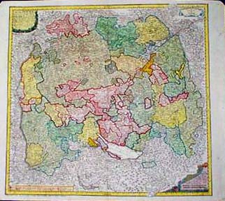
205ger: 1743 Homann Heirs Map of SW Germany. Beautiful engraved map, drawn by D.I.M. Hase and published in 1743 by Homann Heirs. Title of the map is "Circuli Sveviae." It shows an area that is now Schwaben, in Southeastern Germany. At the time Schwaben was divided into numerous small states, each of which is marked with a different color on the map. This map is in very good condition, with no significant flaws. 21x25 in. $600 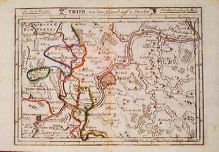
207ger: 1730 Stridbeck Map of Trier, Germany. Engraved map, with original outline hand coloring, published by Johann Stridbeck circa 1730. Map title is "Trier mit dero Gegen auf 2 Stunden." Shows the area around the town of Trier, which is in Western Germany near the Luxembourg border. 7x11 in. $75 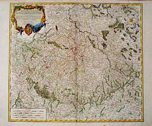 208ger: 1756 De Vaugondy Map: Upper Saxony, Germany. Very detailed map of the southern part of Upper Saxony, published in 1756 by Robert De Vaugondy. Map title is "Partie Meridionale du Cercle de Haute Saxe." Title is surrounded by a decorative cartouche. Woods, rivers and borders are hand colored. Map is in very good condition, with no significant flaws. 20x27 in. $600 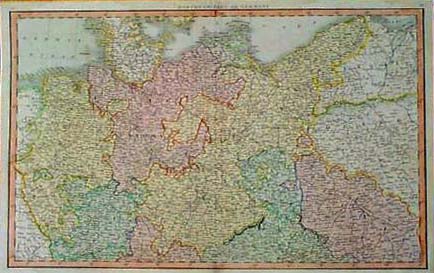 209ger: 1808 Map of North Germany by C. Smith. Detailed, hand-colored map, titled "Northern Part of Germany." Published in 1808 by C. Smith. The island of Rugen, and the adjacent Stralsund County are shown as Swedish possessions. Very good condition, with no tears, stains or other blemishes. 15x24 in. $200 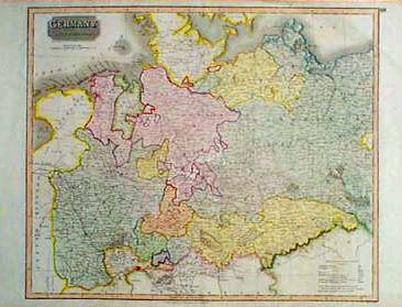 210ger: 1816 Northern Germany Map by Neele. Engraved map, with original hand coloring, titled "Germany North of the Mayne." Drawn by Neele, and published in Thomson's General Atlas of 1816. Each state in the region is individually colored. A dense network of roads is shown. Map is in very good condition. 21x29 in. $300 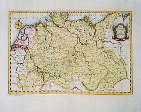 211ger: 1752 Map of North Germany. Hand-colored, engraved map, titled "The North Part of Germany." No cartographer's name given. Published in 1752. Covers much of what is now northern Germany, as well as parts of Central Europe. Title is surrounded by a decorative cartouche. Excellent condition. 15x18 in. $250  212ger: 1794 Jefferys Map: Lower Saxony, Germany. Beautiful, detailed map of the Lower Elbe region in Germany, including the cities of Hamburg, Bremen, Hanover, etc. Cities, towns, major roads and geographical features are all shown. Bright original hand coloring. Title is surrounded by a decorative cartouche. Excellent condition. 20x28 in. $500  213ger: 1720 Map of Bavarian Battlefield. Interesting map, titled "A Most Exact Plan of the Several Attacks at the Battle of Bleinhem and of the Incampment of both Armies Before and After the Battle." Published circa 1720. Refers to a battle which occurred in 1704 during the War of Spanish Succession. No mapmaker's name given. A chart on the left side explains the types and locations of troops in detail. Lower left margin is trimmed close to map border. Otherwise very good condition. 15x16 in. $300 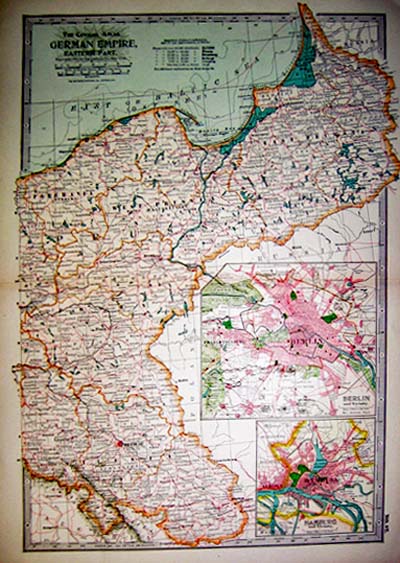 215ger: 1897 The Century Atlas. German Empire, Eastern Part. Copyright, 1897 by The Century Company, New York. The Matthews Northrup Company, Buffalo, N.Y. Map depicts the eastern part of the German Empire, with insets of Berlin and Hamburg. Excellent condition. 11.5x16in. $30
|
|
|||||||||
| Order Form | |||||||||||
| Back to Homepage | |||||||||||