|
|||||||||||
This is a small selection of our inventory of antique Greece maps and prints. Additional inventory is available. Contact us with your request. 1-800-879-6277
|
|||||||||||
|---|---|---|---|---|---|---|---|---|---|---|---|
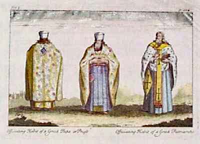
005gr: 1746 Views of Greek Priest Robes. Antique hand colored copper engraving, showing three Greek priests wearing ceremonial robes. Left and center images are titled "Officiating Habit of a Greek Papa or Priest." Image on the right is titled "Officiating Habit of a Greek Patriarch." Printed on hand laid paper. A tear in the top margin has been repaired on the back, but the image is not affected. 8x14 in. $60 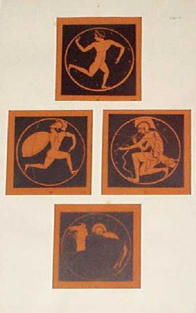 006gr: 1885 Lithograph of Ancient Greek Images. Four lithographed views of Greek warriors, taken from fragments of ancient pottery. 11x17 in. $100 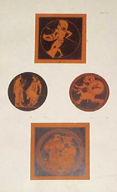 009gr: 1885 Lithograph of Ancient Greek Images. Four lithographed views of Greek gods and warriors, taken from fragments of ancient pottery. 11x17 in. $100 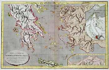 010gr: 1827 Map of Ancient Greece. Hand colored, old engraved map of ancient Greek lands, published in 1827 by D. MacPherson. All titles are written in Latin. The main map titled is "Populi, Urbes etc. in Graecia, Thracia et Asia, quorum meminit Homerus." There are two small inset maps on the right side: 1) "Ilium et Theatrum Iliados;" and 2) Gentes Orientales Priamo Auxiliantes." 10x16 in. $80 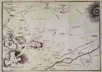 013gr: 1840 Map of Ancient Athens Greece. Interesting map, titled "Plan of the Antiquities of Athens." Published circa 1840 as an illustration to a book. Locations of ancient buildings and other landmarks are shown, with notations about each of the sites. 10x13 in. $40 
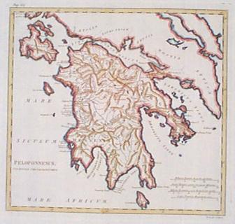
015gr: 1835 Map: Peloponnesus and Attica Greece. Engraved map, with original hand coloring, published by T. Tegg circa 1835. Title of the map is "Peloponnesus et Attica." Provinces within the area are each colored separately. Locations of cities and geographical features are shown. 9x11 in. $50 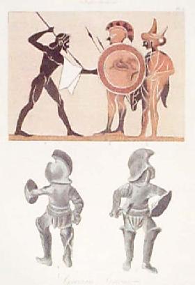 016gr: 1880 Views of Armor, Ancient Greece. Color lithographed views of ancient Greek armor, published circa 1880 in a design book. Top view shows a traditional drawing of Greek warriors with spears. Beneath are front and back views of an entire suit of armour. 10x12 in. $50 |
|
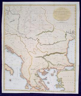
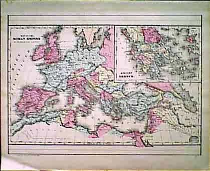
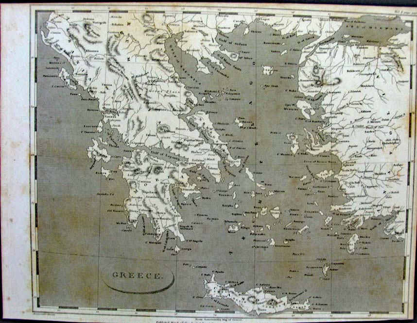
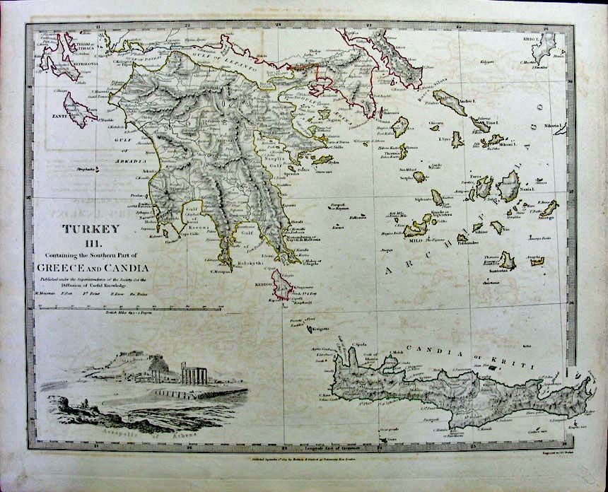 205gr: 1829 Published by Baldwin & Gradock "Turkey containing the Southern Part of Greece and Candia" 16x13 in. $100 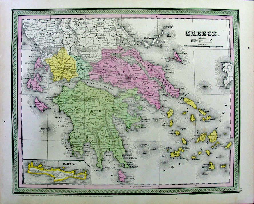 206gr: 1850 Published by Thomas, Cowperthwait & Co. "Greece" 17x13.5 in. $100 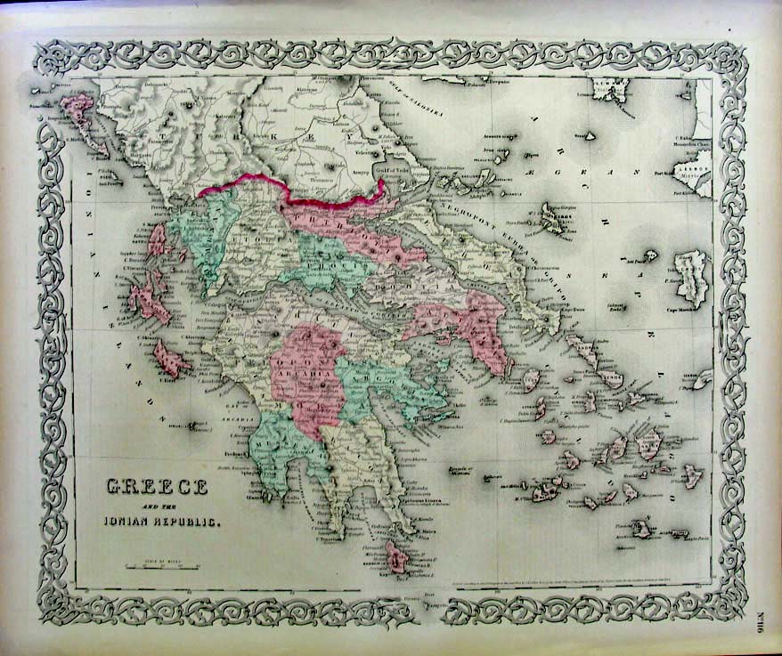 207gr: 1854 Published by Colton "Greece and the Ionian Republic" 17x14.5 in. $60  208gr: C1850s Greece & Candia 17x13.5 in. $90 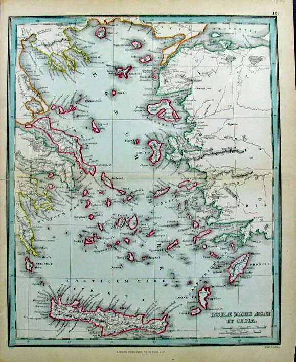 209gr: 1894 Published by Tegg & Co. Greece "Insulae Maris Aegaei et Creta" 9.5x11.75 in. $60 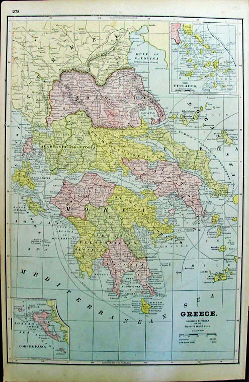 210gr: 1887 Greece for the Standard World Atlas 11.25x17.25 in. $40 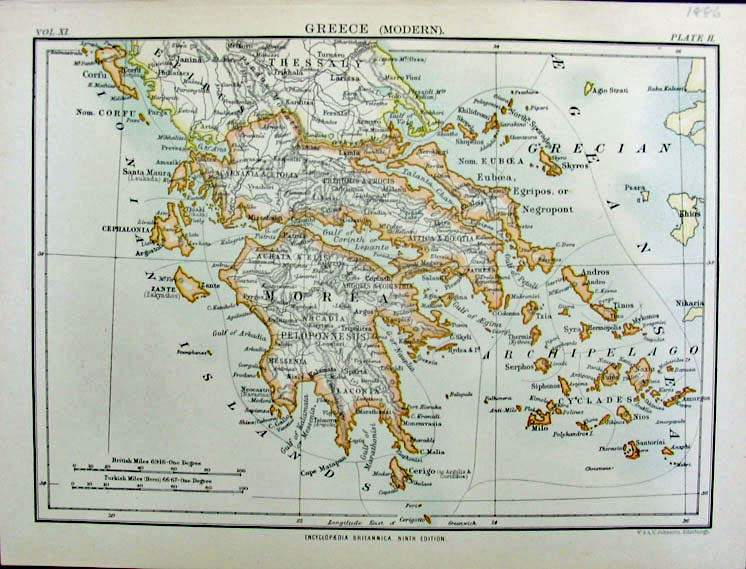 211gr: 1886 encyclopedia Britannica ninth edition Greece 10.25x7.75 in. $30 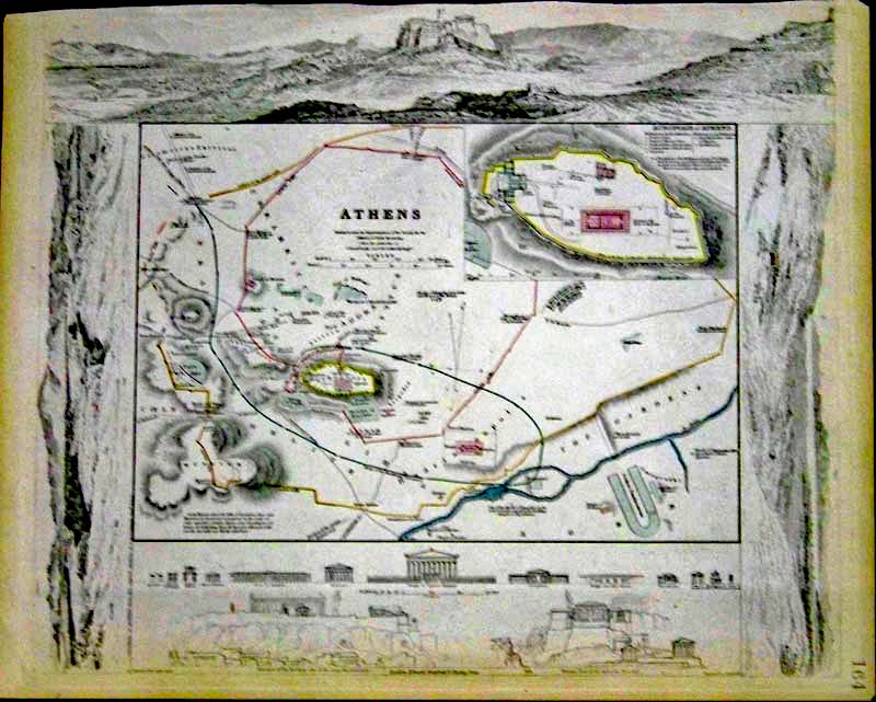 212gr: 1832 Lightly hand colored steel engraved map of Athens, showing a detailed view of the Acropolis. Map is in fine condition and is embellished with vignettes showing the comparison of height of prominent buildings. Published under the Superindendence of the Society for the Diffusion of Useful Knowledge (S.D.U.K.) and published by Baldwin & Cradock, London. 16 x 13-1/2 in. $300 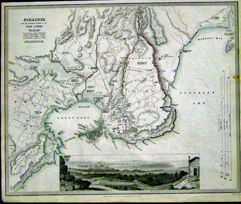 213gr: 1839 Lightly hand colored steel engraved map of Syracuse, With the Remaining Vestiges of its Five Cities. Map is embellished with a "View of Syracuse from the Theatre" on bottom of map. Map is in fine condition and is published under the Superintendence of the Society for the Diffusion of Useful Knowledge (S.D.U.K.). Map is published by Chapman & Hall, London. 16 x 13-1/2 in. $150 |
|||||||||
| Order Form | |||||||||||
| Back to Homepage | |||||||||||