 
|
|||||||||||
This is a small selection of our inventory of antique Iberian Peninsula maps and prints. Additional inventory is available. Lowest Prices! Contact us with your request. 1-800-879-6277
|
|||||||||||
|---|---|---|---|---|---|---|---|---|---|---|---|
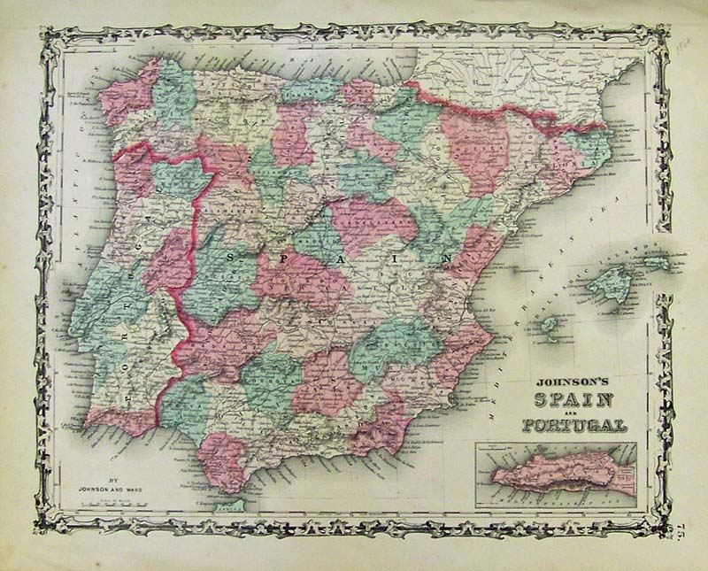 000iber: 1862 Johnson and Ward color map of Spain and Portugal with small inset of Gibralta bottom right. This finely detailed map shows all the cities, roads, counties, districts and other important places. The Balearic Islands are shown off the East coast of Spain. 18 x 14 in. $60 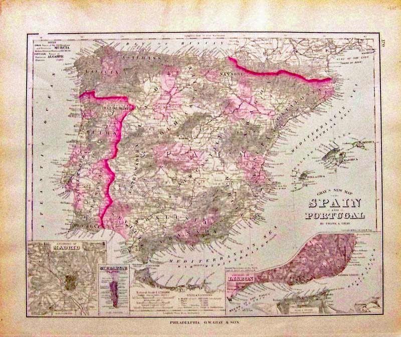
001iber: 1878 O. W. Gray’s New Map of Spain and Portugal - 1878 Handsome original colored map from the National Atlas, with three detailed insets: 1.) Environs of Madrid, 2.) Gibraltar, 3.) Environs of Lisbon. Regions are delineated by color, shows rivers, lakes, mountains, railroads and names of regions, Algarve, Seville, Granada, Estremadura, etc. Condition: Very Good, normal age coloring outside of margins. Size: 12.00 x 15.50 $80 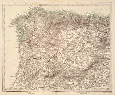 002iber: 1880 Map: Northwest Spain, North Portugal. Extremely detailed rare map of the Northwestern corner of Spain and the Northern portion of Portugal, from Stieler's Hand Atlas. Original outline hand coloring. Cities, towns, roads and geographical features are all shown. 15x19 in. $50 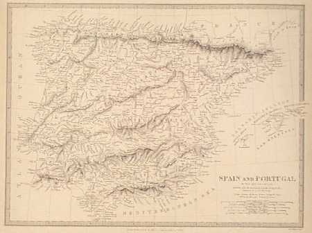 003iber: 1838 SDUK Map of Spain and Portugal. Antique engraved map of the entire Iberian Peninsula, published in 1838 by the Society for the Diffusion of Useful Knowledge (SDUK). Shows cities, towns and geographical features in detail. The Balearic Islands are also shown off the East coast of the peninsula. 13x16 in. $80  004iber: 1880 Map: Southwest Spain, South Portugal. Old engraved map of the Southwestern Iberian Peninsula, including most of Andalusia and Southern Portugal. Also shows the Northern tip of Morocco. From Stieler's Hand Atlas of 1880. This map is very detailed, with original outline hand coloring. 15x19 in. $50 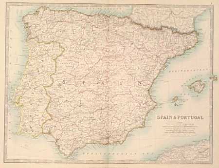 005iber: 1862 Map of Spain and Portugal. Nice, color map of the entire Iberian Peninsula, published in 1862 by W. and A.K. Johnston. National and provincial borders are outlined in color. The Balearic Islands are shown off the East coast of Spain. 15x19 in. $70 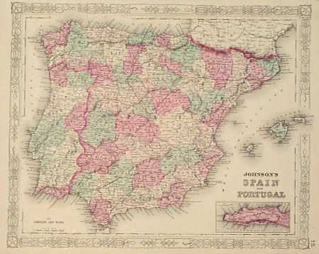 006iber: 1863 Johnson Map of Spain, Portugal. Engraved map of the Iberian Peninsula from the 1863 edition of Johnson's Family Atlas. Each province in Spain and Portugal is individually colored with original hand coloring. Cities, towns, major roads, railroads and geographical features are all marked. There is a small inset map of Gibraltar in the lower right corner. The entire map image is surrounded by a decorative border. 14x18 in. $60 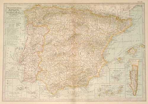 008iber: 1897 Detailed Map of Spain, Portugal. Extremely detailed, color map published in the 1897 Century Atlas. Cities, towns and geographical features are shown throughout. In the bottom corners, there are small inset maps of the Azores, Canary Islands, Madeira and Gibraltar. 12x16 in. $30  009iber: 1890 Bartholomew Map of Spain, Portugal. Colorful map of the Iberian Peninsula by J. Bartholomew, showing cities, towns and geographical features. Provincial and national borders are outlined in red. The Balearic Islands are shown off the East coast of Spain. 13x18 in. $40 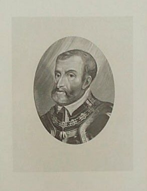 010iber: 1880 Portrait of King Charles V. Handsome portrait of King Charles the V, ruler of Spain from 1516 to 1556 and the last great emperor, is accompanied by several pages of text describing his reign and a chronology of his life. 10x14 in. $30 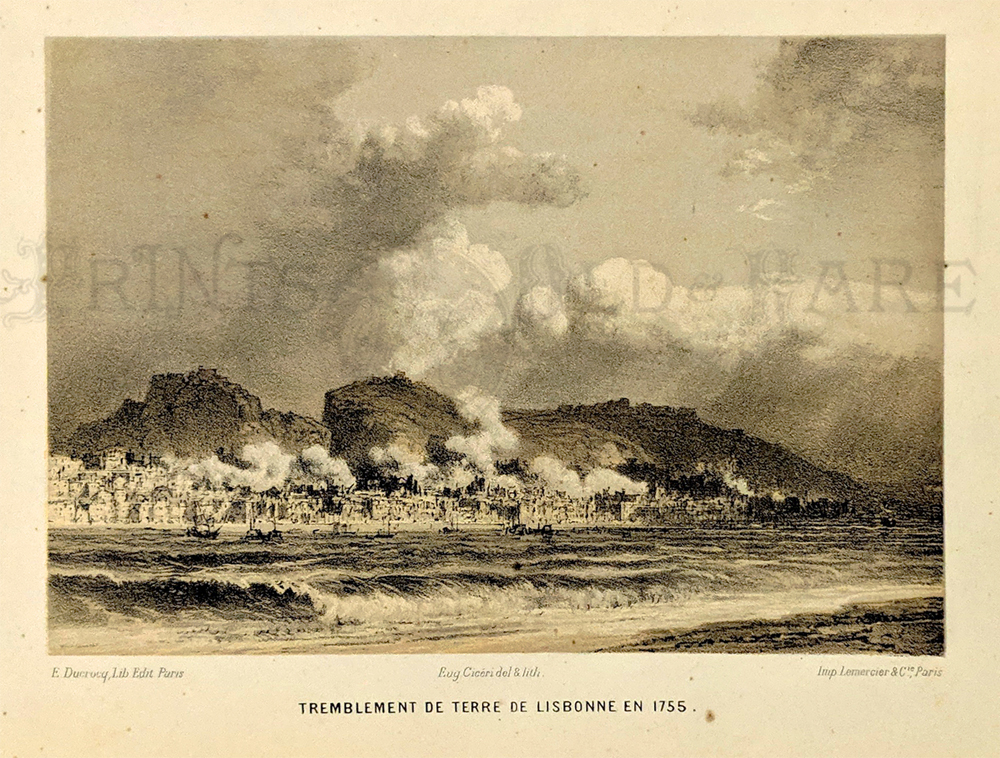 036ndis: Tremblement de terre de Lisbonne en 1755. (Lisbon, Portugal -- Earthquake in 1755) Lithograph. c.1860 6 x 7 in. $60 |
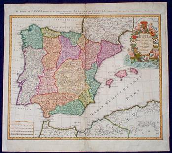 202iber: ca.1720 Homann Map of Spain and Portugal. Large, hand-colored map of the Iberian Peninsula, Titled "Regnorum Hispaniae et Portugalliae, Tabla Generalis de l'sliana." An elaborate, decorative cartouche. Entire map has been archivally mounted on acid-free paper, and the small piece of missing image has been re-drawn. This map would look wonderful in a frame! 22x24 in. $650 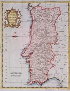
203iber: 1750 Map of Portugal by Kitchin. Attractive, engraved map of Portugal, published circa 1750 by Thomas Kitchin. Nicely hand colored. Title is "A New and Accurate Map of Portugal, Drawn from the Best Authorities." Cities, towns and geographical features are shown in detail. The map title is surrounded by a decorative cartouche. Excellent condition. 9x13 in. $125 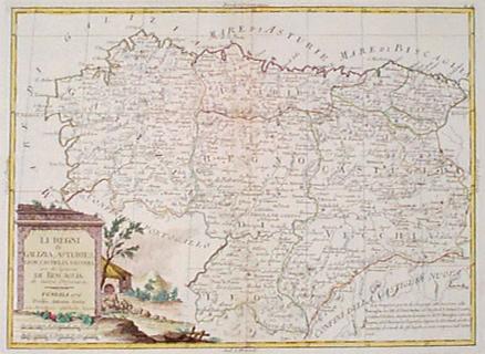 204iber: 1776 Zatta Map of Northwest Spain. Decorative, hand-colored map of Northwestern Spain, published in 1776 by Antonio Zatta. Title is "Li Regni di Galizia, Asturies, Leon, Castiglia Vecchia, con la Signoria di Biscaglia di nuova Projezione." Nice, decorative rural scene surrounds the title. Map is in excellent condition. 15x19 in. $350 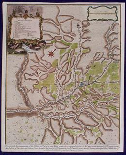 205iber: 1745 Seale Battle Map: Prats del Rey Spain. Interesting map of the area around Prats del Rey, Spain, drawn by R.W. Seale and published in 1745. Shows the positions and movements of troops during a 1711 battle in the War for Spanish Succession. Title is "Plan of the Incampment of the Allies at Prats del Rey under the command of Count Staremberg?." Map key is surrounded by an elaborate cartouche. Nicely hand colored, very good condition. 16x19 in. $200 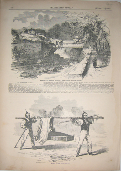
207iber: 1853 Madeira - View Near the Church of "Nossa Senhora Do Monte," Funchal AND Madeira - Native Travelling Chair. Wood engraving showing two pictures with text in between, published in the Illustrated News. 11x16in. $40 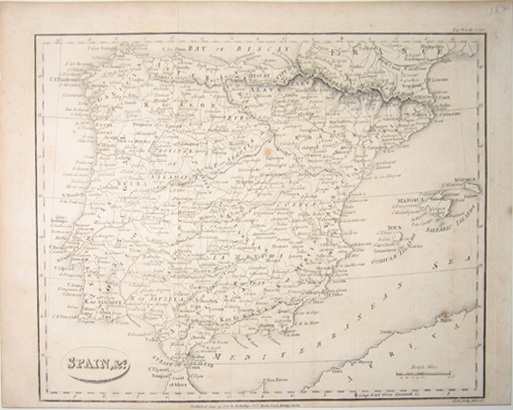 208iber: 1820 Spain, &c. Map - Small map depicting the country of Spain with the Mediterranean Sea and coast of Africa in lower right hand corner. Map published by R. Phillips & Co., Bridge Court Bridge Street. Voy & Vol. III., No. IV. Map is in good condition. 8.5x11in. $150 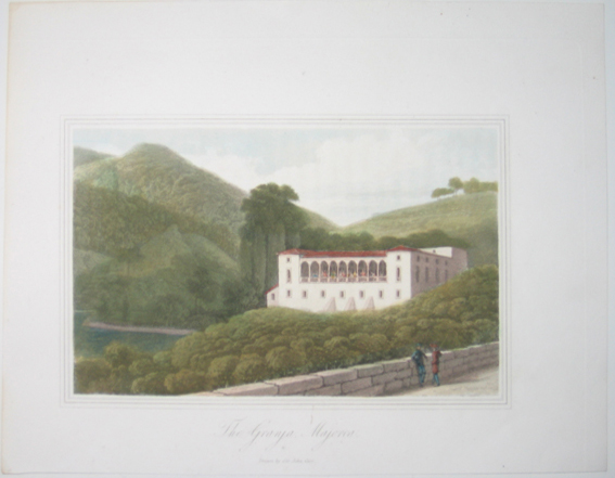 209iber: The Granja Majorca, Drawn by Sir John Carr - Hand colored steel engraving depicting the historic La Granja mansion which dates back into the 10th century. 7.5x10in. $80 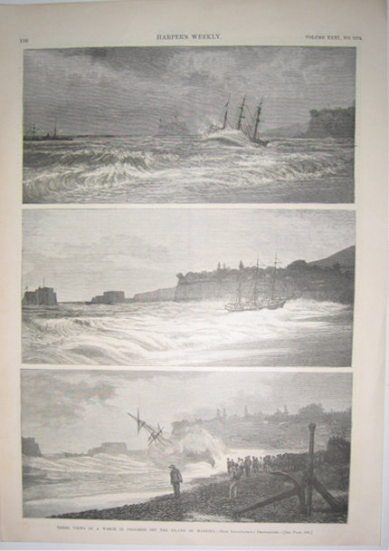 210iber: 1887 Three Views Of A Wreck In Progress Off The Island Of Madeira - From Instantaneous Photographs. Three wood engravings on one page published in Harper's Weekly on Febryary 19, 1887. Volume XXXI., No. 1574. 11x16in. $50 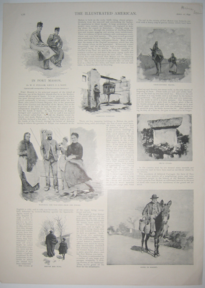 212iber: 1890 In Port Mahon - Text and half-tone pictures featuring various people engaging in activities around Port Mahon, a principal seaport of the island of Minorca, one of the Balearic Islands that lie in the Mediterrean off the coast of Spain. Article published in The Illustrated American on April 12, 1890. 11x16in. $40 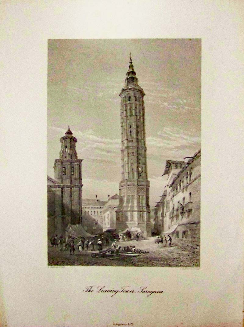 213iber: 1880 Steel engraving showing The Leaning Tower of Saragossa, (also known as Zaragoza), in Aragon, Spain. Published by D. Appleton & Co. 13 x 10 in. $30 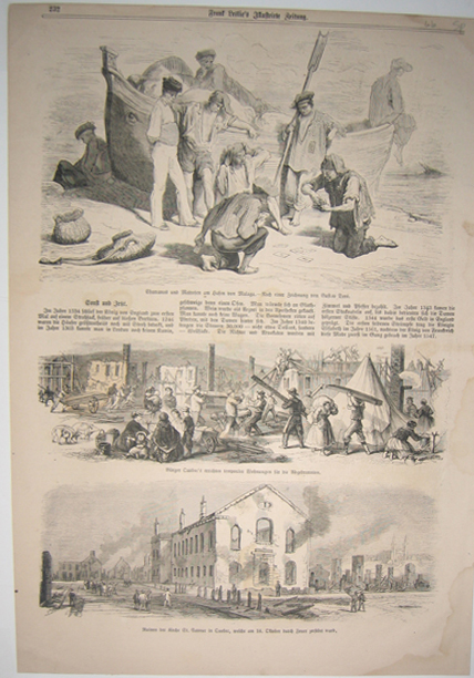 215iber: 1866 Charranos und Matrofen am hafen von Malaga - Nach einer von Guftav Dore. Three wood engravings with German text published in Frank Leslie's (Illustrated Journal) in 1866. 11x16in. $40 |
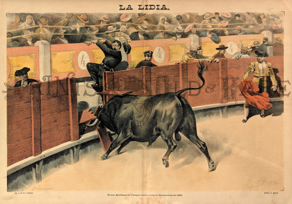 227iber: Bullfight. 1888 (El toro Escribuno de Veragua, en la corrida de Beneficencia de 1888.) Bull charging the fence – Matador looking on. Chromolithograph. 14 3/8 x 21 1/8 in. $60 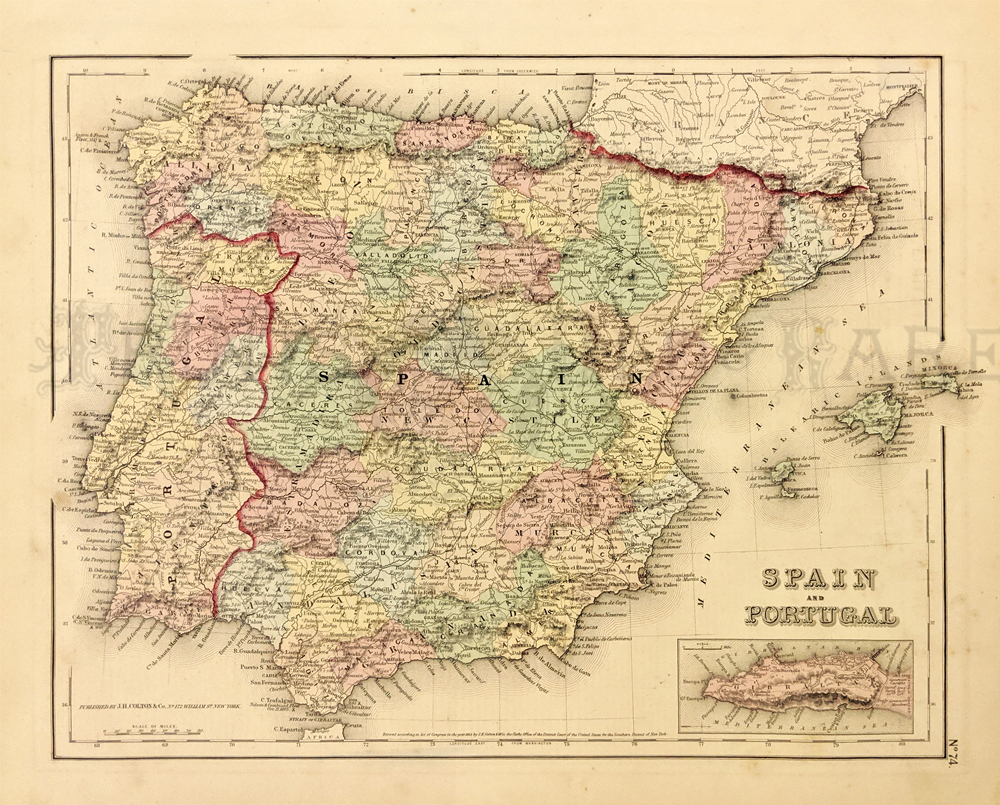 228iber: Spain and Portugal. 1855 Colton. Shows towns, roads, rivers, mountains, railroads, lakes, and other geographical features. Hand colored, lithograph. 13 7/8 x 17in. $60 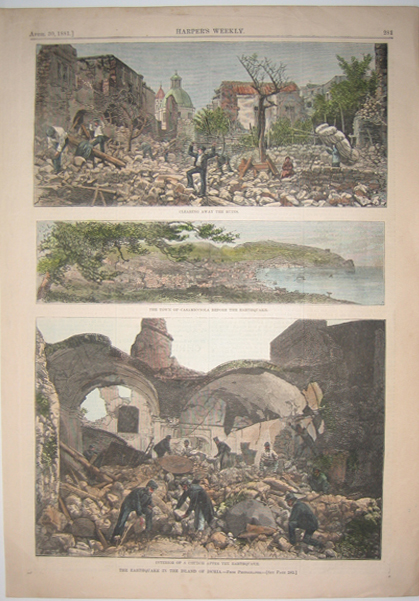 216iber: 1881 The Earthquake In The Island Of Ischia - From photographs. Three hand colored wood engravings titled: Clearing Away The Ruins; The Town Of Casamicciola Before The Earthquake; (and) Interior Of A Church After The Earthquake. Published in Harper's Weekly on April 30, 1881. 11x16in. $60 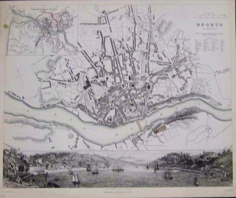 217iber: 1833 Lightly hand colored steel engraved map of Oporto (Porto) in fine condition. Map is embellished with a vignette view of the harbor. Map is published under the Superintendence of the Society for the Diffusion of Useful Knowledge (S.D.U.K.). Caption reads, "View of Oporto from Torre da Marca." Map is published by Baldwin & Cradock in London. 16 x 13 in. $150 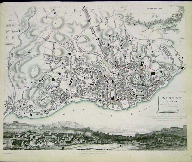
218iber: 1833 Lightly hand colored steel engraved map of Lisbon (Lisboa) in fine condition. Map is embellished with a vignette showing, "Lisbon, from the Quinta da Torrinha Val de Pereiro." Map is published under the Superintendence of the Society for the Diffusion of Useful Knowledge (S.D.U.K.) and published by Chapman & Hall, London. 16 x 13-1/2 in. $175 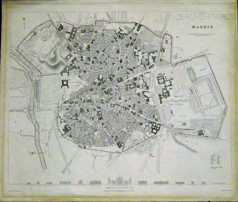
219iber: 1831 Lightly hand colored steel engraved map of Madrid in fine condition. There is a comparison of heights of prominent buildings on bottom of map. Published under the Superintendence of the Society for the Diffusion of Useful Knowledge (S.D.U.K.). Map published by Baldwin & Cradock, London. 16 x 13-1/2 in. $190 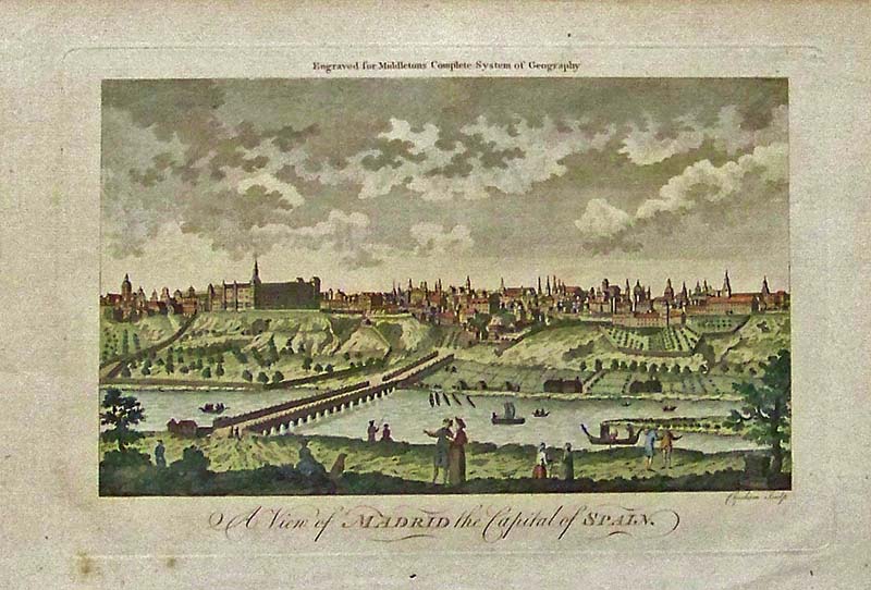
220iber: A View of Madrid, the Capital of Spain - Hand colored antique engraving which was engraved for Middletons Complete System of Geography. 14-1/2 x 9 in. $150 
221iber: 1898 Judge Color lithographed cover titled, "Spain -- War IS Hell!" Image shows Uncle Sam teaching Spain a lesson. Sackett & Willhelms Litho., NY. 13-1/2 x 9-1/2 in. $100 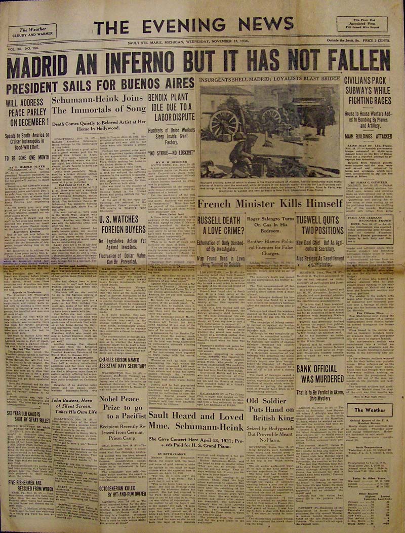
223iber: 1936 Spanish Civil War - The Evening News: Sault Sta. Marie, Michigan. "Madrid an Inferno But It Has Not Fallen" article continues on page 8. 8 pp. 23 x 16-1/2 in. $30 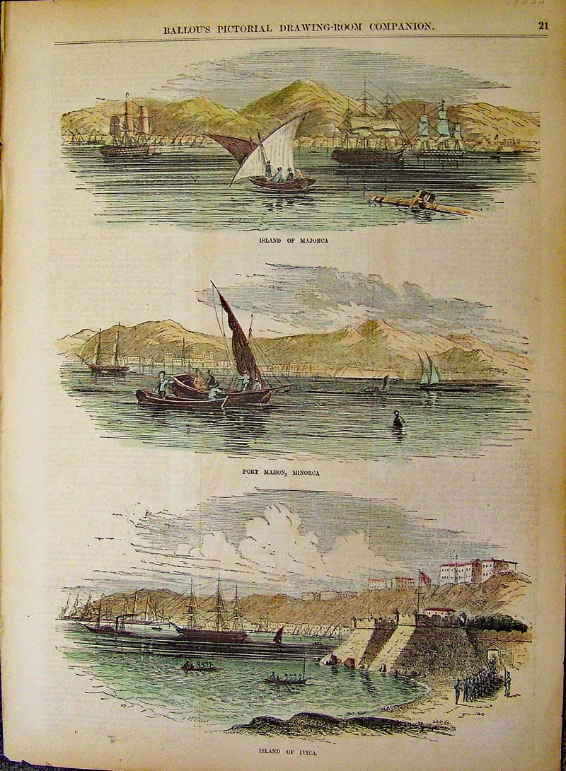
224iber: 1855 Majorca/Minorca/Ivica - Three rare island views; all harbor scenes. Hand colored wood engravings featured in Ballou's Pictorial Drawing-Room Companion. 15 x 11 in. $80 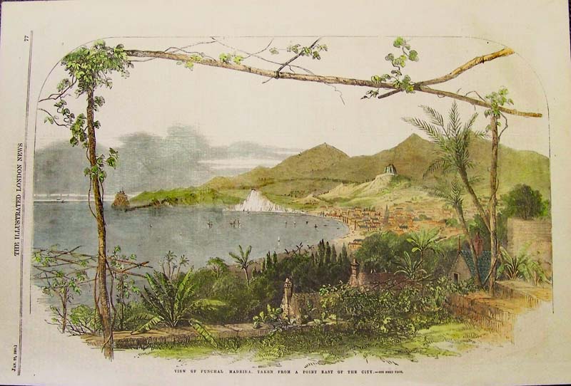
225iber: 1859 Funchal Madeira - Rare view which shows harbor and surrounding hills. Hand colored wood engraving featured in The Illustrated London News. 15-1/2 x 10-1/2 in. $125 
225iber: Lisbon from Fort Almeida 1837. Steel engraving. View of city across Tajo. 7 3/4 x 10 7/8" in. $70 |
|||||||||
| Order Form | |||||||||||
| Back to other Special Interests , Back to Homepage | |||||||||||