 
|
|||||||||||
This is a small selection of our inventory of antique Idaho maps and prints. Additional inventory is available. Contact us with your request. 1-800-879-6277
|
|||||||||||
|---|---|---|---|---|---|---|---|---|---|---|---|
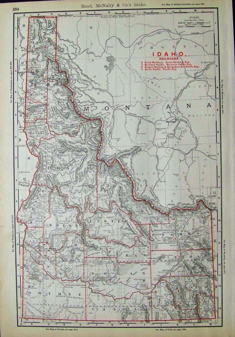 001Idaho: Colored outlined Rand, McNally & Co. map of Idaho showing its Railroads with a Railroad Key on upper right side. 20-1/2 x 14-1/2 in. $100 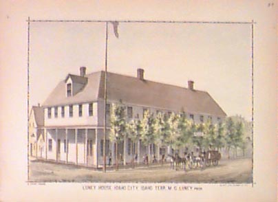
002id: 1884 Idaho City, Idaho Territory. Antique hand colored litho view of the early Luney House Hotel. 13-1/2x10-1/2 in. $60 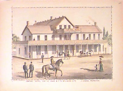
005id: 1884 Boise Idaho view. Hand colored litho view of Central Hotel, corner of Idaho & Seventh Streets, Boise City. 13-1/2x10-1/2 in. $60 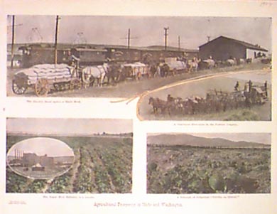
009id: 1909 Palouse County, Idaho. Four hand colored views showing agriculture in the area. 16x12 in. $40 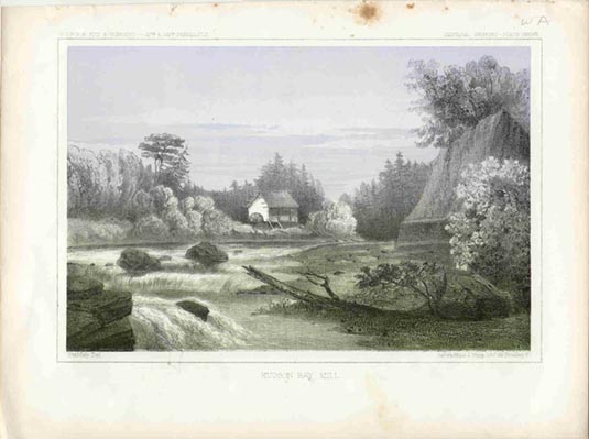 011id: 1855 Hudson Bay Mill, Idaho. Litho Railroad Survey view. Drawn by U.S. Government artist during first crossing of the new Territory. 11x8-1/2 in. $50 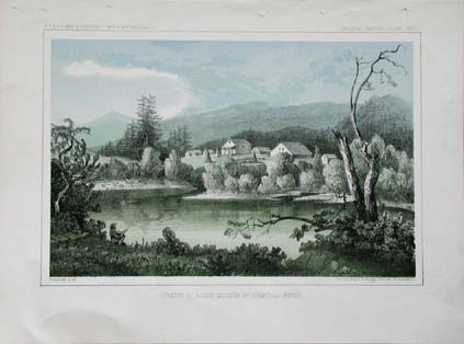 013id: Very beautiful hand colored antique lithograph print, from the old U.S. Railroad Expedition and Surveys, printed in 1855. Coeur d'Alene Mission, St. Ignatuis River. The survey canvassed the western portion of the country, searching for the best rail routes to the west coast from the Mississippi River. 11x8.5 in. $50 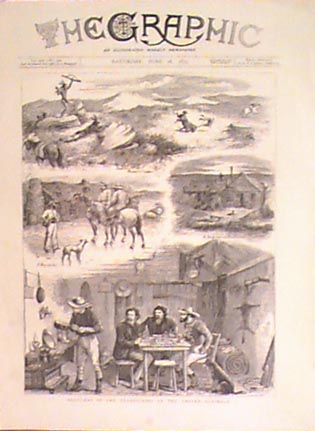
016id: 1879 Idaho engravings. Four black & white sketches from The Graphic (England). $50 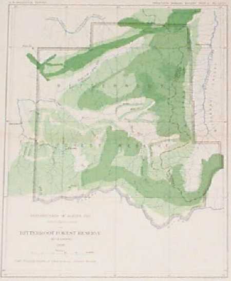 105id: Idaho Forest Tree Distribution Map. Interesting, lithographed map published in 1898 by the U.S. Geological Survey. Shows the distribution of Alpine Fir trees in the Idaho's Bitterroot Forest Reserve. Concentrations of the trees are shown in varying shades of green. 11x14 in. $30 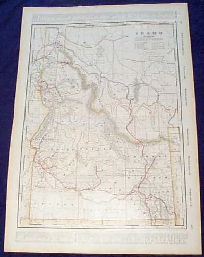
107id: Detailed 1901 Railroad Map of Idaho. Beautiful map from the 1901 first edition of George Cram's folio-size world atlas. Color coded lines on the map show the names and locations of railroads throughout the state. State and county borders are outlined in yellow. Cities, towns and geographical features are all shown. Locations of mining and logging districts are marked in light yellow print. This map would look great in a frame! 18x27 in. $120 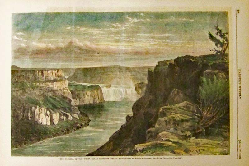 109idaho: 1869 "The Niagara of the West" - Great Shoshone Falls. Hand colored wood engraving published in Harper's Weekly. 15-1/2 x 11 in. $80 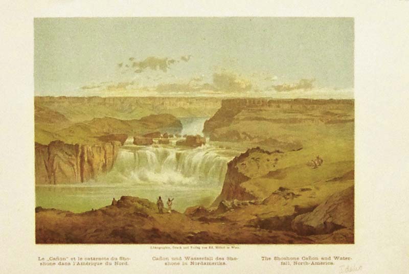
110id: C.1880 Color lithograph showing The Shoshone Canyon and Waterfall in Idaho, North America. 10-1/2 x 7 in. $40 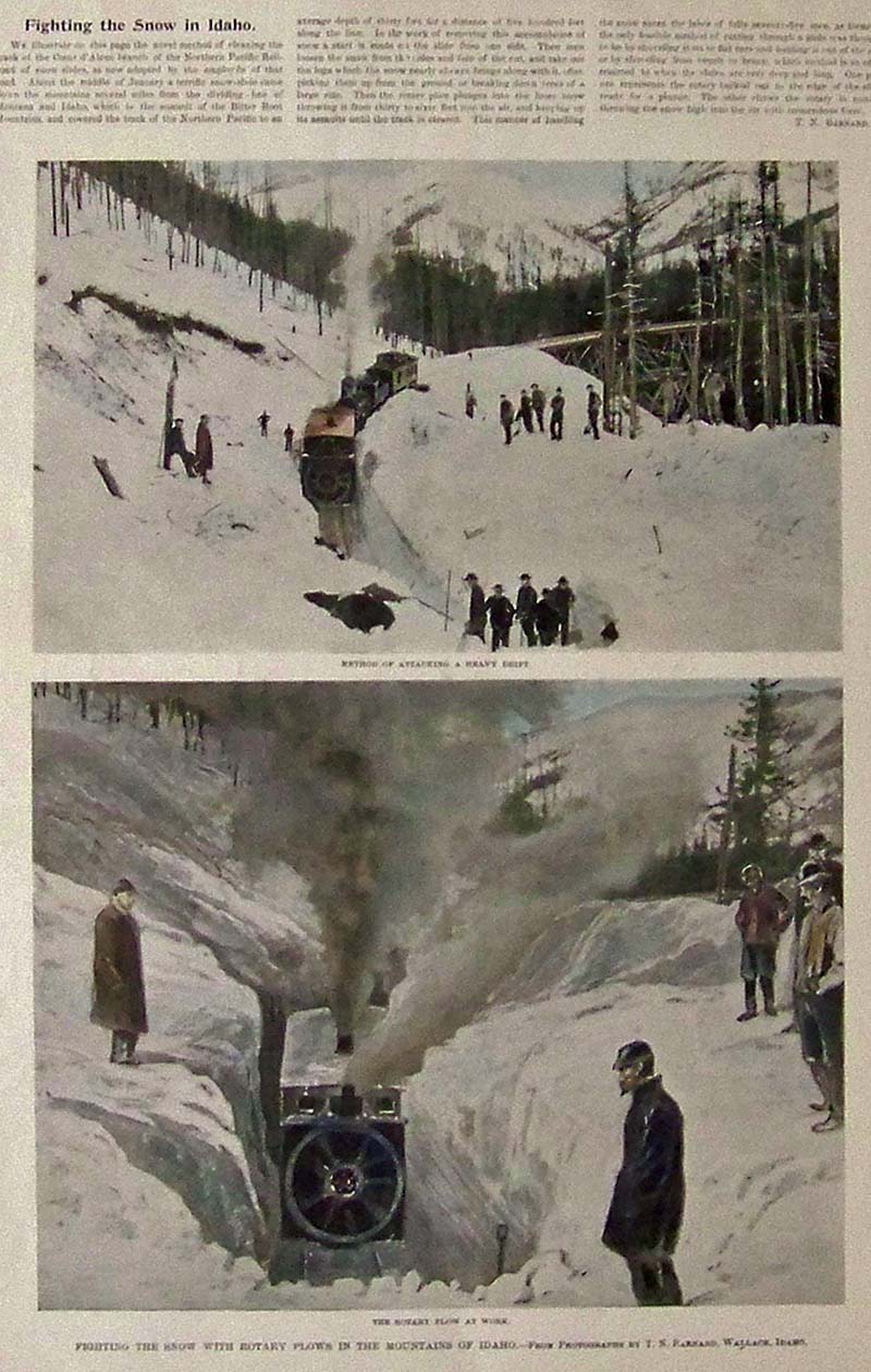
111id: 1894 Hand colored half-tones featured in Frank Leslie's Weekly showing how the heavy snow drifts are managed with Rotary plows. 16 x 11 in. $60 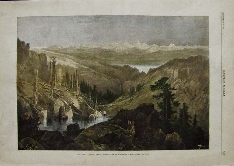
112id: 1882 Harper's Weekly hand colored wood engraving showing the Great Teton Range in Idaho, taking from a painting by T. Moran. 16 x 11 in. $80 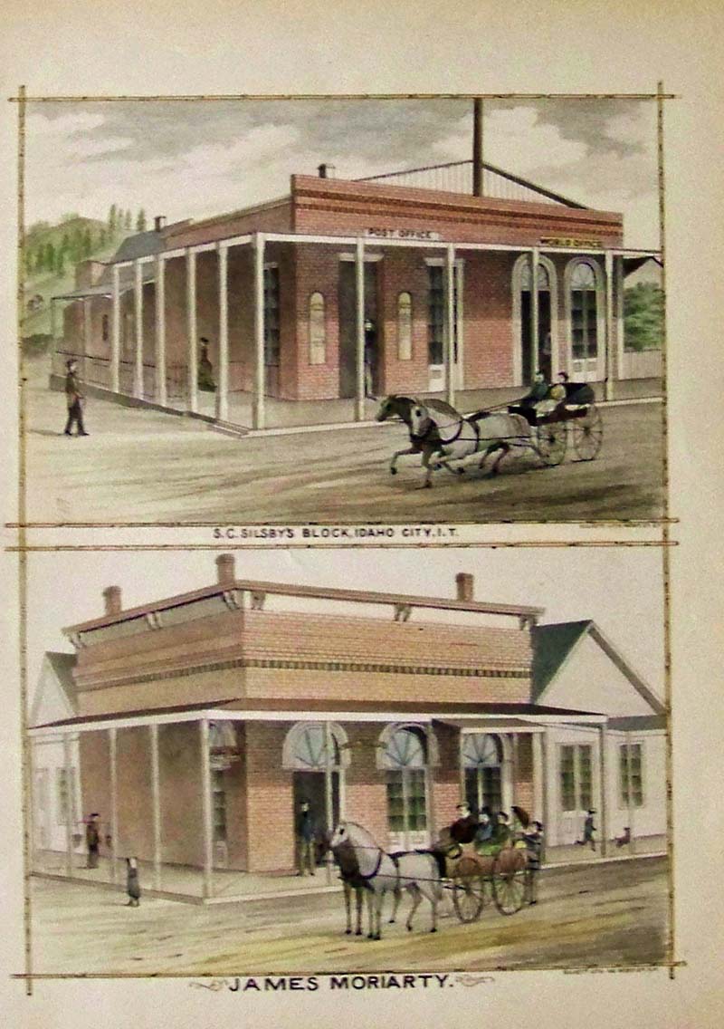
114id: 1884 Hand colored lithograph titled James Moriarty which shows the Post Office in Idaho City. 13 x 9-1/2 in. $80 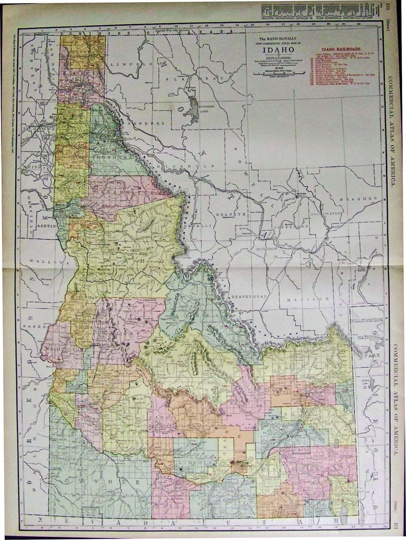
116id: 1918 Color Rand McNally Commercial Atlas Railroad Map of Idaho with a guide to Principal Cities on left and next to title in red are all the railroad lines listed. 28 x 20-1/2 in. $80 |
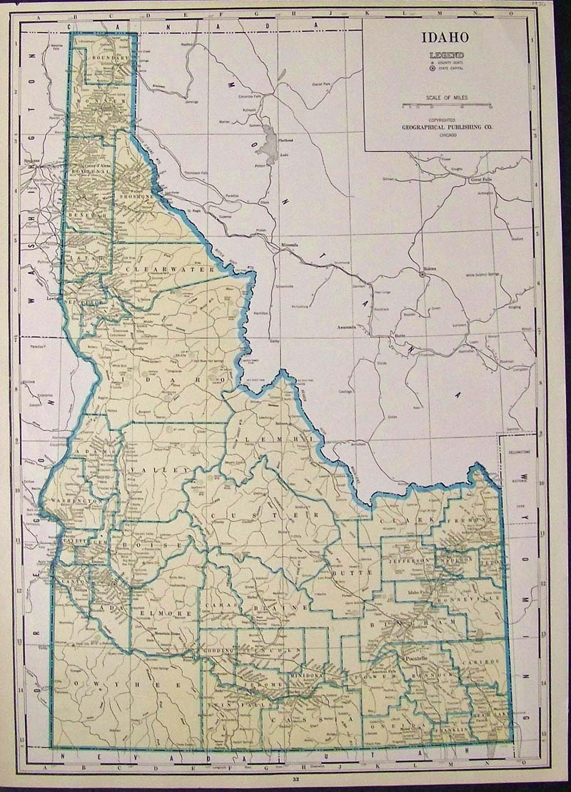
117id: 1936 Color map showing Idaho's County Seats and State Capital, copyrighted by the Geographical Publishing Co. 21-1/2 x 15-1/2 in. $50 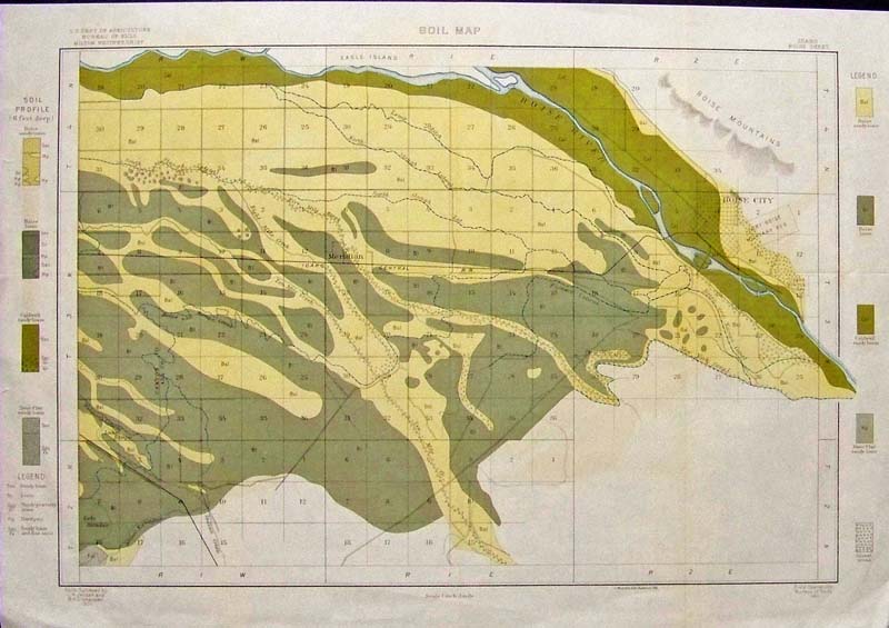
118id: 1901 Color lithograph by A. Hoen & Company showing Boise, Idaho's Soil Map with a Soil Profile outside of margins, furnished by the U.S. Department of Agriculture, Bureau of Soils by Milton Whitney, Chief. 22 x 15-1/2 in. $80 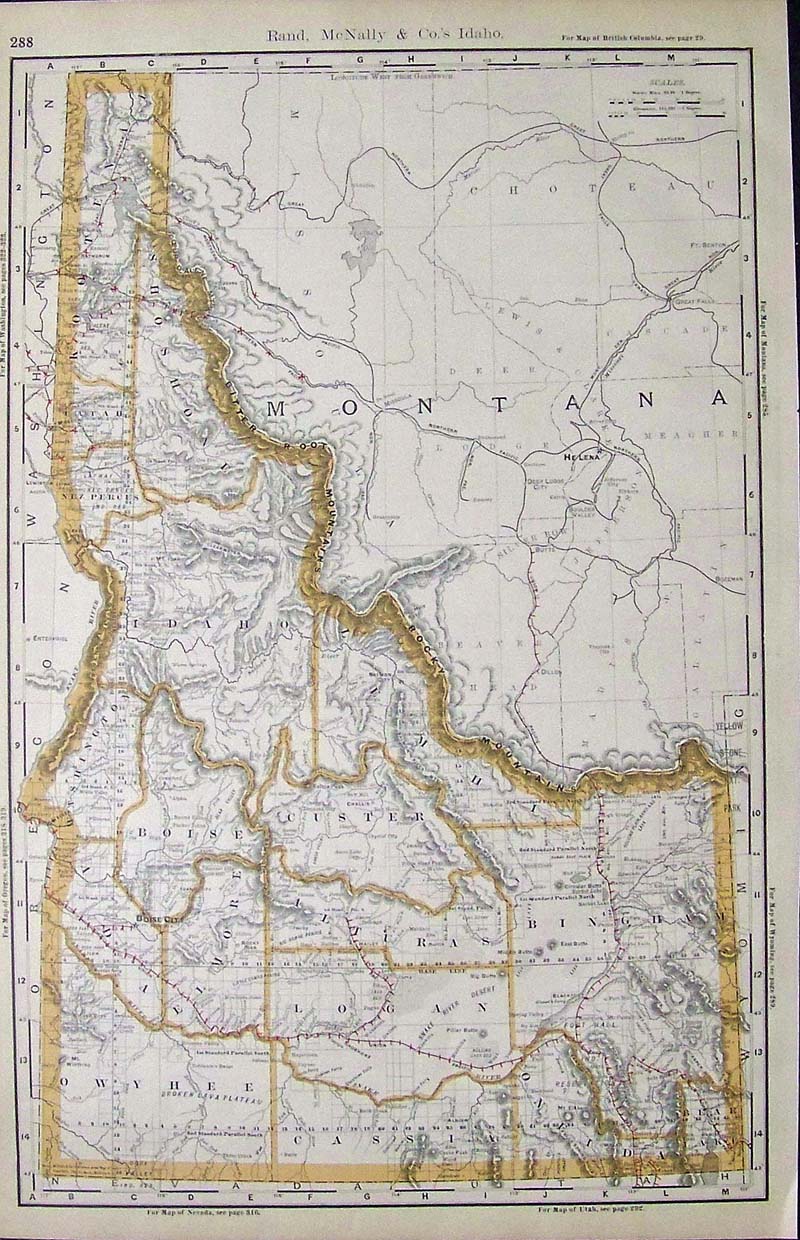
119id: 1892 Rare Rand McNally Railroad Map of Idaho which shows all the railroad stops. All of the counties are outlined. 20-1/2 x 13-1/2 in. $120 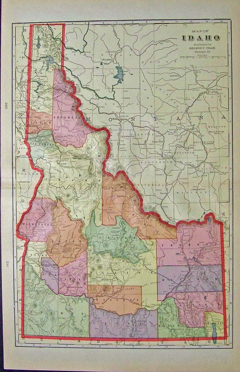
120id: 1894 Color Map of Idaho, published by George F. Cram. Each county is colored differently and the state of Idaho is outlined in red. 22 x 14-1/2 in. $90 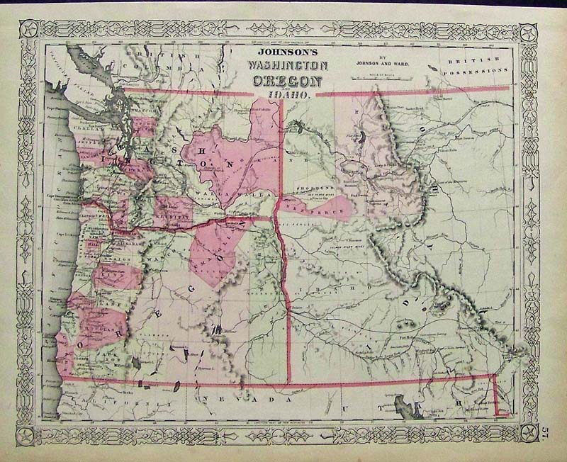
202ow: C.1860 Johnson's Washington, Oregon and Idaho hand colored engraved map. 18 x 14 in. $180 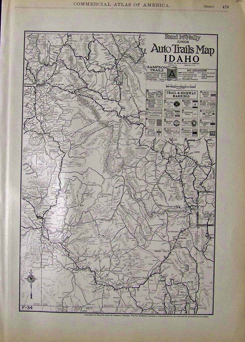
122id: 1925 Rand McNally Junior Early road map and Auto Trails Map of Idaho which show a guide to Trail & Highway Markings. 20-1/2 x 14-1/2 in. $80 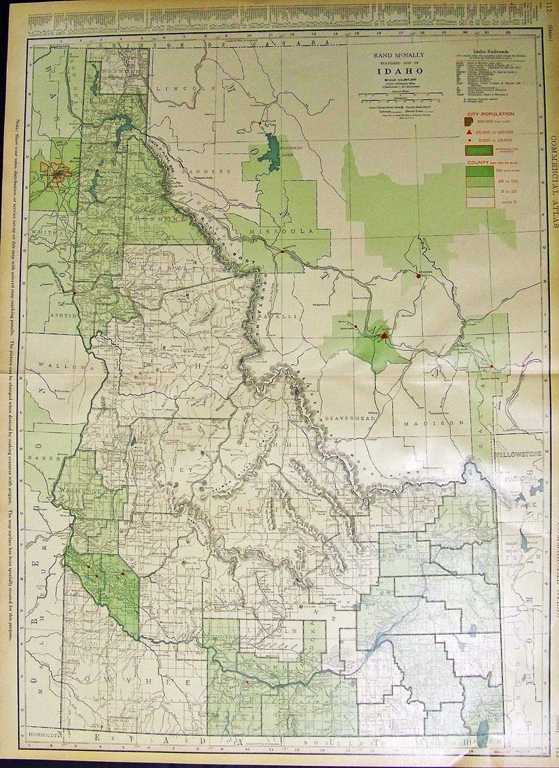
125id: 1937 Color Rand McNally Standard Map of Idaho showing all the Railroads and its Population, with the Principal Cities listed in the left margin. 27-1/2 x 20-1/2 in. $80 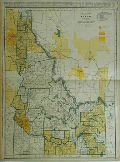
201id: 1943 Map of Idaho. Colorful map of Idaho, published by Rand McNally circa 1943. Shows city and county population as well as railroad lines and geographical features. Some slight yellowing from age, but overall condition is excellent. 27.5x20.5 in. $80 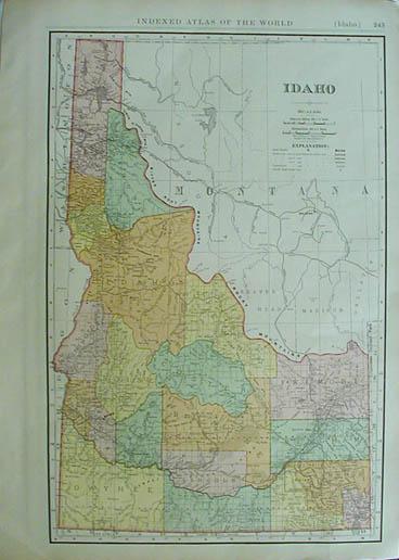
204id: 1914 Map of Idaho. Colorful map of Idaho, published by Rand McNally circa 1914. This hand colored map shows cities (marked in different colors) and towns. Key in the right upper corner gives populations key cities. Condition is excellent. 21x155 in. $80 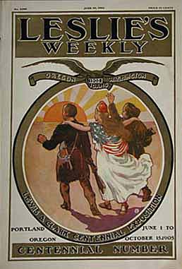 207id: Lewis & Clark Centennial Exposition -Portland, Oregon - Leslie's Weekly cover in 1905, is commemorating the Exploration from St. Louis to the Pacific by Lewis and Clark.This very nice color lithograph celebrates the 100th anniversary of their expedition. 11x16 in. $60 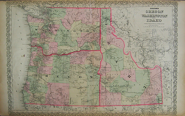
209id: 1855 Colton's hand colored map of Oregon, Washington and Idaho. Counties and townships are marked in each state with counties colored in different pastel colors. Railroads, mountains and rivers are all marked. The western part of Montana is also shown as well as parts of California, Nevada, Utah and Wyoming. 17.5x28 in. $250 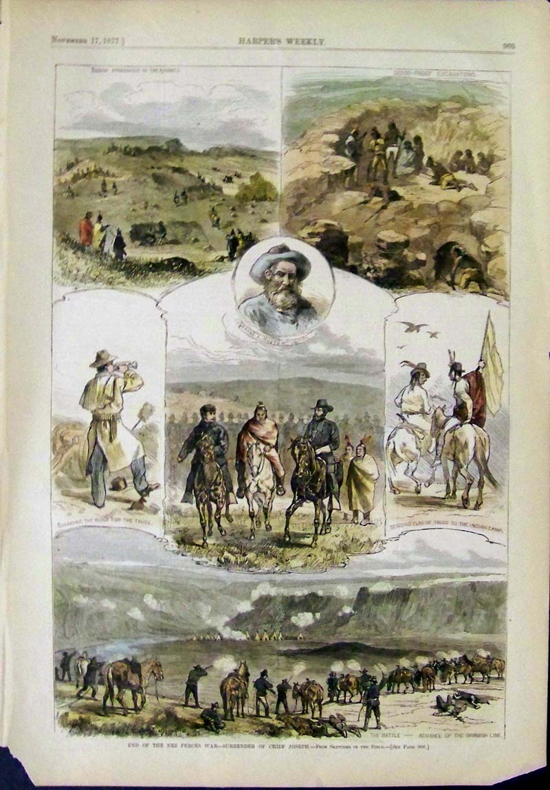 210id: 1877 Hand colored wood engraving featured in Harper's Weekly showing several engravings titled, "End of the Nez Perces War -- Surrender of Chief Joseph." 16 x 11 in. $90 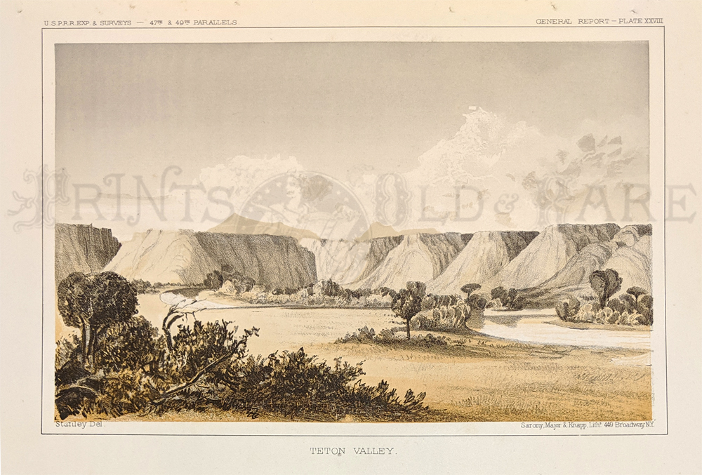 212idaho: 1853 Hand colored lithograph of the U.S.P.R.R. Exp. & Surveys General Report - Plate XXVIII showing the Teton Valley. Lithograpgh by Sarony, Major & Knapp., NY. 11-1/2 x 8-1/2 in. $60 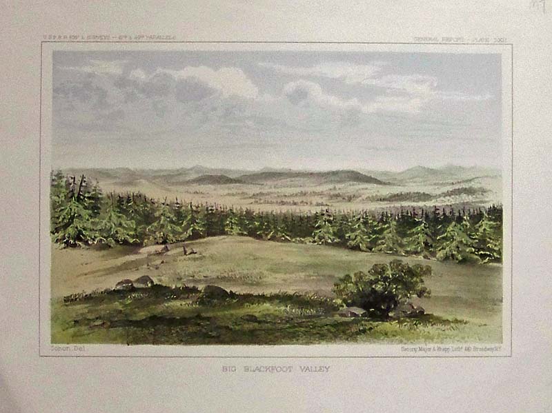 213idaho: 1853 Hand colored lithograph of the U.S.P.R.R. Exp. & Surveys General report Plate LXII showing the Big Blackfoot Valley. Lithograph by Sarony, Major & Knapp, NY. 11 x 8-1/2 in. $50 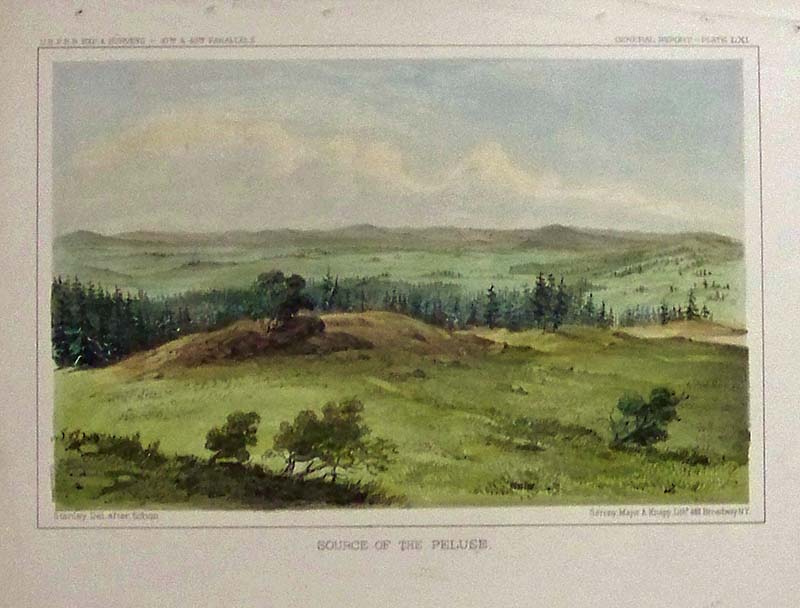
214idaho: 1853 Hand colored lithograph of the U.S.P.R.R. Exp. & Surveys General report Plate LXI showing the Source of the Peluse. Lithograph by Sarony, Major & Knapp, NY. 11 x 8-1/2 in. $50 |
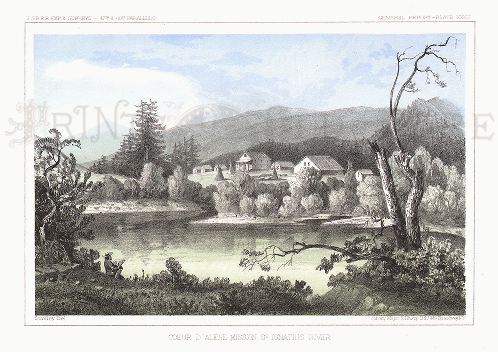
215idaho: 1853 Hand colored lithograph of the U.S.P.R.R. Exp. & Surveys General report Plate XXXV showing the Coeur D'Alene Mission St. Ignatius River. Lithograph by Sarony, Major & Knapp, NY. 11 x 8-1/2 in. $60 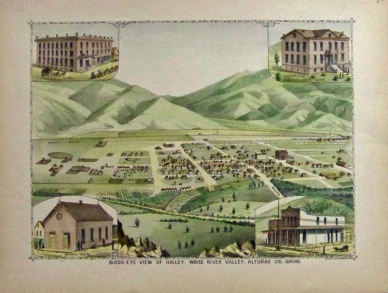
216idaho: 1894 Hand colored lithograph showing a Bird's-Eye View of Haily, Wood River Valley, Alturas Co., Idaho. Elliott Lithograph. 13-1/2 x 10 in. $60 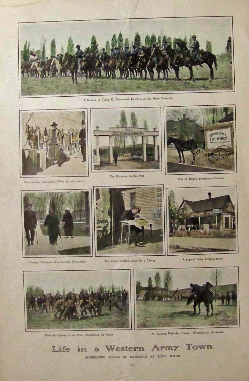
217idaho: 1909 Hand colored half-tone images showing Life in a Western Army Town in Boise, Idaho. 16 x 11 in. $60 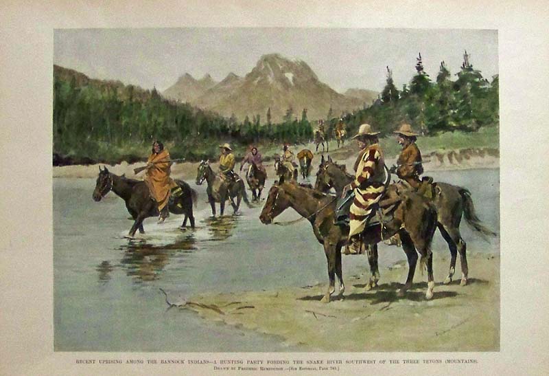
218idaho: 1882 Harper's Weekly hand colored half-tone image showing the "Recent Uprising Among the Bannock Indians -- A Hunting Party Fording the Snake River Southwest of the Three tetons (Mountains." Drawn by Frederic Remington. 15-1/2 x 10-1/2 in. $60 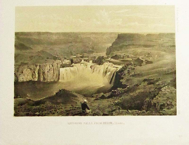
219idaho: 1853 Hand colored lithograph of the U.S.P.R.R. Exp. & Surveys General report Plate XVII showing the Shoshone Falls, From Below - Idaho. 10 x 8 in. $60 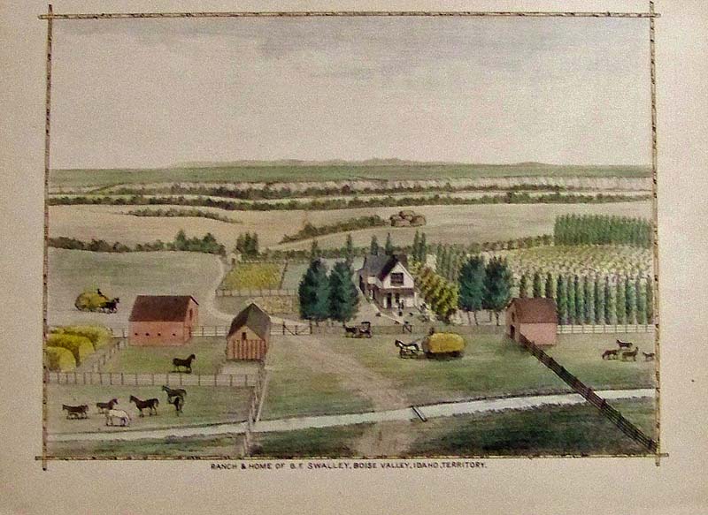
220idaho: 1884 Hand colored lithograph showing the Ranch & Home of B.F. Swalley, Boise Valley, Idaho Territory. 13-1/2 x 9-1/2 in. $60 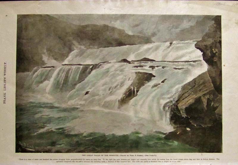
223idaho: 1894 Hand colored half-tone image showing the Great Falls of the Missouri, drawn by Fred. B. Schell. Featured in Frank Leslie's Illustrated Weekly. 16 x 11 in. $60 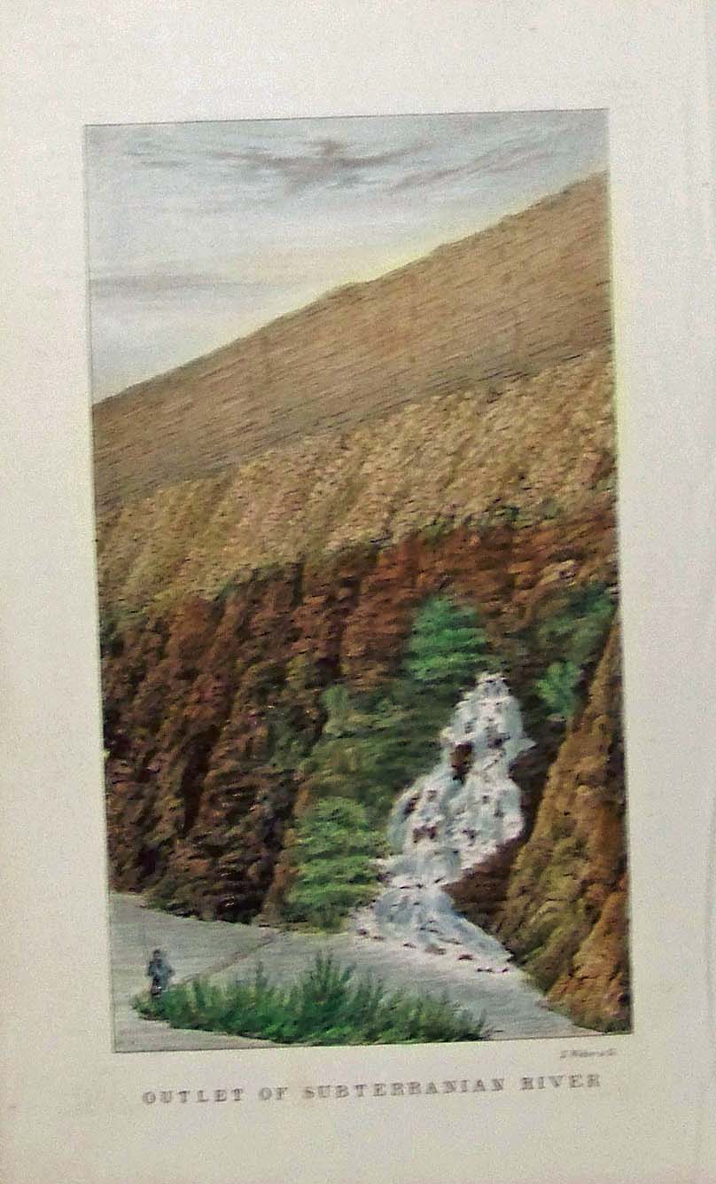
225idaho: 1845 Hand colored lithograph by E. Weber & Co. showing the Outlet of Subterranian River. Part of the Fremont Expedition. 9 x 5-1/2 in. $60 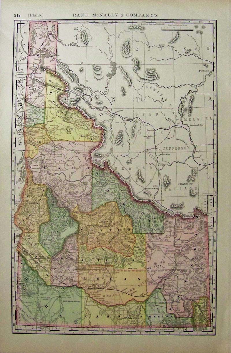
228idaho: Color map of Idaho published by Rand, McNally & Company. 22 x 14-1/2 in. $80 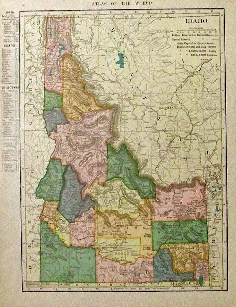
229idaho: Atlas of the World color map of Idaho. 12-1/2 x 10 in. $30 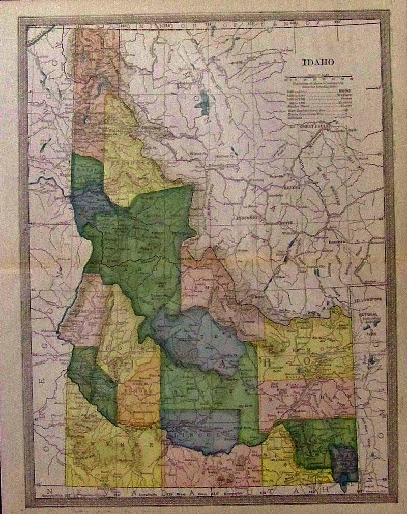
230idaho: C.1880 Color map of Idaho showing all the counties in a different color. 13 x 10 in. $50 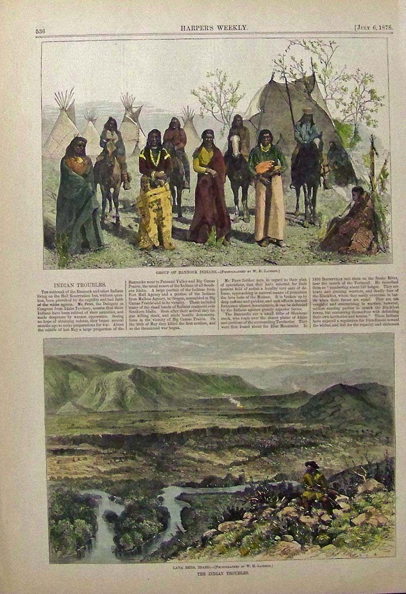
231idaho: 1878 Harper's Weekly hand colored wood engraving showing the lava beds in Idaho in a caption titled, "The Indian Troubles." 16 x 11 in. $50 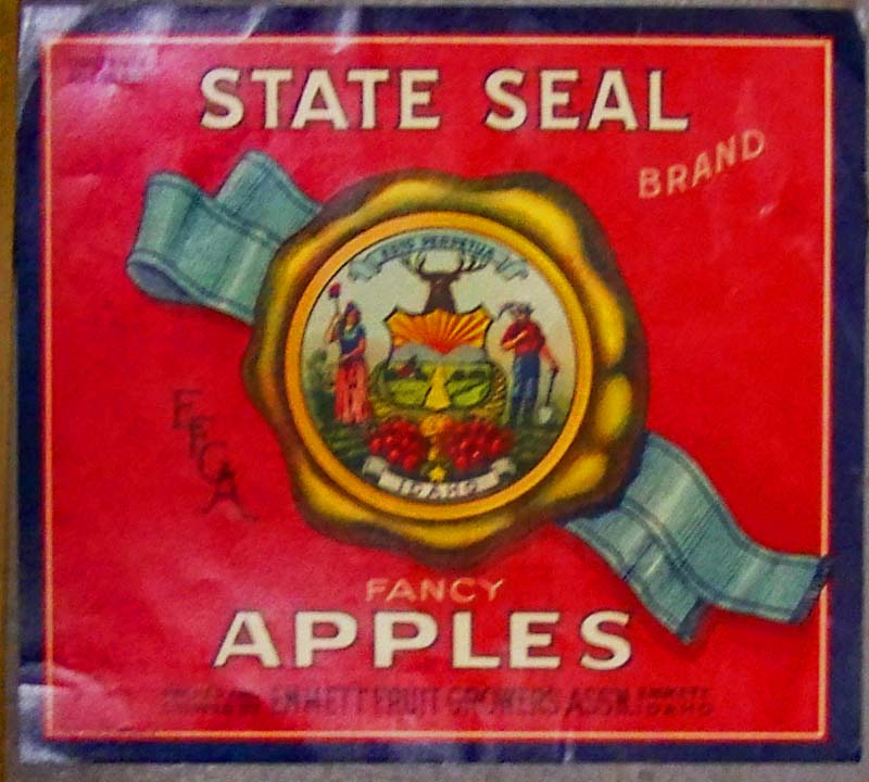
232idaho: State Seal Fancy Apples fruit label, packed and shipped by Emmett Fruit Growers Association; Emmett, Idaho. 10 x 9 in. $40 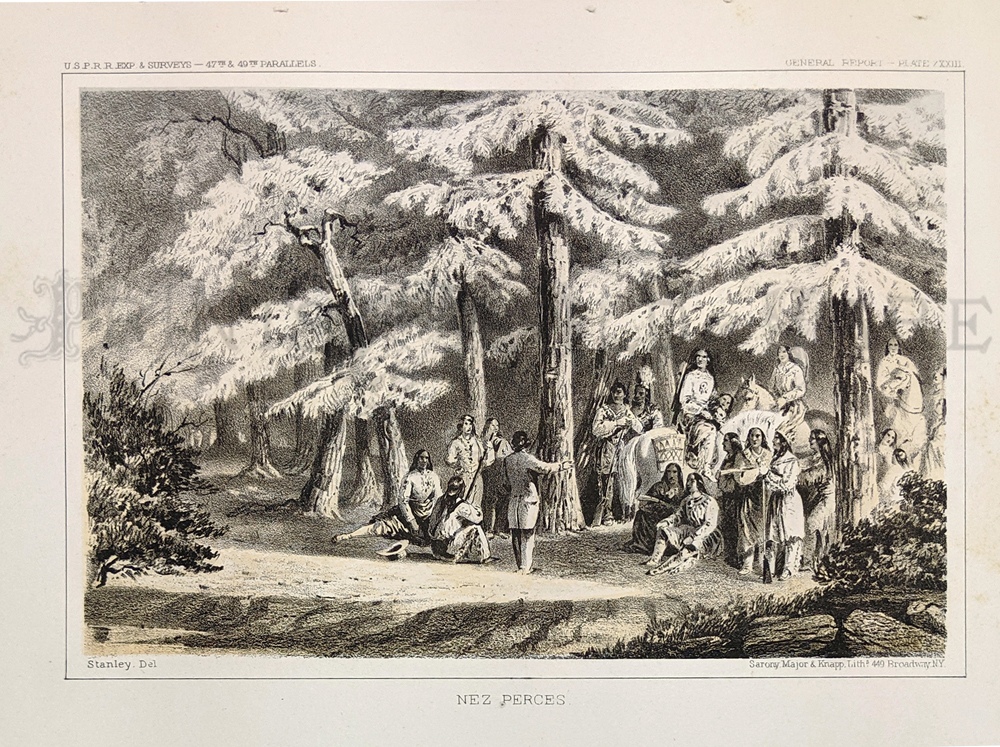 233idaho: Nez Perces. 1855 USPRR Survey. Plate XXXIII. 8 1/2 x 11 1/2 in. $100 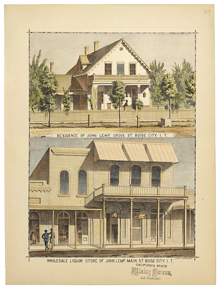 235idaho: 1884 Hand colored lithograph showing the residence of John Lamp, Grove St. Boise City, I.T., bottom image showing Wholesale Liquour Store of John Lemp, Main St. Boise City, I.T. **Stamped California State Mining Bureau, S.F. 10 3/8 x 13 3/4 in. $80 . 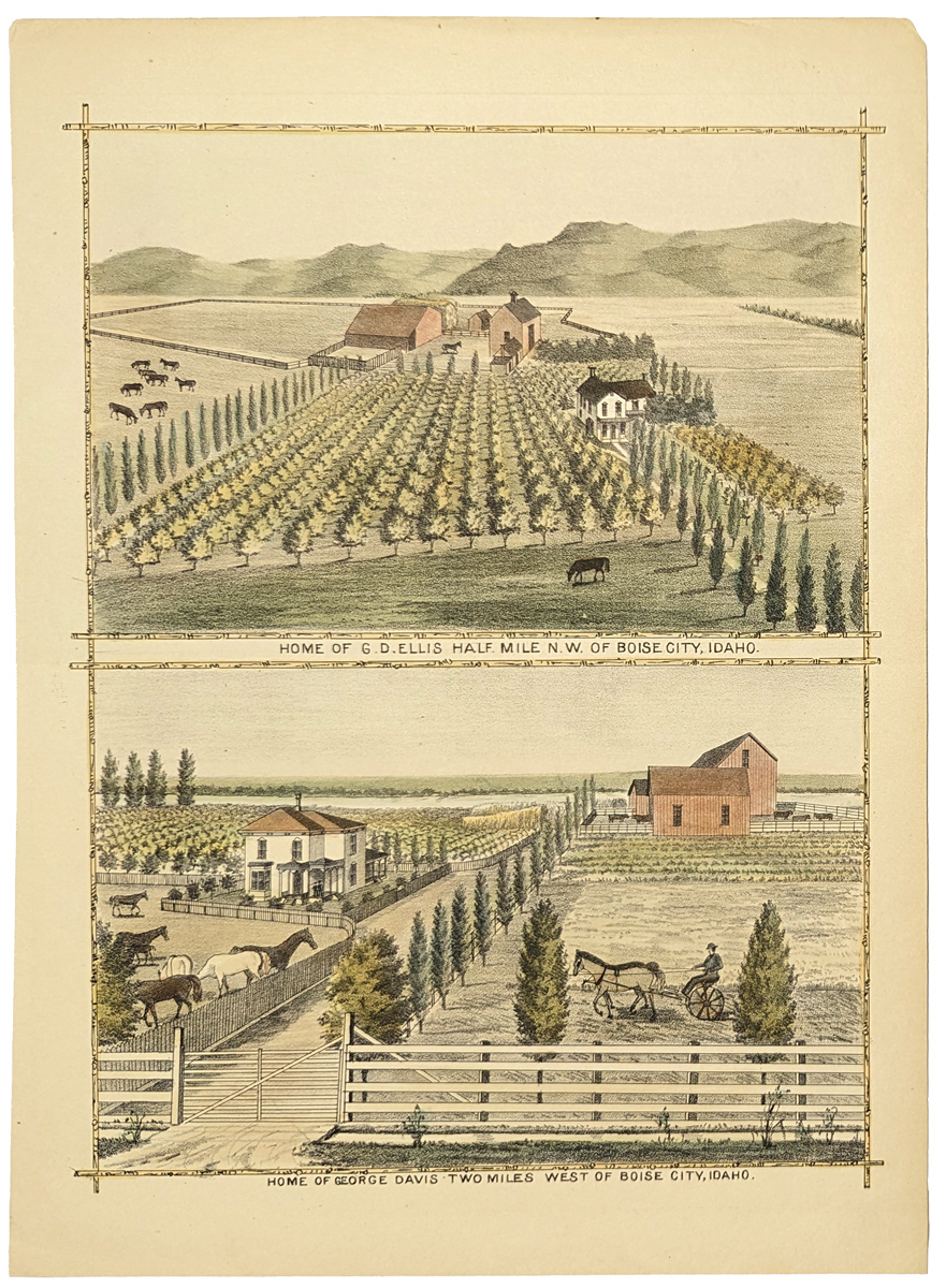 236idaho: 1884 Hand colored lithograph showing the home of G.D. Ellis, Half mile N.W. of Boise City, Idaho. Bottom image showing the home of George Davis, Two miles west of Boise, Idaho. 9 1/2 x 13 3/8 in. $80 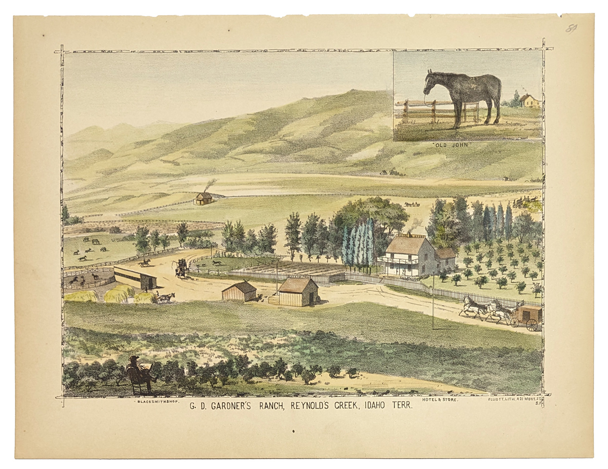 237idaho: 1884 Hand colored lithograph showing G.D. Gardner's Ranch, Rynold's Creek, Idaho Terr. 10 1/4 x 13 5/8 in. $60 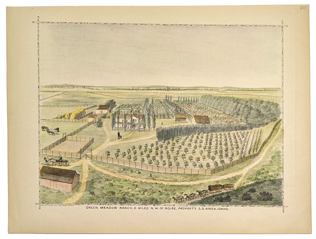 238idaho: 1884 Hand colored lithograph showing Green Meadow Ranch, 6 miles N.W. of Boise, property of S.D. Aiken, Idaho. 10 1/4 x 13 3/4 in. $60 |
|||||||||
| Order Form | |||||||||||
| Back to Homepage | |||||||||||