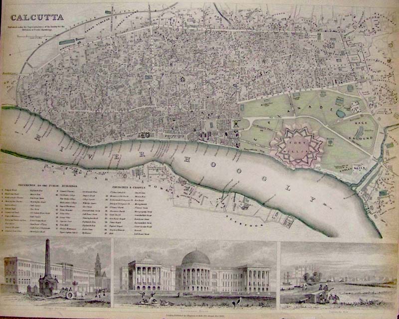
000ind:
Calcutta SDUK Map - 1842 Hand color steel engraved map showing
vignettes of city scenes in very good condition, with some toning near
the edges. There's a small patch in lower right margin. Published by
Chapmin & Hall, London.
16 x 13 in. $225
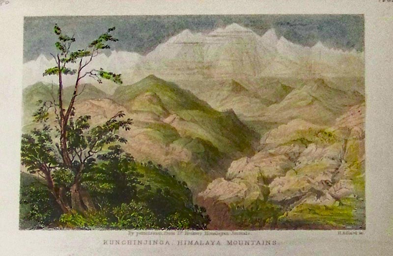
001ind:
Kunchinjinga, Himalaya Mountains. 1860 Hand colored steel engraving.
6-1/4 x 4 in. $30
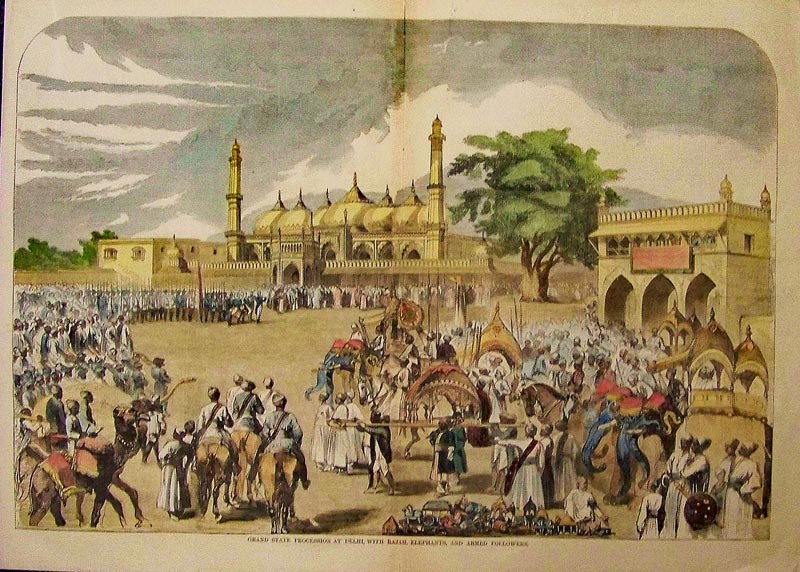
002ind:
Delhi - Procession with Rajah, elephants and armed followers.
Beautifully 1857 hand colored
wood engraving.
21-1/2 x 16 in. $90
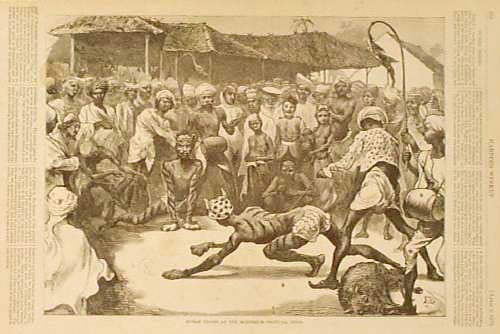
006ind:
1872
"Mohurrum
Festival, India." Shows two men dressed as tigers, with stripes painted
on their skin. They are surrounded by a crowd of curious bystanders.
11x16 in. $30
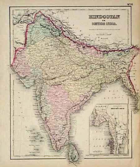
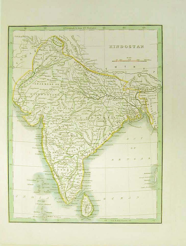
007ind:
1855
Map of India, Hindostan by Colton. Detailed map of the Indian
subcontinent and Ceylon, with each province individually hand colored.
Map title is "Hindostan or British India." In the lower right corner
there is a small inset map showing the far eastern portion of British
India.
14x17 in. $60
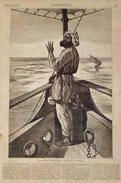
008ind:
1876 "On
a River Steamer, India." Wood
engraving from Harper's Weekly. Fine condition.
11x16 in. $30
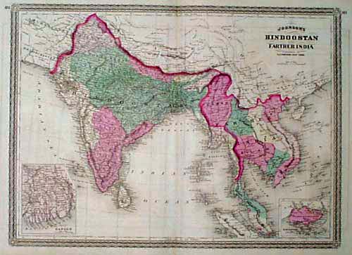
014ind:
1867
Johnson Map of India, Indochina. Hand colored, antique engraved map
published in 1867 by the A.J. Johnson Co. Map title is "Johnson's
Hindoostan and Farther India." The Indian subcontinent is shown in
detail, as well as the countries of Southeast Asia. Small inset maps of
Singapore and the Ganges Delta are also included. Cities, towns,
railroad lines, major roads and geographical
features are all shown.
17x27 in. $60
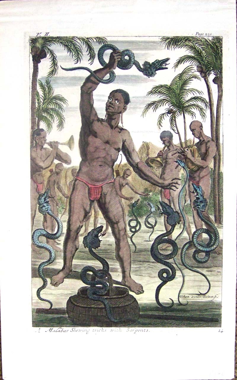
018ind:
1746 Hand colored copper engraving titled, "A
Malabar Shewing tricks with Serpents." V. II, Page 231.
13-1/2 x 8-1/2 in. $150
019ind:
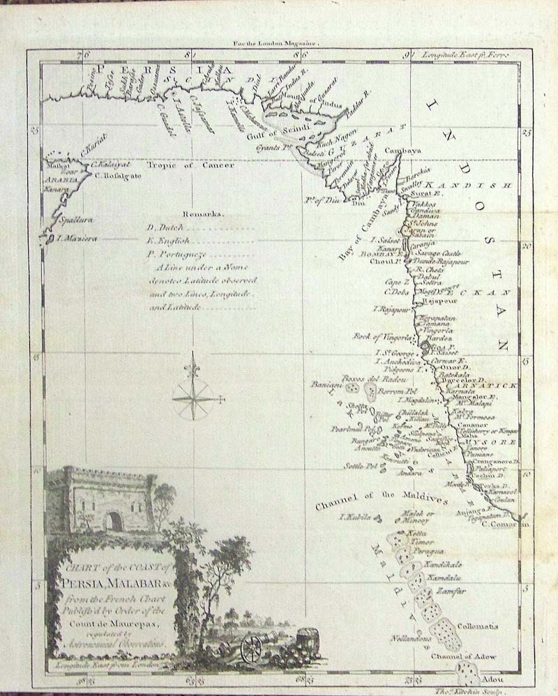
C.
1750 Engraved Chart of the Coast of Persia, Malabar from the French
Chart, Published by Order of the Count de Maurepas, for the London
Magazine. Chart shows the Channel of the Maldives, Tropic of Cancer and
vignette in bottom left corner.
9-1/2 x 8 in. $50
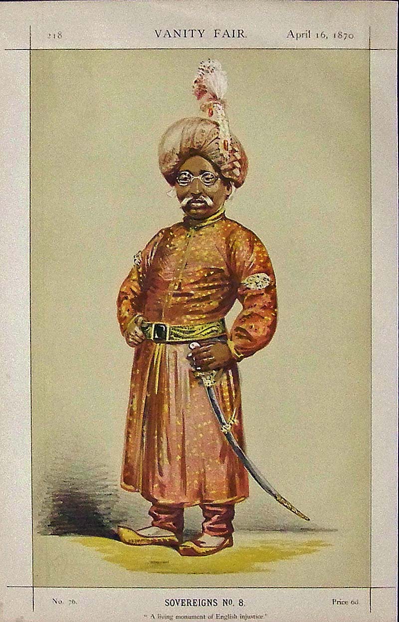
020ind:
1870 Nawab Nazim of Bengal, Behar
and Orissa. Original lithograph from the famous English Vanity Fair.
Image is in fine condition and includes another page about him.
14 x 9 in. $50
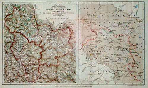
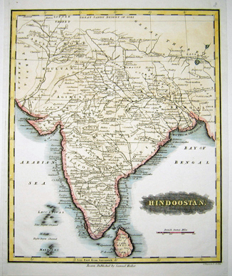
204ind:
1871
Northern India Map by J. Murray. Detailed, steel-engraved map from the
Journal of the Royal Geographical Society, drawn by J. Murray and
printed in 1871. Title is "A Map to Illustrate Captain Harcourt's Paper
on the Himalayan Valleys of Kooloo, Lahoul and Spiti, with a Sketch Map
of the Passes from India to Eastern Turkistan." Shows the area that is
currently under dispute between India and Pakistan. Excellent
condition.
9x17 in. $60
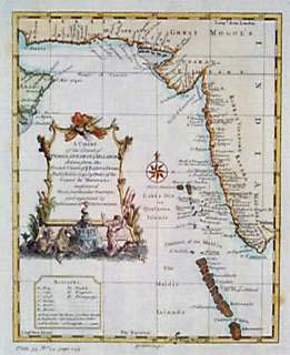
205ind:
1752
Coast Map: Persia, Arabia, Eastern India. Decorative, hand-colored map
by G. Child, titled "A Chart of the Coast of Persia, Guzarat &
Malibar drawn from the French Chart of ye Eastern Ocean." Printed in
1752. Cities, towns and geographical features are shown in detail along
the coastal regions. Title is surrounded by an elaborate cartouche.
Very good condition. $150

206ind:
Johnson's
Hindostan or British India. Beautiful hand colored engraved map
published in 1861. Small inset maps of The Island and Town of Bombay,
Madras and it's Suburbs, and also Calcutta. Small engraving in top left
corner of Government - House & Treasury, Calcutta. 14x18 in. $80
|
210ind:
1835"Hindostan,"
from Bradford's 1835 world atlas. Elegant
Map of Hindostan.Map also shows the Indian Ocean and the Bay of Bengal.
12 x 10in. $150
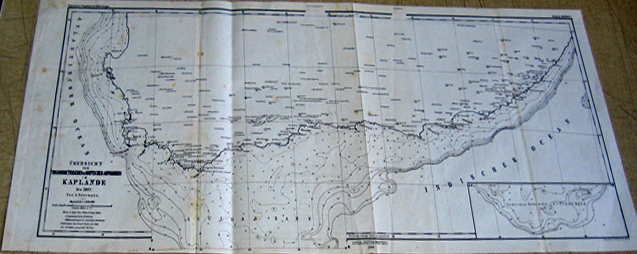
212ind:
1867 Ubersicht der Triconometrischen &
Nautischen Aufnahmen I M Kaplande (Capeland of India Map) (German
edition) 11x27in. $60
215ind:
1875 India Hindostan (with defined territories,
military stations and railroads).
20x28in. $80
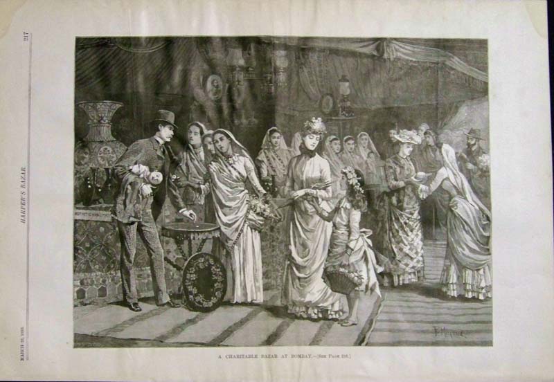
222ind:
1889
"A Charitable Bazar at Bombay." Wood
engraving featured in Harper's Bazar.
16 x 11 in. $50
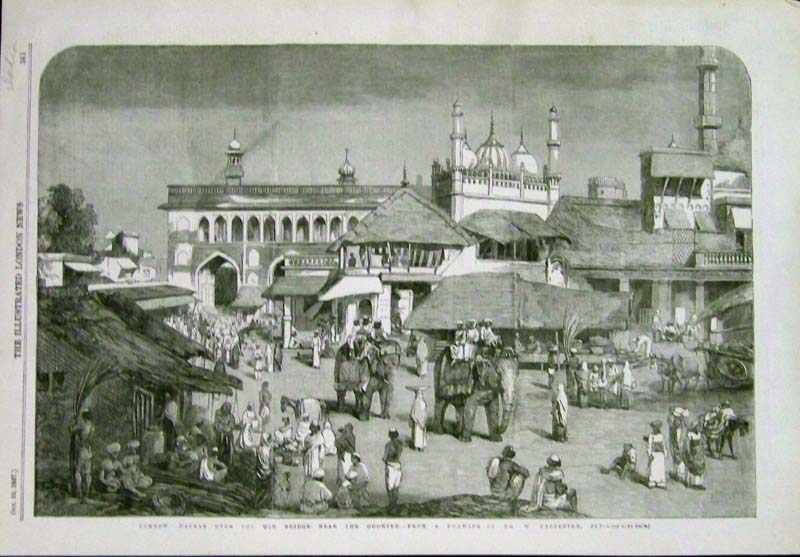
223ind:
1857 "Ucknow
Bazaar Over
the Old Bridge Near the Goomtee."
Wood engraving featured in The Illustrated London News.
16 x 11 in. $40
224ind:
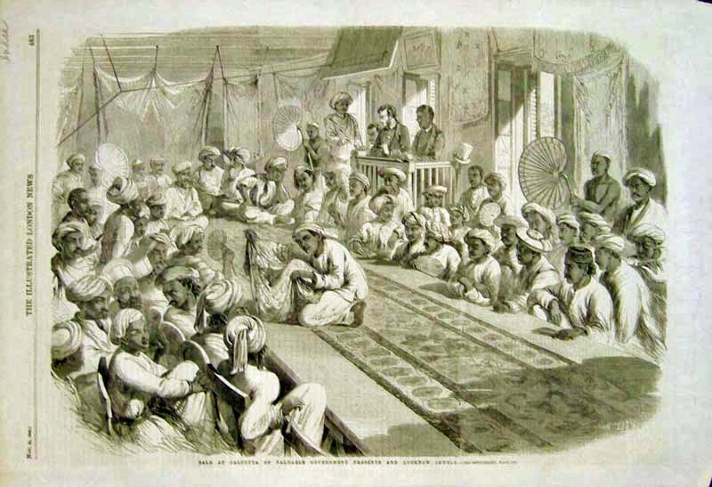
1860
"Sale at Calcutta of Valuable Government Presents and Lucknow Jewels." Wood
engraving featured in The Illustrated London News.
16 x 11 in. $30
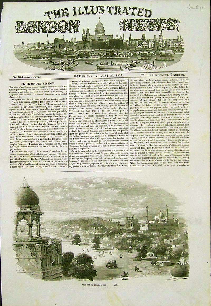
225ind:
1857
"The City of Delhi."
Wood
engraving featured in The Illustrated London News.
Text is included on page.
16 x 11 in. $40
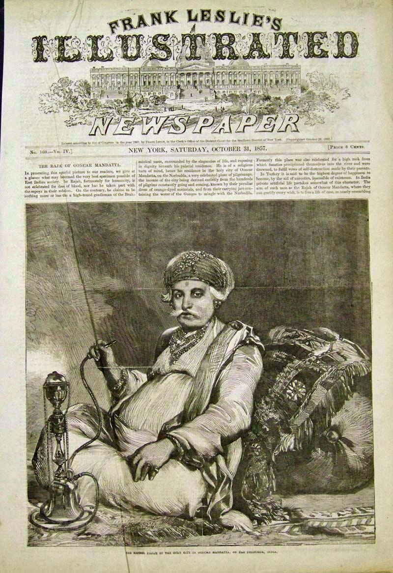
228ind:
1857 "The
Hindoo Rajah of the Holy City of Ooncar Mandatta, On the Nerbudda,
India."
Wood
engraving.
15-1/2 x 11 in. $40
229ind:
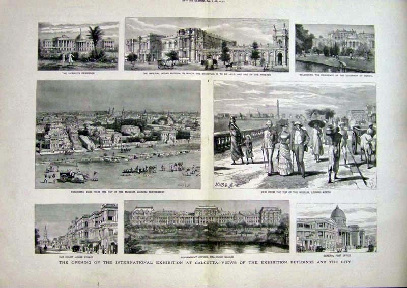
1883 International
Exhibition at Calcutta -- Views of the Exhibition Buildings
and the City. Wood
engravings showing eight views.
23 x 16 in. $100
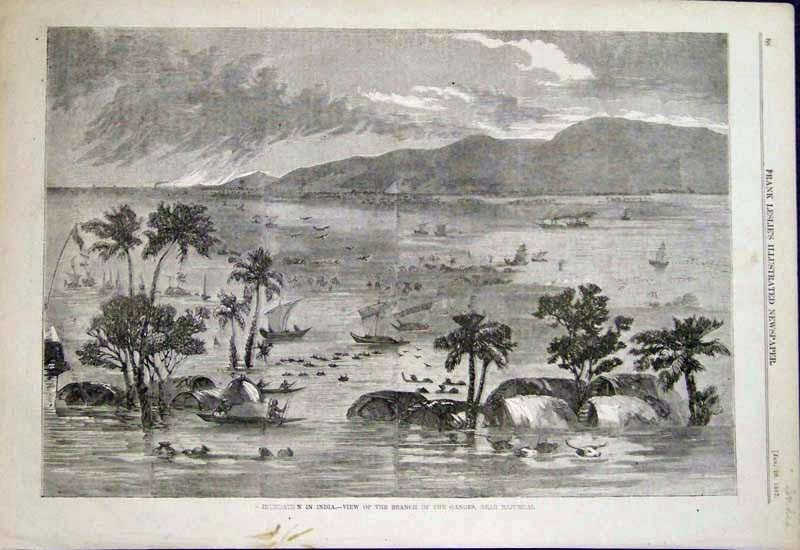
231ind:
1857 Ganges,
Near Rajurnal. Wood
engraving featured in Frank Leslie's Illustrated Newspaper. Light stain
in bottom middle border which doesn't affect the image.
16 x 11 in. $40
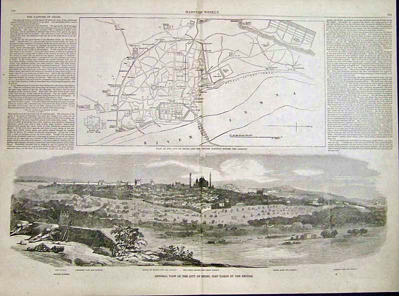
232ind:
1857 Double-page wood engraving with text showing the "Plan of the City
of Delhi, and the British Position Before the Assault" on top image and
bottom image shows, "General View of the City of Delhi, Just Taken by
the British."
21 x 16 in. $80
233ind:
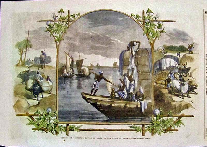
1861
"Methods of Conveying Cotton in India To the Ports of Shipment." Hand
colored wood engraving featured in
Harper's Weekly.
16 x 11-1/2 in. $60
Black & White: $40
234ind:
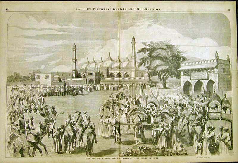
1858 "View
of the Famous and Unrivalled City of Delhi, In India." Delhi
double-page wood engraving featured in Ballou's.
22 x 15 in. $100
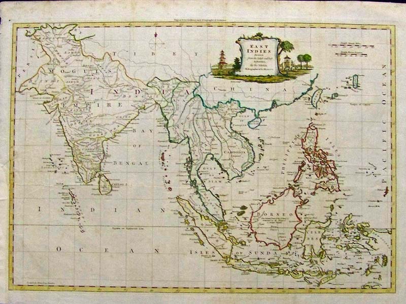
135rare:
1782 Thomas Kitchen, East Indies shows Southeast Asia and India.
Beautiful watercolored copperplate engraving on hand made paper 19 1/2
x 13 1/2" with professional repair of a 1" tear mid-left, barely
noticeable.
$400.
SOLD
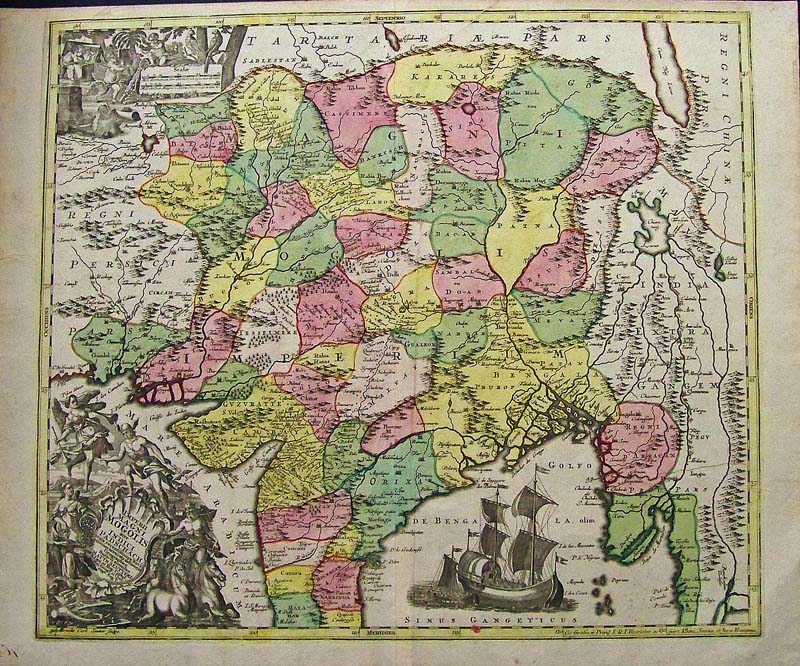
132rare:
1750 INDIA. Albrecht Carl Suetter. Imperii Magni Mongolis . from
Afghanistan through the Himalayas to Myanmar and most of India. Each
province is individually water colored. Beautiful cartouche and
vignette of sailing ship. Watercolor to copperplate engraving on
handmade rag in outstanding condition,with bright colors. 22.5 x 19.5"
plus margins.
$1600.

254India:
Bombay (Mumbai) Area 1779 by T. Kitchin. "A New Map of the Countries Round Surat and Bombay in the East Indies." Hand colored, copper engraving.
7 1/4" x 9 1/2" in. $125
|
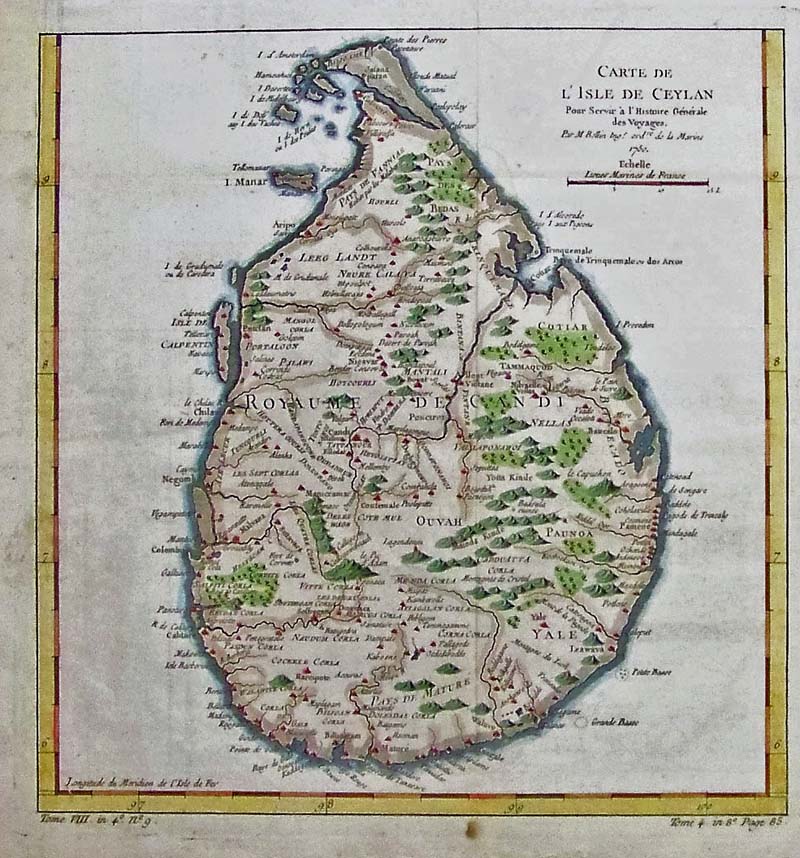
236ind:
C.1760 "Carte de L'Isle de Ceylan." Hand colored copper engraved Perisian map
in fine condition.
11-1/2 x 11 in. $225
237ind:
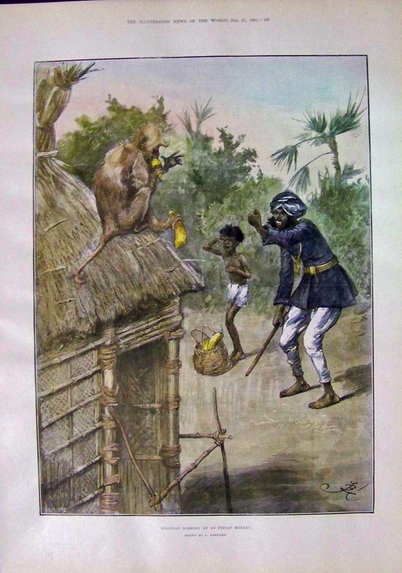
1891 "Highway Robbery By An Indian Monkey." Hand colored wood engraving featured in The
Illustrated News of the World. Drawn by F. Barnard. Image
shows a mischievous monkey sitting on a thatched roof eating a yellow
squash it just stole from the dwellers below.
16 x 11-1/2 in. $50
239ind:
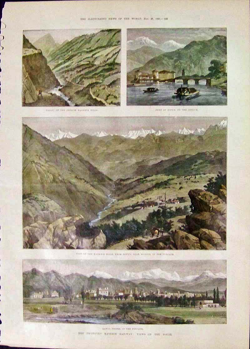
1891 "The
Projected Kashmir Railway: Views On the Route."
Hand
colored wood engraving which was featured in The Illustrated
News of the World.
16 x 11 in. $60
240ind:
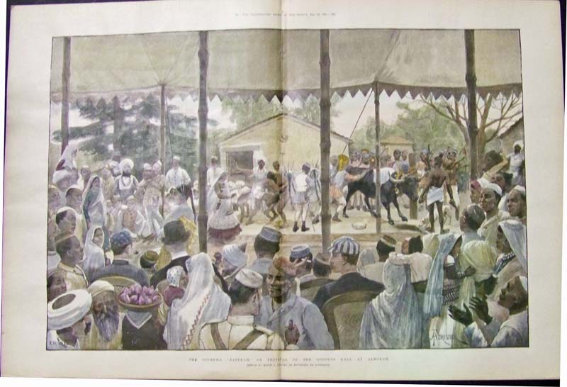
1891 "The Goorkha "Daserah," Or Festival Of the
Goddess Kali, At Almorah." Double-page hand colored wood engraving.
23 x 16 in. $90
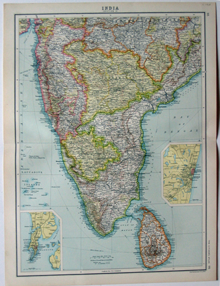
241ind:
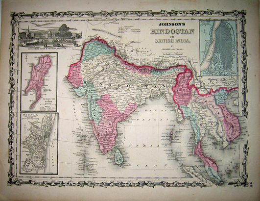
1861 Johnson's HINDOSTAN or BRITISH INDIA Map by Johnson and Ward. This
map covers all of the Indian sub continent and most of southeast Asia.
Many towns, as well as the terrain are displayed. The insets show
Calcutta, "Madras and its suburbs," "The Island & Town of
Bombay," and a vignette of "Government - House & Treasury,
Calcutta." Hand colored antique map is in excellent condition
with very ornate border.
14x18in. $100
242ind:
1830 HINDOOSTAN map, Boston, published by Samuel Walker. Hand colored
wood-engraved map showing Hindoostan with the Arabian Sea on the left
side and the Bay of Bengal on the right. Thick yellow and black border
surrounding this antique map of Hindoostan. Excellent condition.
8x10in. $80
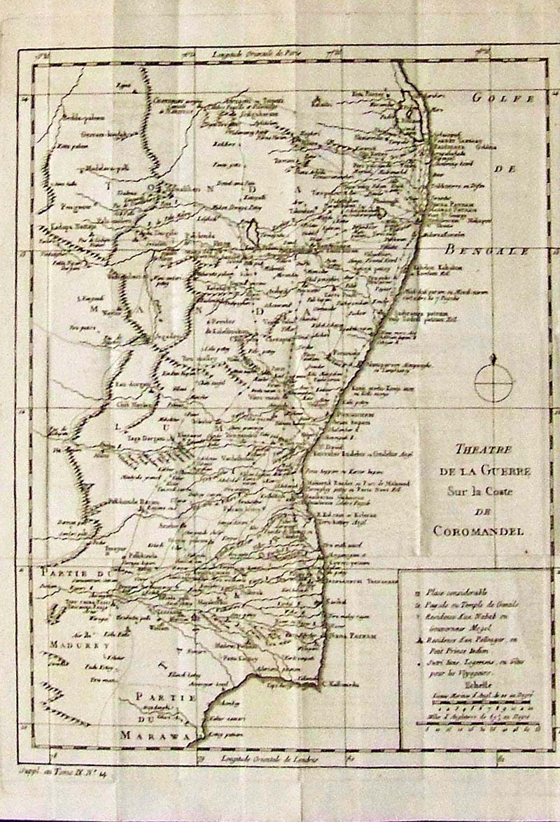
244ind:
1770 Theatre De La Guerre Sur la Coste De Coromandel by
Bellin. Copper engraved map.
14-1/2 x 10 in. $150
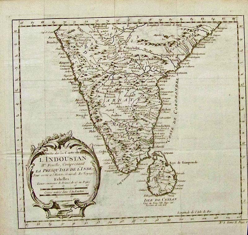
245ind:
1770 L'Indoustan
which also shows the Isle De Ceylon, by Bellin.
Copper
engraved map.
10-1/2 x 10 in. $100
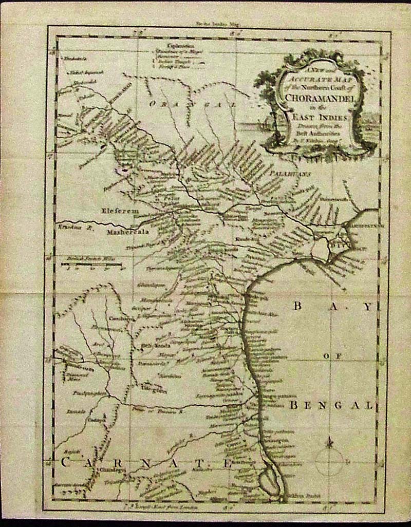
246ind:
1760 A New and Accurate Map of the Northern Coast of
Choramandel in the East Indies by T. Kitchin.
Hand colored copper engraved map featured in
London Magazine.
10-1/4 x 8 in. $125
247ind:
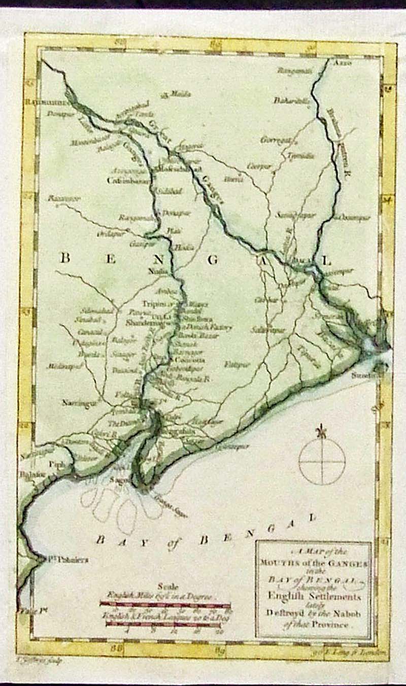
1757 Map of
the Mouths of the Ganges in the Bay of Bengal, Showing the English
Settlements lately Destroyed by the Nabob of that Province. Hand
colored copper engraved map was featured in
Gentleman's Magazine.
8-1/4 x 5 in. $75
248ind:
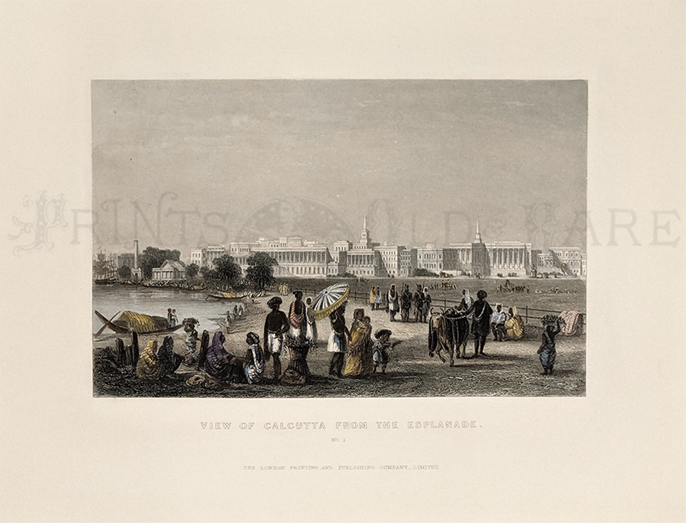
Calcutta
c.1850. View from the Esplanade. Handsome hand colored steel engraved
view.
8 x 10 5/8 in. w/ margins. $50
249ind:
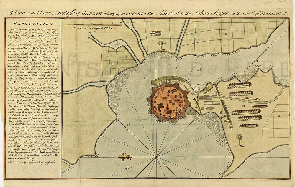
c.1750
India. A Plan of the Town and Fortress of GARIAH belonging to ANGRIA
the Admiral to the Sahou Rajah on the Coast of MALLABAR. Hand colored
copper-engraved antique map with a thin orange and black lined border
and a long Explanation written on the side.
Excellent condition.
12x18 in. $250
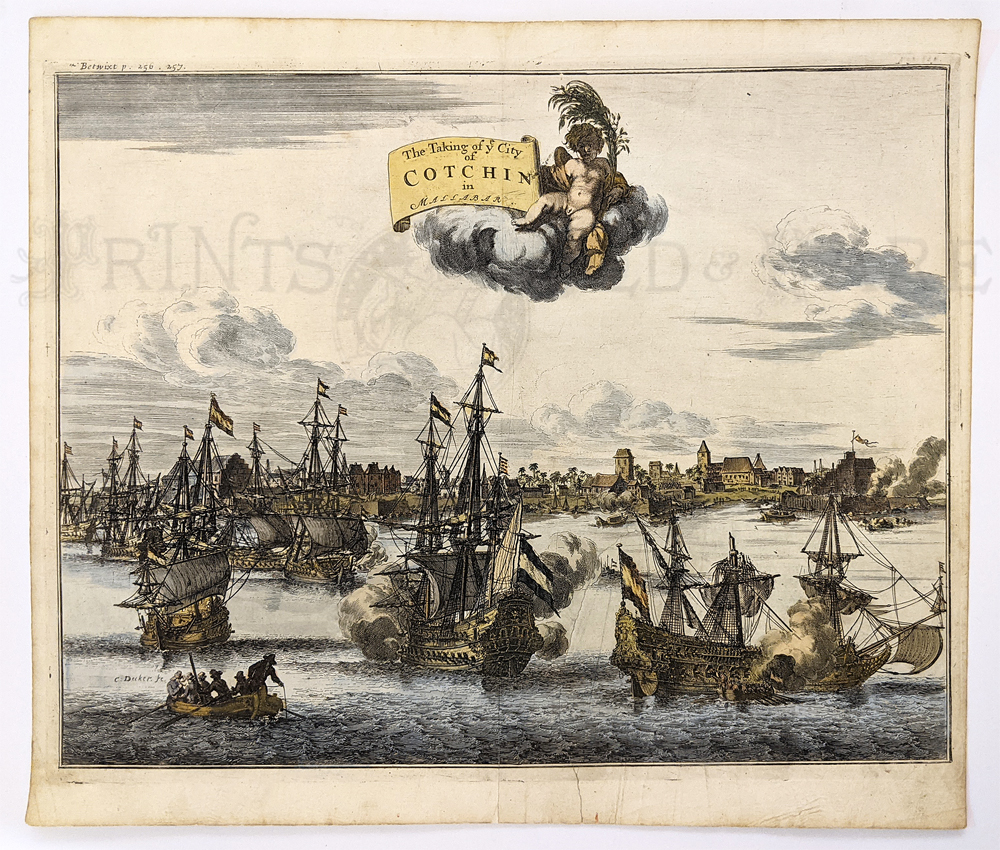
250ind:
Cotchin
under Siege 1682 – Hand colored copper engraved view of the Dutch East
India Company attacking the Portuguese. This harbor view of the
Mallabar Coast city shows war ships in battle in 1663.
12 x 14 in. $150
251ind:
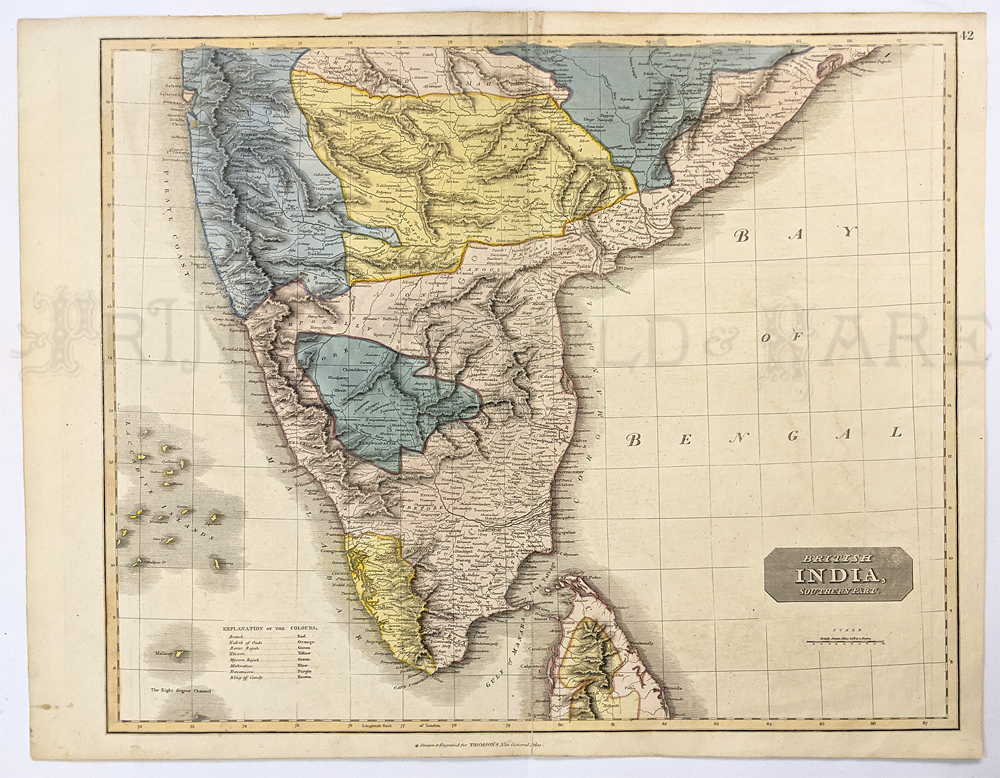
India
– Southern Part 1816. Hand colored engraved map from Thomson Atlas.
Shows part of Ceylon and provinces, towns, roads, lakes, and mountains.
20 x 25 in. $225
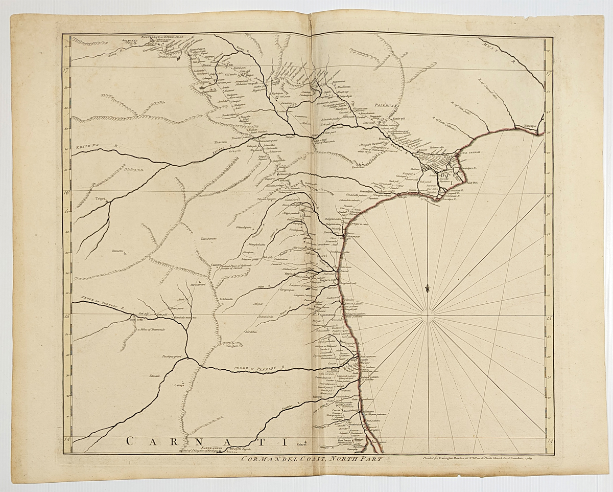
252ind:
Cormandel Coast, Northern Part.1795 Bowlers. Copper engraving, outline color, Caranger River North to Narsapur.
20 5/8 x 26 3/8 in. $200

253India:
Calcutta c.1850. Harbor View. Hand colord, steel engraving.
7 1/8" x 10 1/8" in. $80
|
|