 
|
|||||||||||
This is a small selection of our inventory of antique Iowa maps and prints. Additional inventory is available. Contact us with your request. 1-800-879-6277
|
|||||||||||
|---|---|---|---|---|---|---|---|---|---|---|---|

001Iowa: 1891 Bradley color lithographed map of Iowa. One of the most impressive and colorful of the 19th Century maps of the state. 26 x 19 in. $60 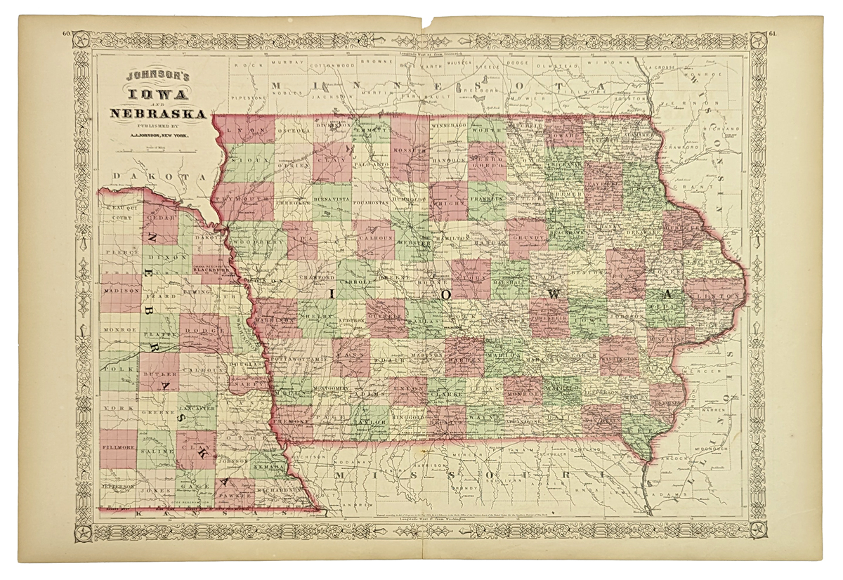 006ia: Johnson's 1864 Iowa Map. Also shows extreme eastern early Nebraska along the Missouri River. Original color, attractive border. 13-1/2x17-1/2 in. $80 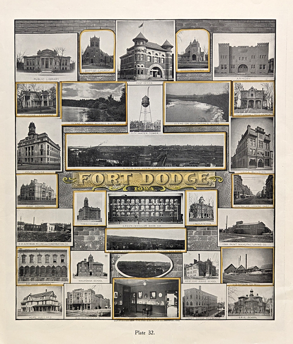
007ia: 1904 Fort Dodge. Many half-tone antique photographic views. 14-1/2x17-1/2 in. $40 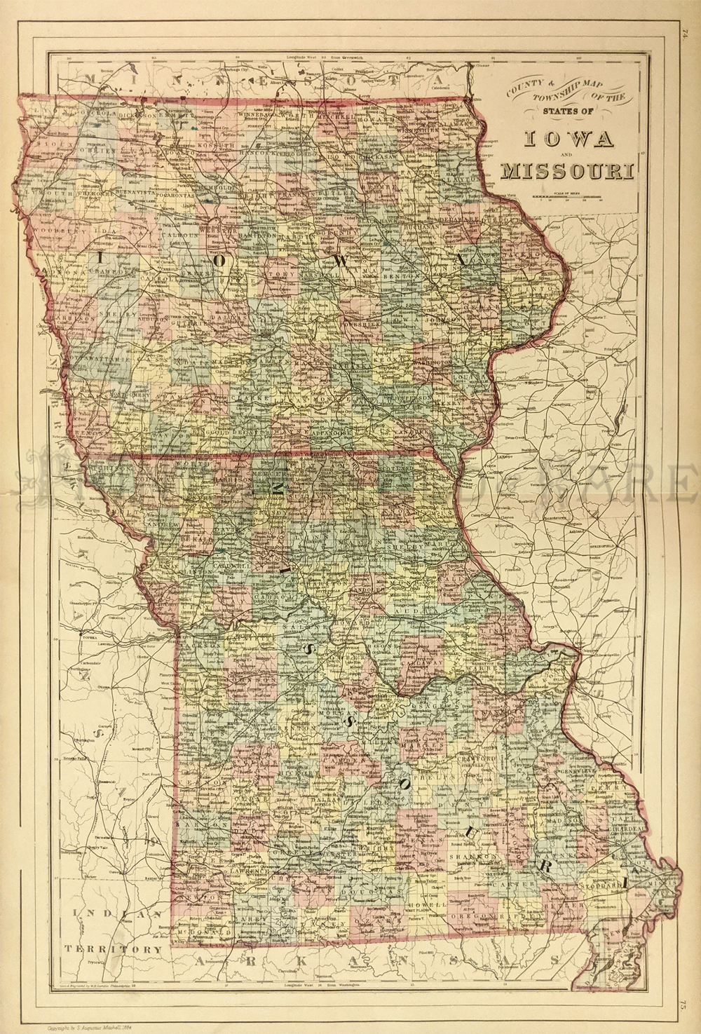
010ia: 1884 Hand colored Bradley Map of Iowa and Missouri. Shows counties and townships. 15x23 in. $60 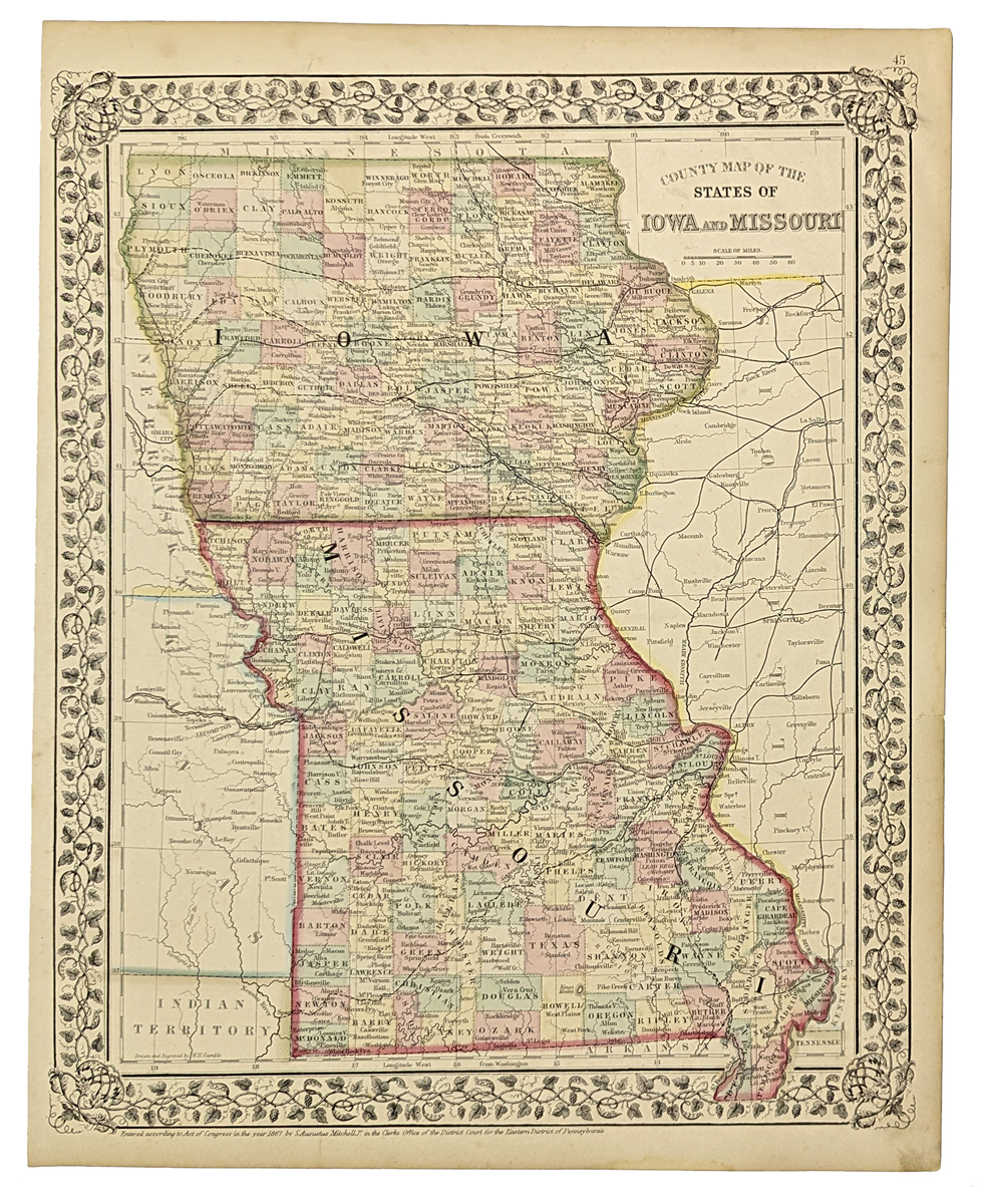
014ia: 1867 Missouri and Iowa Map. Original color by Mitchell. Attractive border, nice looking map. size: 12x15 in. $60 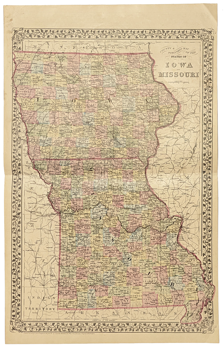
015ia: 1875 Iowa and Missouri Map. Nice margins, original color by county. Very attractive. 15x23 in. $90 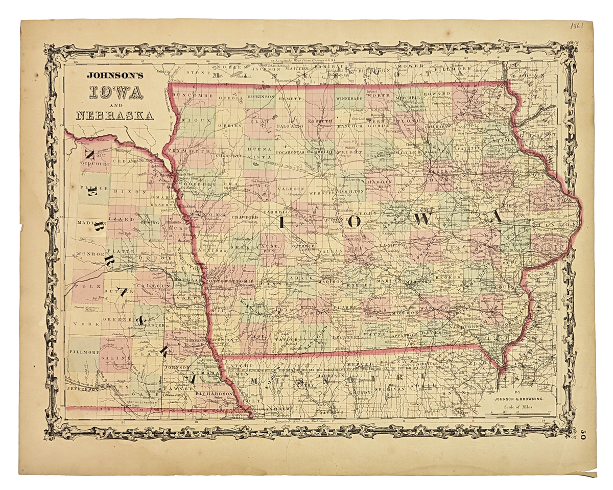
016ia: 1864 Iowa and Eastern Nebraska Map. Nice looking Johnson's map. Original color. 18x14 in. $80 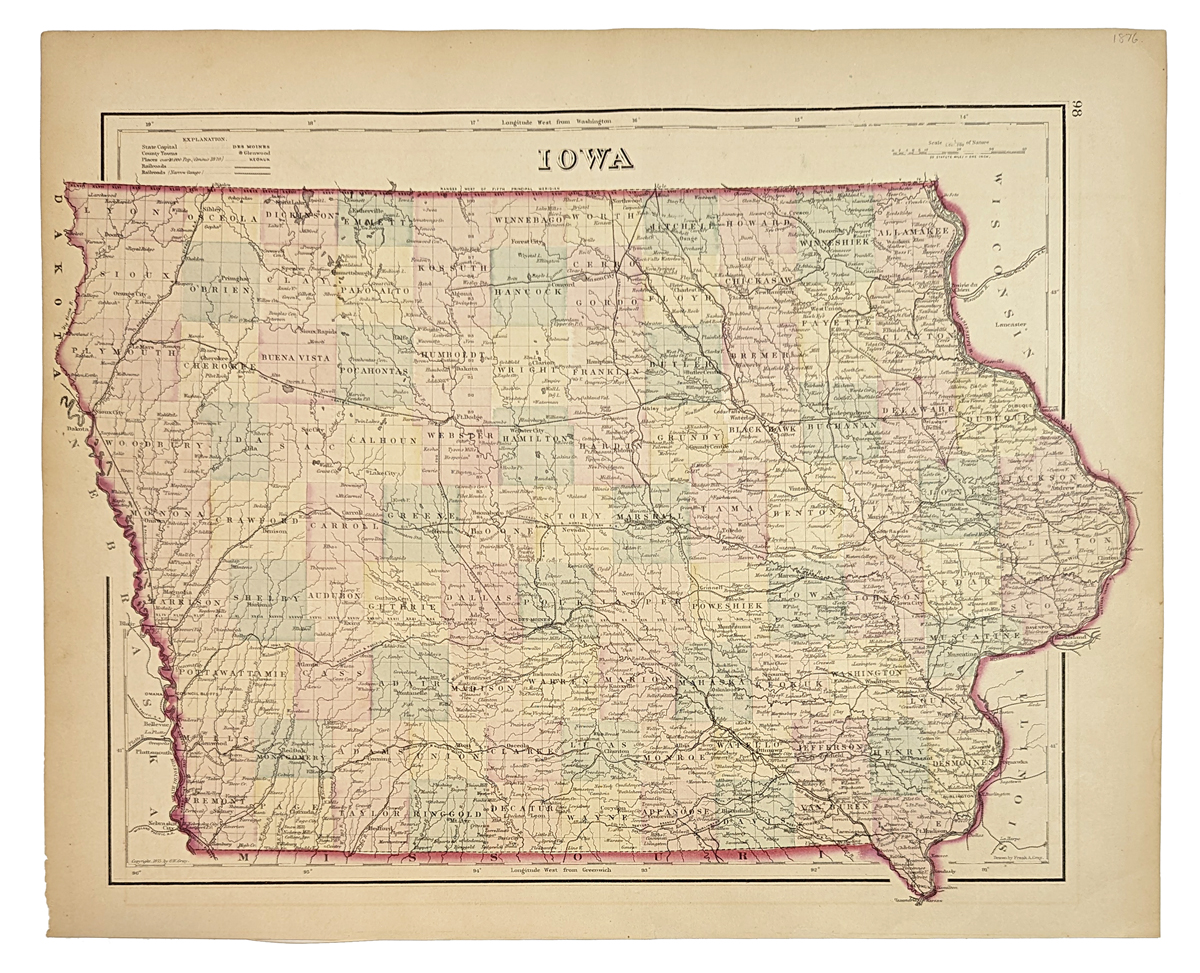
018ia: 1875 Gray's Map of Iowa. Great hand colored 125-year-old antique map. Color by counties, shows principal towns, roads, railroads. 17x14 in. $75 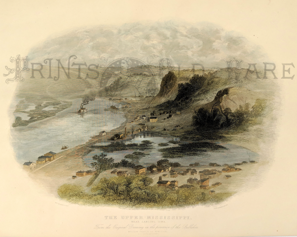 023amla: 1869 Steel engraving by Robert Hinshelwood. Artist is William Momberger. Published by William Pate & Co., New York; G.P. Putnam & Sons. Titled,"The Upper Mississippi, Near Lansing, Iowa." - From the Original Drawing in the Possession of the Publishers. 16 x 13 in. $250 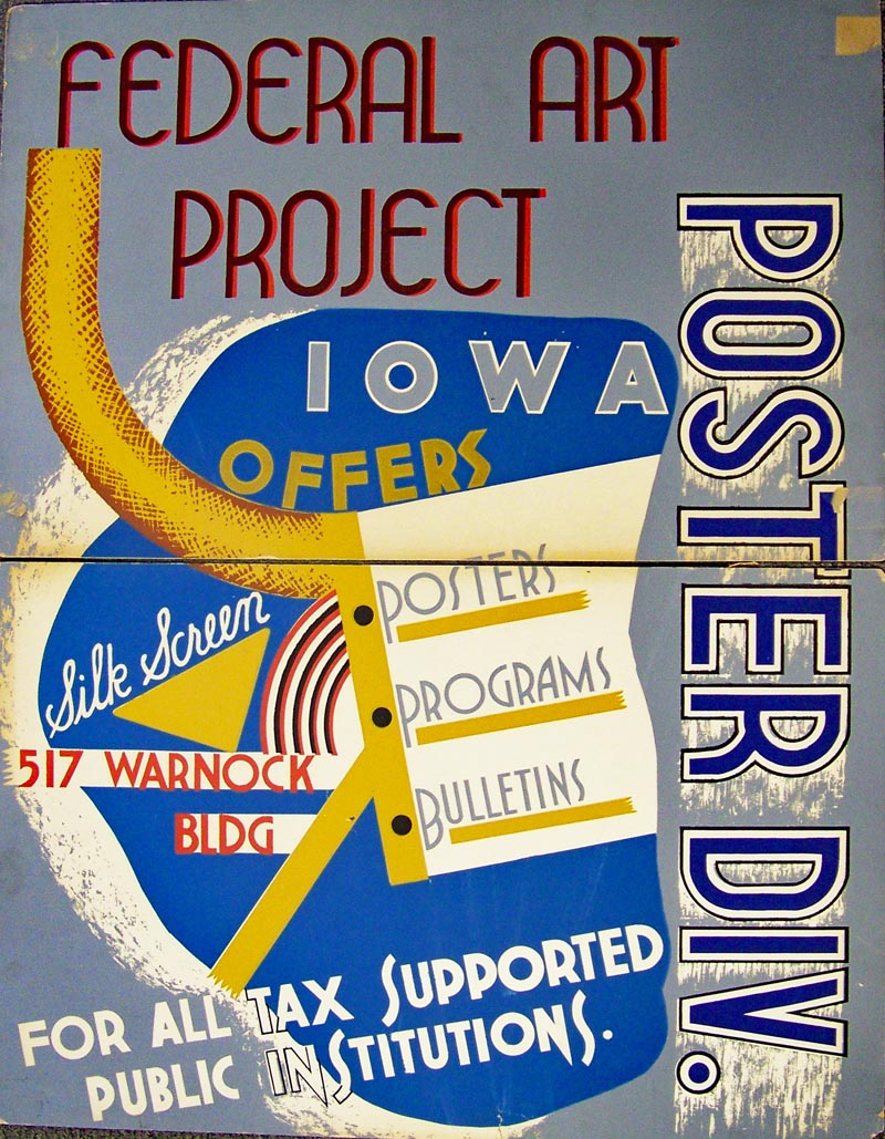 001wpa: Silk Screen poster "Iowa Offers Posters, Programs, and Bulletins." Very rare, two matching halves printed in poster board. Circa 1930s. Each half measures 22 x 14, but assembled, it measures 28 x 22 in. $375 |
021ia: 1854 Rare Iowa Public Survey. Hand colored antique sketch indicates survey progress by township. Produced by Surveyor General's Office. 23x19 in. $120 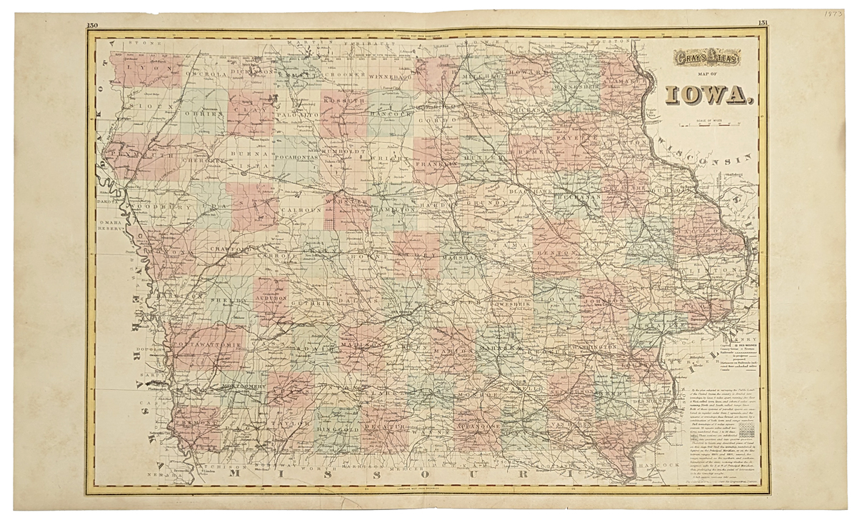 022ia: 1873 Iowa Map. Very handsome antique map by Gray. Hand tinted. Shows principal roads and railroads, color by counties. 27x17 in. $100 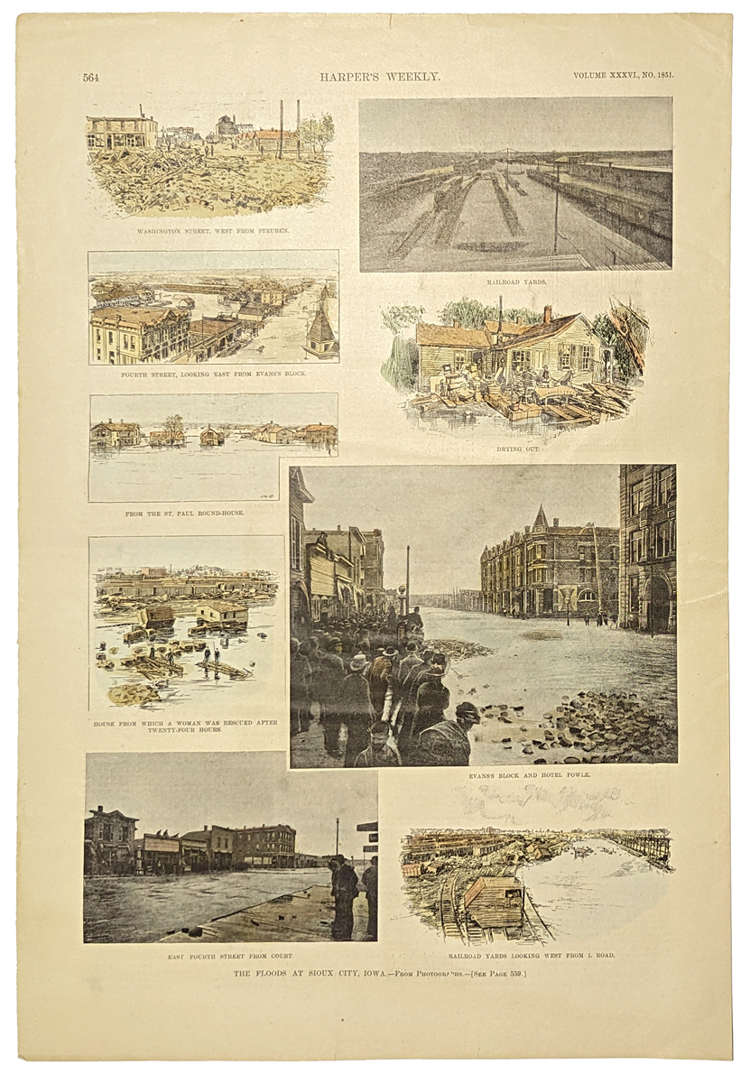 101ia: 1892 Sioux City Iowa Floods. Nine hand tinted images of the floods that destroyed much of Sioux City in 1892. From Harper's Weekly. 11x16 in. $50 
104ia: 1888 Scenes at Amana Colony, Iowa. Hand colored engraving from Harper's Weekly, showing four scenes at the religious Amana Colony in Homestead, Iowa, now famous for the manufacture of household appliances. 10x11 in. $40 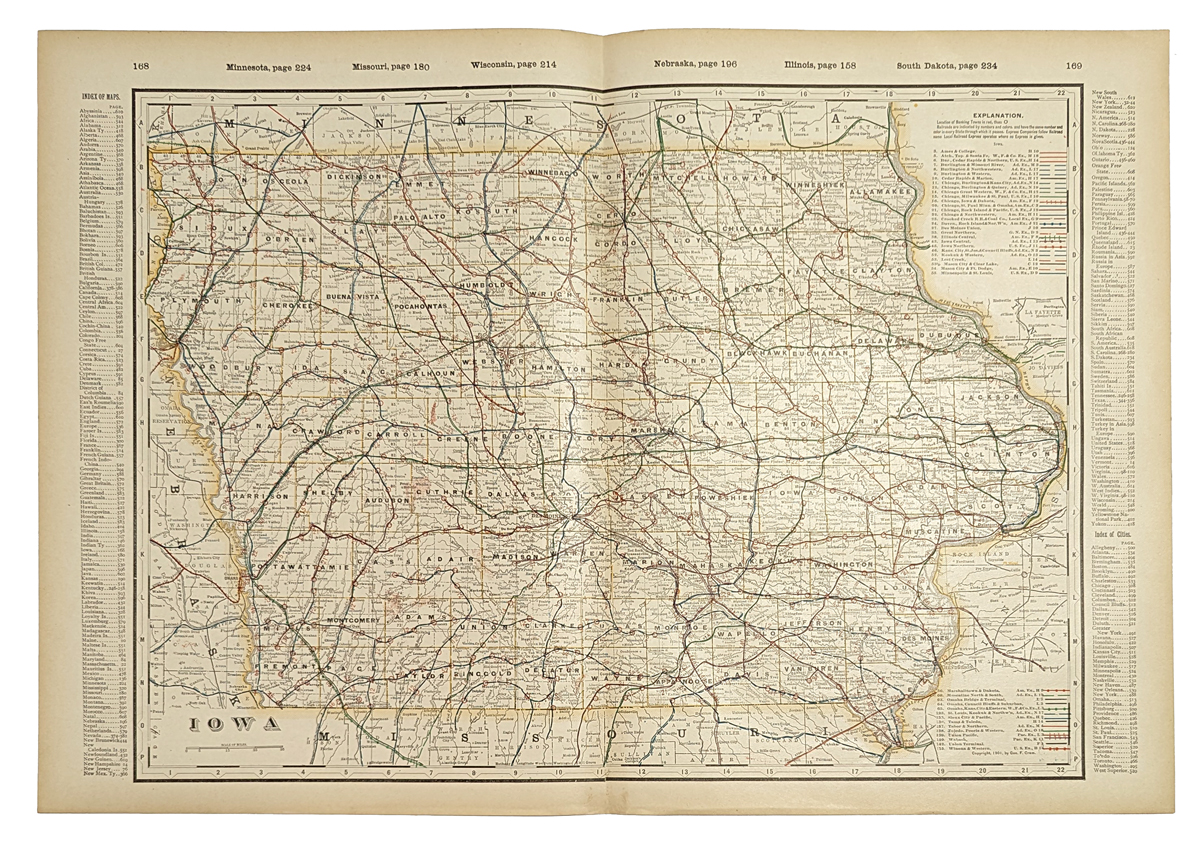 107ia: Detailed 1901 Railroad Map of Iowa. Beautiful map from the 1901 first edition of George Cram's folio-size world atlas. Color coded lines on the map show the names and locations of railroads throughout the state. State and county borders are outlined in yellow. Cities, towns and geographical features are all shown. This map would look great in a frame! 18x27 in. $100 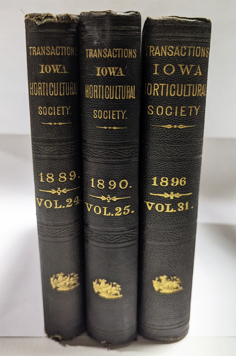
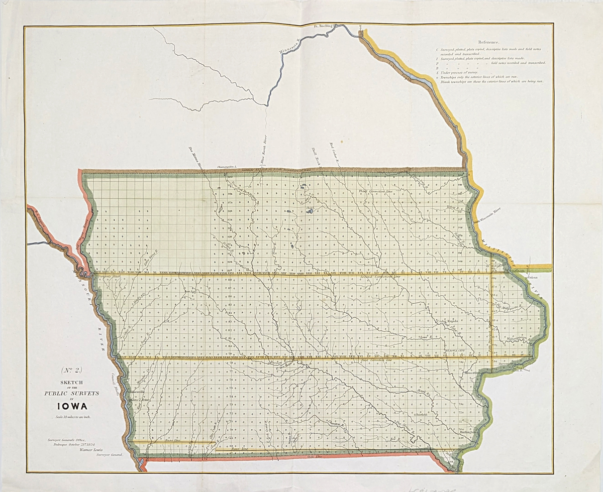
111ia: Farming - Iowa History. Three volumes: Transactions of Iowa Horticultural Society - 1889, 1890 & 1896. 24th, 25th and 31st annual sessions. Condition excellent, original black cloth binding with gold leaf title and decoration. 6-1/4 x 9 in. One map. All articles dealing with orchards, crops, trees, etc. With index. 1532 pages total. $30 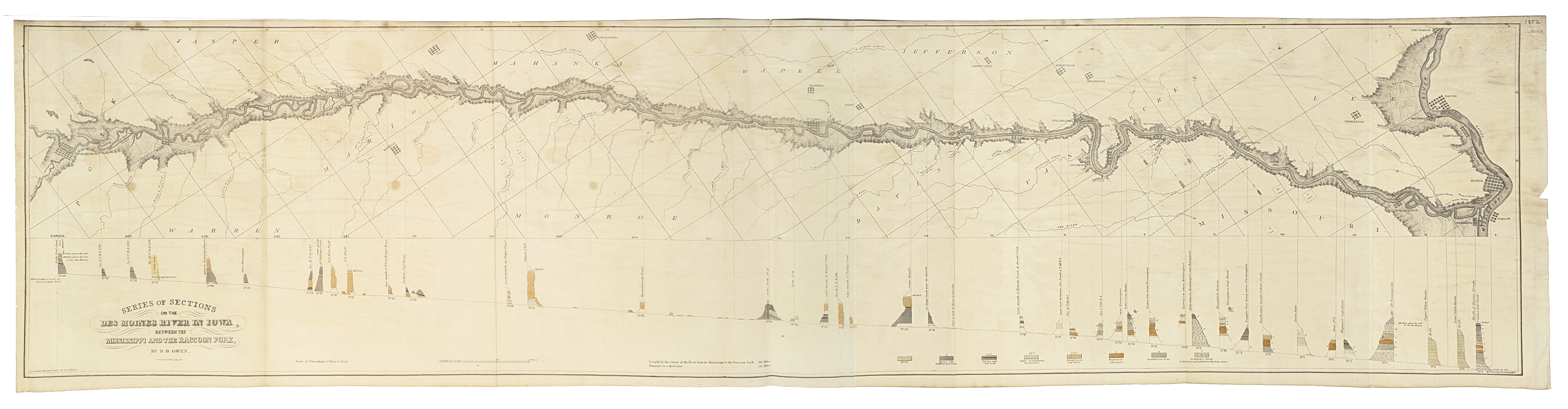 112ia: 1852 Series of Sections on the Des Moines River in Iowa, between the Mississippi River and Raccoon Fork by D.D. Owen with detailed geological observations. Map has great details, showing Ft. Des Moines, Red Rock, Ottuma, Warsaw, and Navou. 48 x 12 in. $325 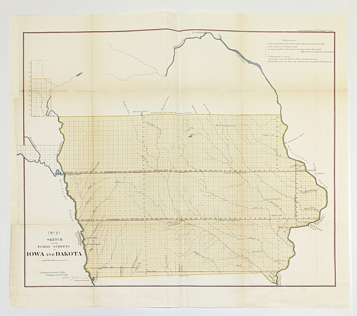 200ia: 1861 Survey Map of Iowa. This hand colored, lithographed map was published in 1861 by the US Government Surveyor's Office. The map is titled "Sketch of the Public Surveys in Iowa and Dakota." The entire state of Iowa is shown, and a very small portion of the Dakota Territory as well. All of the surveyed areas are overlaid with a grid pattern. Inside each square of the grid is a symbol indicating the progress that had been made in surveying that area. Rivers and lakes are shown throughout the surveyed areas. Cities shown are: Dubuque, Davenport, Muscatine, Burlington, Keokuck, Fairfield, Iowa City, Cedar Rapids, Fort Des Moines, Sargent's Bluff, Kanesville and Trader's Point. This map is in very good condition, printed on thin paper that was originally folded into a government report. There are creases along the original fold lines, some of which have been reinforced on the back with archival tape. Several of the creases have darkened slightly, but they are not visually distracting. The left margin has been extended with acid-free paper to facilitate framing. Size of this map is 19x22 in. $100 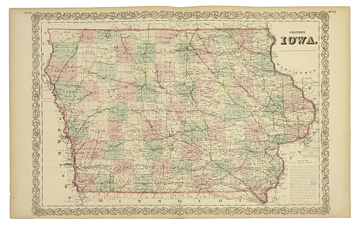 203ia: Hand colored Iowa state map, published by J.H. Colton & Co. in 1855. Counties separated by color, attractive border around map. Hand colored, lithograph. 15 x 23 in. $150 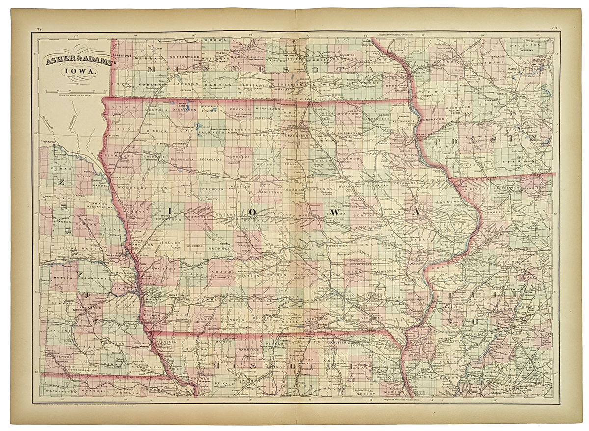 204ia: Beautiful 1872 map of Iowa. Published by Asher & Adams in the New Statistical and Topographical Atlas of the United States. Original hand coloring. 17.5x24.5 in. $100 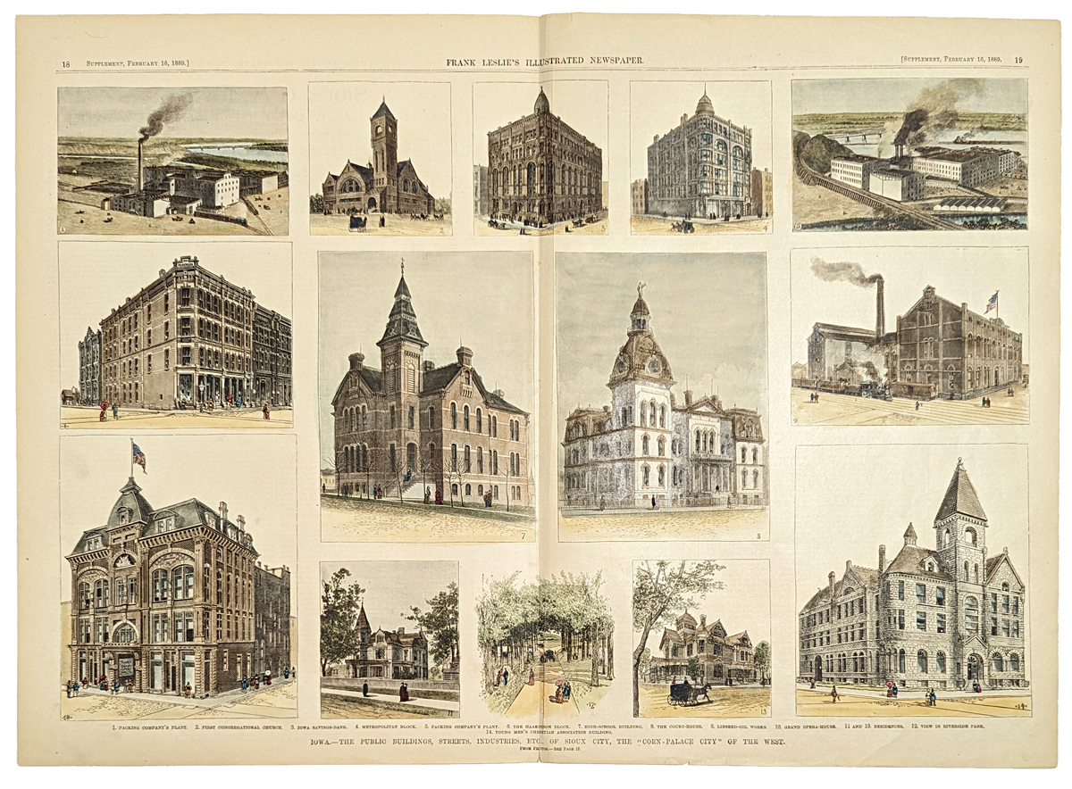 205ia: 1889 Sioux City Iowa Scenes. Hand colored, engraved scenes from Frank Leslie's Illustrated Newspaper. Title is "Iowa: The Public Buildings, Streets, Industries, etc. of Sioux City, the Corn Palace of the West." Major buildings and other landmarks in the city are shown. 16x22 in. $120 |
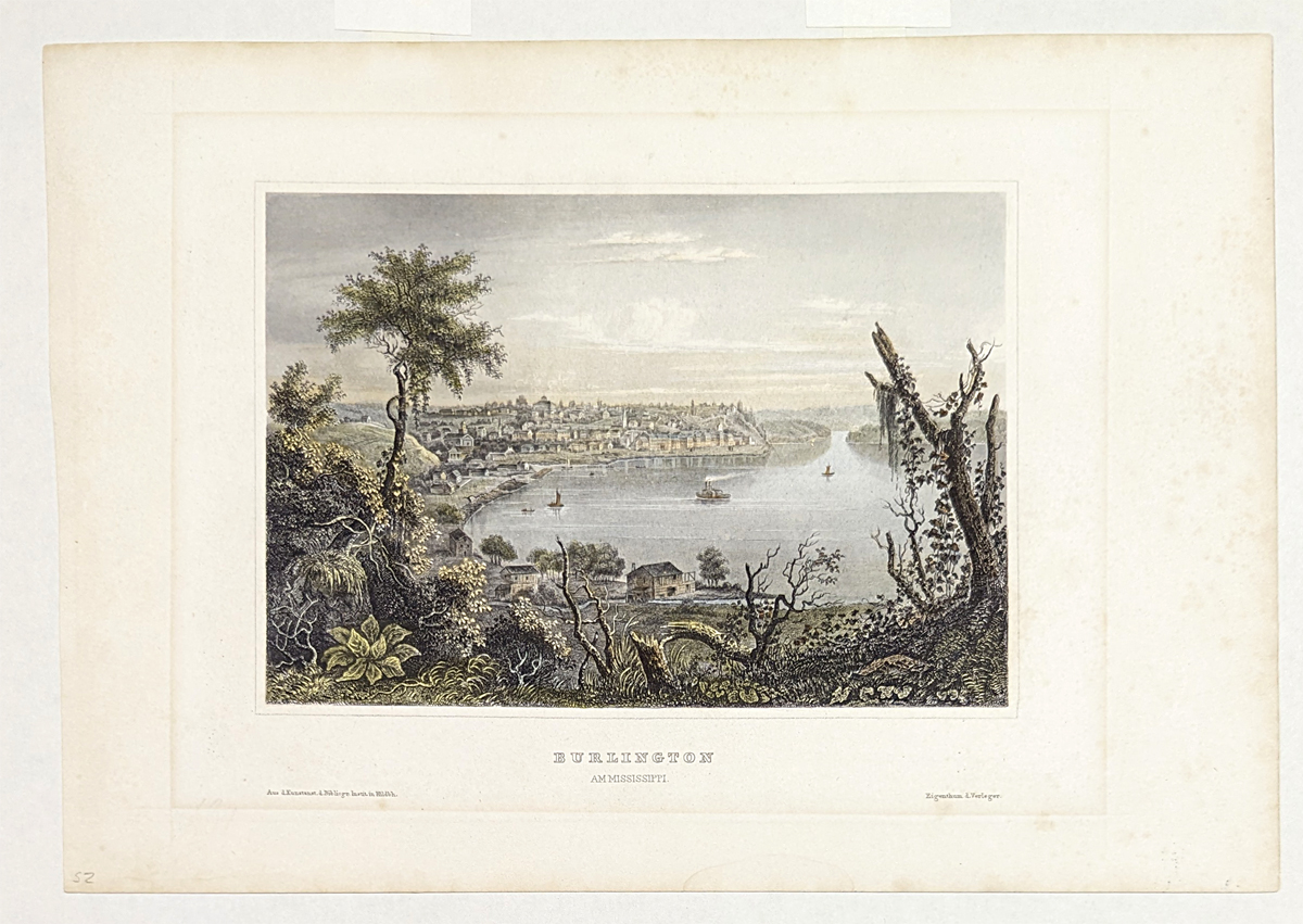 207ia: C.1855 Burlington, Iowa hand colored steel engraving by Hermann J. Meyer. Measured with mat. 13 x 11 in. $85 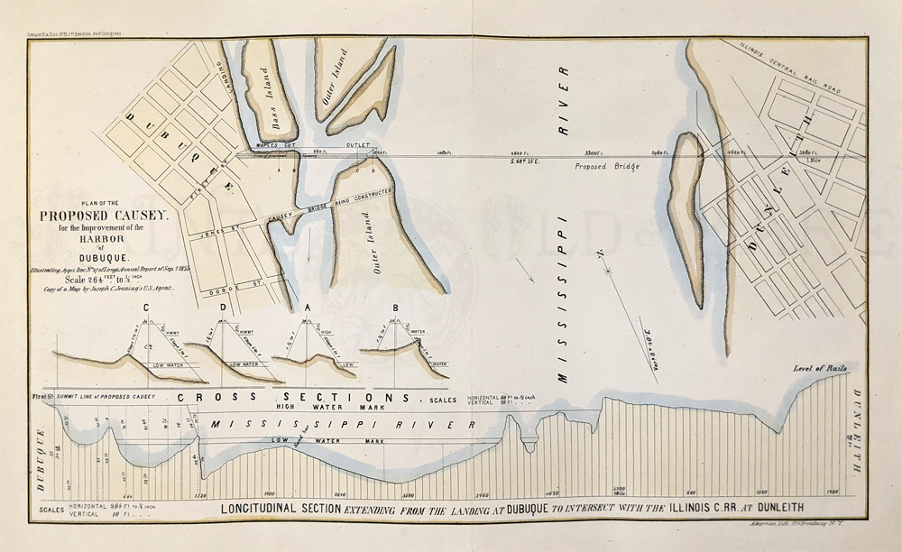 209ia: Dubuque Harbor 1855 "Proposed Causey." Shows a proposed link from Iowa to Illinois Central RR at Dunleith. Hand colored, lithograph. 10 x 15 1/4 in. $150 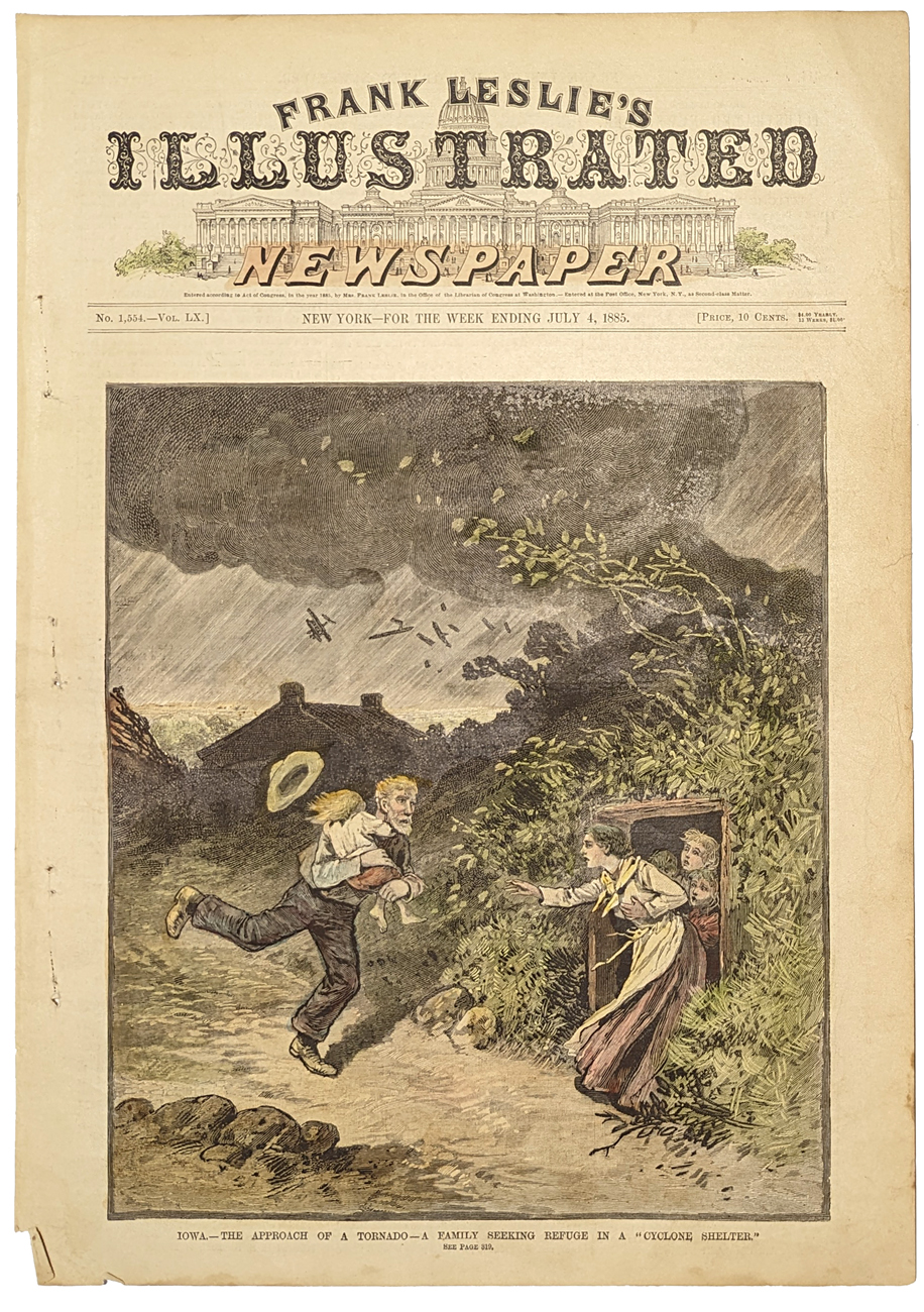 210Iowa: The Approach of a Tornado - A family seeking refuge in a "Cyclone Shelter", Iowa. 1885 Frank Leslies'. Hand colored, wood engraving. 11 x 16 in. $80 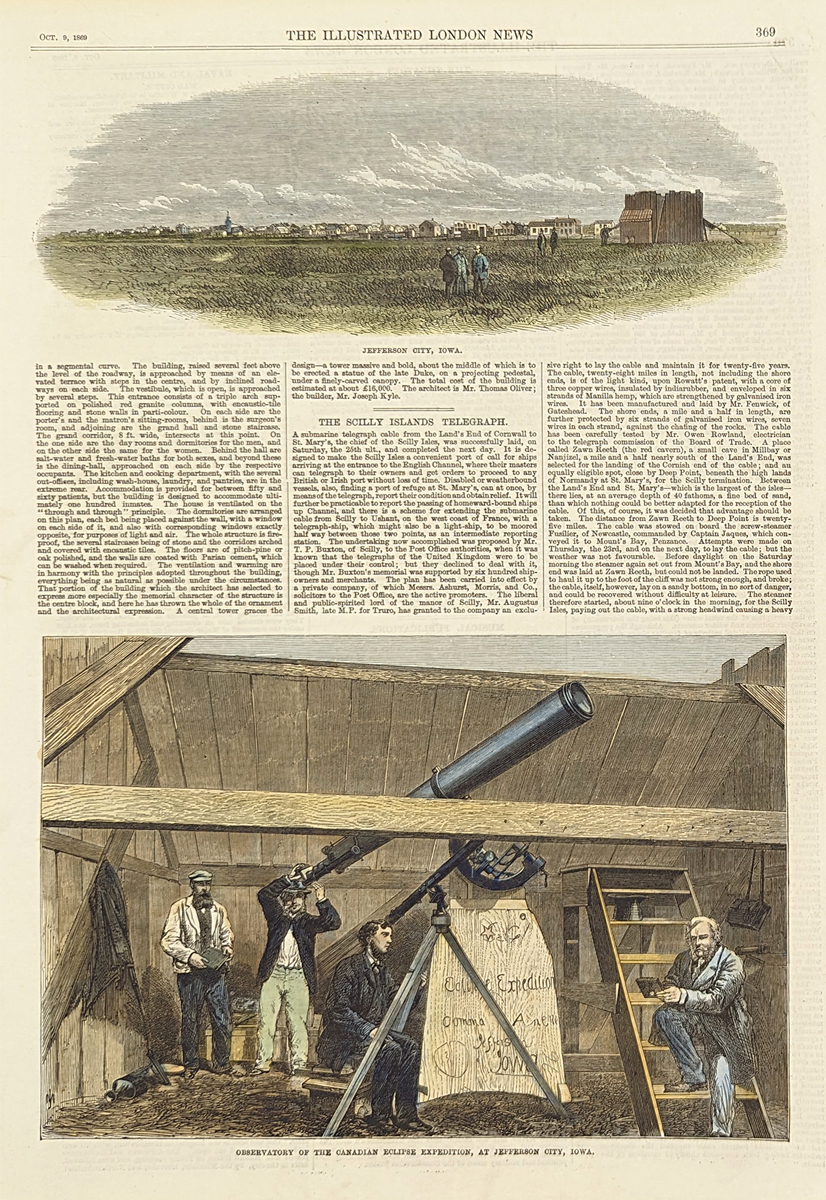 211Iowa: Jefferson City, Iowa view - Observatory of the Canadian Eclipse Expedition, at Jefferson City. 1869 Illustrated London News. Hand colored, wood engraving. 10 7/8 x 15 1/2 in. $60 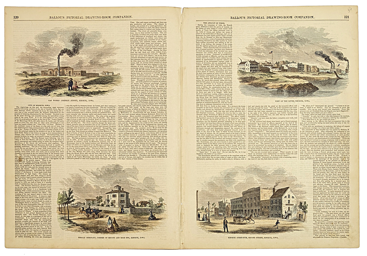 212Iowa: 4 Views of Keokuk, Iowa. Gas Works Johnson Street, Keokuk. Female Seminary, Corner of Second and High STS, View of the Levee, Keokuk Anthemaeum, Second Street, Iowa. 1856 Ballou's Pictorial Drawning-Room. Hand colored, wood engraving. 15 x 22 in. $80 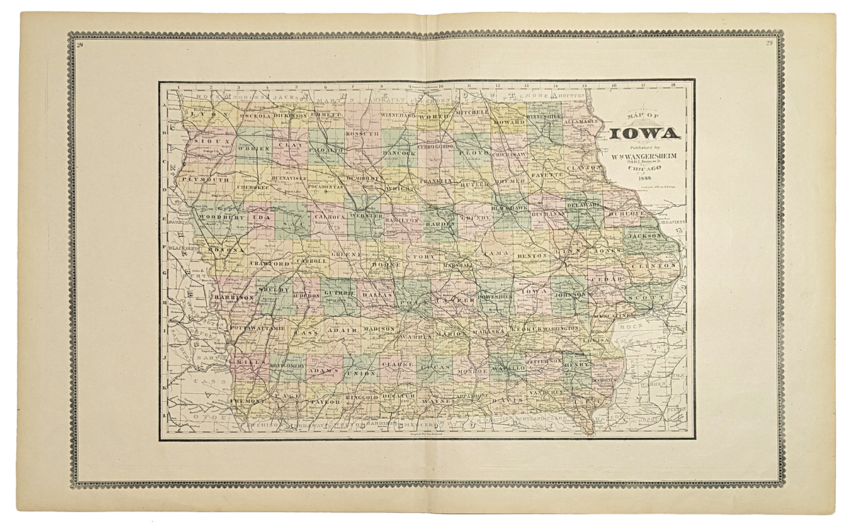 213Iowa: Map of Iowa. 1889 Wangersheim. Hand colored, lithograph. Showing Shows towns, railroads, townships, post offices, etc. 17 3/4 x 28 7/8 in. $100 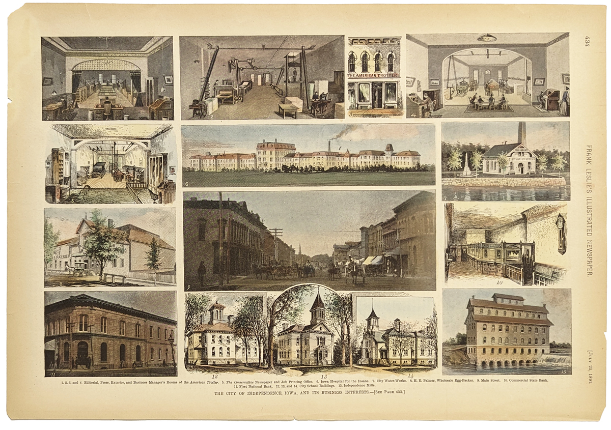 214Iowa: The City of Independence, Iowa, and its Business Interests. 14 views of various rooms, buildings, banks, etc. 1891 Frank Leslies'. Hand colored, wood engraving. 11 x 15 3/8 in. $60 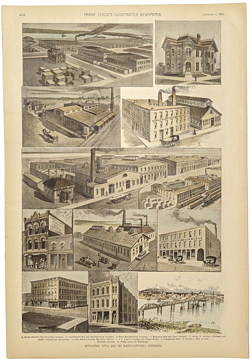 215Iowa: Muscantine, Iowa, and it's manufacturing interests. 10 views of the various companies and Bridge across the Mississippi. 1891 Frank Leslies'. Hand colored, wood engraving. 11 x 15 7/8 in. $60 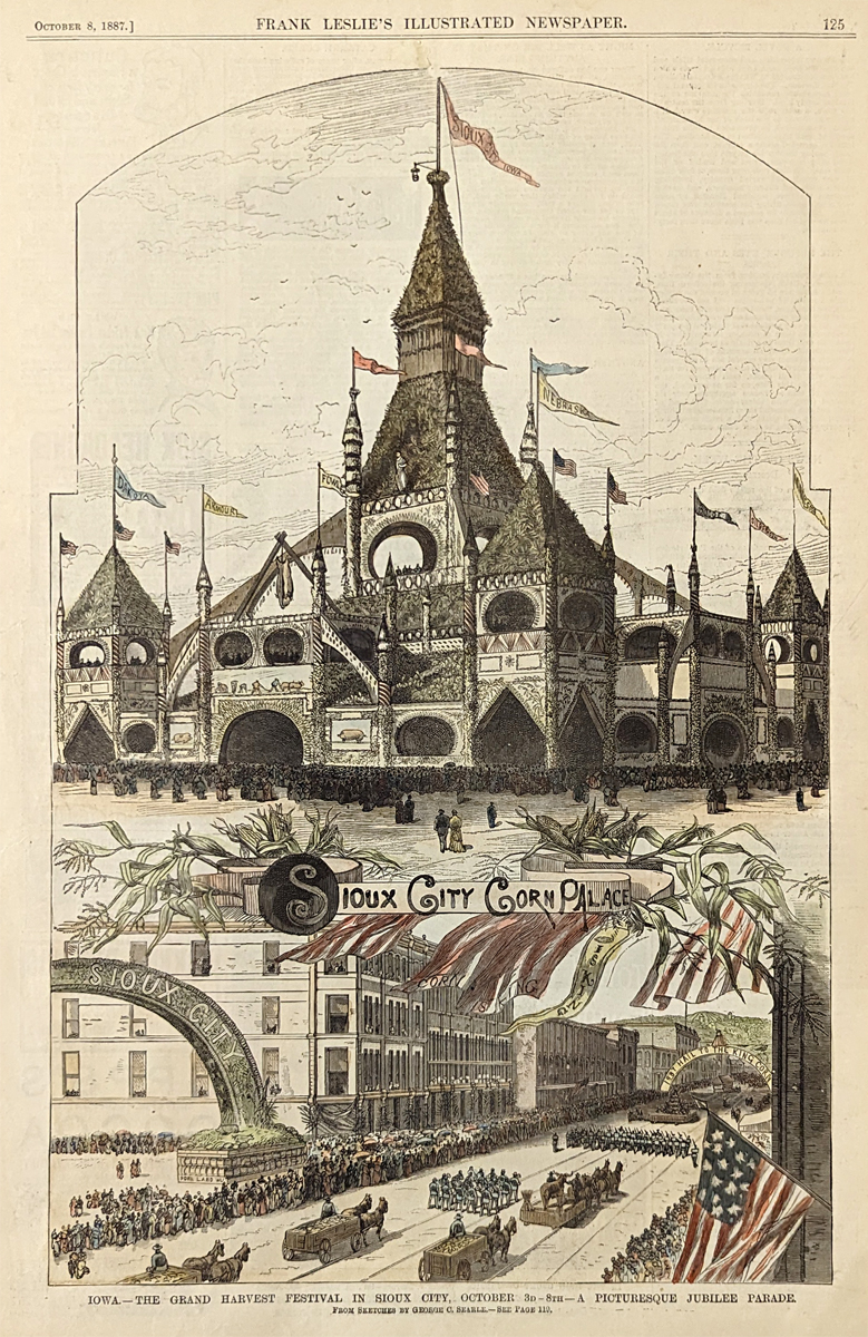 216Iowa: The Grand Harvest Festival in Sioux City, Iowa. October 3-8th - a Pictureque Jubilee Parade. Hand colored, wood engraving. 10 3/8 x 15 3/4 in. $60 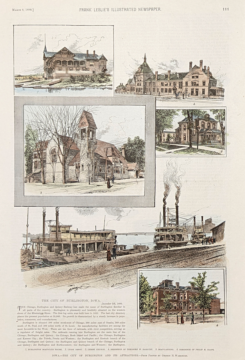 217Iowa: The City of Burlington and it's attractions. 6 views of the various houses, residences, etc. 1890 Frank Leslies'. Hand colored, wood engraving. 10 3/4 x 15 5/8 in. $60 |
|||||||||
| Order Form | |||||||||||
| Back to Homepage | |||||||||||