 
|
|||||||||||
This is a small selection of our inventory of antique Kansas maps and prints. Additional inventory is available. Contact us with your request. 1-800-879-6277
|
|||||||||||
|---|---|---|---|---|---|---|---|---|---|---|---|
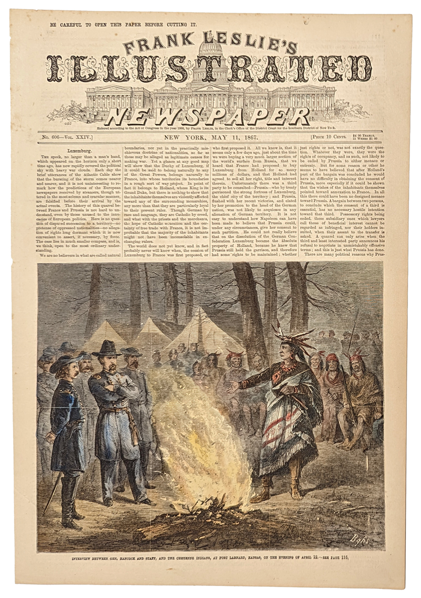
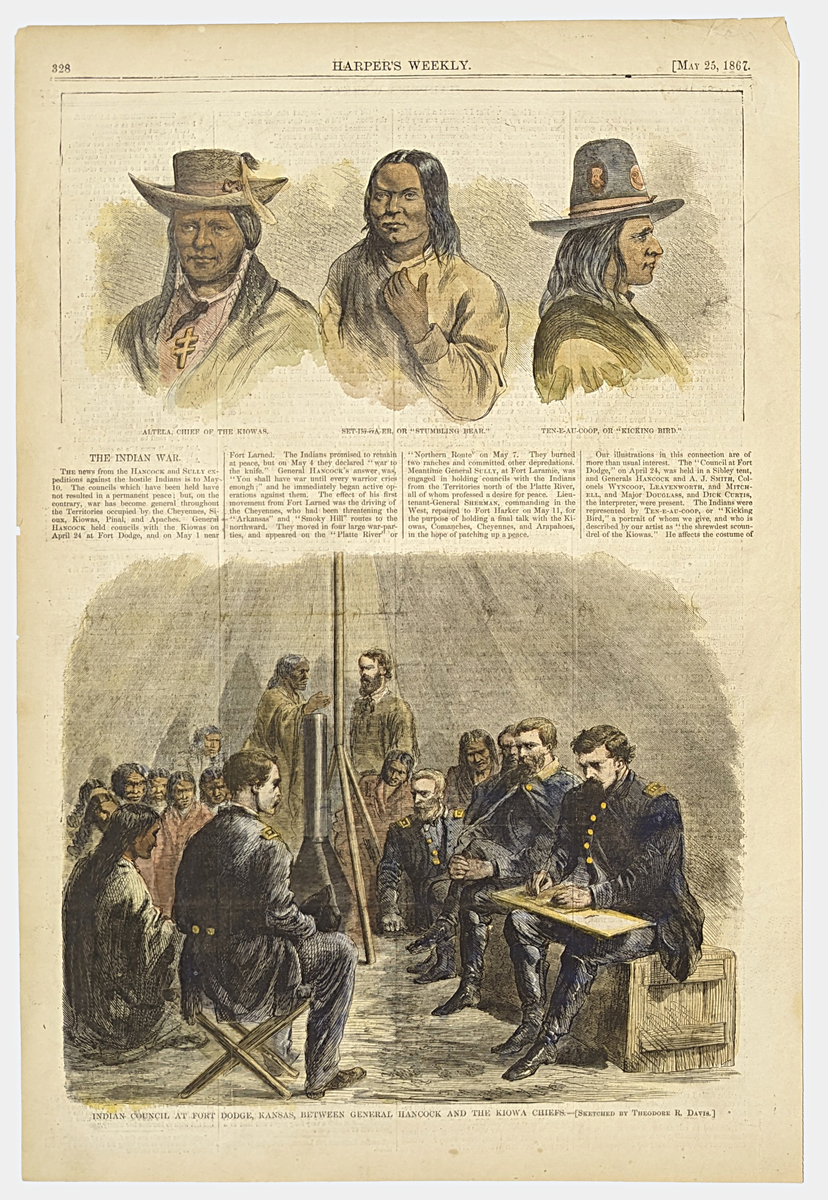 001ks: 1867 Kansas, Early Indian war view. Shows council by General Hancock with Indians at Fort Dodge, plus three portraits of the Indian leaders. Hand colored antique Harper's engraving. 10-1/2x15-1/2 in. $50 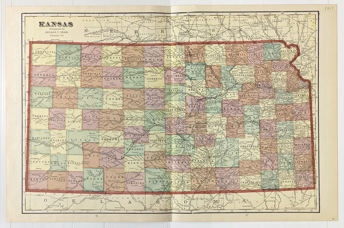
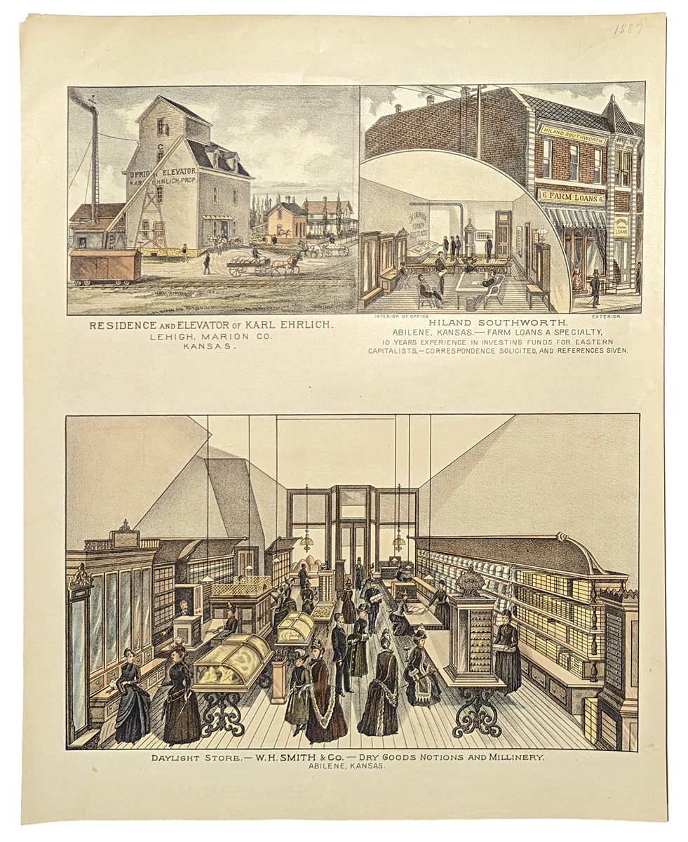
003ks: 1887 Cram's Map of Kansas. Color lithograph. 14x22 in. $40 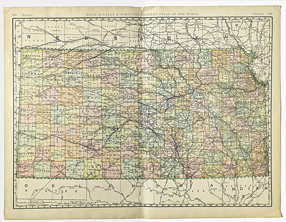 004ks: 1902 Large railroad map of Kansas. Very detailed, litho color by Rand McNally. 21x27 in. $80 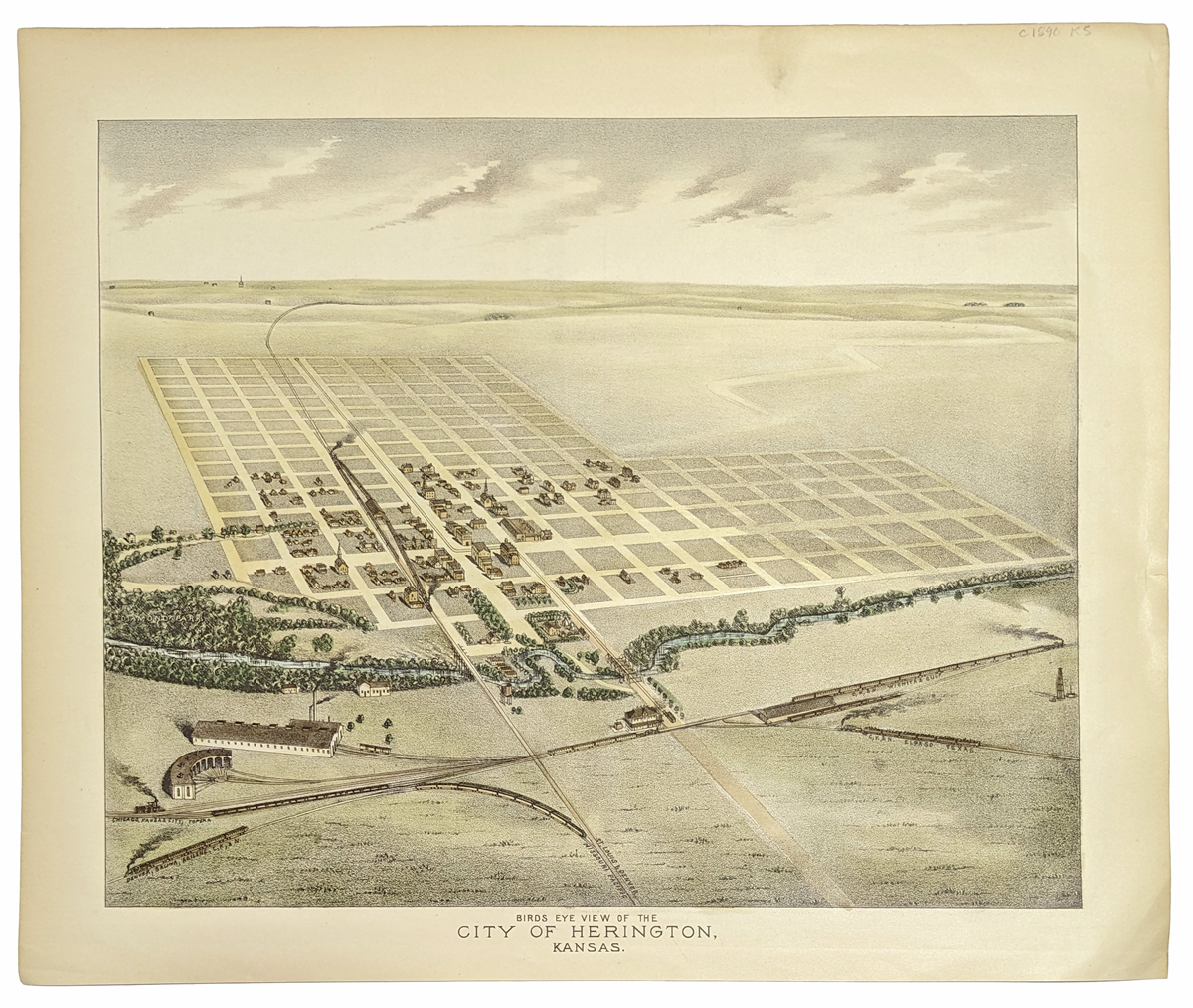 007ks: Bird's-eye view of Herington, Kansas, 1894. Hand colored view clearly shows the precise grid system of old streets, typical for Kansas. 13-1/2x17 in. $60 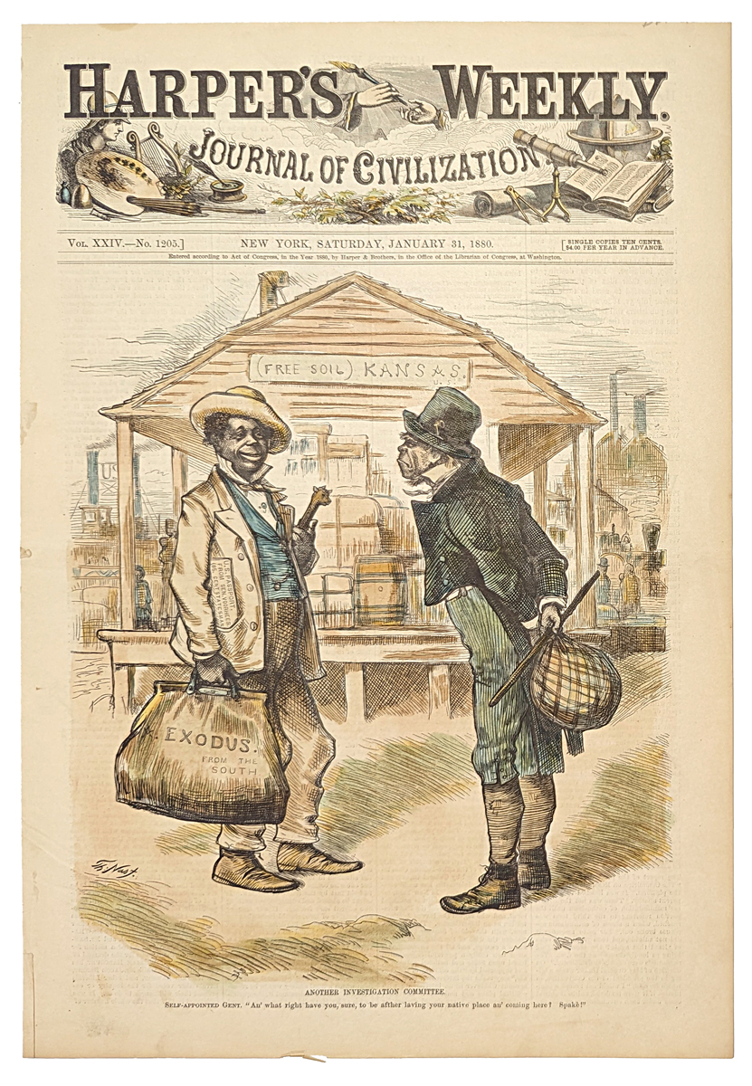 008ks: Underground Railroad, Kansas 1880. The Free Soil state attractive to Blacks met some opposition as shown in this hand colored Thomas Nast cartoon. Harper's front page. 11x16 in. $50 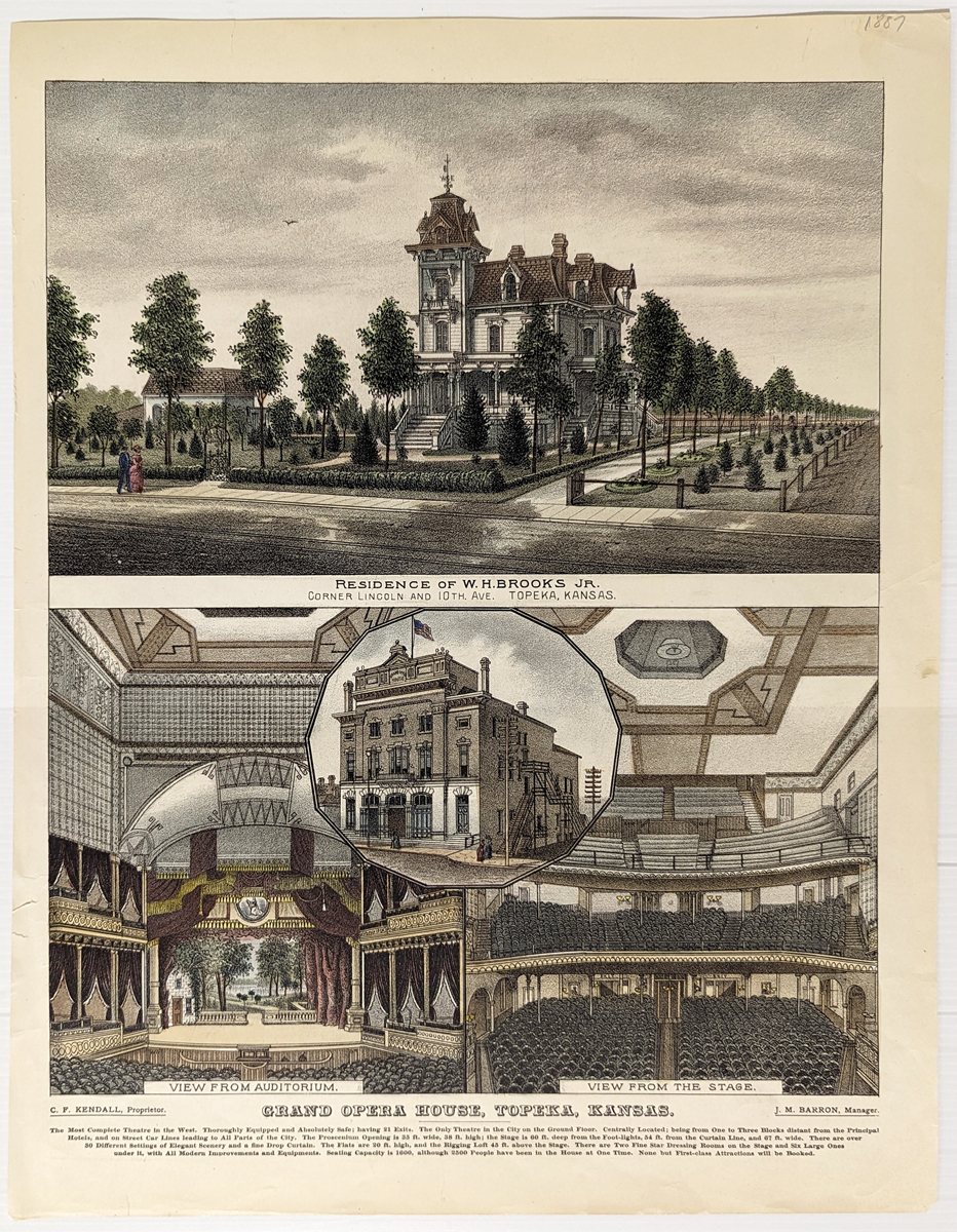 011ks: Topeka 1892. Hand colored lithograph. Views of the Grand Opera House and Residence. 13-1/2x17 in. $80 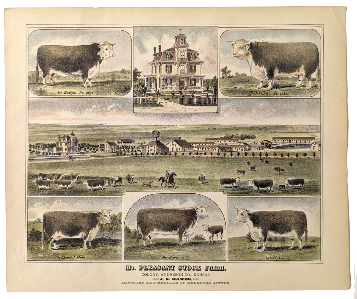 013ks: 1894 Kansas Stock Farm. Several excellent hand colored views of large farm. 11x16 in. $80 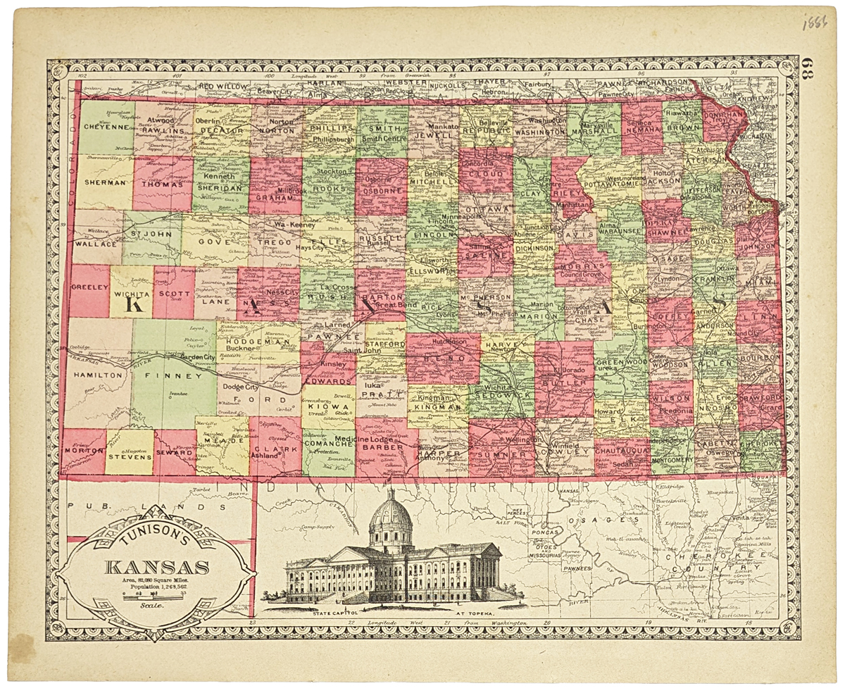 015ks: Kansas Map by Tunison. Vivid original color by county. Engraved picture of of State Capitol at Topeka. 14x11-1/2 in. $80  019ks: 1890 Kansas- Views in Arkansas City. Nine hand colored engravings show: Fifth Ave. Hotel, Opera House, Newman's Residence, Water Works, First National Bank and Street, manufacturies on canal, Head Gas on canal, Walnut River, City Building. This unique engraving is from the March, 1890 edition of Fank Leslie's Illustrated. size: 11x16 in. $60 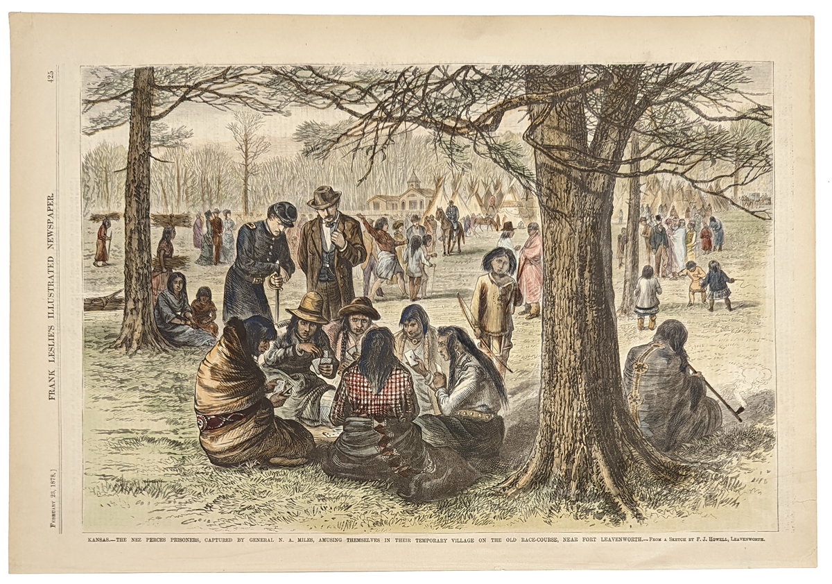 020ks: 1878 Rare hand colored wood engraving showing Nez Perces prisoners, captured by General N.A. Miles, playing cards in their temporary village. Featured in Frank Leslie's Illustrated Newspaper. 17 x 11 in. $90 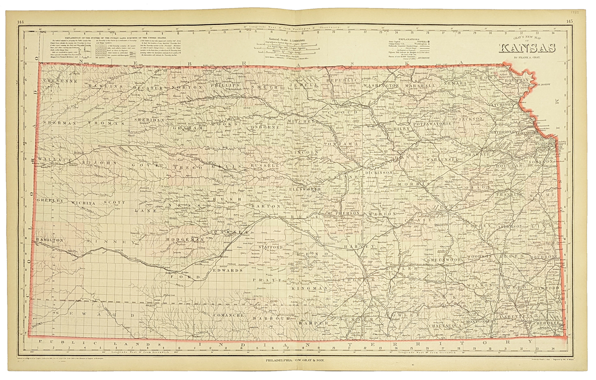
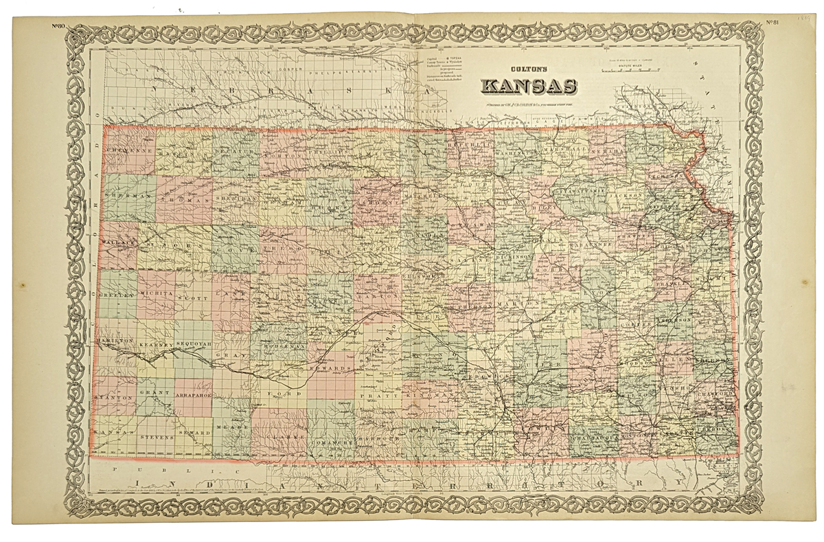
021kansas: 1885 O.W. Gray & Son hand colored New Map of Kansas, published by Gray. Top of map has Explanations of various attributes. 28 x 17-1/2 in. $180 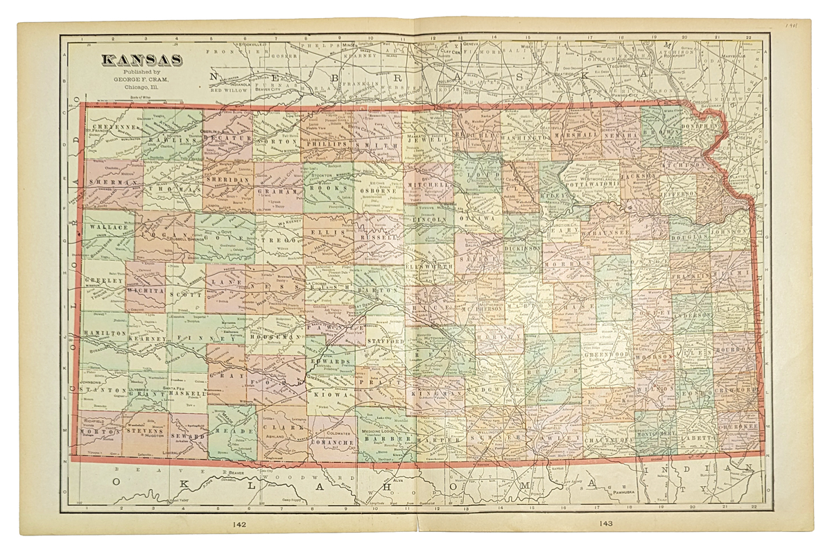
023kansas: 1901 Color Kansas map, published by George F. Cram. Each county is a different color. 22 x 14-1/2 in. $40 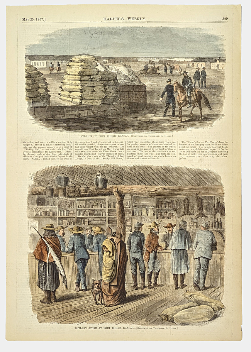
024kansas: 1867 Hand colored wood engraving from Harper's Weekly showing the Interior of Fort Dodge, Kansas in upper immage and lower image shows Sutler's Store at Fort Dodge, Kansas. Both are originally sketched by Theodore R. Davis. 15-1/2 x 10-1/2 in. $60 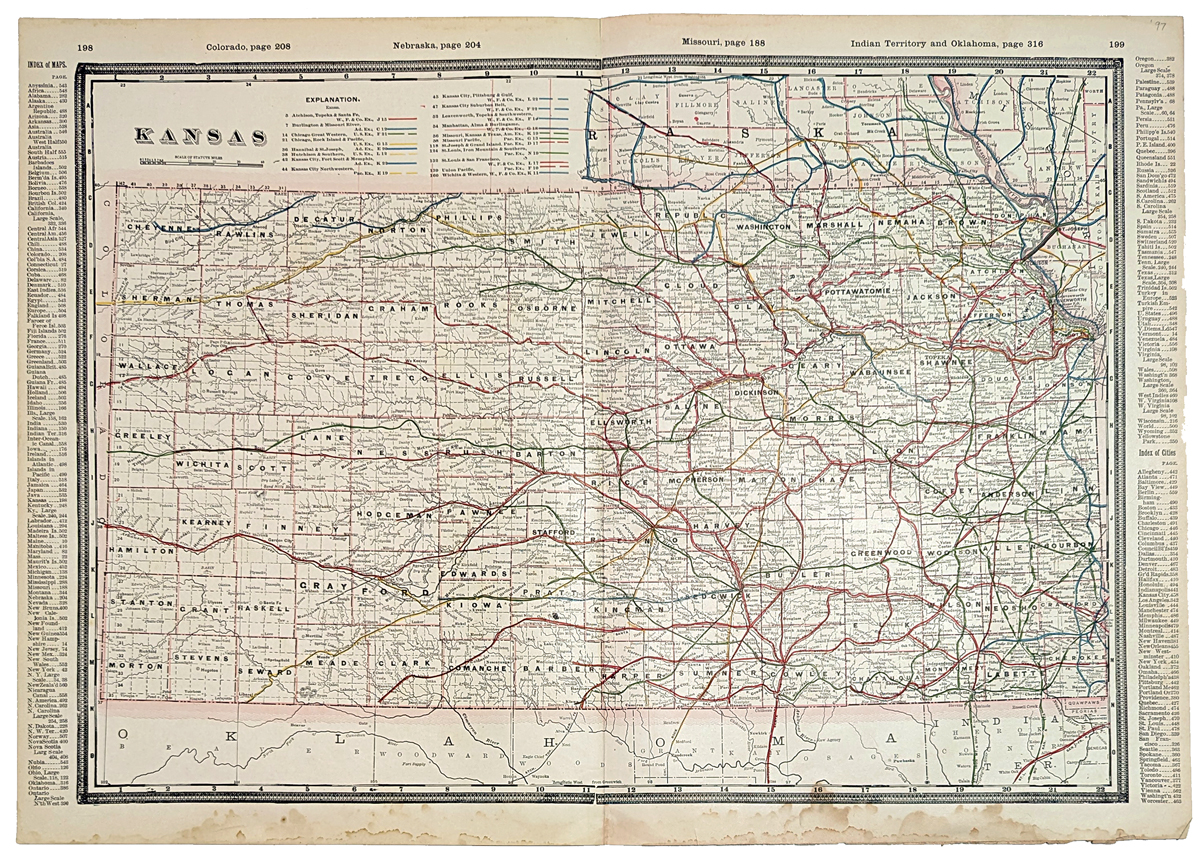
025kansas: 1897 Color map of Kansas with the Explanation of the railroads shown on top left of map. 25 x 17-1/2 in. $100 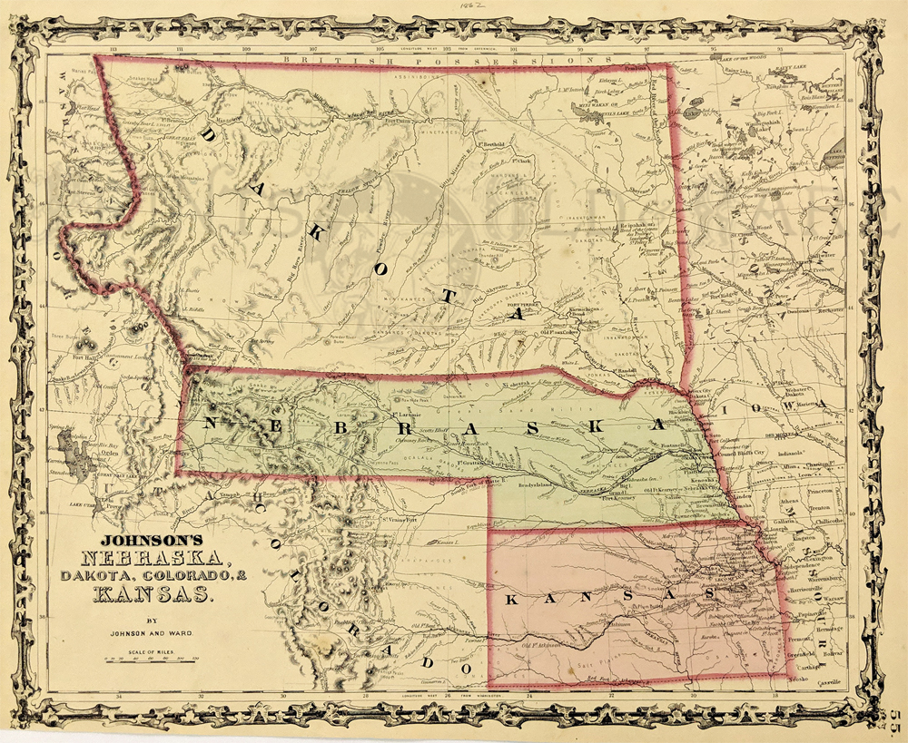 213Nebraska: 1862 Johnson's Nebraska, Dakota, Colorado, & Kansas. Showing an early configuration of the region, Nebraska extends as far as Salt Lake City. Northern half of the region is shown as part as the Dakota Territory, one year before the Idaho Territory was broken off. Other details include rivers, towns, forts, Indian tribes and trails. Hand colored, lithograph. 12 1/2 x 15 3/8 in. $300 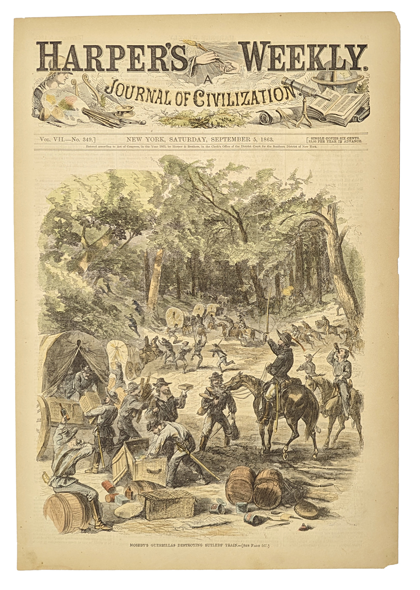 026kansas: 1863 Hand colored wood engraving titled, "Moseby's Guerrillas Destroying Sutlers' Train." Featured in Harper's Weekly, A Journal of Civilization. 15-1/2 x 11 in. $60 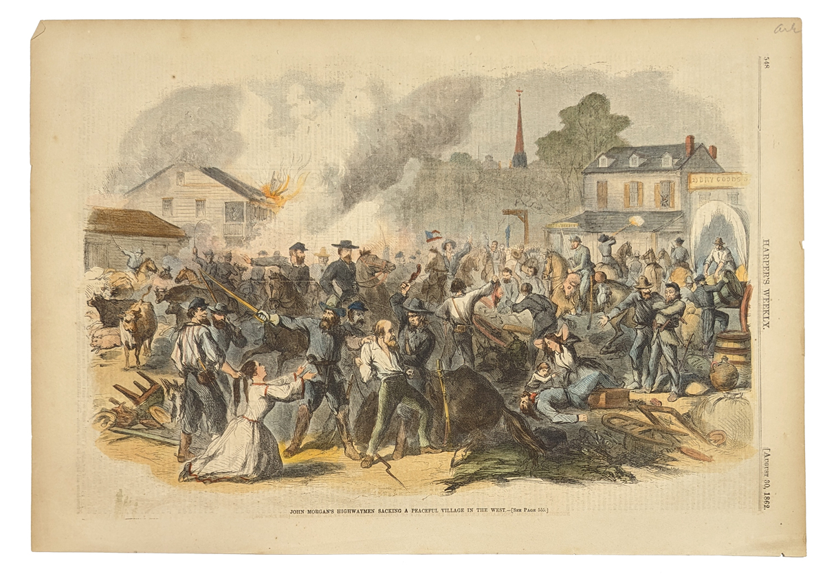 027kansas: 1862 Harper's Weekly hand colored wood engraving titled, "John Morgan's Highwaymen Sacking A Peaceful Village in the West." Featured in Harper's Weekly. 16 x 11 in. $60 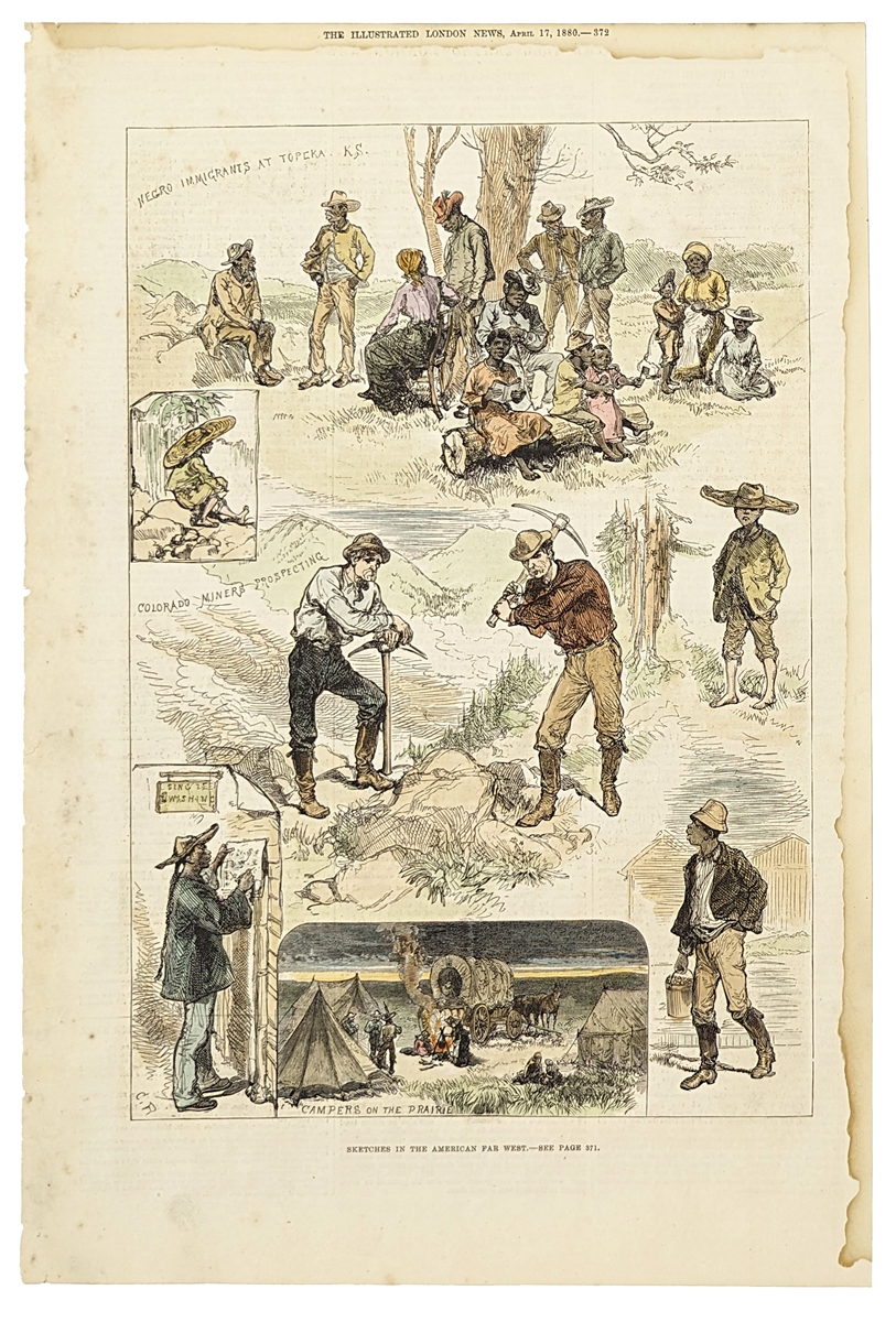 028kansas: 1880 Hand colored wood engraving showing SKetches in the American Far West. Top sketch shows "Negro Immigrants at Topeka, Ks. Featured in The Illustrated London News. 15-1/2 x 10-1/2 in. $50 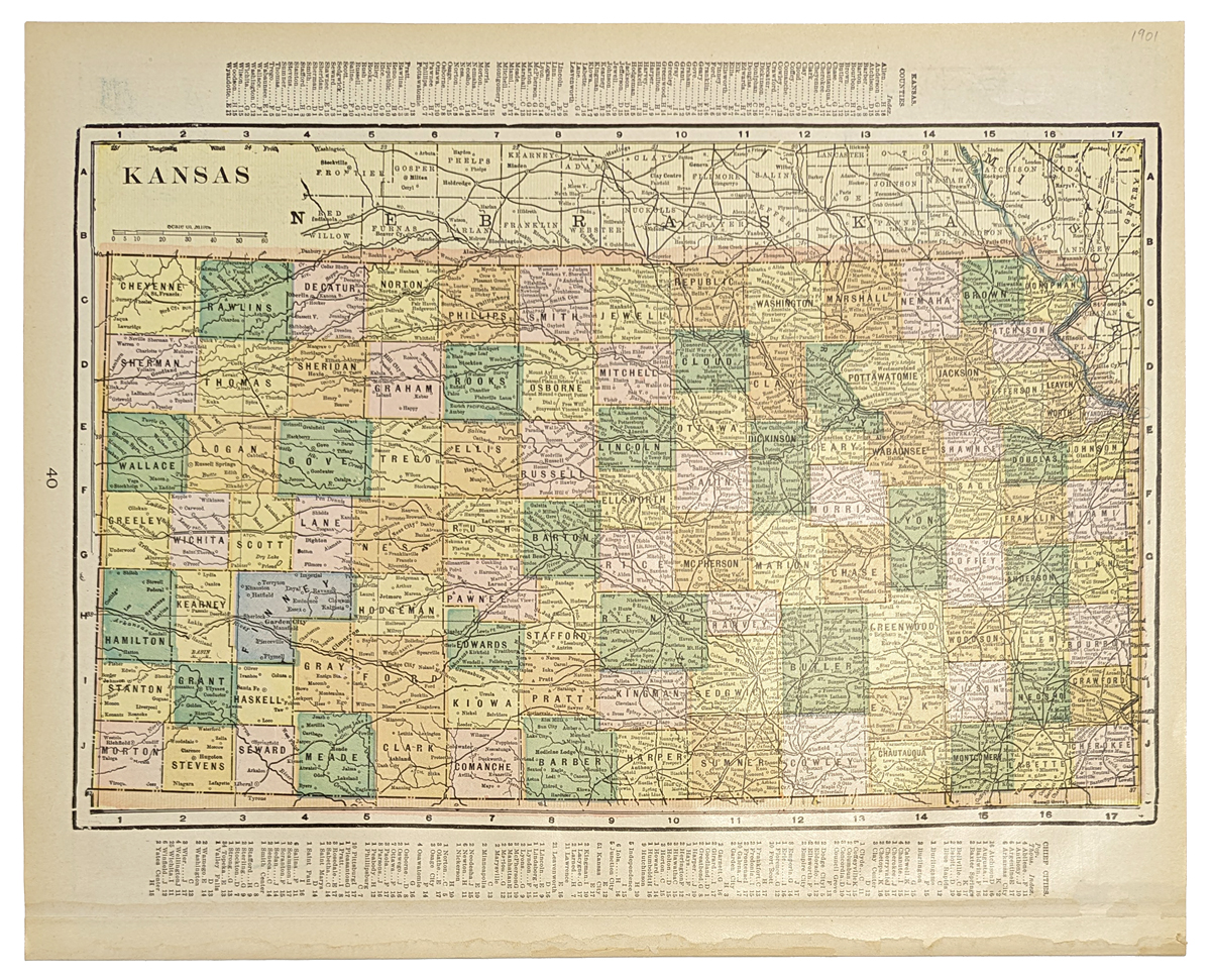
1153ks: 1901 Map of Kansas. Map of Kansas (1901). Color: Printed in Color. Type: Lithograph. Size: 14x11 in. $20
|
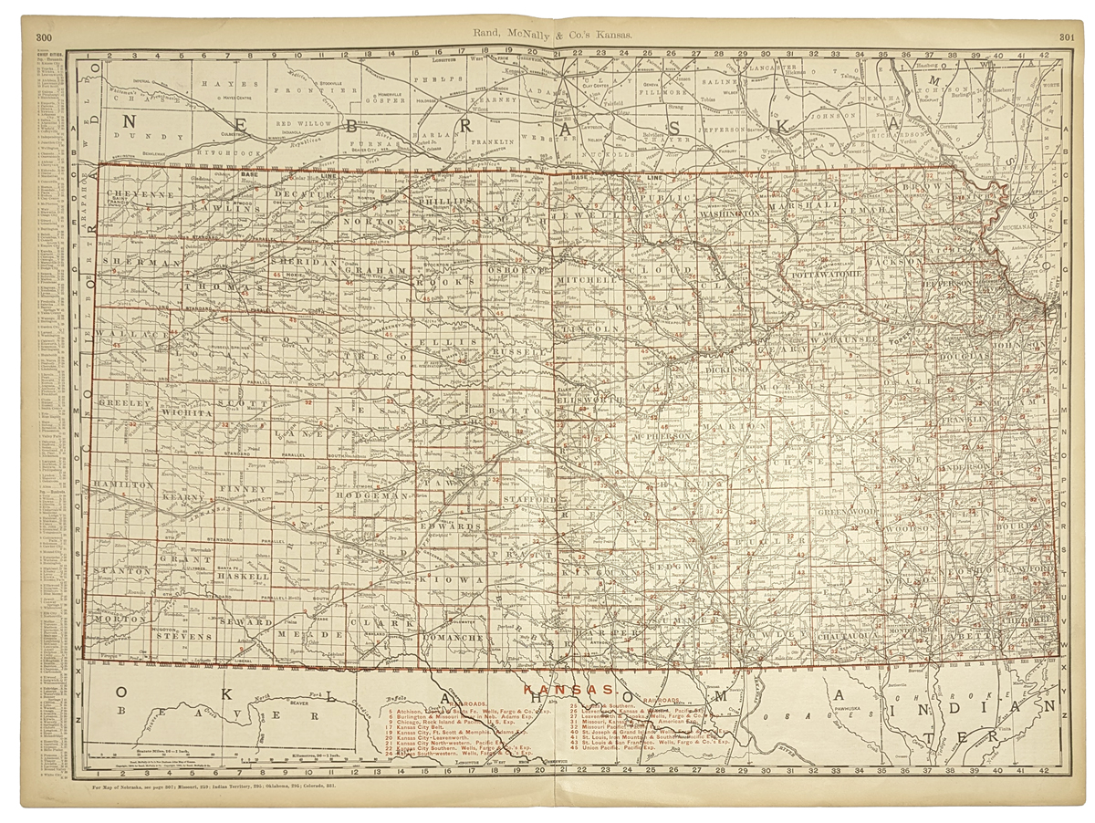
101ks: 1901 Railroad Map of Kansas. Detailed map of Kansas from the 1901 edition of Rand McNally's Commercial Atlas. Railroad lines are shown throughout the state, and each line is identified with the name of the company that owned it. 21x28 in. $80 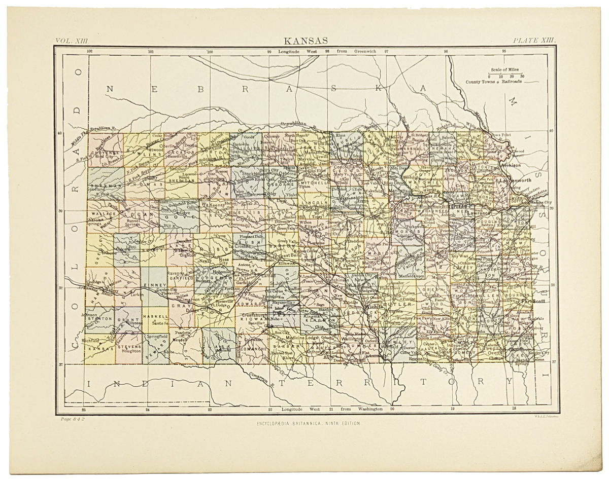 102ks: 1885 Kansas Map. Colorful map of Kansas from the Encyclopaedia Britannica, circa 1885. Each county is colored separately. Cities, towns, rivers and railroad lines are shown throughout the state. 9x11 in. $30 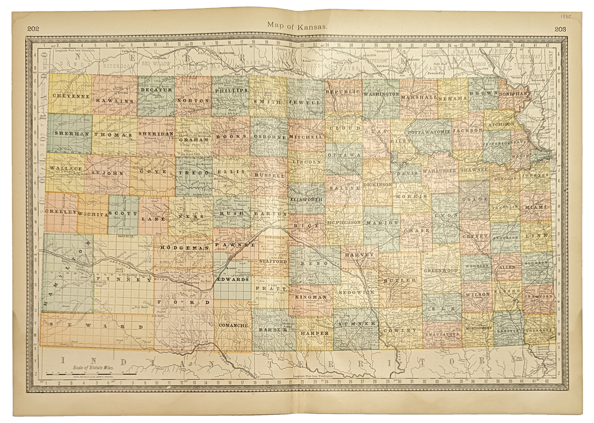 104ks: 1888 Rand McNally Map of Kansas. Nice map of Kansas, with each county colored separately, published by Rand McNally in 1888. Cities, towns, rivers and railroad lines are all marked. Entire map image is surrounded by a decorative border. 14x21 in. $40 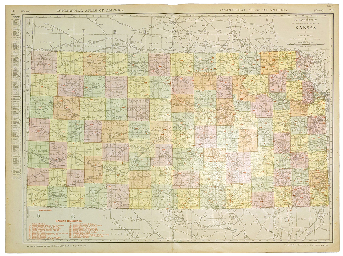
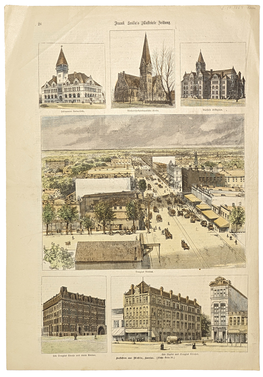
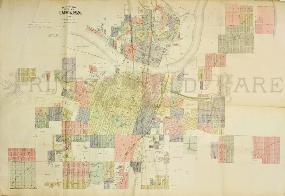
107ks: 1917 Kansas Railroad Map. Large, colorful map of Kansas from the 1917 edition of Rand McNally's Commercial Atlas. Railroad lines are featured throughout the state, with the names of the companies that owned each line given in a key at the bottom. Also shows cities, towns and rivers. 20x27 in. $60 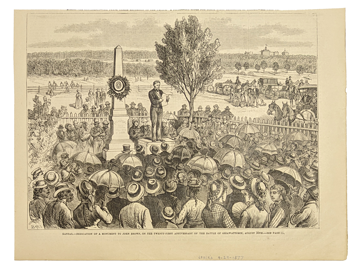 109ks: 1877 John Brown Memorial Dedication. Engraved scene from Frank Leslie's Illustrated Newspaper, titled "Kansas: Dedication of a Monument to John Brown, on the Twenty-First Anniversary of the Battle of Ossawattomie, August 30th." Shows a large crowd gathered to honor the memory of the famous Kansas abolitionist. $20 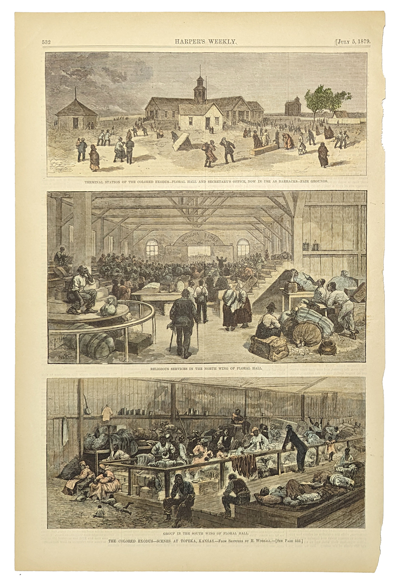 112ks: 1879 Black History: Topeka Kansas Scenes. Fascinating, hand colored engraving from Harper's Weekly, showing African Americans who left the Southern states to live and work in Kansas. Title of the print is "The Colored Exodus: Scenes at Topeka, Kansas." Each of the three images has its own caption: 1) "Terminal Station of the Colored Exodus: Floral Hall and Secretary's Office, Now in Use as Barracks." 2) "Religious Services in the North Wing of Floral Hall;" and 3) "Group in the South Wing of Floral Hall." 11x16 in. $60 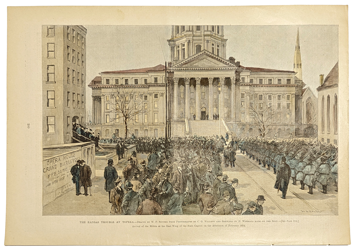 113ks: 1890 Topeka Kansas Civil Unrest. Hand colored engraving from Harper's Weekly, circa 1890, titled "The Kansas Trouble at Topeka. Arrival of the Militia at the East Wing of the State Capitol on the Afternoon of February 16th." Shows troops marching in front of the capitol building, as a large crowd watches. 11x16 in. $50 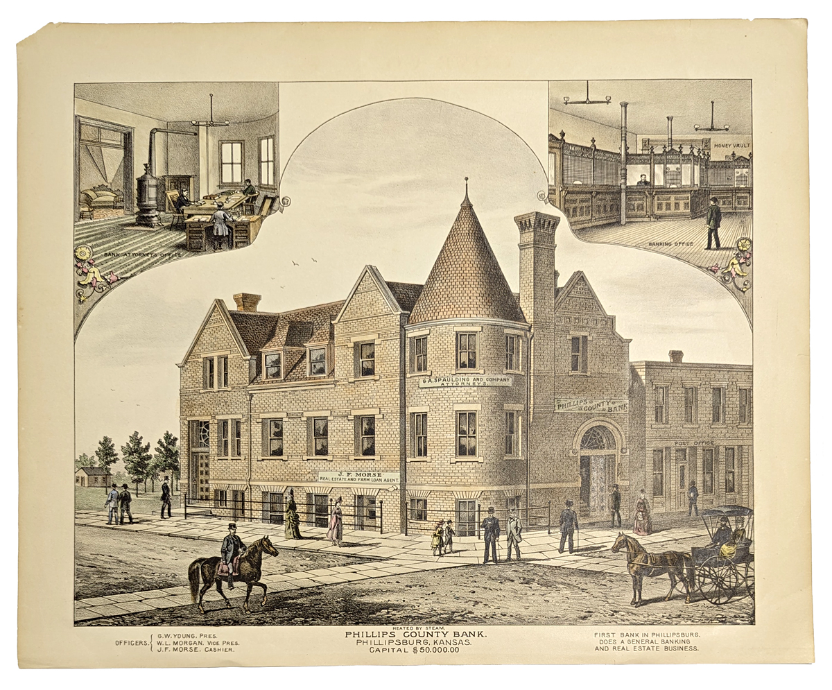 116ks: 1875: Bank in Phillipsburg Kansas. Hand colored lithograph from an 1875 state atlas of Kansas. Shows the exterior and two interior views of the Phillips County Bank. Very attractive print, would look great in a frame! 14x17 in. $60 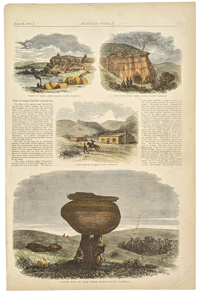 117ks: 1867 Kansas Pacific Railroad Western Scenes. Four hand colored engravings from Harper's Weekly, accompanied by text describing sights along the route of the Kansas Pacific Railroad. The four scenes are titled as follows: 1) Valley of Spring Creek; 2) Cave on Mulberry Creek; 3) Look's Ranch; and 4) Pulpit Rock on Alum Creek. Each image is described in the accompanying text. 11x16 in. $50  118ks: 1877 Hand colored Mitchell County & Township Map of the States of Kansas and Nebraska with very ornate ivy border. 23 x 15-1/2 in. $80 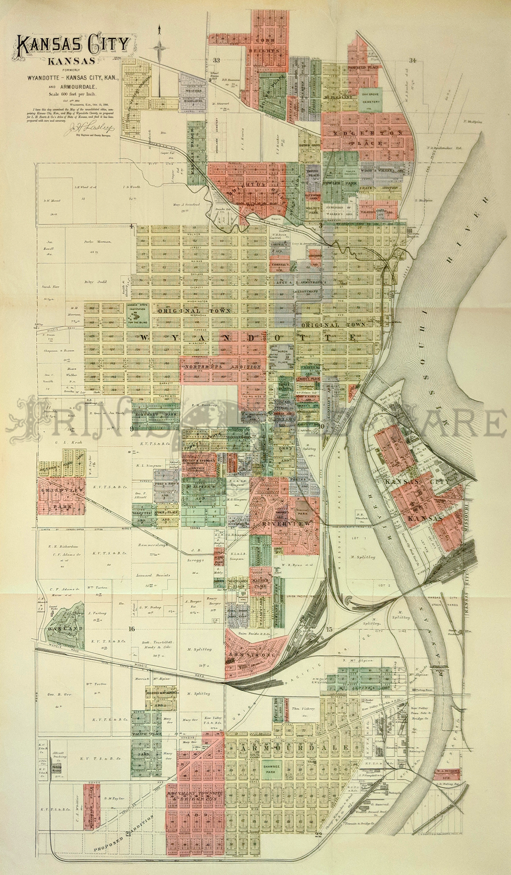 122Kansas: Map of Kansas City, Kansas. 1886 as a newly formed city encompassing Kansas City, Wyandottle, and Armourdale. Compiled by City Engineer J.H. Laslip. Map shows old and new areas, railroads, and ownership. Fine condition, small patch top center map affecting image. 38 x 22 in. $500 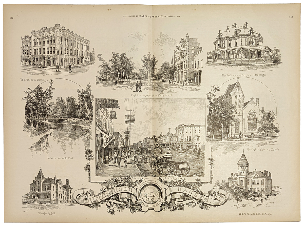 202ks: 1888 - Scenes in Hutchinson Kansas. This wood-engraving is featured in Harper's Weekly and is titled, "Hutchinson Kansas." It contains eight small scenes in the city,each with its own caption: 1) The Masonic Temple; 2) First Avenue, East from Main Street; 3) The Residence of Mrs. John Puterbaugh; 4) View in Glendale Park; 5) Main Street; 6) The First Presbyterian Church; 7) The County Jail; and 8) The North Side School House. This print is in excellent condition. 16x22 in. $90 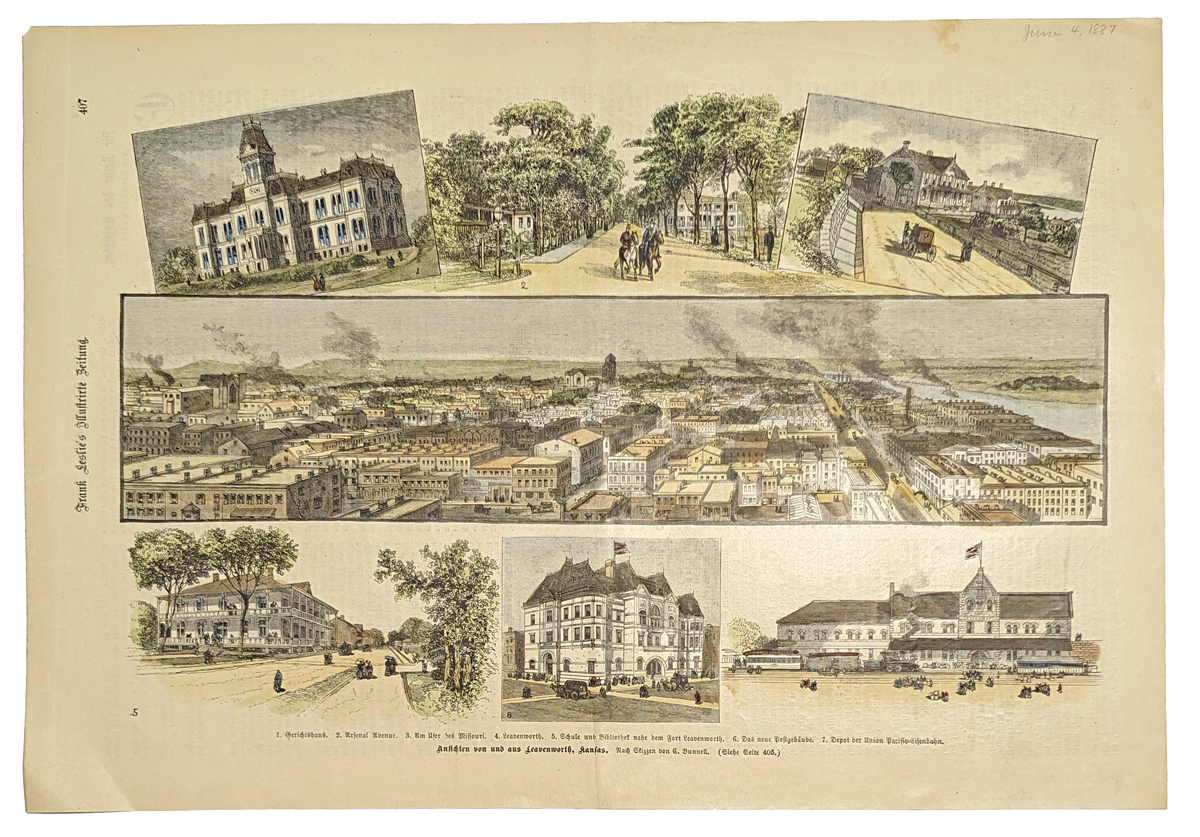 203ks: 1887 Views in Leavenworth Kansas. Nicely hand-colored, engraved scenes from the German language edition of Leslie's Weekly. Image in the middle is a bird's eye view of Leavenworth. Smaller images above and below show points of interest in the city. Excellent condition. 11x16 in. $80 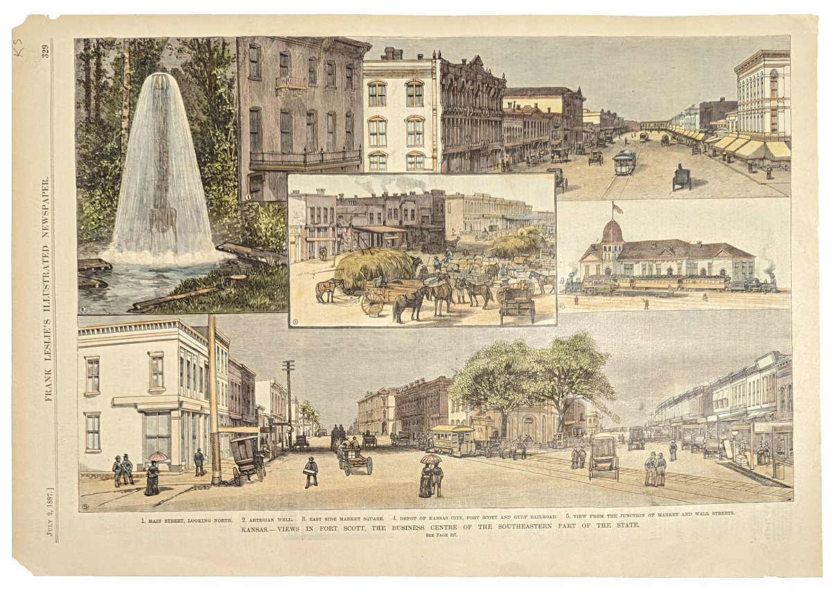
204ks: 1887 Scenes in Fort Scott, Kansas. Hand colored engraving from Leslie's Weekly, July 2, 1887. Title is "Kansas: Views in Fort Scott, the Business Center of the Southeastern Part of the State." Contains five views of landmarks throughout the city. Available with text in English or German. 11x16 in. Excellent condition. $80 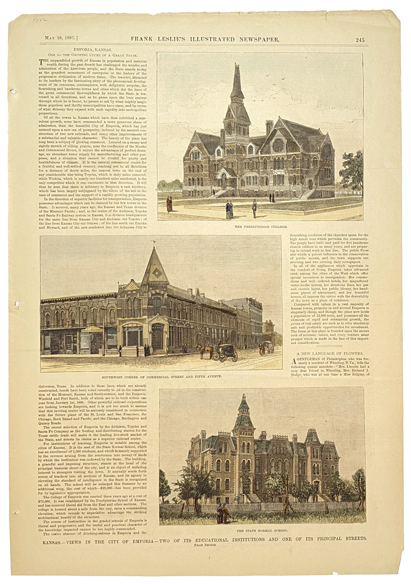 205ks: 1887 Emporia, Kansas Landmarks. Hand colored, engraved views of three major buildings in Emporia, Kansas. Images are surrounded by an article titled "Emporia Kansas. One of the Growing Cities of a Great State." Excellent condition. 11x16 in. $80 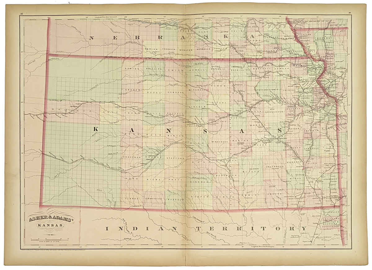 208ks: Beautiful 1872 map of Kansas. Published by Asher & Adams in the New Statistical and Topographical Atlas of the United States. Original hand coloring. 17.5x24.5 in. $150 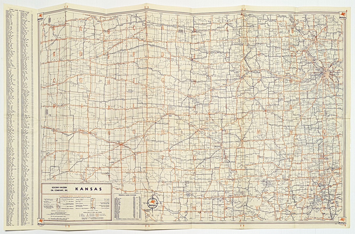 209ks: Miracle Fold Road Map of Kansas and adjoining states. Published in 1950 by Mobilgas Oil Company. 18x29 in. $30
|
|
|||||||||
| Order Form | |||||||||||
| Back to Homepage | |||||||||||