|
|||||||||||
This is a small selection of our inventory of antique Kentucky maps and prints. Additional inventory is available. Contact us with your request. 1-800-879-6277
|
|||||||||||
|---|---|---|---|---|---|---|---|---|---|---|---|
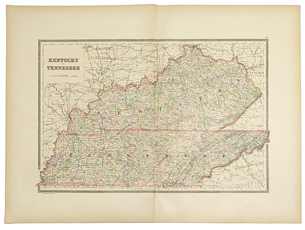
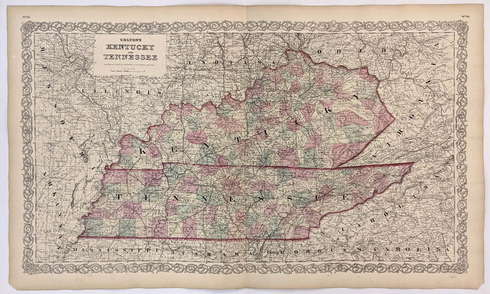
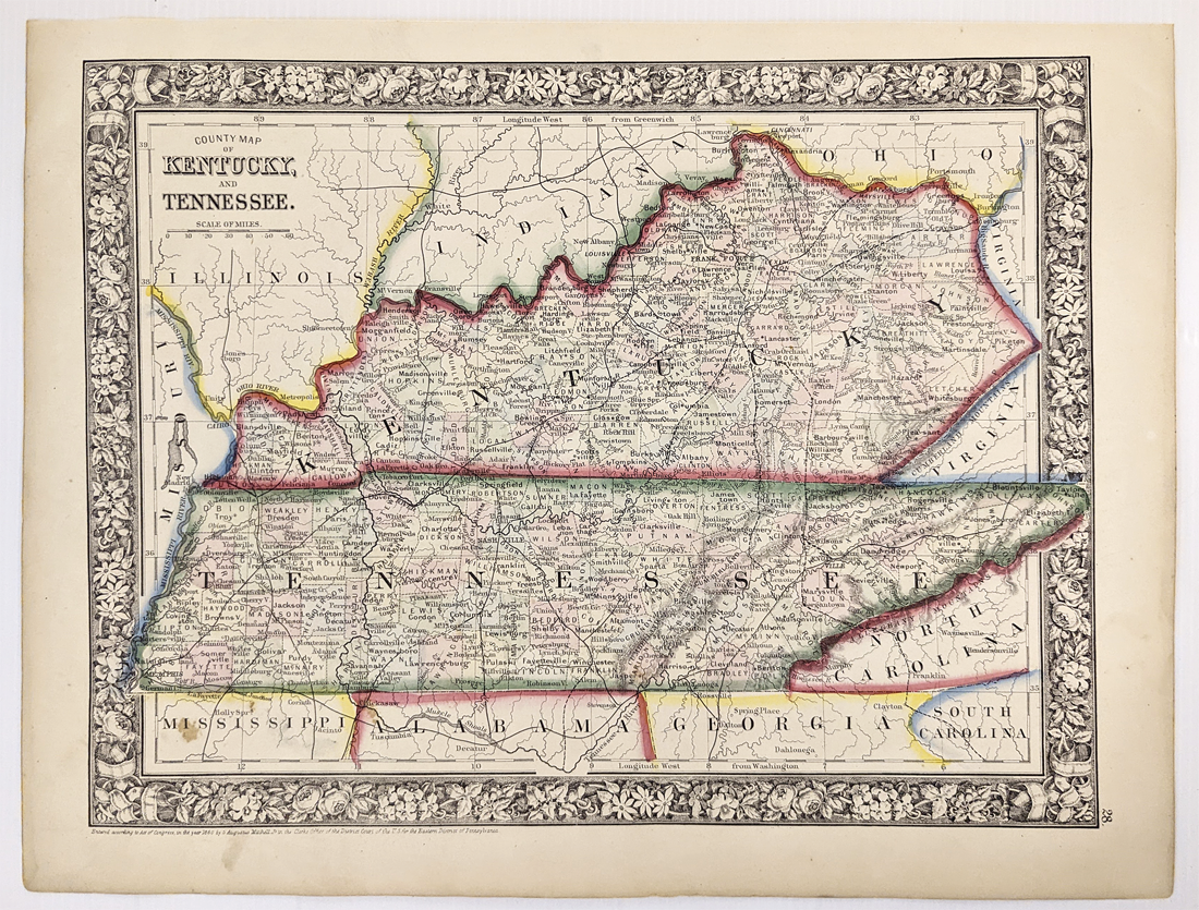
001Kentucky: 1889 Bradley color map of Kentucky and Tennessee. 26 x 19 in. $100 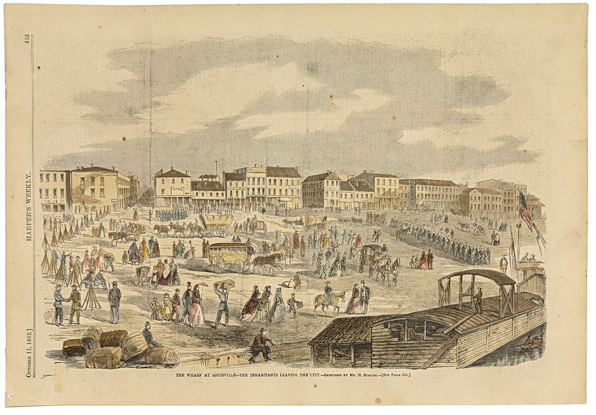 002ky: 1862 Louisville. Scene at wharf during Civil War. Good view of the city. Hand colored view of the waterfront. Harper's. 16x11 in. $60 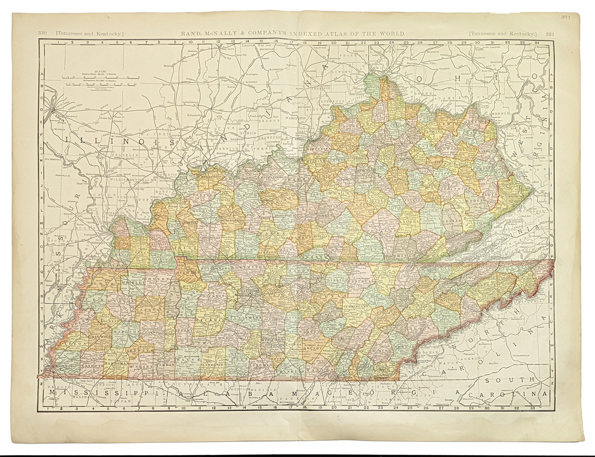 004ky: 1897 Kentucky Map. Also shows Tennessee. Color by counties. Large scale map, greatly detailed. By Rand McNally. 28-1/2 x 22 in. $80 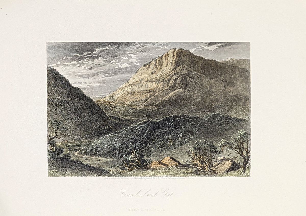
006ky: 1873 Kentucky Cumberland Gap. Hand colored steel engraving from Picturesque America. 12-1/2x9-1/2 in. $50 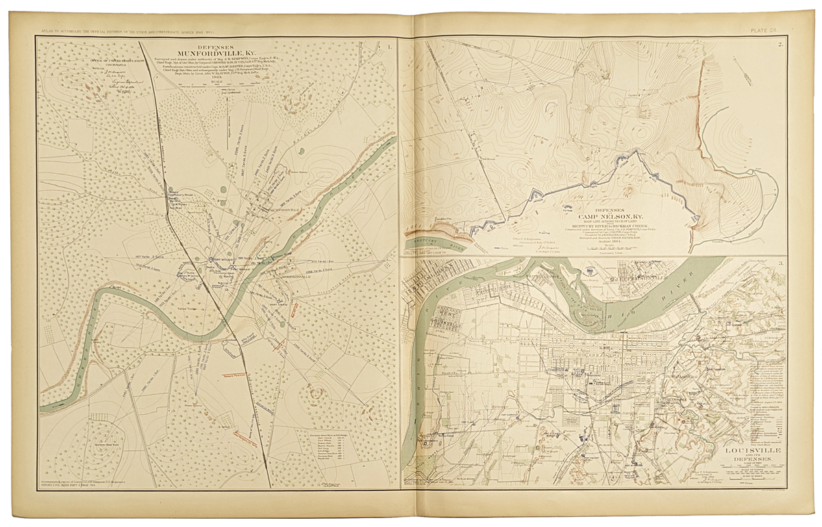 010ky: Civil War Kentucky map. Showing old defenses of Louisville, Munfordville and Camp Nelson. Color lithograph printed by the U.S. Government after the Civil War. 29x18 in. $80 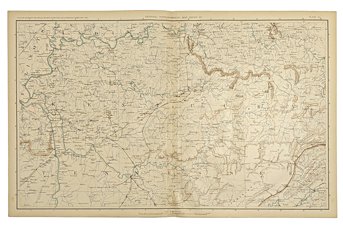 015ky: Civil War Map of Kentucky. Shows forts, great detail of state. Large scale color lithograph, published by the U.S. Government. 29x18-1/2 in. $80 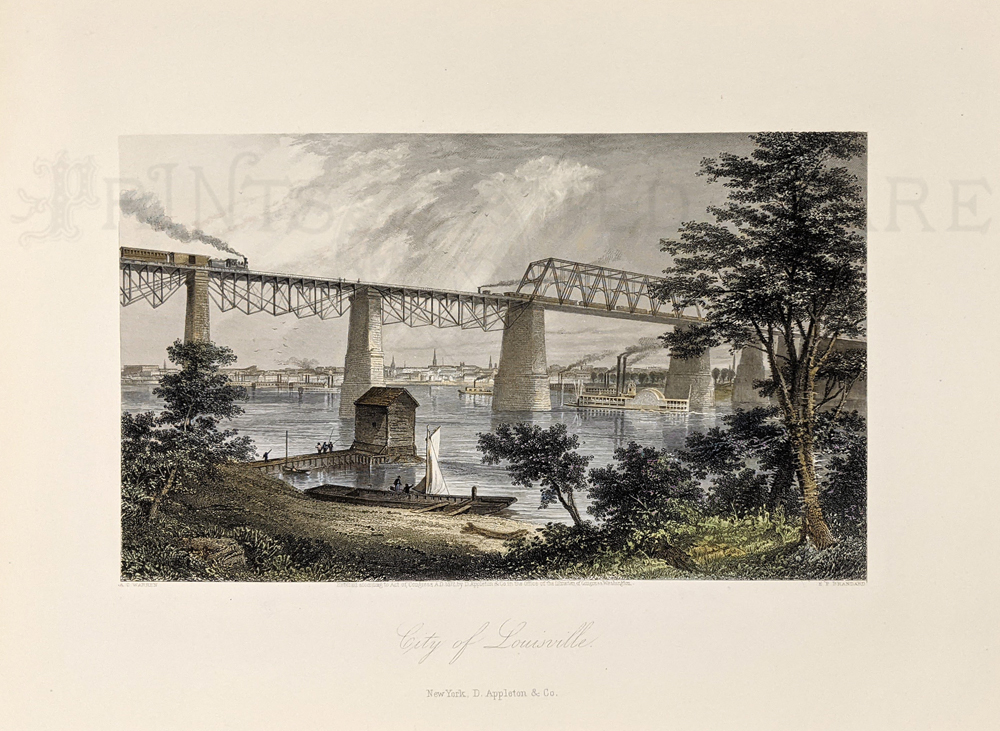 017ky: 1873 Great Louisville view. One of the best views produced of the city. Hand colored engraving from Picturesque America. 12-1/2x9-1/2 in. $40 b/w: $30 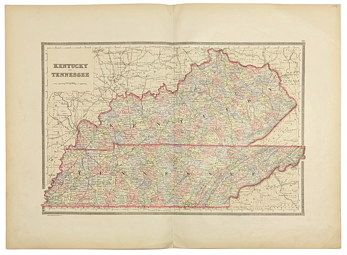 019ky: 1886 Bradley Map of Kentucky. Also Tennessee. Large scale, attractive map, original color litho. 26x19 in. $100  021ky: 1865 Johnson Kentucky-Tennessee Map. Large original hand-watercolored engraving. Very attractive borders. Large scale with great detail. Counties each colored separately. Genuine antique produced in 1865 - NOT a reproduction! 26-1/2x18 in. $80 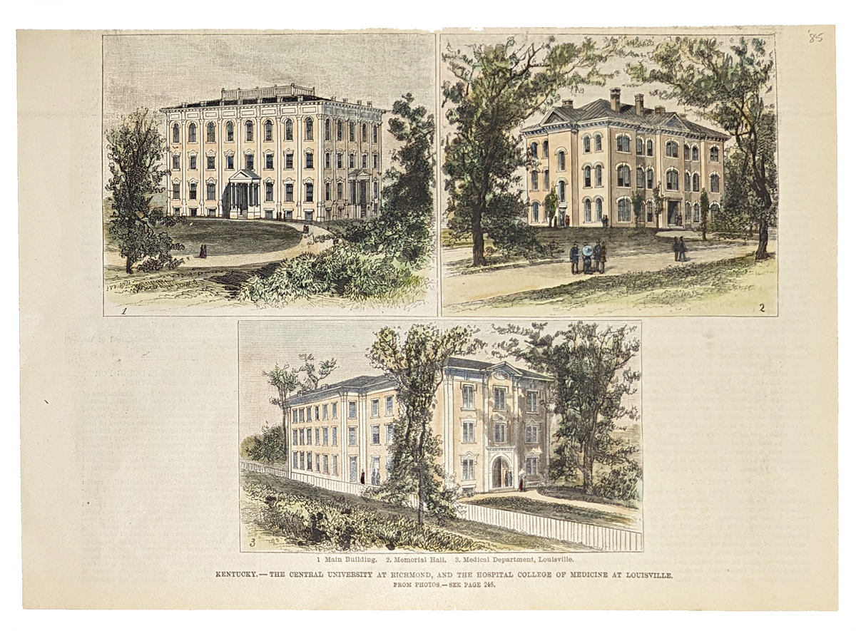 023ky: 1885 Hand colored wood engravings showing The Central University at Richmond, and the Hospital College of Medicine at Louisville in Kentucky. 10 x 7 in. $40 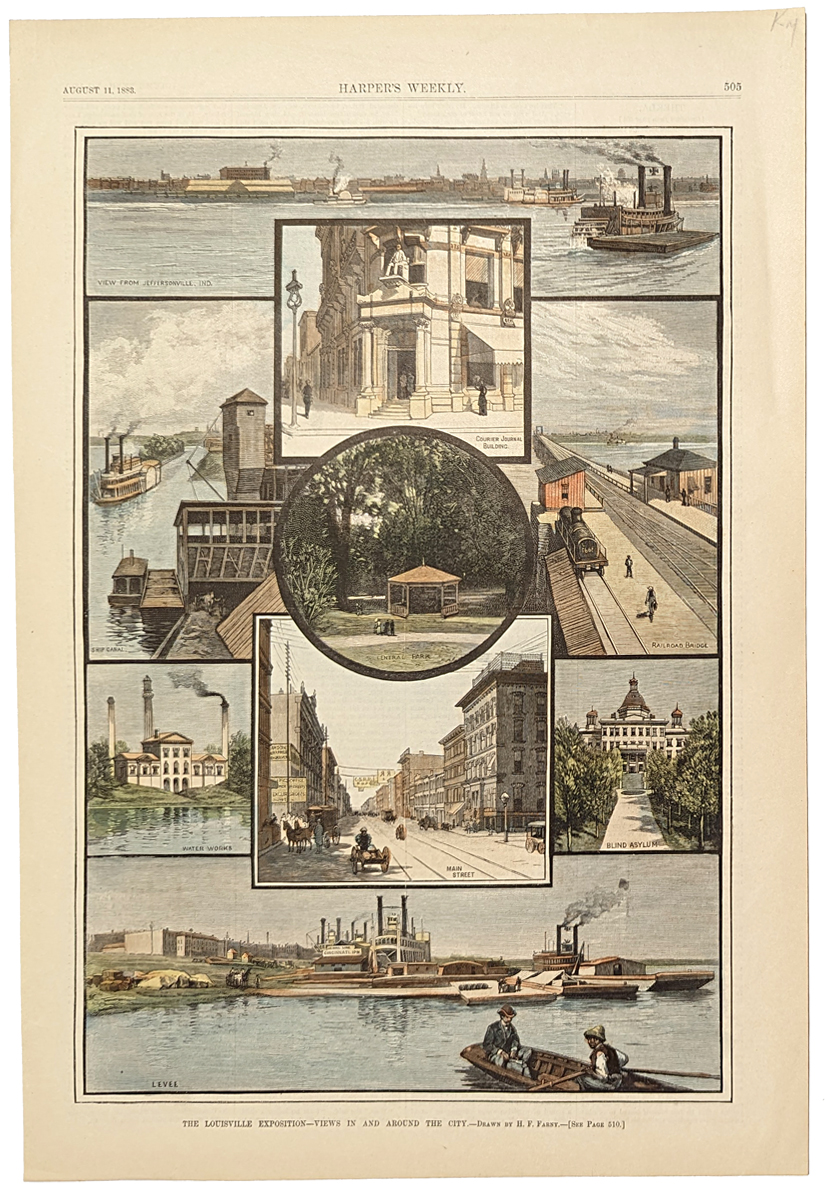 100ky: 1883 Louisville Kentucky Views. Hand colored engraving from Harper's Weekly, showing buildings and other landmarks in the city of Louisville. Published as part of Harper's coverage of the 1883 Louisville Exposition. 11x16 in. $60 b/w: $40 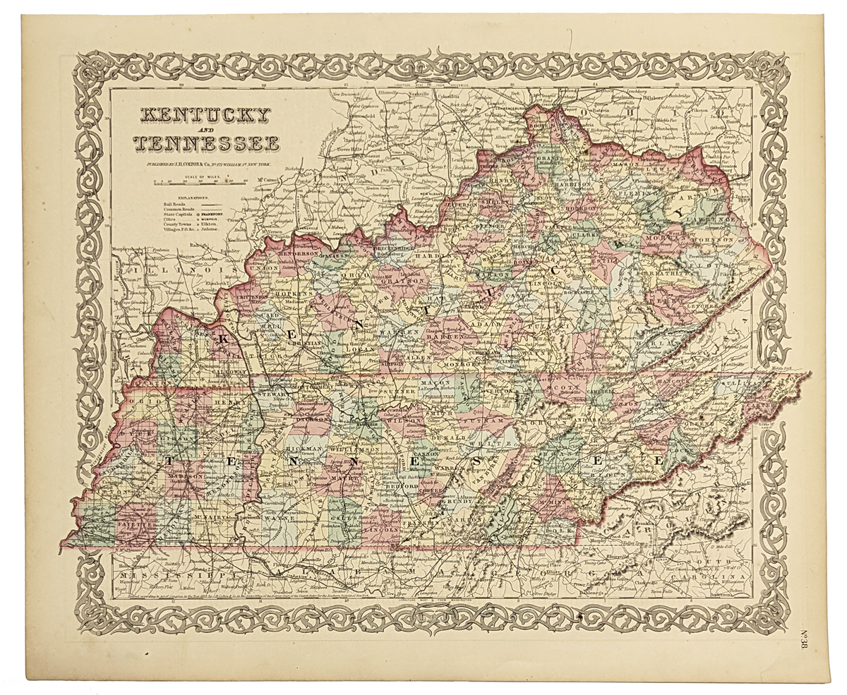 101ky: 1855 J.H. Colton original hand colored engraved map of Kentucky and Tennessee. Colton was among the earliest map makers with very accurate maps depicting cities and states in the United States. 17-1/2 x 14-1/2 in. $150  110ky: Beautiful 1872 map of Kentucky & Tennessee. Published by Asher & Adams in the New Statistical and Topographical Atlas of the United States. Original hand coloring. 17.5x24.5 in. $100 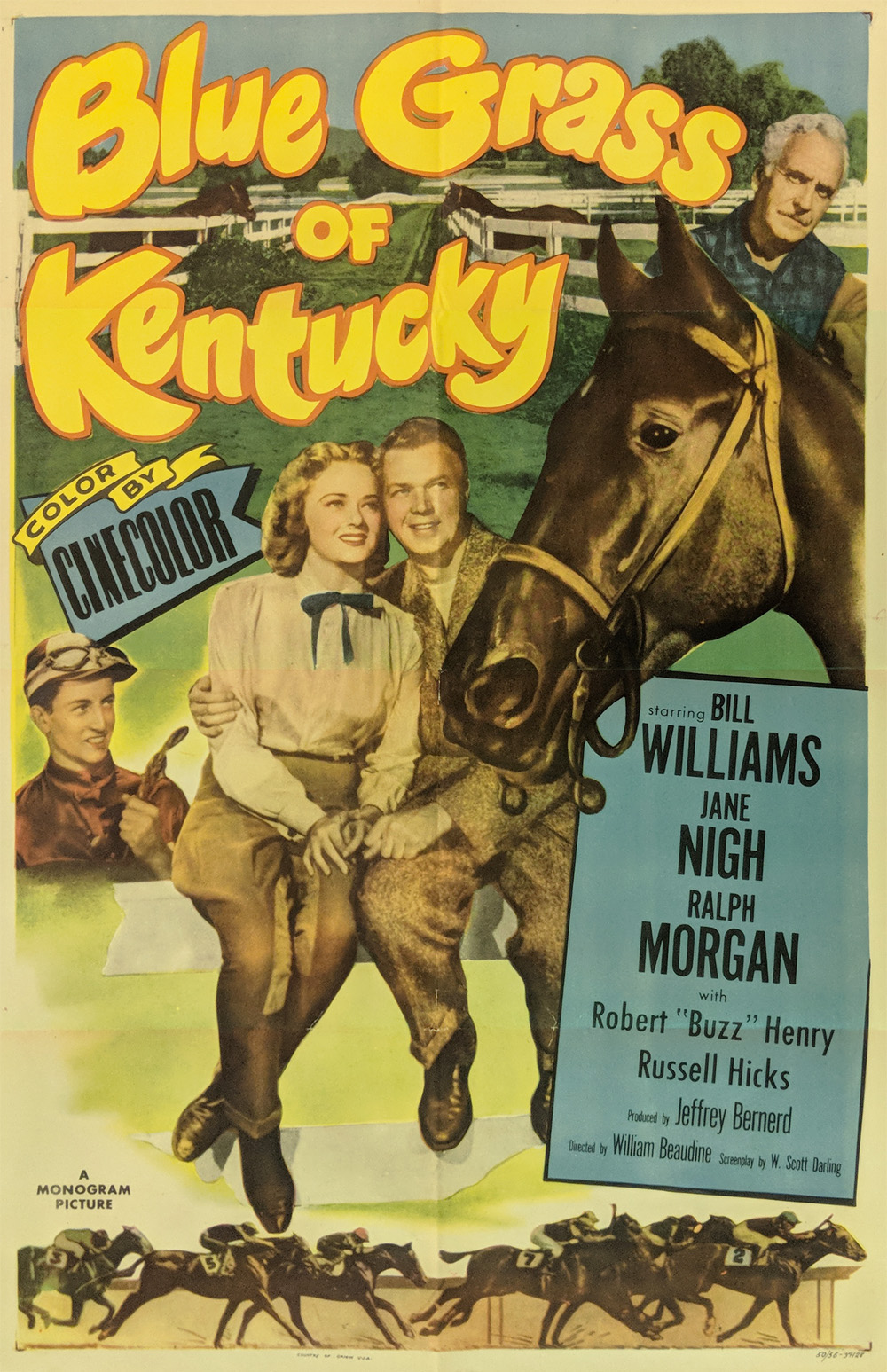 118ky: Movie Poster : Blue Grass of Kentucky. 1950s Movie poster starring Bill Williams and Jane Nigh - Monogram Pictures. Printed in color. 41 x 27 in. $60 |
|
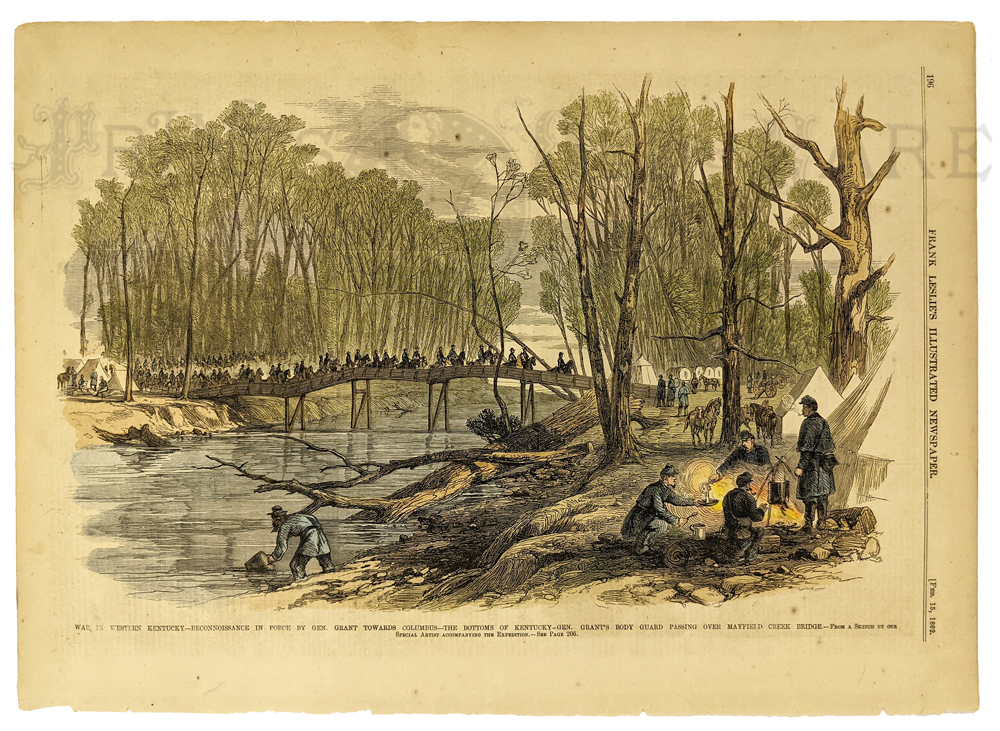
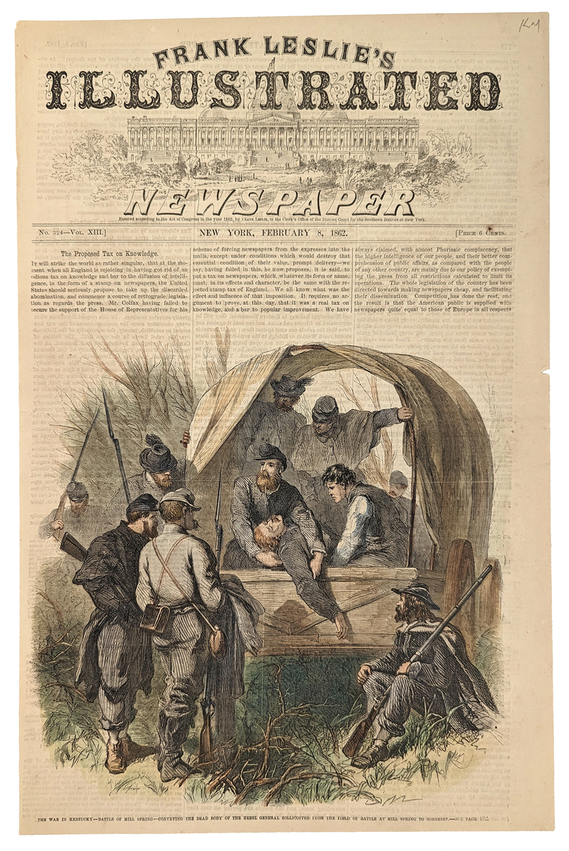 138Kentucky: The War in Kentucky - Battle of Mill Spring. Conveying the dead body of the Rebel General Zollicoffer from the field of battle at Mill Spring to Somerset. 1862 Frank Leslie's Illustrated Newspaper. Hand colored, wood engraving. 10 3/8 x 15 1/2 in. $60 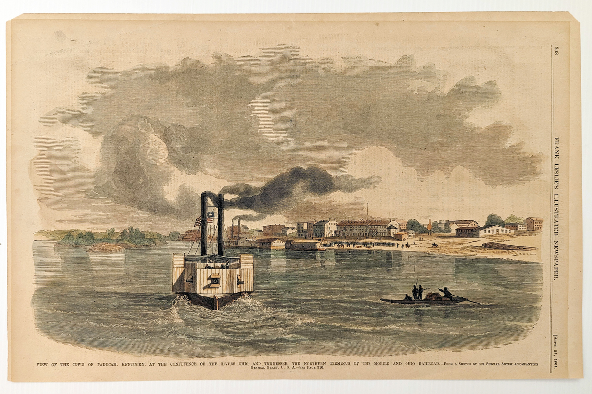 139Kentucky: View of the Town of Paducha, Kentucky, at the confluence of the rivers Ohic and Tennessee. The Northern Terminus of the Mobile and Ohio Railroad. Hand colored, wood engraving. 10 1/2 x 16 in. $60 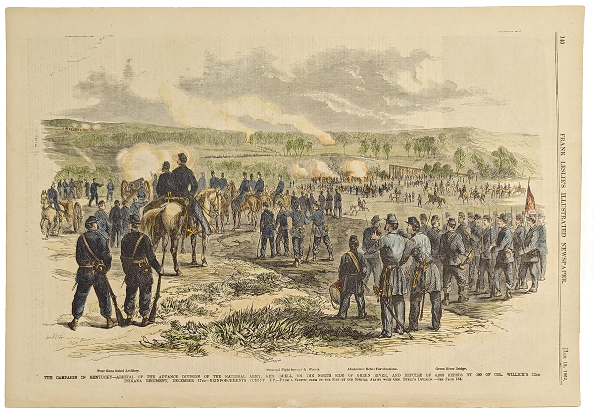 140Kentucky: The Campaign in Kentucky - Arrival of the advance division of the National Army, Gen. Buell, on the North side of Green River. 1862 Frank Leslie's. Hand colored, wood engraving. 10 7/8 x 15 7/8 in. $60 b/w: $40 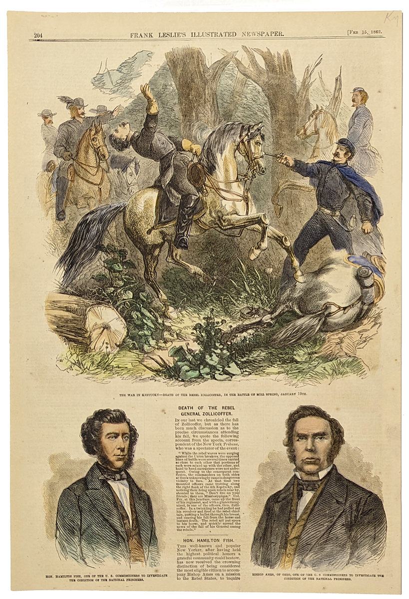 141Kentucky: The War in Kentucky - Death of the Rebel Zollicoffer, in the Battle of Mill Spring, January 19th. 1862 Frank Leslie's. Hand colored, wood engraving. 10 8/8 x 15 3/8 in. $60 b/w: $40 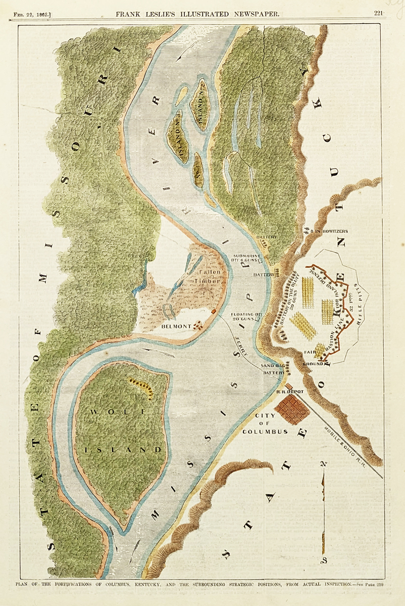 142Kentucky: Plan of the Fortifications of Columbus, Kentucky, and the surrounding strategic positions, from actual inspection. 1862 Frank Leslies. Hand colored, wood engraving. 10 3/4 x 15 7/8 in. $80 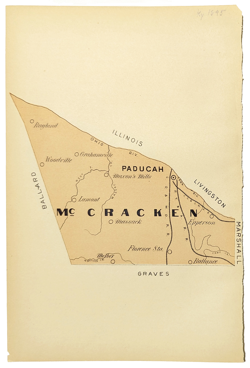 143Kentucky: McCracken, Kentucky. 1895. Map showing cities, river, railroad, etc. 7 3/8 x 11 in. $60 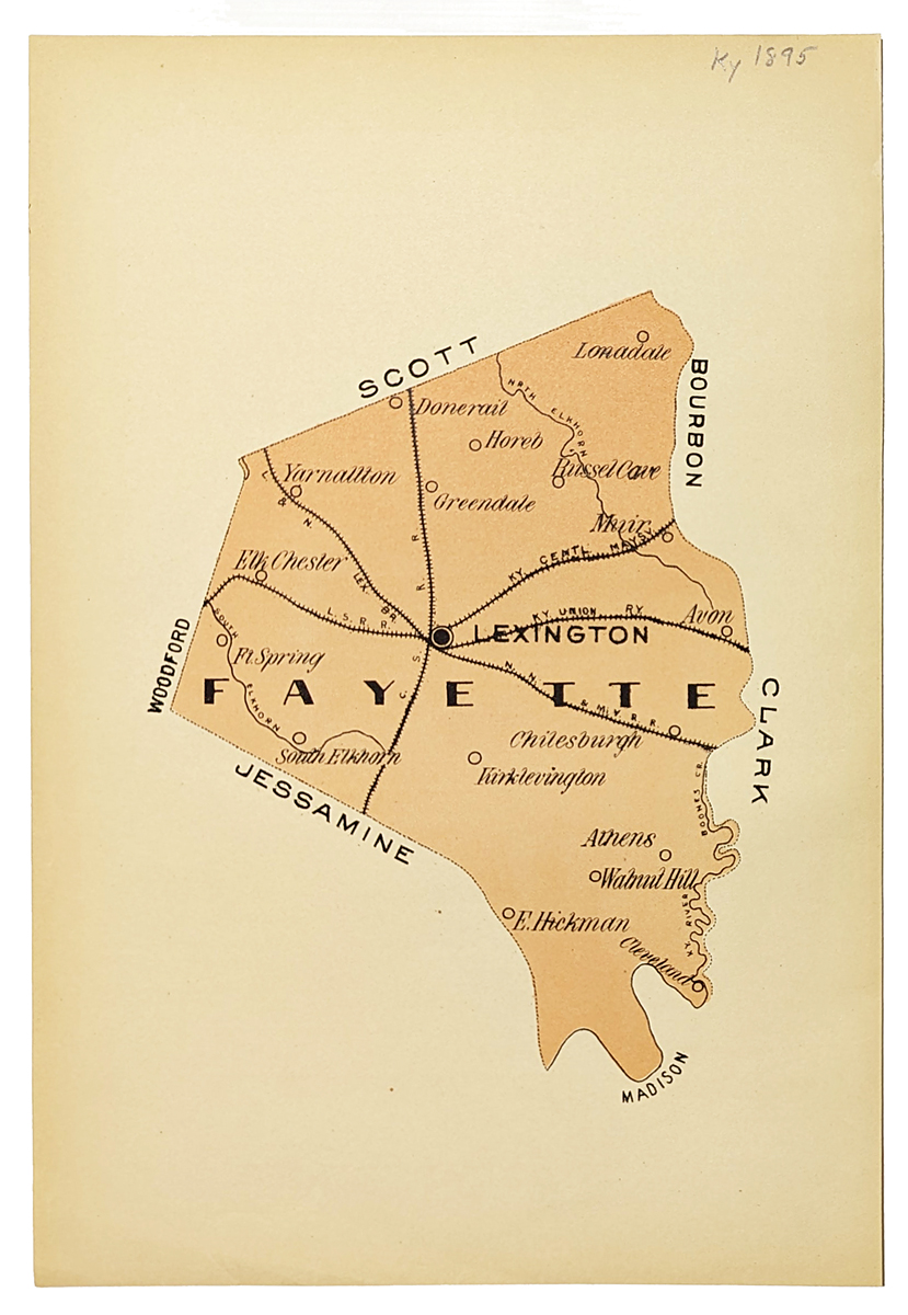 144Kentucky: Fayette, Kentucky. 1895. Map showing cities, river, railroad, etc. 7 3/8 x 11 in. $60 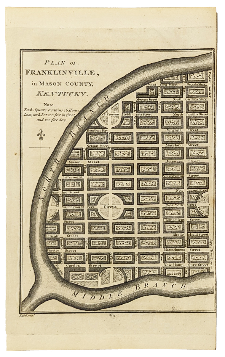 145Kentucky: Plan of Franklinville, in Mason County, Kentucky. 1796 Benjamin Tanner. Showing towns that were never built in the present-day state of Kentucky. Copper engraving. 5 x 8 3/8 in. $80 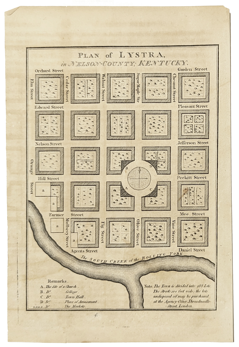 146Kentucky: Plan of Lystra, in Nelson-County; Kentucky. 1796 Benjamin Tanner. Showing college, a church, a theater, and a town hall. Earliest printed American Town Plans. Copper engraving. 5 x 8 3/8 in. $80 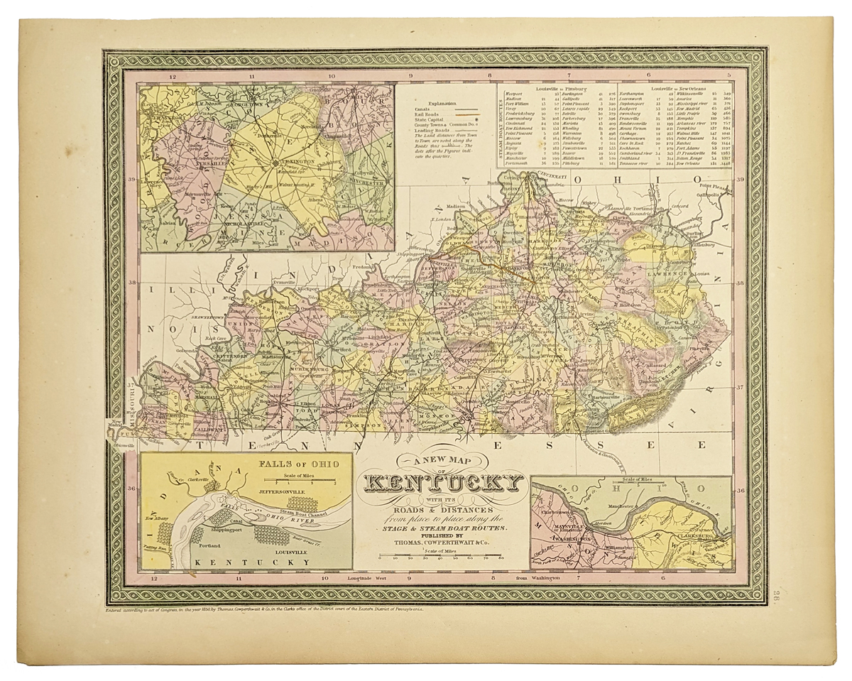 148Kentucky: A New Map of Kentucky with its roads and distances. 1850 Cowperthwait. Hand colored, lithograph. Showing information on distances between towns, and showing roads and routes, and with insets of the area around Lexington, and the Falls of Ohio, and Washington and Clarksburg. 13 1/2 x 17 in. $200 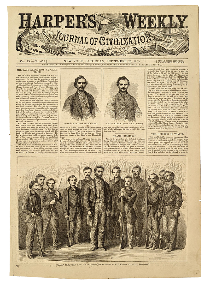 149Kentucky: Champ Ferguson and his Guard 1865. A brief history during his trial in Nashville where he was accused of raids in Kentucky and Ohio and other crimes. Wood engraving. 10 3/8 x 15 1/2 in. $60 |
|||||||||
| Order Form | |||||||||||
| Back to Homepage | |||||||||||