|
|||||||||||
This is a small selection of our inventory of antique Maine maps and prints. Additional inventory is available. Contact us with your request. 1-800-879-6277
|
|||||||||||
|---|---|---|---|---|---|---|---|---|---|---|---|
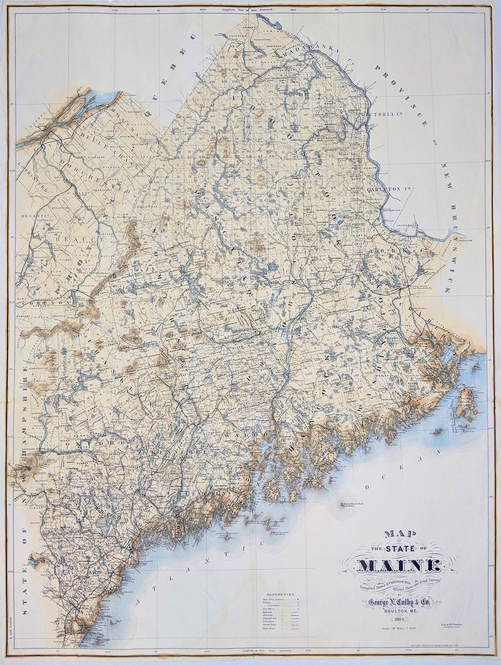
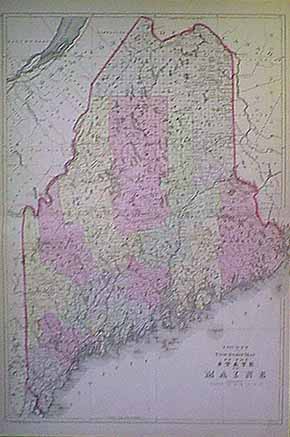 001me: 1882 Bradley Map. County and Township Map of the State of Maine. Size: 23 x 15.25 in. $90 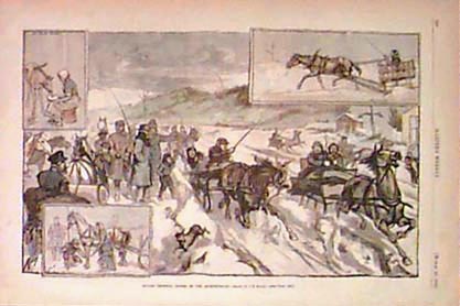 005me: 1880 Maine "Androscoggin River - Trotting Horses" Hand colored antique engraving. 15x11 in. $50 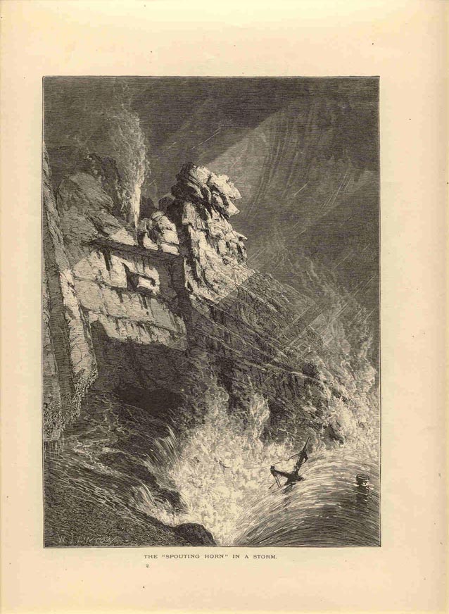 009me: 1873 "Spouting Horn" engraving. Hand colored antique print. 9-1/4x12 in. $40 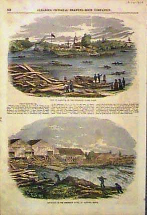
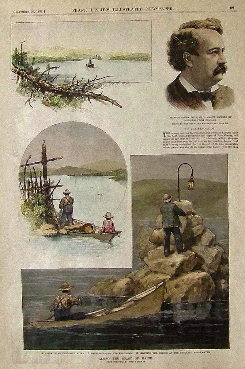
010me: 1854 Two views of Penobscot River (Gleason's). Hand colored original engravings. 10-1/2x15 in. $50 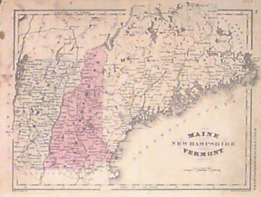 011me: 1863 Map - Maine, New Hampshire and Vermont. Hand colored. 12x9-1/2 in. $60 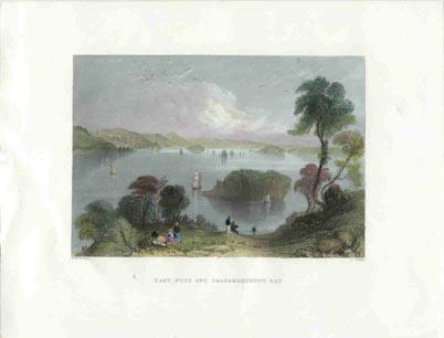 017me: 1838 Bartlett 'East Port and Passamaquoddy Bay.' Hand colored genuine antique steel engraving. 10-1/4x8-1/2 in. $40 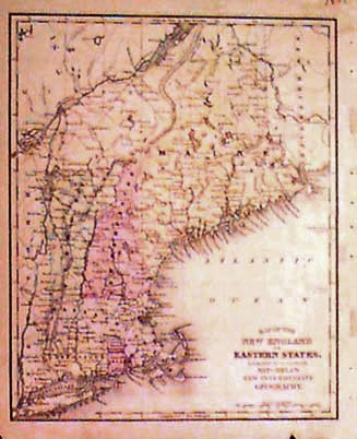
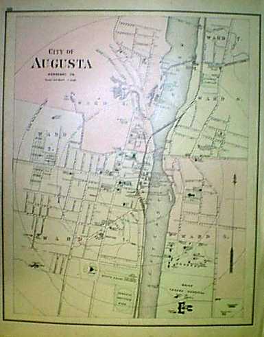
020me: 1872 New England Map. Hand colored engraved antique Mitchell map of New England. 9-1/2x12 in. $50 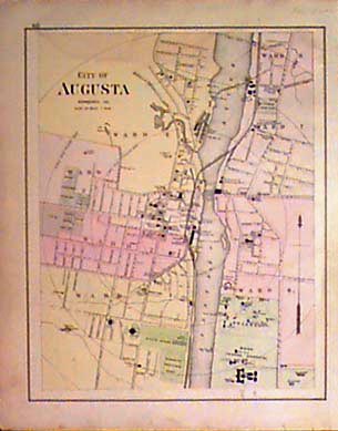 023me: 1901 Map of Augusta Maine. Hand colored antique map of State Capitol. Names different wards' principal buildings. 14x17-1/2 in. $60 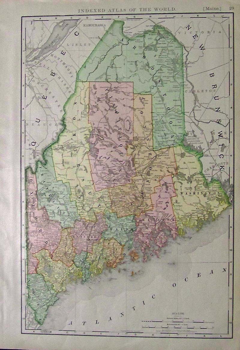
025me: 1902 Rand McNally colored map of Maine showing highlighted counties. Featured in Indexed Atlas of the World. 21 x 15 in. $60 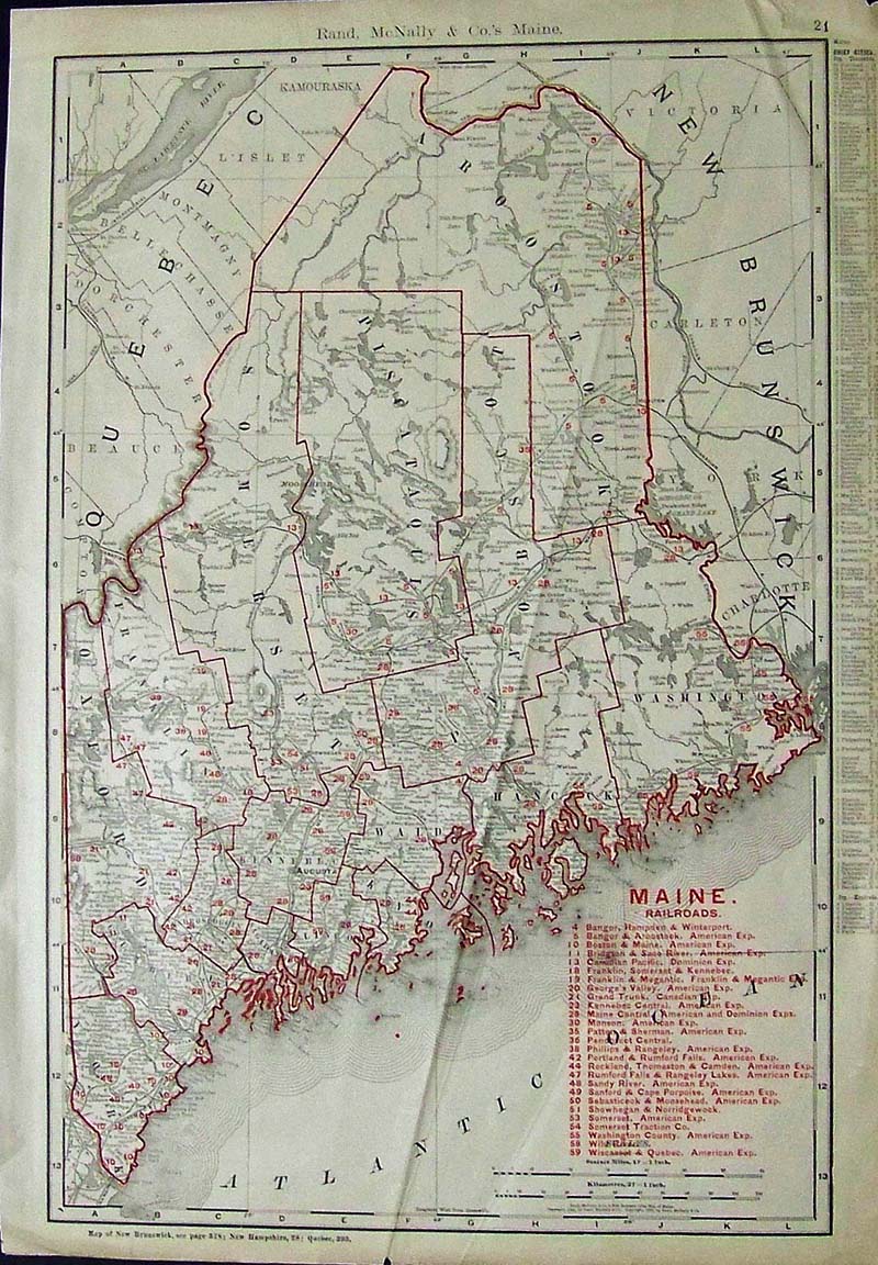
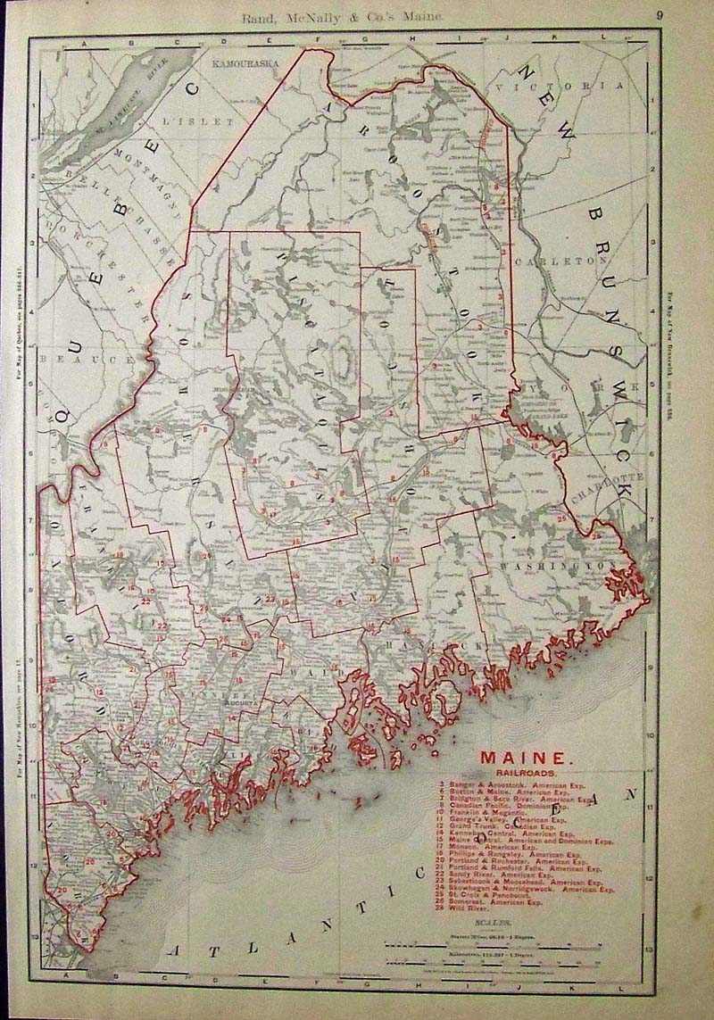
027me: 1901 Rand McNally color Map of Maine showing the Oulines of Counties, the chief cities, along with Key in red to the Maine Railroads. 20-1/2 x 14-1/2 in. $60 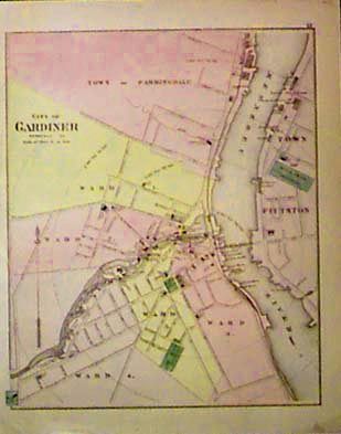
028me: 1890 Gardiner Maine Map. Original hand colored antique map of City of Gardiner. Shows railroads, streets. Identifies principal buildings. Portion of Pittston across Kennebec River. 14x18 in. $60 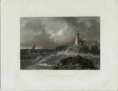
030me: Hand colored steel engraving from 1839. Bartlett print titled Desert Rock, Light House. Showing a Maine lighthouse in the middle of a storm. 8x11 in. $60 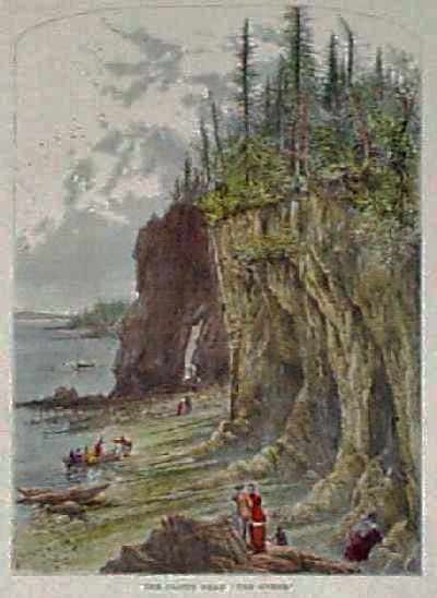
100me: 1873 View of the Cliffs near "The Ovens" on Mount Desert Island. Nicely hand colored engraving from Picturesque America, with boats and sightseers in the foreground. 9x12 in. $40 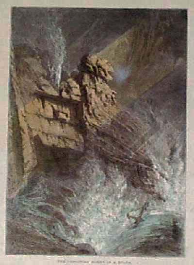
101me: 1873 Scene: "The Spouting Horn in a Storm." Hand colored woodcut engraving from Picturesque America. 9x12 in. $40 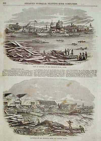
102me: 1854 Scenes: Sawmills on the Penobscot River at Oldtown, Maine. Two engraved views from Gleason's Pictorial Drawing Room Companion. Text between the images describes the river and the mills. 11x16 in. $50 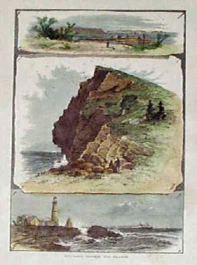
103me: 1873 Views of Portland Harbor, and Islands. Hand colored engraved scenes from Picturesque America. 9x12 in. $40 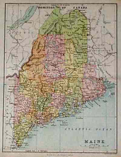
104me: 1897 Map of Maine, published by the J.B. Lippincott Company. Color lithographed map, shows railroad lines throughout the state. 10x12 in. $40 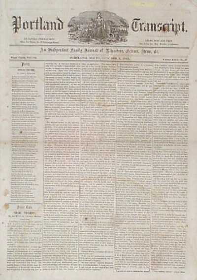 106me: 1863 issue of the Portland Transcript, "An Independent Family Journal of Literature, Science, News, Etc." Eight pages long. Contains short stories, poems, and news about current events in the Civil War. There are some light water stains and age spots on the pages, but overall condition is good. 12x18 in. $30 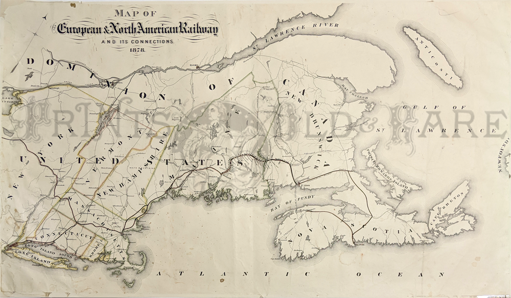 073can: Map of the European and North American Railway (E&NA) and its connections. Early (1878) large format map of this system designed to link to ice-free port in Nova Scotia. Lithograph with color markings of boundaries and rail lines. 20 x 36 in. $350 |
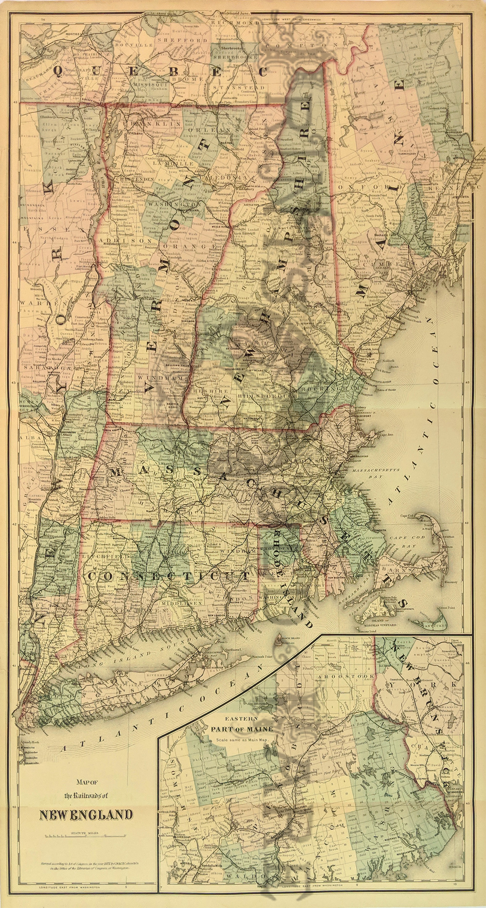 321Maine: Map of the Railroads of New England O.W. Gray. Large map of New England from New York to the Canadian border, detailing state and county boundaries and the extensive network of the railroads. Inset map at lower right shows the 'Eastern Part of Maine.'. 17 x 31 in. $280 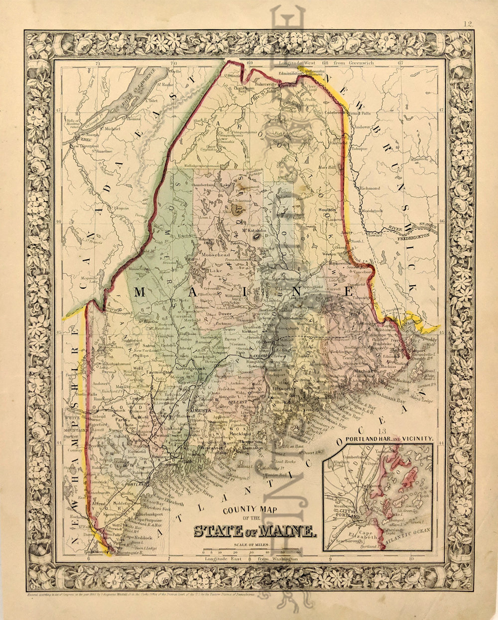 105me: Map of Maine from S. Augustus Mitchell's world atlas of 1860. Beautiful map, with original hand coloring. A small inset map of Portland harbor is in the lower right corner. Entire map image is surrounded by a decorative border. 12x15 in. $90 SOLD 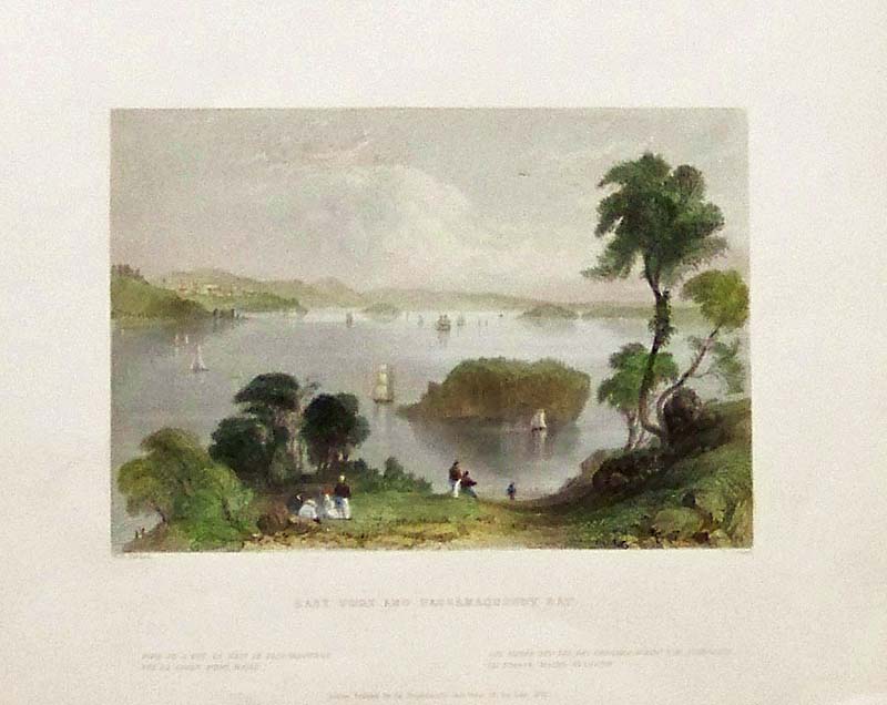
108me: 1839 W.H. Bartlett View of East Port and Passamaquoddy Bay, Maine. Hand colored steel engraving, showing a view of the bay from a nearby hill. 10 x 8 in. $50 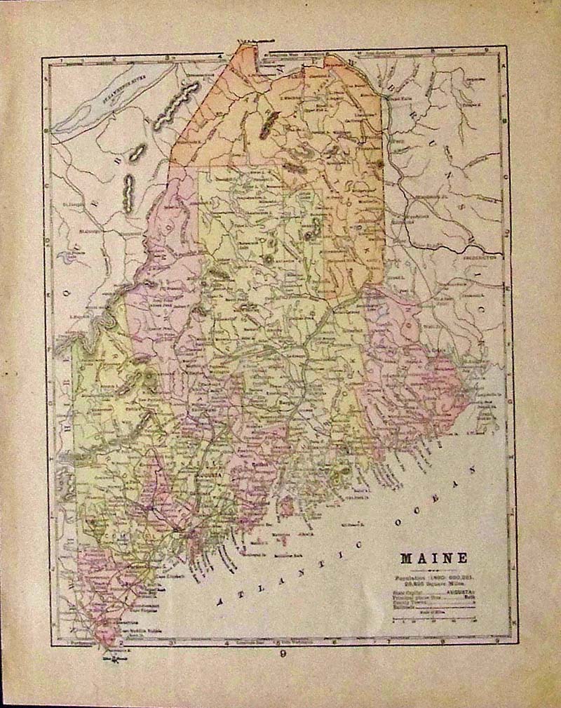
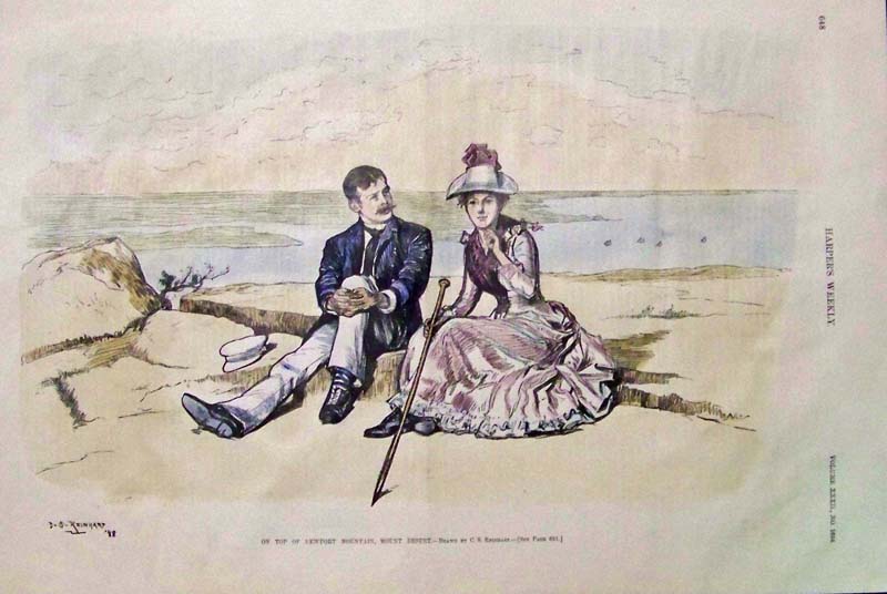
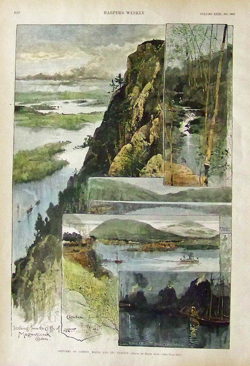
109me: 1889 Color lithographed map of Maine, showing the population, geographical features, cities and railroad lines. 13 x 11 in. $30 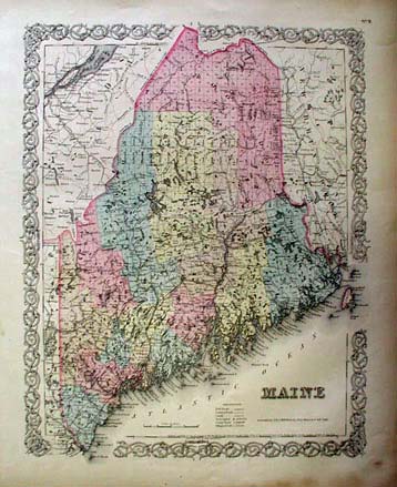 201me: Beautiful map of Maine published in 1855 by J.H. Colton. Original hand coloring shows individual counties. Map includes railroad lines, common roads, canals, and more. Decorative border surrounding map. 15x18 in. $160 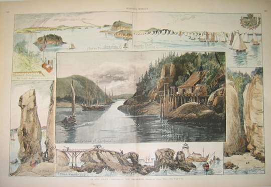 205me: 1887 In and About Campobello, New Brunswick - Drawn By Harry Fenn. Five hand colored wood engravings bordering a larger hand colored wood engraving in the center of points of interest in and about Campobello, New Brunswick. Published in Harper's Weekly in 1887. 16x22in. $180 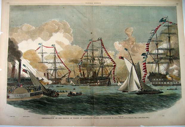 208me: 1860 Embarkation of the Prince of Wales at Portland, Maine, On October 20, 1860. - Drawn By C. Parsons, Esq. Double-page hand colored wood engraving published in Harper's Weekly in 1860. Scene depicts three tall-masted ships with flags and smaller boats with people in the foreground. 16x22in. $90 Check for availability
|
 323Maine: Portland Birdseye View 1865. Beautiful steel engraved panorama showing river with ships and hills, ship building in the foreground. 9 x 16 in. $375 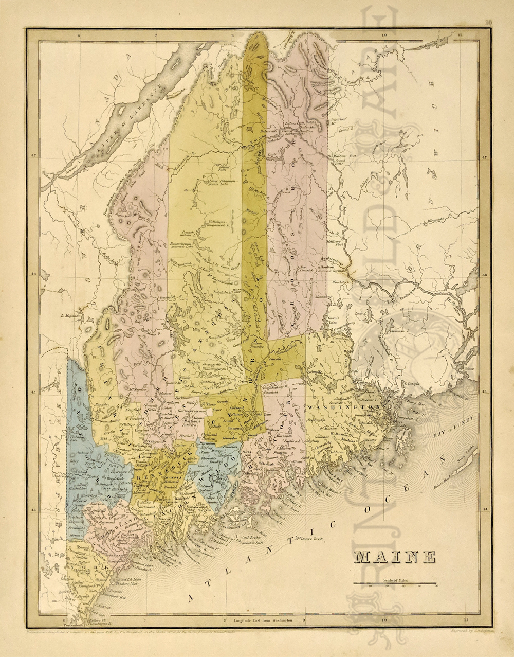 325Maine: 1841 Bradford map of Maine. Detailing the rivers, lakes, towns and counties. Political and topographical are also featured. Hand colored, lithograph. *Map was first issued in the 1838 edition of Bradford's Atlas but this one appeared in Samuel Goodrich's atlas from 1841. 13 x 16 5/8 in. $375 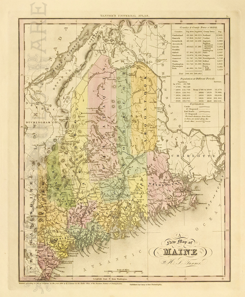 328Maine: 1843 A New Map of Maine by H.S. Tanner. c.1840-43. Counties, towns, railroads, canals are shown along with the statistical tables of the counties and town populations then and at different periods. Early northern counties are still incomplete. Hand colored, copper engraving. 13 1/2 x 16 3/4 in. $395 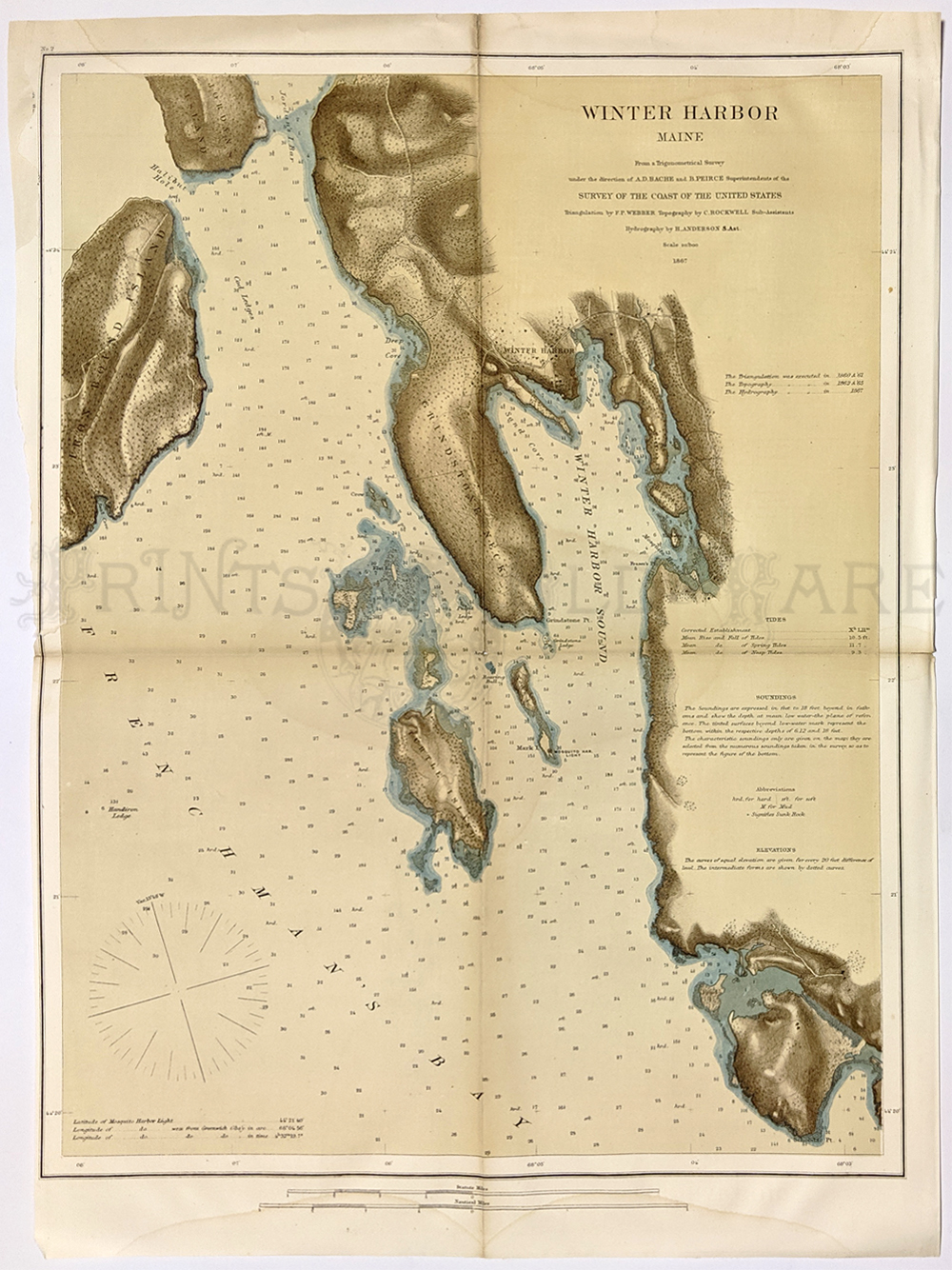 329Maine: Winter Harbor Map. Rare 1867 chromolithograph outstanding view of eastern shore of Frenchman’s Bay & Winter Harbor Sound – just east of Bar Harbor. Coast Survey Map. 13 1/2 x 16 3/4 in. $395 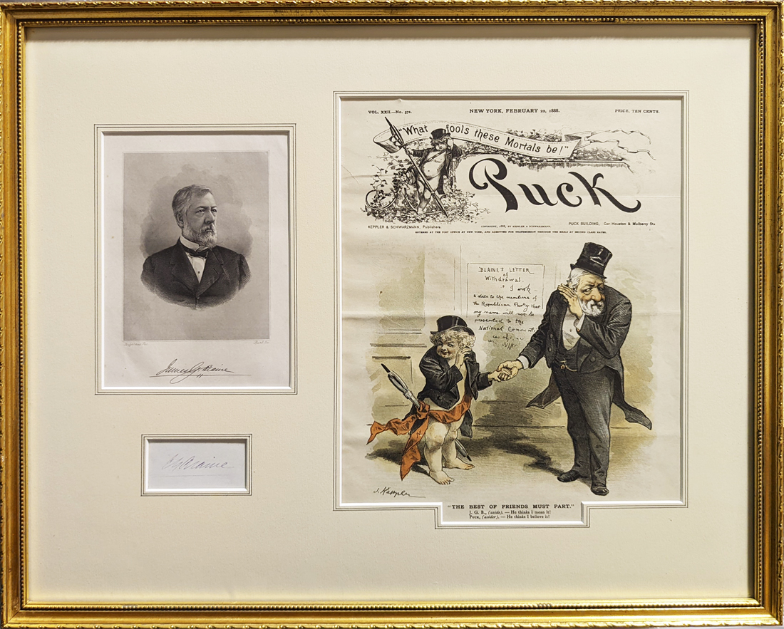 330Maine: Blaine Autograph 1880s. Signature on card, and steel engraved portrait plus a 1888 chromolithograph cover from Puck. All framed in a museum quality matt in a narrow gold frame. The cartoon depicts Blaine telling skeptics he won’t be running for President. All in fine condition – signature is a little faded. 18 3/8 x 22 in. $125 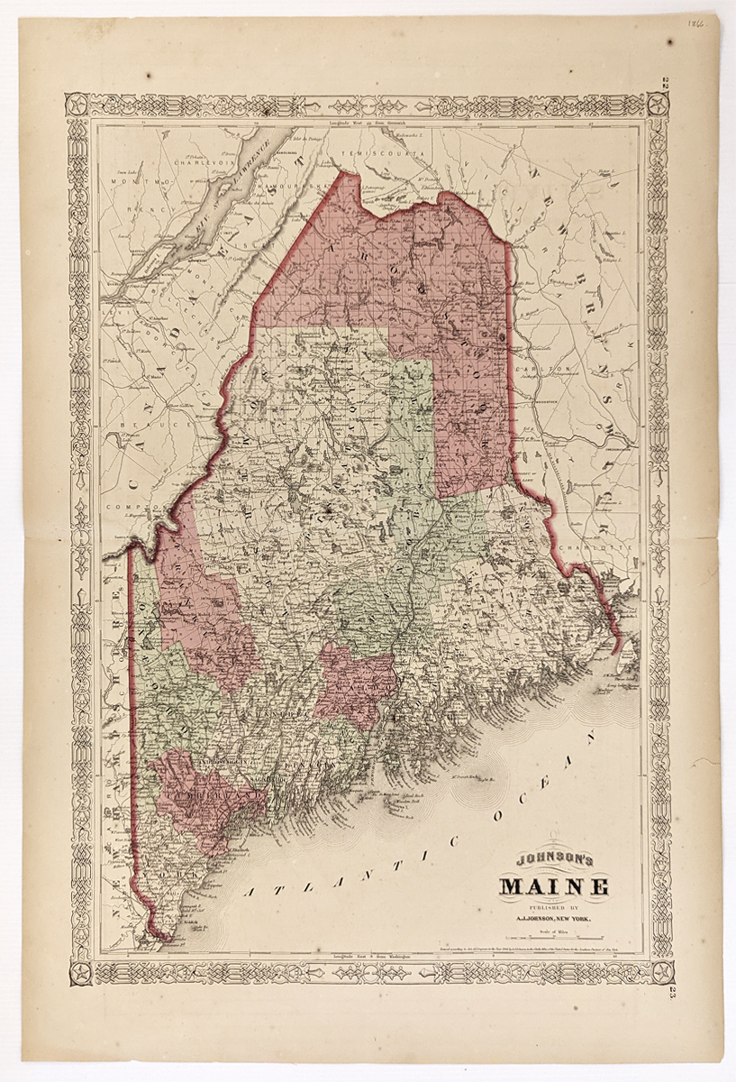 331Maine: 1866 Johnson's Map of Maine. Showing railroads, roads, canals, counties, towns and villages. Hand colored, lithograph. **Center fold has been reinforced. 18 x 26 1/2 in. $140 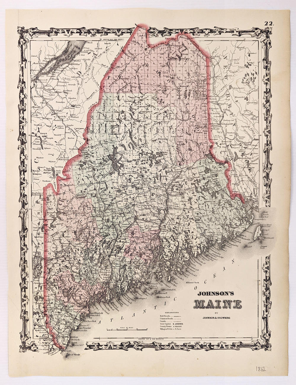 332Maine: 1862 Johnson's Map of Maine. Covers the entire state along with portions of adjacent Canada and New Hampshire. Color coded according to county and notes several roads, railways, rivers, cities and towns. Hand colored, lithograph. 13 3/4 x 17 1/4 in. $120 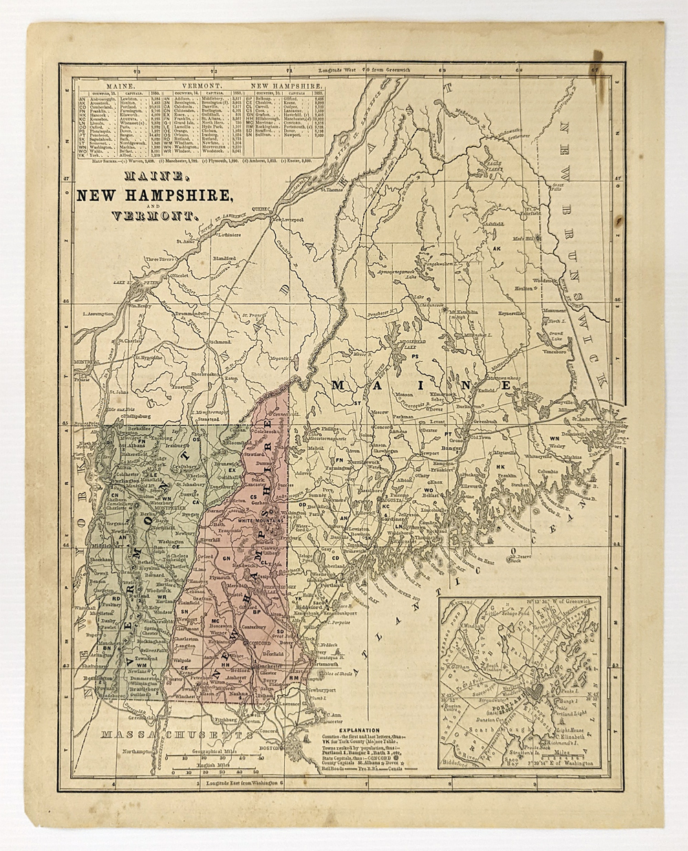 333Maine: 1861 Map of Maine, New Hampshire, and Vermont. Showing railroads, canals, capital and counties. Inset of Portland. Hand colored. 13 x 11 in. $60 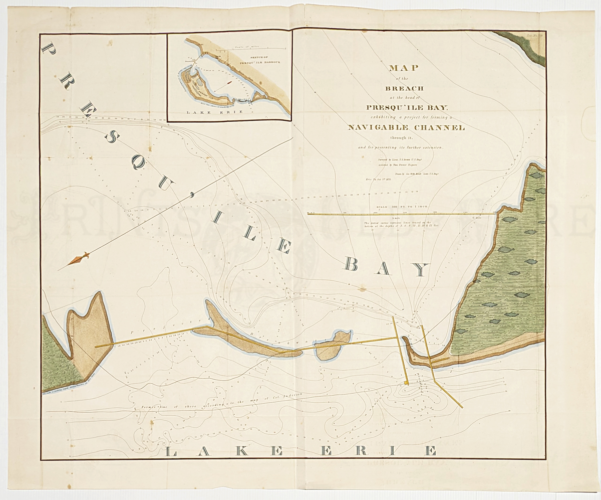 334Maine: Map of the breach at the head of Presqu'ile Bay: exhibiting a project for forming a navigable channel through it and for preventing its further extension. 1835. Rare map showing the proposed channel and showing the depths. Small inset sketch of Presqu'ile Harbor. Hand colored, lithograph. 26 x 31 3/8 in. $600 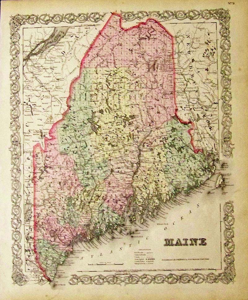 317Maine: 1855 J.H. Colton original hand colored engraved map of Maine. Colton was among the earliest map makers with very accurate maps depicting cities and states in the United States. 17-1/2 x 14-1/2 in. $190 SOLD 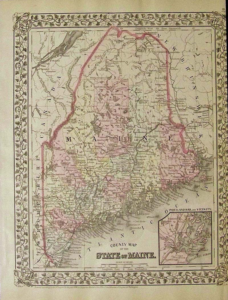
318Maine: 1879 Mitchell's original hand colored County Map of the State of Maine, with small inset of Portland Harbor and Vicinity. Entered According to Act of congress in the Office of the Librarian of Congress at Washington. 15 x 11-1/2 in. $120 SOLD 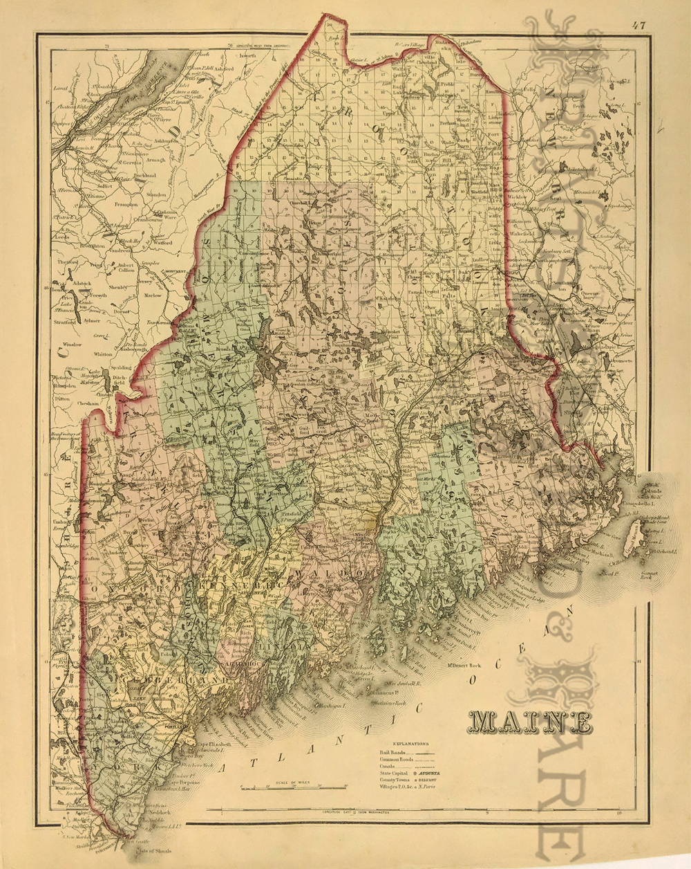 320Maine: Gray’s Atlas Map of Maine. Shows Railroads, Common Roads, Canals, State Capital, Counties, Towns and Villages. 1875. Hand colored, Lithograph. 13 x 15 in. $110 SOLD 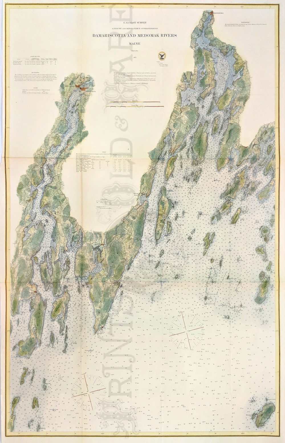 322Maine: 1872 U.S. Coast Survey Map of Damariscotta and Medomak Rivers, Maine. Beautifully hand colored lithograph showing light houses, soundings, buoy's, tides, topography and hydrography. Includes Monhegan Island and Pemaquid Point. 27 1/2 x 42 in. $500 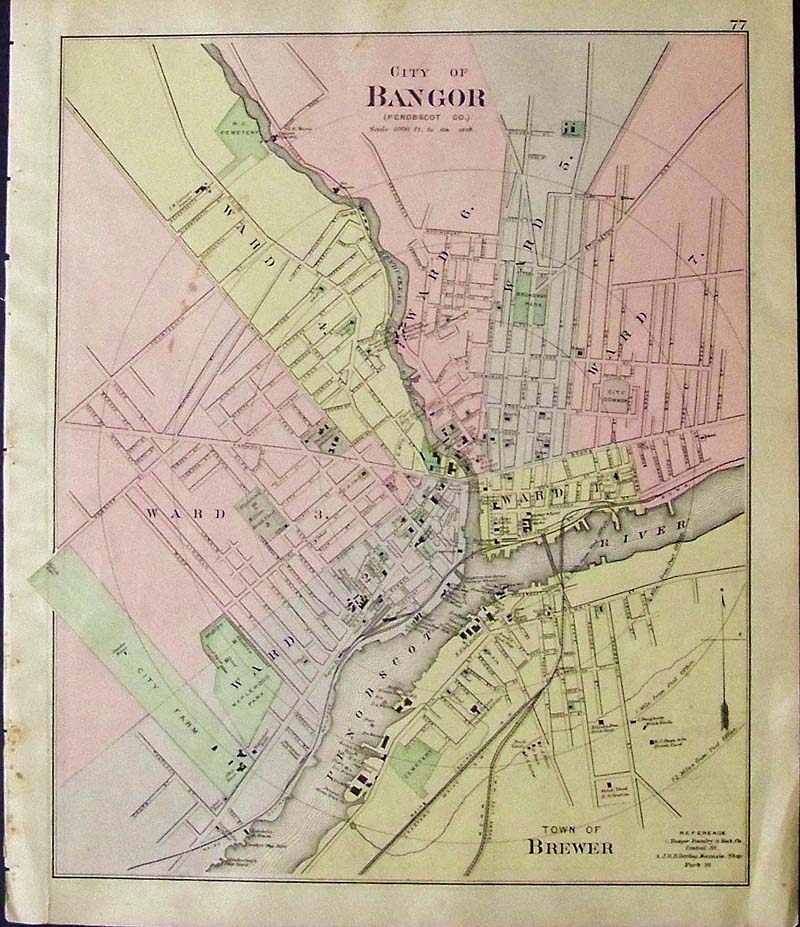 311Maine: 1905 Color map showing the City of Bangor. (Penobscot Co.) Bottom of map shows the Town of Brewer. 17 x 14 in. $60 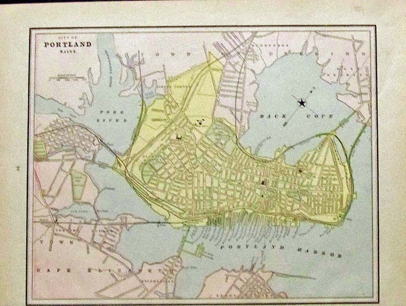
312Maine: 1889 Crams color City of Portland, Maine map. 14-1/2 x 11 in. $40 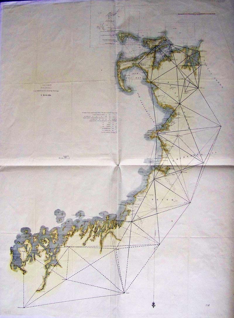
313Maine: 1850 Hand colored lithographed U.S. Coast Survey showing the progress in Sketch A. Cape Cod Bay and Massachusetts Bay are shown, alongwith New Hampshire and Rhode Island, among other locations. 31 x 23-1/2 in. $250 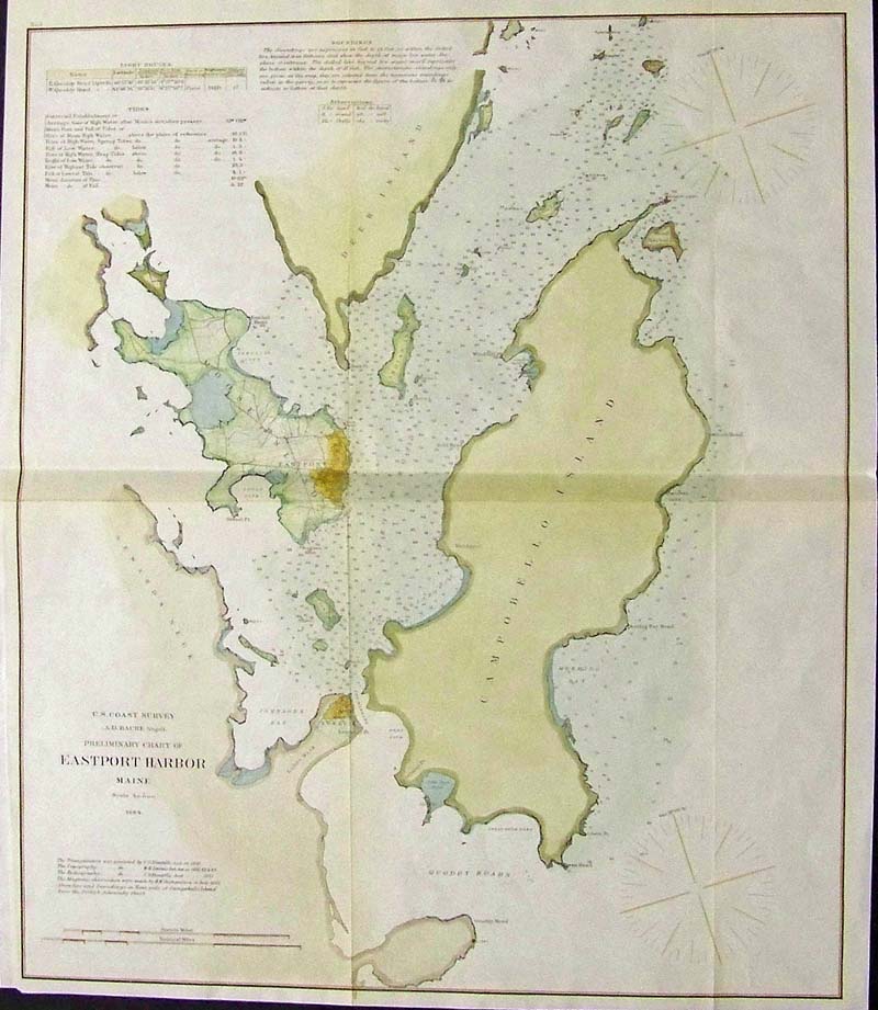
315Maine: 1864 Hand colored lithographed U.S. Coast Survey by A.D. Bache showing a Preliminary Chart of Eastport Harbor, Maine. 21 x 18 in. $150 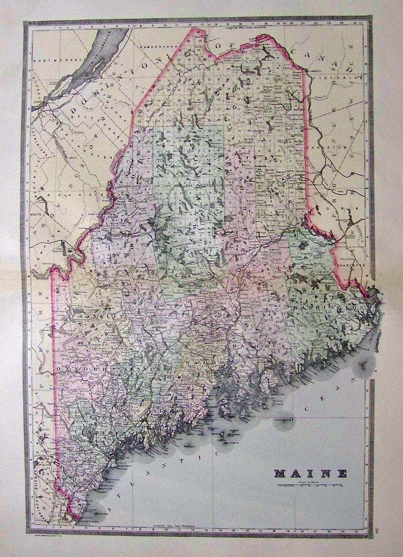
319Maine: 1891 Bradley's Atlas of the World's colored map of Maine. 26 x 19 in. $80 |
|||||||||
| Order Form | |||||||||||
| Back to Homepage | |||||||||||