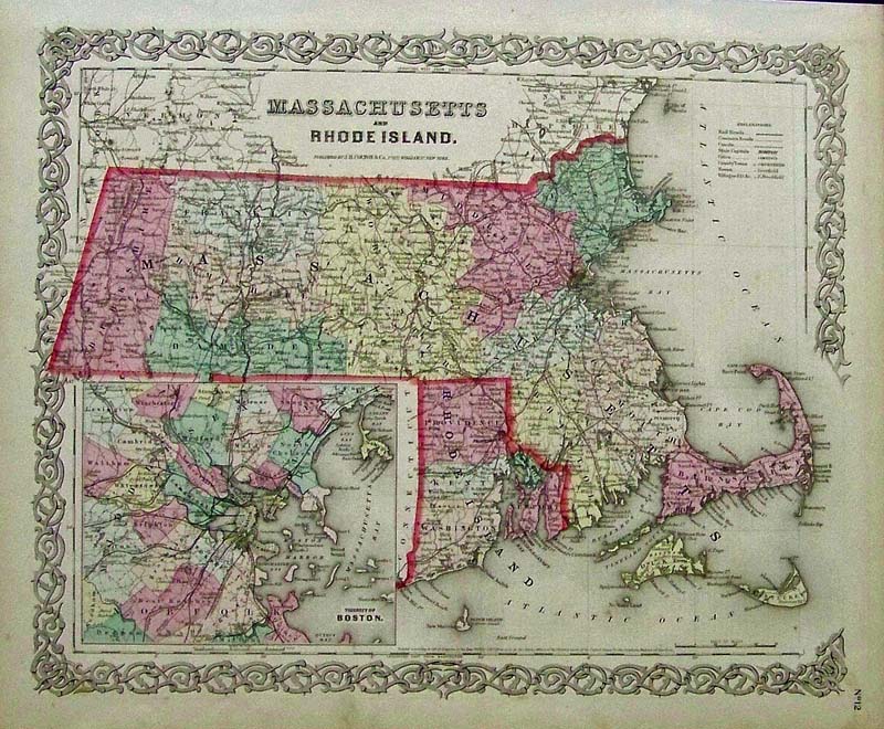
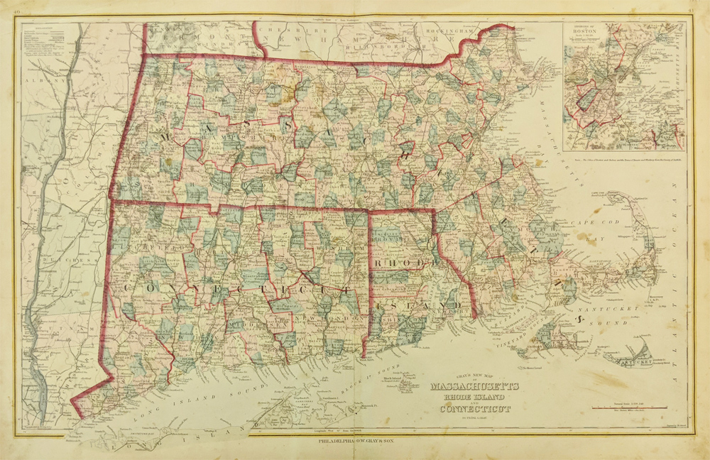
1215ma:
J.H. Colton original hand colored
engraved map of Massachusetts and Rhode Island, with inset showing the
Vicinity of Boston. Colton was among the earliest map makers with very
accurate maps depicting cities and states in the United States.
17-1/2 x 14-1/2 in. $250
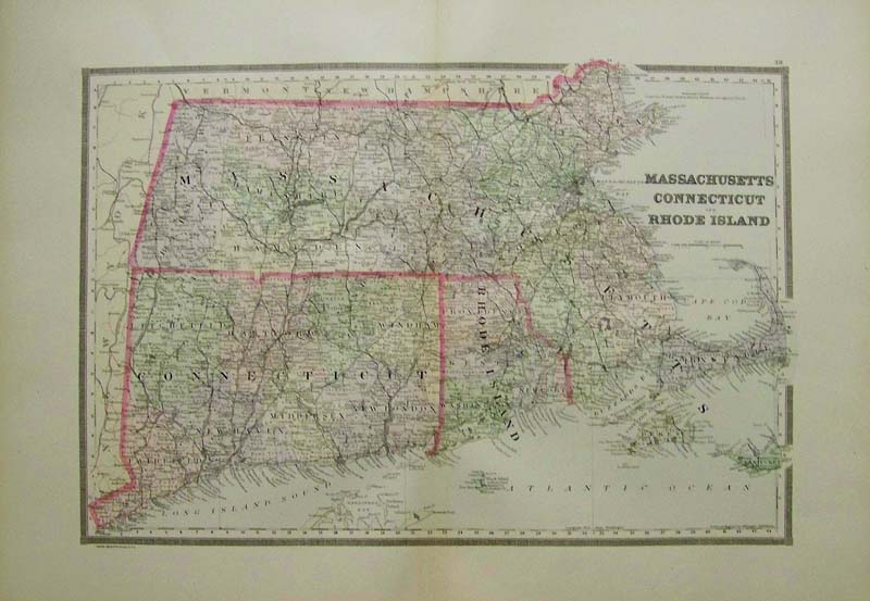
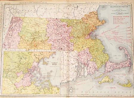
001Massachusetts:
1889 Bradley's color map of Massachusetts, Connecticut
and Rhode Island.
26 x 19 in. $100
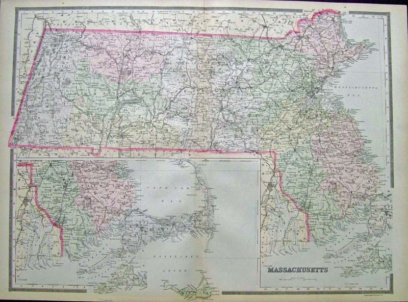
013Massachusetts:
1891 Bradley's color map
of Massachusetts with lower section highlighted on lower left of map.
Featured in Bradley's
Atlas of the World.
26 x 19 in. $100
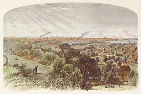
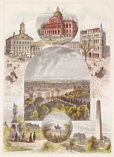
015ma:
1873 Boston. Hand colored bird's-eye view from Mt. Bowdoin. Antique
engraving from Picturesque America. 12-1/2x9 in. $30
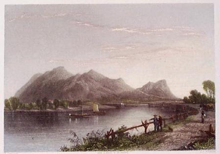
016ma:
1839 Massachusetts. Bartlett view, "Mount Tom and the Connecticut
River." Hand colored engraving. 11x8-1/2 in. $60
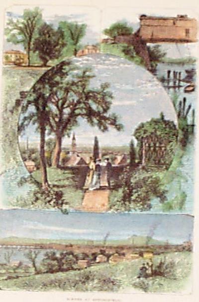
017ma:
1872
Massachusetts. Several hand colored scenes on one page from Springfield
MA. Antique wood engravings from Picturesque America. 9x12-1/2 in. $30
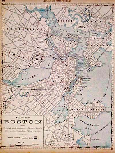
019ma:
1900 Map of Boston. Shows freight and passenger depots, grain
elevators, steamboat wharves. From Rand McNally. 11x14 in. $30
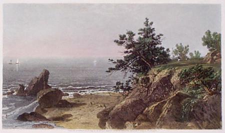
024ma:
1873
Massachusetts view. "On the Beverly Coast." (North of Boston) Hand
colored steel engraving from Picturesque America.
12-1/2x9 in. $40
025ma:
1873 Boston scenes. Seven views of Old Boston from Pictuesque America.
Hand colored engravings. 9-1/2x12-1/2 in. $30
027ma:
Massachussets Connecticut Rhode Island. Map by Bradley. Attractive map
on a very large scale. Nice border, great detail.
26-1/2x19-1/2 in. $120
032ma:
1911
Railroad Map of Massachusetts. Ten railroads listed and shown, plus
shipping routes and lines. Inset of environs of Boston. 29-1/2x21-1/2
in. $80
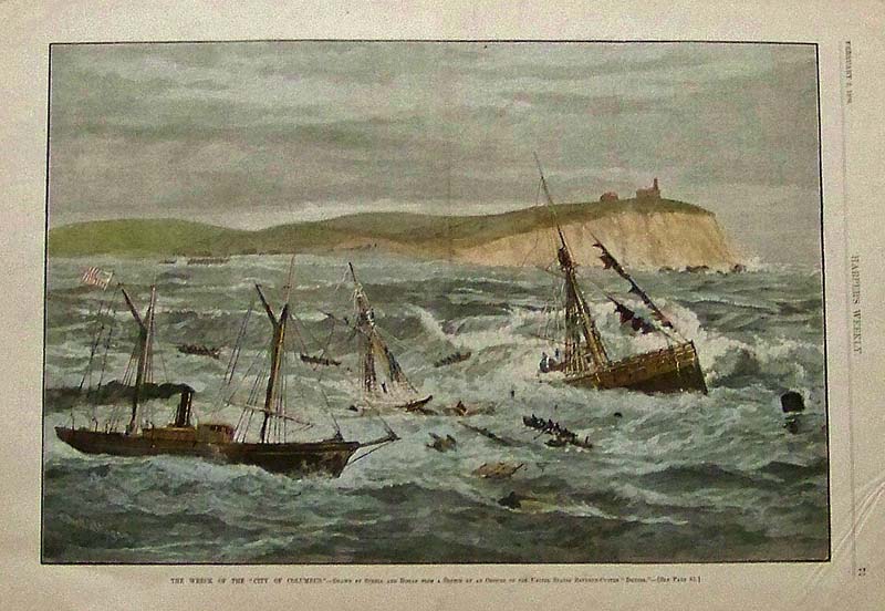
034ma:
1884 Gay Head on Martha's Vineyard is
the backdrop for the sinking of the "City of Columbus" in this hand
colored wood engraving. Drawn by Schell and Hogan.
16 x 11 in. $95
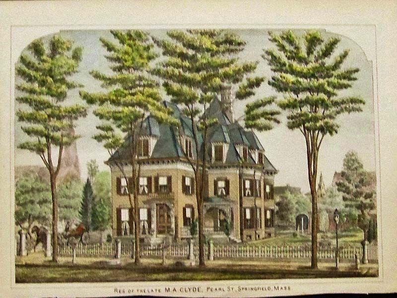
202ma:
C.1880 Springfield Massachusetts
Victorian Residence. Hand colored lithograph showing an authentic
antique view of the residence
of M.A. Clyde.
11-1/2 x 8-1/2 in. $50
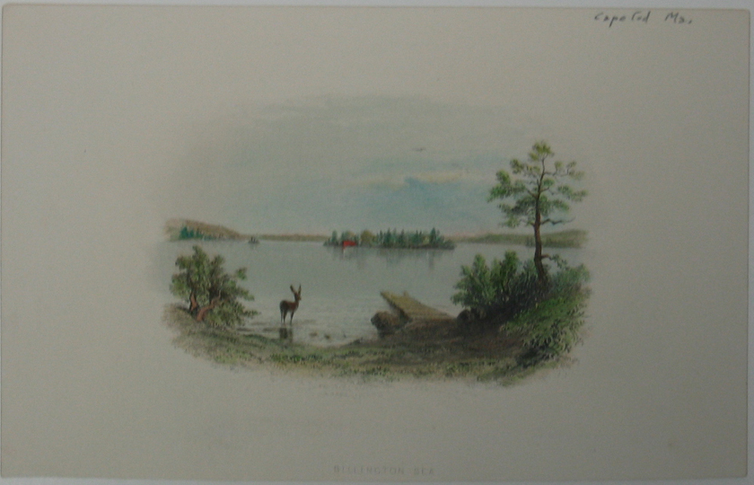
209ma:
Hand
colored antique American view titled, "Billington Sea." Shows scene of
a deer overlooking the Billington Sea in Cape Cod,
Massachusetts.
5 x
8in. $30
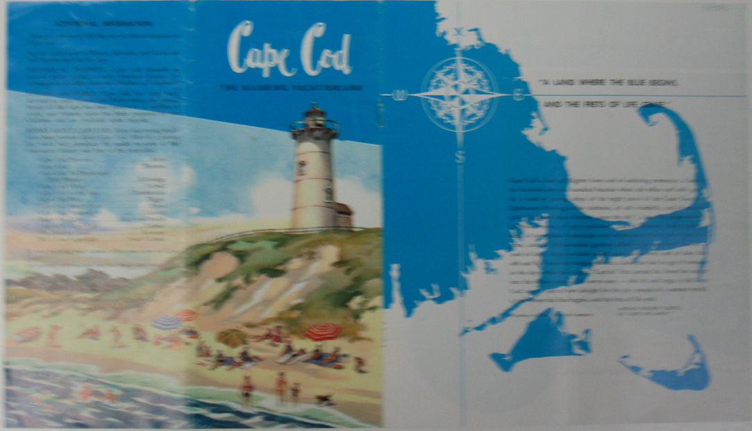
213ma:
C.1950 Colorful vacation pamphlet of
Cape Cod. This pamphlet includes the history and popular sights of Cape
Cod, Massachusetts, including historical exhibits, forests,
parks and books.
16 x 9in. $30
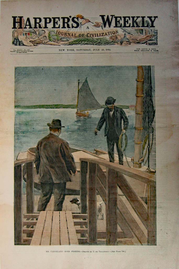
216ma:
1892 Picture of two men on their way to go fishing on Cape Cod.
Elegantly hand colored engraved image titled, "Mr. Cleveland Goes
Fishing," drawn by T. de Thulstrup from Harper's Weekly. 11 x 16in. $50
217ma:
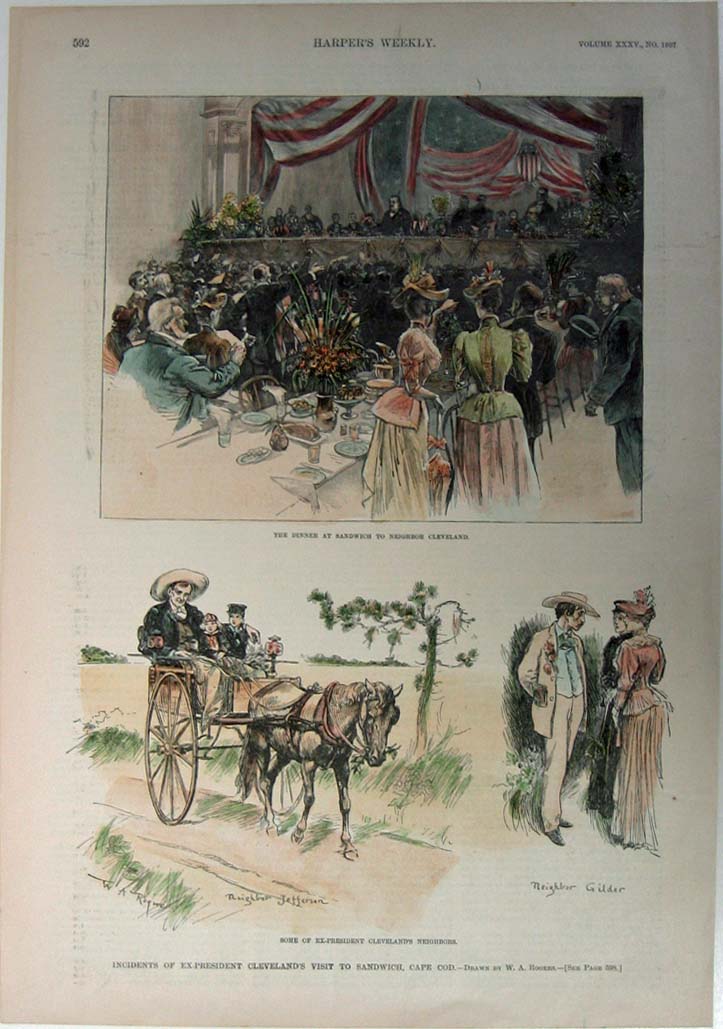
1891 Pictures of Ex-President Cleveland's visit to Sandwich, Cape Cod.
Elegant hand colored engraved image titled, "Incidents of Ex-President
Cleveland's Visit to Sandwich, Cape Cod, The Dinner at Sandwich to
Neighbor Cleveland and Some of the Ex-President Cleveland's Neighbors,"
drawn by W. A. Rogers from Harper's Weekly. 11 x 16in. $50
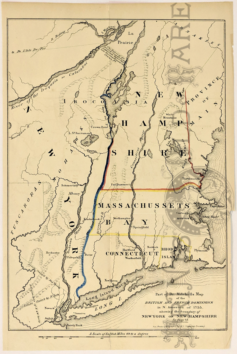
108NewHampshire:
"Part of Dr. Mitchells Map of the British and French Dominions in N.
America of 1755, Showing the boundary of New York on New Hampshire."
Re-issue of a 1755 Map published in 1850 by Am. Photo-Lithographic Co.
NY. Hand colored lines showing the boundry between each of the
states. Cities, rivers and sounds are shown, along with limits and
division lines claimed.
9 x 13 1/2 in. $150
|
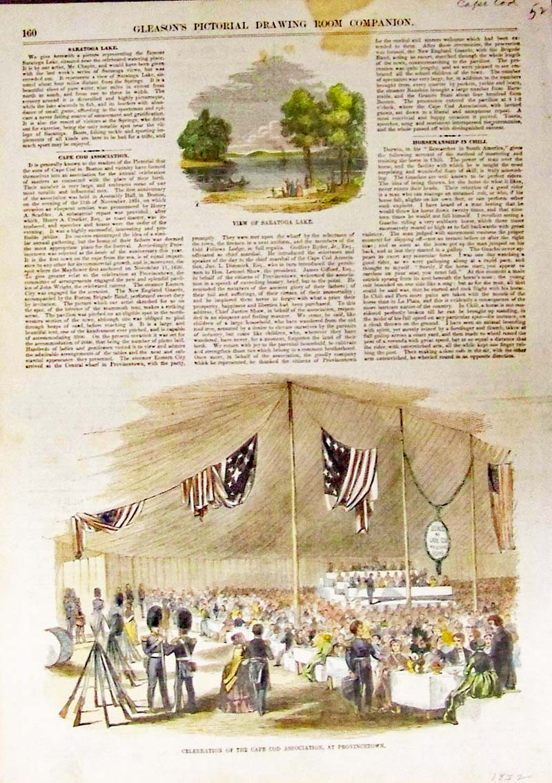
218ma:
1852 Provincetown - Cape Cod - Catered celebration of the "Sons of Cape
Cod with descriptions and article. Hand colored wood engraving featured
in Gleason's Pictorial Drawing Room Companion.
15 x 10-1/2 in. $60
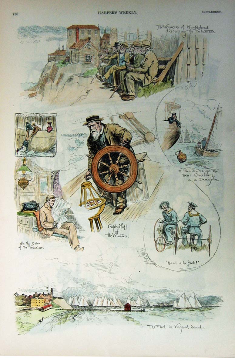
220ma:
1887 Pictures of the Wiseacres of Marblehead and the Fleet in Vineyard
Sound. Beautifully hand colored engraved images various captions read:
Wiseacres of Marblehead discussing the Volunteer, A Chivalrous Deed, A
Reporter Drops the News Overboard in a Demijohn, In the Cabin of the
Volunteer, Capt. Haff of the Volunteer, Hard a lee Jack and the Fleet
in Vineyard Sound from Harper's Weekly.
11 x 16in. $60
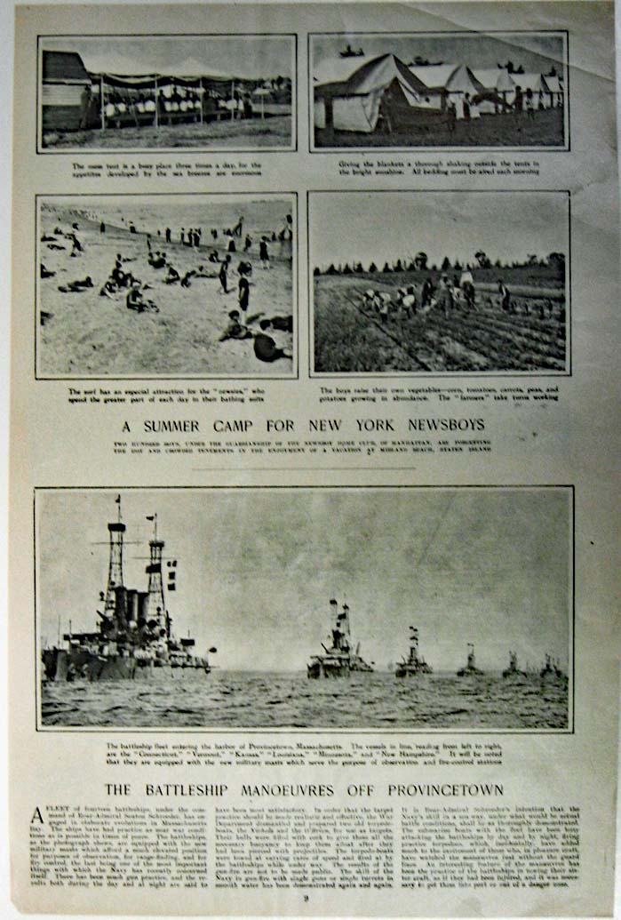
221ma:
C1900 Images of the Battleship Manoeuvres Off Provincetown. Gorgeous
photographed images titled,"The Battleship Manoeuvres Off
Provincetown." Shows scene of the battleship fleet entering the harbor
of Provincetown, Massachusetts.
11 x 16in. $30
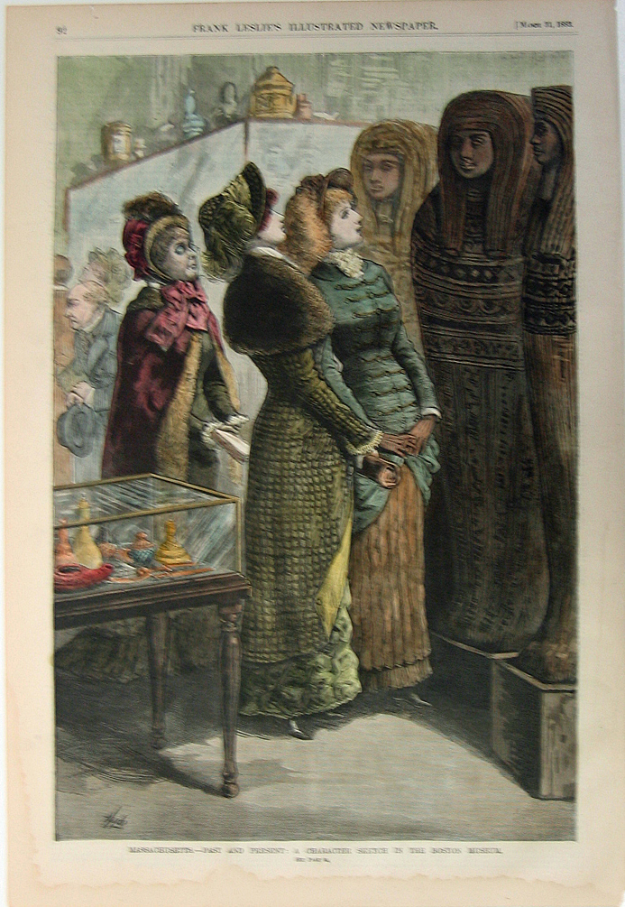
224ma:
1883 Image of women admiring artifacts in a museum.
Beautifully hand colored engraved image titled, "Massachusetts-Past and
Present: A Character Sketch in the Boston Museum," drawn by Hyde from
Frank Leslie's Illustrated Newspaper. 11 x 16in. $50
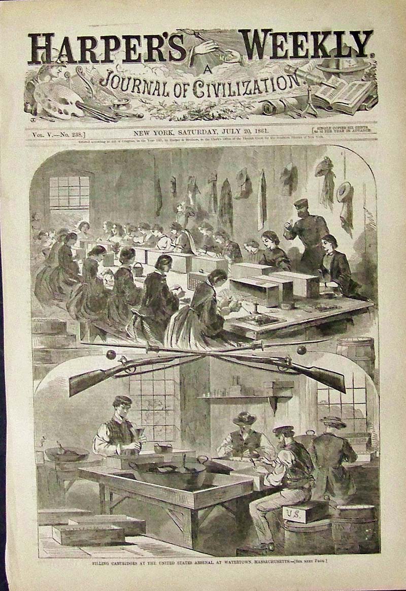
227ma:
1861 Winslow Homer wood engraving titled, "Filling Cartridges at the
United States Arsenal, At Watertown, Massachusetts." Featured in
Harper's Weekly, A Journal of Civilization.
16 x 11 in. $50
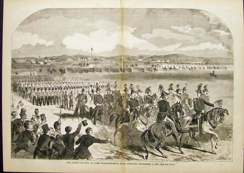
228ma:
1859 Winslow Homer double-paged wood engraving featured in Harper's
Weekly titled, "The Grand Review at Camp Massachusetts, Near Concord,
September 9, 1859."
22 x 16 in. $125
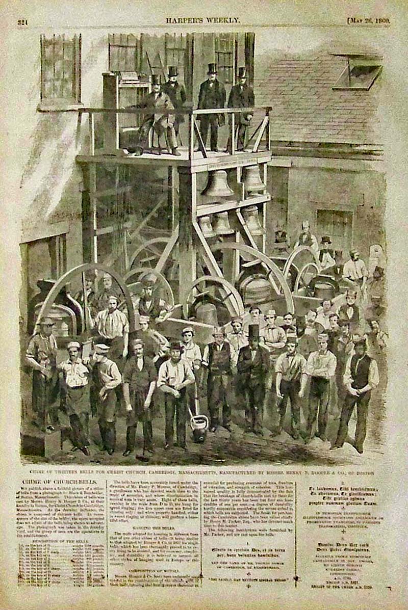
229ma:
1860 Winslow Homer wood engraving featured in Harper's Weekly titled,
"Chime of Thirteen Bells for Christ Church, Cambridge, Massachusetts,
Manufactured by Messrs. Henry N. Hooper &
Co., of Boston."
15-1/2 x 11 in. $60
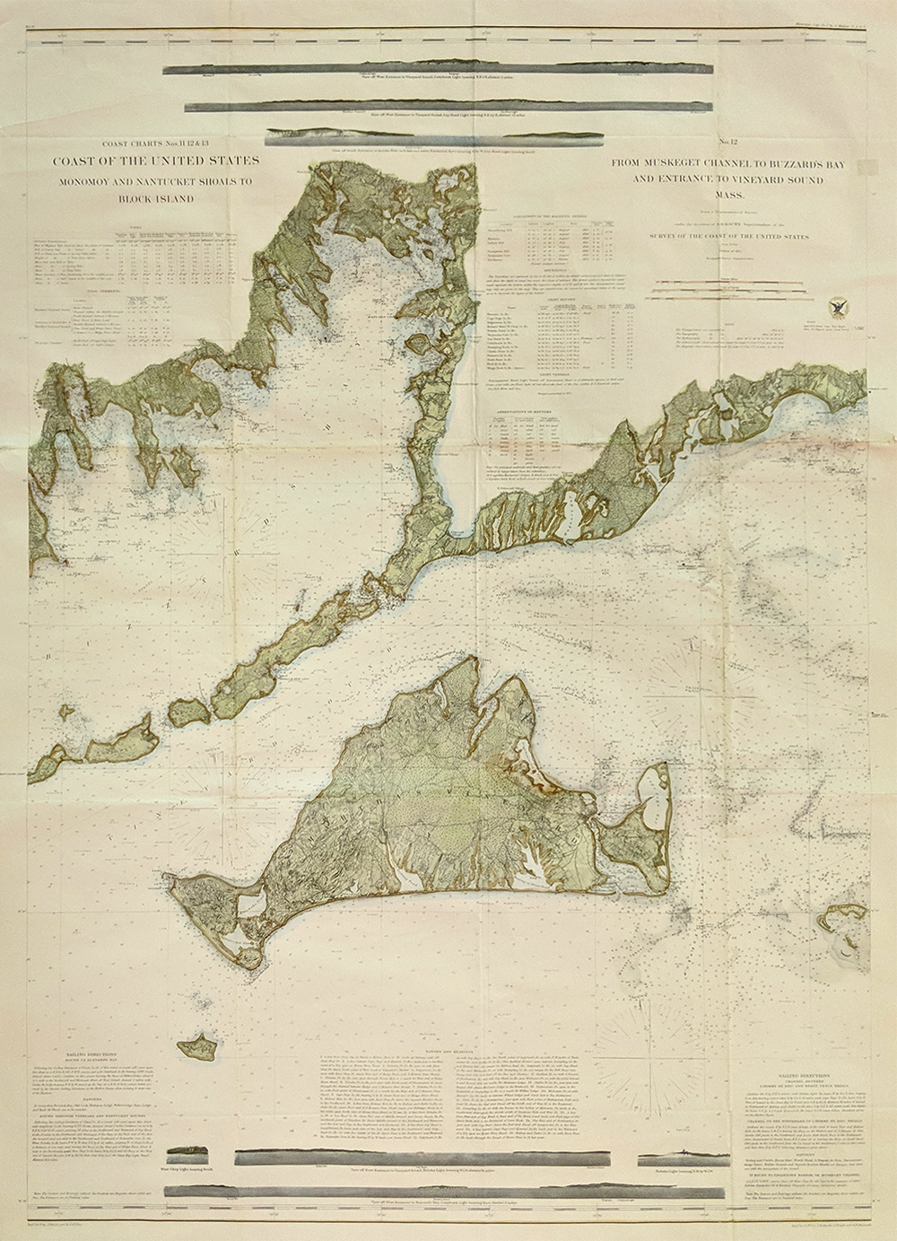
230ma:
Martha's Vineyard - Large hand colored chart showing the Muskeget
Channel, Buzzard's Bay and the entrance to Vineyard Sound. Issued by
the U.S. Coast Survey Office in 1860. Detailing the Topography of the
city New Bedford and surrounding towns of Wareham, Agawam, Falmouth
Village, Oysterville Annharbor. Shows depth and insets of lighthouses.
42 1/2 x 29 1/2 $900
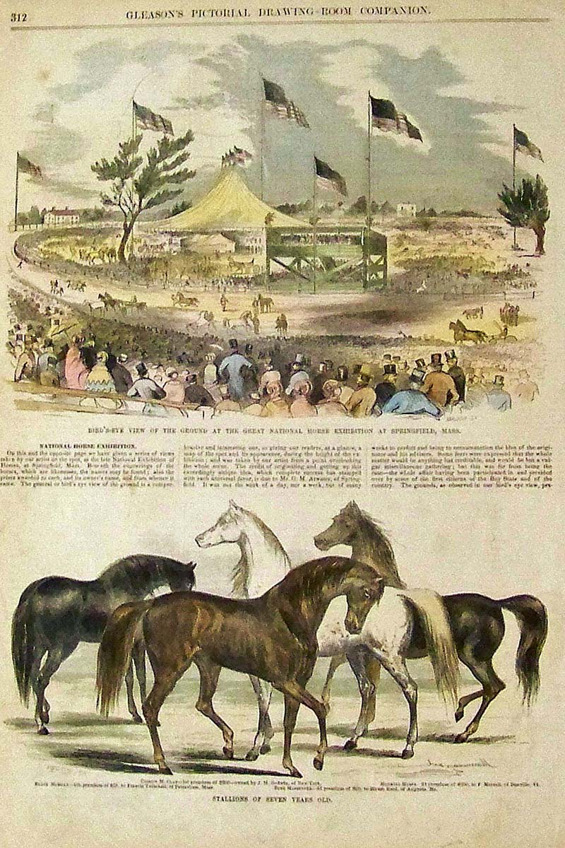
0115ma:
1853 Springfield Horse Show -- Hand colored wood engraving and text
showing the National Horse Exhibit in top image and bottom image shows
some of the
seven-year-old stallions.
15-1/2 x 11 in. $50
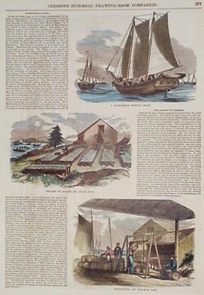
1184ma:
1853 Fishing Print: Marblehead, MA. Gleason's Pictorial (1853). Fishing
at Marblehead, plus text. Color: Water Color. Type: Wood
Engraving.
Size: 11x16 in. $40
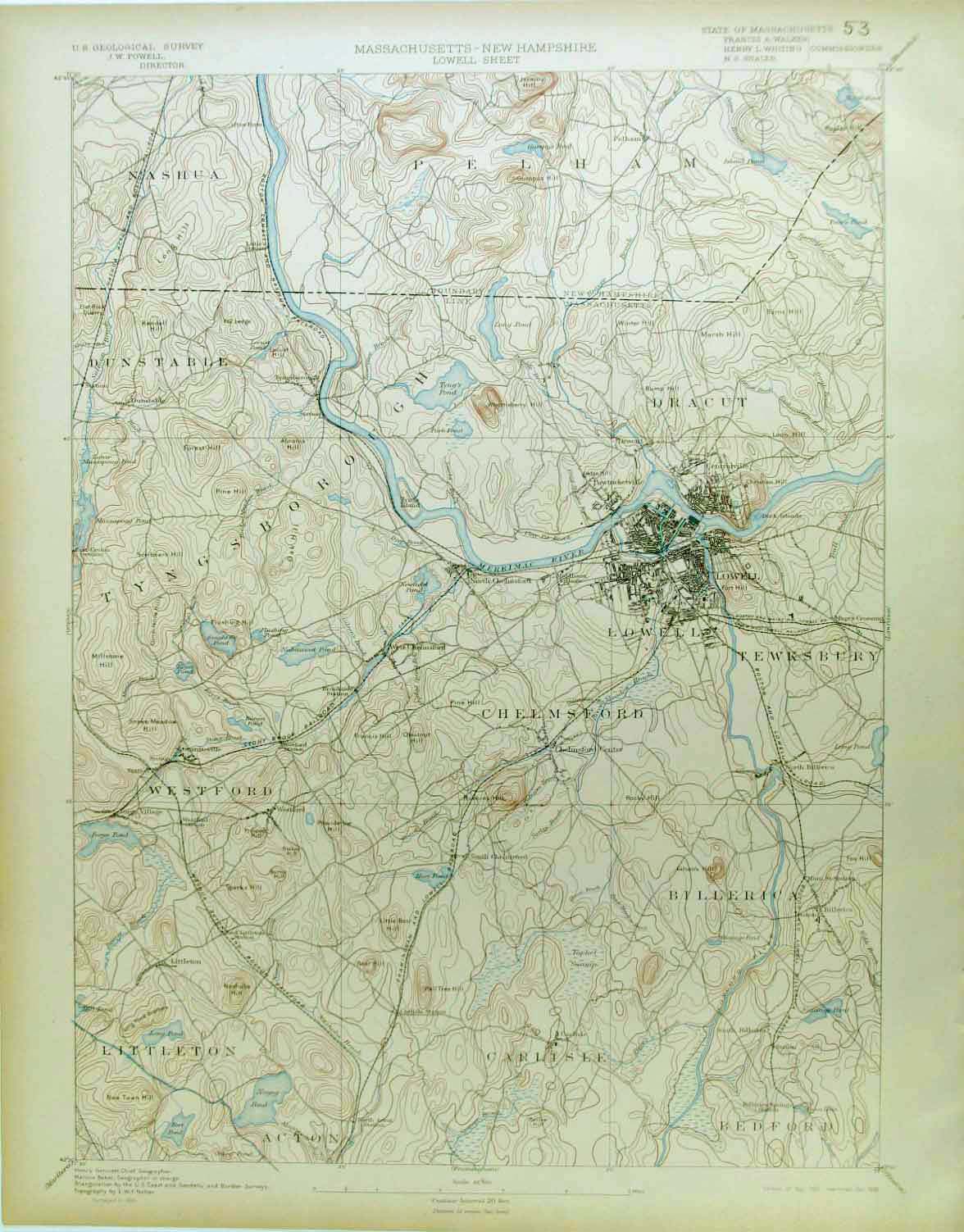
1187ma:
Lowell,
MA, 1898 U.S. Geological Survey No.53 Shows Merimac River, Town of
Lowell, Chelmsford, Tewksbury, Framingham
and Lowell RR.
19 x 13 in. $80
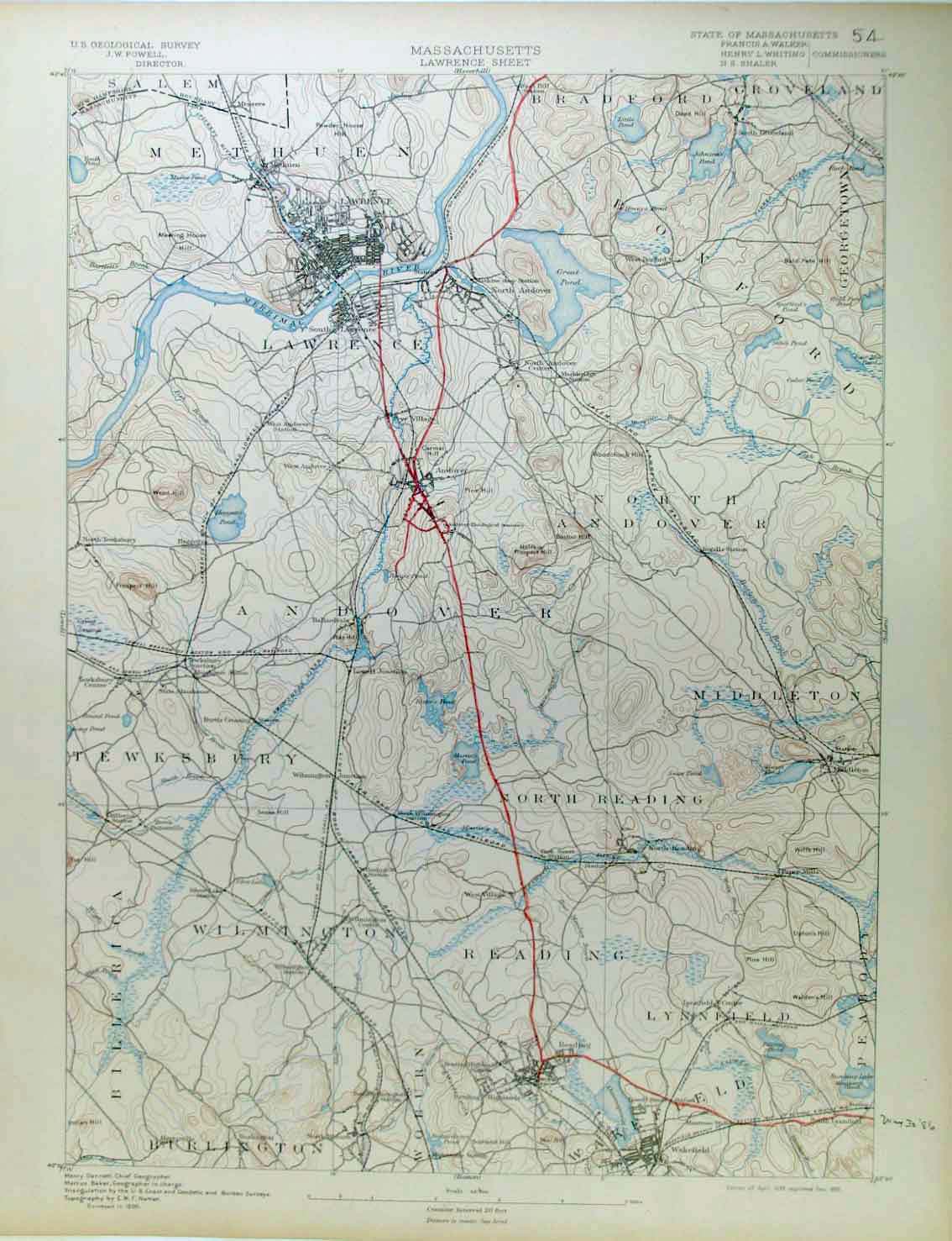
1188ma:
Lawrence, MA, 1898 U.S. Geological Survey No. 54 Showing
Salem and Lawrence.
19 x 13 in. $80
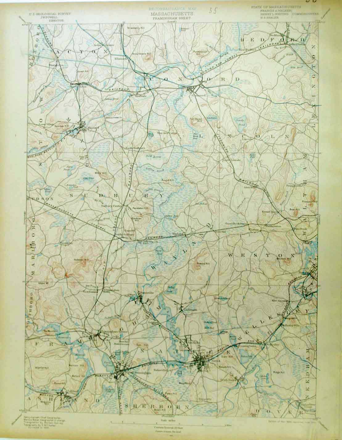
1189ma:
Framingham Sheet, MA, 1898 U.S. Geological Survey No. 55 Showing Old
Colony RR, Mass Central RR, Town of Natuck
19 x 13 in. $90
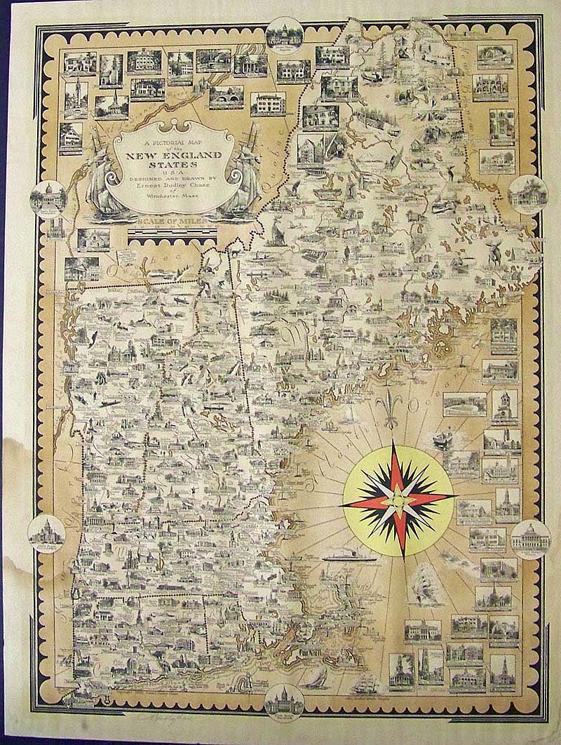
230us:
1939 Ernest Dudley Chase Pictorial lithographed Map of New England
States. Map shows cities, towns, historic sites, landmarks, buildings,
animals, and people doing recreational activities. Artist signature in
pencil on lower left margin. Beautiful compass rose. Map also includes
Connecticut, Rhode Island, New Hampshire, Vermont, and Maine. Water
damage to left margin, extending slightly into map. In margin, small
insets of
the State Houses.
25 x 19 in. $275
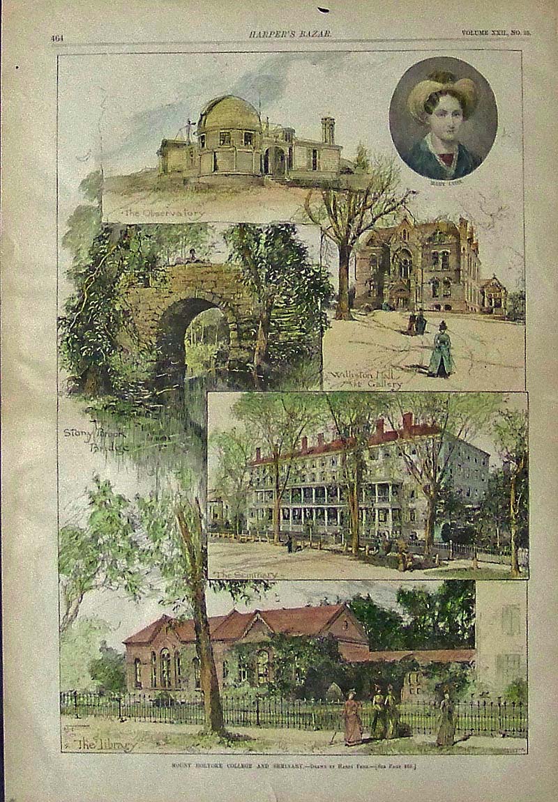
310univ:
1889 MOUNT HOLYOKE COLLEGE AND SEMINARY - Very Rare hand colored
engraving
from Harper's Bazar.
16 x 11 in. $150
000rare:
1834 New Bedford
with large inset of its Vicinity. Very rare lithograph by J. Congdon,
published by Pendleton's Lithography, Boston. Map includes Village of
New Bedford with public buildings, roads, cemeteries, churches, plan
and waterfront docks, population and more.
Condition: Good. Browning and aging throughout with small margins, and
foxing throughout.
34 x 21 in. $2,500
|
235ma:
Camp Andrews, 128th Regt. P.V. in the Vicinity of Fort Worth, 1862.
Showing a view of West Roxbury's Brook farm; site that hosted Camp
Andrew, a Civil War encampment. Colored lithograph.
10 3/4 x 14 1/2 in. $90
236ma:
Boyden Family Documents, early 1800’s, Massachusetts. 27 pieces of
Boyden Family historical documents. These are primarily from Denham and
Walpole MA. and are handwritten documents and misc. papers relating to
Harvey, Henry and Phinehas Boyden. Most are dated 1811, 1812-1828 a few
in the 1870s – 1874 Porter Boyden 1879 Maynard Boyden. There are
probate documents, wills and guardianships.
Various sizes - $500
237ma:
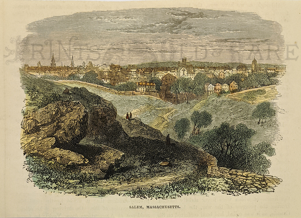
Salem c.1860 - Birdseye view.
4 3/8 x 7 in. $40
239ma:
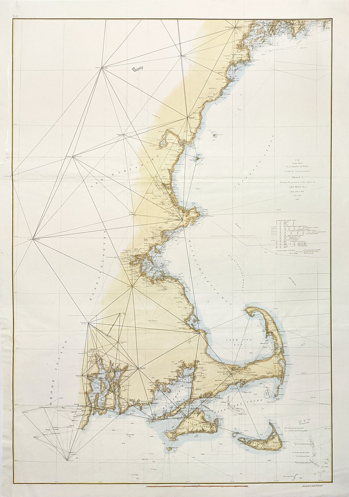
Cape Cod to Maine 1861. Detailed and informative US Coast Survey map
showing North of Newport, Martha’s Vineyard, Nantucket, Boston area,
Portsmouth, and Portland. Hand colored, lithograph. **Folds have been reinforced and/or mended.
22 x 32 in. $80
240ma:
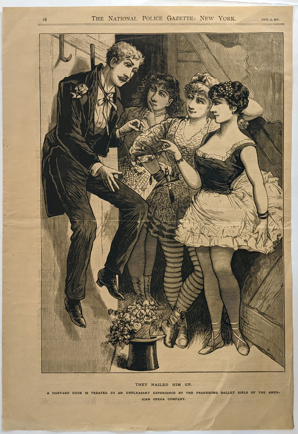
1887 Ballet Girls dispute a Harvard dude. A pranksome nails up unruley
student.
11 x 16 in. $75
241ma:
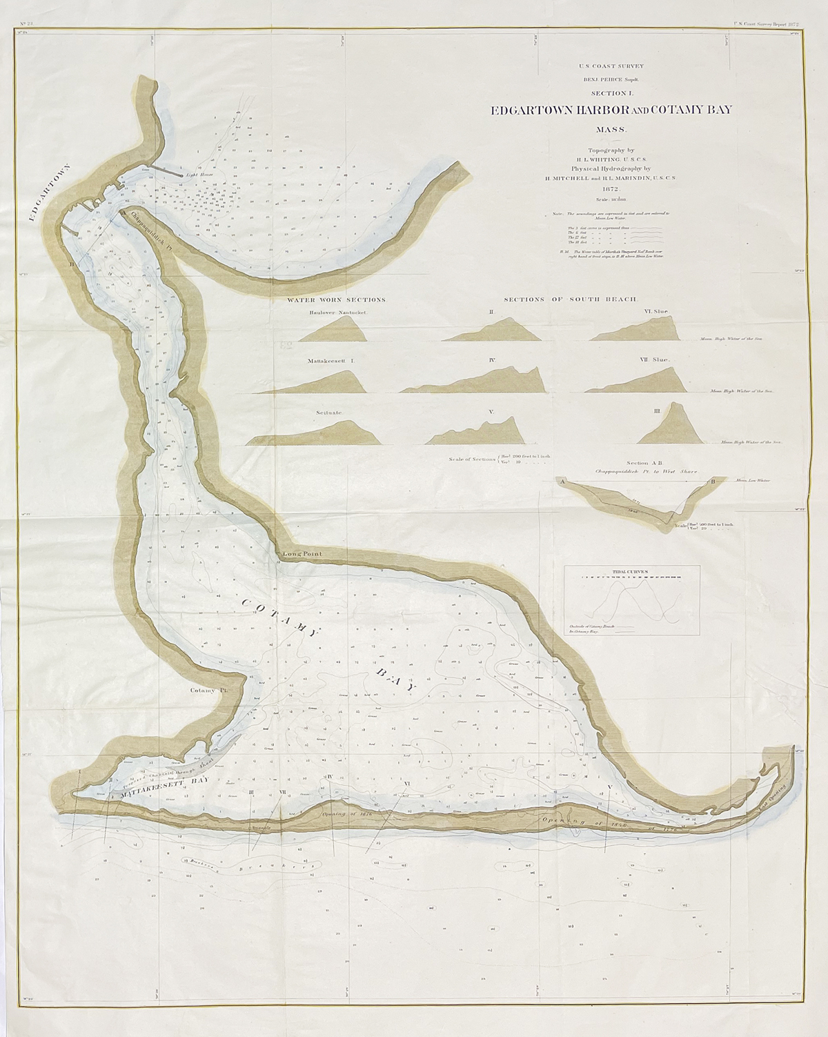
Edgartown Harbor and Cotamay Bay 1872. Antique map of this Martha’s
Vineyard location. Original U.S. Coast Survey Map, showing soundings,
and water warn sections.
21 1/2 x 31 in. $475
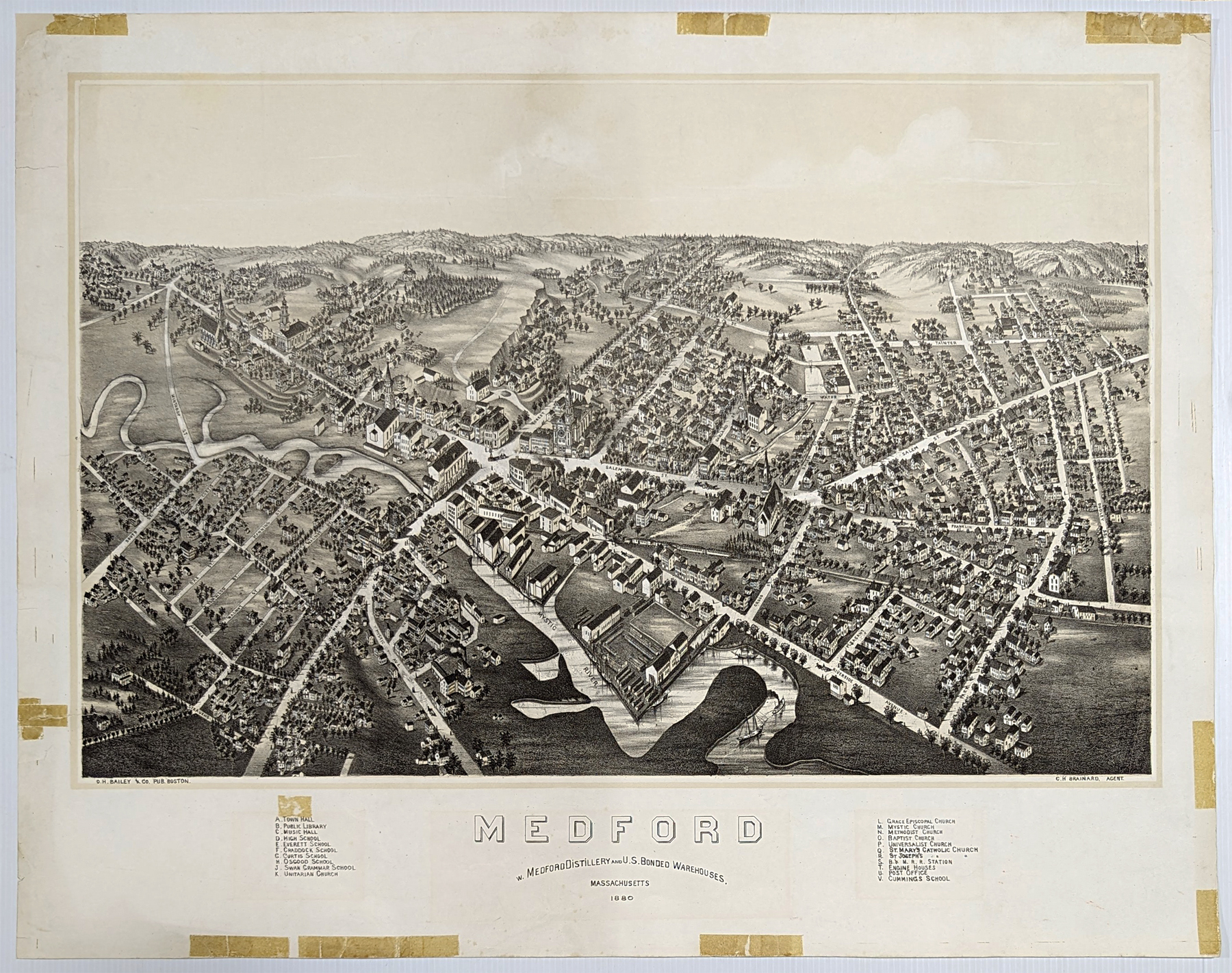
242ma:
Rare Medford Distillery, Lithograph 1880. Detailed Birdseye view of the
historic town on the Mystic River and home to Medford Distillery.
Original b/w. Condition - Interior 3/4" tape residue over first set of
keys. Tape residue on outer edges but can easily be covered by matting.
22 x 27 7/8 in. $950
232ma:
Massachusetts – Rare map by Bradford. 1838. Hand colored engraving.
Shows counties, towns, railroads.
12 3/4 x 15 7/8 in. $225
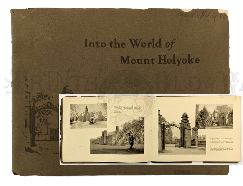
678univ:
Mt. Holyoke College. 1921 large oblong booklet – “Into the World of Mt.
Holyoke.” Descriptive and informative 36pp of sepia toned photos of
college life, professors, buildings, students. Printed letter from Mr.
Woolley and U.S. Vice President Calvin Coolidge. *Cover has few chips
at top and corners.
9 1/4 x 12 1/8 in. $75
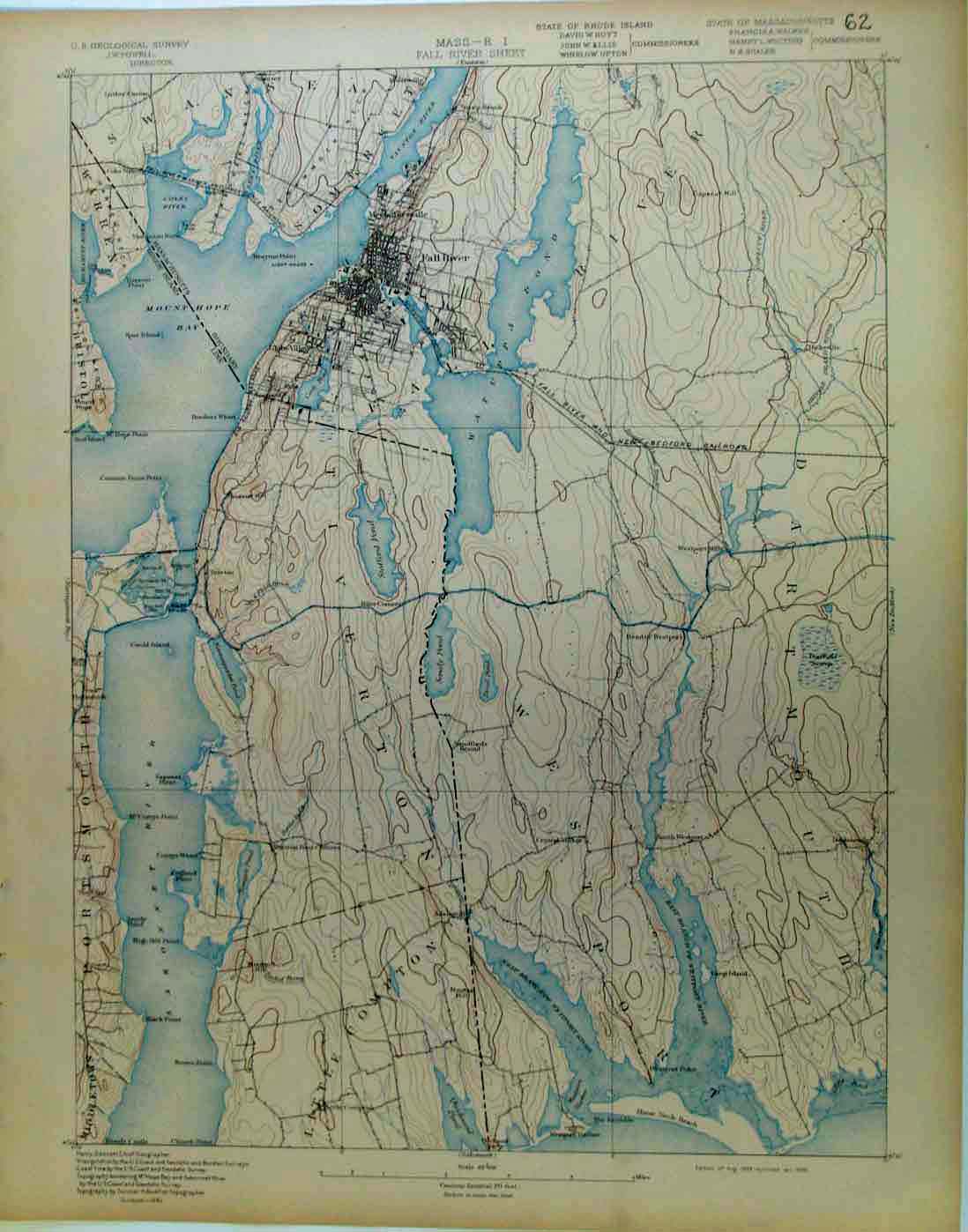
1191ma:
Fall River Sheet, MA, 1898 U.S. Geological Survey No. 62 Showing Mt
Hope Bay and RR Lines
19 x 13 in. $80

1192ma:
Newburyport, MA, 1898 U.S. Geological Survey No. 68 Showing Newburyport
19 x 13 in. $90
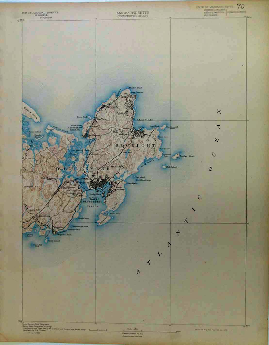
1194ma:
Gloucester Sheet, MA, 1898 U.S. Geological Survey No.70 Showing
Gloucester and Rockport
19 x 13 in. $70
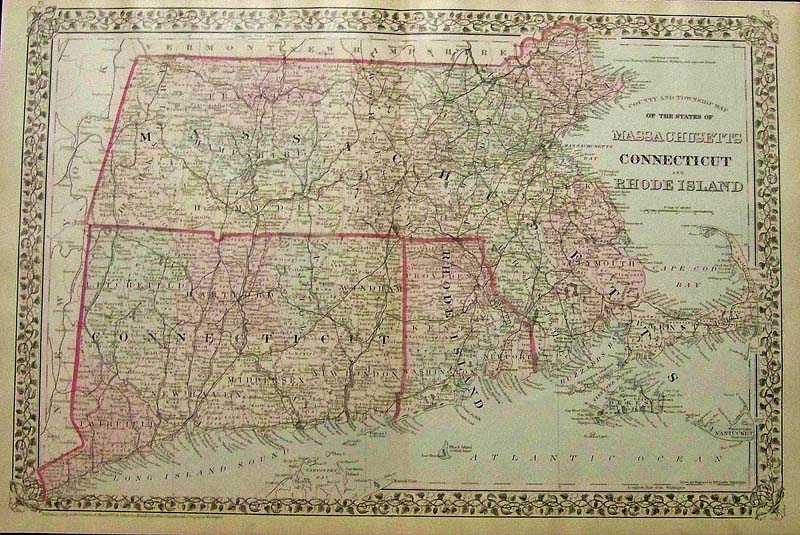
1196Massachusetts:
1879 Mitchell's original hand colored County and Township Map of the
States of Massachusetts, Connecticut, and Rhode Island. Entered
according to Act of congress in the Office of the Librarian of Congress
at Washington.
23 x 15 in. $150
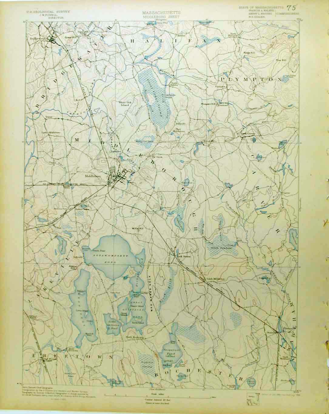
1197ma:
1898 U.S. Geological Survey No.75 Middleboro Old Colony RR (Plymouth)
19 x 13 in. $50
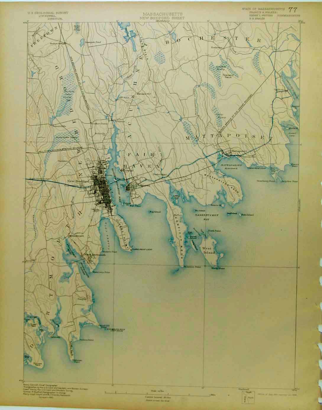
1199ma:
New Bedford Sheet, MA, 1898 U.S. Geological Survey No.77 Showing New
Bedford, Clarks Pt. Old Colony RR Tracks 19 x 13 in. $60
1205ma:
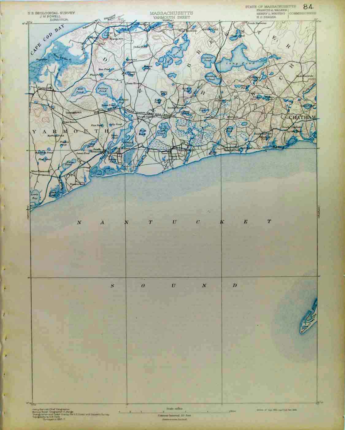
1898 U.S. Geological Survey No.84 Yarmouth Cape Cod.
19 x 13 in. $70
1207ma:
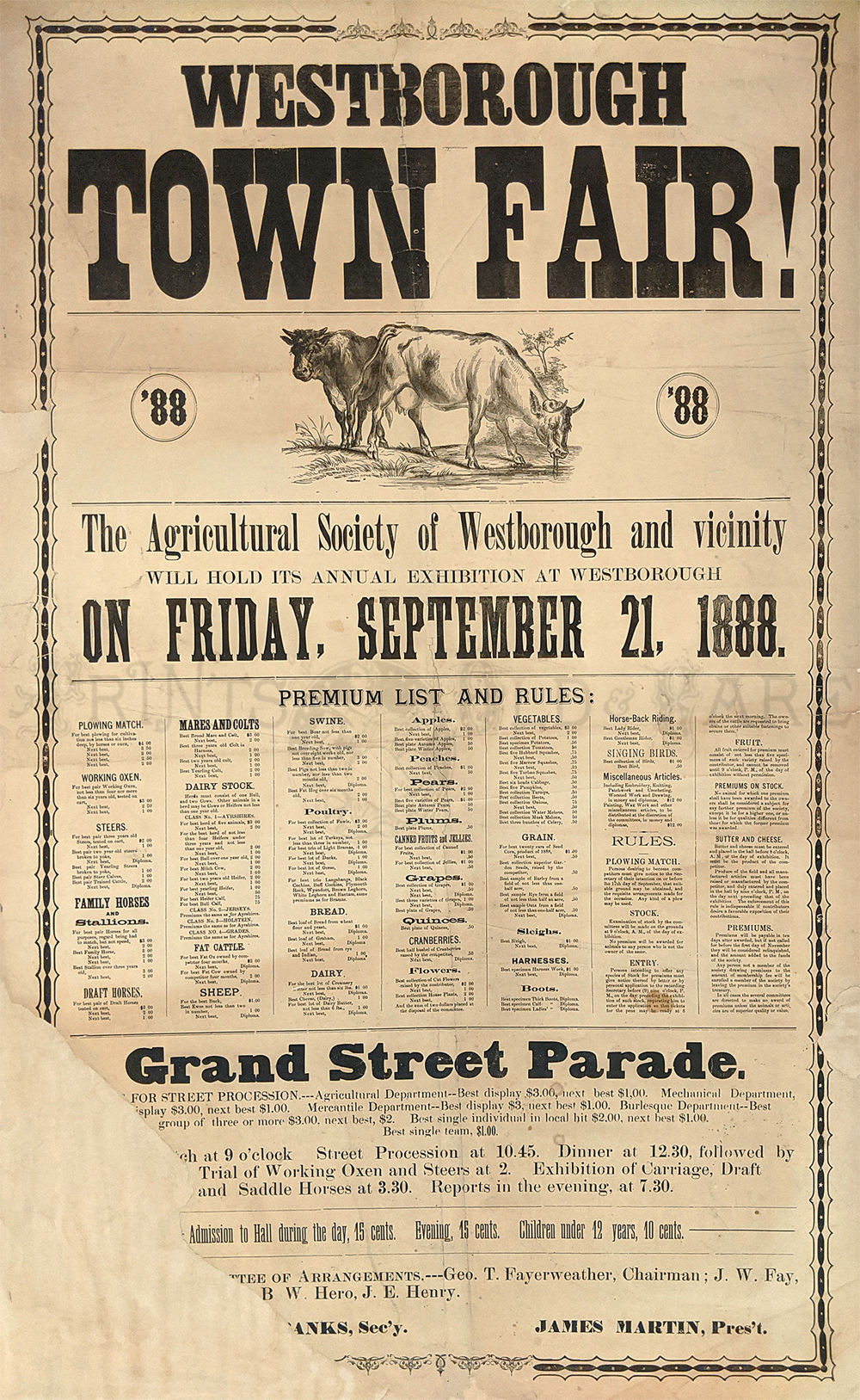
This is an original Broadside
poster printed in 1888
It advertised the Westborough Town Fair and Grand Street Parade held on
Friday, September 12, 1888 It was put on by the Agricultural Society of
Westborough & Vicinity. The Poster includes premium lists and
rules: ie. fat cattle, draft horses, bread, etc. 38in x 24in.
Condition:
Left corner (11in long 2-9
in wide) is missing and has been archivally patched and blends in
nicely (see picture). Otherwise this poster is in good condition with a
few other miscellaneous tears. All mending is archival and the paper in
not at all brittle.
$250
1208ma:
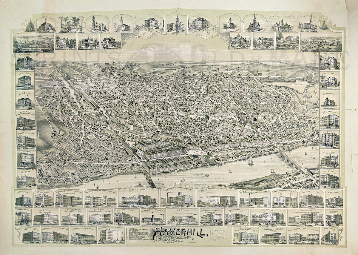
RARE 1893 Authentic lithographed City View of Haverhill, Massachusetts,
published by O.M. Bailey & Co., Boston. View shows several
vignettes surrounding the city of prominent buildings in Haverhill at
that time. Key to the prominent buildings is on
bottom center of page.
39 x 26-1/2 in. $1,200
1209ma:
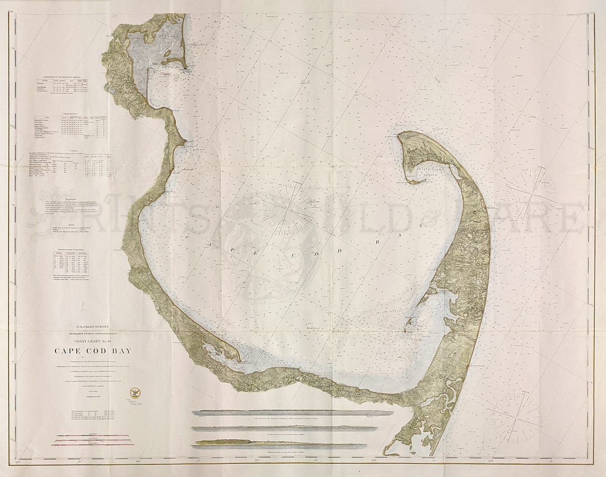
1872 Hand colored U.S. Coast Survey of Cape Cod Bay showing the keys on
the left side. Benjamin Peirce, Superintendent. Coast
Chart No. 10.
38 x 30 in. $800
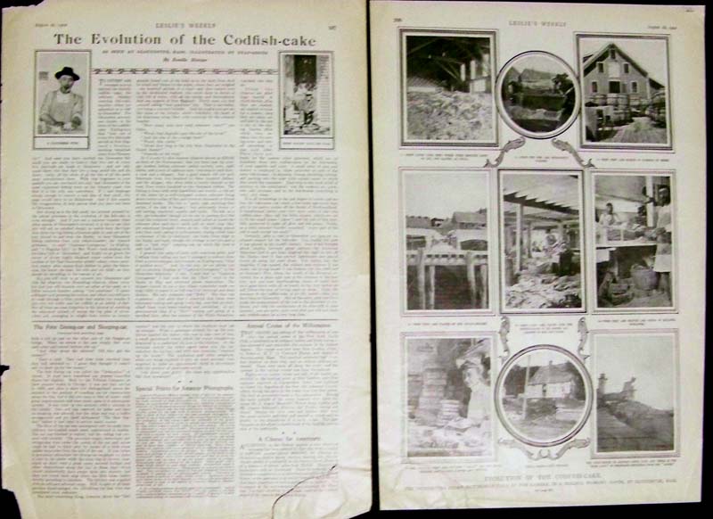
1210ma:
1902 Double-paged half-tone engraving showing the Gloucester,
Massachusetts Codfish Cake Evolution. This article was featured in
Leslie's Weekly and shows in several half-tones the process of
catching, cutting, and packaging the codfish cakes from start to
finish. Title of article is, "The Evolution of the Codfish-Cake," by
Roselle Mercier. Two-page article. Dimension of both pages
side by side is:
22 x 16 in. $40
1211ma:
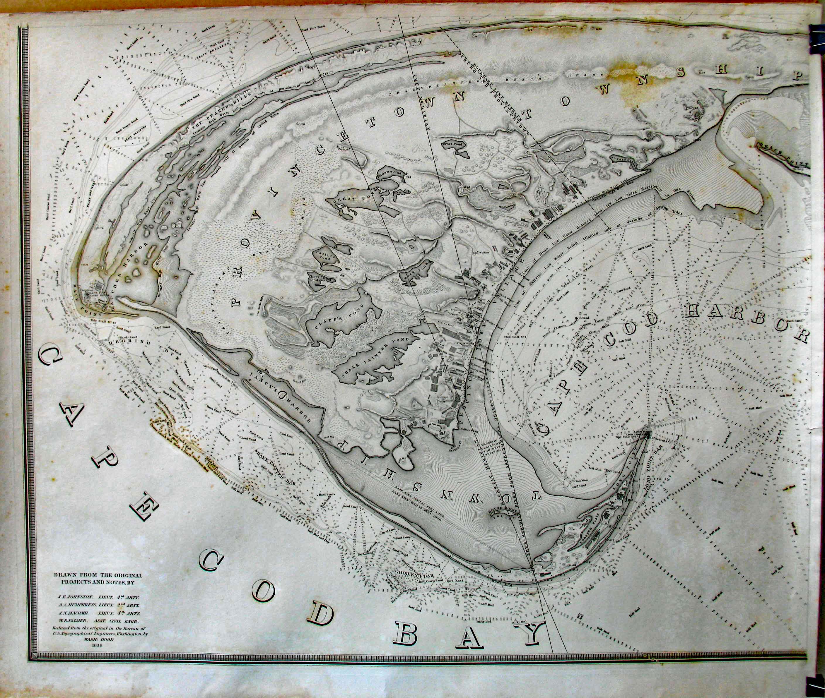
1835 Four-part Map of the Extremity of Cape Cod, including the Township
of Provincetown and Truro, with a chart of their Sea Coast and of Cape
Cod Harbour. Shows eleven wharves, individual structures, roads, hills,
ponds, Navy Chart, soundings and lighthouses. Excellent impression done
on heavy paper stock. 6 inches to the mile. Photo shown is only 1
section of the 4-part map. Additional photos for the remaining 3 parts
are available upon request. Entire map
(all 4 parts) measures:
56-1/2 x 69-1/2 in. $4,000
1212ma:
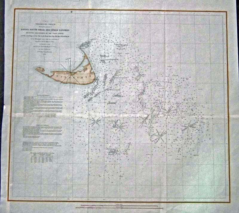
C.1847 Hand colored copper engraved Preliminary Sketch showing
Nantucket Island and the Davis's South Shoal and Other Dangers that had
recently been discovered by the Coast Survey and the Soundings of the
Old South Shoal, Bass Rip, Old Man, Pochick Rip, &cc. Left side
of map shows Bearings and Distances, and Tides and Tidal
Currents.
A.D. Bache, Superintendent.
21 x 19-1/2 in. $350
1214ma:
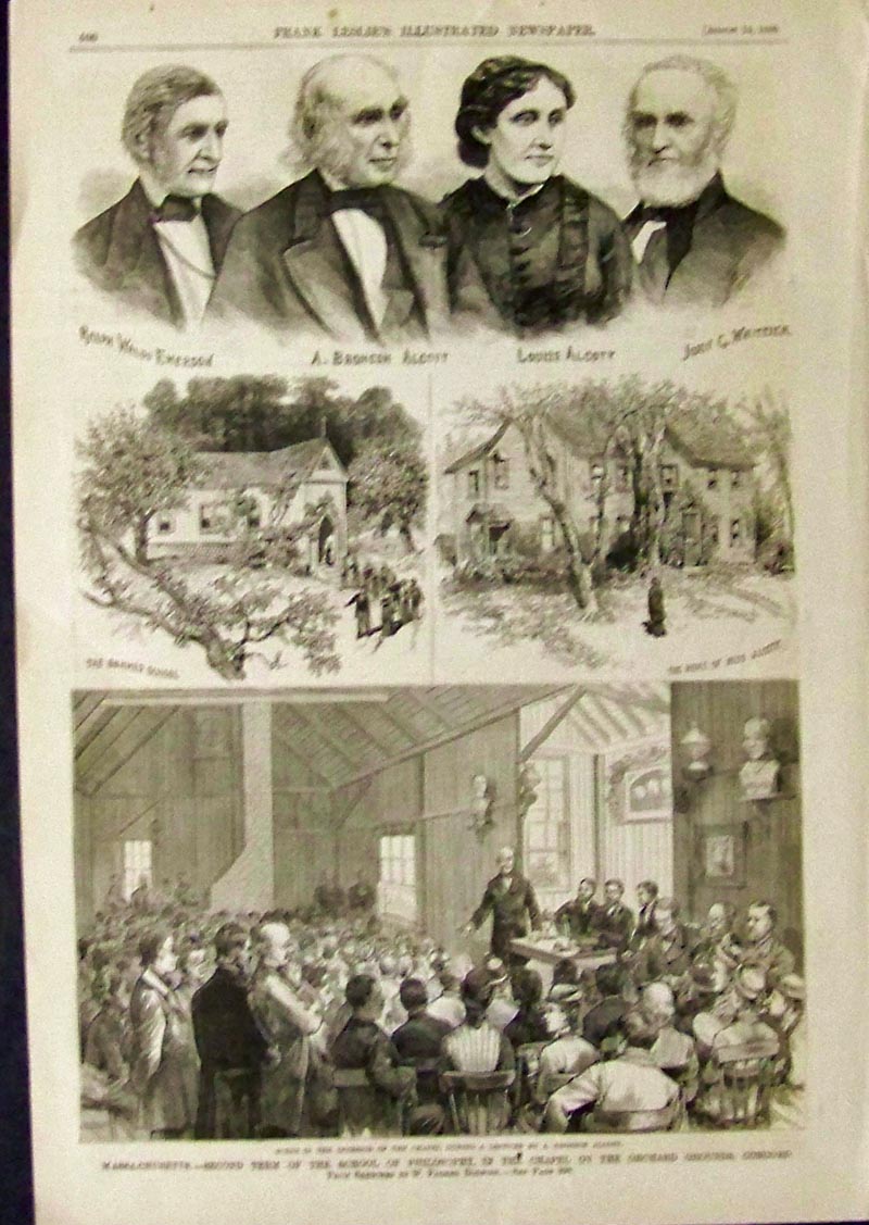
1880 Wood engraving showing Concord. Transcendentalism. Pictured is the
second term of the School of Philosophy with pictures of Ralph Waldo
Emerson, A. Bronson Alcott, Louise Alcott and John Greenleaf Whittier.
Featured in Frank Leslie's Illustrated
Newspaper and
in fine condition.
16 x 11 in. $45
|
|