 
|
|||||||||||
This is a small selection of our inventory of antique Mexico prints and maps. Additional inventory is available. Contact us with your request. 1-800-879-6277
|
|||||||||||
|---|---|---|---|---|---|---|---|---|---|---|---|
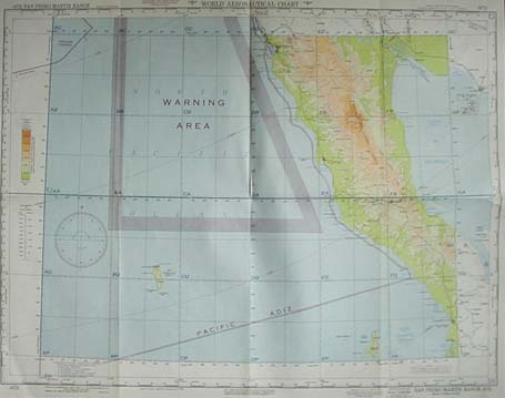
001mex: 1952 Baja Air Chart. Color air chart/map of the northern half of Baja California. Very large scale, highly detailed. 29x22 in. $40 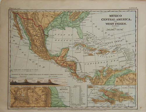
004mex: 1870 Mexico, Central America and West Indies map. Original color. Insets of Haiti, Dominica and part of Mexico. 12x9-1/2 in. $20 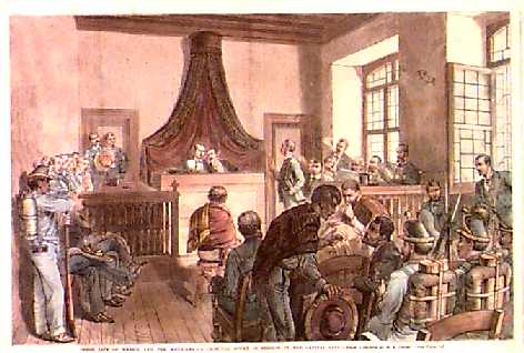
005mex: 1881 MEXICO CITY CRIMINAL COURT SCENE. Excellent professionally watercolored antique engraving: Inner Life of Mexico and the Mexicans - A Criminal Court in Session in the Capital City. From a sketch by H.A. Ogden for Frank Leslie's. 16" x 11" $50 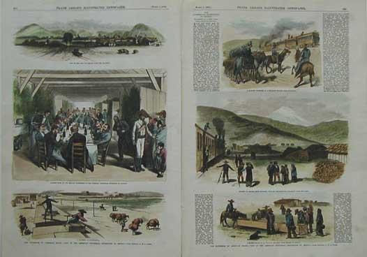
006mex: 1879 The Extension of American Trade- Visit of the American Industrial Expedition to Mexico. This double page set of six hand colored engravings shows the following views: View of the Town of Orizaba from the railroad, Banquet given by the Mexican government to the American Industrial Expedition at Apizaco, a hacienda at Guadaloupe, A Military reception at a railroad station near Esperanza, glimple of Orizaba from Maltrata withte excursionists debarking from the cars, and a water trough at La Bota on the road from Orizaba to Mexico. Excellent professionally watercolored antique engraving: Inner Life of Mexico and the Mexicans - A Criminal Court in Session in the Capital City. From a sketch by H.A. Ogden for Frank Leslie's. size: 22x16 in. $120 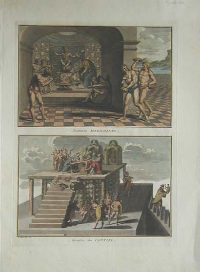 008mex: 1723 Print: Aztecs in Mexico: Human Sacrifice. This beautiful copper-engraved print was drawn by B. Picart, and printed in 1723. It contains two scenes of life in the Aztec empire. The titles of each scene are in French, as follows: "Penitences Mexicaines," and "Sacrifice des Captifs." The print is in excellent condition, with modern hand coloring and no tears, stains or other blemishes. Size is 10x15 in. $120 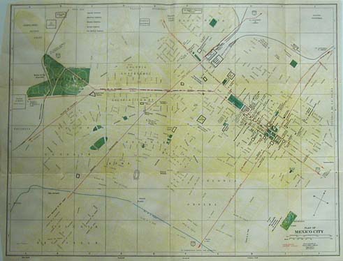 009mex: c.1960 Mexico City Map. Attractive color, lots of details. Streets, buildings, parks clearly shown. 20-1/2x15-1/2 in. $50 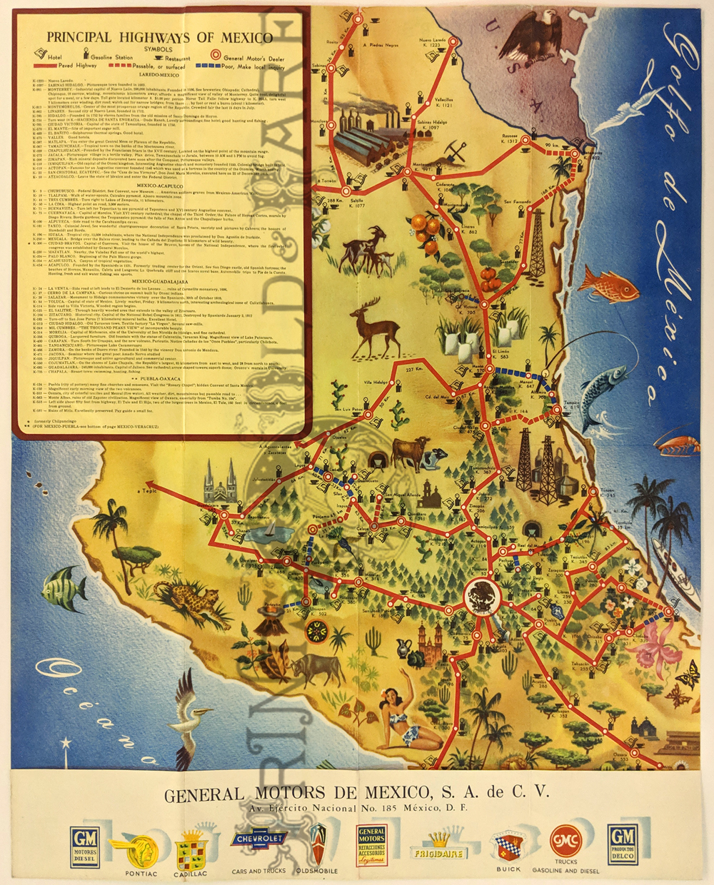 006pictorialmaps: Highway Map of Mexico – Pictorial map showing paved highways, passable and poor roads. Also, hotels, gas stations, restaurants and General Motors dealers. c.1950. Find condition. 17 x 23 ½ in. $125 |
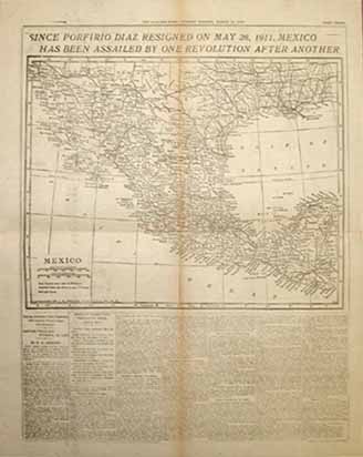 013mex: 1916 Newspaper Map of Mexico. With text regarging revolution and changes of government in previous five years. 22x17-1/2 in. $40 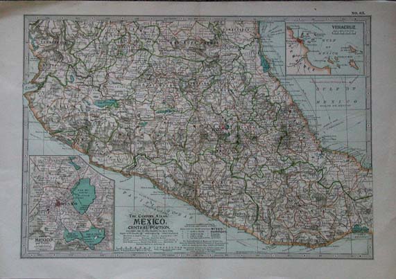 015mex: The Century Atlas, Mexico, Central Portion, published in 1897. Printed in color by Centuty, this very detailed map has insets of the Mexico City area and one of Veracruz. 17x12 in. $40 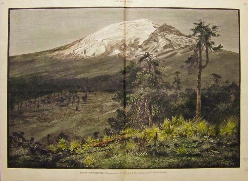
016mex: 1886 Hand colored wood engraving from Harper's Weekly titled, "Mount Popocatepetl," the volcano, originally photographed by W.H. Jackson & Co., Denver, Colorado. 22 x 15-1/2 in. $60 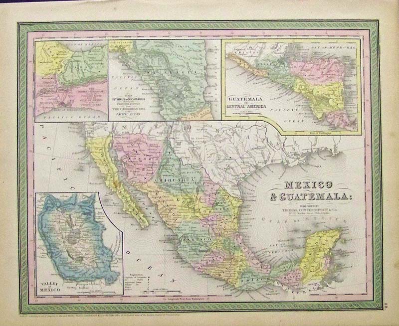 017Mexico: 1850 Cowperthwait hand colored Mexico and Guatemala map with insets of the Isthmus of Nicaragua, the Valley of Mexico which is Mexico City now. Also shows Texas as a Republic. 17 x 13-1/2 in. $500 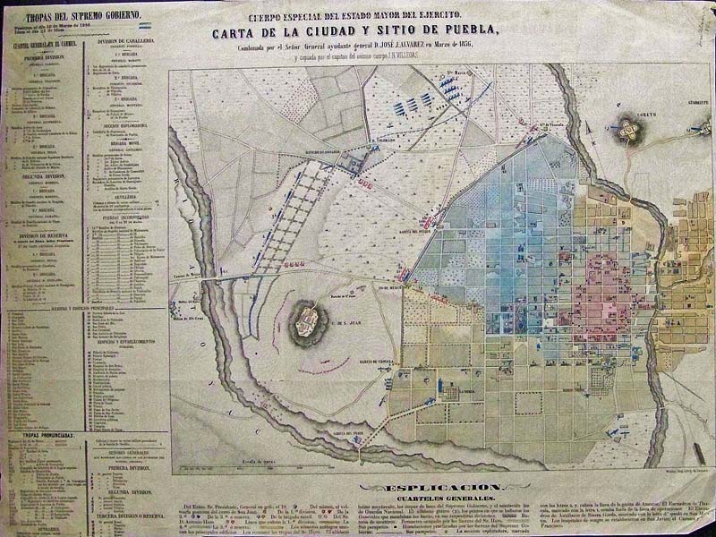
018Mexico: 1856 Puebla, Mexico city hand colored lithographed map showing street names, principal buildings, institutions, ranches, and fortifications. An index on the left side of map shows the explanation of the various places. Relief shown by hachures. scale. Map created by Jose Justo Alvarez in Mexico. 24 x 18 in. $275 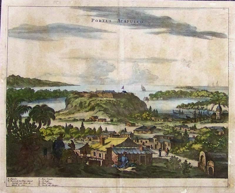 020mex: Portus Acapulco circa 1750, With Shipping in Wide Landscaped View. A rare and unusual copper engraved print of the port of Acapulco, shows Spaniards, with Aztec helpers descending into the port of Acapulco, many buildings of the time depicted along with sailing ships and the port with church and moored sailing vessels. Legend depicts, a. Acapulco, b. Fuerca (fort,) c. Boca Grande, d. El Grifio, e. Boca Chica, f. Puerto del Marques. Wonderful rendition of the time and style of dress of Aztecs (maybe) and Spaniards on horseback. Petrus Montanus, Del J. Ogliby S. C. Publisher 1670 London. Condition: Very good, some missing paper on outside margins and in the middle of image above horizon, normal browing and yellowing with age. Rare copper engraving, colored. 13.6 x 10.3" re-margined, enhanced color and mounted on background paper. $500 with backing. 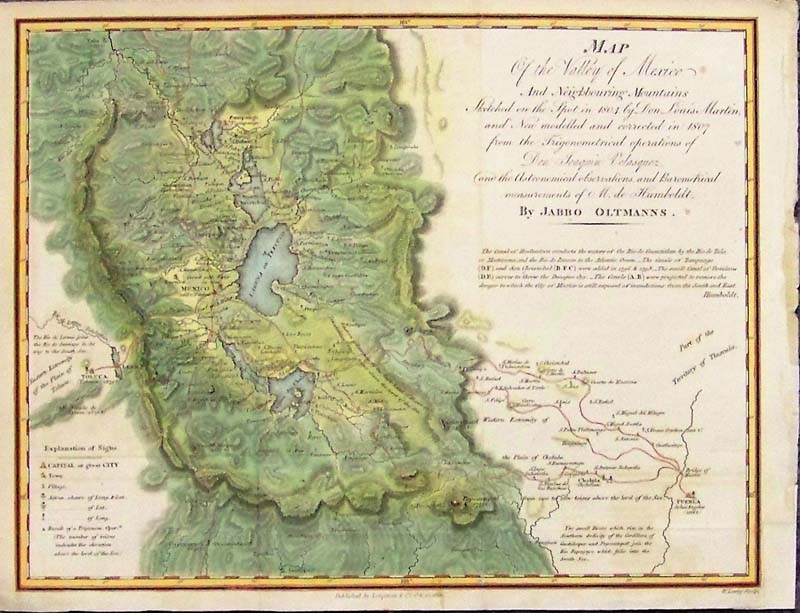 021mex: 1810 Map of the Valley and City of Mexico Oltmann. A small and very finely detailed and engraved map and hand colored example of the English edition of Humboldt's map of the Valley of Mexico, with Mexico City at the center, which appeared in Political Essay on the Kingdom of New Spain. Containing Researches Relative to the Geography of Mexico, from the English edition of Humboldt's monumental work, published by Longman and Co. Condition: small fold on right side, good margin with some aging color at margins. size, 10.5 x 8.5 image. SOLD 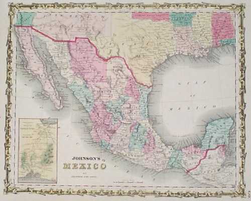 101mex: 1861 Johnson Map of Mexico. Hand colored, engraved map of Mexico, published in 1861 by Johnson and Ward. Each state within the country is separately colored. In the bottom left corner, there is a small map of the territory and isthmus of Tehuantepec. Above Mexico's northern border, the US territory of New Mexico is shown extending from California to Texas. 14x18 in. $90 |
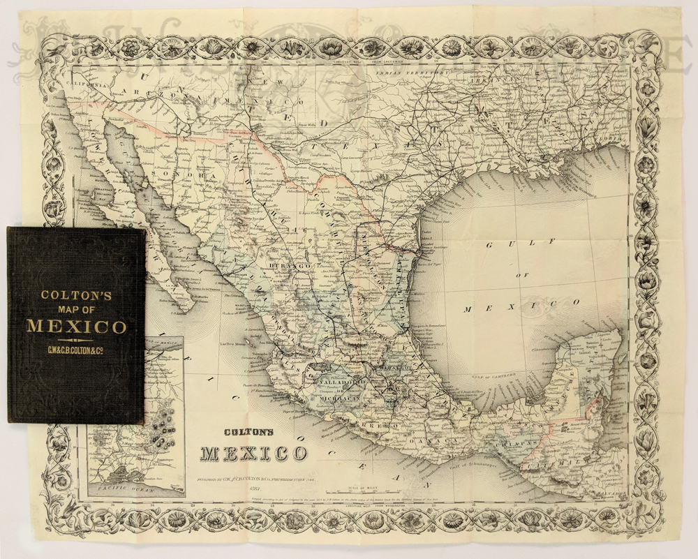 011fpm: Colton’s Mexico. New York: G.W. & C.B. Colton & Co., 1883. Separately issued map on banknote paper, folding into original covers. Lithograph. Hand colored. Excellent condition. 12 1/2 x 15 1/4 in. $650  004SanFrancisco: Apache Warrior Victorio, died near border. 1880 San Francisco Illustrated Wasp "Semi-Tropical Impudence." An amused Uncle Sam leans over border fence as the Mexican Government asks for money to help defeat Victorio. Victorio pictured as a dead wild boar. Chromolithograph Wasp Cover. 14 x 10 1/4 $150  105mex: 1859 German issue of Frank Leslie's Illustrated Weekly hand colored wood engraving showing a cock fight in a ring as spectators watched. 15-1/2 x 11 in. $50 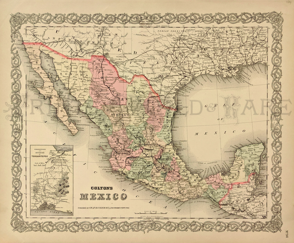 106mex: 1859 Colton's Mexico. Showing the towns, counties, Gulf of Mexico and Gulf of California. Small inset of the Territory and Isthmus of Tehuantepec. Hand colored, lithograph. 14 x 17 in. $110 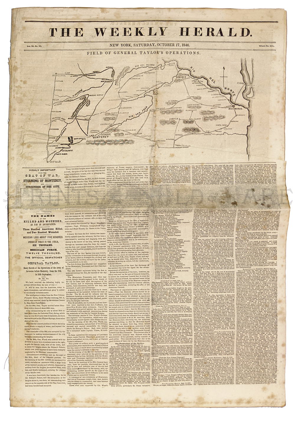 107mex: Mexican War 1846. "Field of General Taylor's Operations." Map of Montery & Vicinity. Front page Weekly Herald. Long article on storming and surrender of Monterey. 8pp total - also includes portrait and article on Zachary Taylor. 11 1/2 x 22 in. $45 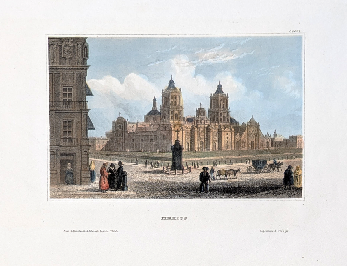 108Mexico: Mexico City - c.1860. Zocalo. The center of historic area including a magnificent Cathedral. Hand colored, steel engraving. 10 1/4 x 7 3/8" in. $75 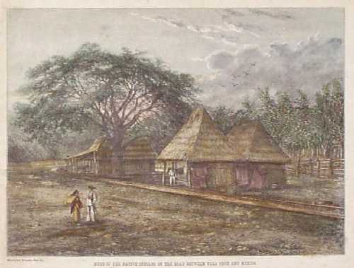
102mex: 1875 Mexico: Indian Houses by Railroad Line. Hand colored engraving, published in 1875 as an illustration to a book. Title is "Huts of the Native Indians on the Road Between Vera Cruz and Mexico." The huts are situated within several feet of the railroad track. 9x11 in. $30 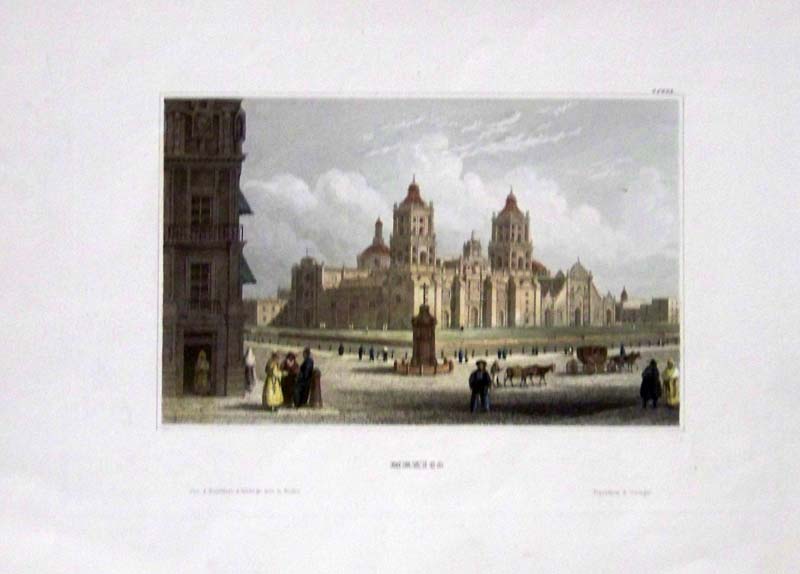 103mex: Beautifully hand colored steel engraving. Published by Herrmann J Meyer in Meyer's Universum c 1850. Picture titled, Mexico. 7.5x10 in. $75 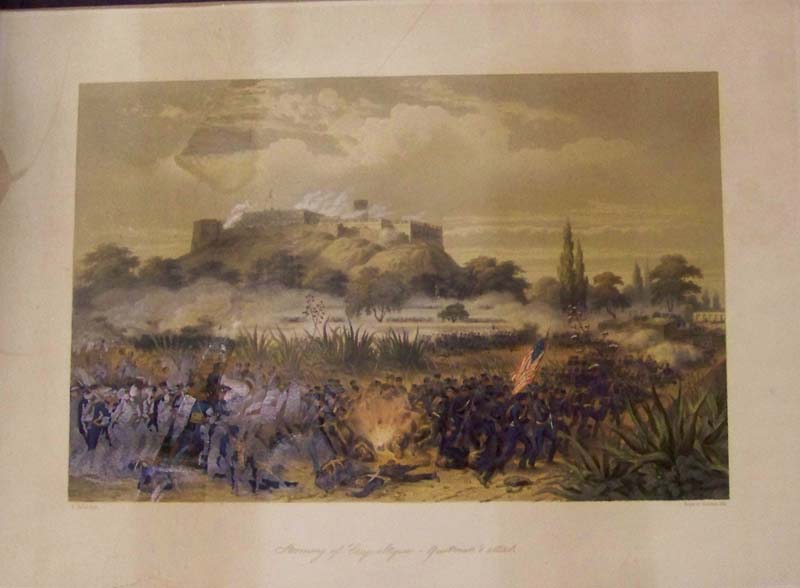 104mex: 1848 Hand colored lithograph showing C. Nebel's "Storming of Chapultepic -- Quitman's Attack" during the Mexican-American war in Mexico City. Entered According to Act of Congress stamped on bottom lefthand corner of lithograph. C. Nebel fecit. lr: Bayot et Bichebois lithograph. Slight discoloration upper left of image and border. 21 x 15 in. SOLD |
|||||||||
| Order Form | |||||||||||
| Back to Homepage | |||||||||||