|
|||||||||||
This is a small selection of our inventory of antique Michigan maps and prints. Additional inventory is available. Contact us with your request. 1-800-879-6277
|
|||||||||||
|---|---|---|---|---|---|---|---|---|---|---|---|
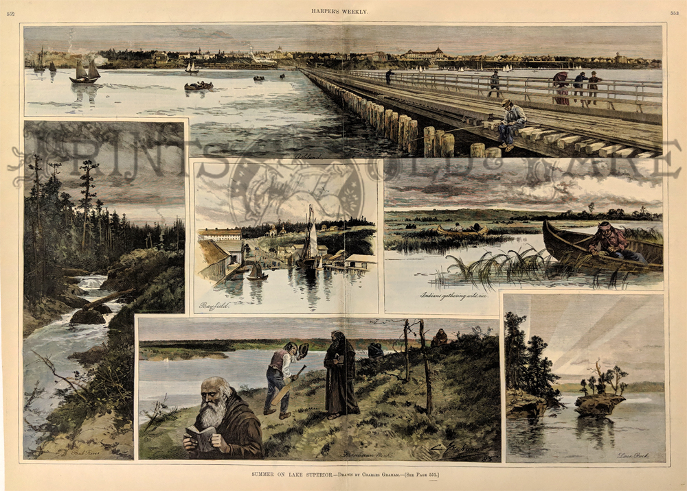 003mi: Lake Superior Summer 1885. 6 vignettes including Birdseye of Ashland, Bayfield, Indians Harvesting Wild rice, Lone Rock, Franciscan Works and Mad River. Hand colored, wood engraving by Charles Graham. 16 x 22 in. $60 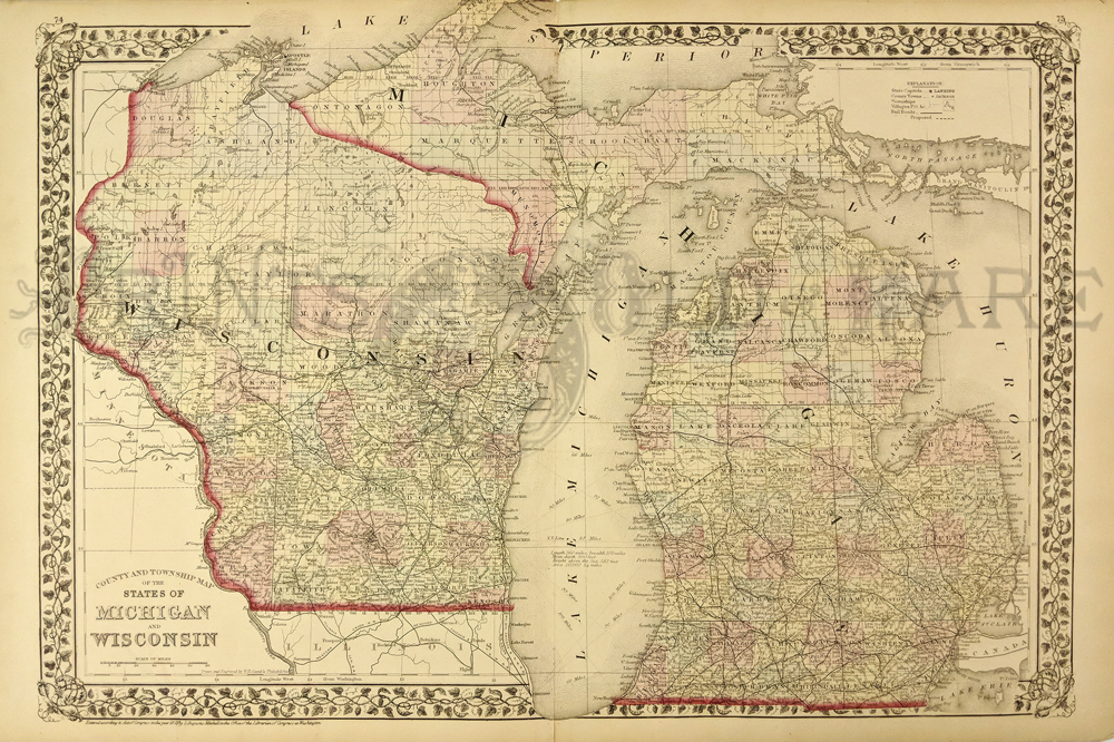 004mi: Michigan and Wisconsin map 1873 by Augustus Mitchell 23x15in $80  005mi: View, Waterford, Oakland County, Michigan. Handcolored lithographic view of Farm and Residence of Thomas Whitfield. From Oakland County Atlas 1878. 21x14 in. $80  009mi: 1934 Colored Lincoln Zephyr ad - Car sells for only $1275! FOB Detroit-. 11x14in $30 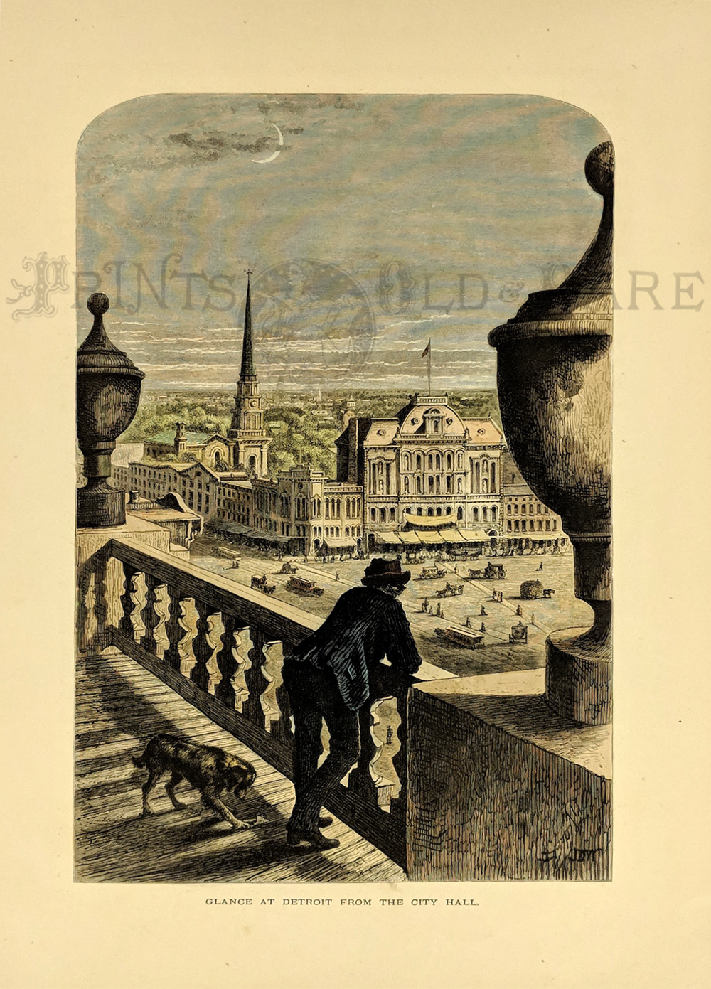 010mi: View of Detroit from City Hall 1873. Handcolored. Picturesque America. 9x12in $40 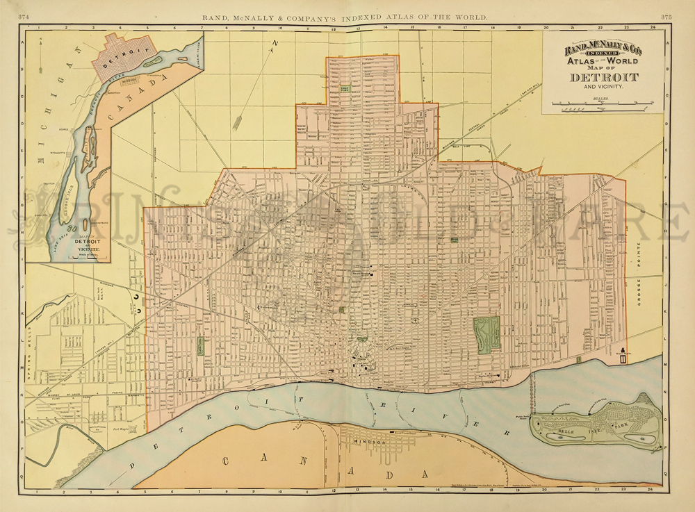
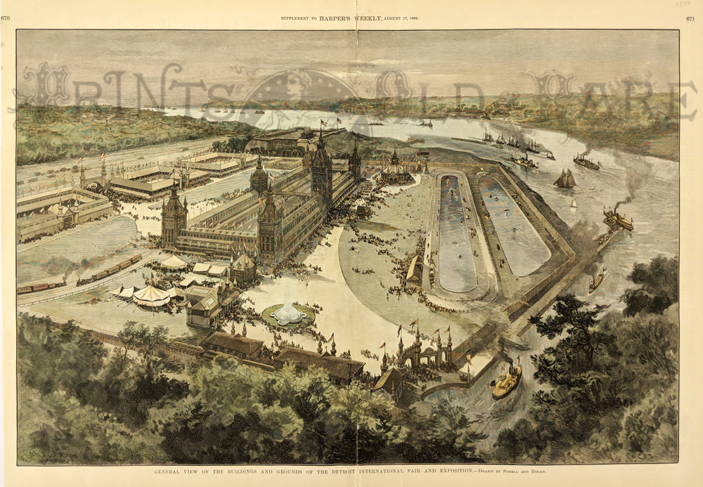
016mi: 1897 Map of Detroit Michigan. Interesting map of Detroit, from the 1897 edition of Rand McNally's Indexed Atlas of the World. Streets, railroad lines, major buildings and parks are all shown. In the upper left corner, there is an inset map of Detroit and its vicinity. 22x18 in. $60 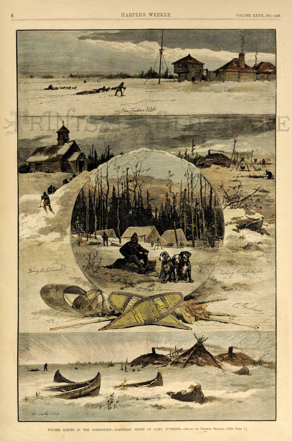 020mi: 1892 Handcolored views of Winter Scenes in the Northwest by Lake Superior. Wood engraving, Harper's. 11x16in $50 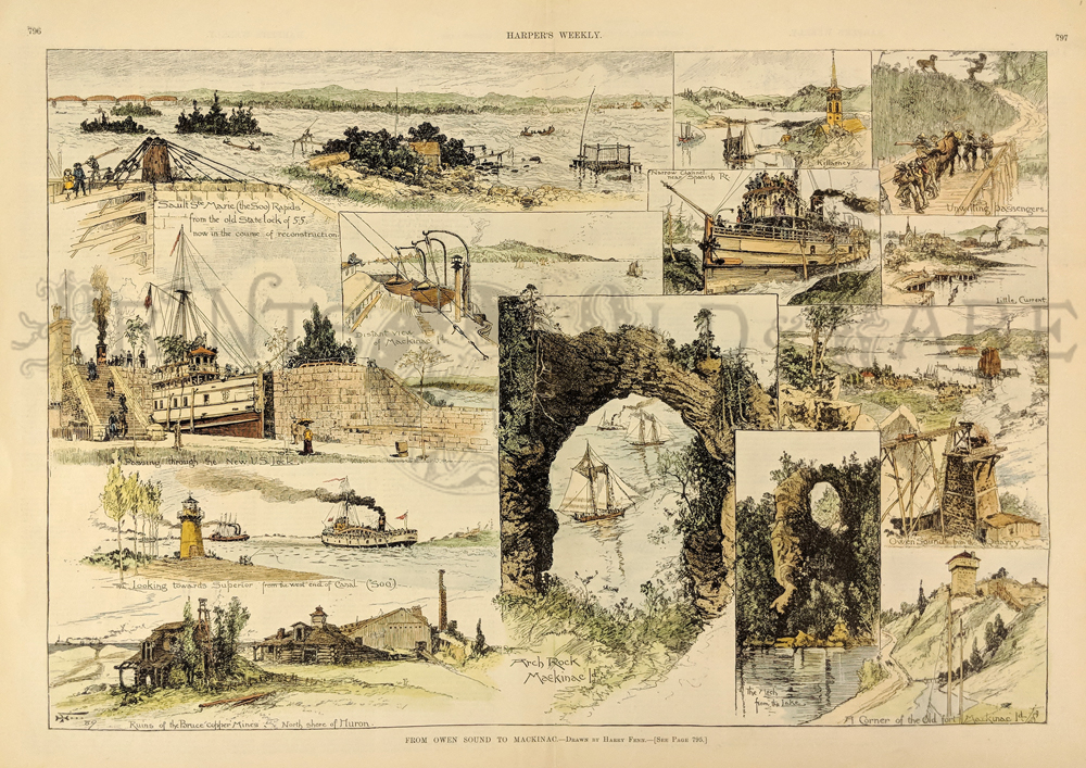 024mi: 1889 From Owen Sound to Mackinac. This rare handcolored, double page engraving shows 13 views of northern Michigan: Sault Ste. Marie Rapids from the old State lock of 55, Passing through the new U.S. Lock, looking towards Superior from the west end of canl, Ruins of the Bruce copper mines-north shore of Huron, Arch Rock- Mackinac Island, distant view of Mackinac Island, Killarney, narrow channel near Spanish Rr., unwilling passengers (livestock), Little Current, Owen's Sound from the quarry, the arch from the lake, and a corner of the old fort- Mackinac Island. This genuine antique print is from the October, 1889 edition of Harper's Weekly. 22x16 in. $180 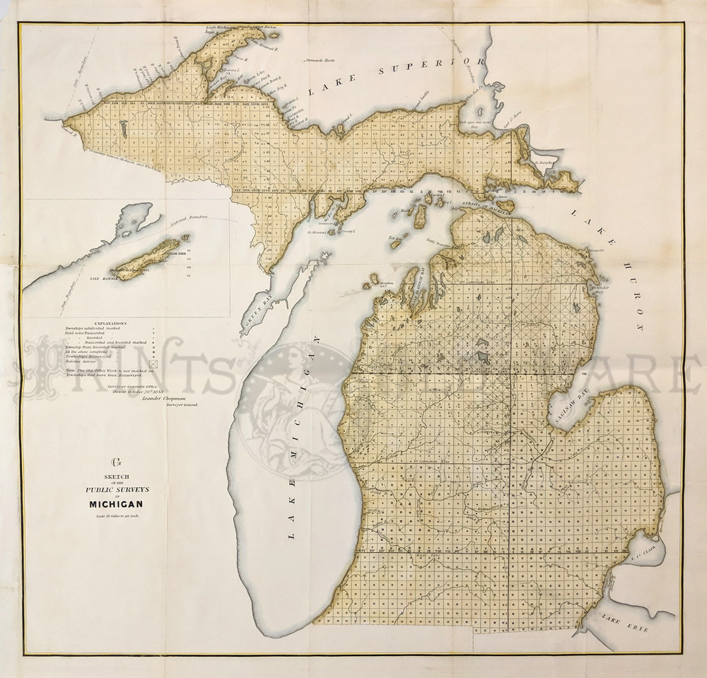
025mi: 1853 Hand colored lithographed Sketch of the Public Surveys of Michigan. 23-1/2 x 23 in. $300 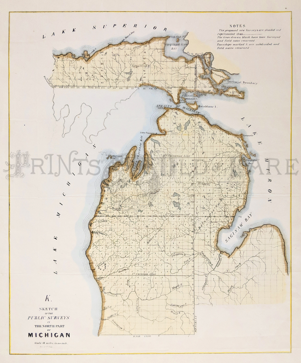
026mi: 1844 Hand colored lithographed Sketch of the Public Surveys in the North Part of Michigan. 21-1/2 x 18 in. $300 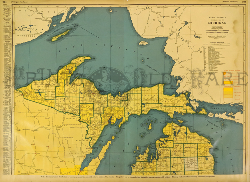
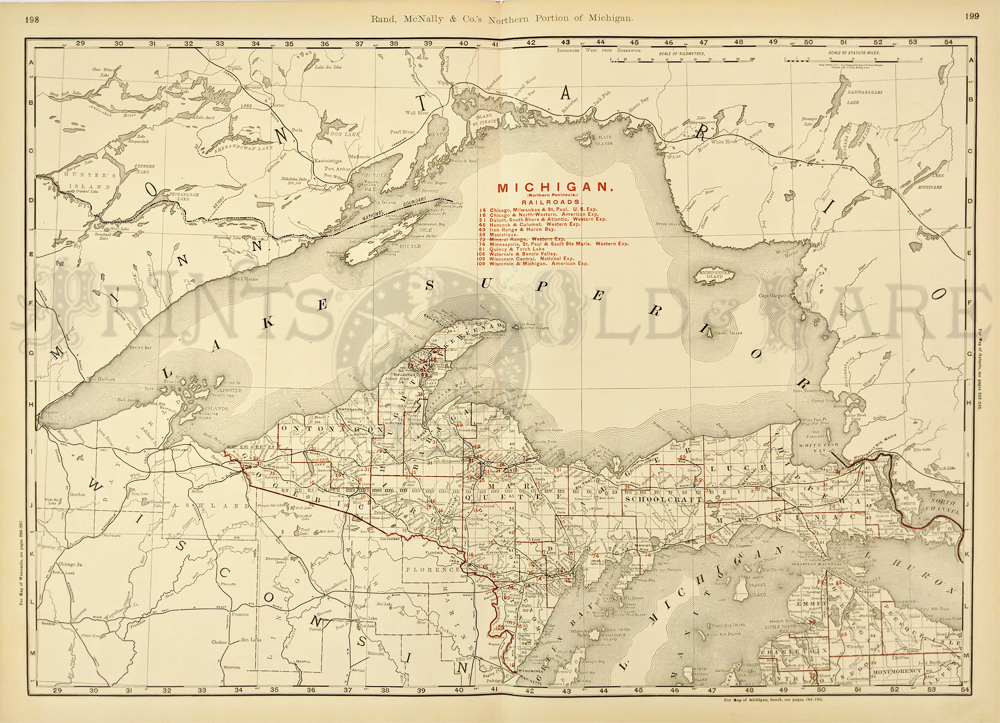
027mi: 1945 Rand McNally Standard Map of Michigan which shows all the Michigan Railroads and City Population key. 27 x 20-1/2 in. $80  031mi: Color map of Michigan from the World Atlas and Gazetteer. 14-1/2 x 10-1/2 in. $30 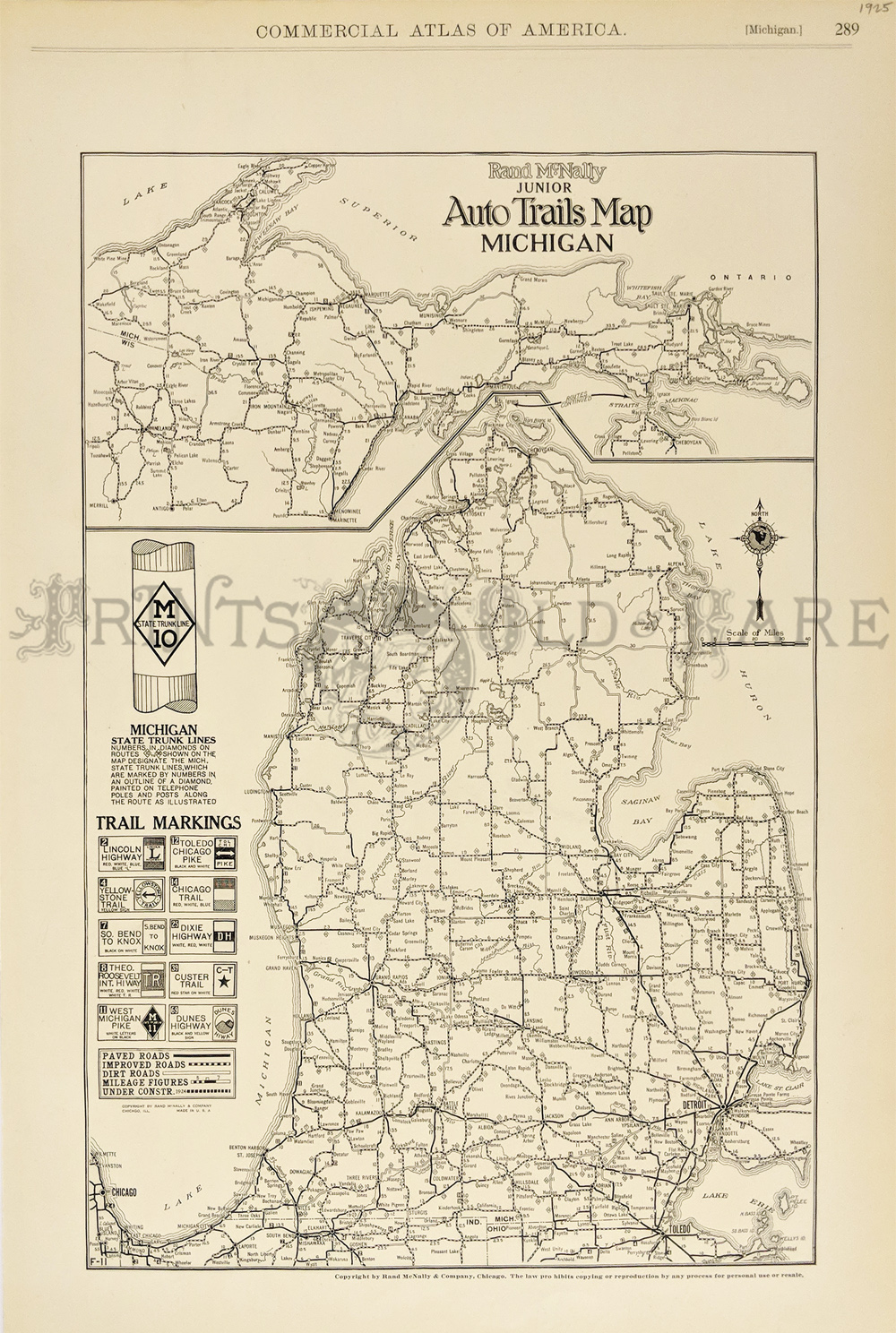 033mi: 1925 Commercial Atlas of America's Rand McNally Junior Auto Trails Map of Michigan which show the State Trunk Lines and Trail Markings. 20-1/2 x 14 in. $90  034mi: Color Rand-McNally Indexed Atlas showing the Northern Peninsula of Michigan and a guide to all the Michigan Railroads. 28 x 20-1/2 in. $100 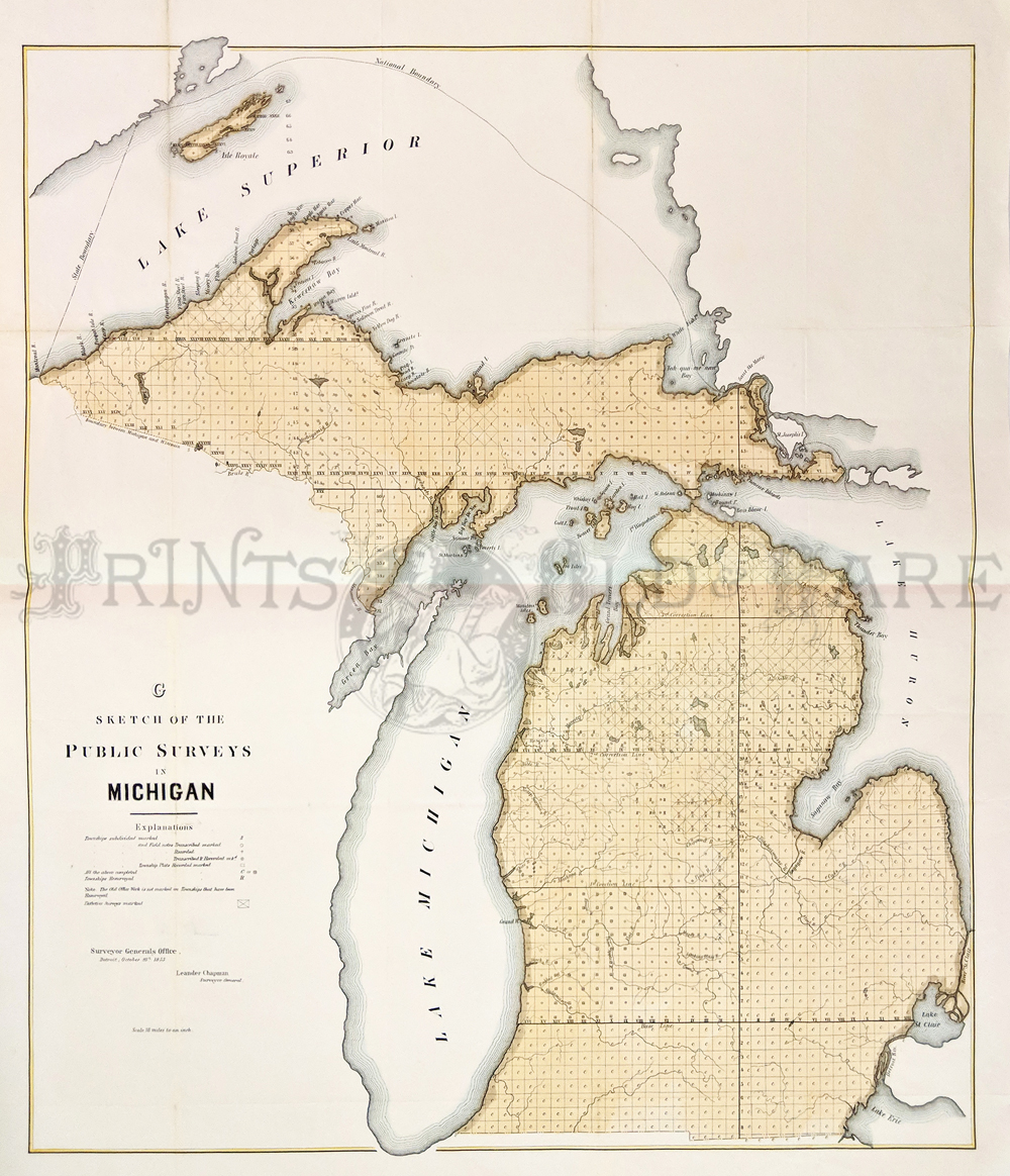 035mi: 1853 Hand colored lithographed Sketch of the Public Surveys in Michigan which also shows the outskirts of Lake Superior. 27 x 23 in. $300 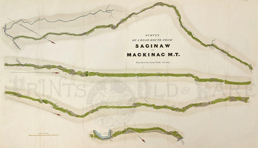 041rare: Macinac M. T. 1838. executed by Lieut. Poole 3d Arty. Survey of a road route from saginaw to Macinac M. T.T he road is shown in four sections with towns and the typography of the land. 16 x 27.5 in. $350 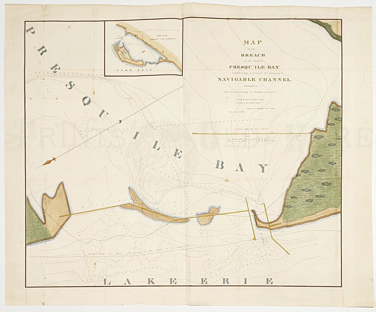 334Maine: Map of the breach at the head of Presqu'ile Bay: exhibiting a project for forming a navigable channel through it and for preventing its further extension. 1835. Rare map showing the proposed channel and showing the depths. Small inset sketch of Presqu'ile Harbor. Hand colored, lithograph. 26 x 31 3/8 in. $600 |

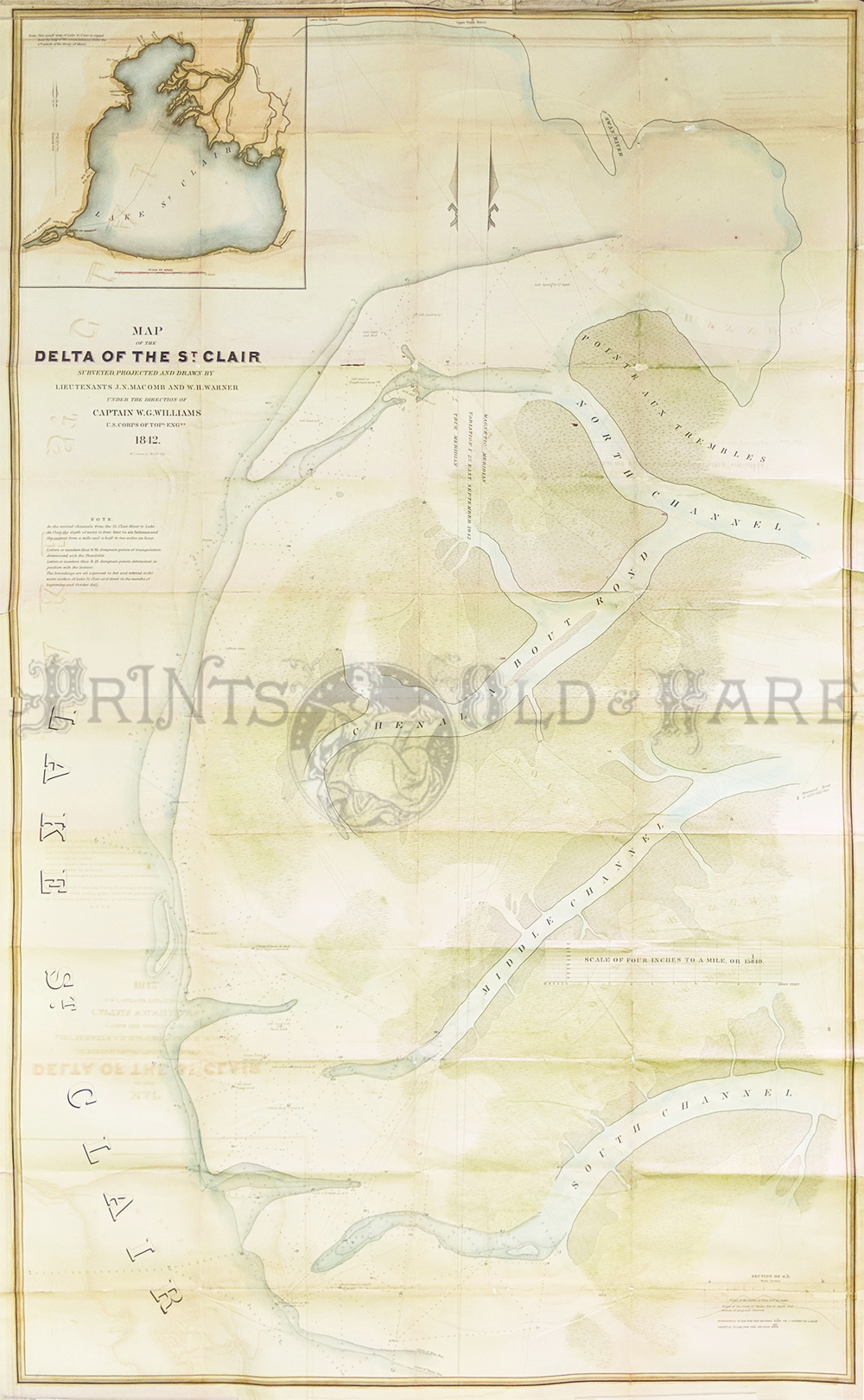
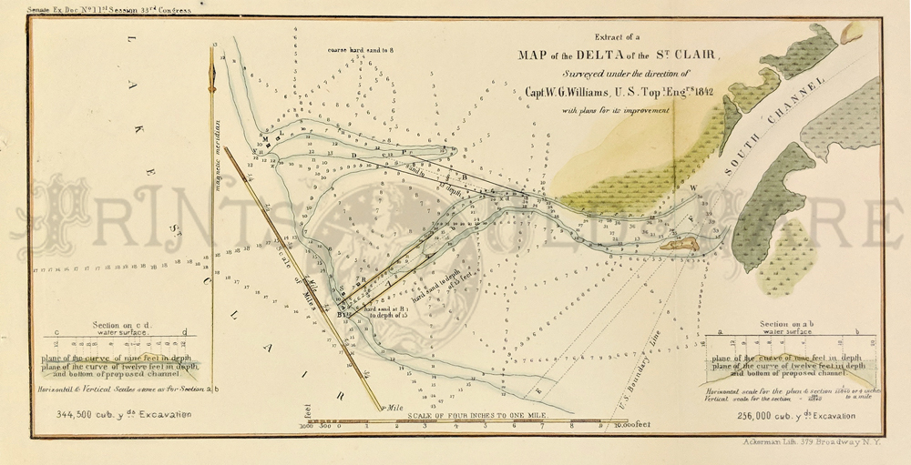
037mi: 1852 Hand colored lithographed map showing the River of St. Clair Examination of the Outlet of the South Channel. 20 x 17 in. $250 
038mi: Rand McNally & Company's color Indexed Atlas of the World showing Michigan. 21 x 15 in. $90 
039mi: Color Rand, McNally & Company's Indexed Atlas of the World's map of Michigan surrounded by Lake Superior. 27-1/2 x 20-1/2 in. $100 
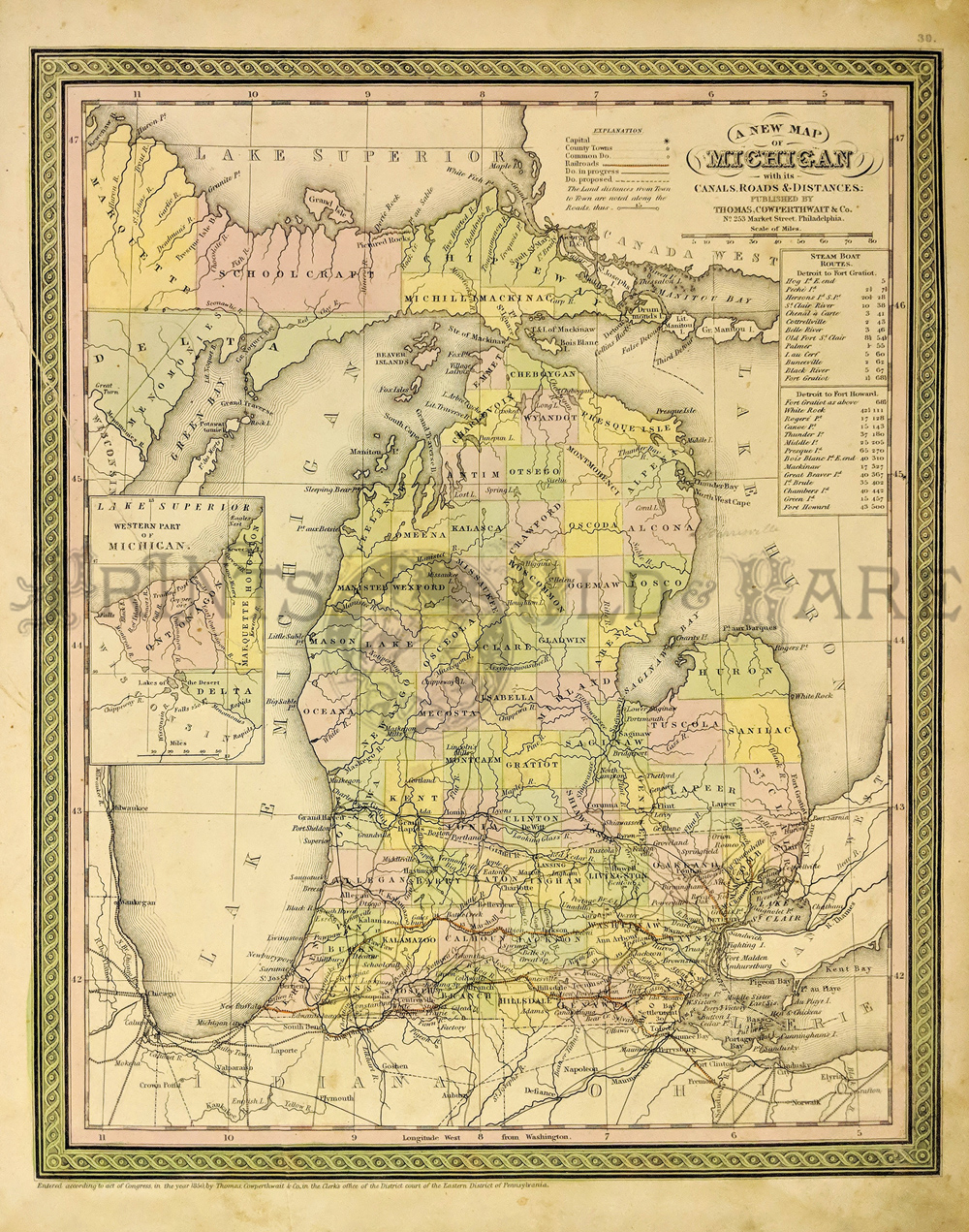
040mi: 1849 P.S. Duval's Steam color lithograph showing the Diagram of the State of Michigan which shows the districts bounded by shaded lines with names of Deputies, and the Townships marked R.S. have been surveyed. 16 x 15 in. $150 
041mi: 1863 Hand colored engraved Johnson's Michigan and Wisconsin map by Johnson and Ward. 26 x 18 in. $110 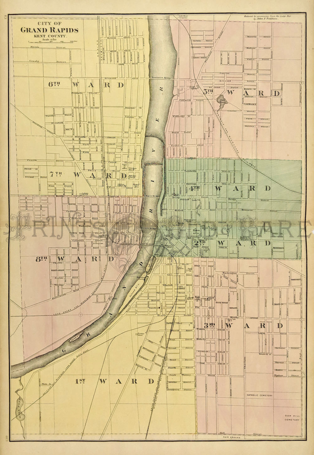 102mi: 1873 Map of Grand Rapids Michigan. Large, hand colored map of the city of Grand Rapids, from an 1873 Michigan state atlas. Streets and bridges throughout the city are all named. Railroad lines are shown, as well as the locations of churches and public buildings. Each ward within the city is separately colored. 17x25 in. $100 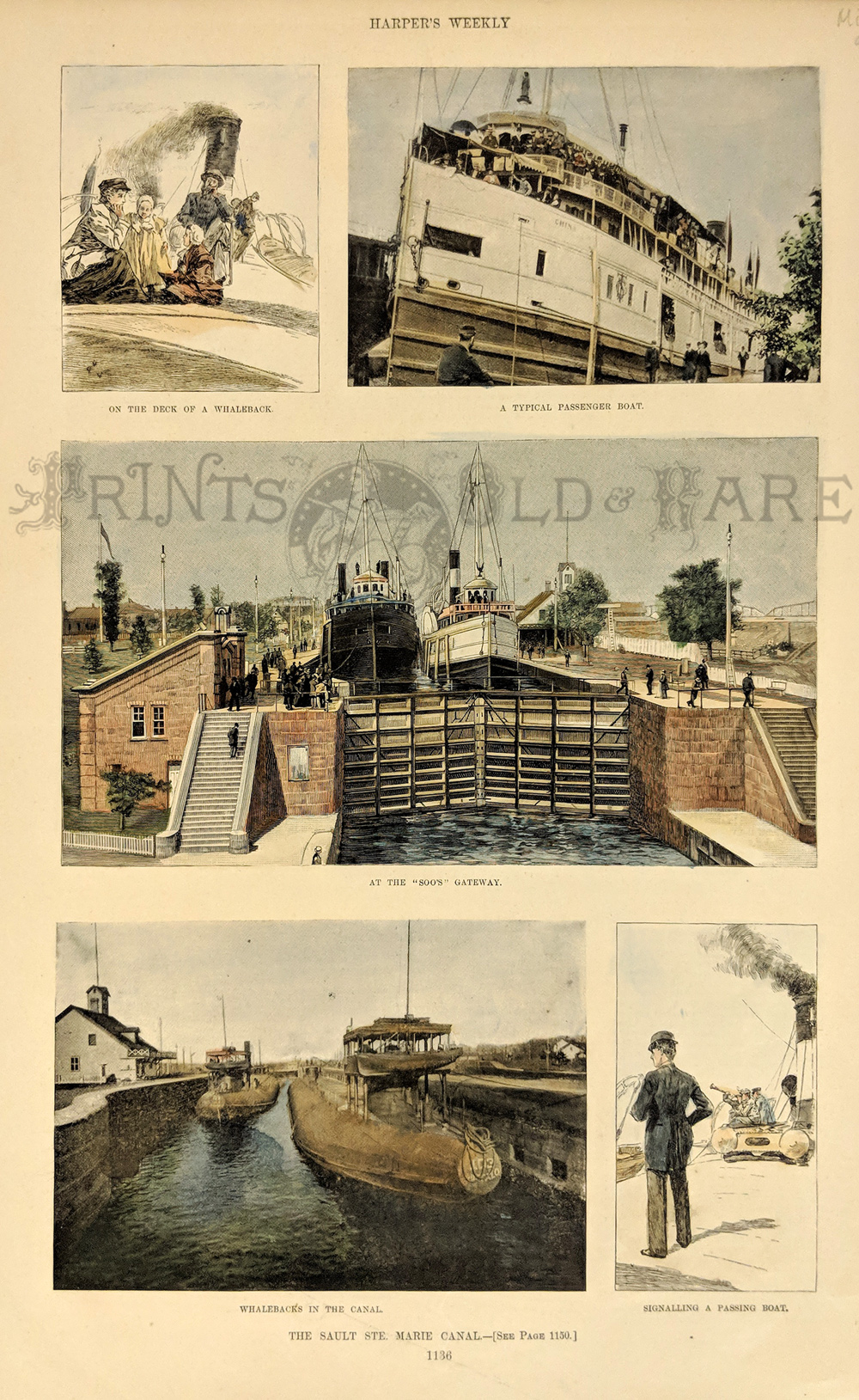
107mi: Sault St. Marie Canal Michigan Whalebacks. Five hand colored scenes from an 1892 issue of Harper's Weekly, titled "The Sault St. Marie Canal." Page contains images of ships moving through the canal, and also includes a view of two "whaleback" boats moving through the water. 11x16 in. $50
|

222mi: 1853 Clinton River - Hand colored lithographic Survey of the Mouth of Clinton River, Michigan. Made in 1853 by Captain A. Canfield, U.S.T.E. 17-1/2 x 13-1/2 in. $120 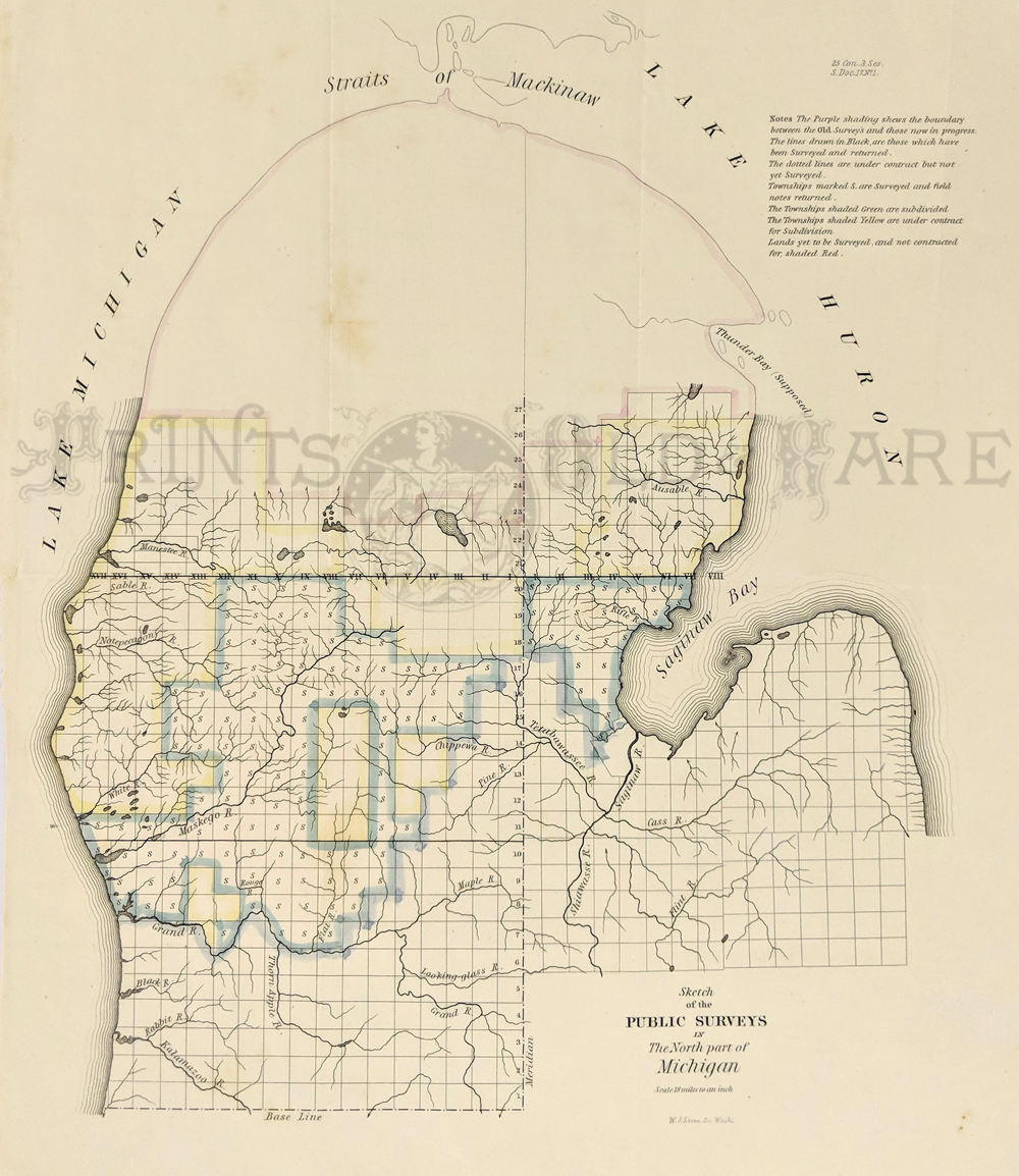
224mi: C.1840 Very early Pre-Civil War Survey Map of the North Part of Michigan. Note that survey has only started in the new Territory. 16 x 13 in. $220 
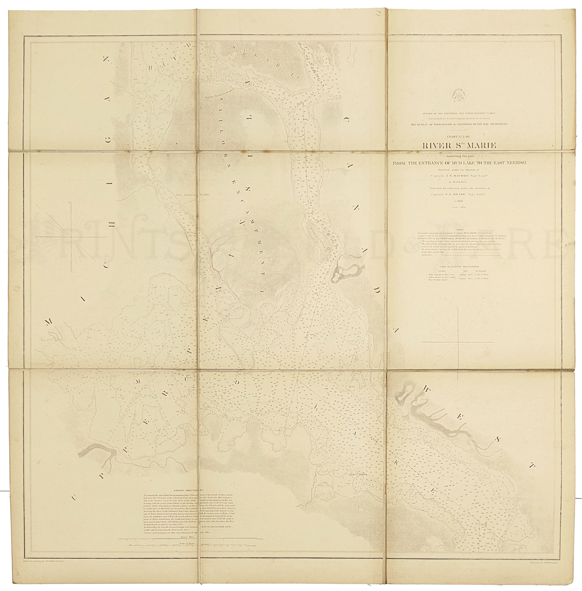
227Michigan: 1889 Bradley's color map of Michigan which shows all the pertinent geographical areas, counties, and part of Canada. *Mended at border. One inch from fold. 26 x 19 in. $100  228Michigan: 1857 Michigan by Colton. Hand colored engraving. Fine condition. 17 x 14 in. $200 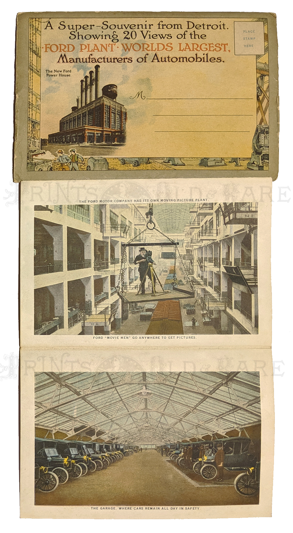 229Michigan: Ford Motor Company 1924. Highland Park, Michigan Assembly Plant - 20 views accordian folded postcard folder with text and statistics. 4 1/4 x 6 1/8 in. $40 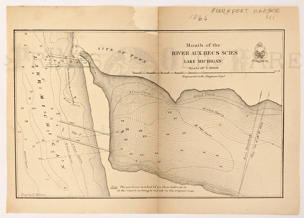 231Michigan: Frankfort, at Lake Michigan. Mouth of the River Aux Becs Scies 1866. Lithograph. Shows soundings, entrance to Betsie Lake. Very rare. *has been archivally patched/mended middle fold. 7 x 10 in. $120  232Michigan: 1838 Michigan. Saginaw to Macinac M. T. executed by Lieut. Poole 3d Arty. Road is shown in four sections with towns and thetypography of the land. 16 x 27.5 in. $350 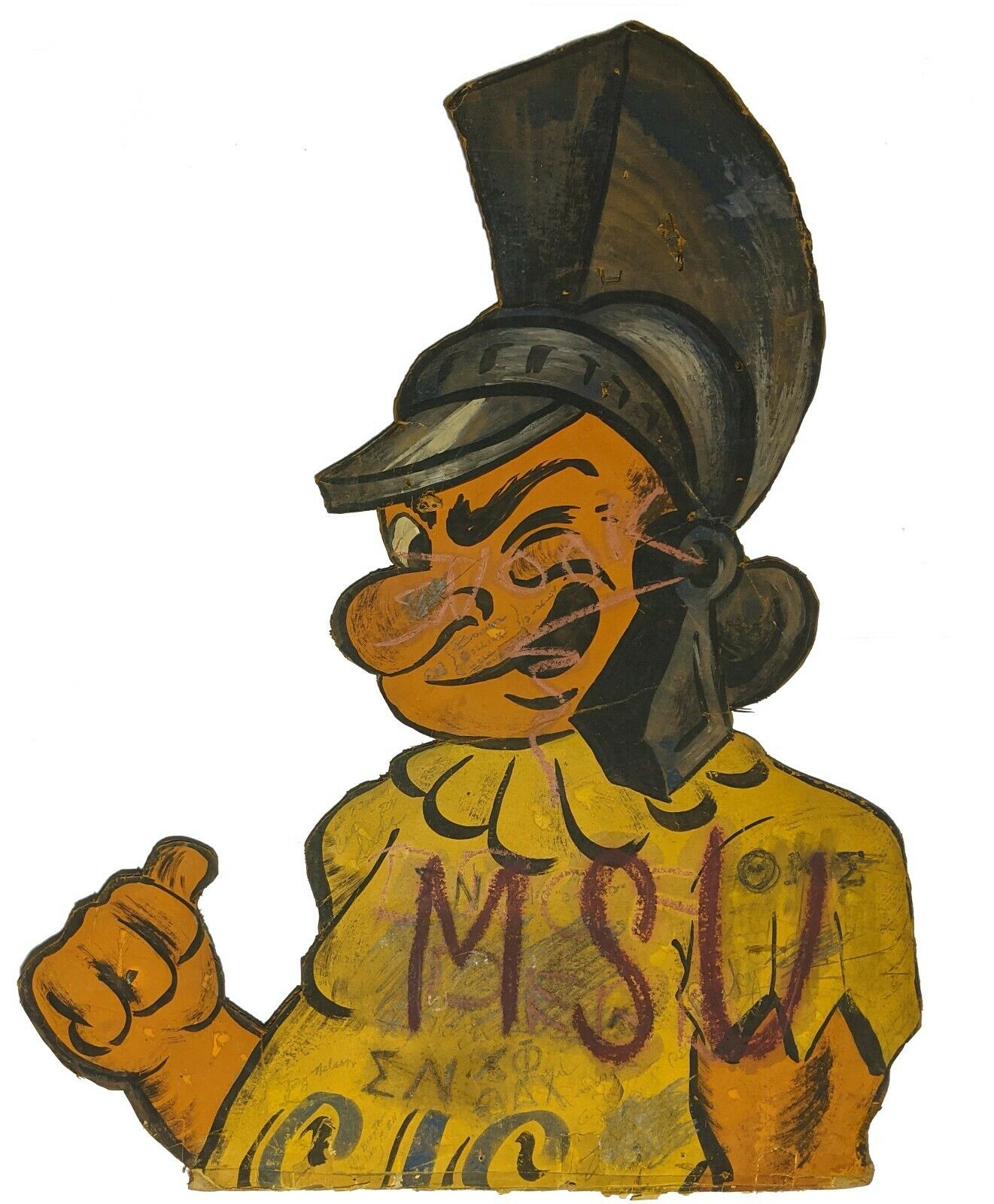 233Michigan: Spartan – MSU – 1950s Football Sign This vintage cut-out caricature of the Spartan of Michigan State University Football – Painted on cardboard. **Some damage (tears and/or rips) to the sign; writing/signatures/scribble are also present. Size: 34 1/2 x 44 1/4" in. $175 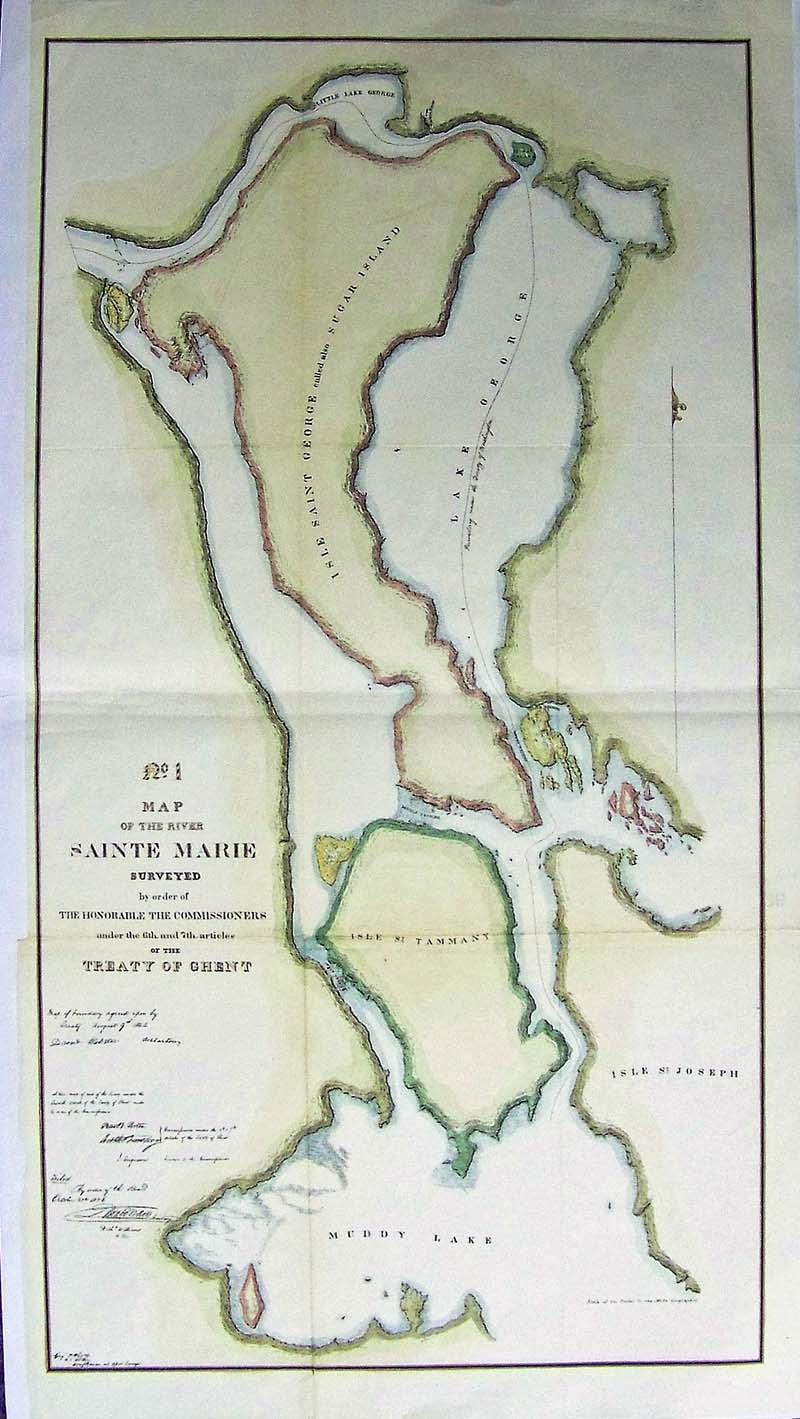 234Michigan: Map of the River Sainte Marie, 1857 - Very detailed and large longitudinal map surveyed by the order of the Honorable Commissioners. Engraved and hand colored beautiful map of the Island of George, also called Sugar Island, Isle of St Joseph, Isle St. Tammy and Little Lake George with Muddy Lake at the bottom, near Sault Ste. Marie Condition: Very good, folded on each side size.13 x 24 image with uneven margins some of left margin missing. $160 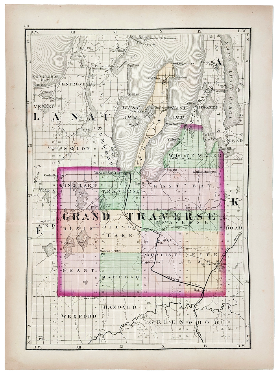 235Michigan: 1873 Map of Grand Traverse County, Michigan. Drawn, compiled, and edited by H.F. Walling. Published in the Atlas of the State of Michigan. Showing townships, sections, railroads, lakes, rivers, bays, etc. Hand colored, lithograph. 12 5/8 x 17 in. $150
|
|||||||||
| Order Form | |||||||||||
| Back to Homepage | |||||||||||