 
|
|||||||||||
This is a small selection of our inventory of antique Mississippi maps and prints. Additional inventory is available. Contact us with your request. 1-800-879-6277
|
|||||||||||
|---|---|---|---|---|---|---|---|---|---|---|---|
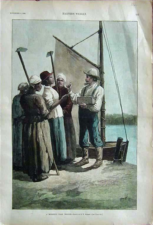
004ms: 1888 Mississippi Coast Peddler view. Shows him dealing with a group of black women. Hand colored, excellent image, Harper's. 11x16 in. $70 SOLD 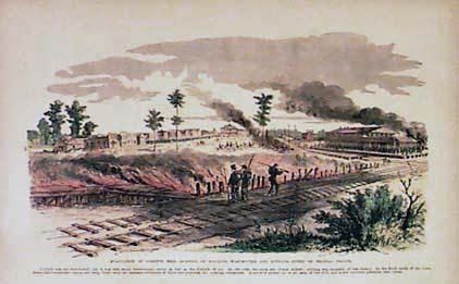 005ms: Civil War view of Corinth, Mississippi, at the time of the evacuation of the town. Hand colored. 16 x 11 in. $50 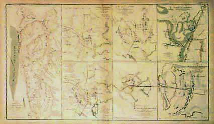 007ms: Civil War Atlas Maps. Seven on one page showing Vicksburg, Jackson, Black River Bridge; battles. Printed by U.S. Government after the war. 29 x 18 in. $80 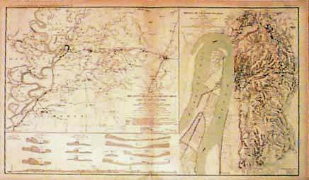 008ms: Civil War Atlas Map by the U.S. Government. Two antique maps on one page: Millikens Bend, Louisiana and Jackson, Mississippi, and Siege of Vicksburg. 29 x 18 in. $80 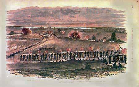 016ms: 1863 Siege of Vicksburg. Hand colored Civil War engraving showing the fight in the crater of Fort Hill in 1863. 16x11 in. $50 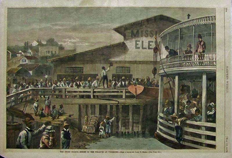 017ms: 1879 Hand colored wood engraving from Harper's Weekly titled, "The Negro Exodus -- Scenes on the Wharves at Vicksburg." From a Sketch by James H. Moser. 15 x 11 in. $100  019ms: 1898 Map of Mississippi. Genuine antique map printed in color for Atlas of the World. Lists counties, chief cities, populations. 11x14 in. $40 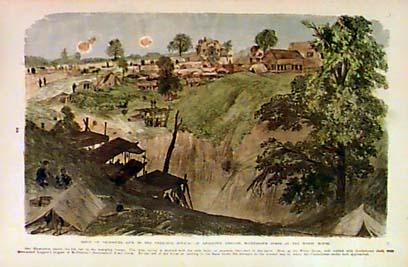 020ms: Civil War Vicksburg. Bivouac of Leggett's Brigade, McPherson's 17th Army Corps., at the White House, during siege of Vicksburg. Genuine hand colored antique print. 16x11 in. $40  021ms: 1866 Vicksburg Street Scene. Black & white antique woodcut engraving, depicting people mingling in front of Washington Hotel. 10-1/2x8-1/2 in. $30 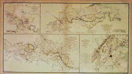 022ms: C.1880 Jackson Mississippi Civil War Map. Operations of U.S. forces against Jackson. Other Civil War maps on same page of Fredericksburg area. Printed in color after the war from official field maps. 29x18 in. $80 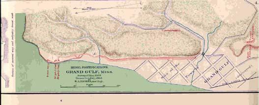 023ms: C.1880 Grand Gulf Mississippi. Color Civil War era map of Rebel Forts. Original map drawn October 1863. published by U.S. Government after the war. 14x5 in. $25  024ms: 1901 Map of Mississippi. Cram's Mississippi map printed in color. 11x 10 7/8 x 14 3/8 in. $40  025ms: 1856 Steamer Wooding Up on the Mississippi River. This hand colored, double page engraving shows The Sutlan Steamer being loaded up. This is one of the very best dynamic Steam Boat engravings from the 1856 edition of Ballou's Pictorial. size: 22x16 in. $350 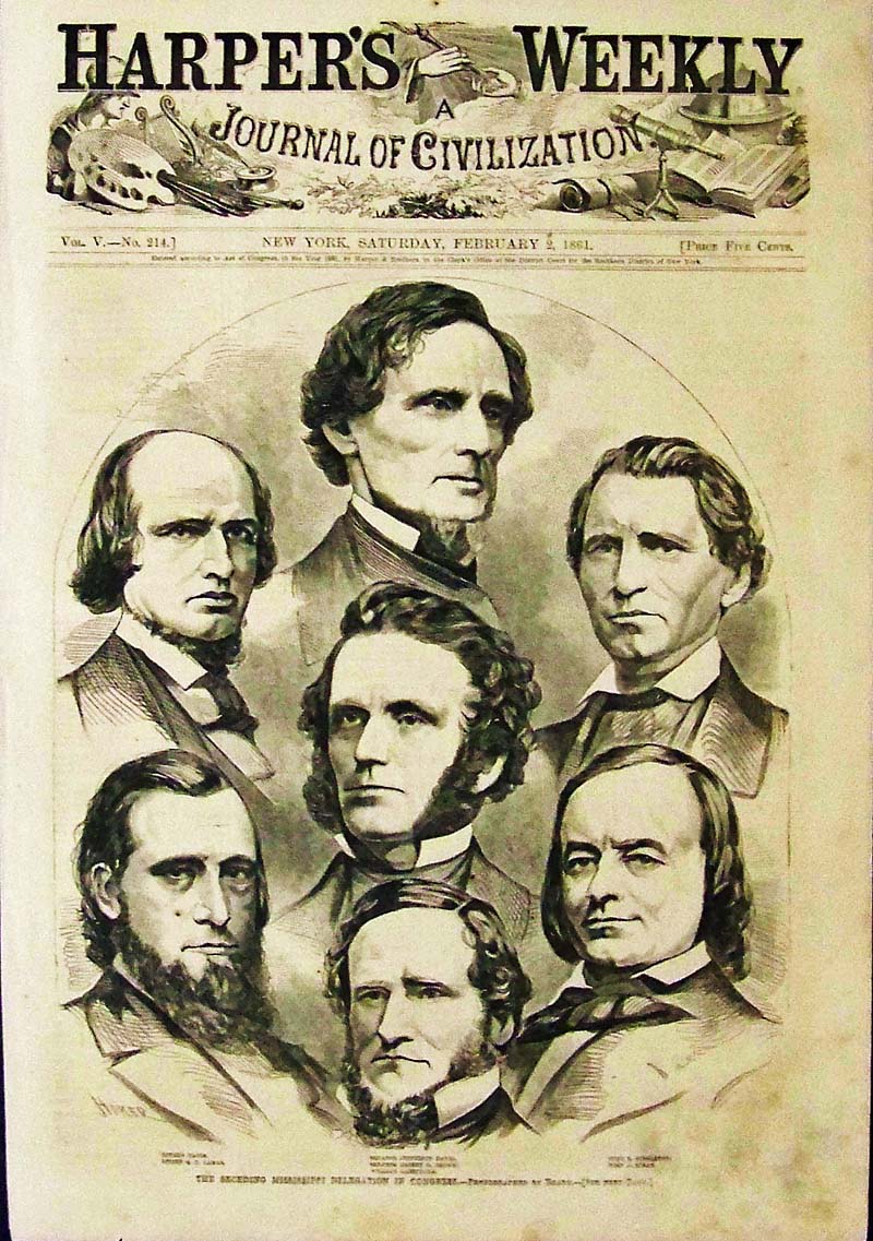 026ms: 1861 Winslow Homer wood engraving showing Jefferson Davis leading the seceding Mississippi delegation in congress on the eve of the Civil War. Drawn by America's foremost artist, signed in the plate. Featured in Harper's Weekly, A Journal of Civilization. 15-1/2 x 11 in. $75 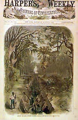 105ms: 1862 Civil War View: Digging a Canal in Vicksburg. Hand colored engraving, showing teams of workers using shovels to dig a canal for military purposes. The top margin of this print is cut close to the heading, but the image is in very good condition. 11x16 in. $50 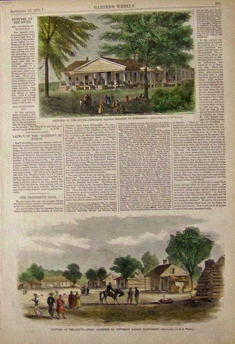 106ms: 1866 Scenes on the Jefferson Davis Plantation. Two hand colored wood engraved views on the plantation: 1) the mansion; and 2) the Negro quarters. Text to the left of the top image describes the scenes. 11x16 in. $80  010cw: Map of the Siege of Vicksburg, Mississippi by the U.S. Forces Under the Command of Maj. General U.S. Grant, U.S. VLS. This map is an attractive, highly detailed black and white lithographed map showing the topography around Vicksburg, with five profiles, six cross-sections of batteries and one cross-section of a "rebel rifle pit." There is a 4-inch square patch in the upper right margin. 29 x 27-1/2 in. $395 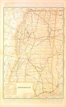 107ms: Detailed 1901 Railroad Map of Mississippi. Map from the 1901 first edition of George Cram's folio-size world atlas. Color coded lines on the map show the names and locations of railroads throughout the state. State and county borders are outlined in yellow. Cities, towns and geographical features are all shown. 18x27 in. $100 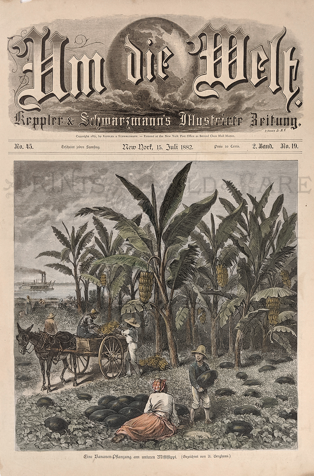 187la: Banana & Watermelon Plantation, 1882 on the Mississippi. Hand colored, wood engraving (German language) – Shows watermelon being loaded onto a wagon, banana trees, a river view and steamboat in the distance. Rare view. 10 x 14 ¾ in. $50 |
 108ms: 1885 Map: State of Mississippi. Interesting map of Mississippi published by George F. Cram. State and county borders are outlined in color. Cities, towns, railroad lines and geographical features are all shown. Nice, decorative border. 11x13 in. $40 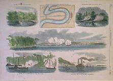
201ms: 1862 Civil War Battle, Vicksburg Mississippi. This hand colored, wood-engraved print is from the July 26, 1862 issue of Harper's Weekly. The print contains six images of military action that was occuring near Vicksburg Mississippi at the time. The images are captioned as follows: 1) Cutting a Canal Across the Isthmus; 2) Position of the Fleets Above and Below the City; 3) Mortar-Boats Firing on the City at Night; 4) The Fleet Shelling the Rebel Batteries at Vicksburg, June 28th; 5) Attack Upon the Mortar Fleet, by Rebel Land Forces; and 6) Com. Davis's Fleet on its Way Down the Mississippi. This print is in excellent condition. Size is 11x16 in. $80  202ms: 1866 Vicksburg Mississippi. This hand colored, wood-engraved print is from the July 14, 1866 issue of Harper's Weekly. The print contains five images of views of Natchez and Vicksburg, Mississippi.The images are captioned as follows: Vicksburg from the old Spanish fort, Water carts-Vicksburg, The Vicksburg monument erected on the site of the interview between Grant and Pemberton, Natchez under the hill and Natchez on the hill from the Marine Hospital. Size is 21x16 in. $200 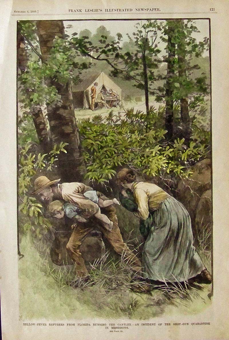 020jax: 1888 Yellow-Fever Quarantine - Frank Leslie's hand colored wood engraving titled, "Yellow-Fever Refugees from Florida Running the Gantlet, -- An Incident of the Shot-Gun Quarantine in Mississippi." 16 x 11 in. $60  203ms: 1890 Mississippi River Boat Scene. Hand colored, wood-engraving from the March 1, 1890 issue of Harper's Weekly, titled "Making a Landing by Search-Light on the Mississippi." Shows a view from the deck of a riverboat, as it approaches the shore. Excellent condition. 11x16 in. $80 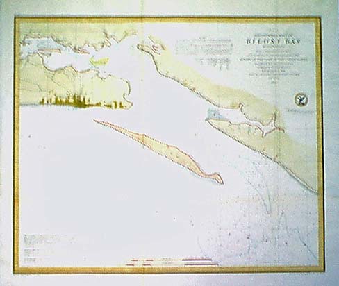 204ms: Beautifully hand colored 1855 Preliminary Chart of Biloxi Bay Mississippi from a Trigonometrical Survey under the direction of A.D Bache Superintendent of the Survey of the Coast of the United States. Chart includes information about tides. Excellent condition no tears, slight browning on original folded crease. Size 16 X 18 in. $120  213ms: Hand colored wood engraving from the July, 1863 issue of Harper's History of the Great Rebellion. Image titled, Federal Troops Before Jackson, Mississippi. Size 16 X 11 in. $40 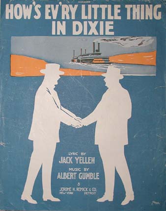 215ms: Sheet music from 1916. How's Ev'ry Little Thing in Dixie. Lyric by Jack Yellen, Music by Albert Gumble. Size 10.5 X 13.5 in. $20 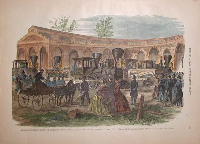 216ms: ive Locomotives Built at Vicksburg by the Soldiers under the Supervision of Colonel Colbaugh, of McPherson's Staff. Very nice hand colored wood engraving from The Civil War in the United States, published in 1907. Size 16 X 11 in. $60 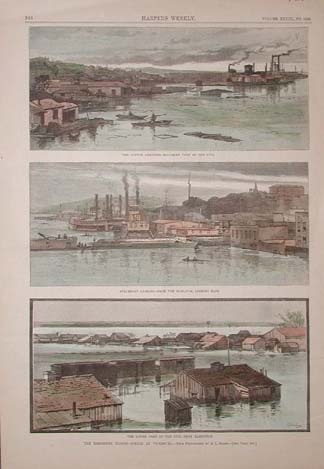 217ms: The Mississippi Floods - Scenes at Vicksburg. Three hand colored wood engravings from the April 19, 1884 issue of Harper's Weekly. Top image titled, The Cotton Compress - Southern Part of the City. Middle image captioned, Steamboat Landing - From the Elevator, Looking East. Bottom image of, The Lower Part of the City - From Kleinston. Size 11 X 16 in. $40 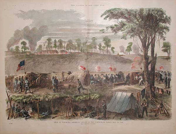 219ms: Hand colored wood engraving from The Soldier in our Civil War. Siege of Vicksburg. - Sherman's Attack on the Confederate Works, May 22, 1863. Size 22 X 16 in. $80 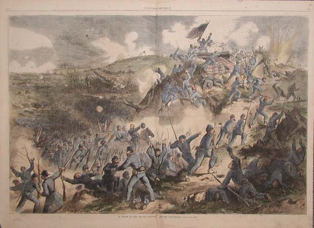 221ms: A Scene in one of the Battles Before Vicksburg. Very nice hand colored wood engraving from the March 7, 1863 issue of Harper's Weekly. Small archival repairs have been done where the original binding was in the page, barely noticeable, does not detract from image. Size 22 X 16 in. $80 
222ms: Several hand colored engravings from the January 17, 1880 issue of Harper's Weekly. Page titled, A Cotton Blockade at Meridian, Mississippi. Some staining in margins, does not effect image. Size 16 X 11 in. $50 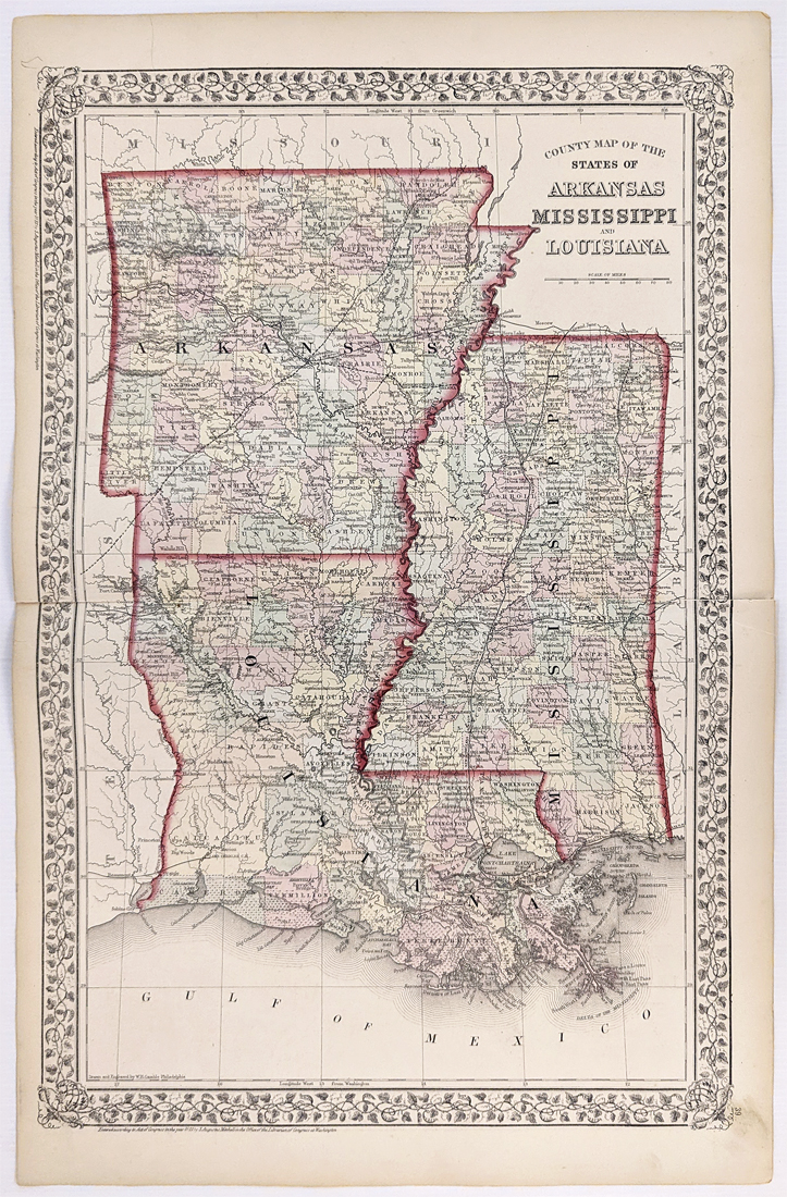 144Arkansas: 1872 Mitchell's County Map of Arkansas, Louisiana Mississippi. Showing various cities, towns, rivers, railroads, along with some topographical details. Hand colored, lithograph. 15 1/4 x 23 5/8 in. $150 |
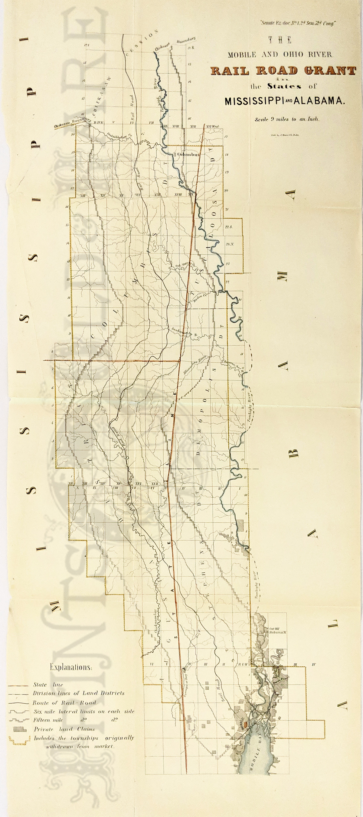 230rr: 1853 The Mobile and Ohio River Railroad Grant in the States of Mississippi and Alabama. Long map showing 20 miles on either side of railroad running down the state line between MS & AL. Shows Chickasaw boundary (just north of Columbus, MS) south to Mobile, AL. Also private land grants, rivers, counties, etc. Lithograph. 13 x 31 in. $600  244Mississippi: View from Vicksburg from the Mississippi river. 1923. Size 7 x 10 1/4 in. $60 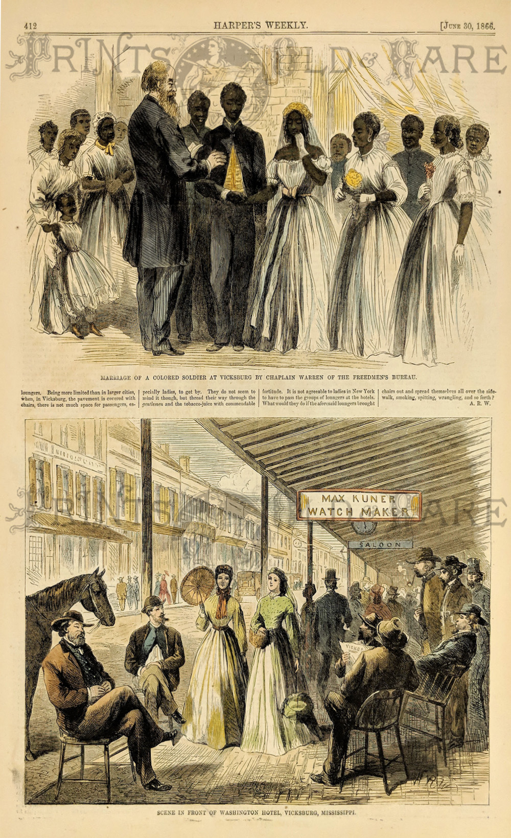 245Mississippi: "The Marriage of A Colored Soldier at Vicksburg by Chaplain Warren of the Freedmen's Bureau." & "Scene in front of Washington Hotel, Vicksburg, Mississippi." 1866 Harper's Weekly. Hand colored, wood engraving. Size 11 x 16 in. $50 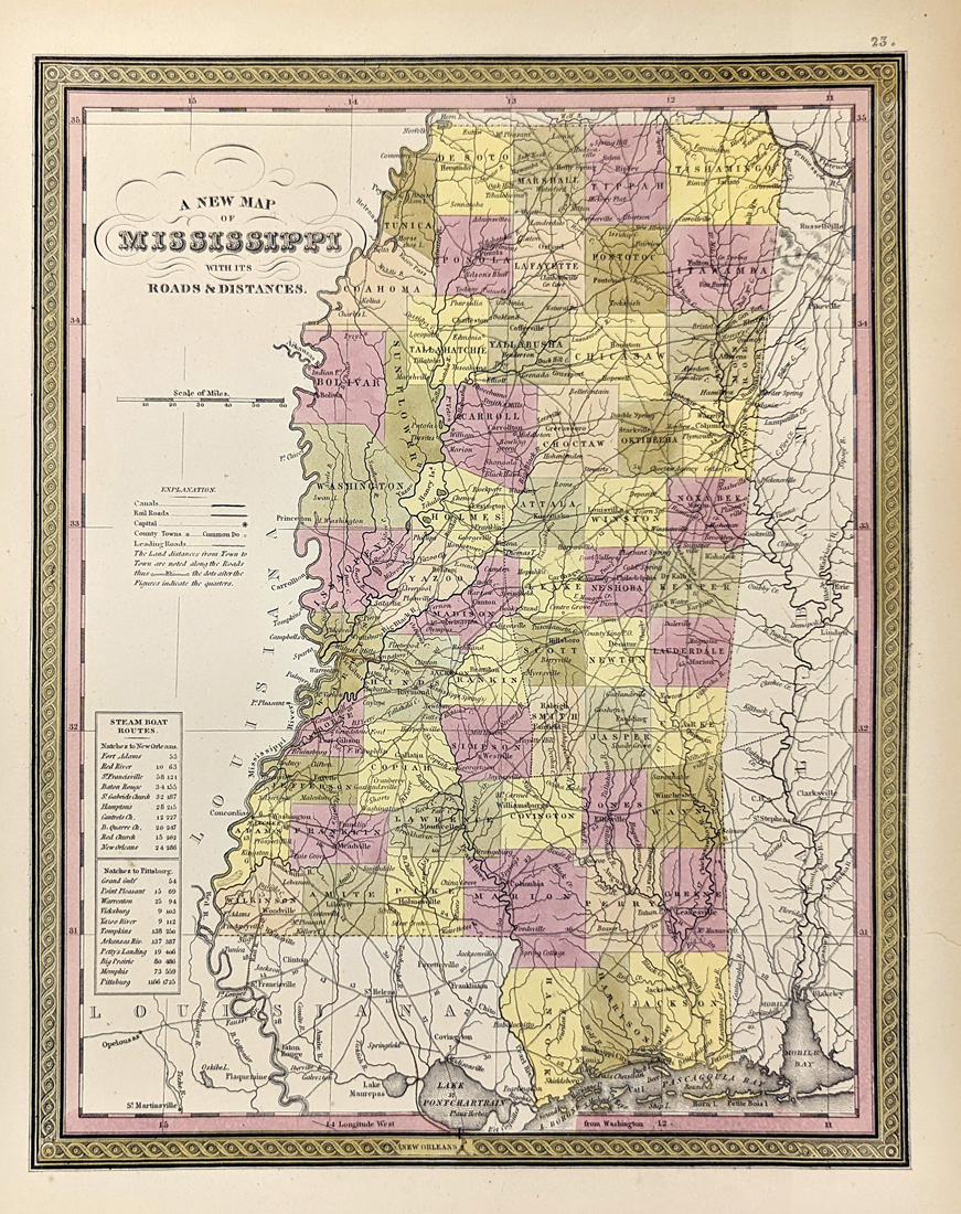 246Mississippi: 1853 Mitchell's A New Map of Mississippi with it's roads and distances. Showing canals, railroads, capital, counties, towns, roads, lakes, etc. Steamboat routes and distances are shown on index table. Hand colored, lithograph. **Minor tear lower right quadrant, archivally mended. 12 5/8 x 15 1/2 in. $240 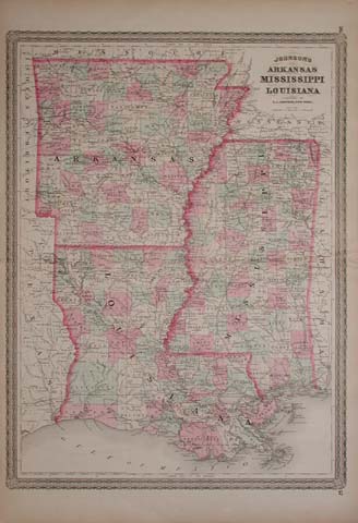 223ms: 1866 Johnson's Map of Arkansas, Mississippi and Louisiana. Original hand color, with each county colored separately. Very attractive border, would look excellent in a frame. Size 18 X 26.5 in. $120 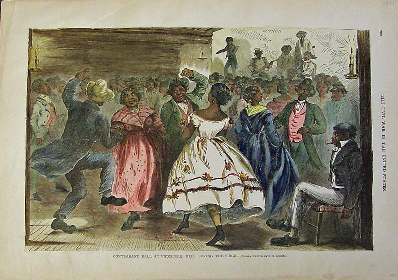 225ms: 1907 Hand colored wood engraving featured in The Civil War in the United States. Title of engraving is "Contraband Ball at Vicksburg, Miss. During the Siege." From a Sketch by F.B. Schell. 16-1/2 x 12 in. $50 Black & White: $30 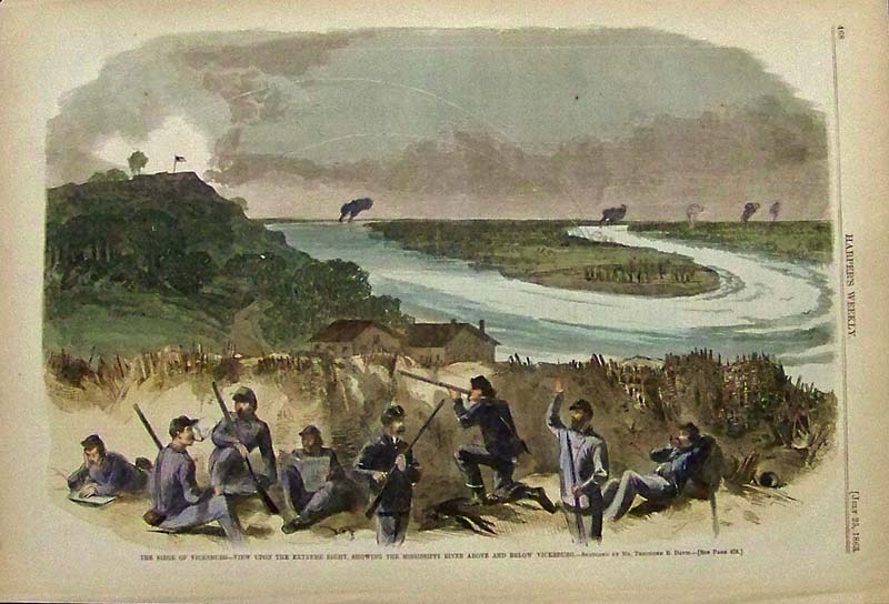
231Mississippi: 1863 Hand colored wood engraving from Harper's Weekly titled, "The Siege of Vicksburg -- View Upon the Extreme Right, Showing the Mississippi River Above and Below Vicksburg." Sketched by Theodore R. Davis. 16 x 11 in. $50 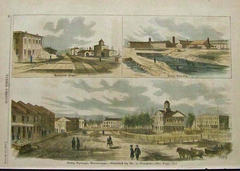
232Mississippi: 1863 Hand colored wood engraving from Harper's Weekly showing images of Holly Springs, Mississippi. 16 x 11 in. $50 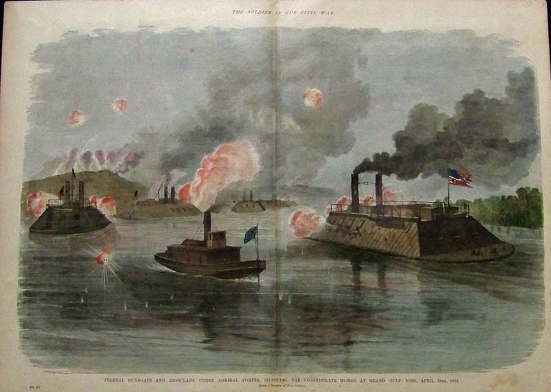
233Mississippi: 1885 Hand colored wood engraving featured in The Soldier In Our Civil War showing Federal Gunboats and Ironclads under Admiral Porter, Silencing the Confederate Works at Grand Gulf, Mississippi, April 29th, 1863. 22 x 16 in. $50 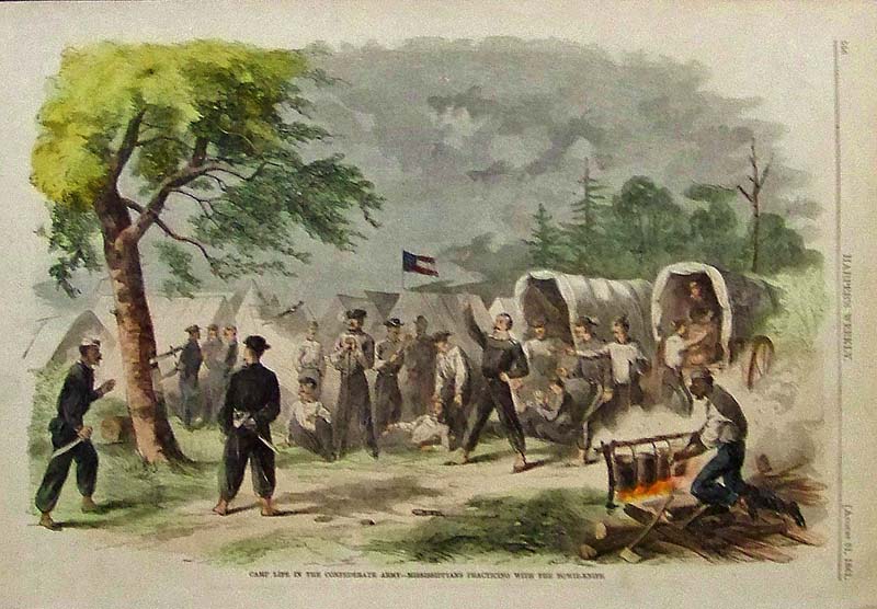
235Mississippi: 1861 Harper's Weekly hand colored wood engraving titled, "Camp Life in the Confederate Army -- Mississippians Practicing with the Bowie-Knife." 15-1/2 x 10-1/2 in. $60 
236Mississippi: 1862 Hand colored wood engraving from Harper's Weekly titled, "Naval Combat Off Fort Wright, in the Mississippi River, May 8, 1862." 15-1/2 x 11 in. $40 
237Mississippi: 1863 Harper's Weekly hand colored wood engraving showing The Battle of Jackson, Mississippi, May 14, 1863 -- Charge By General Crocker's Division in bottom image and upper image shows Raising the Stars and Stripes Over the Capitol of the State of Mississippi. 15-1/2 x 11 in. $50 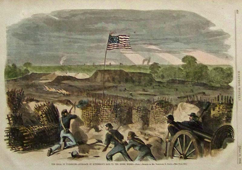
238Mississippi: 1863 Harper's Weekly hand colored wood engraving titled, "The Siege of Vicksburg -- Approach of McPherson's Saps to the Rebel Works." Sketched by Theodore R. Davis. 16 x 11 in. $50 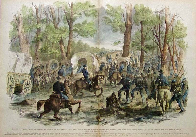
239Mississippi: 1862 Hand colored wood engraving showing the Advance of Federal Troops on Corinth -- The Carnival of Mud -- Scene at Lick Creek Bottom Between Pittsburg Landing and Monterey, Four Miles From Corinth, Monday, May 5th, 1862 -- General Burlbut's Division Forcing their way through the Mud. 22 x 16 in. $100 
240Mississippi: 1908 Rand McNally color Mississippi map, with a red railroad explanation on bottom showing all the railroad lines throughout Mississippi. 28 x 20 in. $60 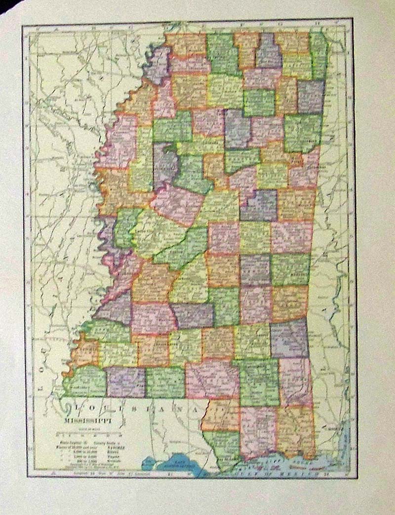
241Mississippi: 1904 Color People's Atlas map of Mississippi. 13-1/2 x 10-1/2 in. $40 |
|||||||||
| Order Form | |||||||||||
| Back to Homepage | |||||||||||