 
|
|||||||||||
This is a small selection of our inventory of antique New Hampshire maps and prints. Additional inventory is available. Contact us with your request. 1-800-879-6277
|
|||||||||||
|---|---|---|---|---|---|---|---|---|---|---|---|
 000NewHampshire: 1887 Goffstown, NH, in Hillsborough County. Hand colored lithographed Bird's-Eye View. 22 x 17 in. $500 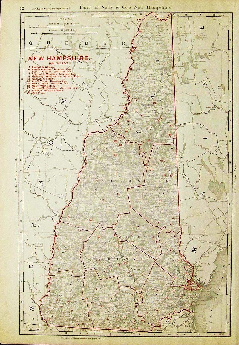
001NewHampshire: 1894 Rand, McNally & Co. color outlined New Hampshire Railroads Map with Railroads Key on top left of map. 20 x 14 in. $100  003nh: 1838 Bartlett New Hampshire view. Lake Winnepiseogee Saw Mill and Log Cabin. Hand colored rare steel engraving. 11x8 in. $60  004nh: 1897 New Hampshire and Vermont Map. Attractive Century map, printed in color. Nice border. 11-3/4x16 in. $30 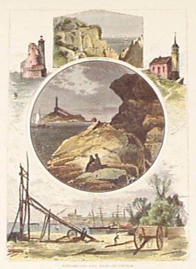 005nh: 1873 Portsmouth and Isles of Shoals. Five antique hand colored New Hampshire views on one page. 9x12-3/4 in. $40 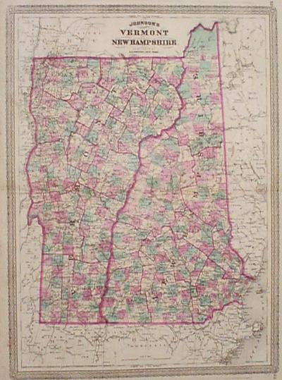 006nh: 1872 Johnson's Map of New Hampshire and Vermont. Each county in separate original color. Large scale, very detailed, good looking border. 16x24 in. $100 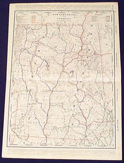
008nh: 1897 New Hampshire and Vermont Railroad Map. Am amazing 18 separate railroad companies crossed New Hampshire & Vermont. All are listed and routes of each are shown in separate line colors. 15x23 in. $100 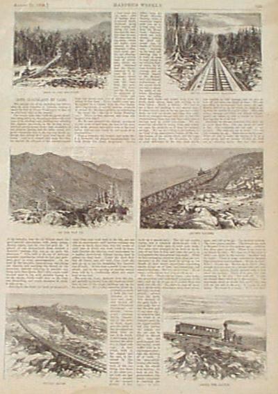 010nh: 1869 Cog Railroad White Mountains. New Hampshire, black & white Harper's engravings, 6 on one page. Titled "Into Cloudland by Cars." 11x15 in. $30 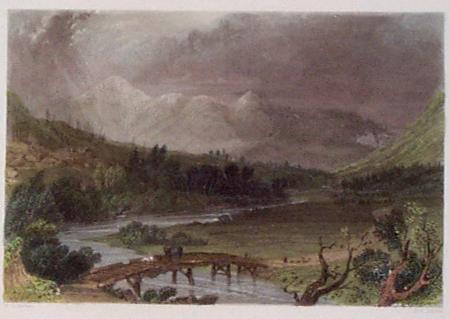 011nh: 1838 Mt. Washington White Mountains. Barlett New Hampshire view. Hand colored steel engraving. 10-3/4x6-1/2 in. $60 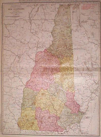 013nh: 1920 Railroad Map of New Hampshire. Very large scale, printed in color by Rand McNally. Lists and shows railroads, early roads, etc. in great detail. 15-1/2x22 in. $80 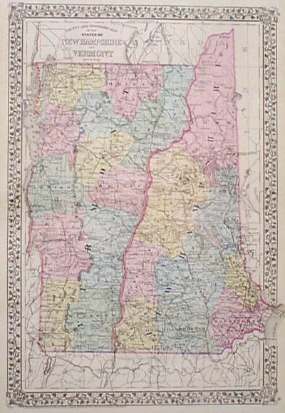 015nh: 1877 Large Mitchell Map of New Hampshire and Vermont. Original hand color. Good looking border, very good detail for this large scale map. 14x23 in. $110 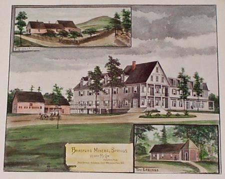 016nh: 1892 Hermitage Hotel New Hampshire. Bradford Mineral Springs, East Washington, N.H. With insets of the cottages and the mineral springs. 17x14 in. $80 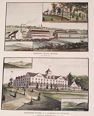 017nh: 1892 Littleton and Franconia New Hampshire. Two large hand colored lithographs on one page, showing the Goodnow House and the Saranac Glove Works. 15x17-1/2 in. $80  019nh: 1884 New Hampshire and Vermont Map. Attractive Bradley original hand colored map. Nice border. Large map with lots of details including individual townships. 19x26-1/2 in. $80 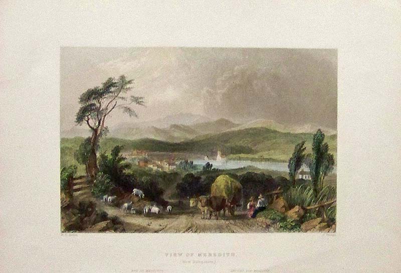 020NewHampshire: 1839 W.H. Bartlett hand colored steel engraving showing a View of Meredith (New Hampshire). 10-1/2 x 7-1/2 in. $80 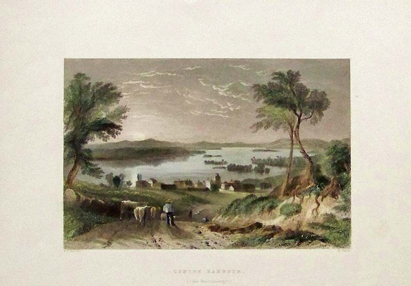
021NewHampshire: 1838 W.H. Bartlett hand colored steel engraving showing Centre Harbour, (Lake Winnipisseogee). 10-1/2 x 8 in. $80 
022NewHampshire: 1838 W.H. Bartlett hand colored steel engraving showing Squawm Lake, (New Hampshire). 10-1/2 x 8-1/2 in. $80 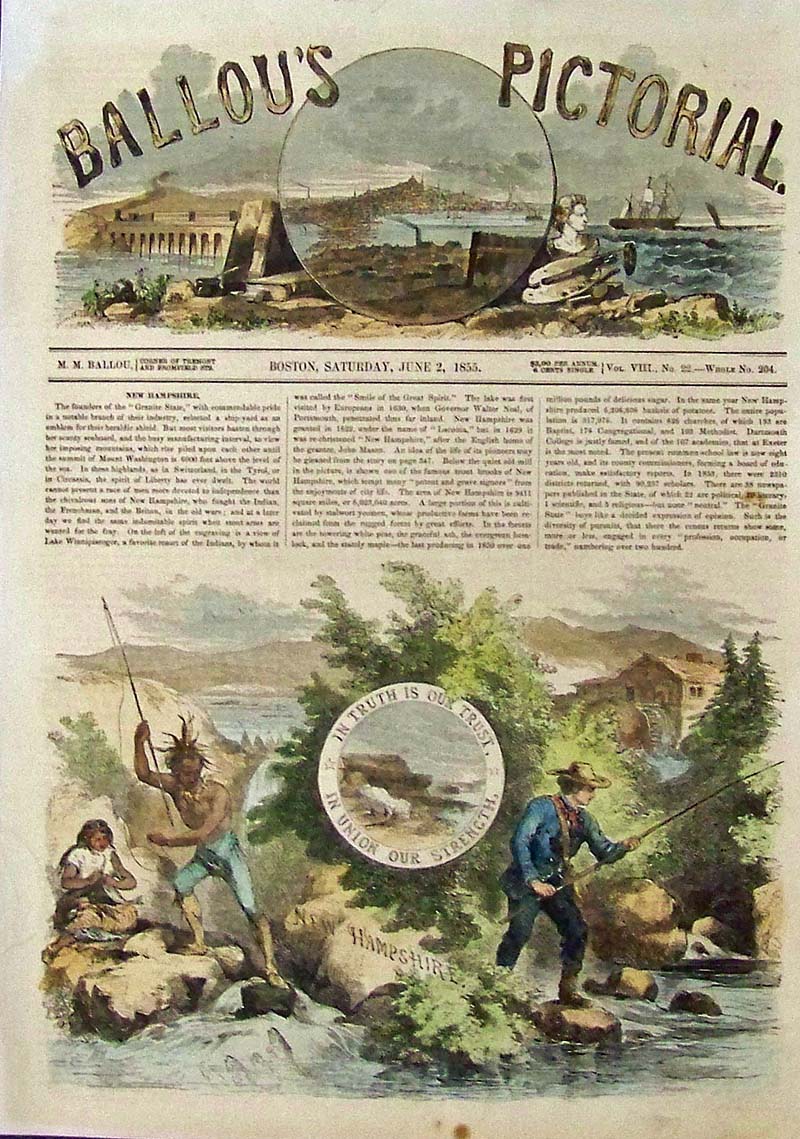
023NewHampshire: 1855 Hand colored wood engraving from Ballou's Pictorial showing New Hampshire's Seal, "In Truth Is Our Trust, In Union Our Strength. 15 x 11 in. $60 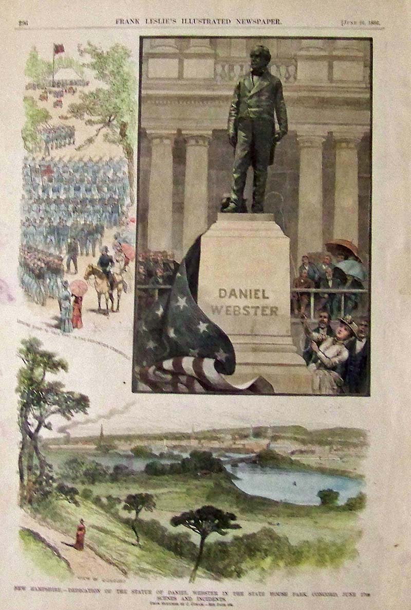
024NewHampshire: 1886 Hand colored wood engraving from Frank Leslie's Illustrated Newspaper showing the Dedication of the Statue of Daniel Webster in the State House Park, Concord, June 17th and other scenes and incidents. 16 x 11 in. $60 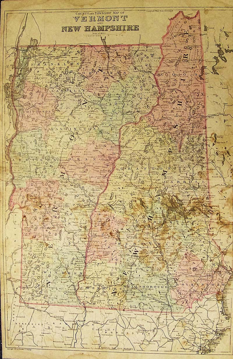 021Vermont: County and Township Map of Vermont and New Hampshire 1882 Bradley - Unusual engraved and original hand colored map of County and Township of Vermont and New Hampshire. Published by the M. Bradley and Co. Each county and township is colored separately, cities, towns, railroad lines, major roads and geographical features are all shown. Condition: Foxing and mottling through most of middle image, fold in middle with a small tear in center of Vermont, small margins. size 14.5 x 22.5 image $75 |
 025NewHampshire: 1882 Harper's Weekly hand colored wood engraving showing Mount Washington with text about it. Small brown stains in border and text but not in images. 16 x 11 in. $60 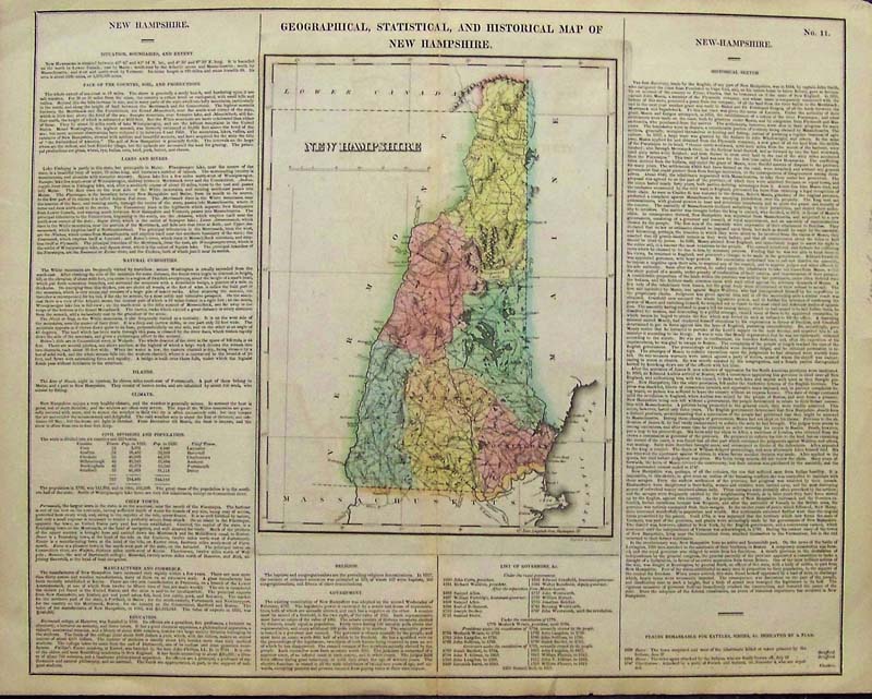
107NewHampshire: Geographical, Statistical and Historical Map of New Hampshire, Carey, 1823 - An attractive and engraved with original hand coloring (large sheet) early map of New Hampshire, from the second edition of Carey & Lea's Atlas. Size includes text surrounding map, which includes wonderful contemporary details concerning the topography, indigenous lands, rivers, climate, towns, manufacturing, commerce, education, history, population by county, and other information. Roads, towns, rivers, and lakes included on map. Flags indicate three "places remarkable for battles and sieges." Carey & lea's Atlas is highly prized not only for its cartographic information but the marvelous information about each of the states and territories included. The atlas was issued in six editions in English, French, and German between 1822 and 1827. Condition: Very good overall, fold in middle with slight tears top and bottom, some water marks on lower map outside main image. size, 20.5 x 16.5 image $375 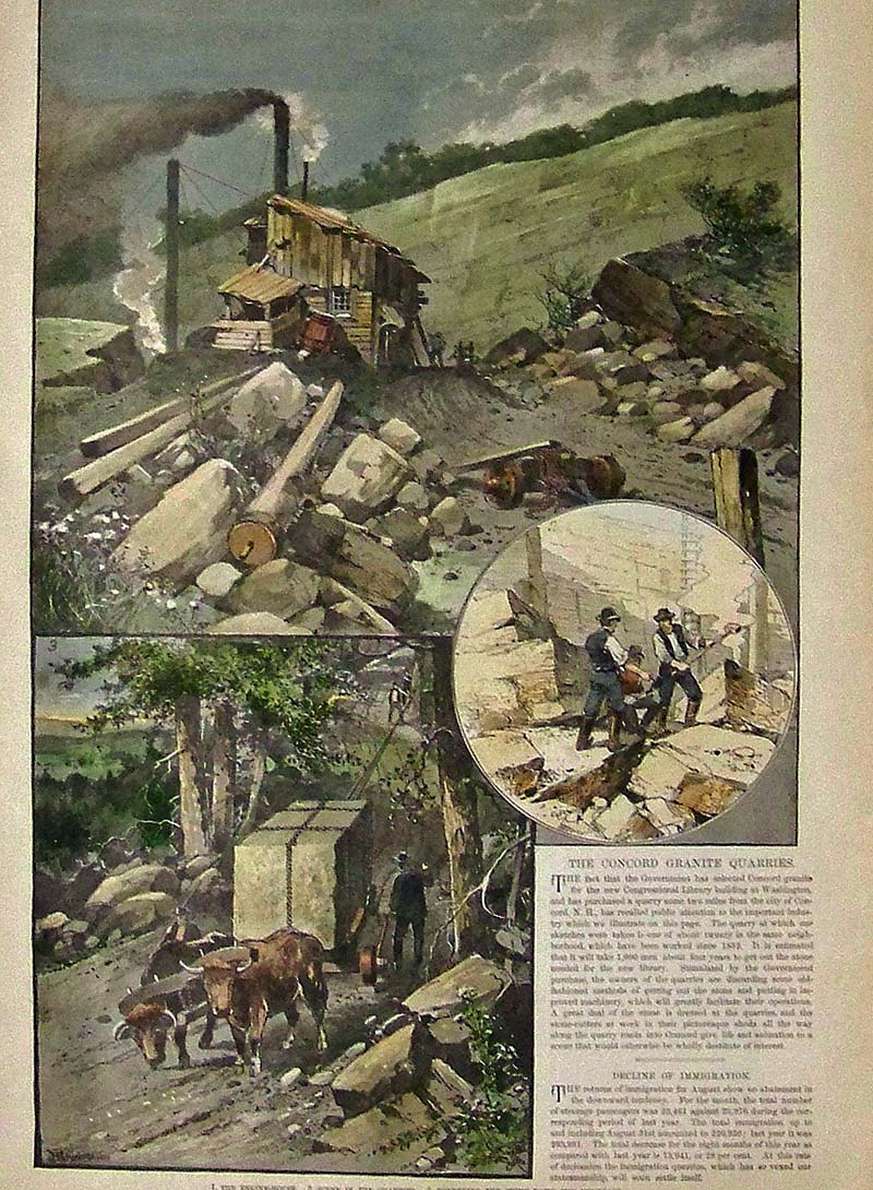
026NewHampshire: 1889 Hand colored wood engraving from Frank Leslie's Illustrated Newspaper showing the granite quarries near the city of Concord in New Hampshire. 16 x 11 in. $50 
028NewHampshire: 1837 W.H. Bartlett hand colored steel engraving showing Lake Winnipisseogee, from Red Hill. 10-1/2 x 8 in. $80 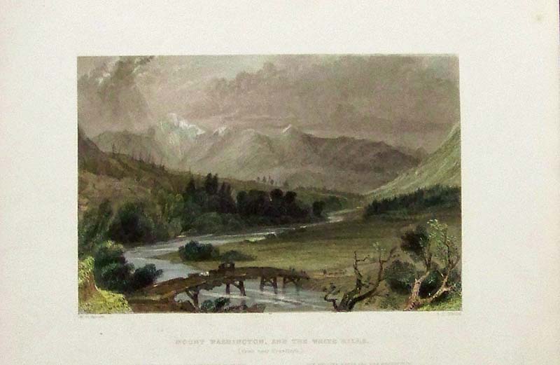
030NewHampshire: 1842 W.H. Bartlett Hand colored steel engraving showing Mount Washington, and the White Hills, (From Near Crawford's). 10-1/2 x 8 in. $60 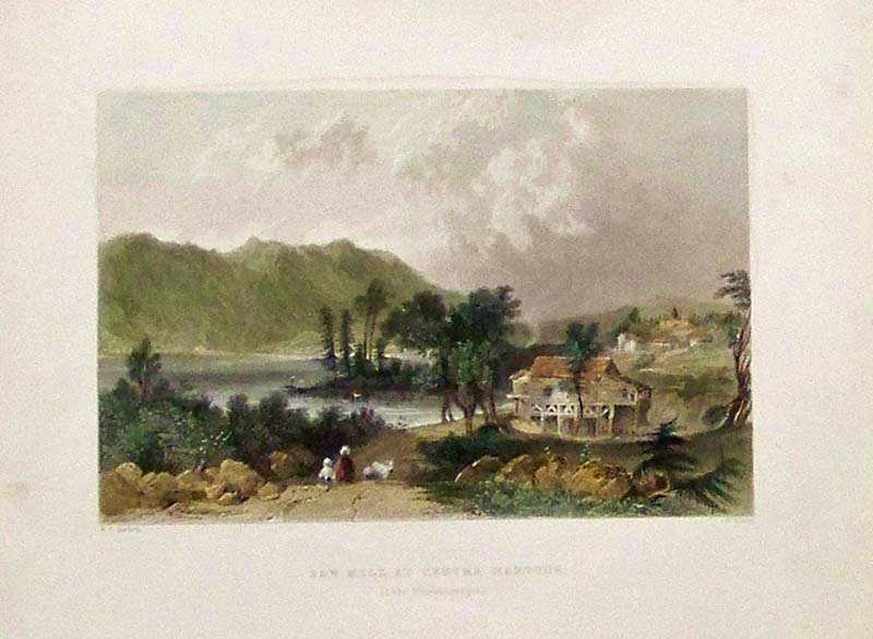
031NewHampshire: 1839 W.H. Bartlett hand colored wood engraving showing the Saw Mill at Centre Harbour, (Lake Winnipisseogee). 10-1/2 x 8 in. $60 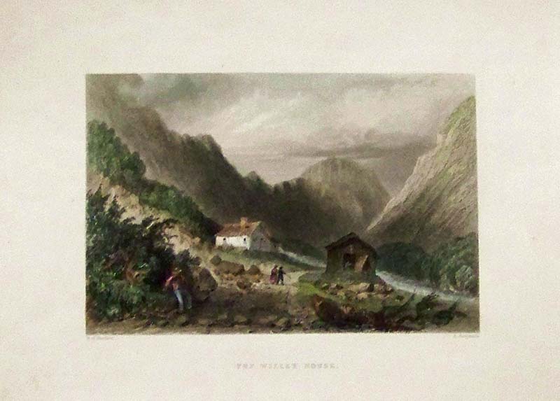
032NewHampshire: 1838 W.H. Bartlett hand colored steel engraving showing the Willey House. 10-1/2 x 8 in. $60 
033NewHampshire: 1839 W.H. Bartlett hand colored steel engraving showing people nestled on the top of Mount Jefferson, (From Mount Washington). 10 x 8 in. $60 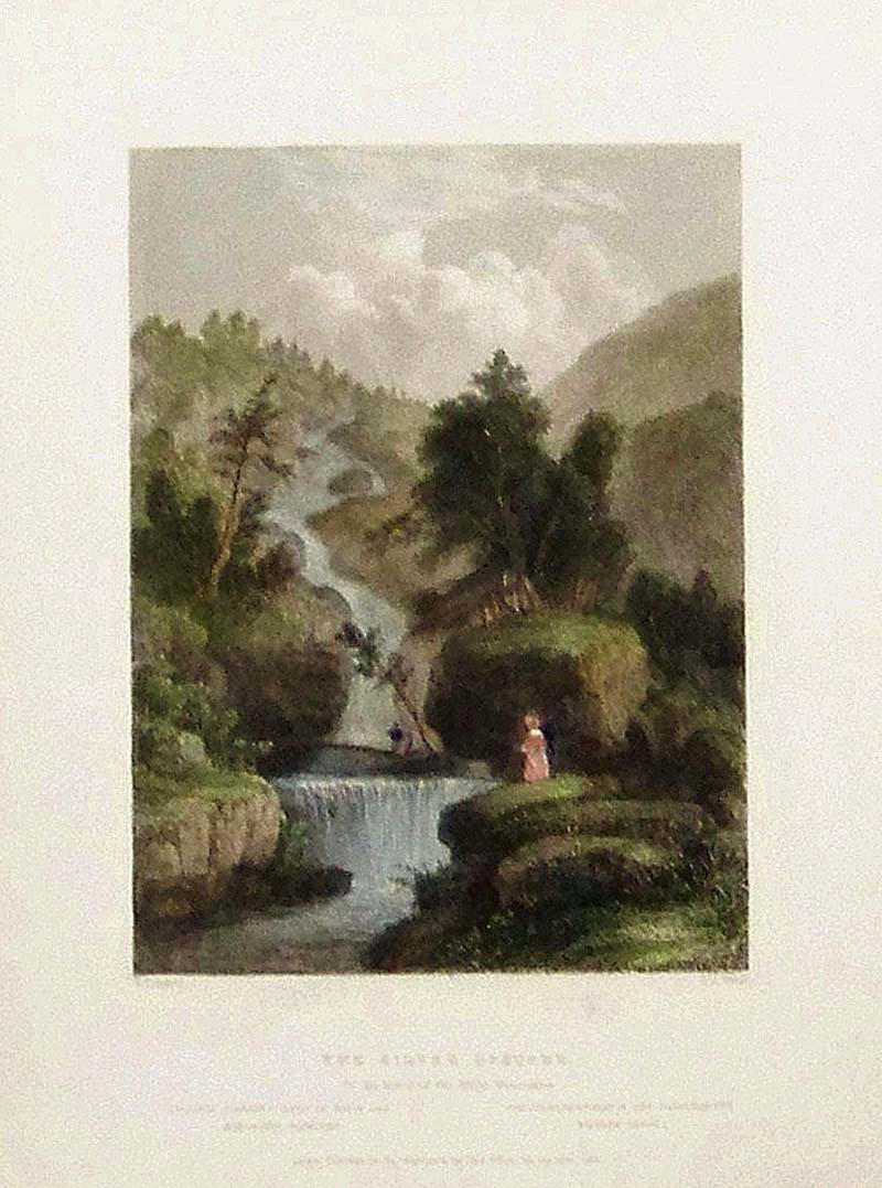
034NewHampshire: 1839 Hand colored steel engraving showing the Silver Cascade, in the Notch of the White Mountains. 10-1/2 x 7-1/2 in. $60 
035NewHampshire: 1839 W. H. Bartlett hand colored steel engraving showing Pulpit Rock (White Mountains). 10-1/2 x 8 in. $60 
036NewHampshire: 1873 Hand colored steel engraving showing the very steep Mount Washington Road in the White Mountains. 12-1/2 x 9 in. $50 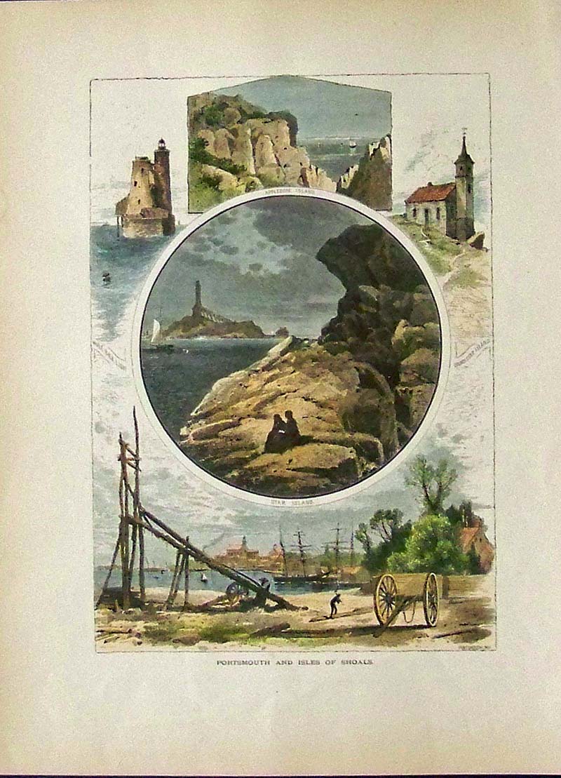
037NewHampshire: 1873 Hand colored wood engraving showing Portsmouth and Isles of Shoals. 12-1/2 x 9-1/2 in. $40 
038NewHampshire: Picturesque America hand colored wood engraving with text showing Profile Mountain. 12 x 9 in. $30 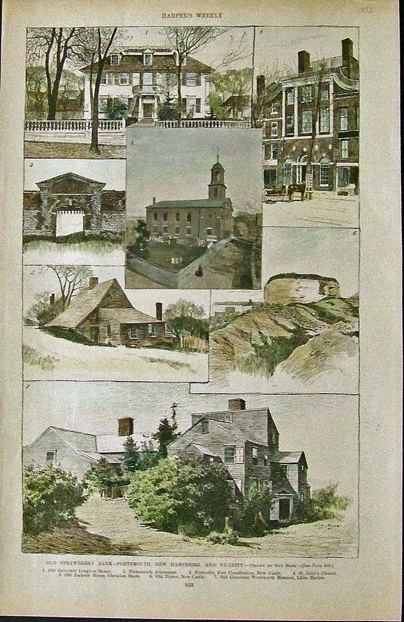
039NewHampshire: 1893 Harper's Weekly hand colored wood engraving showing images of the Old Strawberry Bank -- Portsmouth, New Hampshire, and Vicinity. Two separate text pages about Old Strawberry Bank are included. 15-1/2 x 10 in. $80 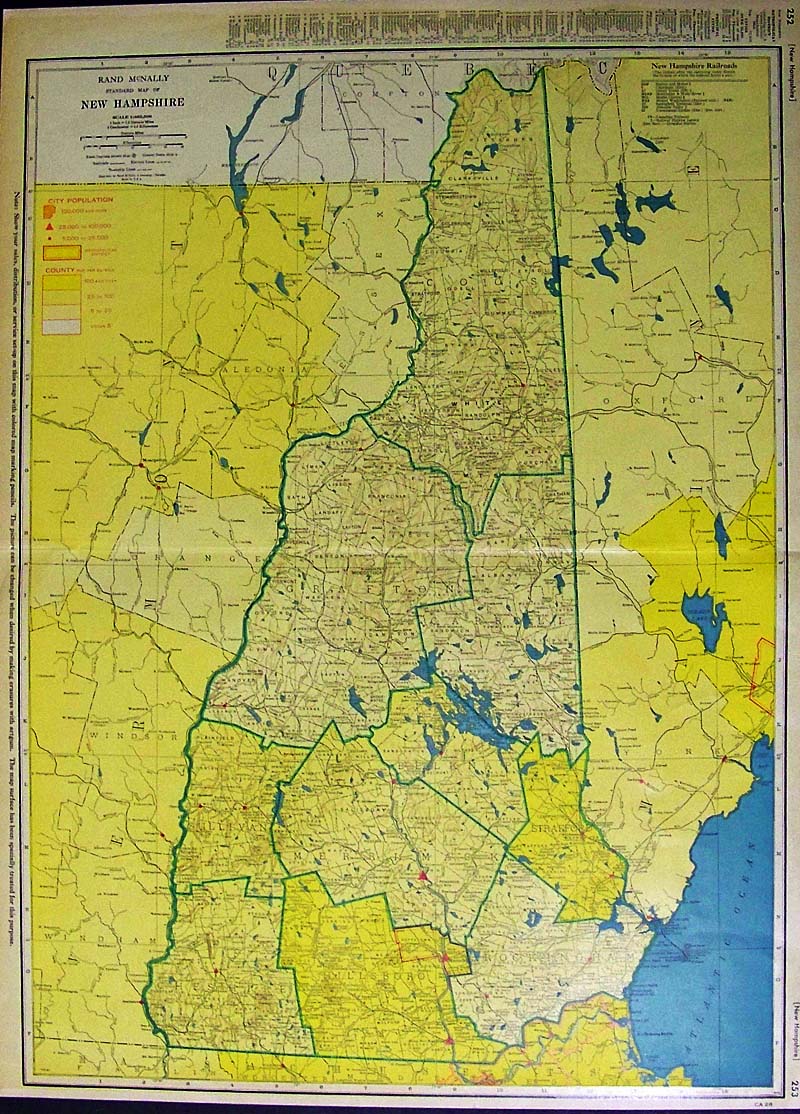
040NewHampshire: Color Rand McNally Standard Map of New Hampshire with keys to City Population and Cities shown. 27 x 20-1/2 in. $80 
041NewHampshire: 1904 Color Rand-McNally Indexed Atlas of New Hampshire and its Railroads with a Railway key on top of map. 20-1/2 x 15 in. $60 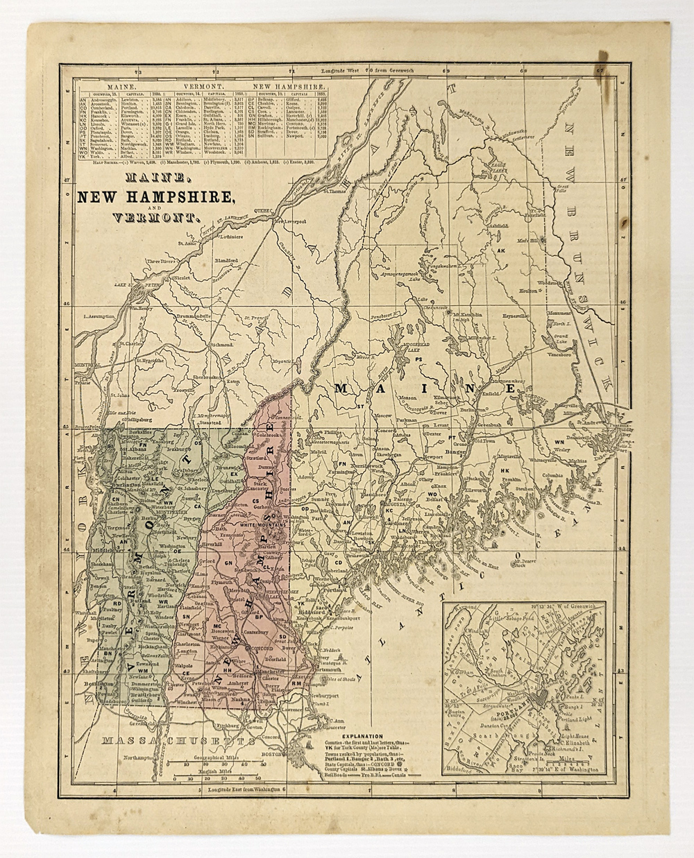 333Maine: 1861 Map of Maine, New Hampshire, and Vermont. Showing railroads, canals, capital and counties. Inset of Portland. Hand colored. 13 x 11 in. $60 |
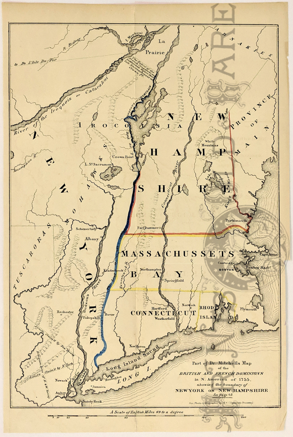 108NewHampshire: "Part of Dr. Mitchells Map of the British and French Dominions in N. America of 1755, Showing the boundary of New York on New Hampshire." Re-issue of a 1755 Map published in 1850 by Am. Photo-Lithographic Co. NY. Hand colored lines showing the boundry between each of the states. Cities, rivers and sounds are shown, along with limits and division lines claimed. 9 x 13 1/2 in. $150 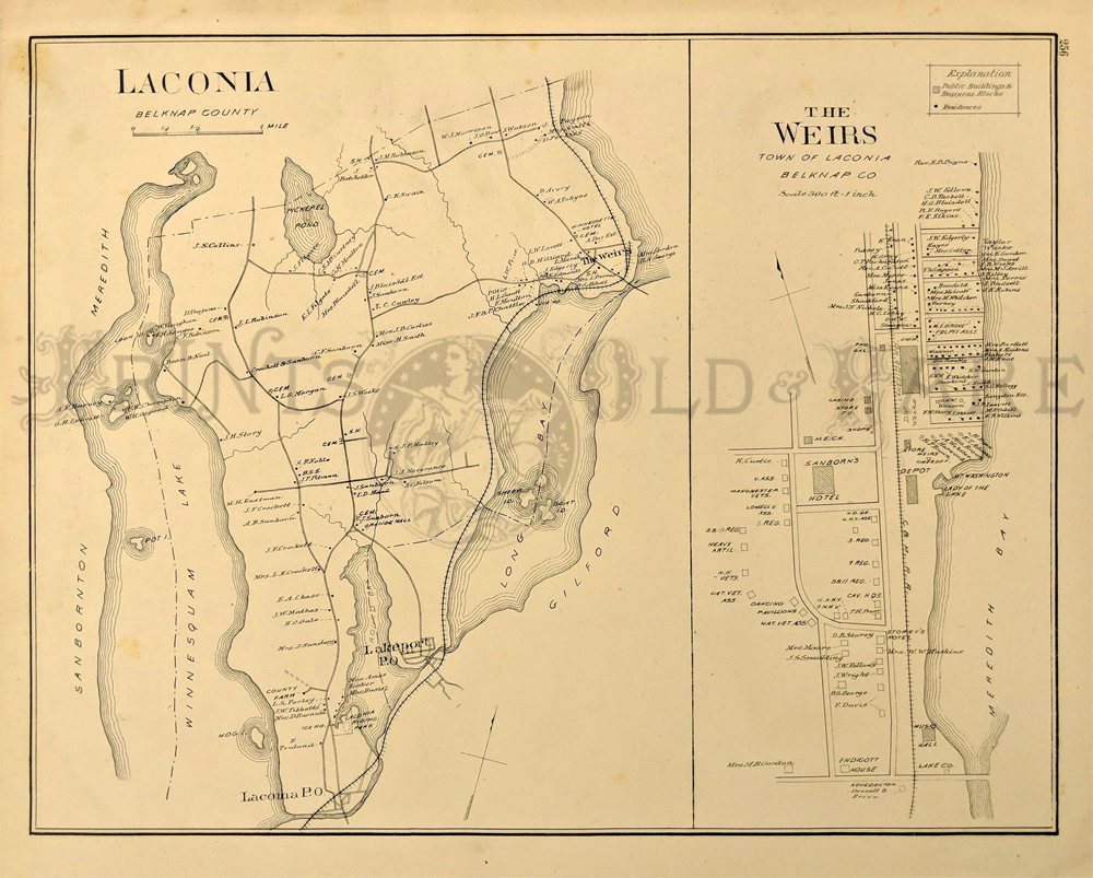 109NewHampshire: 1892 Laconia, Belknap County Map. Shows settlements, roads, railroad, landowners, etc. 14 3/4 x 17 1/2 in. $50 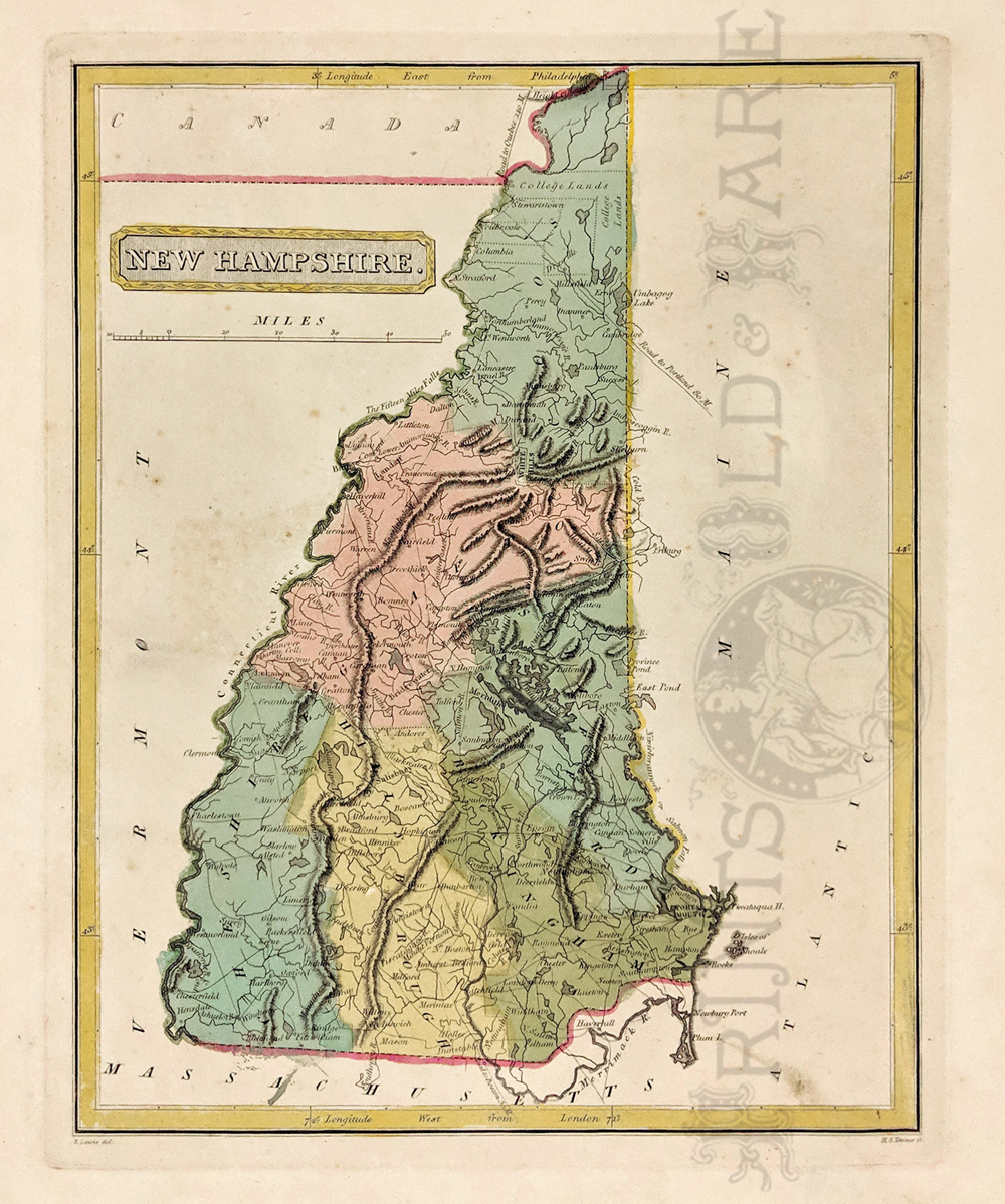 111NewHampshire: 1817 Map of New Hampshire by H.S. Tanner. Eary Tanner map detailing the counties, cities, rivers and some topography details. Great condition. Hand colored, copper engraving. 11 1/4 x 13 3/8 in. $300 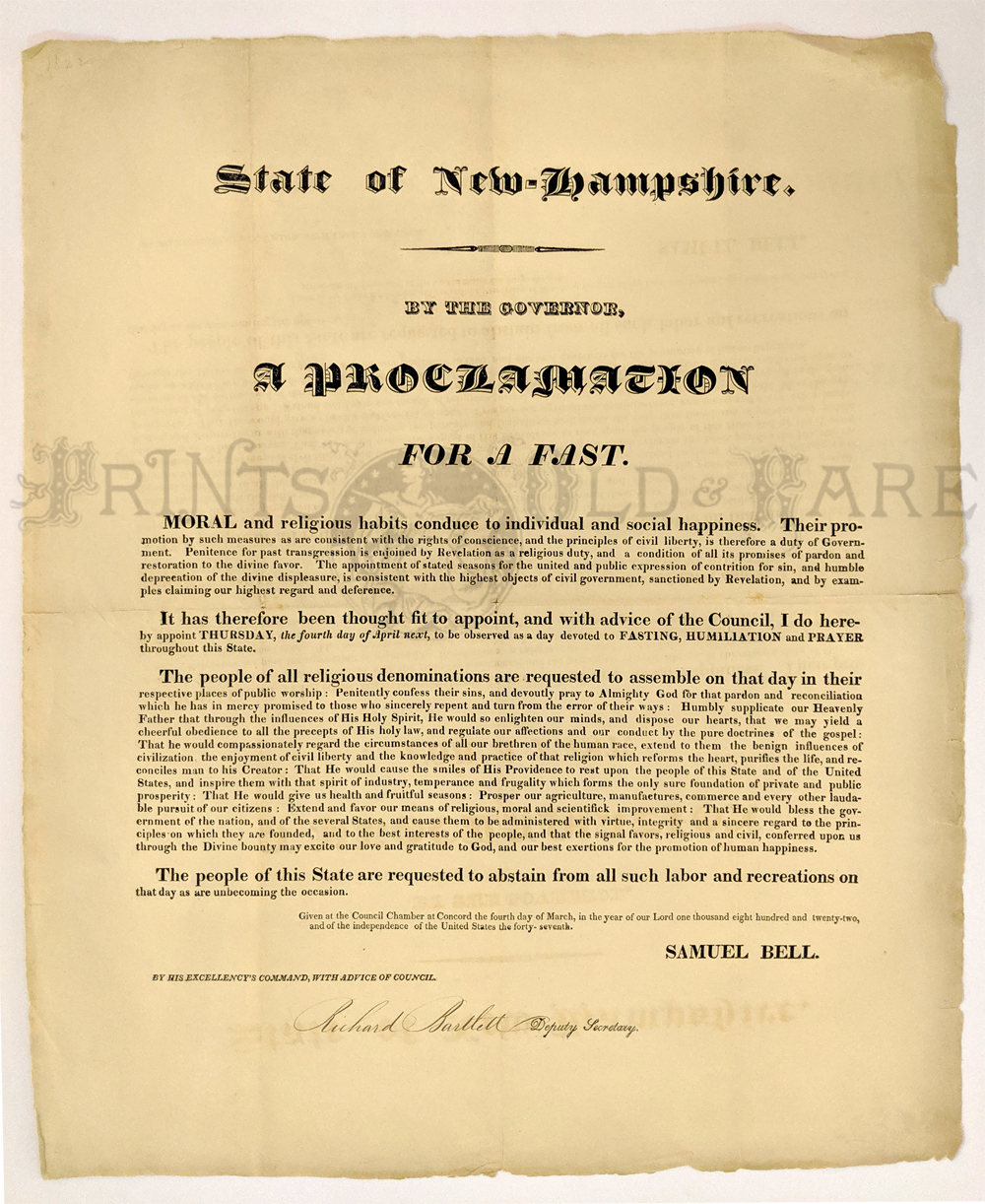 112NewHampshire: 1817 State of New-Hampshire. By the Governor. A proclamation for a day of humiliation, fasting and prayer ... appoint Thursday the seventh day of April next, to be observed as a day of public humiliation, fasting and prayer, throughout this state. 13 1/2 x 16 1/2 in. $100 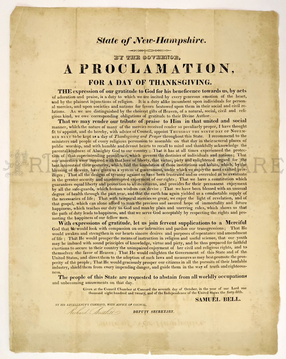 113NewHampshire: 1855 State of New-Hampshire. By the Governor. A proclamation for a day of Thanksgiving. A proclamation for a day of thanksgiving and praise: by the governor ... I appoint Thursday, the twenty-ninth day of November inst., to be observed throughout this State as a day of prayer, praise and thanksgiving to God. 12 3/4 x 16 3/8 in. $100 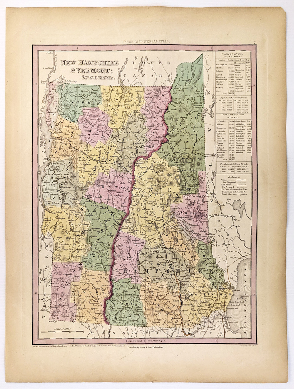 114NewHampshire: 1840 Tanner's Map of New Hampshire and Vermont. Counties, towns, roads with distances, railroads, and a host of other details. The key shows counties and towns in each state with populations. Hand colored, lithograph. 13 3/4 x 17 3/8 in. $300 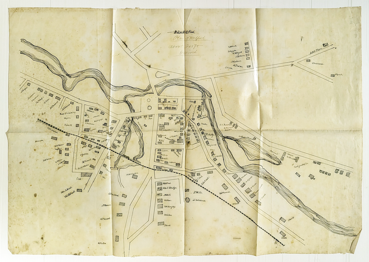 115NewHampshire: Original hand drawn town plan of Milford, New Hampshire. 1888. Shows property by owner identified and railroads. Signed by M. Foster. 19 5/8 x 28 3/4 in. $400 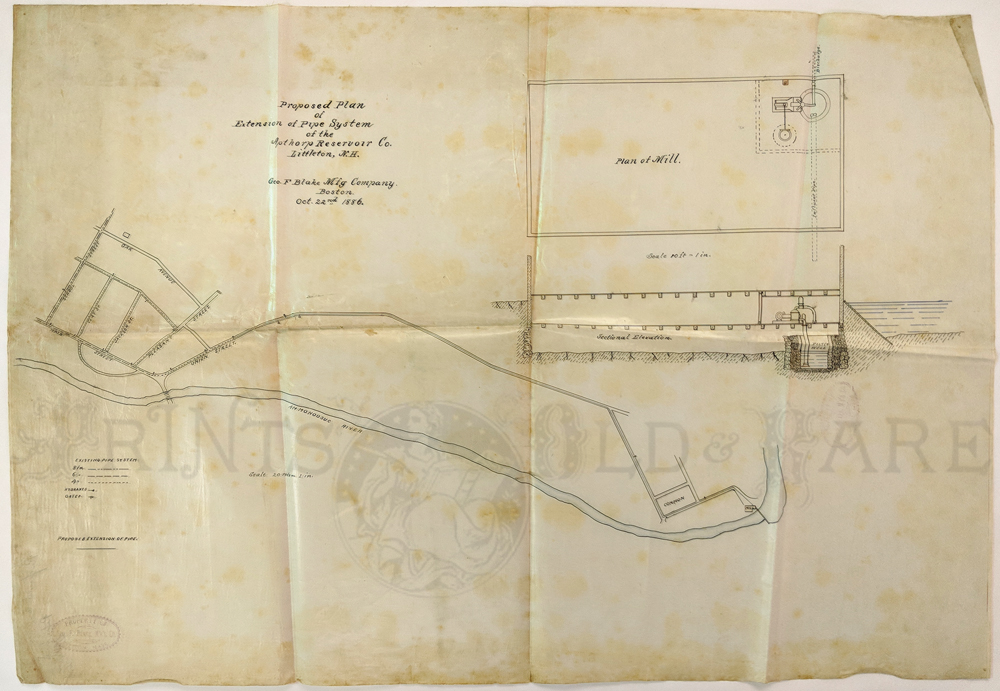 051NewHampshire: Original 1888 Map of Littleton, NH. Extension of pipe system of Apthorp Reservoir. Shows town grid and Ammonoosuc River. 18 x 29 in. $80 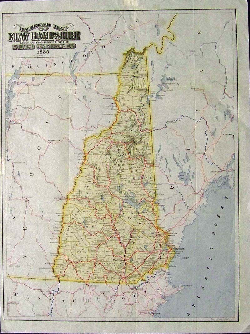
044NewHampshire: 1886 Rare hand colored Railroad Map of New Hampshire Accompanying Report of the Railroad Commissioners. 21-1/2 x 16-1/2 in. $300 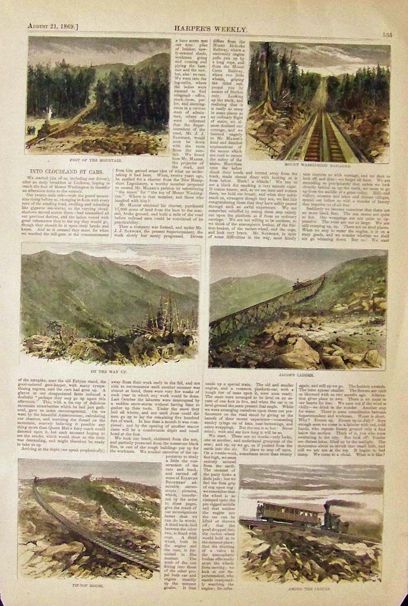
046NewHampshire: 1869 White Mountains and Cog Railroad. Harper's Weekly hand colored wood engravings with text showing different scenes of the ascent of Mt. Washington. 16 x 11 in. $40 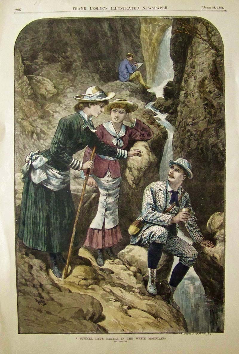
047NewHampshire: 1884 Frank Leslie's Illustrated Newspaper hand colored wood engraving showing, "A Summer Day's Ramble in the White Mountains." 16 x 11 in. $80 
048NewHampshire: New Hampshire Colton 1855 - A very attractive original color map, one of the few maps specifically of New Hampshire published in the mid-19th century. Depicts the state in full with superb detail regarding the cities, transportation system, geographical features and counties. Prepared by J. H Colton for inclusion as plate no. 10 in the 1855 issue of Colton's New General Atlas. Dated and copyrighted 'Entered according to act of Congress in the year 1855 by J. H. Colton & Co. in District Court for the Southern Dist. of New York. Condition: Excellent, large wide margins with normal age coloring and yellowing. size, 11.5 x 15 image. $150 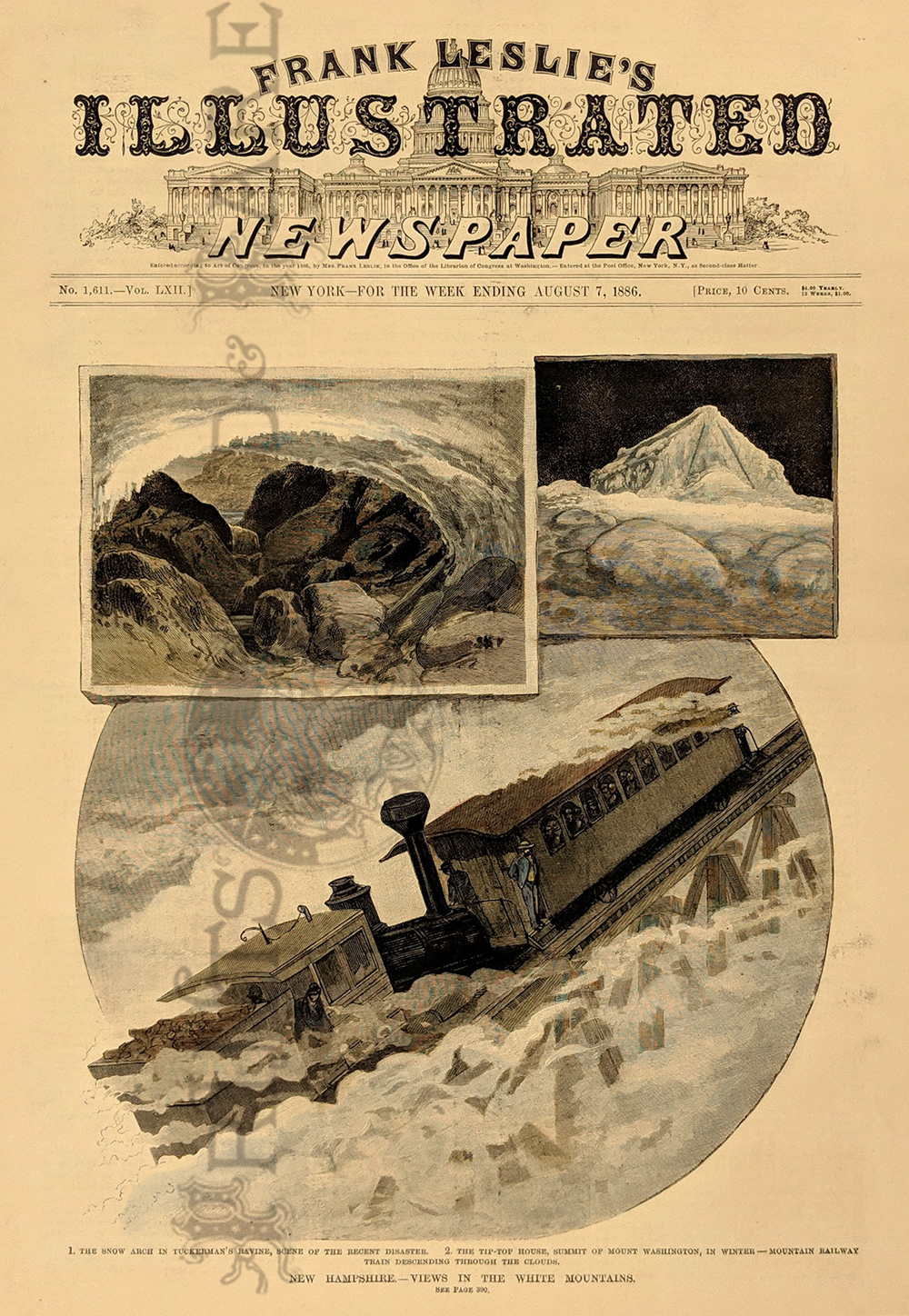
050NewHampshire: 1886 Mountain Railway in Winter - White Mountains. Three views, including snow-covered Tip Top House. Hand colored wood engraving. 11 x 16 in. $80  103nh: EARLY CAREY & LEA MAP OF NEW HAMPSHIRE. Stunning old hand colored engraving, "New Hampshire" by Carey & Lea, produced in 1822. Much informational text is included on soil, climate, waterways, civil divisions and population, chief towns, commerce, education, religion, government, military. Also includes a historical sketch. A genuine antique. 22 x 17.5 in. Excellent Condition. $300 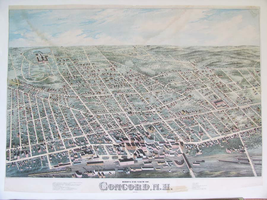 104nh: 1875 Rare color lithograph showing a "Bird'e-Eye View of Concord, N.H." Archivally mounted as the original margins are small, with slight water stain in the sky, and residue of old tape near the letter H in the title. With margins: 32-1/2 x 23-1/2 in. $1200 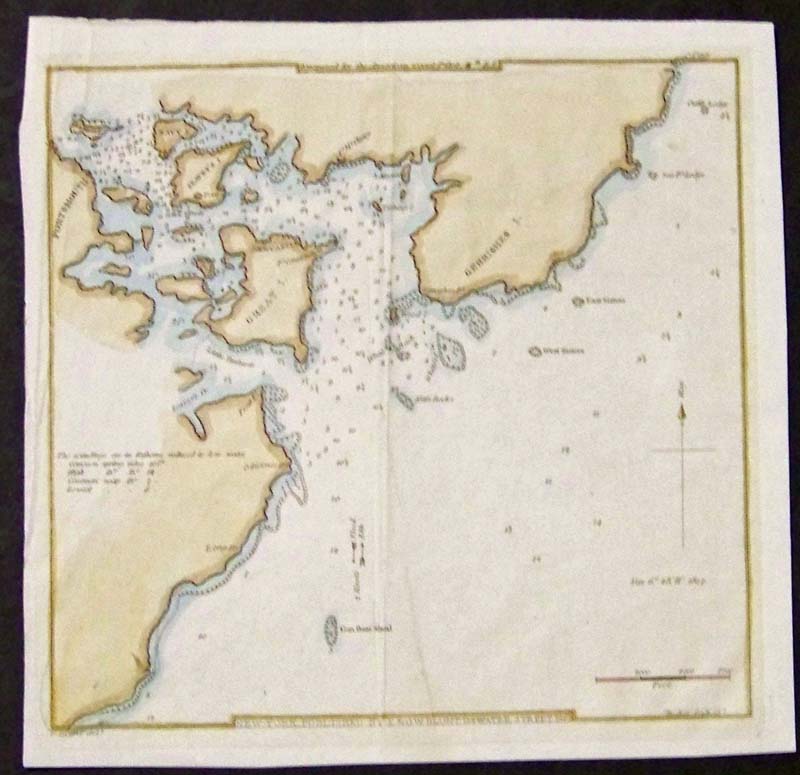
106nh: 1827 Hand colored copper engraved map showing Portsmouth, New Hampshire and surrounding areas. Published in New York by E. & G.W. Blunt. Engraved for the American Coast Pilot, 11th. Edition. 8 x 701/2 in. $150 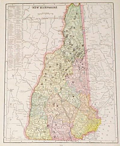 1156nh: 1901 Map of New Hampshire. New Hampshire Map (1901). Color: Printed in Color. Type: Lithograph. Size: 11x14 in. $30 |
|||||||||
| Order Form | |||||||||||
| Back to Homepage | |||||||||||