 
|
|||||||||||
This is a small selection of our inventory of antique New Mexico maps and prints. Additional inventory is available. Contact us with your request. 1-800-879-6277
|
|||||||||||
|---|---|---|---|---|---|---|---|---|---|---|---|
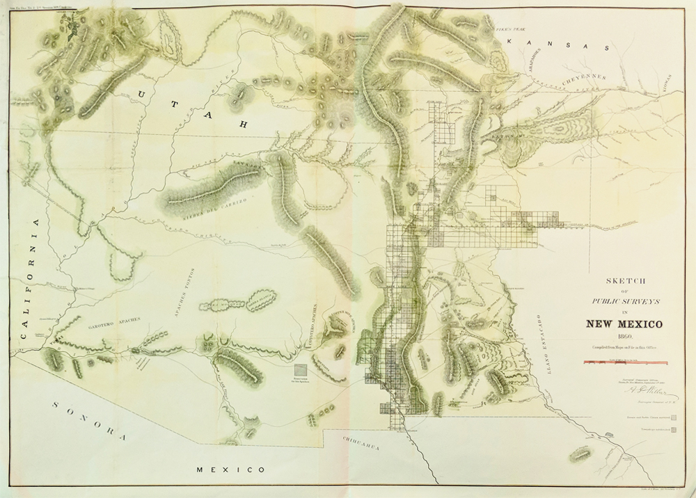 000NewMexico: Hand Colored Litograph of Public Surveys in New Mexico, 1860 large double folio map showing sparse detail of New Mexico, Texas and Indian Territory (Oklahoma); major rivers, Santa Fe, Taos, William's Pass and various Indian Tribes and various Apache klans and Moquis. 1860 Santa Fe. Condition: Good, multiple folds as issued, small margin on left. size 23.5 x 22.5 size $700 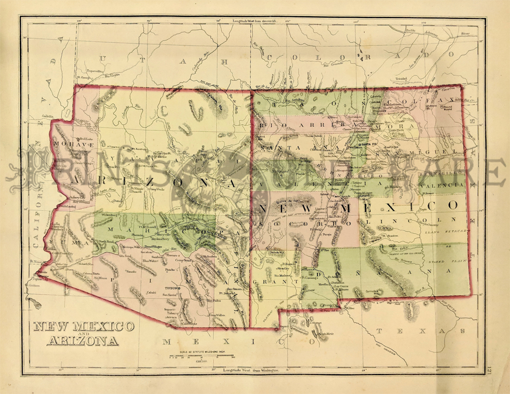 216NewMexico: Gray's New Mexico & Arizona Map. 1875. Detailed map showing a number of newly formed counties and transitional borders in both states. Also shows cities, mountains, plains areas, rivers and creeks. Hand colored, lithograph. 11 1/2 x 15 in. $220 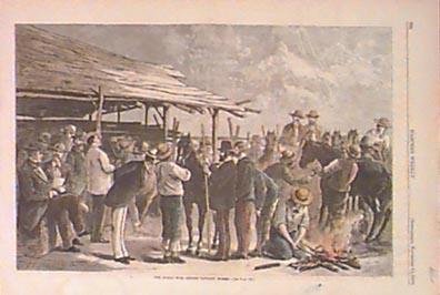 001nm: 1876 New Mexico. "Indian War - Buying Cavalry Horses." Hand colored engraving from Harper's. 16x11 in. $60 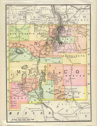 006nm: 1890 Map of New Mexico. Attractive map of the Territory, by Rand McNally. 9x11 in. $60 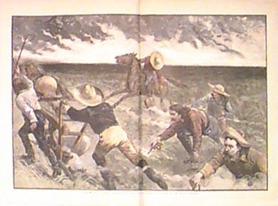 008nm: 1886 Rare New Mexico view. Cowboys. Large beautifully hand colored German engraving. 22x15-1/2 in. $120 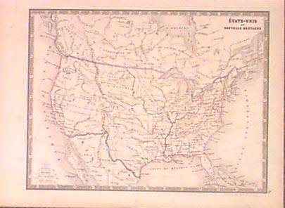 012nm: C.1850 French Map of the United States. Outline color. Mexico still penetrates into what is now New Mexico. All names and text in French. 13x10 in. $90  013nm: 1889 Views Along the Rio Grande. Three fine hand colored engraved views of scenes in the Rio Grande area. Pueblo of Taos, Wagon Wheel Gap, Lake St. Maria at Antelope Park. Two page spread with text in Harper's 22x16 in. $80  014nm: 1963 Carlsbad, New Mexico Contour Map. Reprint of 1954 map of Carlsbad region by Army Corps of Engineers. Color litho in exacting detail. 35x22 in. $40 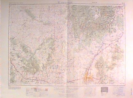 015nm: 1954 Albuquerque New Mexico Contour Map. Color litho map of Albuquerque region by Army Corps. of Engineers. Large scale, exacting detail. 35x22 in. $50 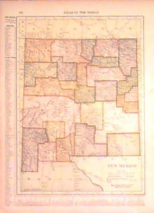 017nm: 1910 Map of New Mexico. Original hand colored map from Atlas of the World. Color by county, lists cities. 10x13 in. $30 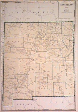
018nm: 1934 New Mexico Map. Color litho map, large scale. Shows cities and towns, and connecting roads. Counties named. 16x19 in. $50 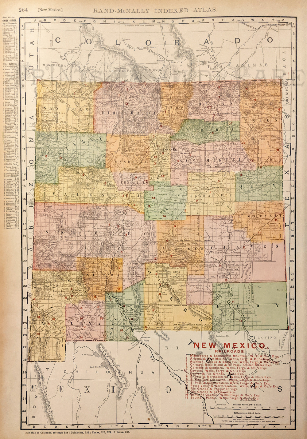 019nm: 1906 Map of New Mexico. Original hand colored engraving by Rand McNally. Color by counties, shows topography, cities and roads. A very attractive map. 14 1/8 x 21 1/2 in. $80 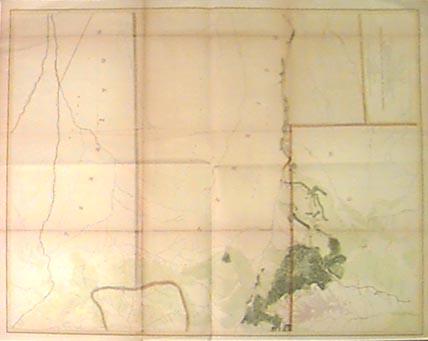 020nm: 1855 New Mexico Railroad Survey Map. Rare hand colored 145-year-old antique map. From exploration for rail route from the Mississippi River to the Pacific Ocean. Shows area from the Santa Fe Crossing to the Coo-Che-To-Pa Pass. Survey made under direction of Jefferson Davis, Secretary of War. 24x33 in. $250 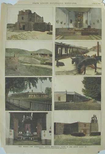 021nm: 1883 New Mexico. The Approaching Tertio-Millennial- Views in and about Santa Fe. Eight hand colored engraved views of : Church of San Miguel, Interior of Church of San Miguel, Old Fort Marcy from the Loma, San Francisco Street, Military A.Q. Dept of N.M. Santa Fe, the old Palace, Interior of Church of Santa Guadaloupe, and Church of Santa Guadalope. This genuine antique print is from the June 1883 edition of Frank Leslie's Illustrated Newspaper. size: 11x16 in. $40 |
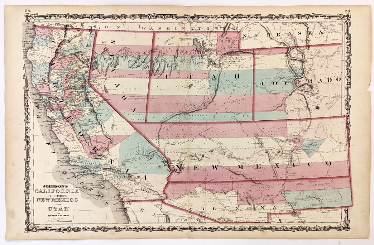 279California: Johnson’s California, Territories of New Mexico, Arizona, Colorado, Nevada and Utah 1863 - A large engraved and original hand colored map of California & the Southwest, the map has a very decorative border, pastel colored counties and shows a number of interesting territorial anomalies. Nevada has its lower corner truncated, leaving Las Vegas in Arizona. Utah extends approximately 1 degree too far to the west, prior to the last set of reductions undertaken by the US Government. Several counties still extend into both Arizona and New Mexico. In each of the states and territories, the county configurations are still largely incomplete. This is one of the most detailed accurate commercial maps of the era that includes the US Pony express route, explorer routes, the major routes of commerce, towns, forts, Indian Tribes, mountains, rivers, roads, mining districts, proposed railroad routes, important dates in the evolution of the US-Mexico Boundary, etc. Johnson's map of the West is one of the most interesting and collectable maps of the period. The maps were updated annually or more often, showing profound territorial boundary changes and county formations from year to year and even within a single year. Condition: Very good, fold in middle with some staining along the fold, water marks on margins and some light foxing inside image. size 23.5 15.5 image. $600 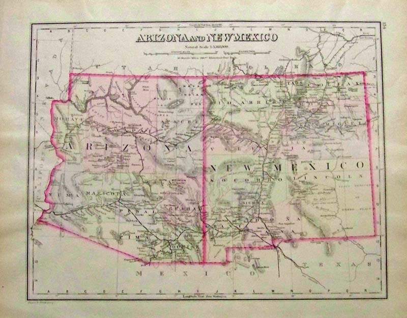 022nm: 1885 Rare Gray's hand colored Arizona and New Mexico map with each state outlined. Note that Washington and Oregon are over in the Nebraska Territory. 17 x 14 in. $180 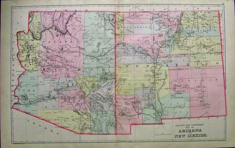 023nm: 1887 Rare Hand colored County and Township Map of Arizona and New Mexico. Copyrighted by Bradley & Brothers. 24 x 15 in. $200 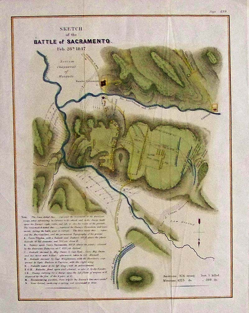
024nm: 1847 Antique hand colored copper engraved Sketch of the Battle of Sacramento, February 28, 1847 for the US-Mexican War. Casualty figures are listed bottom right and bottom left details the troops' journey. 14 x 12 in. $150 
001Arizona: 1891 Bradley's color map of Arizona and New Mexico from Bradley's Atlas of the World which shows the mountain ranges, counties, and other geographical details. 26 x 19 in. $120 SOLD 
259ca: 1864 Hand colored engraved Johnson's California, also Utah, Nevada, Colorado, New Mexico, and Arizona. Published by Alvin J. Johnson & Co., New York. 26 x 18 in. $350 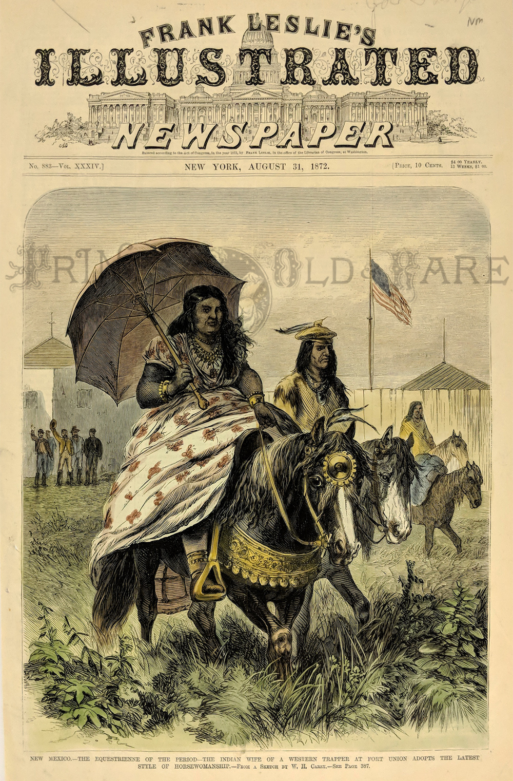 100nm: 1872 New Mexico: Indian Woman on Horseback. Hand colored engraving from Frank Leslie's Illustrated Newspaper, ridiculing the Indians' attempts at adpoting white customs and fashions. Title is "New Mexico: The Equestrienne of the Period. The Indian Wife of a Western Trapper at Fort Union Adpots the Latest style of Horsewomanship." Shows a Native American Woman, wearing a large flowered dress and holding a parasol, riding past the fort on horseback. 11 x 16 in. $50 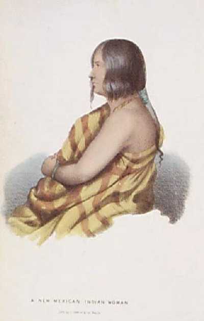 105nm: 1848 Portrait of Native American Woman. Hand colored lithograph from the report of the W.H. Emory expedition, which explored the U.S. Mexico border region in the late 1840s. Title is "A New Mexican Indian Woman." 5x9 in. $50 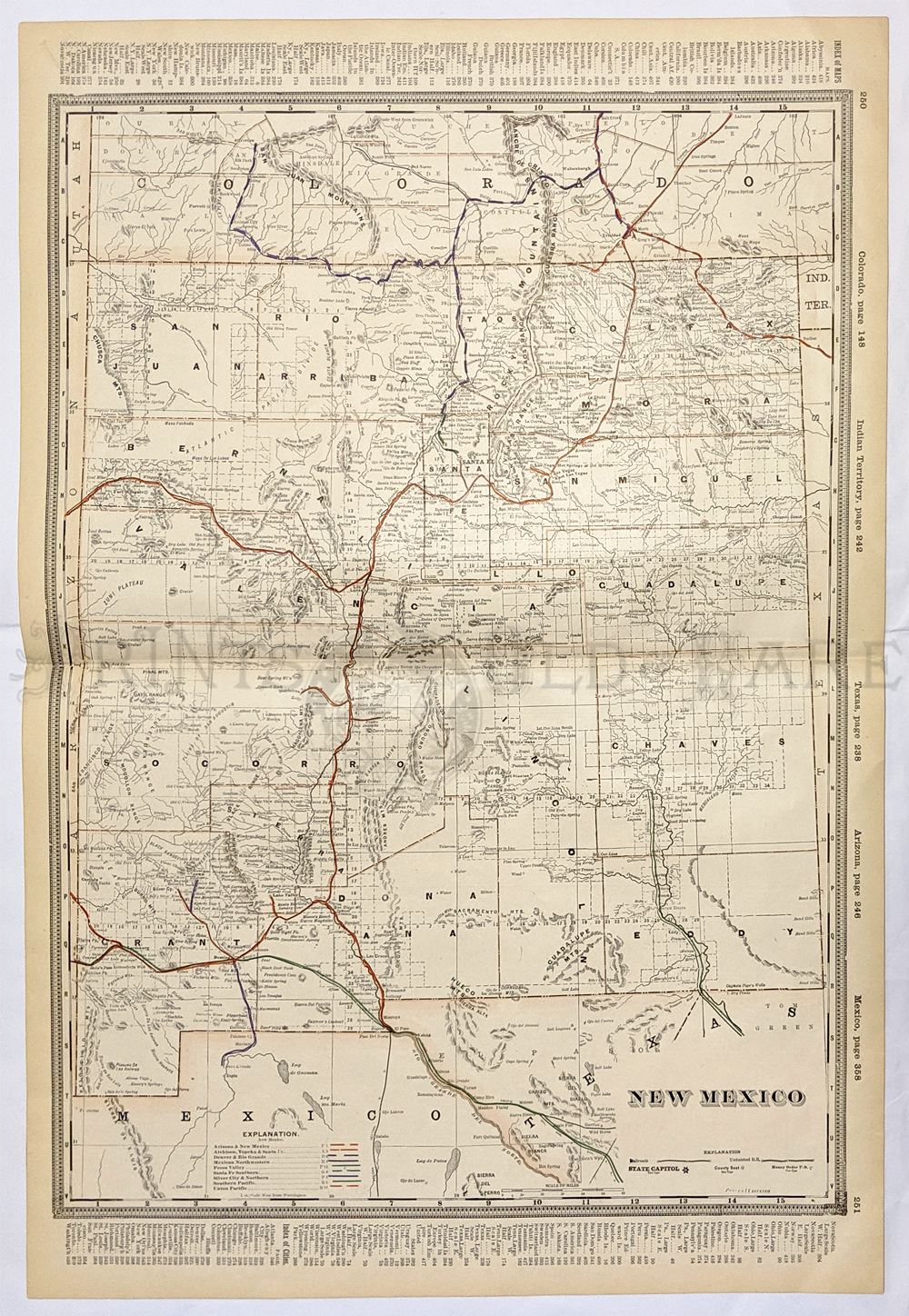 108nm: Detailed 1901 Railroad Map of New Mexico. Beautiful map from the 1901 first edition of George Cram's folio-size world atlas. Color coded lines on the map show the names and locations of railroads throughout the state. State and county borders are outlined in yellow. Cities, towns, Indian reservations and geographical features are all shown. This map would look great in a frame! 17 1/2 x 25 3/8 in. $150 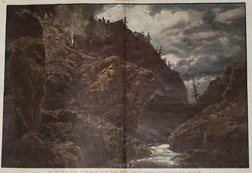 109nm: 1886 New Mexico: Las Animas Canyon. Hand colored engraving from Harper's Weekly, titled "The Canyon of Las Animas, on the Denver and Rio Grande Railway, Colorado." Dramatic view from the base of the canyon, with a train passing by above. There are several very small scratches on the left side of the image, but they are not visually distracting. Otherwise, condition is excellent. 16x22 in. $100 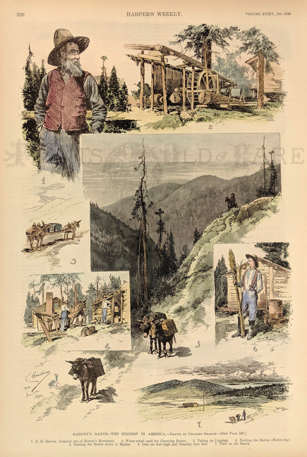 201nm: RARE Old New Mexico Ranch Scenes. Hand colored, engraved scenes from the July 6, 1890 issue of Harper's Weekly, titled "Harvey's Ranch: The Highest in America." Contains scenes on the property owned by E.H. Harvey, a Boston merchant who moved West and established a ranch in the mountains of New Mexico. 11x16 in. $50 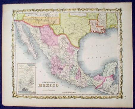 202nm: 1861 Johnson Map: Mexico, New Mexico, Arizona. Beautifully hand-colored map of Mexico, published in 1861 by Johnson & Browning. Each state in Mexico is colored separately, as are the states and territories of the South and Southwest United States. Of particular interest are New Mexico and Arizona, which are situated on top of each other, rather than side by side. Excellent condition. 14x19 in. $150 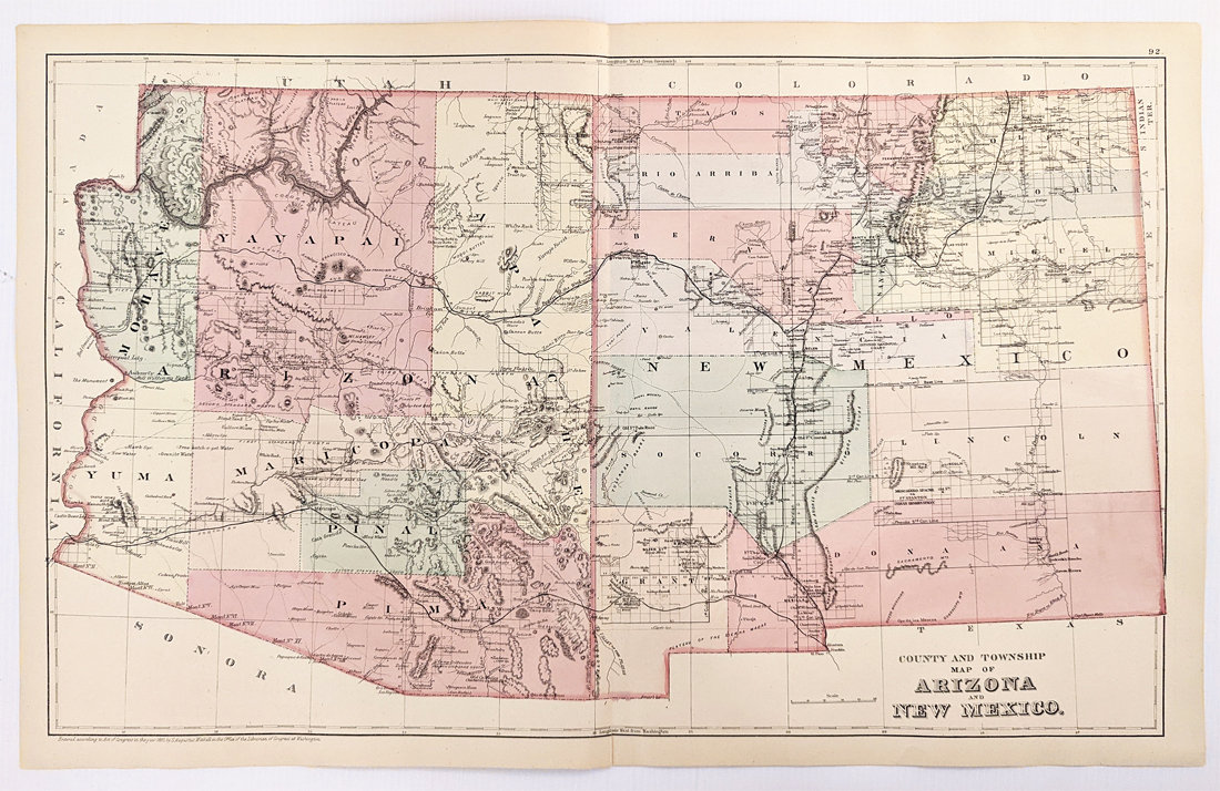 227Arizona: 1882 Mitchell's County and Township Map of Arizona and New Mexico. Showing roads, towns, railroads, rivers, lakes, mountains and topographical details. Hand colored, lithograph. 17 1/4 x 23 in. $180 |
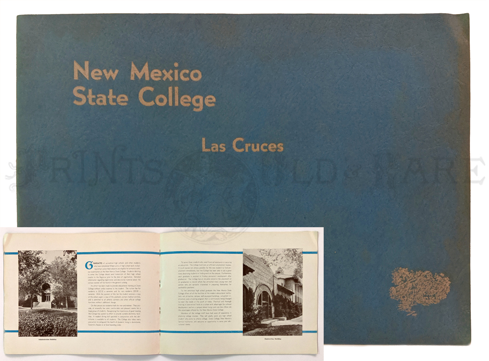
218NewMexico: Las Cruces 1963. New Mexico State College. Sephia toned views of campus, buildings and college life. “College Recard.” July 1936. 40pp soft cover booklet. 9 x 12 in. $40 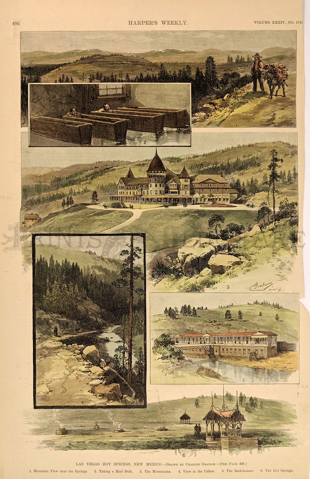 219NewMexico: 1890 Las Vegas Hot Springs, New Mexico. Showing 6 views- (Mountain View, Mud Bath, Montezuma, Canon view, Bath-Houses and the Hot-Springs.) Harper's Weekly. Hand colored, wood engraving. 10 x 16 in. $50 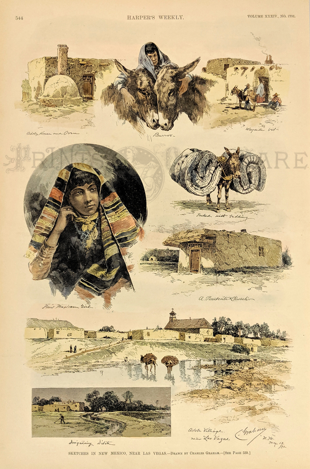 220NewMexico: Sketches in New Mexico, Near Las Vegas - Drawn by Charles Graham. 1890 Harper's Weekly. Hand colored, wood engraving. 10 1/2 x 16 in. $80 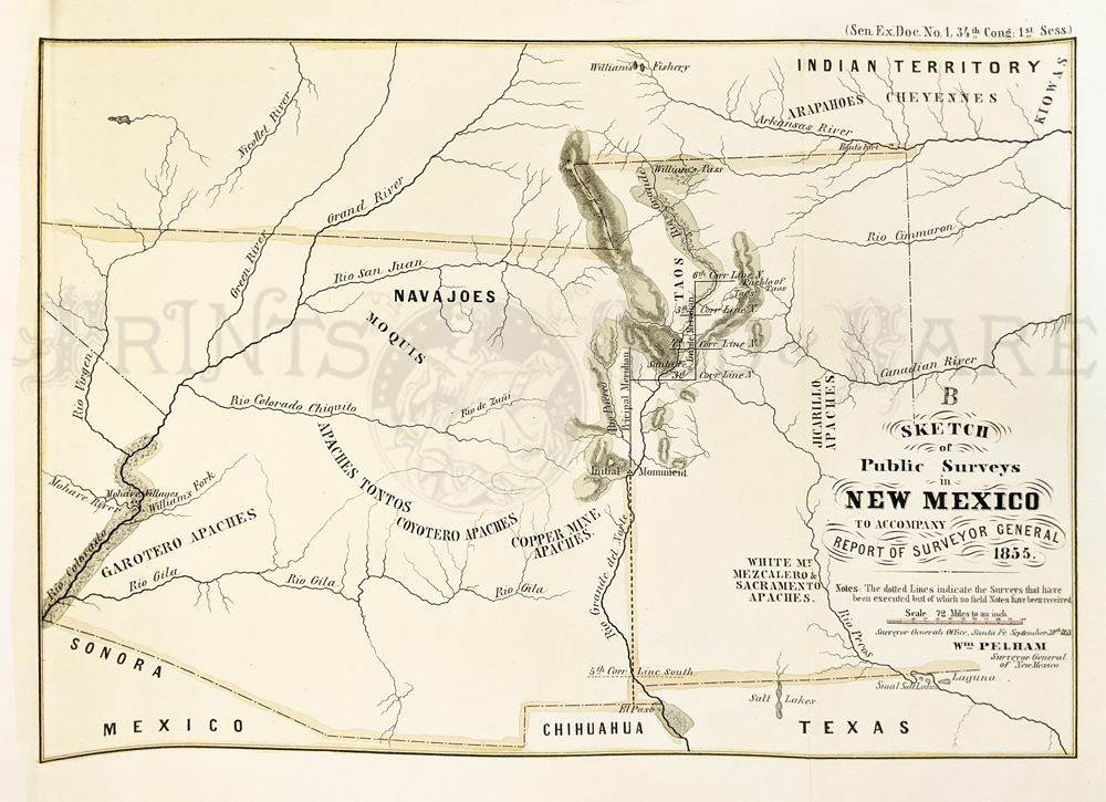 224NewMexico: Public Surveys in New Mexico 1855 by Surveyor General. Indian Territory to Mexico, Texas, Rio Grande, Indian Territories also shown. Hand colored, lithograph. **Has been archivally mended. 11 1/2 x 8 5/8 in. $250 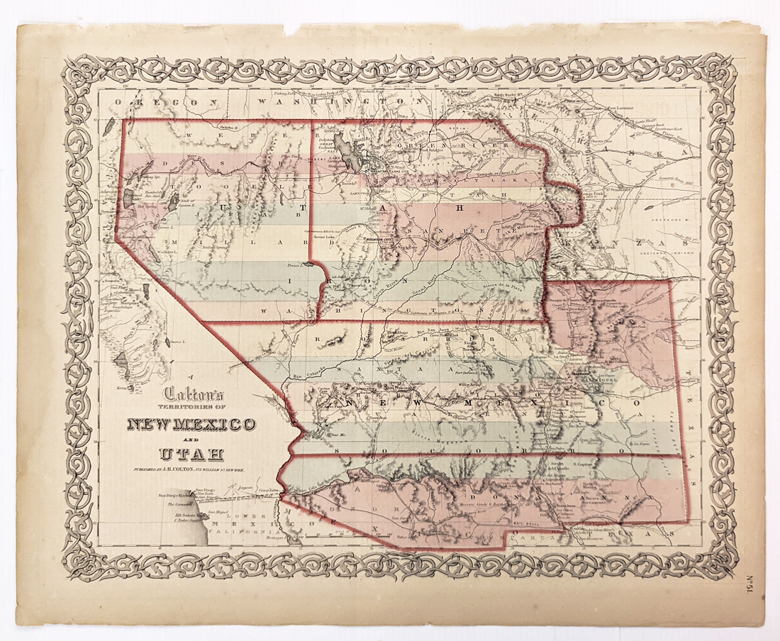 225NewMexico: 1855 Colton's Territorie of New Mexico and Utah. Map of the territories encompassing present-day Nevada and Arizona. Also shows parts of Mexico, California, Oregon Territory, Nebraska, Kansas, Texas, and present-day Oklahoma. Routes shown for possible railway extensions. Routes of explorers such as Fremont and Gunnison are shown. Hand colored, lithograph. 14 1/2 x 17 1/2 in. $500  204nm: 1857 Sketch of Public Surveys in New Mexico to accompany Report Of Surveyor General, by Wm. Pelham, Surveyor General, in his Office in Santa Fe, New Mexico on September 30, 1857. Hand colored lithograph by C.B. Graham, Washington, D.C. Map in excellent condition with yellow and black border. 22x32in. $600 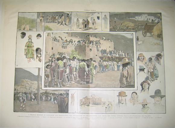 206nm: 1898 A Strange Mixture of Barbarism and Christianity - The Celebration Of San Geronimo's Day Among the Pueblo Indians. - Drawn by E.L. Blumenschein. Double-page hand colored wood engravings published in Harper's Weekly in 1898. Each scene reads as follows: 1. Entrance to Underground Council-Chamber; 2. Racers at the Beginning of the Course; 3. Carrying the Patron Saint to the Race-Track; 4. Drummer at the Church Door; 5. The Last of the Wheat; 6. Types - Apaches and Mexicans; 7. Ready for the Race; 8. A Gunner; 9. The "Chiflonetes; 10. Types - "Pueblos;" and 11. The Dance. 16x22in. $120  209nm: 1894 The Application of New Mexico For Admission To Statehood; The Leaders of the Movement and Types of the Territorial Population - From Photographs. Hand colored half-tones and hand colored wood engravings published in Frank Leslie's Weekly. 11x16in. $80 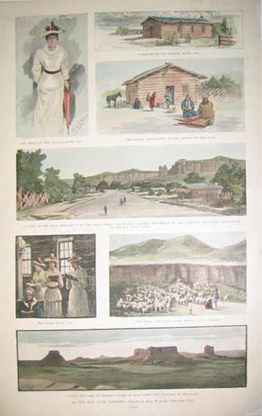 210nm: 1893 In the San Juan Country - Drawn By Rem. W. Lane. Seven lithographs published on one page which depict the people and region of San Juan Country. 10x15.5in. $50 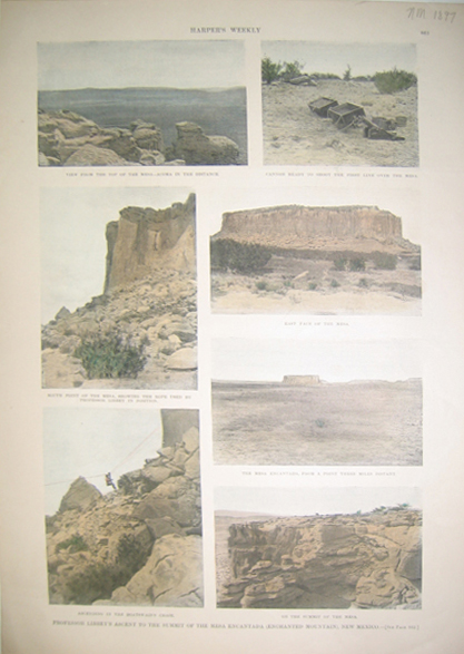 211nm: 1897 Professor Libbey's Ascent To the Summit of the Mesa Encantada (Enchanted Mountain), New Mexico. Seven hand colored half -tones published on one page which depict several views of the Mesa Encantada. Published in Harper's Weekly. 11x16in. $40 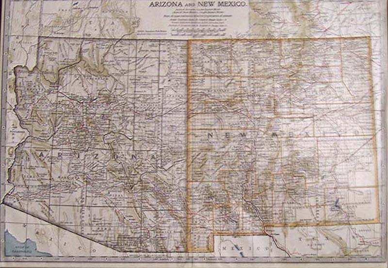 212nm: 1897 Hand colored map of Arizona and New Mexico with small sections of the surrounding states around the edges. Map copyrighted by the Century Company in 1897 and 1902. Map number 110. Map is enclosed within a large cardboard frame and total of all measures: 19-1/2 x 14-1/2 in. $60  214NewMexico: 1894 Rand, McNally & Co. color outlined New Mexico Railroads Map with a key to all the railroads on bottom right. 21 x 14-1/2 in. $200 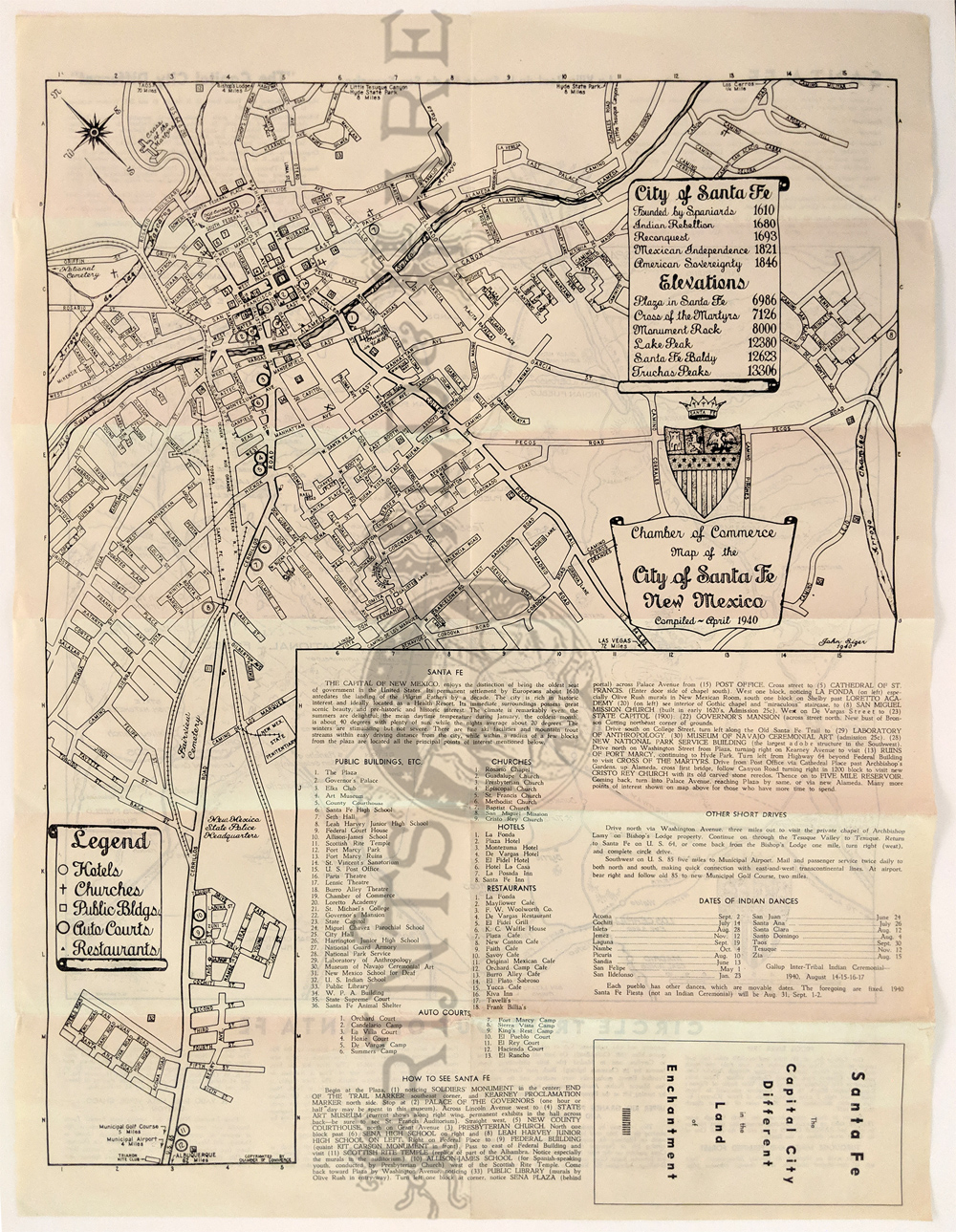 217NewMexico: 1940 Map of Santa Fe by H.H. Dorman. Santa Fe City Map with way to hotels, churches, public buildings, auto courts and restaurants. Verso: Circle Trips out of Santa Fe. 17 x 22 in. $85 |
|||||||||
| Order Form | |||||||||||
| Back to Homepage | |||||||||||