 
|
|||||||||||
This is a small selection of our inventory of antique North Dakota maps and prints. Additional inventory is available. Contact us with your request. 1-800-879-6277
|
|||||||||||
|---|---|---|---|---|---|---|---|---|---|---|---|
 001nd: 1892 Sisseton Indians North Dakota. Seven hand colored views from Harper's. 11x16 in. $50 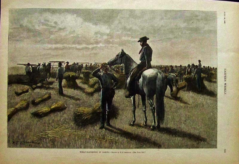 002nd: 1887 Wheat Harvesting in Dakota. One of the best early views of Dakota. Drawn by Rufus Zogbaum. Professionally hand-watercolored engraving from Harper's Weekly published in 1887 - a genuine antique. 16x11 in. $80  010nd: 1878 Bismarck North Dakota. Hand colored views of the early "Western Settlement." From Harper's. 11x16 in. $50 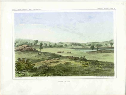 014nd: 1855 Antique North Dakota view. "Sauk River," hand colored lithograph. One of the first views of the West from the US Government Railroad Survey of the 47th-49th parallels. 11-1/4x8-1/4 in. $50 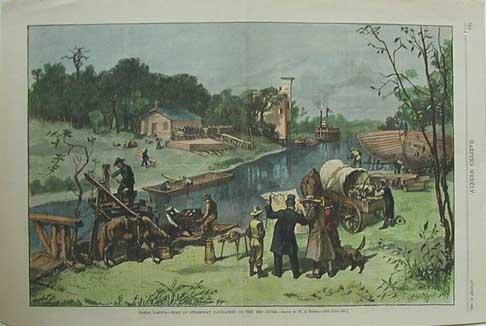 015nd: 1881 Fargo, Dakota- Head of Steamboat Navigation On the Red River. This rare, hand colored engraving by W.A. Rogers is from Harper's Weekly. 11x16 in. $80 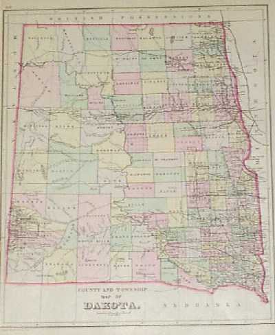
101nd: 1887 Bradley Map of Dakota Territory. Interesting map showing counties and townships in Dakota, before it was split into North and South. Cities, towns, railroad lines, Indian reservations and geographical features are all shown. 12x15 in. $80 SOLD 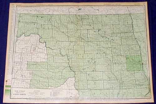 102nd: 1935 Rand McNally Map of North Dakota. Large, colorful map of North Dakota from the 1935 edition of Rand McNally's Commercial Atlas. Shows cities, towns, railroad lines and geographical features. The population per square mile is indicated in each county by various shades of green. 20x28 in. $80 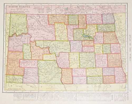 103nd: 1906 North Dakota Map. Colorful map of North Dakota from Hammond's 1906 world atlas. Each county is colored separately. Shows cities, towns, railroad lines and geographical features. A key beneath the image gives locations of counties, cities and towns. 11x13 in. $40 SOLD 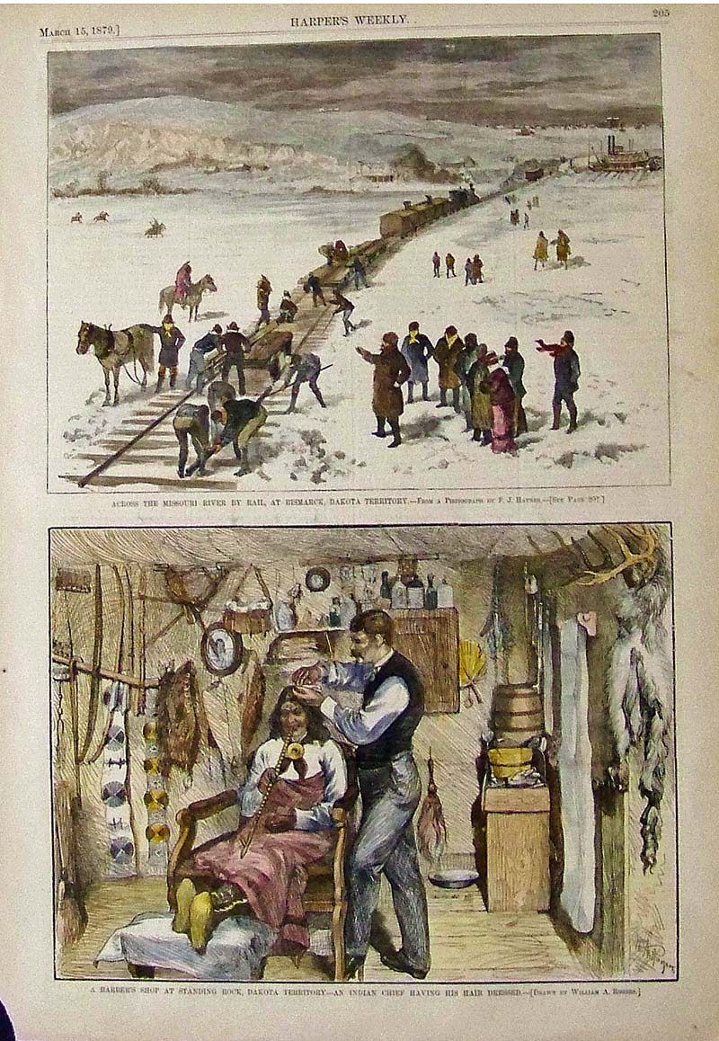 106nd: 1879 Scenes in Northern Dakota. Two hand colored, engraved images from Harper's Weekly. Top image is titled "Across the Missouri River by Rail, at Bismarck, Dakota Territory. Shows teams of men laying temporary railroad tracks across the frozen river, so that trains could pass through. Bottom image is titled "A Barber's Shop at Standing Rock, Dakota Territory: An Indian Chief Having his Hair Dressed." 11x16 in. $50 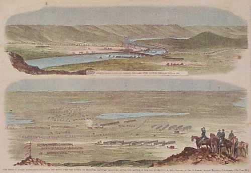 108nd: 1863 North Dakota Indian War Scenes. Hand colored engraving from Harper's Weekly, showing scenes from General Sibley's expedition against the Sioux Indians after the Battle of the Big Hills in Northern Dakota Territory. There are some age spots on the paper, but the image is generally clean and clear. 11x16 in. $50 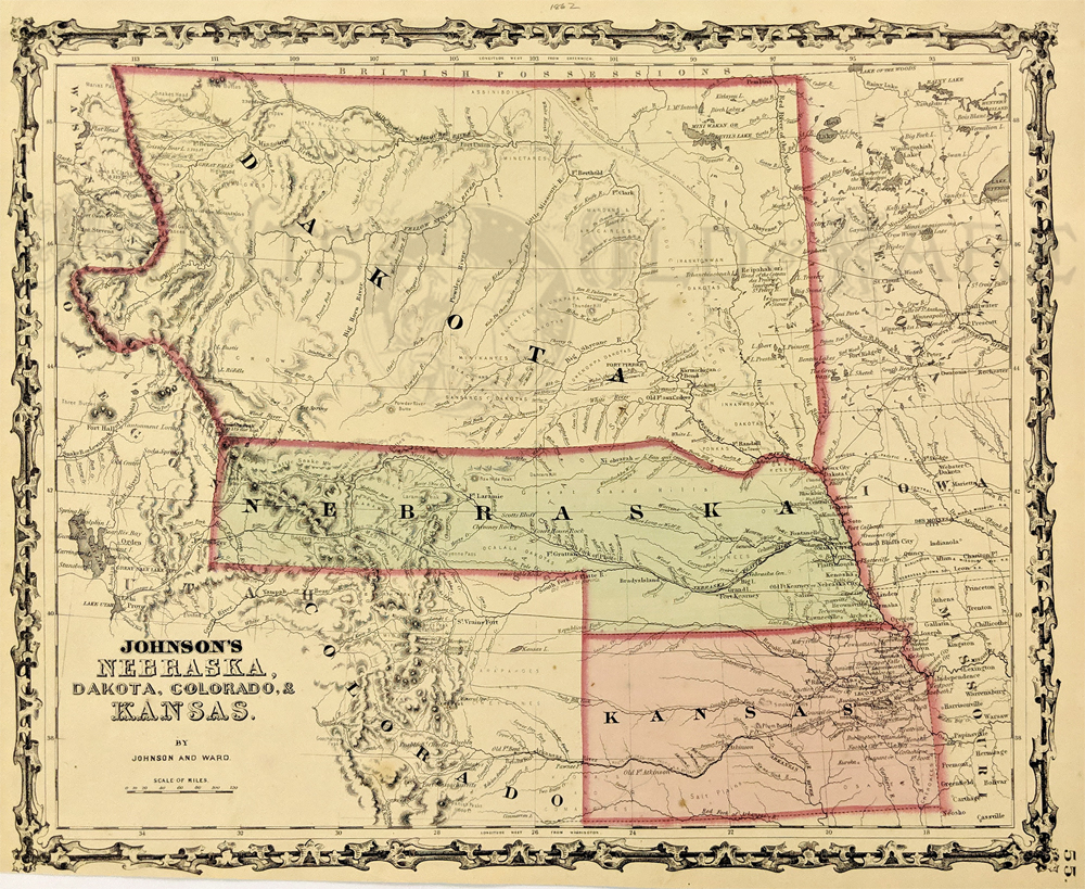 213Nebraska: 1862 Johnson's Nebraska, Dakota, Colorado, & Kansas. Showing an early configuration of the region, Nebraska extends as far as Salt Lake City. Northern half of the region is shown as part as the Dakota Territory, one year before the Idaho Territory was broken off. Other details include rivers, towns, forts, Indian tribes and trails. Hand colored, lithograph. 12 1/2 x 15 3/8 in. $300 |
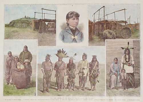
109nd: 1889 Views of North Dakota Mandan Indians. Hand colored, engraved images from Harper's Weekly, showing Mandan Indians near Fort Berthold in the Dakota Territory. In the top center is a portrait of an Indian girl who was taken to a school in Hampton Virginia, and educated there. 11x16 in. $60 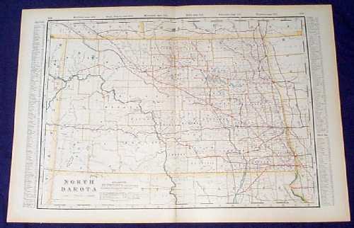 110nd: Detailed 1901 Railroad Map of North Dakota. Beautiful map from the 1901 first edition of George Cram's folio-size world atlas. Color coded lines on the map show the names and locations of railroads throughout the state. State and county borders are outlined in yellow. Cities, towns, Indian Reservations and geographical features are all shown. 18x27 in. $80 SOLD 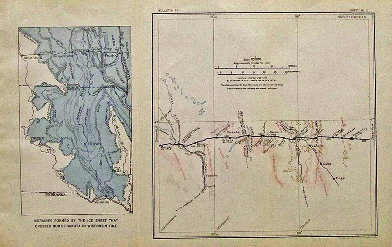 112NorthDakota: Color North Dakota map and Distance chart showing Moraines formed by the ice sheet that crossed North Dakota in Wisconsin Time on Sheet No.5, Bulletin 611. 14 x 9 in. $30 
113NorthDakota: 1893 Leslie's hand colored half-tone images showing The Recent Excursion of World's Fair Commissioners, Representing Twenty-Four Nationalities, to the Wheat-Fields of the Northwest in bottom image and top image shows a Lineof Binders at Work on a farm in North Dakota. 15-1/2 x 11 in. $80 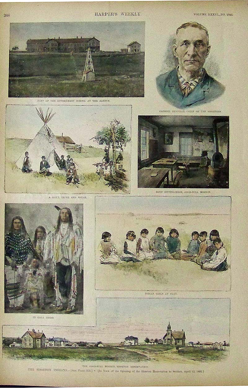
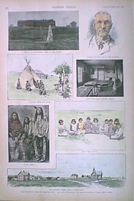
114NorthDakota: 1892 Harper's Weekly hand colored half-tone images showing Gabriel Renville, Chief of the Sissetons, along with Sisseton Indian tribe scenes. 15-1/2 x 11 in. $50 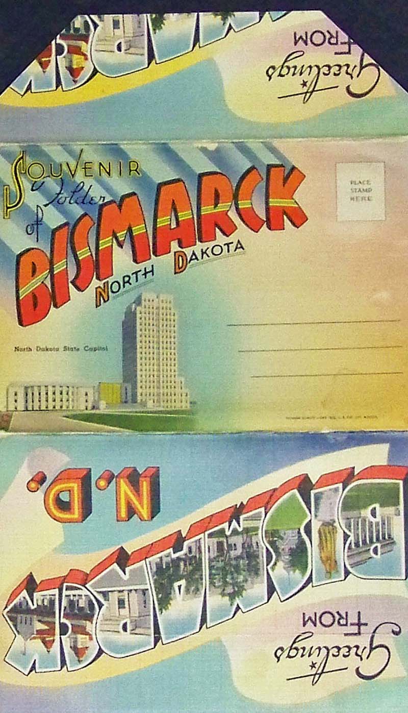
115NorthDakota: C.1940s Colorful Souvenir Folder of Bismarck, North Dakota which contains colorful images and facts of the Liberty Memorial Bridge, Lignite Mining in Western North Dakota, the Federal Building in Bismarck, the Liberty Memorial Building, the Historic Chateau de Mores at Medora, in the North Dakota Badlands, and many more historic images. Eighteen images total. Published by Tichnor Quality Views, The Hafstrom Company, Belfield, ND. Opened all the way, it measures: 39 x 5-1/2 in. $20 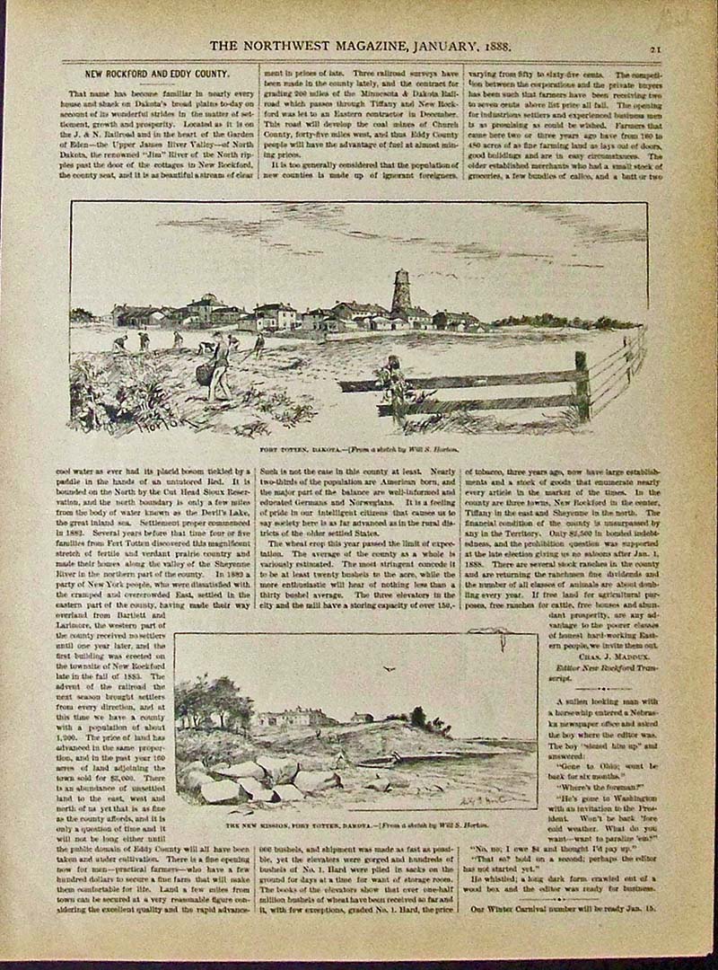
116NorthDakota: 1888 Wood engraving with text featured in The Northwest Magazine showing Fort Totten, Dakota in both images. 13 x 10 in. $40 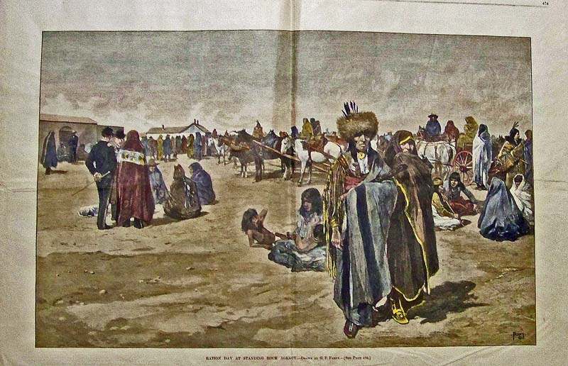
117NorthDakota: 1883 Harper's Weekly hand colored wood engraving titled, "Ration Day at Standing Rock Agency." Drawn by H.F. Farny. 23 x 16-1/2 in. $120 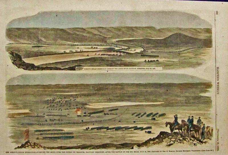 118NorthDakota: 1863 Harper's Weekly hand colored wood engraving showing General Sibley's Indian Expedition -- Persuing the Sioux Over the Coteau Du Missouri, Dacotah Territory, After the Battle of the Big Hills, July 24, 1863." 15-1/2 x 10 in. $50 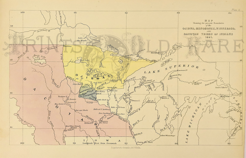 224Minnesota: Dacotah and Ojibwa boundary. Also, Menomonee and Winnebago. c.1850 by Seth Eastman from Schoolcraft’s History. Hand colored engraving. 9 ½ x 13 $90 |
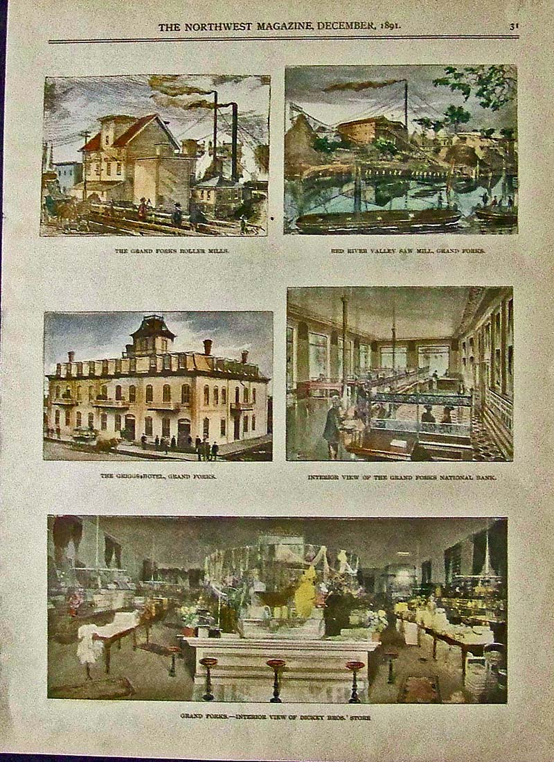
119NorthDakota: 1891 Hand colored half-tones featured in The Northwest Magazine showing views in Grand Forks. 13 x 9-1/2 in. $60 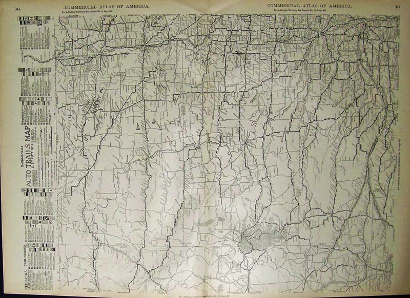
120NorthDakota: 1923 Rand McNally Auto Trails Map from the Commercial Atlas of America North Dakota and other territories. A Trail Key is on left side of map's border. 28 x 20-1/2 in. $80  200nd: RARE Old West US Map: North Dakota is Lincoln. This map of the Western United States was printed circa 1885 by William Collins, Sons & Co. Of particular interest on this map is the Dakota Territory. It is divided into Northern and Southern portions, but the names are different. South Dakota is simply called "Dakota," while North Dakota is called "Lincoln." Cities, major roads and geographical features are shown throughout this map. It is in excellent condition, with no tears, stains or other blemishes. 10x13 in. $160 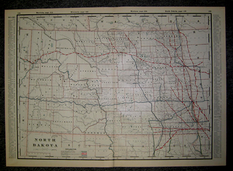 203nd: Old, Antique Railroad Map of North Dakota. This beautiful, engraved map from 1892 is divided into counties with county borders showing as well as meridians. Cities, towns, railroad lines and rivers are shown throughout the state. Each railroad line is labeled with the name of the company that operated it as well as all the stops on each line. 18x26 in. $80 SOLD 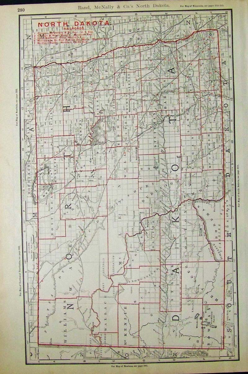 204NorthDakota: 1898 Rand, McNally & Co.'s North Dakota Railroads map with red outlines for counties and railroads, including key. 20-1/2 x 14-1/2 in. $150 SOLD 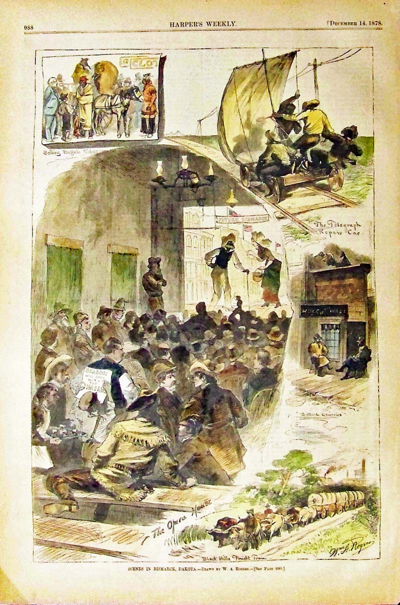
205NorthDakota: 1878 Harper's Weekly hand colored wood engraving showing Scenes in Bismarck, Dakota. Drawn by W.A. Rogers. 15-1/2 x 10-1/2 in. $80 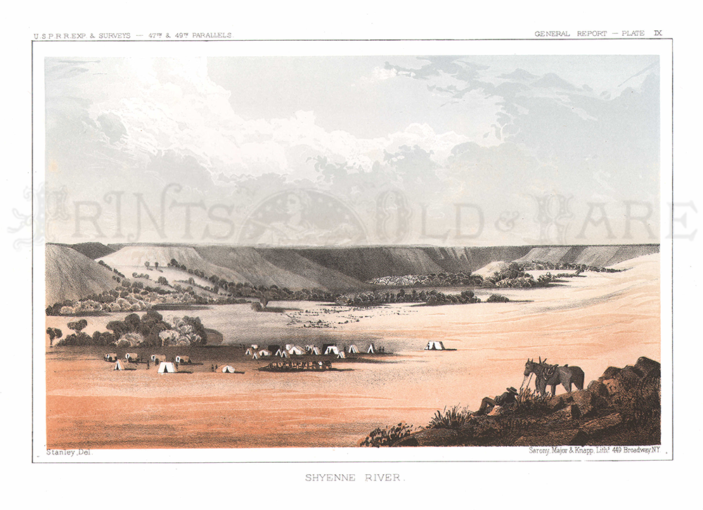 206NorthDakota: Shyenne River. 1855 USRR Survey. Plate XVIII. 8 1/2 x 11 1/2 in. $50 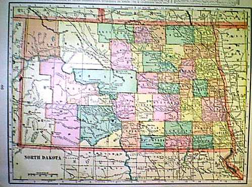 1152nd: 1901 Map of North Dakota. North Dakota Map (1901). Color: Printed in Color. Type: Lithograph. Size: 11x14 in. $30 SOLD |
|||||||||
| Order Form | |||||||||||
| Back to Homepage | |||||||||||