|
|||||||||||
This is a small selection of our inventory of antique Ohio maps and prints. Additional inventory is available. Contact us with your request. 1-800-879-6277
|
|||||||||||
|---|---|---|---|---|---|---|---|---|---|---|---|
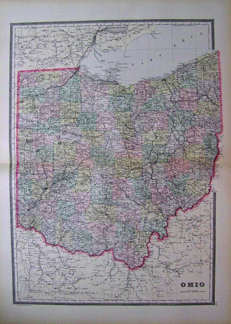
 001Ohio: A New Map of the State of Ohio, Cowperthwait, 1850 - A handsome engraved and original colored map by Thomas Cowperthwait and S. A. Mitchell's 1850 map of Ohio with a profile of the Ohio and Erie Canal along the lower border. A smaller profile of the Miami Canal is also presented in the lower right quadrant. On the map proper, Ohio's many canal routes are highlighted in blue while the state's still fledgling railroad network appears in orange. The whole is engraved and colored in Mitchell's distinctive style with green border work and vivid pastels. Political and topographical features are noted and color coded with elevation rendered by hachure. 13 3/4 x 17 1/8 in. $250 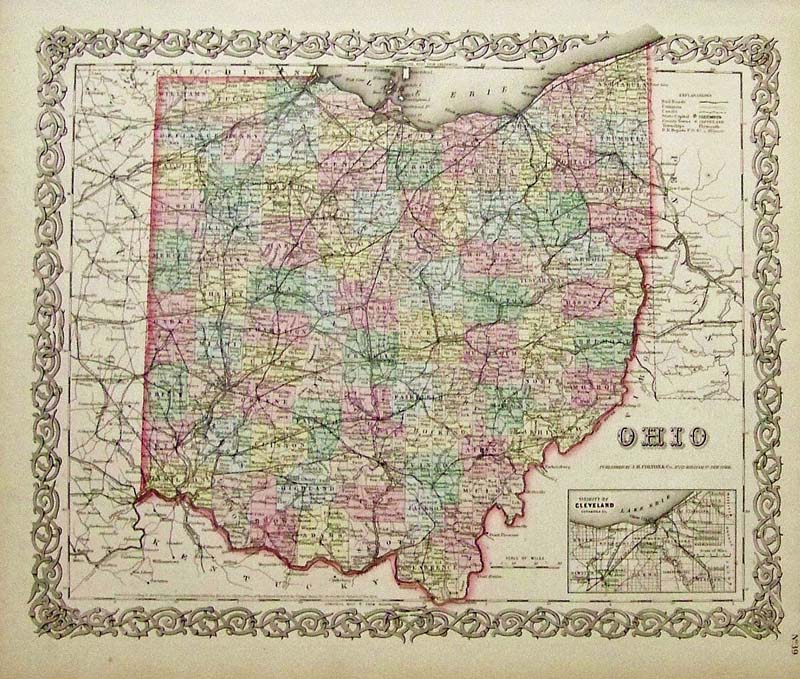
002oh: 1855 Colton Map of Ohio. Beautiful hand colored example of one of the earlier maps of the area. Decorative border. 18-1/2 x 16 in. $200 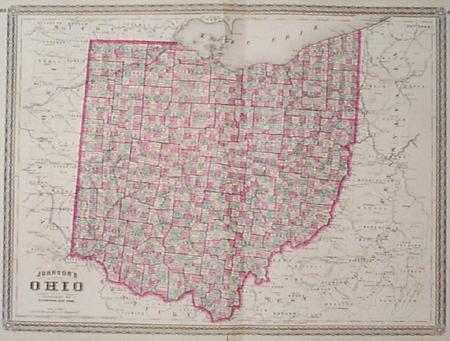
004oh: Large A.J. Johnson 1864 Map of Ohio. Each of the many counties throughout the state individually hand colored. 18x25 in. $90 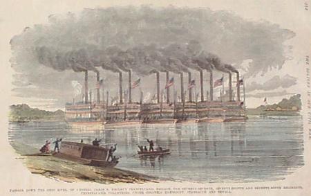
005oh: Civil War view. Hand colored. Shows many Union vessels transporting troops down the Ohio River. 11x16 in. $40 SOLD 
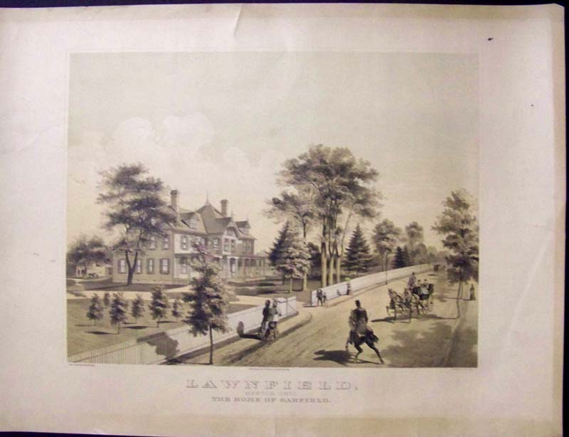
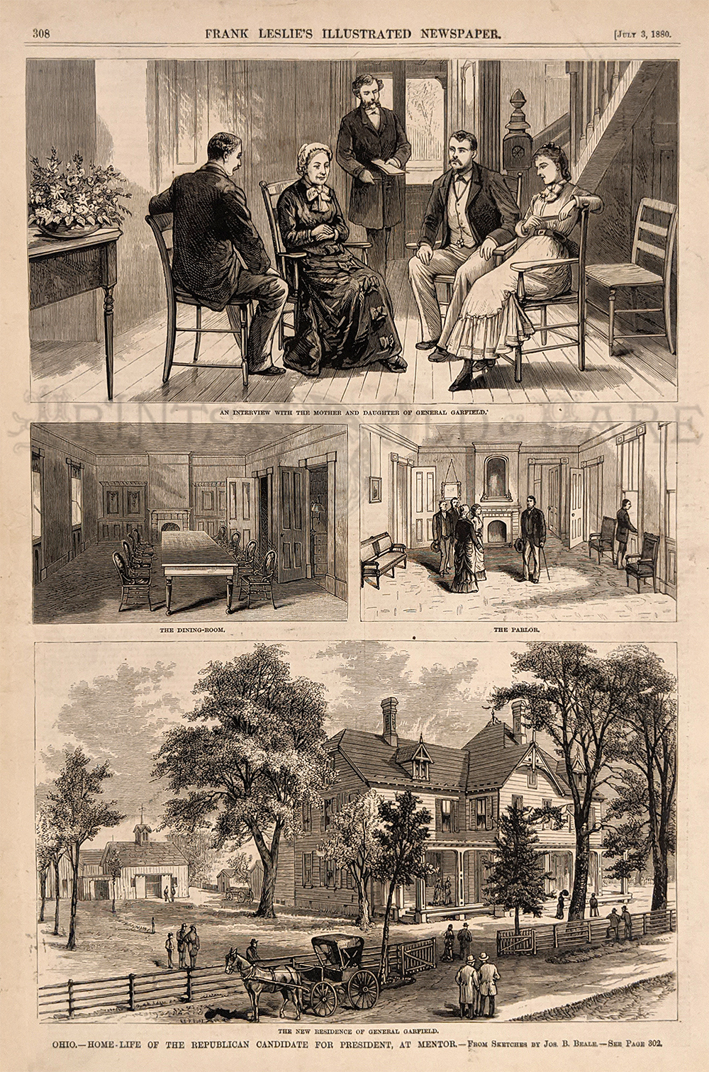
006oh: President Hayes - Menton Ohio views, 1876. Two engravings (Harper's). 11x16 in. $40 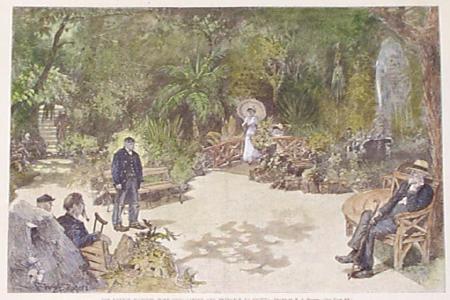
007oh: 1891 Dayton Soldier's Home. Hand colored view in the garden. 11x16 in. $40 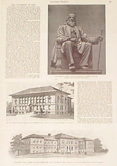
008oh: 1897 OHIO STATE UNIVERSITY VIEWS. Two old engravings of Ohio State University: The Biological Building, and Townshend Hall, College of Agriculture. Antique print with descriptive text on the college, from Harper's Weekly, 1897. 11" x 16" $40 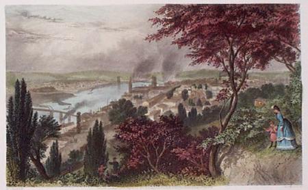
009oh: 1873 Great view of Cincinnati. Hand colored steel engraving from Picturesque America. One of the best of the city from the last century. 9x12 in. $50 
010oh: 1873 Steel engraving of Cleveland. Hand colored excellent view from Picturesque America. 9x12 in. $50 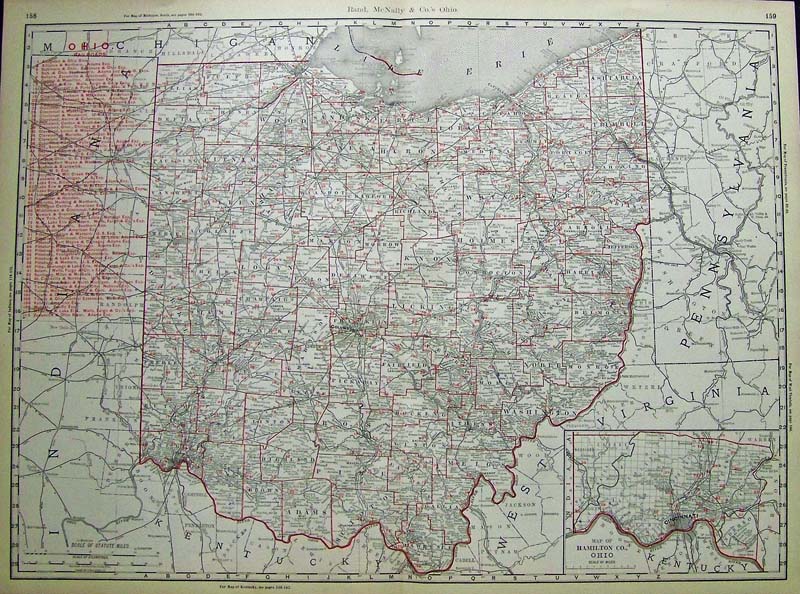 012Ohio: 1898 Rand, McNally & Co.'s Map showing the Ohio Railroads of that era all in red, with red county lines. Inset on bottom right shows a small Map of Hamilton Co., Ohio. 27-1/2 x 20-1/2 in. $250 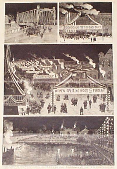
014oh: 1887 Findley views. Celebration of area natural gas. Engraving for Leslie's. 11x16 in. $30 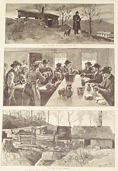
015oh: 1884 Hocking Valley Strike pictures. Engraved views of the early strikers managing to cope. Harper's 1884. 11x16 in. $30 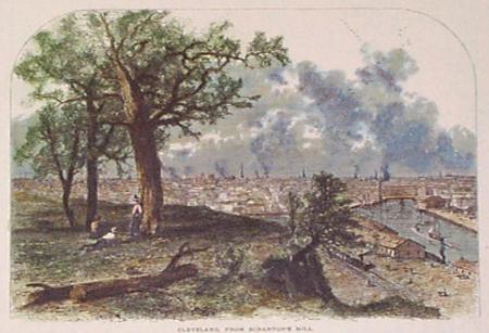 017oh: 1873 Cleveland hand colored view from Scranton's Mill. Bird's-eye view from Picturesque America. 9x12 in. $30 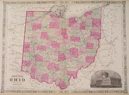
019oh: 1865 Johnson's hand colored map, with insert engraving of Capitol and attractive border. 18x26 in. $90 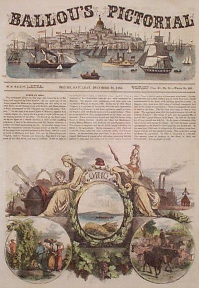
020oh: 1856 Ohio featured front page from Ballou's Pictorial. Hand colored views and text about the early state. 10-1/2x14-1/2 in. $40
|
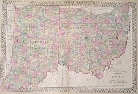 027oh: 1882 Ohio and Indiana Mitchell's map. County and township map. Each county colored separately. Shows railroads and other good detail. 23x15 in. $80 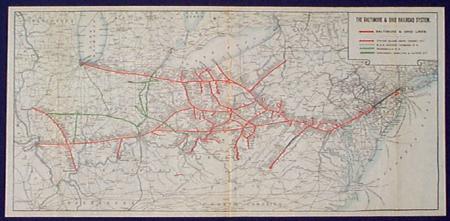
028oh: 1930 Ohio Railroad Map. Printed in litho color, shows B&O, Staten Island Rapid Transit, B&O Chicago Terminal, Sharpsville, Cincinnati, Hamilton & Dayton. 24x11-1/2 in. $40 SOLD 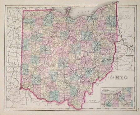
030oh: 1876 Ohio Map. Beautiful original hand colored map by Bradley. Inset of Cleveland vicinity. Genuine antique. 17-1/2x13-1/2 in. $80 SOLD 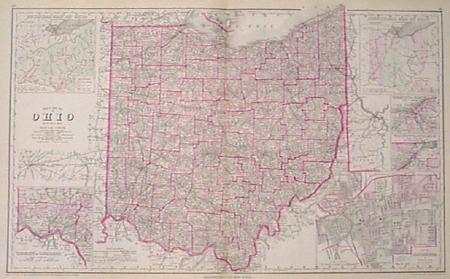
032oh: 1877 Beautiful hand colored map of Ohio by Gray. Shows townships, highlights counties, maps railroads. Insets including a physical map of Ohio, historical, and vicinites of Cleveland, Toledo, Cincinnati. Shows city of Columbus. 28-1/2x17-1/2 in. $120 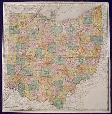
033oh: 1883 Ohio Map. Original hand colored copper engraving. Authentic antique large scale map by Hardesty. Very detailed. 25x25-1/2 in. $100 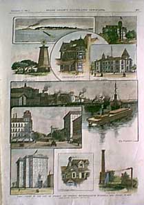
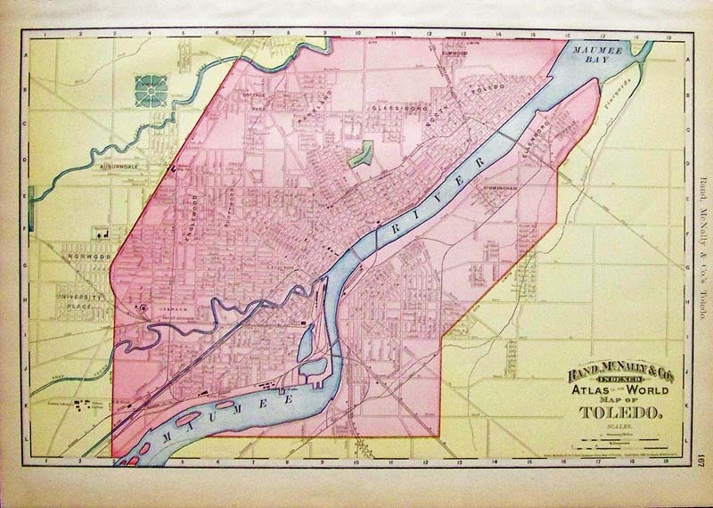
034oh: 1887 Ohio, Views in the City of Toledo- It's Streets, Representative Buildings and Public Works. 10 hand colored engravings show: Presque, Point Place,the convent, a reminiscence of Queen Anne, Soldiers Memorial, the Maumee, Madison Street, a picturesque gable, waterworks. 11x16 in. $80 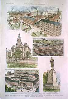
035oh: 1890 Ohio, The Grand Festival of the City of Springfield, February 13th in Honor of the Completion of the New City Building and the Introduction of Natural Gas. Five, hand colored, engraved views of: The great champion reaper works of the Warder, Bushnell & Glessner Co., P.P. Mast and Co.'s Factory, court house, Soldiers' Monument, Springfield Engine and Thresher Co.'s Works. size 11x16 in. $80 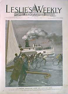
036oh: 1899: A Strange Midwinter Scene Off Sandusky, Ohio. The steamer "American Eagle" cutting through the ice on Lake Erie while horse speeders, bicyclers, skaters, and ice-boatmen enjoy themselves on the icy highway. This hand colored chromolithograph is from the cover of the February 1899 edition of Leslie's Weekly. size: 11x16 in. $60  037oh: 1888: General View of the City of Cincinnati and Characteristic Types of its Architecture. Ten hand colored views: Lincoln Club, Dorrway of Court-house, Art School on left, Art Museum on right, entrance to Art Museum, Post Office and Government Building, view from Pine Hill, Chamber of Commerce, Residence of Mr. Alexander McDonald, Queen City Club and the Court-house. This double page engraving is from the June, 1888 edition of the Supplement to Harper's Weekly. size: 16x22 in. $150 SOLD 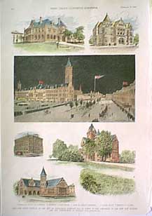
038oh: 1890: Ohio-The Grand Festival of the City of Springfield, February 13, in Honor of the Completion of the New City Building and the Introduction of the New City Building and the Introduction of Natural Gas. This hand colored engraving shows six views: residence of General ASA S. Bushnell, Post Office, Public Square, "Farm and Fireside" Springfield, Warder Library, and residence of F.F. Mast. This unique print is from the February, 1890 edition of Frank Leslie's Illustrated Newspaper. size: 11x16 in. $80 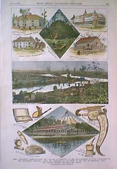 039oh: Frank Leslie's Illustrated Newspaper dated July 21, 1888. Hand colored engravings from sketches by C. Upham. Ohio - Centennial Commemoration, July 15th - 12st, at Marietta, of the Establishment of Civil Government in the Northwest Territory, Under the Ordinance of 1787 - Views of the City, of Centennial Hall, and Various Historic Buildings and Relics. 16x11 in. $60 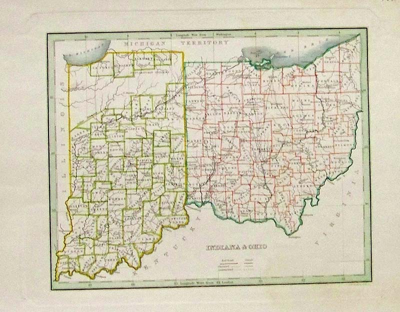 040in: 1835 Hand colored Bradley map showing Indiana & Ohio. 13 x 10 in. $80 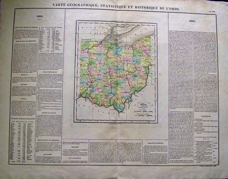
099Ohio: Carte Geographique, Statistique, Et Historique, De L Ohio, Cary 1822 - A wonderful large engraved and original colored map of the state of Ohio in French, from Henry Charles Carey and Isaac Lea's important American Atlas published in Philadelphia in 1822. These "Carey and Lea" maps as they are known, are highly prized not only for their comprehensive cartographical information, but for the text that brackets each map offering detailed description of each state, territory, or area. The atlas was so popular that it was issued in six editions in English, French and German between 1822 and 1827. This beautifully engraved early map of the State of Ohio shows all counties delineated in hand applied color, rivers and mountain ridges names, important cities and towns identified. Condition: Very good, wide margins, some browning on the edges, on major vertical fold in center. size 23.5 x 18 image $350 SOLD 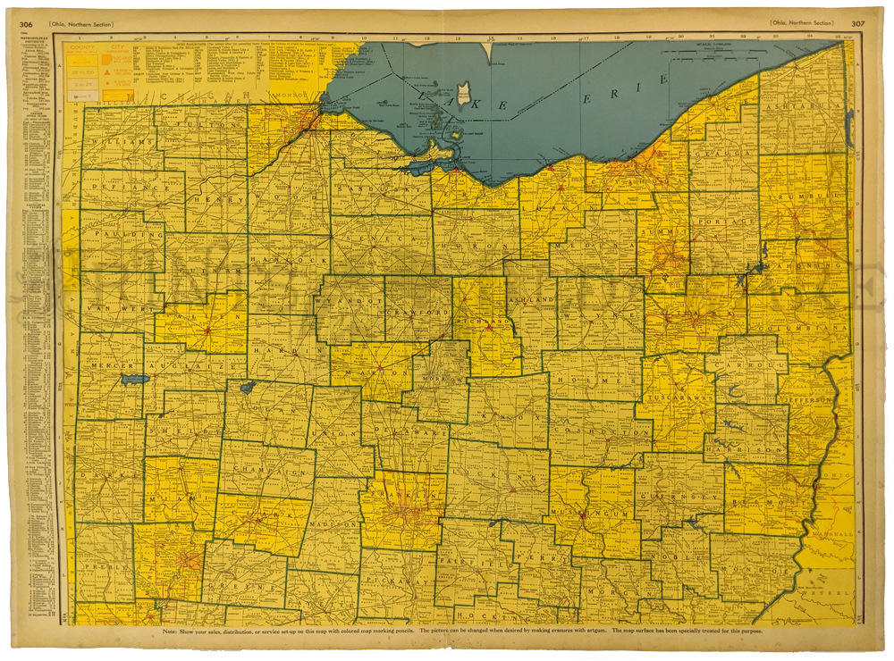 100Ohio: 1939 Color Northern Section of Ohio Map with an index of the Metropolitan Districts and populations on the left margin. 27-1/2 x 20-1/2 in. $80 
101oh: 1875 Map of Ohio by Gray. Interesting map, with original hand coloring, from O.W. Gray's world atlas of 1875. Each county in the state is separately colored. Cities, towns, railroad lines and geographical features are all shown. A small inset map of Cleveland is in the lower right corner. Very attractive map which would look great in a frame! 14x17 in. $120  102Ohio: 1846 Ohio Stiles, Sherman and Smith. A rare engraved and original color map of the State of Ohio, showing all counties in blue, yellow, green and pink pastel colors. A large Lake Erie looms at the top, major roadways are clearly defined, along with some cities, rivers and tributaries. Sherman and Smith (1829 - 1855), sometimes working as Stiles, Sherman & Smith, were American engravers active in New York City during the middle part of the 19th century. The firm including John Calvin Smith (surveyor and engraver), George Sherman, and sometimes, Samuel Stiles. Their work primarily focused on government publications, including the maps and engravings prepared to illustrate the official records of the 1838-42 United States Exploring Expedition (U.S. Ex. Ex.), maps issued for the Army Corps of Topographical Engineers, and various U.S. Coast Survey Charts. Condition: Very good, wide margins normal brown and yellow aging color on outside margins, with some small foxing on image hardly noticeable. size 11.5 x 14 image. $300 SOLD |
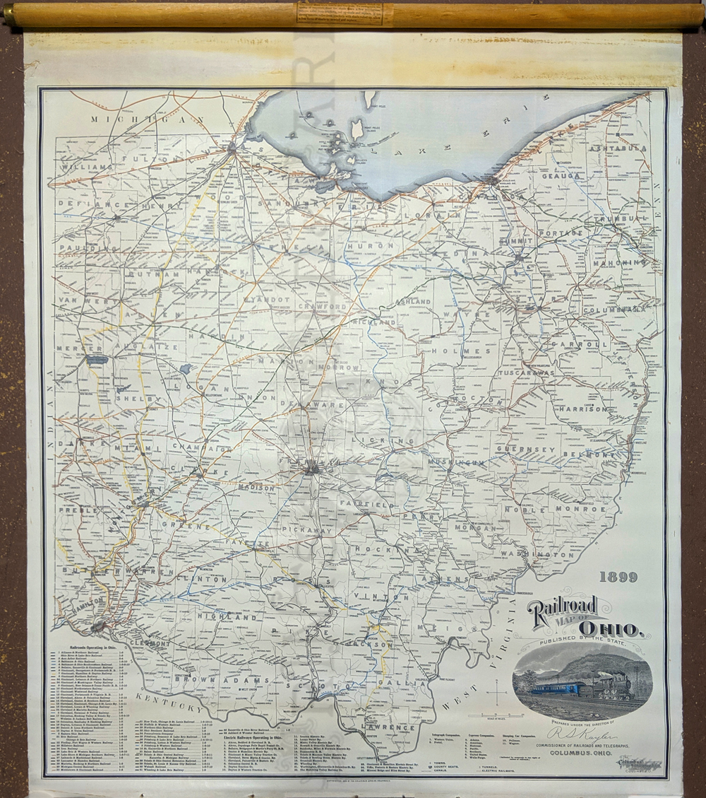 209oh: Railroad Map of Ohio 1899. Rolled lithograph mounted on linen. Engraved vignette of train of the Ohio Railroad. Listing the 44 railroads operating in Ohio as well as 25 electric railways, 2 telegraph companies, 7 express companies and 2 sleeping car companies. 28 x 31 in. $350  200oh: Old, Antique 1882 Railroad Map of Ohio. Beautiful, engraved map, with original hand coloring, printed in 1882 by the R. Sutton Co. Title is "New Railroad Map of Ohio, Prepared by H. Sabine, Commissioner of Rail Roads and Telegraphs." Each county in the state is separately colored. Cities, towns, railroad lines and canals are shown throughout the state. Each railroad line is labeled with the name of the company that operated it. All the stops on each line are shown as well. This map is in very good condition. Expert repairs have been made to the left and right margins and borders. If it were framed, it would look fantastic! 22x23 in. $150 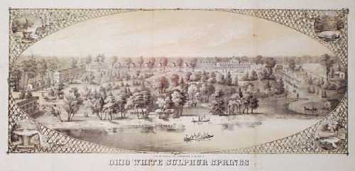 201oh: ca.1860 View: Ohio White Sulphur Springs. Interesting, lithographed bird's-eye view of Ohio White Sulphur Springs, a 19th century resort near Columbus Ohio. Each corner contains a small image of a different spring. Printed circa 1860 by Middleton, Strobridge & Co. 9x17 in. $120  202oh: Beautiful 1872 map of Ohio and Indiana. Published by Asher & Adams in the New Statistical and Topographical Atlas of the United States. Original hand coloring. 17.5x24.5 in. $140 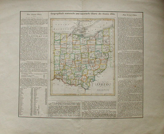 203oh: EARLY CAREY & LEA MAP OF OHIO. Stunning old hand colored engraving, "Ohio" by Carey & Lea, produced in 1822. Much informational text is included on soil, climate, waterways, civil divisions and population, chief towns, commerce, education, religion, government, military. Also includes an historical sketch. A genuine antique. Published in German. Excellent Condition. 22 x 17.5 in. $350 SOLD 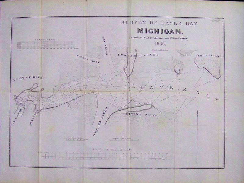 204oh: 1836 Rare Early lithographed Survey Map of Havre Bay, Michigan, surveyed by Lieuts.A.J. Center and E. Rose U.S. Army and drawn by J.M. Berrien. Map shows the Ottawa River at Lake Erie. This land was later ceded to Ohio. Map is in excellent condition and it was originally folded. 22-1/2 x 17-1/2 in. $325 SOLD
|
|||||||||
| Order Form | |||||||||||
| Back to Homepage | |||||||||||