|
|||||||||||
This is a small selection of our inventory of antique Rhode Island maps and prints. Additional inventory is available. Contact us with your request. 1-800-879-6277
|
|||||||||||
|---|---|---|---|---|---|---|---|---|---|---|---|
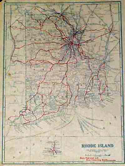
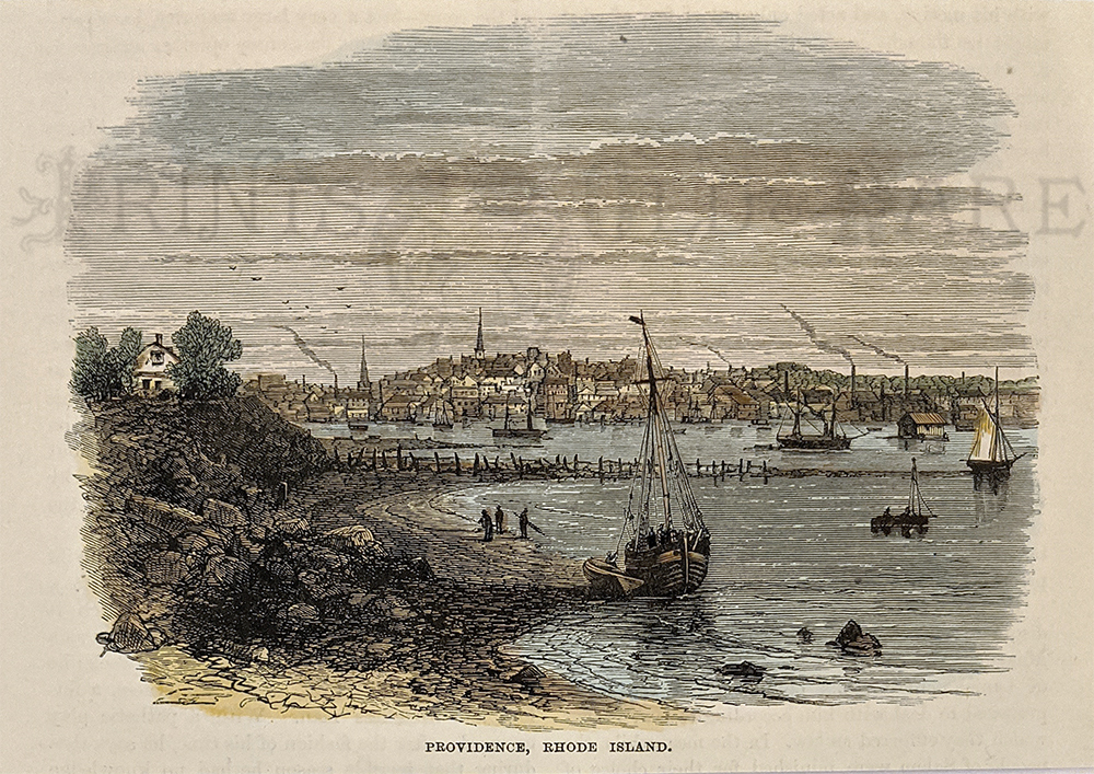
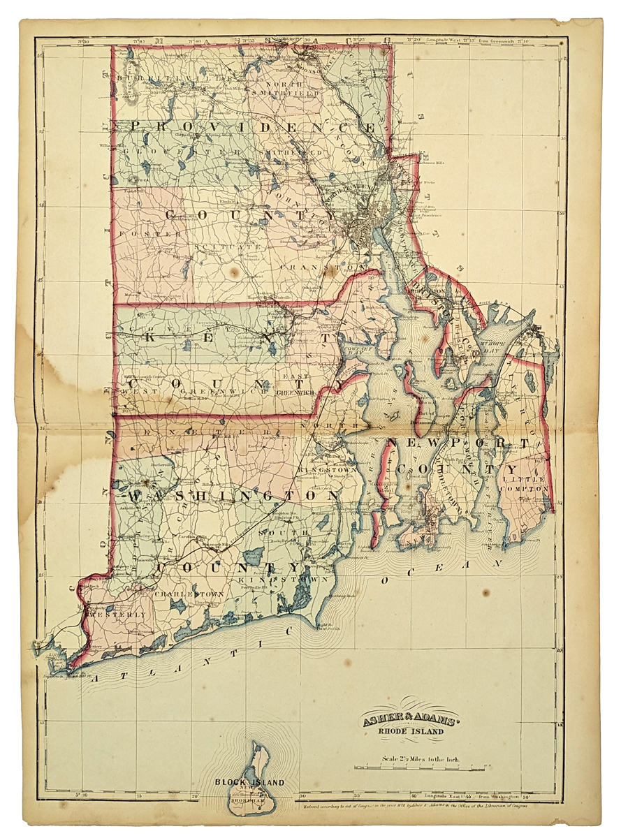
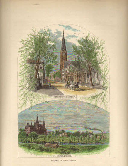 002ri: 1873 Providence Rhode Island. Two hand colored views on one page, from Picturesque America. 9-1/2x12-1/2 in. $30 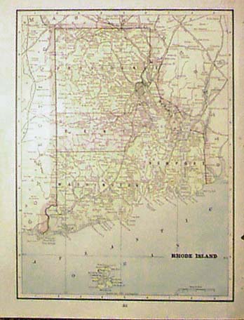 003ri: 1894 Rhode Island Map. Litho color, showing old counties, towns, major roads. Good detail. 11-1/2x14-1/2 in. $30 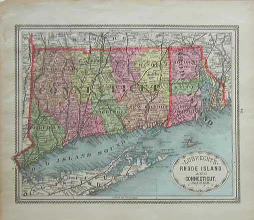 004ri: 1887 Lubrecht's Rhode Island and Conneticut Map. This hand colored map has an excellent border and is in good condition. Shows counties and towns and cities. size: 11.5 x 14 in. $60 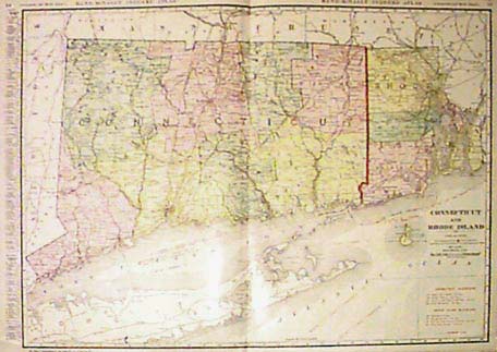 006ri: 1911 Connecticut and Rhode Island Map. Color lithograph by Rand McNally. Large scale, shows railroads and ship routes. Lists principal towns and populations. 28x21 in. $80 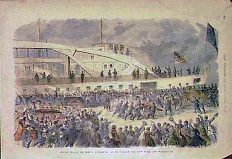 007ri: Civil War. Rhode Island regiments embarking at Providence for New York and Washington. Hand colored engraving from Harper's. 16x11 in. $40 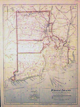 008ri: 1911 Rhode Island map, Cram's. Color lithograph shows ship routed, major roads and electric lines. 11-1/2x15 in. $30 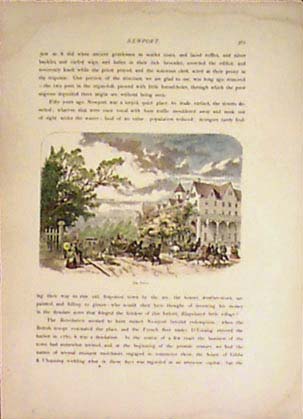 009ri: 1873 Newport, Rhode Island. Hand colored view of street scene with horse carriages, "The Drive." From Picturesque America. 6-1/2x4-1/2 in. $30 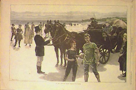 010ri: 1884 Rhode Island. "On the Newport Sands." Hand colored beach scene. Wood engraving from Harper's. 16x11 in. $80 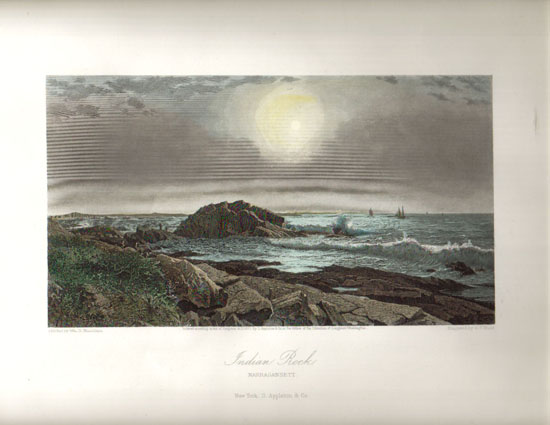 012ri: 1873 Rhode Island. Hand colored steel engraving of Indian Rock, Narragansett, from Picturesque America. 12-1/2x9-1/2 in. $60 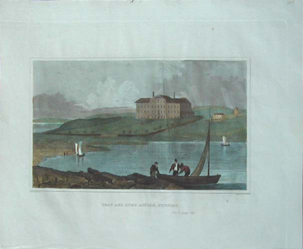 013ri: 1834 Antique Rhode Island engraving. Hand colored view across the water of the "Deaf and Dumb Asylum, Newport." From Hinton. 11x9 in. $40 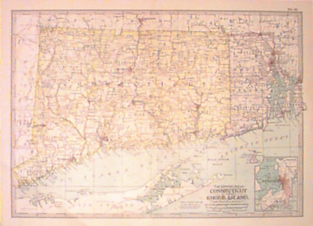 014ri: 1897 Rhode Island and Connecticut Map. Color lithograph by Century. Names counties, cities, towns. Includes elevation lines. 16-1/2x12 in. $30 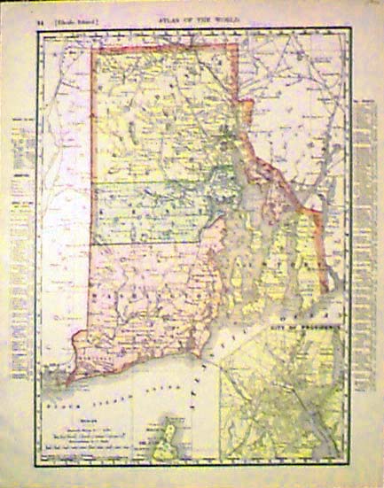 017ri: 1901 Rhode Island Map. Large color Rand McNally lithograph. Lists counties, chief cities and towns, with populations. 11x14 in. $30 |
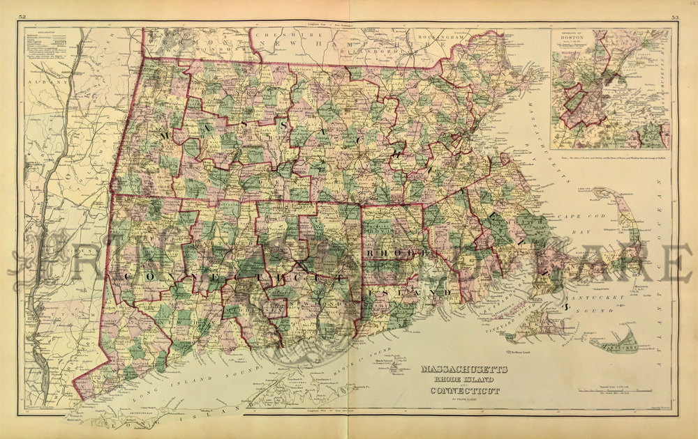 233ma: Gray's New Map of Massachusetts, Rhode Island, and Connecticut. 1875. Showing Counties (distinguished by color), Rivers, Railroads, Canals, and Towns. Inset depicts Environs of Boston. Hand colored, lithograph. 16 x 26 in. $120  001Massachusetts: 1889 Bradley's color map of Massachusetts, Connecticut and Rhode Island. 26 x 19 in. $100 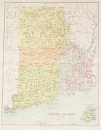
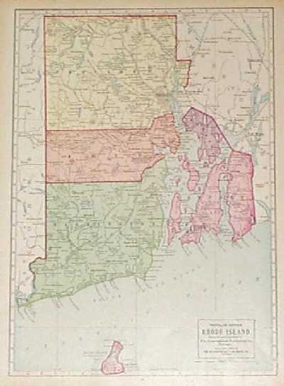
100ri: 1897 Map of Rhode Island. Color map of Rhode Island, published in 1897 by the J.B. Lippincott Company. Each county is colored separately. Cities, towns and railroad lines are all shown. In the bottom right corner there is a small inset map of Block Island. 10x12 in. $20 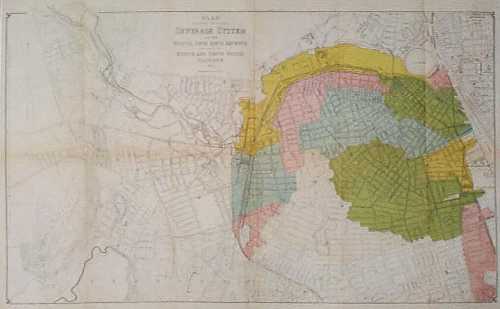 101ri: 1884 Map of Providence RI Sewage System. Color lithographed map published by the Providence RI City Engineer's Office. Map title is "Plan Showing Proposed Sewerage System for the Fourth, Fifth, Sixth, Seventh and a part of the Eight and Tenth Wards, Providence R.I." Areas affected by the new system are colored in. The locations of the sewers are marked with dotted lines. 17x27 in. $40 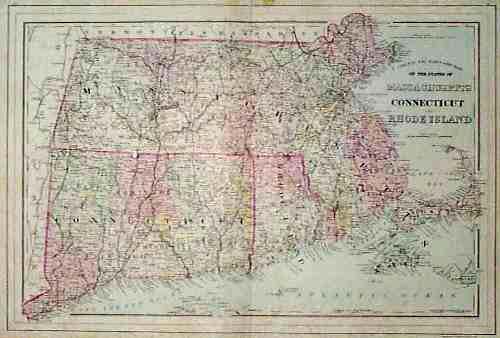 102ri: 1884 Map: Rhode Island and Vicinity. Nicely hand colored map of Massachusetts, Connecticut and Rhode Island, published in 1884 by S. Augustus Mitchell. Cities, towns and railroad lines are shown in detail throughout the map. Each county is colored separately. 15x22 in. $80 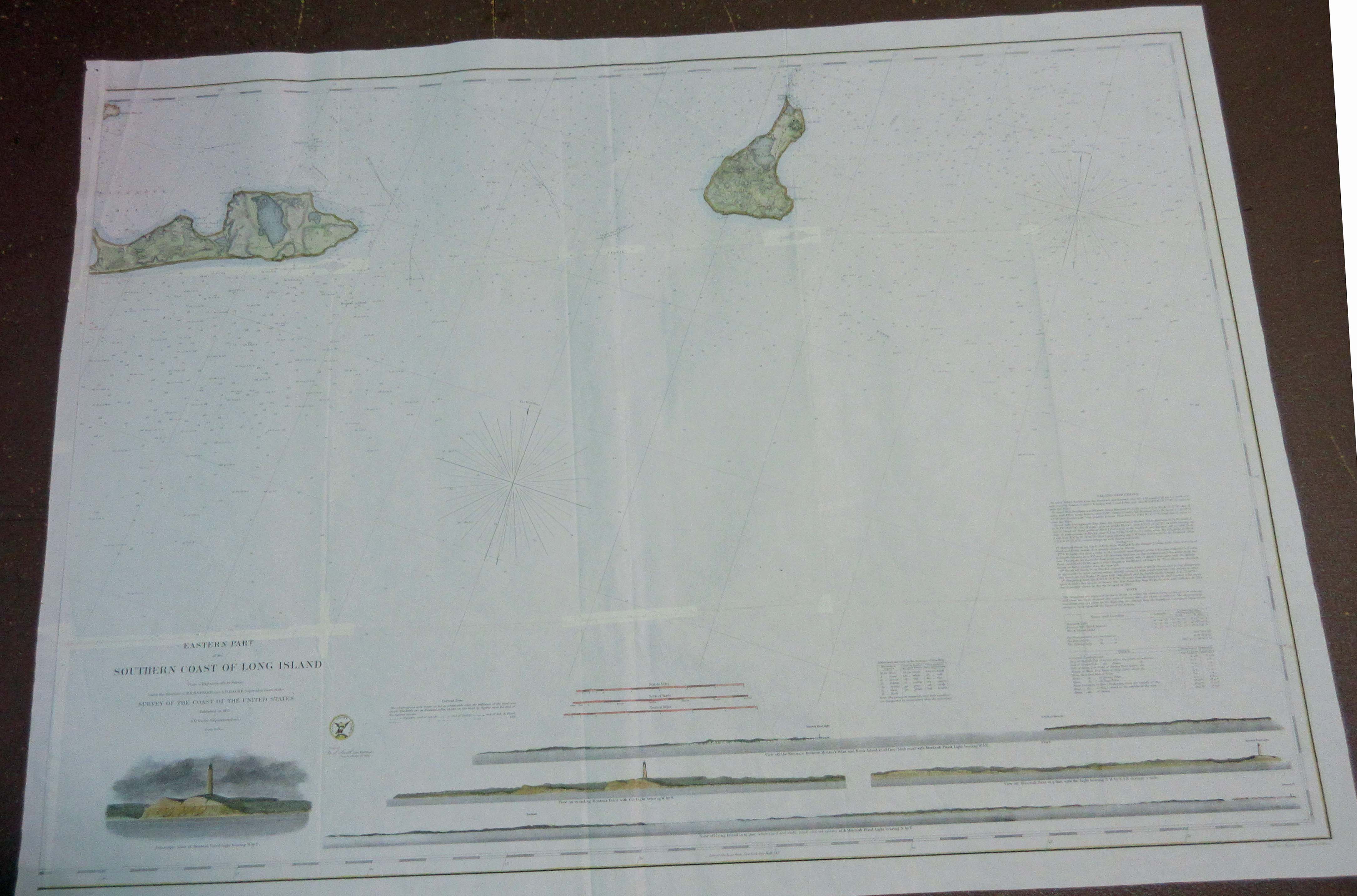 131lni: 1857 - Southern Tip of Long Island/Block Island. Hand colored lithograph showing the Montauk area and Block Island. Beautiful Survey of the Coast of the United States by A.D. Bache. Vignettes on bottomwhich include Montauk lighthouse. 36 x 26-1/2 in. $500
|
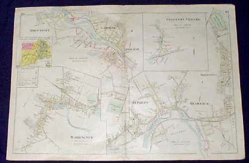
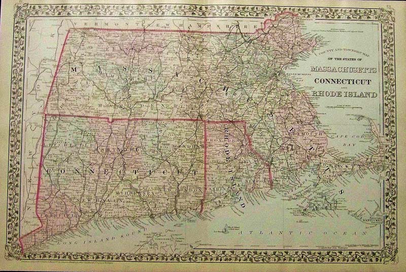 1196Massachusetts: 1879 Mitchell's original hand colored County and Township Map of the States of Massachusetts, Connecticut, and Rhode Island. Entered according to Act of congress in the Office of the Librarian of Congress at Washington. 23 x 15 in. $150 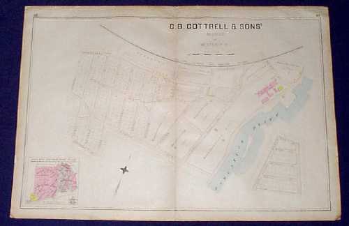 108ri: 1895 Plat Map of Westerly Rhode Island. This is a plat map from an 1895 Rhode Island atlas, showing a portion of the town of Westerly in Washington County. The map is titled "C.B. Cottrell & Sons's Addition to Westerly, R.I." Each lot and building is shown on this map. Locations of future manufacturing sites are shown as well. 22x32 in. $80 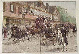
200ri: RARE Antique View of Newport Rhode Island. Beautifully hand colored, engraved scene from the Sept. 18, 1886 issue of Harper's Weekly. Title is "Bellevue Avenue, Newport, Opposite the Casino." A bustling street scene is shown, with pedestrians and horse-drawn carriages passing by. Condition is very good. There was a split in the center vertical crease, which has been repaired on the back with archival tape and there is no image loss. If this item were matted and framed, the split would be barely visible. 16x22 in. $300 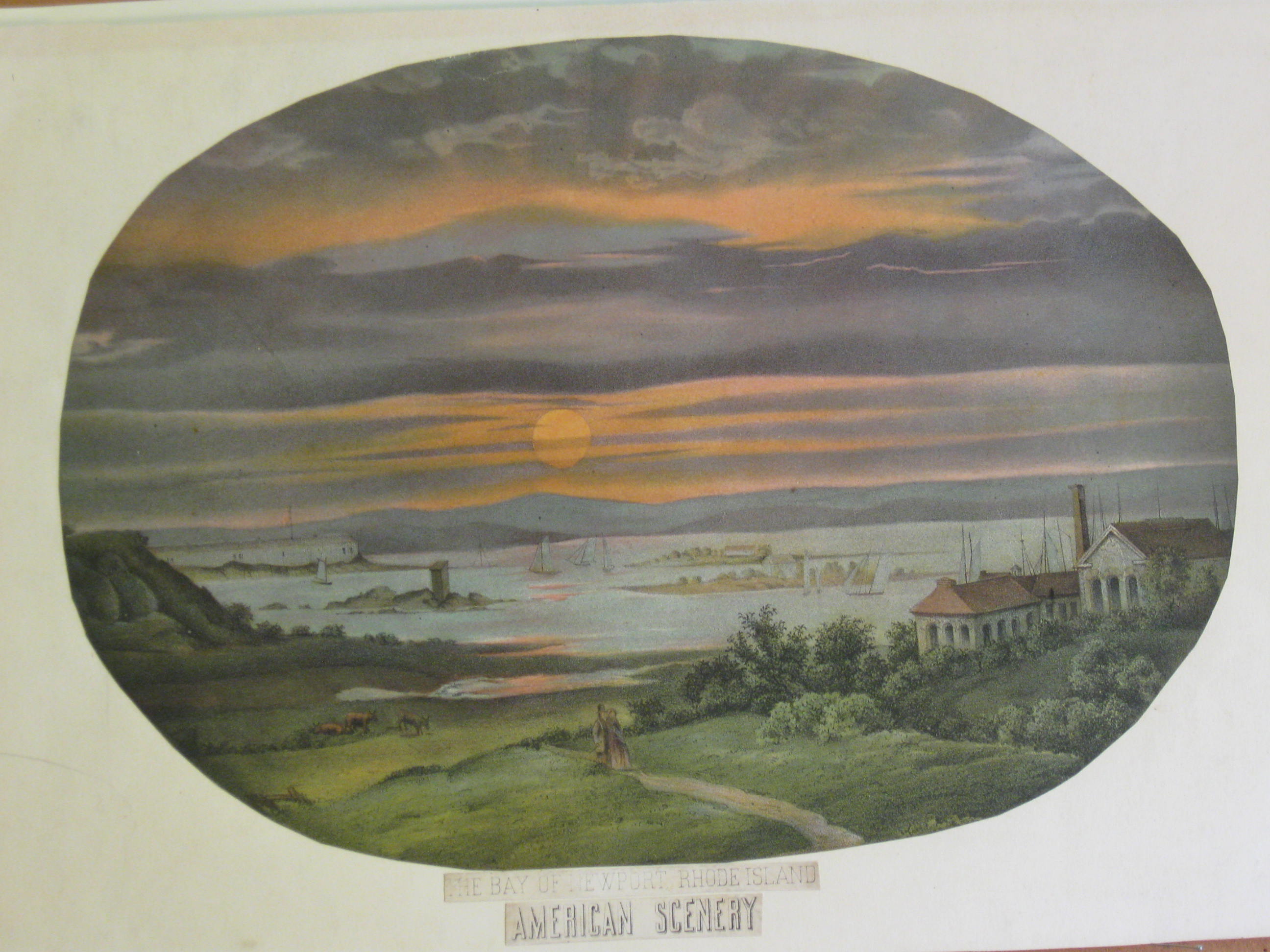 215ri: C1870 Hand colored lithograph showing, "The Bay of Newport Rhode Island -- American Scenery." Condition was cut out and mounted on acid-free paper. 16-1/2 x 11-1/4 in. $100 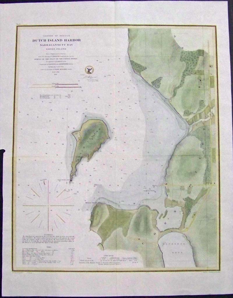 216ri: 1862 Hand colored copper engraved map showing the "Harbor of Refuge - Dutch Island Harbor - Narragansett Bay - Rhode Island." Under the direction of A.D. Bache Superintendent of the Survey of the Coast of the United States. Under the Direction of Henry Mitchell. Soundings and Tide keys, along with Light House key on bottom left. 20-1/2 x 18 in. $300 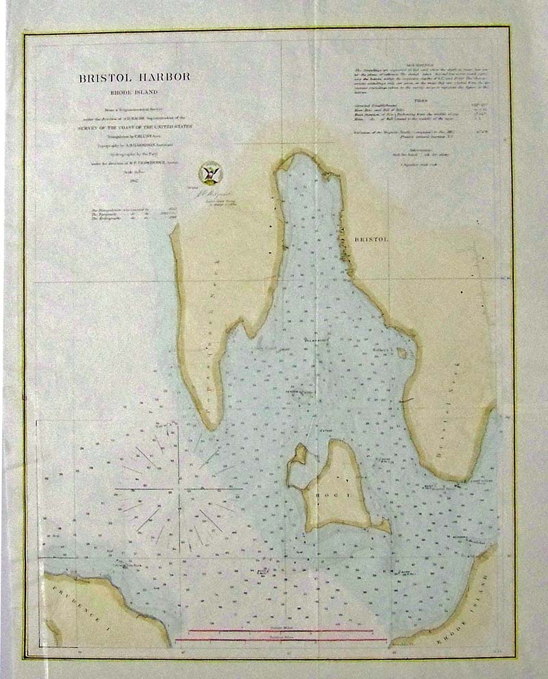 225ri: 1862 Hand colored lithographed map showing Bristol Harbor in Rhode Island from a Trigonometrical Survey under the direction of A.D. Bache, Superintendent of the Survey of the Coast of the United States. The Soundings and Tides are displayed. 18 x 14-1/2 in. $120
|
|||||||||
| Order Form | |||||||||||
| Back to Homepage | |||||||||||