 
|
|||||||||||
This is a small selection of our inventory of antique Russia maps and prints. Additional inventory is available. Contact us with your request. 1-800-879-6277
|
|||||||||||
|---|---|---|---|---|---|---|---|---|---|---|---|
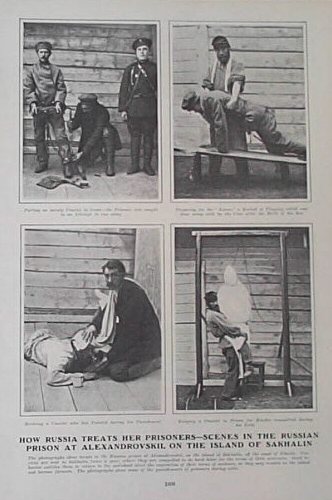
001rus: 1904 Scenes from a Russian Prison. Print shows several photographs of common scenes at Alexandrovskii, a Russian prison off the coast of Siberia. Each photo is accompanied by text. 9x12 in. $30 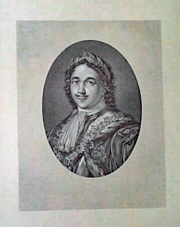 002rus: 1880 Portrait of Peter the Great. Engraving shows a detailed portrait of Peter the Great , Czar of Muscovy and founder of the Russian navy. Print is accompanied by text and a chronology of his life. Published in 1880 as an illustration to a book. 10x14 in. $30 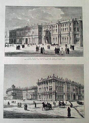 003rus: 1880 The Winter Palace. Two, handsome antique wood engravings show the exteriors of the Winter Palace. Published in an 1880 issue of The Graphic. 11x16 in. $30  004rus: 1894 Funeral Scene of Alexander III. Engraving shows the Archbishop of Moscow blessing the new emperor in the cathedral of St. Michael. Published in an 1894 issue of The Illustrated London News. 11x16 in. $30 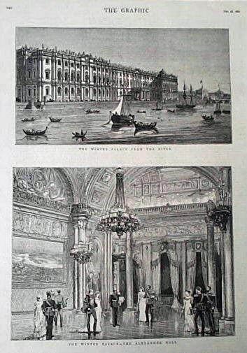 005rus: 1880 Scenes from The Winter Palace. Two wood engravings show an exterior view of the Winter Palace from the River and an interior view of Alexander Hall. Published in an 1880 issue of The Graphic. 11x16 in. $30 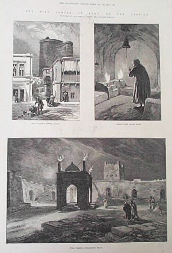 006rus: 1885 Fire Temple at Baku. Three wood engravings show scenes of the Fire Temple at Baku, located on the Caspian. Each scene is accompanied by text. Published in an 1885 issue of The Illustrated London News. 11x16 in. $30 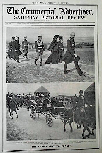 007rus: 1901 Czar's Visit to France. Print shows several photographs of the Czar and Czarina on their trip to France. Print also shows French President Loubet. Published in a 1901 issue of The Commercial Advertiser. 11x16 in. $30 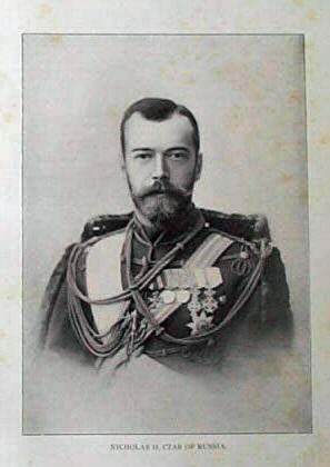 009rus: 1900 Portrait of Nicholas II. Photograph shows Czar Nicholass II, ruler of Russia from 1894 until 1917 when the Russian revolution forced him to abdicate the thrown. He and his family were later shot in 1918. 7x10 in. $20 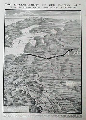 013rus: 1915 Pictorial Map of Russian Territory. Engraving shows the vast expanse of the Czar's empire. Title is "The Invulnerabilty of Our Eastern Ally." Captions describe Russia's victory over the French and Swedish. Print was published in a 1915 issue of The Graphic. 11x16 in. $30  014rus: 1882 Siberian Scenes. Large print shows several wood engravings of native Siberians from several economic classes and the towns they inhabit. 16x22 in. $50 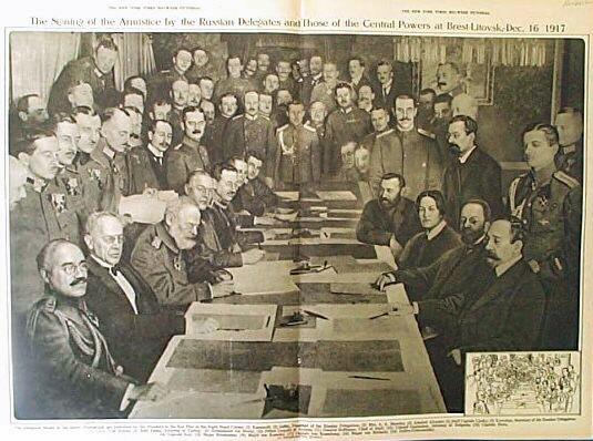 015rus: 1917 Russian Delegates at Brest-Litovsk. Large print shows several Russian delegates and leaders from the Central Powers gathered to sign an armistice. The agreement forced Russia to cede large areas to the Central Powers and recognized the independence of Poland, the Baltic states, Georgia, and Ukraine. Print includes a key identifying the delegates. Published in a 1917 issue of The New York Times Med Week Pictorial. 16x22 in. $40 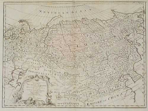 018rus: Beautiful 1770 Russian Empire Map by Bowen. Detailed, copper engraved map by Emanuel Bowen, published circa 1770. Title is "A New & Accurate Map of the Whole Russian Empire, as Contain'd Both in Europe and Asia. Drawn from Authentic Journals, Surveys, and Most Approved Modern Maps, and Regulated by Astronomical Observations." Provinces, cities and towns are marked throughout the empire. Rivers, mountain ranges and forests are shown as well. Much of northern China and Tibet is included. The map title is surrounded by a decorative cartouche. This map is in excellent condition, with no tears, stains or other blemishes. 15x20 in. $300 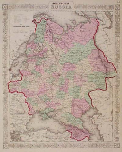 019rus: 1865 Johnson Map of Russia. Hand colored, engraved map of Russia, from the 1865 edition of Johnson's Family Atlas. Each province within Russia is separately colored. National boundaries are outlined in dark red. Cities, towns, railroad lines and geographical features are all shown. Entire map is surrounded by a decorative border. There are several small age spots on the paper, but overall condition is excellent. 14x18 in. $60 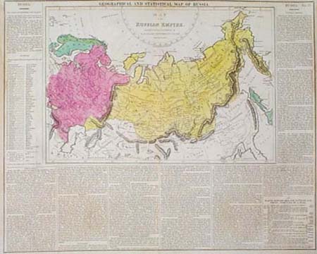 020rus: 1821 Lavoisne Map of Russia. Hand colored, engraved map of the Russian empire, from the 1821 edition of Lavoisne's Historical Atlas. European and Asian Russia are separately colored. Map image is surrounded on three sides by text describing the geography, population, government and economy of the region. 17x21 in. $225 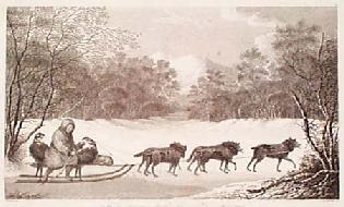 201rus: Antique Cook Expedition Scene: Dog Sled. RARE. Beautiful, engraved image, published in 1785 as an illustration to the report of Captain James CookÂ’s expedition to the Pacific. Title of the image is "A Man of Kamtschatka, Travelling in Winter." Kamtschatka is on the far eastern, Pacific coast of Russia, facing the Aleutian Islands. In the scene, a man is shown sitting on a sled which is being pulled by five dogs. This item is in very good condition. There is a light vertical crease in the middle, which appears to be the result of the paper being slightly crimped in the printing press. The crease is barely visible, and not distracting. Printed on hand laid paper. 13x18 in. $150 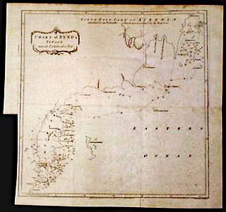 203rus: 1780 Map: Bering Strait, Alaska, Russia. Engraved map, titled "Chart of Synd's Voyage Towards Tschukotskoi Noss." Drawn by Thomas Kitchin, and published in 1780 by T. Cadell. The map focuses on the island of Kamtschatka, one of the Aleut Islands in the Bering Strait. Positions of Synd's ship are shown for each day he was in the area. Map is not colored. A piece has been cut from the lower left margin, but the map border and image are not affected. Overall very good condition. 18x18 in. $250 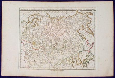 204rus: 1780 Map: Russia in Asia, China, Etc. Engraved map, with original outline hand coloring, titled "Siberie ou Russie Asiatique, Tartarie Chinoise, Pays des Eluts et Isles du Japon." Published in 1780 by Robert De Vaugondy. Shows most of northern Asia, with geographical features prominently displayed. Some light foxing in margins, but image is clean and clear. Overall very good condition. 11x17 in. $110 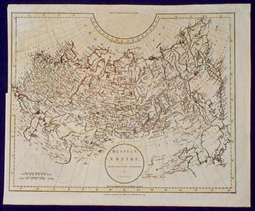 205rus: 1799 Russell Map of Russia. Engraved map titled "Russian Empire, published by J. Russell in 1799. Uncolored except for a red line across the continental border between Europe and Asia. Cities are shown, as well as geographical features. There is a light "ghost" image on the paper, where the map was originally folded onto itself. The ghosting is visible, but not distracting. Otherwise in very good condition. 16x20 in. $100  206rus: 1809 Arrowsmith Map of South Russia. Hand colored copper-engraved map, titled "South Part of Russia in Europe." Drawn by Arrowsmith, and published in 1809. Two segments of the Russian border with Prussia are not drawn, indicating disputed territory. Excellent condition. 11x16 in. $75 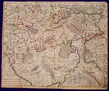 207rus: 1700 De L'Isle Map of Moscow Russia Area. Beautifully engraved map, with original outline hand color, titled "Partie Meridionale de Moscovie." Drawn by G. De L'Isle, and published circa 1700 by Pierre Mortier. Moscow is in the upper left side of the map. Towns and geographical features throughout the area are shown in detail. Forests are clearly marked, as well as rivers and mountains. Political borders are indicated with original outline hand coloring. Margins are trimmed into the map borders on left and right. There are several small age spots on the image, but overall condition is very good. 20x24 in. $750 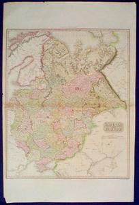 208rus: 1810 Pinkerton Map: Russia in Europe. Hand colored, engraved map titled "Russia in Europe." Drawn by Neele, under the direction of M. Pinkerton, and published in 1810. Each province is separately colored. Cities, towns and geographical features are all shown. Several tears into the image from the sides have been professionally repaired on back. Otherwise very good condition. 21x31 in. $200  209rus: 1830 Map of Sakhalin Island, Russia. Nicely colored copper-engraved map, showing the island of Sakhalin which is Russian territory north of Japan. Drawn by A.R. Fremin, and published circa 1830. The day-to-day locations of an unnamed 18th century explorer's ship are shown along the island's eastern shore. Very good condition. 18x22 in. $90  211rus: 1784 Maps: Russian Canals Near Baltic Sea. Two maps on one sheet, drawn by Thomas Kitchin and published in 1784. Top map is titled "Plan of the Canal of Vishnei Voloshok, which Unites the Baltic and the Caspian." It shows an area halfway between Moscow and St. Petersburg, including the town of Vishnei Voloshok. Bottom map is titled "Plan of the Ladoga Canal." It includes the area along the south shore of Ladoga Lake, east of St. Petersburg. 10x14 in. $75 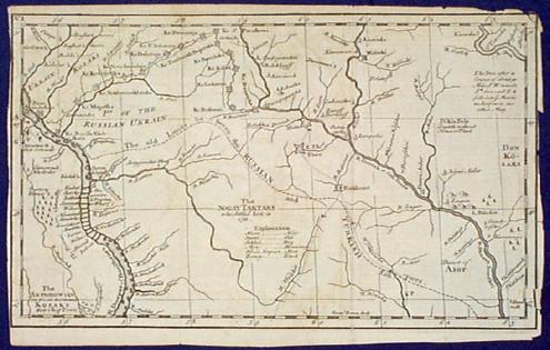 212rus: 1750 Bowen Map: Ukraine Region. Engraved map by Emanuel Bowen, showing an area along the Dnieper River southeast of Kiev. Map is untitled. It shows the border between the Russian and Turkish empires, where Zaporozhi Kozaks were guarding against encroachments by Tartar hordes. Margins are cropped to the map border on right and left sides. Otherwise very good condition. 8x13 in. $75 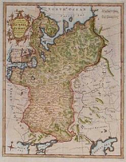 213rus: 1794 Map of Russia in Europe, by Kitchin. Hand colored, engraved map by Thomas Kitchin, titled "A New and Accurate Map of Russia in Europe, Drawn from the Best Authorities." Printed on hand-laid paper, in 1794. Map title is surrounded by a decorative cartouche. Excellent condition. 10x16 in. $125  214rus: Circa 1800 Map of Russia in Europe. Hand colored, engraved map titled "Russia in Europe." Drawn by W. Milton, and published circa 1800. Cities and geographical features are shown. Political borders are drawn with dotted lines. Very good condition. 10x17 in. $60 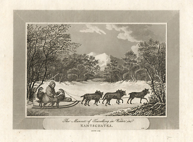 216rus: 1806 Black and white copper engraving from Vol. I of Pelham's "World" titled, "The Manner of Travelling in Winter in KAMTSCHATKA." The scene shows a native on a sled being pulled by a team of five dogs. The area shows a snow filled meadow surrounded by trees and mountains in the distance. 9x11.5in $30 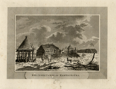 217rus: This copper engraving from the early 1800's is titled, "Bolcheretzkoi in Kamtschatka." This engraving shows the different types of buildings used by the native people such as huts and cabins. The foreground shows a worker on the roof of a hut. Extremely fine engraving showing minute details. 9x11.5in. $30 |
 218rus: This sled engraving is from the early 1800's. The title reads,"A Snow Sledge Drawn by Dogs, as Viewed in Kamtschatka." This nine dog team is pulling a native in his sled across the snow. Tall mountain ranges surround them. Extremely detailed copper engraving done in black and white. 8.25x10.5in. $30 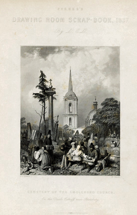 219rus: Title page for the 1837 Fisher's Drawing Room Scrap-Book, 1837 by L.E.L. The engraving's title is "Cemetry of the Smolensko Church, On The Vasili Ostroff, near Petersburg." This extremely detailed engraving shows people at the cemetery. Some are grieving at the headstone others are sharing a meal on nearby benches. The costuming is extremely interesting as well as the detailing on the church. 10x7.25in. $20 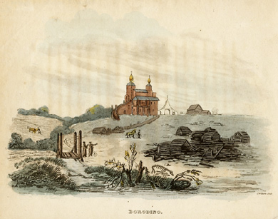 220rus: This hand colored engraving shows the village of Borodino in Russia near Moscow. A great battle with Napoleon was fought here in 1812 This is a pastoral scene with farmers in their fields and two men standing near a small foot-bridge. Ruined buildings are in the foreground while a large church is at the top of the hill. 8x10in. $60  221rus: SMOLENSKO is the tile of this 1815 hand colored engraving published by J.J. Stockdale, Pall Mall. It shows the walled village of Smolensko with the surrounding buildings . There is a boat in the river, a man with his horse-drawn wagon and two men talking in the foreground. 8x10in. $60 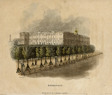 222rus: HERMITAGE is the tile of this 1815 hand colored engraving published by J.J. Stockdale, Pall Mall. It is a beautifully hand colored engraving of St. Petersburg showing a tree-lined street and the Hermitage behind. 8x10in. $60 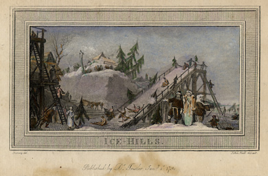 223rus: This beautiful engraving was done by Doctor Trusler and is dated January 1st,1790. It is beautifully hand colored and is titled "Ice-Hills." It shows snow covered slides framed in wood and people sliding down the snow slopes on a sack. It is supposed to be in St. Petersburg. There is a beautiful engraved border surrounding the view. 5x8.33in. $40  225rus: 1859 Black and white engraving titled, "Der Caucasus" The bottom reads "Aus d. Kunstanst . d.Bibliogr. Inst. in Hildbh. - Eigenthum d.Verleger." Beautifully detailed river scene with the Caucasus Mountains in the distance. The top of the plate is numbered "CCCXXXXVII" 7.5x10.25in. $20  227rus: The village of Zagorsk near Moscow is shown in this 1852 engraving. The full title is marked as, "ZARTSKOE Aus. d. Kunstanst s. Bibli. Insit. in Hildbsn Eigenthum d.Verleger." Pastures with cattle, a river and the city itself with beautifully detailed buildings are all shown. 6.75x9.5 in. $40 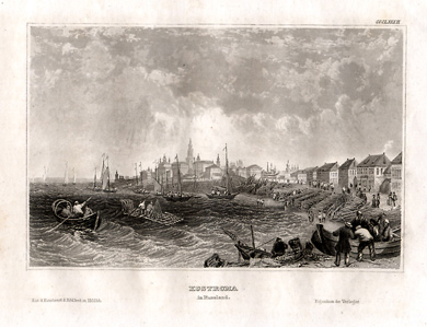 228rus: This fishing village is shown in in such fine detail it is hard to believe. There are fishermen in the boats out on the water and spires of buildings in the far distance that are almost too small to measure. The full title is "KOSTROMA in Russland Aus. d. Kunstanst s. Bibli. Insit. in Hildbsn Eigenthum d.Verleger." The top of the plate is numbered "CCCLXXXII." 7.25x10.25in. $20 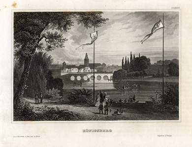 229rus: This 1850 engraving is of the town of Kalingrad near the Russian - Polish Border. Title is: "KONIGSBERG Aus. d. Kunstanst s. Bibli. Insit. in Hildbsn Eigenthum d.Verleger." Very detailed black and white engraving with the top of the plate marked " DCXXXVI." 7.25x10.5in. $20 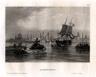 230rus: 1842 black and white engraving titled, "ARCHANGEL Aus. d. Kunstanst s. Bibli. Insit. in Hildbsn Eigenthum d.Verleger." Top of the print is marked "CCCCI". This extremely detailed engraving mainly shows boats in the harbor with the city in the distance. 7.25x10.25in. $20 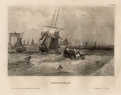 231rus: 1841 black and white engraving of Astrakhan near the mouth of the Volga River is titled, "ASTRACHAN Aus. d. Kunstanst s. Bibli. Insit. in Hildbsn Eigenthum d.Verleger." This shows ships in the harbor with all their sails and crews rowing to the ships. This engraving has very fine detailing. Top of the engraving is marked, "CCCLIV." 7.25x 10.25in. $20 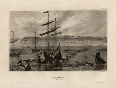 232rus: Black and white engraving from 1841 showing Taganrog on the Azov Sea. The engraving is titled, " TAGANROG in Russland Aus. d. Kunstanst s. Bibliog. Insit. in Hildbsn Eigenthum d.Verleger." This shows a ship that is being unloaded at low tide with horses pulling wagons in the shallow water across the bay. The city is on the riverbank in the distance. Beautiful detailing on the ship and buildings in the distance. Top of the print is marked "CCCLXIV." 7.25x10.25in. $20 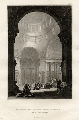 233rus: This extremely detailed black and white engraving from 1837 shows the interior of St. Nicholas Church in St. Petersburg. The full title is, "INTERIOR OF THE NIKOLSKOI _ KIRSCHE in St. Petersburg Philadelphia: NA.B. I." T he top of the print is marked, "CLX". There is the remainder of a blue tissue glued along the bottom of the engraving that can be covered by re-matting. 9.5x7.33in $30 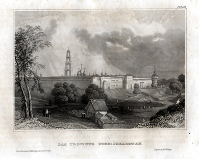
236rus: 1841 engraving in black and white of Troitskaya Lavra showing the walled city and the surrounding pastures. The title shown reads, "DAS TROIZKER SERGIUSKLOSTER Aus. d. Kunstanst s. Bibliog. Insit. in Hildbsn Eigenthum d.Verleger." Top of the engraving is marked, "CCCLX". 10.25x7.25in. $20  239rus: Beautiful copper engraving of a man and a woman in the native clothing of Russia titled, "Habits of a Moscovite Woman and Arms and Dress of A Calmock engraved for Moores Voyages and Travels W. Grainger, Sculp." Done circa 1730 this pair of engravings is so detailed that you can see the feathers on the man's arrows and the fringe on the woman's shawl. 9x14.25in. $60 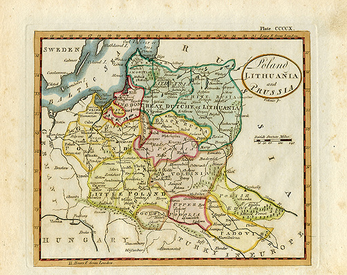
244rus: Hand colored steel engraved map titled "Poland Lithuania and Prussia." This map shows the different divisions of the area in approximately 1792. Areas are labeled, Little Poland, Great Poland, Upper Podolia, Pocupia, Padovi, Polish Kiovia, Volhinia, Polesia, Black Russia, Great Dutchy of Lithuania, Kingdom of Prussia, Polish Prussia. Rivers, forests and mountains are all shown as well as major cities. The border has Longitude markings and the key is in British Statute miles. The top of the map is marked "Plate CCCCX." 8x10.5in. $ 90 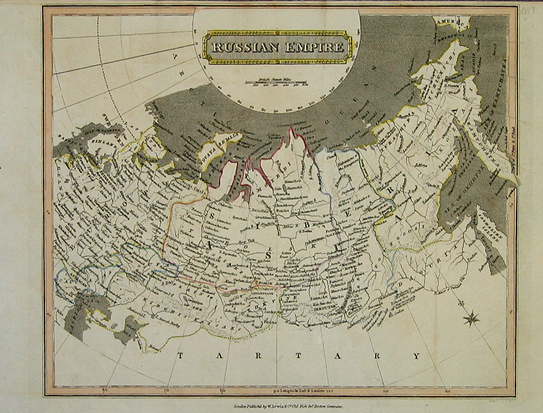 246rus: 1817 hand colored map of the Russian Empire published by W. Lewis & Company. This hemisphere style map shows the major divisions within the Russian Emipre at the time separated by colored borders . Names are done in English with the Arctic Ocean across the top and Tartary across the bottom. Mountains rivers and major cities are all shown on this lovely map. 9.5x13in. $40 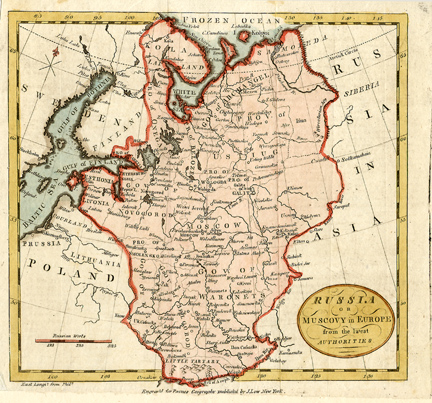 247rus: Small hand colored map of Russia from 1784. The full title in the cartouche of this copper engraving reads, "Russia, or Muscovy in Europe from the Latest Authorities." It was engraved for Paynes Geography and published in New York. This map focuses on only one section of Russia with "Russia in Asia" marked to the east. Major rivers and cities are marked as well. The scale of the map is marked in Russian werts. The bottom border of the map has been archivally repaired. 8.5x9in. $50 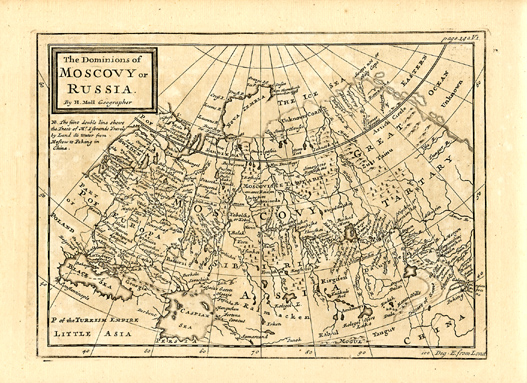 249rus: 1748 Moll map titled, "The Dominions of Moscovoy of Russia by H. Moll, cartographer." This black and white map shows the major cities, rivers and lakes. Russia is divided into Moscovy and Great Tartary. It is done as a hemisphere map with the Arctic called "The Ice Sea." A wonderful addition to any collection. 8.5x14in. $90 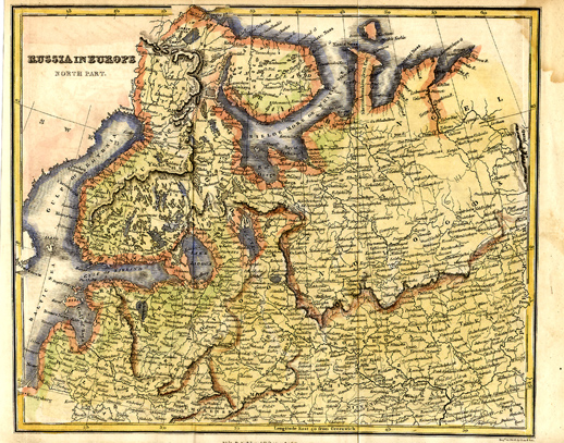 250rus: Hand colored map of "Russia in Europe - the North Part." The map is divided into different colored areas. The White Sea, Gulf of Bothnia and Baltic Sea are all shown. Towns, rivers and lakes are all named. Some of the area names include: Vologda, Novgorod, Livonia, Valdimir and Muskow. 8.25x10.5in. $60  251rus: This 1830 engraved map of Russia in Europe was published by Samuel Walker of Boston. There are four keys at the bottom left corner of the map. They are British Statute miles, Russian Versts, Common French Leagues, German and Polish Miles. The note above the key reads, " Note: The Governments are defined by dotted lines and are named after the principal Town contained in each, distinguished by Sloping Capitals." A very detailed map with lots to study. 10.75x8.5in. $25 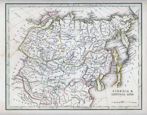 252rus: 1835 Bradford map of Siberia and Central Asia. This map covers the eastern section of Russia as well as China, Japan, Korea, India and Tibet. Each of the different areas are outlined in a pastel color with major rivers and mountain ranges shown. The light green border has longitude and latitude markings for reference. 10x13in. $40 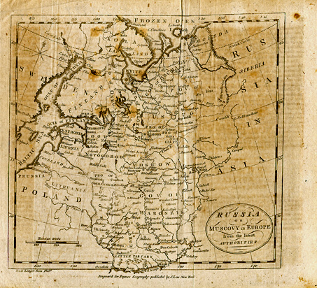 255rus: Small black and white map of Russia from 1784. The full title in the cartouche of this copper engraving reads, "Russia, or Muscovy in Europe from the Latest Authorities." It was engraved for Paynes Geography and published in New York. This map focuses on only one section of Russia with "Russia in Asia" marked to the east. Major rivers and cities are marked as well. The scale of the map is marked in Russian werts. This is the same map as 247rus but in black and white. 8.5x9in. $50  256rus: This map was done in 1778 by Thomas Bowen. The full title form the cartouche reads, "An Accurate Map of the Russian Empire as contained in Europe and Asia. Drawn from the best authorities by Thomas Bowen 1778. It was engraved for Middleton's Complete System of Geography. It is done with brilliant outline colors marking each division within the Russian Empire. The key at the bottom right corner is done in both British Statute miles and Russian wersts. The simple border has both longitude and latitude markings for reference. 8.75x14in. $90 |
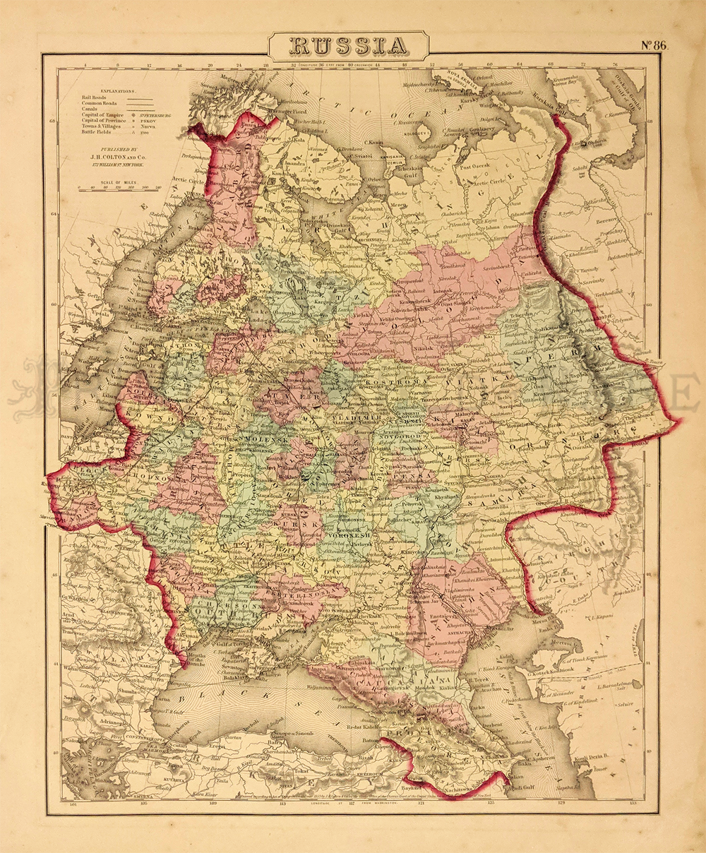 286rus: Russia - 1855 Colton. Showing roads, canals, capital, towns, villages and battlefields. 14 x 17 1/8 in. $25 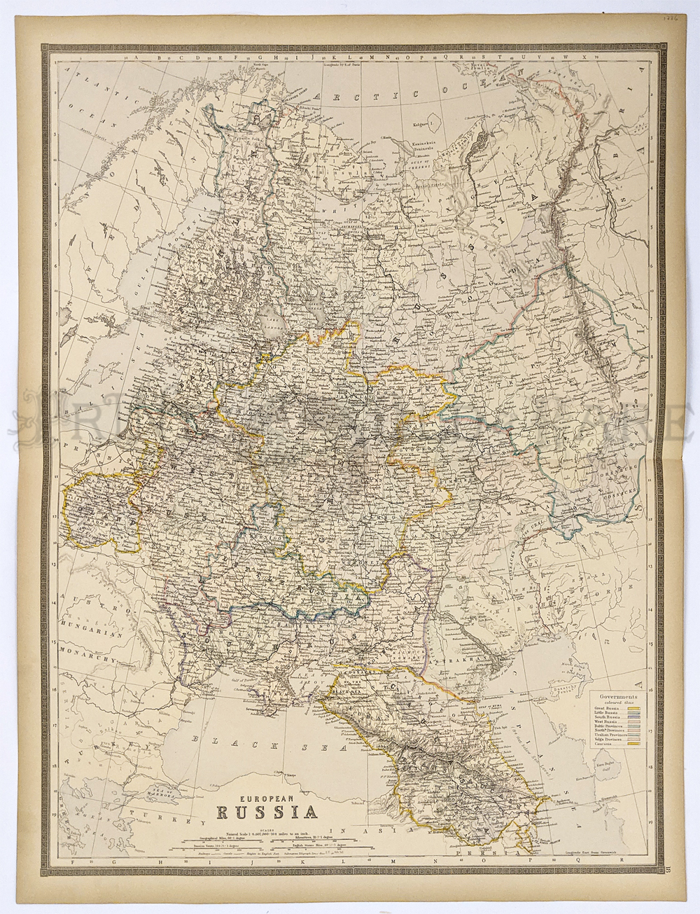 288rus: European Russia 1886. Greatly detailed map showing provinces. Hand colored engraving by Bradley. 19 x 24 ½ in. $60 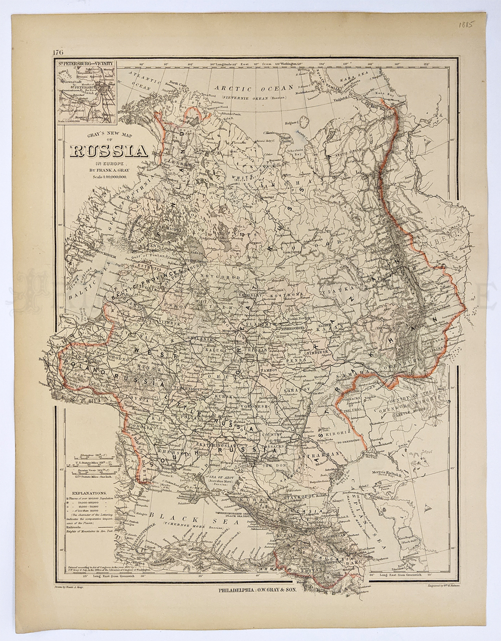 289rus: Russia 1805 – European Russia includes South to Black Sea and Crimea and Caspian Sea. By Gray & Son. 13 ¾ x 17 3/8 in. $50 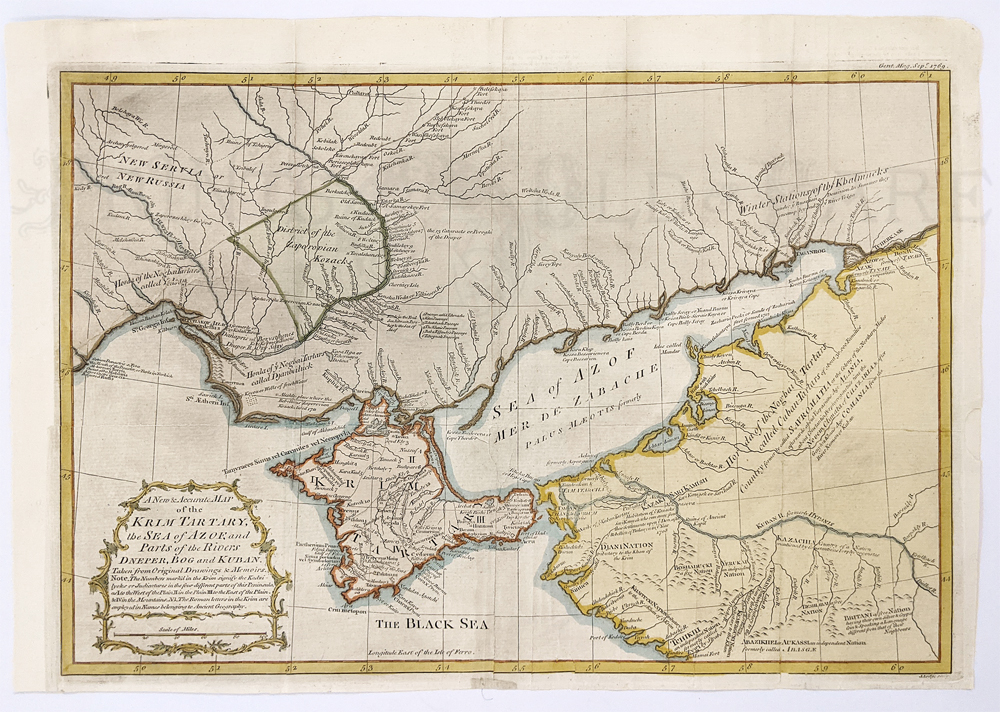 290rus: Ukrainian Area 1769 – detailed view of Crimea and Sea of Azof. Hand colored copper engraving Gentleman’s Mag. Showing different tribes of Tartans and many printed notes. close up study of the Krim of Tartary, the Sea of Azof and parts of the Rivers Dneper, Bog and Kuban. This is a very informational study map giving old and new place names, notes on the local population and historical notes. Both major and minor rivers are shown as well as mountain ranges. 12 7/8 x 17 in. $180 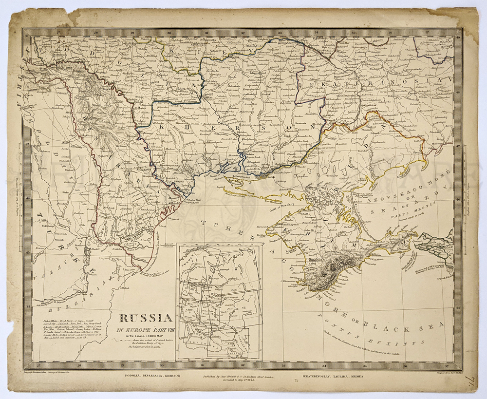 291rus: Ukrainian Area 1845 includes Crimea Peninsula by Charles Knight. Outlined in color. Steel engraving. 13 7/8 x 16 ½ in. $80 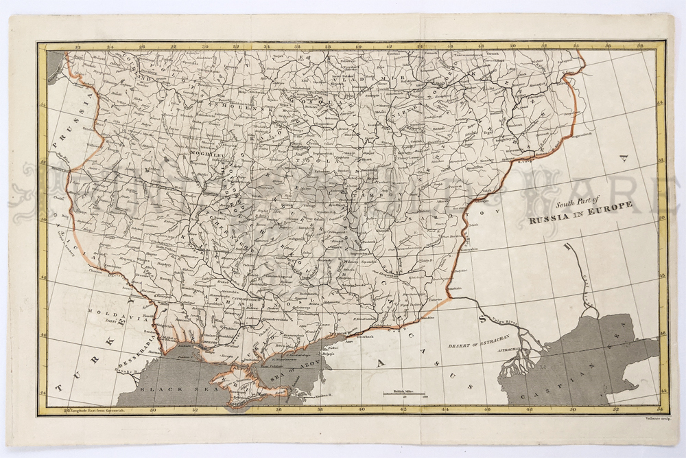 292rus: Southern Part of Russia in Europe 1813. Black Sea & Crimea. Hand colored engraving by Vallance. 10 7/8 x 16 ½ in. $50 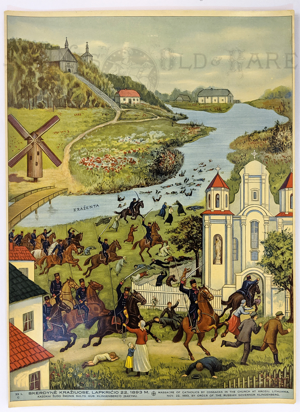 293rus: Lithuania c.1900 “Massacre of the Catholics by the Cossacks.” Chromolithograph. Colorful depiction of the horrible massacre at church at Krasin. 15 x 20 in. $35 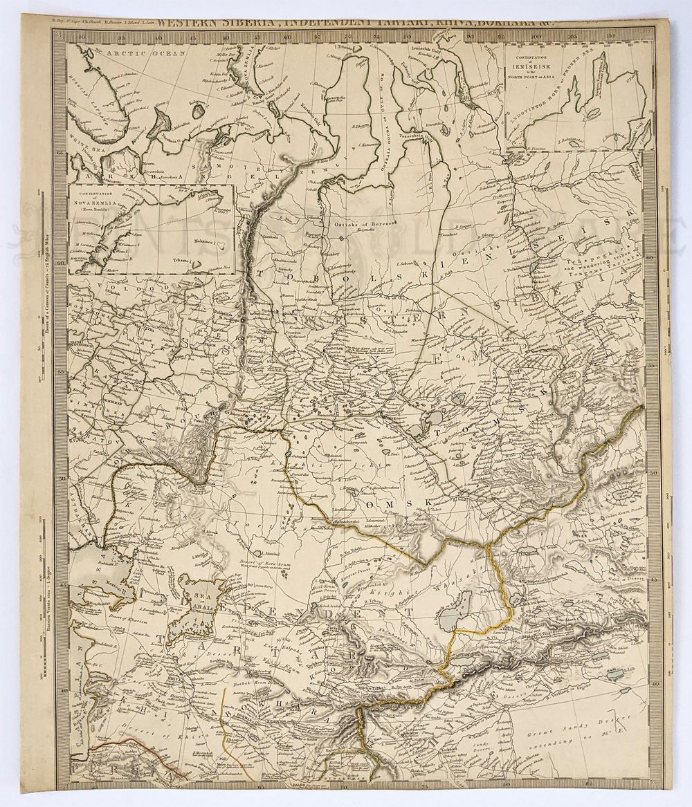 294rus: Tartary 1840 – SDUK Map (Society for Diffusion of Knowledge) “Western Siberia and Independent Tartary, Khiva and Bokhara” engraving with borders outlined in color. 13 ¼ x 15 ¾ in. $150 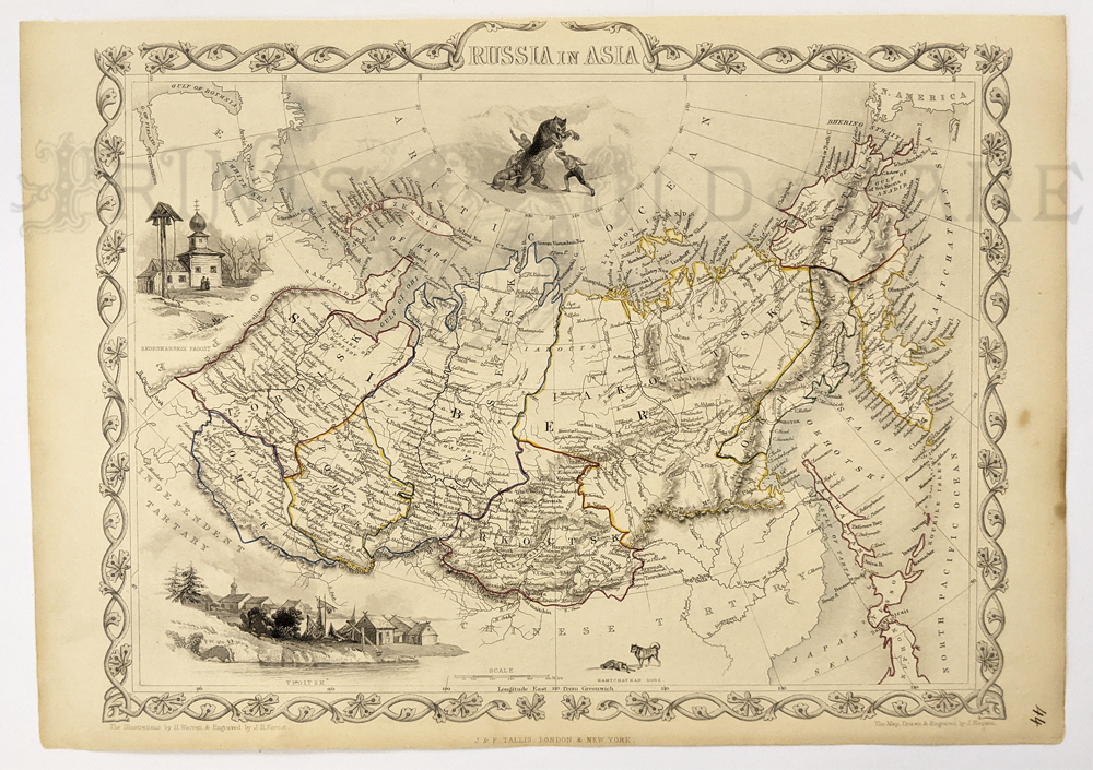 295rus: Russia in Asia 1851 by John Talis. Finley engraved – provinces outlined in color from Ouralian mountains to Kamchatka. 9 ½ x 13 in. $125  257rus: This beautiful hand colored map was published in 1843 as part of Cruchley's General Atlas. It is titled, "Russia in Europe" and shows the different divisions within the Western part of Russia each in a different pastel color. Major cities, mountains and rivers are all shown as well as the Baltic Sea, Caspian Sea, Black Sea, White Sea and Arctic Ocean. 18.5x14in. $250  258rus: This black and white map was done in 1780 by Thomas Cadell. The title of the map is in a beautiful cartouche and reads "General Map of the Russian Empire" and shows all of northern part of Asia. To the north is the "Northern or Frozen Ocean." At the bottom right corner is the key done in Russian Versts. The areas are divided by the type of governments. Some listed include, Government of Irkutsk, Government of Tobolsk, Government of Kasan, Government of Orenburg and Government of Astracan. 13.5x 23.5in. $120 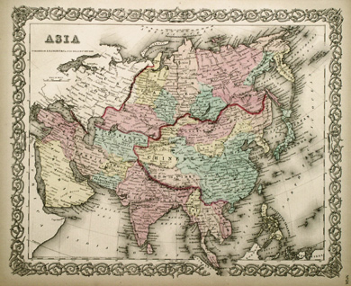 259rus: This is a hand colored Colton's map of Asia from 1856. The areas are done in different pastel colors with each of the empires marked. The entire Chinese Empire is outlined as well as marking the borders between Asia and Europe. There is a beautiful engraved border with the tip of Malasia breaking down into the border. 14.5x17.5in. $80 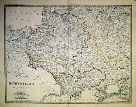 260rus: This detailed map was done in 1868 by Keith Johnston. The full title of the map reads, " SOUTH-WEST RUSSIA Showing the extent of the Kingdom of Poland previous to its partition in 1772." The scale in the bottom left corner is done in: geographical and Italian miles, Russian versts, Polish miles, Austrian post miles, Austrain statute miles, Prussian miles and English statue miles. The topography is very detailed with mountains, streams, rivers, canals and lakes all shown. The different sections of Russia are divided by pastel boundaries with each area labeled. There is a simple reference grid in the engraved border. 19.5x24.5in. $80  261rus: 1864 Johnson's hand colored map of Russia with a beautifully detailed engraved border. Each of the diffferent provinces are outlined and colored in a different pastel color. Province names are marked as well as towns, villages and battlefields. The map is done in English. 18x14in. $40 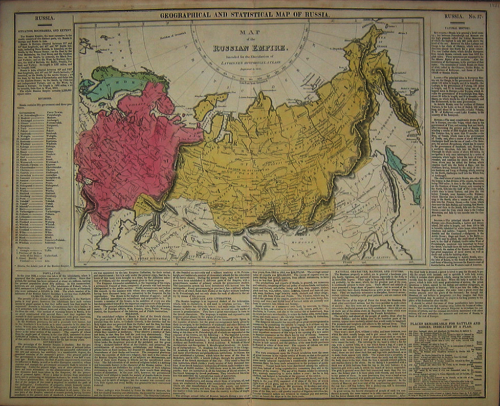 262rus: 1821 map titled, "Map of the Russian Empire Intended for the Elucidation of Lavoisne's Historical Atlass engraved in 1821." It is divided into Russia in Europe and Russia in Asia with each area in a different pastel color. Surrounding the map is descriptive text on population, education, religion, govenment, etc. 17.5x22in. $100  263rus: Spectacular map done in 1747 by Bowen. The wonderfully engraved cartouche reads, "A New & Accurate map of the Whole Russian Empire as contain'd both in Europe and Asia." This map is full of details showing mountains, forests, rivers as well as province and city names. The text is in English and the key at the bottom is in English miles. 15x20in. $250 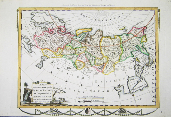 264rus: 1778 hand-colored steel engraved map of the Russian Empire from Moore's New and Complete Collection of Voyages and Travels. There is a wonderful cartouche in the lower left corner with trees, animals and a waterfall surrounding it. The cartouche reads, "A New and correct Map of the Russian Empire as Comprehended in Europe and Asia from the best Authorities and Latest Improvements." Each of the provences or governments are outlined and colored differently with the Arctic Circle accented as well. The map has wonderfully engraved tassels in the upper corners and a nautical themed salloped design below the botom of the map. 9.25x14in. $90 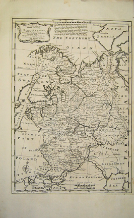 265rus: 1770 copper engraving of Russia in Europe. The lovely engraved cartouche reads A New & Accurate map of MOSCOVY or Russia in Europe with its Aquisitions ... by Bowen." This detailed map shows the different Kingdoms, Provinces and towns as well as rivers and seas. A simple compass rose is in the lower left corner. 16.5x10in. $80 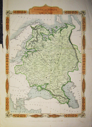 266rus: From the London Printing and Publishing Compcany we get this 1850 hand-colored map titled, " Russia in Europe showing the territorial acquisitions since the time of Peter the Great." Acquisitions from Turkey, Sweden, Poland and Persia are all marked along with the date of their acquisition. Major cities are marked as well as mountains and rivers. There is a wonderfully detailed engraved border surrounding the map that is also colored. The left margin of the map is partially missing on the upper edge which woud not interfere with framing. 15.5x11in. $40 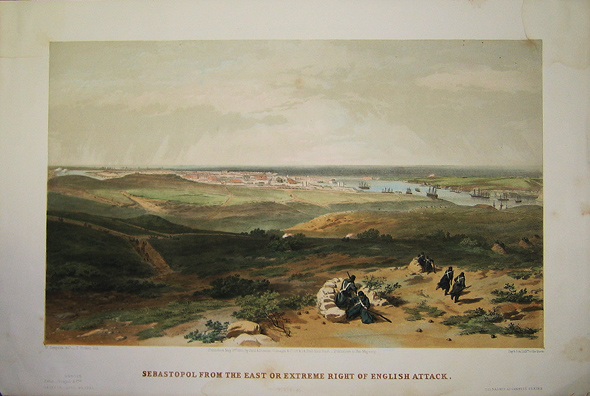 268rus: This lithograph from 1855 shows the attack on Sebastopol located on the Black Sea. There is wonderful coloring as well as detailing of the town, harbor and ships in the distance. There are slight stains in the upper and right margins of this print that should not show once framed.14.5x22in. $200 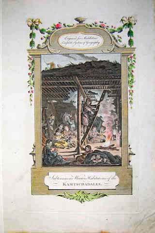
272rus: 1778 Picture of the Winter Habitations of the Kamtschadales. Beautifully hand colored engraved image titled,"Subteraneous Winter Habitations of the Kamtschadales," from Middleton's Complete System of Geography. Shows the people of Kamschatka in their winter habitation. 14 x 9in. $80 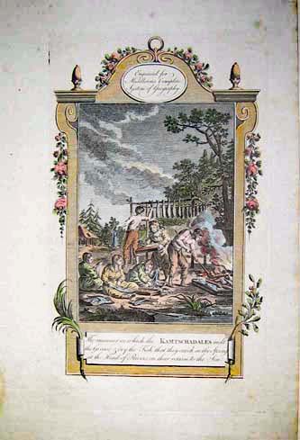 273rus: 1778 Image of Kamtschadales preserving the fish they've caught. Elegant hand colored engraved image titled, "The Manner in Which the Kamtschadales Melt the Grease and Dry the Fish that they Catch in the Spring at the Head of Rivers on their Return to the Sea," from Middleton's Complete System of Geography. Shows the Kamschadales preserving the Fish they've caught. 14 x 9in. $80 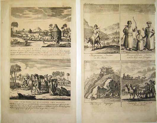 274rus: Gorgeous images of the Tartars daily life. Intricate images titled, "A Tartar Camp in Motion, The Ceremony of Blessing the Horses, Targazinian Tartar on Ox-Back, Xixigarfchian Tartar with his Wife and Daughter, The Temple Tugangu and Samojedes Travelling with Harts Sleads." Shows scenes of the Tartars during their everyday life. 16 x 9in. $50  275rus: Early intricate hand colored map of Russia. Gorgeous map titled, "Russia or Moscovy in Europe." This beautiful map shows an early view of Russia and its surrounding neighbors. 10 x 8in. $80  276rus: 1831 Elegant copper engraved map of Russia. This intricate map was published by Samuel Walker in Boston. This beautiful map shows an early view of Russia and its surrounding neighbors. 11 x 8in. $40 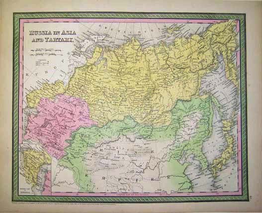 277rus: 1850 Cowperthwait map of Russia. Gorgeous map titled, "Russia in Asia and Tartary." This beautiful map shows an early view of Russian and its surrounding neighbors. 17 x 14in. $120 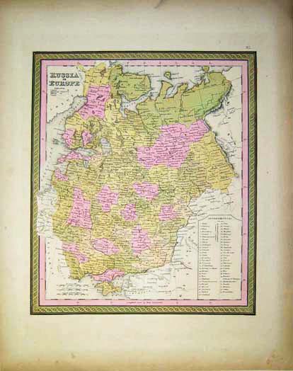 278rus: 1850 Cowperthwait map of Russia. Elegant map titled,"Russia in Europe." This beautiful map shows an early view of Russian and its surrounding neighbors. 17 x 13in. $100 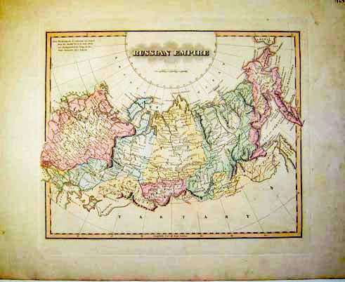 279rus: 1823 Intricate hand colored map of the Russian Empire. Map is titled, "Russian Empire." Shows image of the early Russian Empire. 15 x 12in. $150 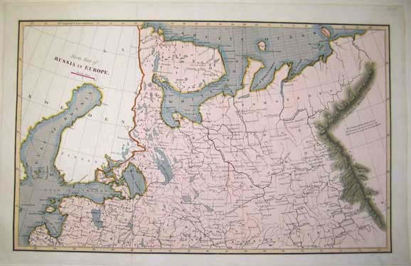 280rus: 1812 hand colored map of Russia. Intricate map titled,"North Part of Russia in Europe." Shows the Uralian Mountains and the Arctic Ocean. 17 x 11in. $120  281rus: Map of Russia by de Vaugondy. Gorgeous map titled,"Partie Meridionale de la Russie Europeenne Tartarie Russienne Petite Tartarie," by Robert de Vaugondy. Early views of Russia and the surrounding neighbors. 17 x 12in. $120 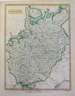 282rus: 1805 Intricate hand colored map of Russia. Gorgeous map titled,"Russia in Europe," published by Cadell and Davies. This beautiful map shows an early view of Russia and its surrounding neighbors. 10 x 8in. $80 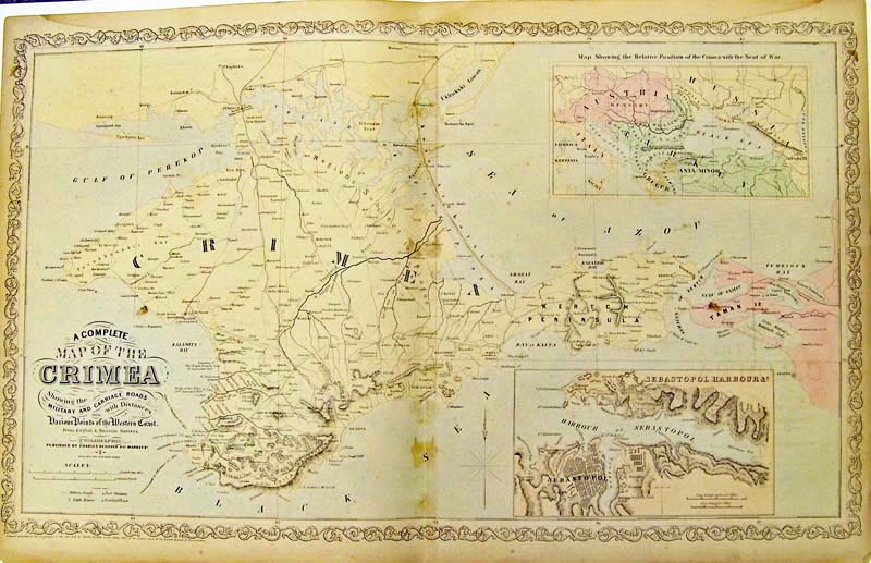
283rus: 1856 Large Crimea Map - Desilver. "Complete map of the Crimea, showing the Military and Carriage Roads." Inset of Sebastapol and inset showing the area of war. There are four light discolorations along the center fold. 27 x 17 in. $165 |
|||||||||
| Order Form | |||||||||||
| Back to Homepage | |||||||||||