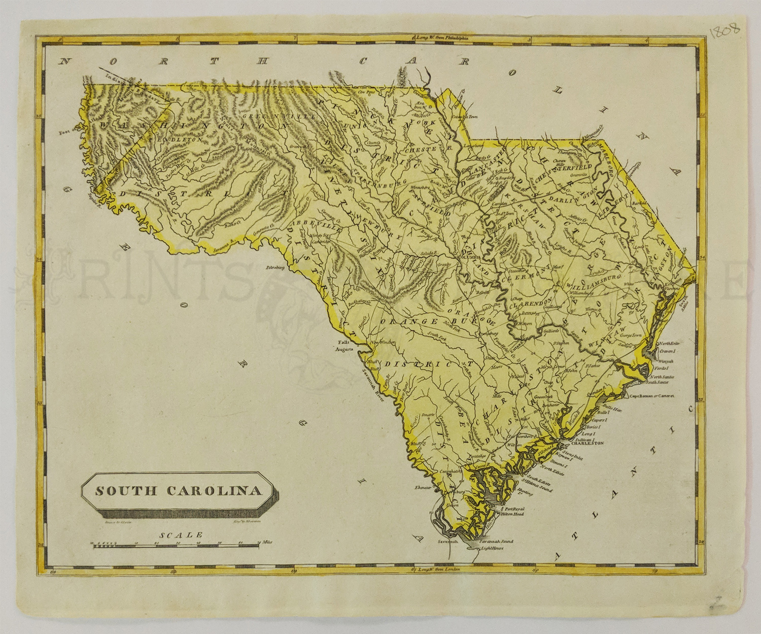
000SouthCarolina:
South Carolina, Samuel
Lewis 1808 Hand colored copper engraved small early map of
South
Carolina by Samuel Lewis engraved by D. Fairman circa 1808.
Counties, towns, rivers
and roads are noted.
Condition: Very good.
10.75 x 8.5 image.
$450

002sc:
1862 Port Royal South Carolina. Six views of area during Civil War era.
Black and white engraving from Harper's. 16x11 in. $30
006sc:
Civil War South Carolina views. Large sepia litho views
of Charleston Harbor during Civil War.
29x18 in. $100
008sc:
1919
South Carolina Railroad Map. Large very detailed map by Rand McNally.
28 seperate railroads listed and shown, plus steamship lines, etc.
Printed in color.
27-1/2x21 in. $100
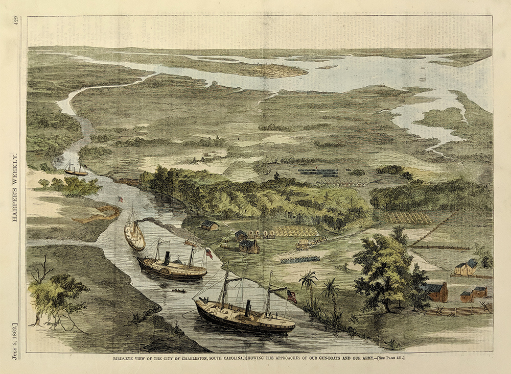
009sc:
1862
Charleston South Carolina view. Bird's-eye view of city showing
approaches of gun boats and army. Hand colored antique engraving from
Harper's. 16x11 in. $50
Check for availability
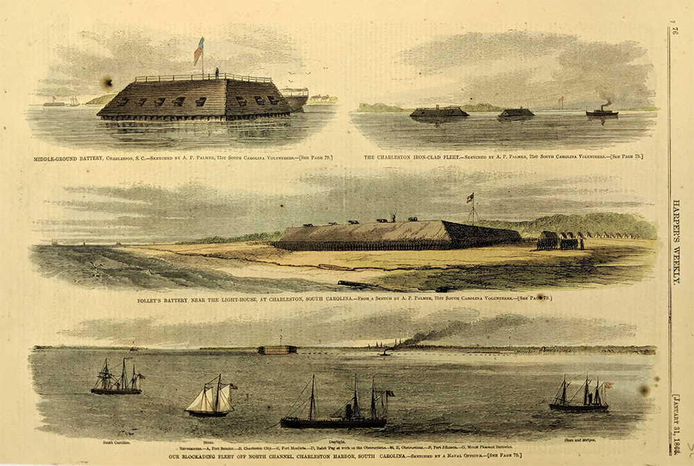
011sc:
1863
Charleston South Carolina Blockade. Union blockading fleet off
Charleston. Several hand colored views from Harper's. (half-dozen small
spots of foxing, but do not interfere) 16x11 in. $40

013sc:
1861
Fort Sumter Interior view. Shows a 10-inch gun mounted as a mortar.
This fort however as soon reduced to rubble as South Carolina artillery
pounded it relentlessly, the first action of the Civil War. Excellently
hand colored.
16x11 in. $50
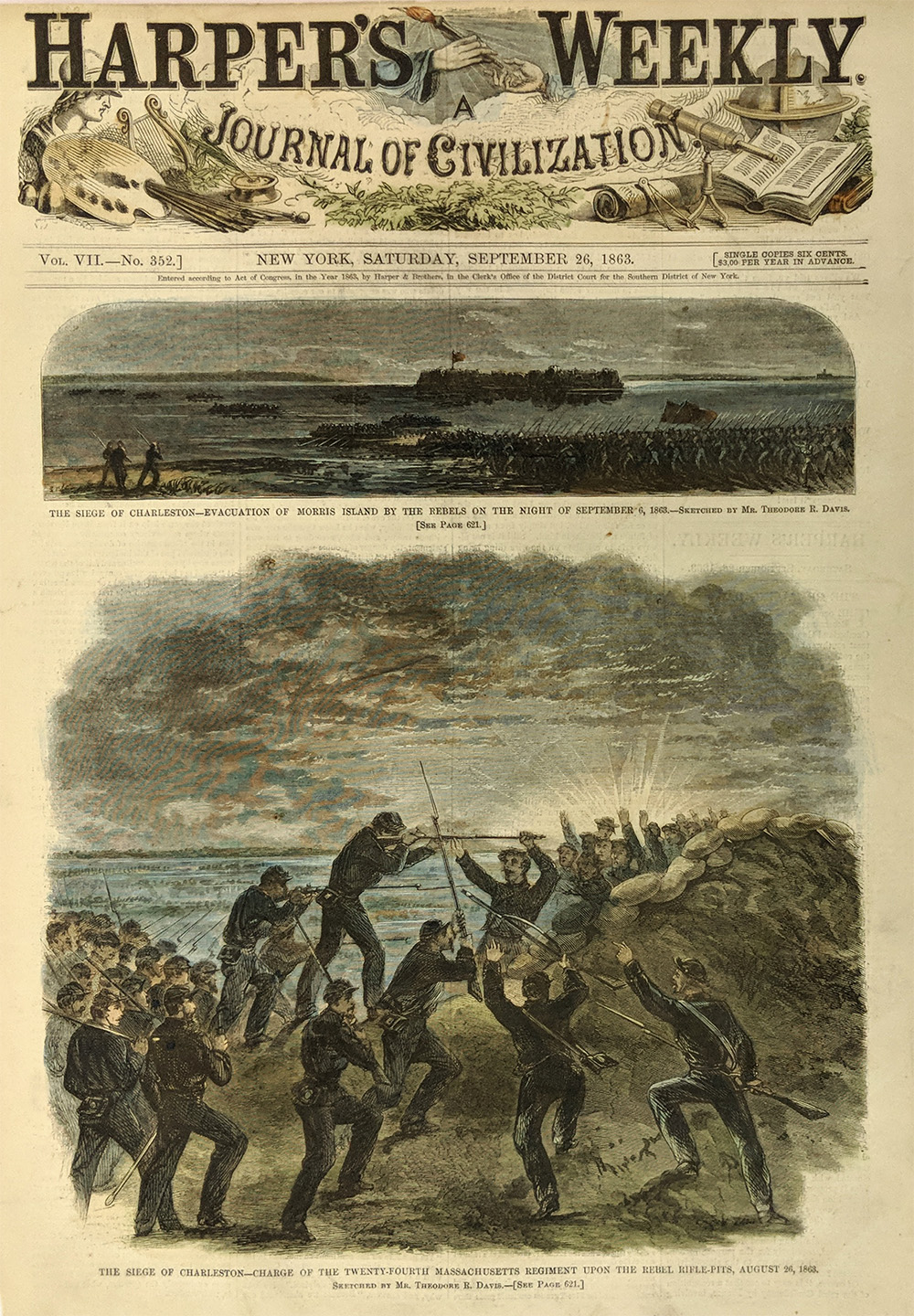
018sc:
1863 Siege of Charleston. Two front page views from
Harper's. Hand colored engravings.
11x16 in. $50
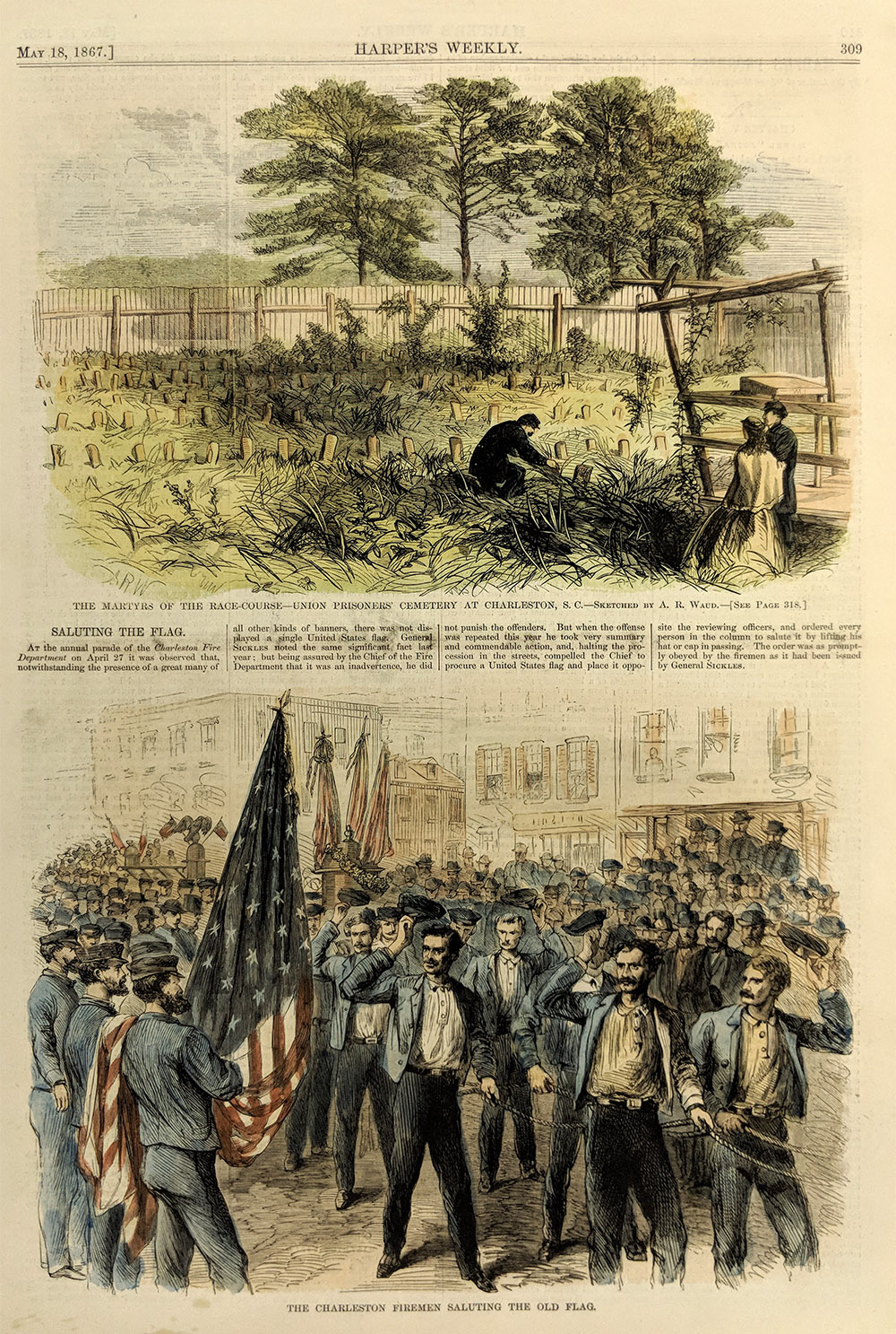
019sc:
1867
Charleston South Carolina. Hand colored views "Martyrs of the Race
Course--Union prisoners cemetary," and "Charleston Firemen Saluting the
Old Flag." Harper's. 11x16 in. $40

020sc:
1860 Winslow Homer's depiction of the
seceding South Carolina delegation to Congress on the eve of the Civil
War. Original wood engraving featured in Harper's Weekly, A Journal of
Civilization.
16 x 11 in. $50
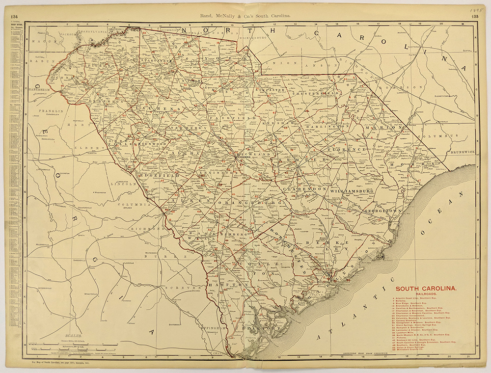
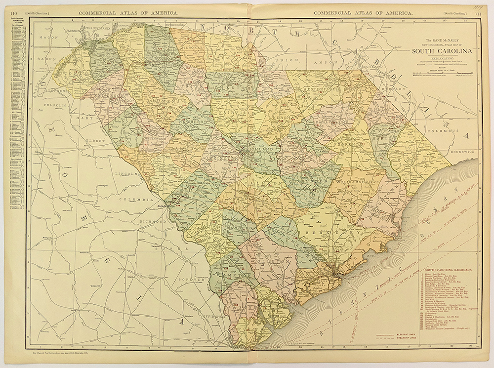
101sc: 1895
Railroad Map of South Carolina. Large map, published by Rand McNally
& Co. Shows the locations and names of each railroad line in
the
state. A key in the left margin gives the locations of chief cities.
20x27 in. $100

102sc:
1927
South Carolina Map. Small, color map, published in a 1927 world atlas
and gazetteer. Cities, towns and railroad lines are shown throughout
the state. 6x9 in. $20
103sc:
Large
1920 South Carolina Map. Color map from Rand McNally's 1920 Commercial
Atlas of America. Shows the locations and names of each railroad line
in the state. Locations of electric lines are shown, and steamship
routes are marked along the coast. Also shows cities, towns and
geographical features.
20x27 in. $100
104sc:
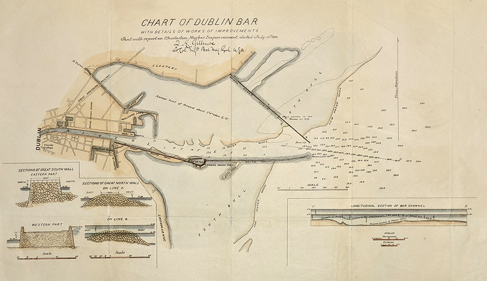
1882
Chart: Dublin Bar, Charleston, SC. Hand colored chart of Dublin Bar,
near Charleston, South Carolina, published by the US government in
1882. Title is "Chart of Dublin Bar with Details of Works of
Improvements. Sent with Report on Charleston Harbor Improvement, Dated
July 15, 1881." Includes cross section views of sea walls along the
bar, and a longitudinal section of the bar channel. 12x19 in. $80

241Chaleston:
"Fort Moultrie (Sullivan's Island). Charleston, South Carolina, in the
Distance." 1860 Harper's Weekly. Hand colored, wood engraving.
11 x 16 in. $80

020ndis: 1886
Hand colored wood engraving from the Harper's Weekly Supplement showing
four views of "The Earthquake at Charleston," with buildings turned to
rubble, displaced families and the earth's fissure on the line of
Charleston and Savannah railroad.
15-1/2 x 10-1/2 in. $80
|
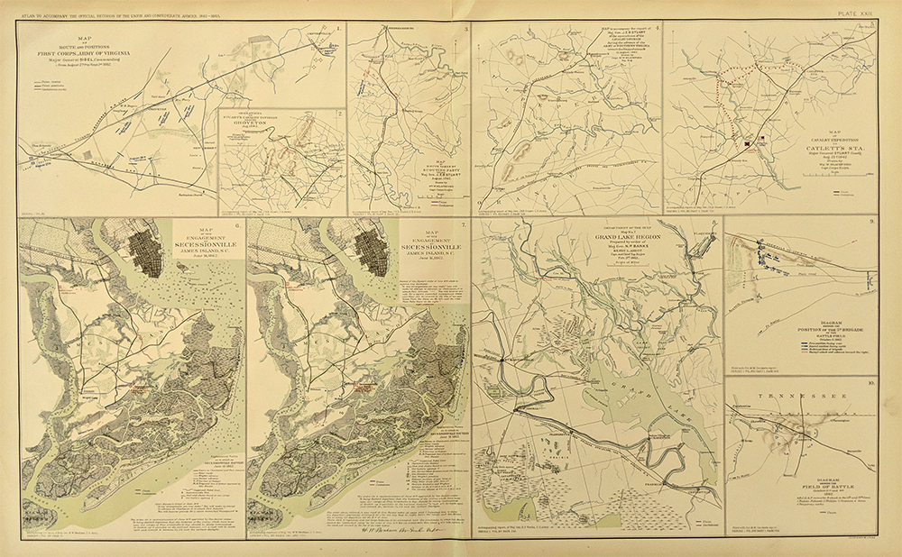
106sc:
Civil War Map of South Carolina Localities. Sheet from the Atlas to
Accompany the Official Records of the Union and Confederate Armies,
published by the United States government in 1895. Contains numerous
small maps of battlefields throughout the South, including two detailed
battle maps of the engagement at Secessionville SC in June 1862. 18x30
in. $80
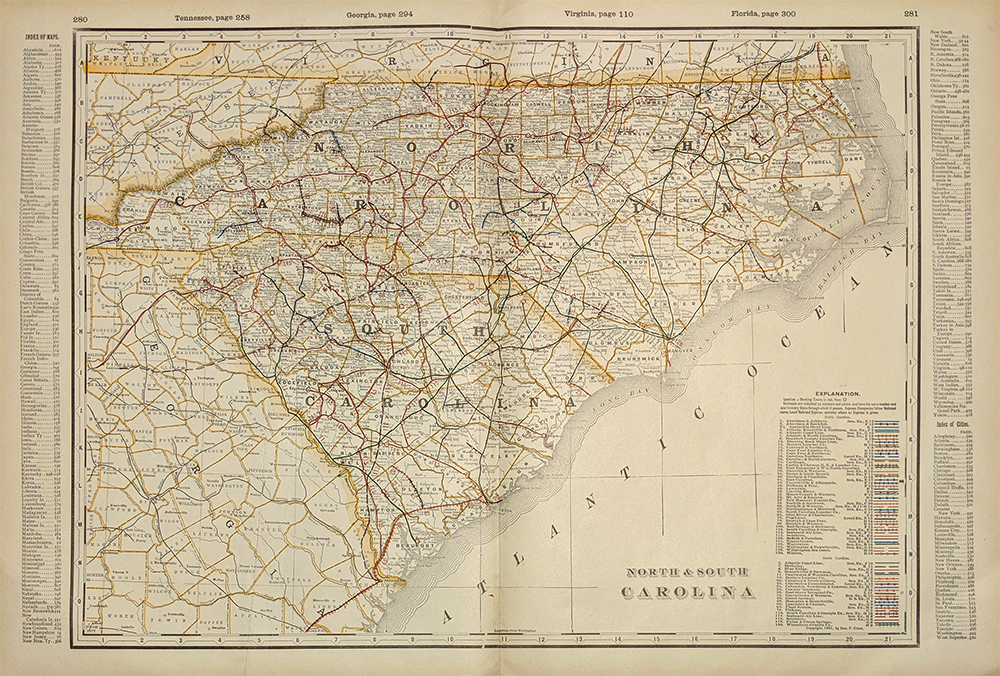
108sc:
1901 Map: North and South Carolina. Map is from the 1901 first edition
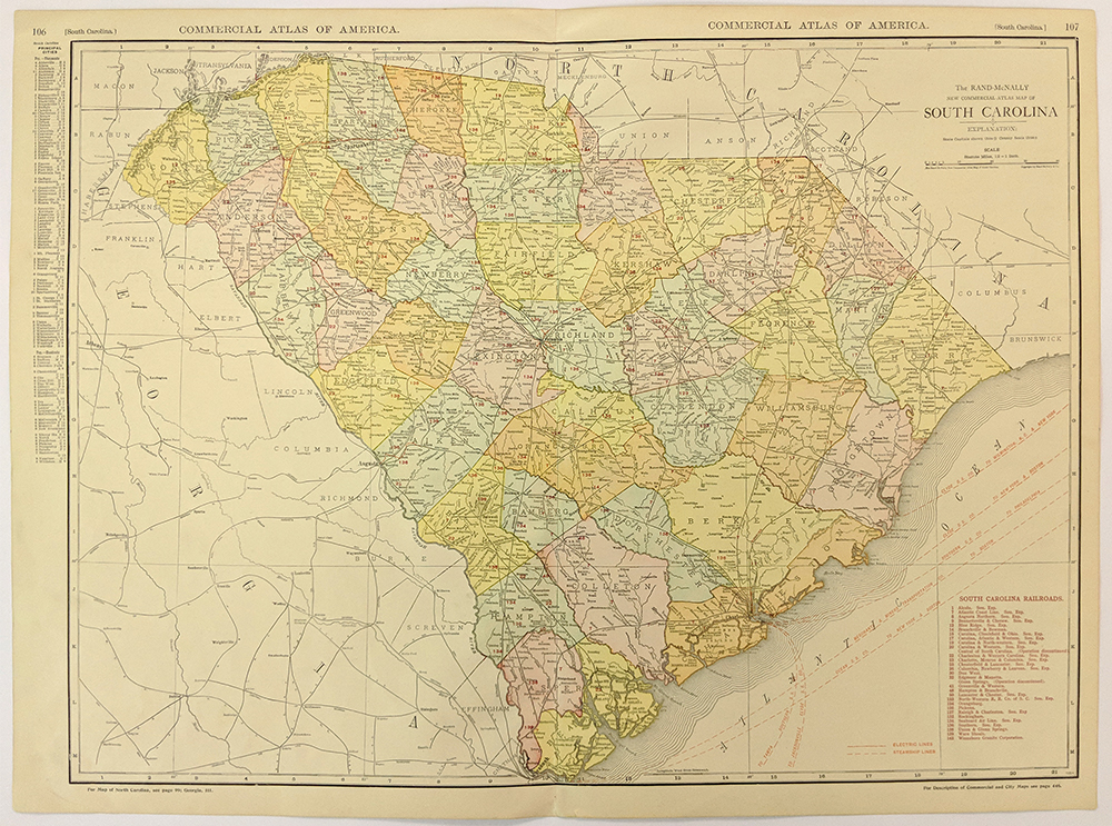
of George Cram's folio-size world atlas. Color coded lines on the map
show the names and locations of railroads throughout the two states.
State and county borders are outlined in yellow. Cities, towns and
geographical features are all shown. This map would look great in a
frame! 18x27 in. $100
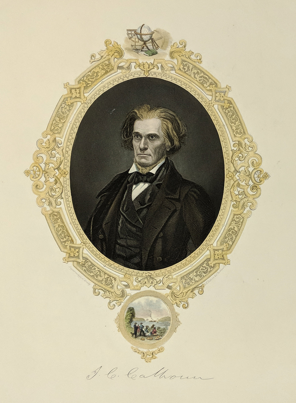
111sc:
1854 Handcolored steel engraving showing aportrait of John C. Calhoun
with a small inset below him of a cotton plantation.
11 x 9 in. $40
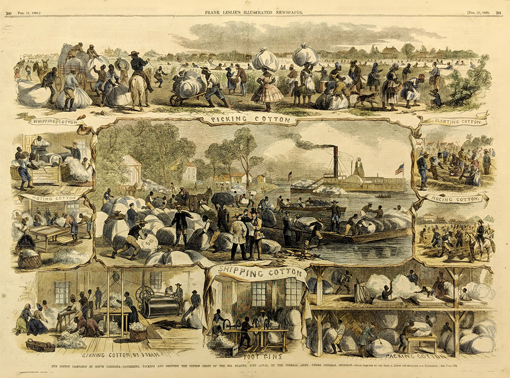
200sc:
1862 Rare - Pt. Royal, Sea Islands, Cotton in Port
Royal South Carolina. Hand colored, woodcut vignettes of slaves
gathering, packing and shipping the crops. Rare Frank Leslie's
engraving.
Very good condition.
16x22 in. $300
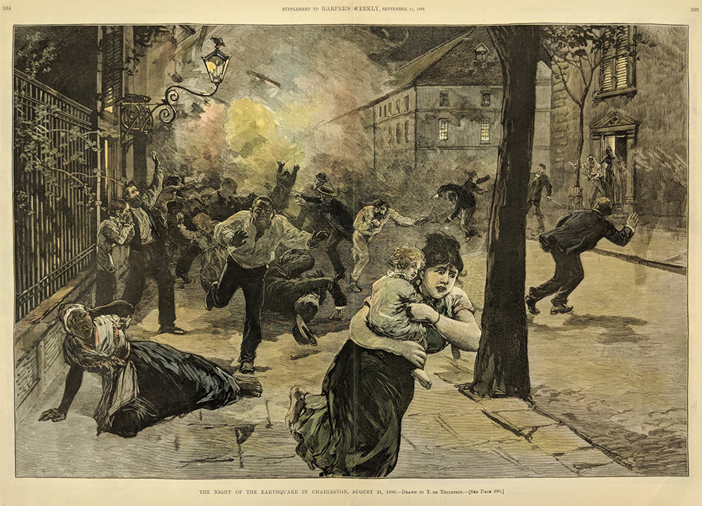
202sc:
1886 Charleston South Carolina Earthquake Scene.
Dramatic, hand-colored engraving from the Sept. 11, 1886 issue of
Harper's Weekly, titled "The Night of The Earthquake in Charleston,
August 31, 1886." Shows chaos and panic in the streets, where people
are fleeing the fires and collapsing buildings.
16x22 in. $120
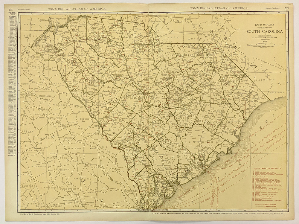
208sc:
1925 Rand McNally Standard Map of South Carolina. Nice
color map includes electric lines, steamship lines, as well as cities
and counties. Each county is outlined and labled. This map would look
great in a frame. 27.5x20.5 in. $100
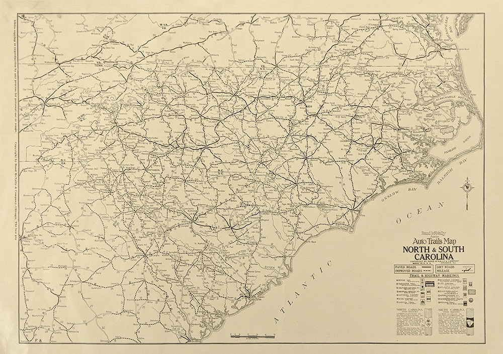
209sc:
1925 Rand McNally Junior Auto Trails Map of North & South
Carolina. Map shows the Highway System, with different lines for paved
roads, improved roads, and dirt roads. At the bottom of the map there
is a section that shows the Trail and Highway Markings.
20.5x14.5 in. $60
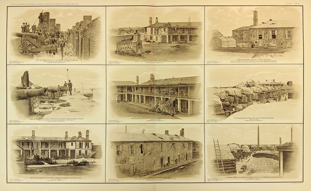
210sc:
Sepia tone views of Fort Sumter and Fort Moultrie. From
the U.S. Government's official atlas of Civil War records. Printed from
photographs taken during the Civil War. 18.5 x 29.5 in. $90
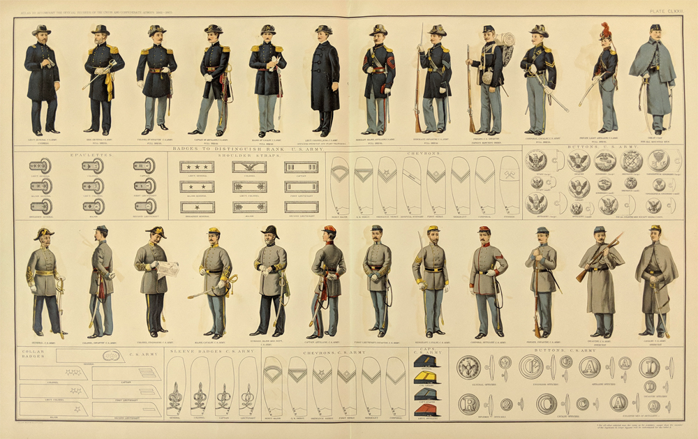
213sc:
Rare double page spread from the Atlas to Accompany the Official
Records of the Union and Confederate Armies. This hand colored
engraving shows various uniforms for both the US Army and the CS Army,
as well as samples of their Chevrons, Buttons, Badges, Caps, and more.
28.5 x 18 in. $300
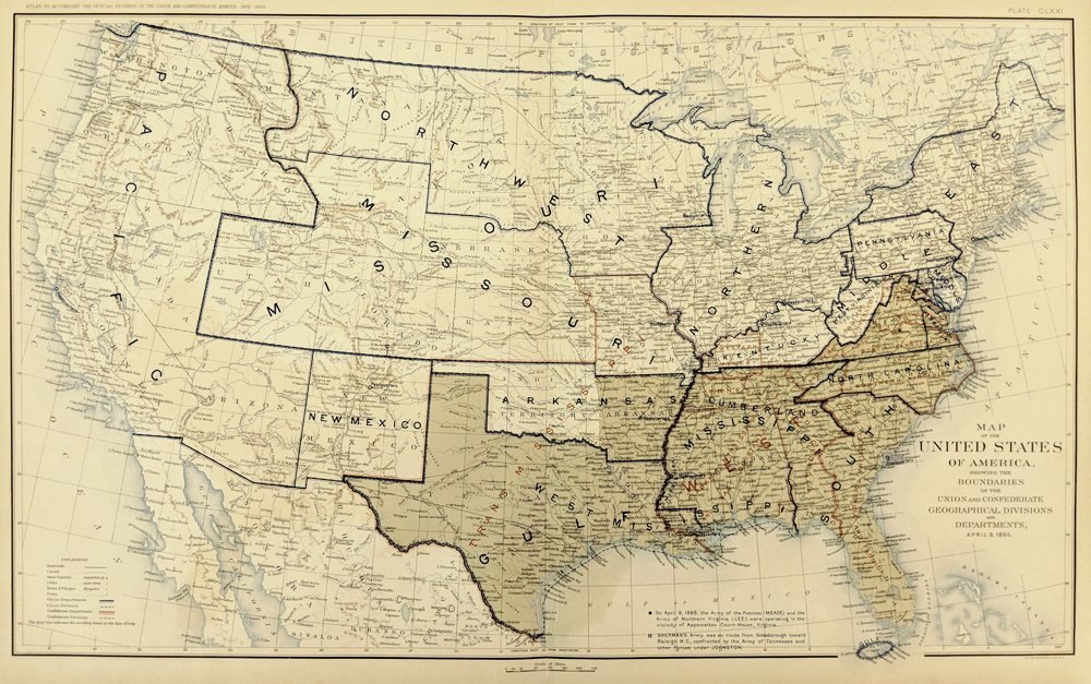
214sc:
Map of the United States of America Showing the Boundaries of the Union
and Confederate Geographical Divisions and Departments, April 9, 1865.
From The Atlas to Accompany the Official Records of the Union and
Confederate Armies.
28.5 x 18 in. $120
215sc:
Sepia tone views of Forts Sumter and Moultrie. Shows interior and
exterior views of the Forts. From the U.S. Government's official atlas
of Civil War records.
28.5 x 18 in. $90
217sc:
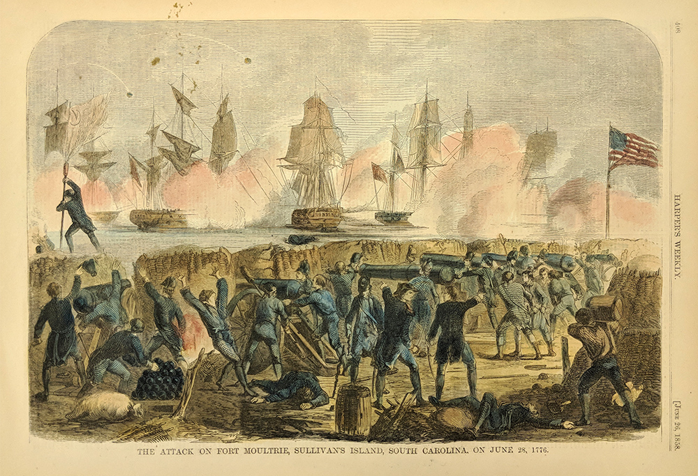
1858 view of the attack on Fort Moultrie, Sullivan's Island, South
Carolina. Dramatic, hand-colored engraving from the June 26, 1858 issue
of Harper's Weekly. Shows fighting on the shore and on the boats in the
distance. 11x16 in. $50
219sc:
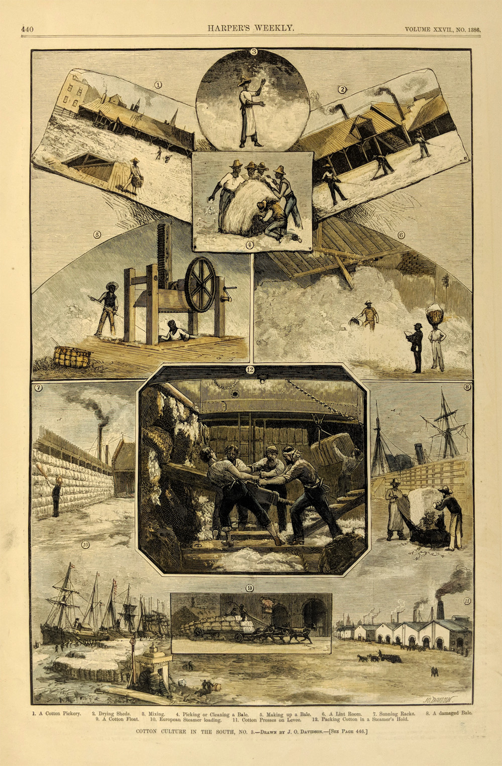
1883 Cotton Culture in the South, No. 3. - Drawn by J.O. Davidson.
Twelve assorted hand colored wood engravings depicting the process of
getting cotton ready for shipment, from beginning to end. Published in
Harper's Weekly on July 14, 1883. Volume XXVII., No. 1386. 11x16in. $80

017jax:
1906 Half-tone showing the Palmetto Guards of Palmetto Camp No. 3.
11-1/2 x 9 in. $30

021ndis: 1886
Hand colored wood engraving from Harper's Weekly showing several views
of the "Incidents of the Earthquake At Charleston," -- Drawn By Schell
and Hogan.
15-1/2 x 10-1/2 in. $80
|

233sc:
Careus Rice 1956 – “My South Carolina Low Country.”
Original scissor cut silhouette by this famous black American folk
artist. Dated and signed in pencil.
Image size: 4 x 6 in.
Overall: 8 x 13 in. $150

234sc:
1856 Ft. Sumpton. Charleston Harbor. 2 views of past Civil War showing
visitors touring. Hand colored, wood engraving.
16 x 22 in. $80
236sc:
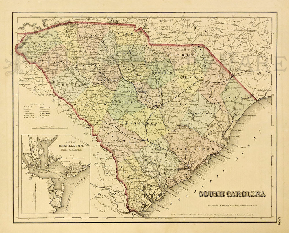
1855 South Carolina Map by J.H. Colton. Railroads, common roads,
canals, district capitals, p.o. and r.r. depots and counties are shown.
Inset: Plan of Charleston, Vicinity and Harbor. Hand colored,
lithograph.
14 5/8 x 17 1/4 in. $175
230NorthCarolina:
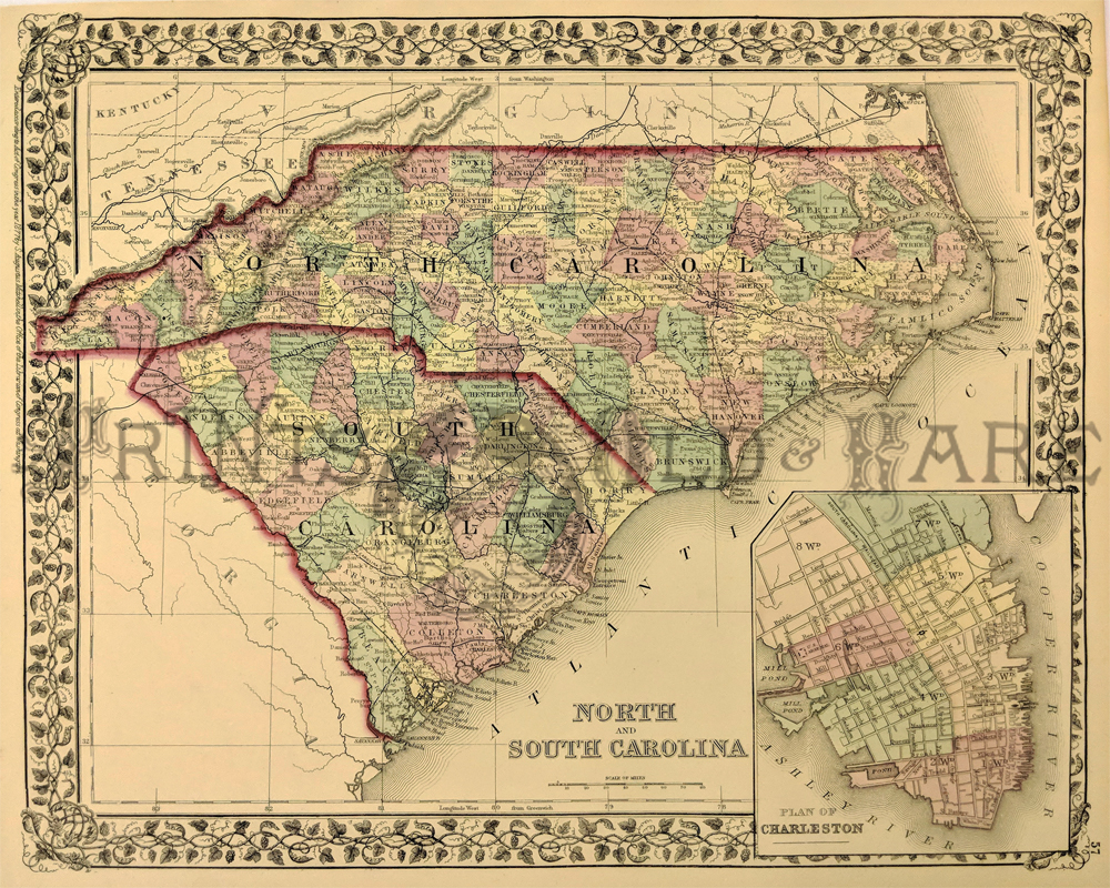
1877 Map of North & South Carolina by Mitchell. Shows names of
counties, cities, towns, transportation routes, rivers, lakes, and
mountain ranges. Regions are distinguished by color. Inset showing the
Plan of Charleston. Hand colored, steel engraving.
12 x 16 in. $160

239nc:
Johnson's 1861 Map of North and South Carolina. Showing the counties,
towns, railroads, lakes, rivers, forts, swamps and islands. Inset plan
of Charleston and Fort Sumter and large vignettes of Table Mountain and
Chimney Rocks and French Broad River.
18 x 27 in. $200

240sc:
Aiken, SC - 1872. Derby Farm Peach Harvest "Picking, sorting and
packing." 2 hand colored wood engraved views.
11 x 16 in. $50

022ndis: 1886
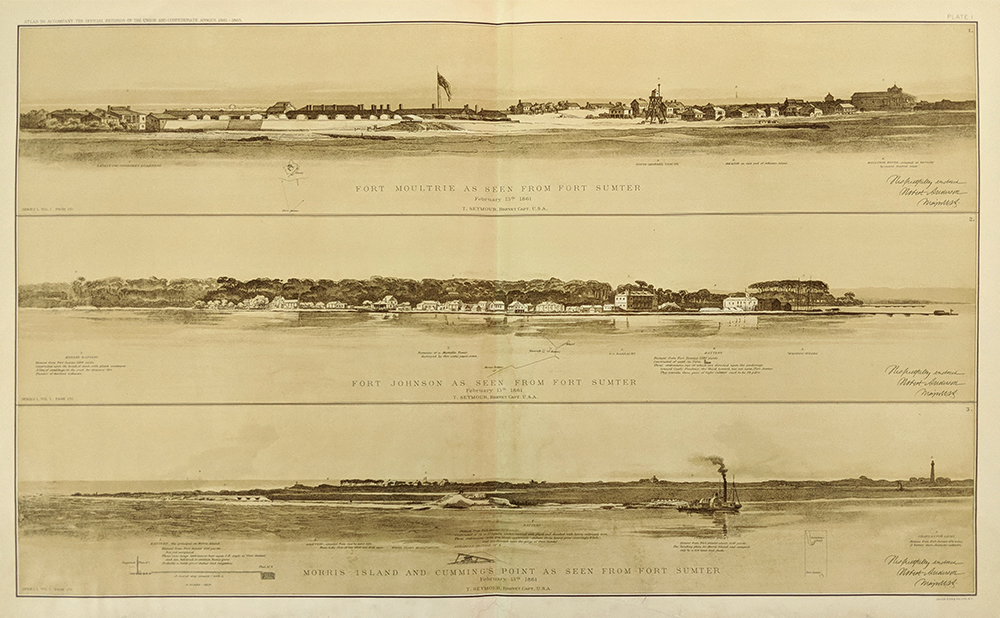
RARE Hand colored wood engraving from Frank Leslie's Illustrated
Newspaper showing, "South Carolina -- The Terrible Earthquake at
Charleston -- Scene After the First Shock."
16 x 11 in. $90

250NorthCarolina:
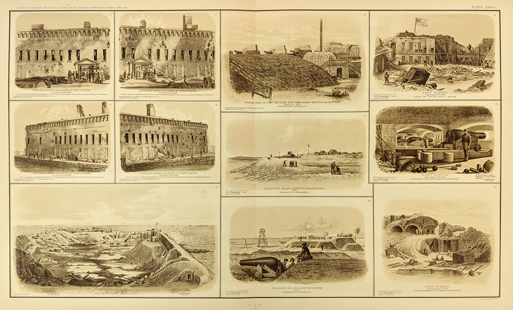
1865 Johnson's North Carolina and South Carolina. Showing the counties,
towns, railroads, lakes, rivers, forts, etc. Inset of Charleston
Harbor. Vignettes of Table Mountains and Chimney Rocks & French
Broad River. Hand colored, lithograph.
18 x 26 5/8 in. $120

265va:
1861 Map of Virginia, North Carolina, South Carolina also Maryland.
Showing Counties, capitals, railroad and canals. Hand colored.
13 x 11 in. $80

242Chaleston:
The House-Tops in Charleston
During the Bombardment of Sumter. Wildy considered to be the first shot
and start of the civil war; people made it a day to see the spectacle,
thinking it would be a quick skirmish not knowing it would be the start
of the Civil War. 1861 Harper's Weekly. Hand colored, wood engraving.
10 1/2 x 15 in. $100
|
|

