|
|||||||||||
This is a small selection of our inventory of antique South Dakota maps and prints. Additional inventory is available. Contact us with your request. 1-800-879-6277
|
|||||||||||
|---|---|---|---|---|---|---|---|---|---|---|---|
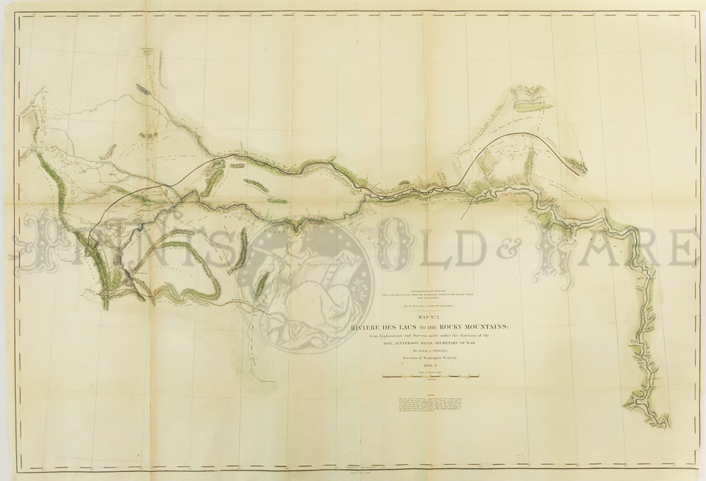
 001sd: 1904 South Dakota Railroad Map. By Rand McNally. Thirteen railroads and their routes shown in this large scale map. 14 x 20-1/2 in. $60 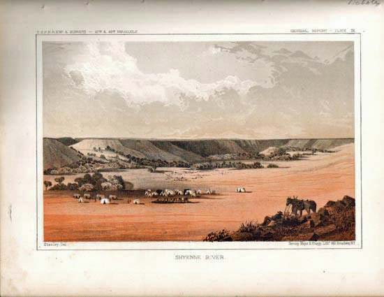 003sd: 1855 Railroad Survey Litho of Shyenne River. Published by the U.S. Government. Among the first views of the then unknown west. 9 x 11-1/2 in. $40 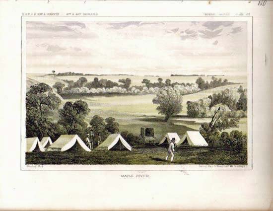
004sd: 1855 Railroad Survey View of Maple River. Lithograph view from U.S. Army expedition across early territory. 9 x 11 in. $40 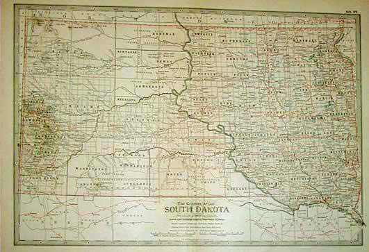
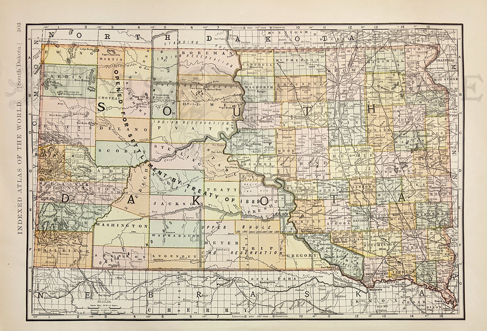
012sd: 1897 Century Atlas Map of South Dakota. Attractive map in litho color. 12-1/2 x 17 in. $30 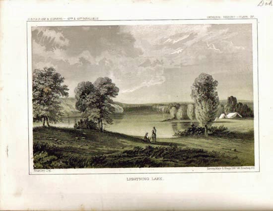
014sd: 1855 Lightning Lake view. Early color litho view from U.S. Railroad Survey expedition. 11-1/2x8-1/2 in. $40 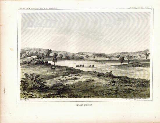
015sd: 1855 Sauk River view. Very early lithographic print from U.S. Railroad Survey expedition. Printed by U.S. Government. 11-1/2x8-1/2 in. $40 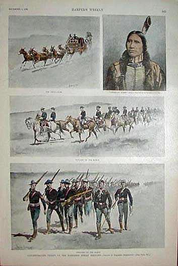 018sd: 1890 Indians and Troops at Pine Ridge. Several antique hand colored views of troops concentrating on the Northern Indian Agencies, by Frederic Remington. Harper's. 11x16 in. $50 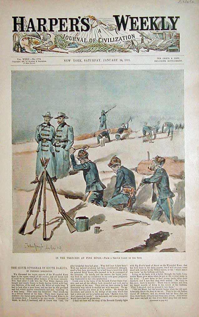
020sd: 1891 Remington Pine Ridge scene. "In the Trenches at Pine Ridge." Antique hand colored Frederic Remington print from Harper's front page. Includes text. 11x16 in. $40 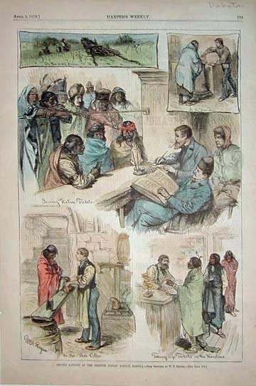
022sd: 1879 Sisseton Indian Agency engravings. Several hand colored views on one page. Shows rations being issued to Indians. 11x16 in. $50 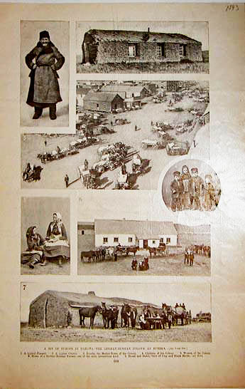
026sd: 1893 German-Russian Colony at Eureka views. Several black & white photo engravings on one page of the settlement. 11x16 in. $40 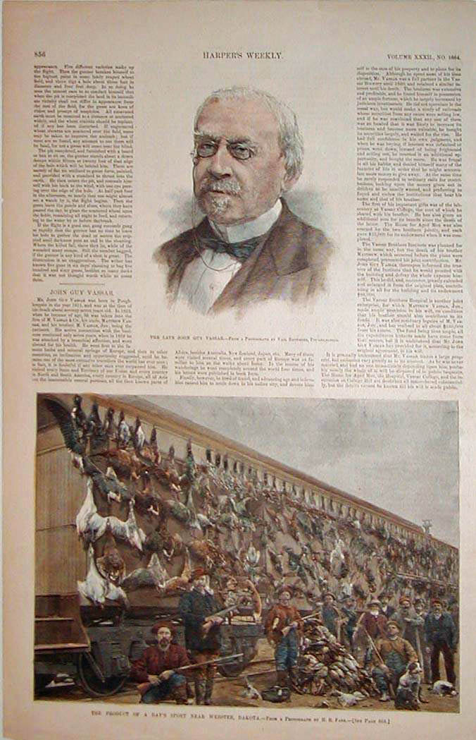
028sd: 1888 Gamebird Hunting in Dakota. Hand colored engraving depicts the return of a hunting party near Webster, Dakota, displaying their tremendous "kill." 11x8 in. $30 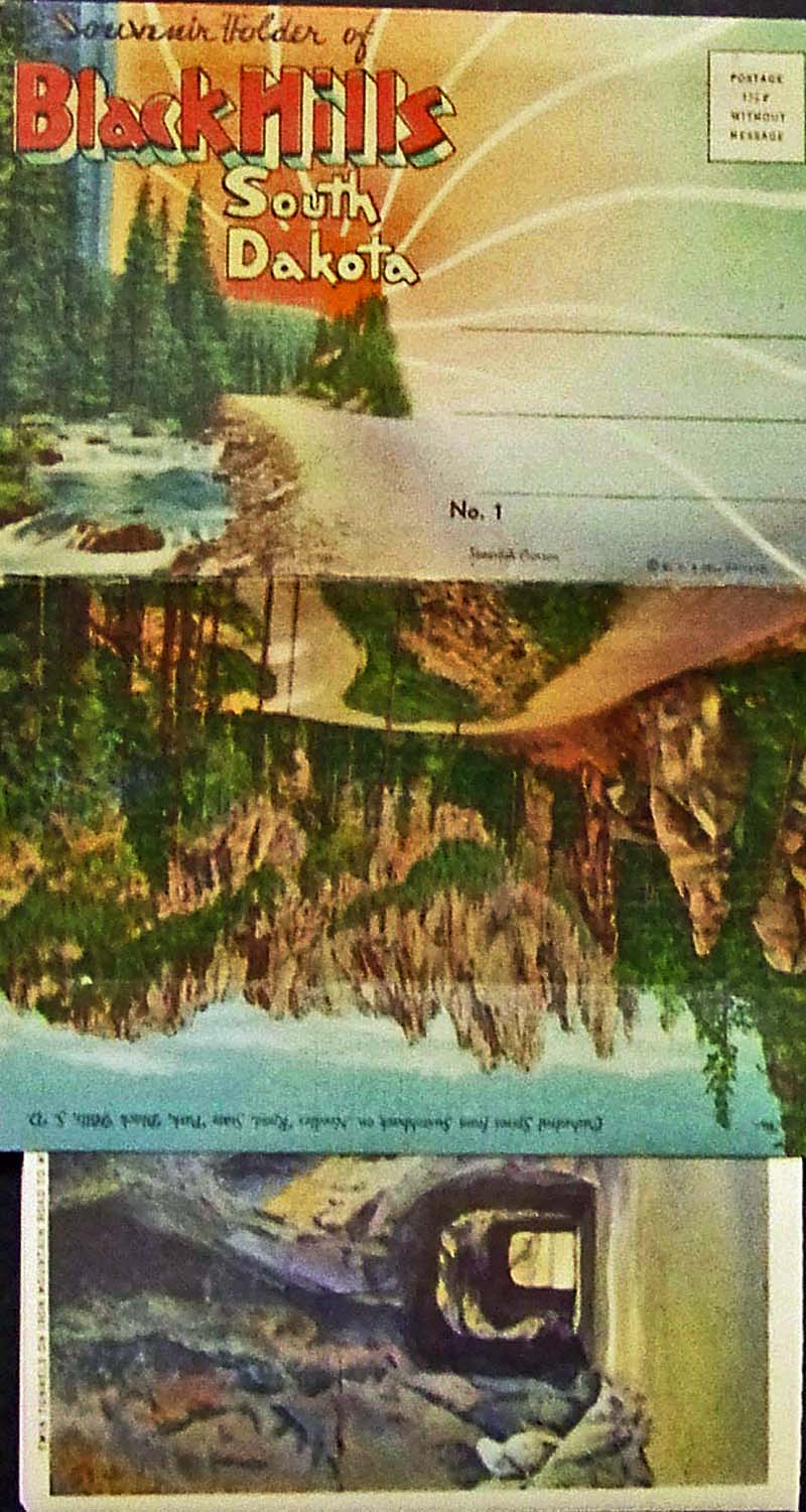 030SouthDakota: C.1936 Souvenir Folder of the Black Hills in South Dakota. About twenty monumental attractions are displayed on attached cards with a description on inside cover about South Dakota. As folded like pictured, it measures: 11 x 6 in. $20 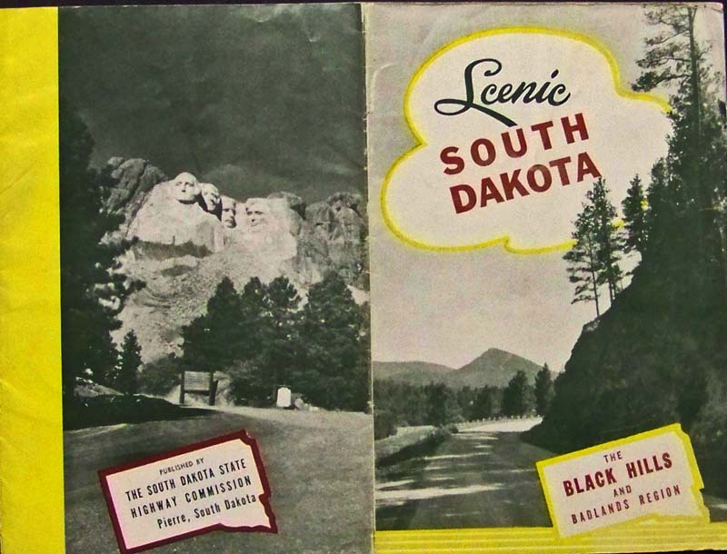
031SouthDakota: C.1950s Scenic South Dakota booklet showing the Black Hills and famous Badlands Region. A Highway map is shown inside as well as numerous points of interest. 9 x 6 in. $20 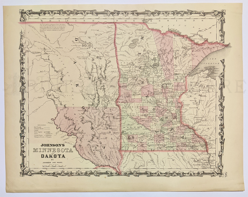 228Minnesota: 1862 Johnson's Minnesota and Dakota. Original hand colored engraved map showing North & South Dakota (pre-split) - also showing rail roads, roads, canals, captitals, counties. 14 x 17 3/4 in. $120 |
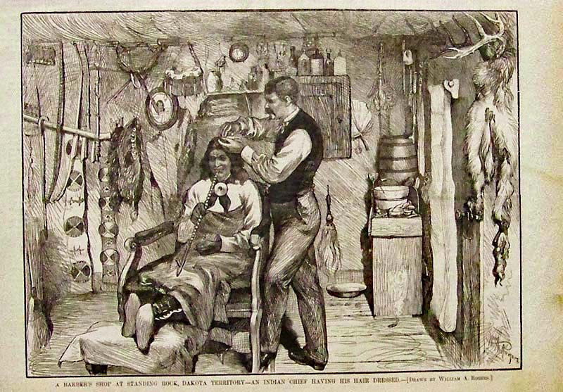 032SouthDakota: 1879 Harper's Weekly wood engraving showing an Indian Chief having his hair dressed as he enjoyes his long peace pipe while sitting in the barber shop at Standing Rock, Dakota Territory. Drawn by William A. Rogers. 11 x 8 in. $30 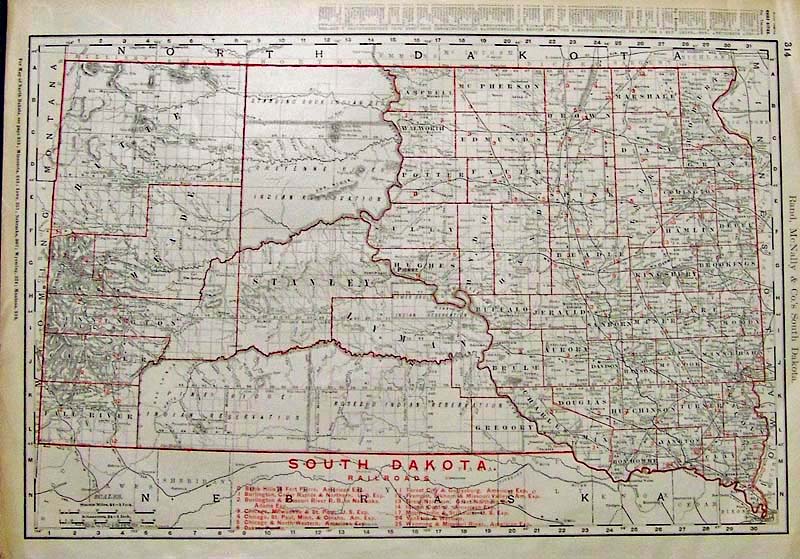
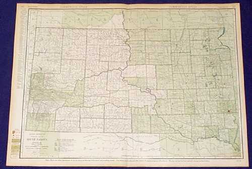
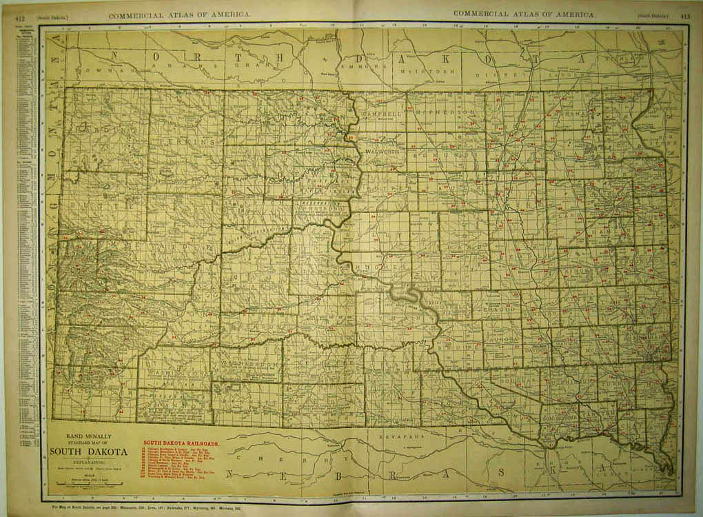
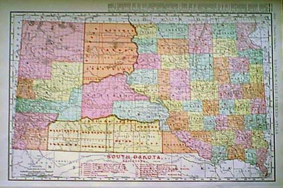
033SouthDakota: 1898 Rand McNally & Co.'s South Dakota map showing all the Railroads with has a Railroad Key on bottom of map. Red outlines. 20-1/2 x 14-1/2 in. $150 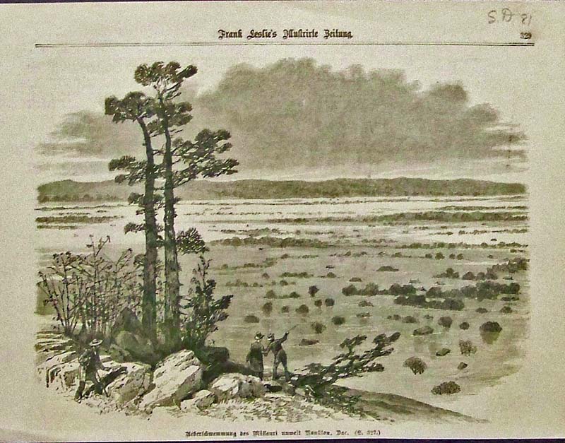
034SouthDakota: 1881 Half-page German issue of Frank Leslie's Illustrated Newspaper showing the flooding of the Missouri River. 11 x 8 in. $30 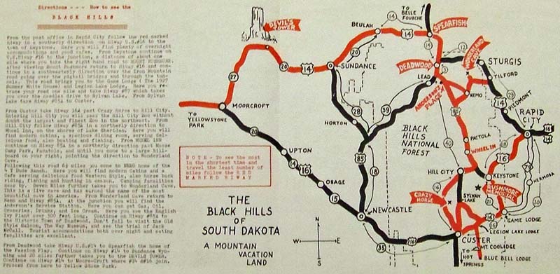
035SouthDakota: The Black Hills of South Dakota -A Mountain Vacation Land map showing attractions in Black Hills National Forest, Mt. Rushmore Memorial, Davil's Tower and surrounding cities. This brochure also shows images of cave formations in the area. Unfolded, it measures: 20 x 10 in. $20 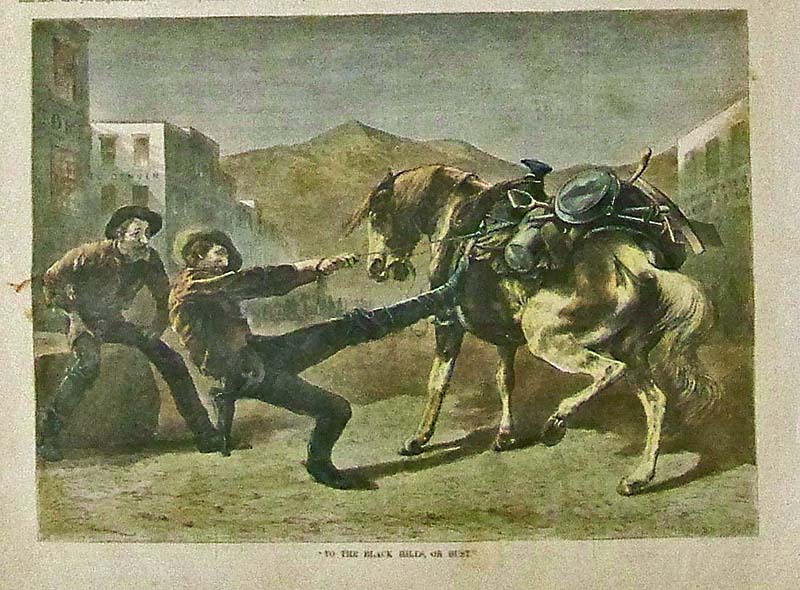
036SouthDakota: 1876 Harper's Weekly hand colored wood engraving titled, "To the Black Hills, or Bust." 10 x 8 in. $40 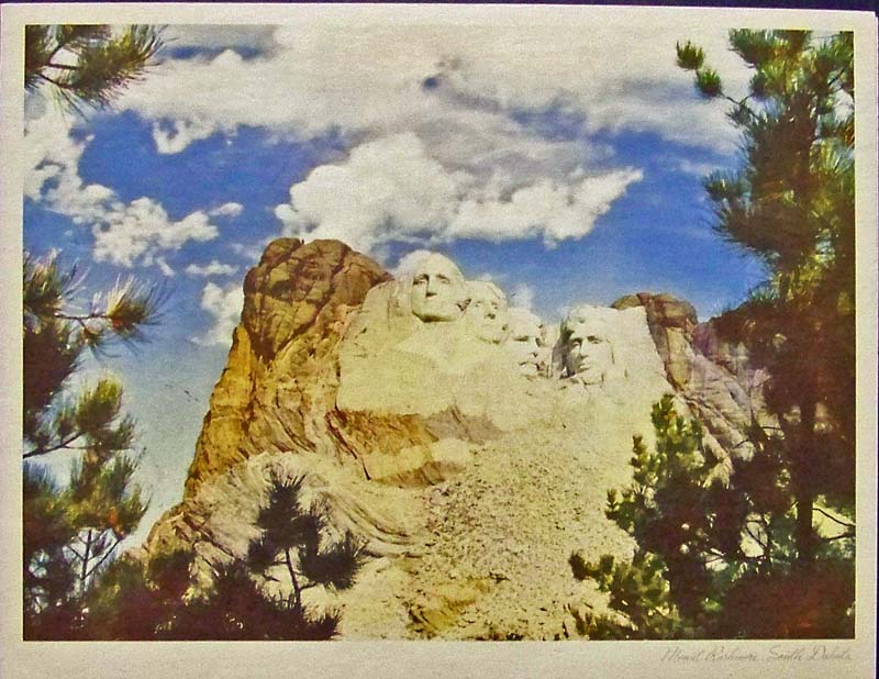
037SouthDakota: 1942 Color image of Mount Rushmore, South Dakota. This was published by the Standard oil Company for one of its folio series for the interest of better appreciation of the West. Inside image are facts about Mount Rushmore and vicinity and backpage details the story behind Mt. Rushmore. 13 x 10 in. $25 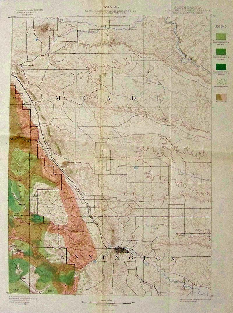
038SouthDakota: 1891 Color lithograph by Julius Bien & Co. showing Plate XIV of the Land Classification and Density of Standing Timber for the South Dakota Black Hills Forest Reserve Rapid Quadrangle as part of the U.S. Geographical Survey. 20 x 15-1/2 in. $40 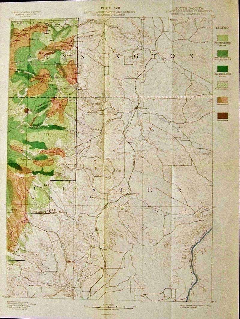
039SouthDakota: C.1892 Colol lithograph by Julius Bien & Co. showing Plate XVII of the Land Classification and Density of Standard Timber by the U.S. Geological Survey for the South Dakota Black Hills Forest Reserve Hermosa Quadrangle. 20 x 15 in. $40 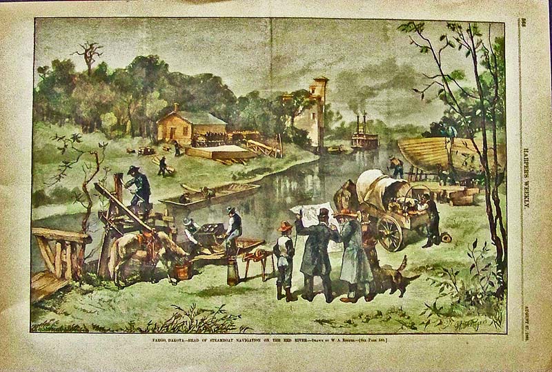
040SouthDakota: 1881 Harper's Weekly hand colored wood engraving titled, "Fargo, Dakota -- Head of Steamboat Navigation on the Red River." Drawn by W.A. Rogers. 16 x 10-1/2 in. $60 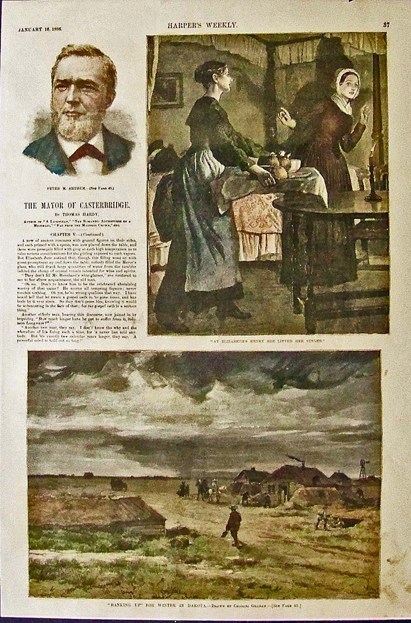
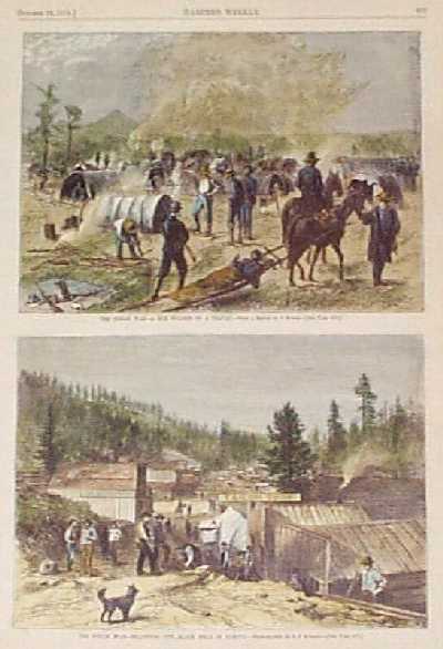
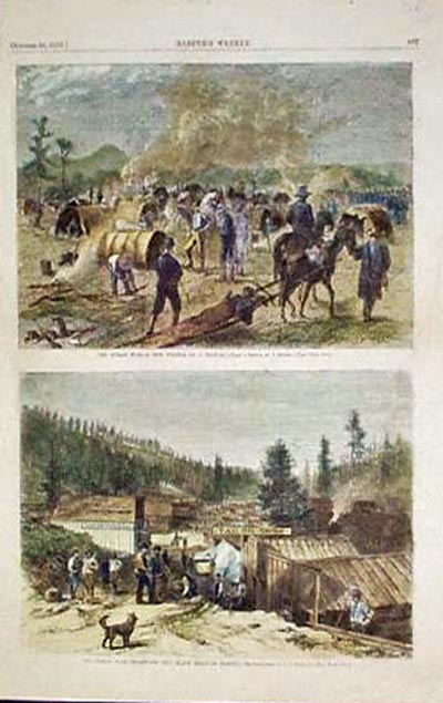
041SouthDakota: 1886 Harper's Weekly hand colored wood engraving showing in bottom image, "Banking Up" For the Winter in Dakota." Drawn by Charles Graham. 15-1/2 x 10-1/2 in. $60 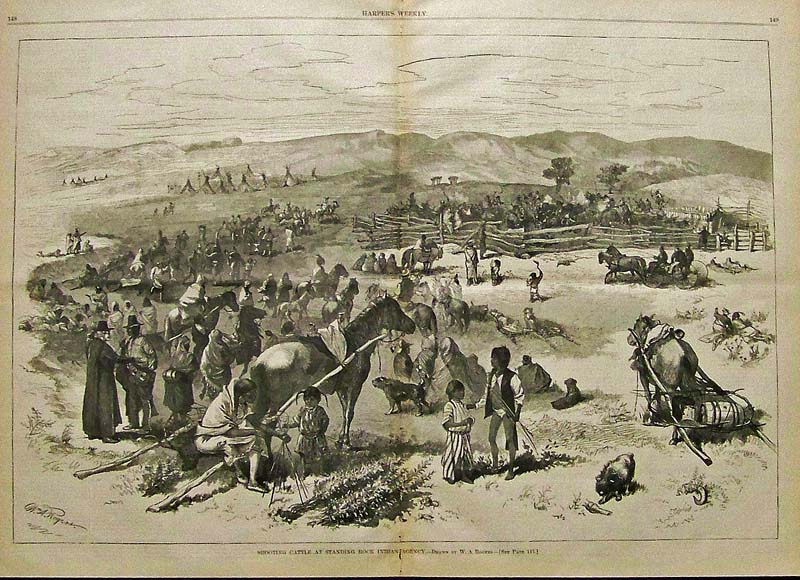
042SouthDakota: 1879 Wood engraving signed by W.A. Rogers titled, "Shooting Cattle at Standing Rock Indian Agency." Featured in Harper's Weekly. 21-1/2 x 16 in. $120 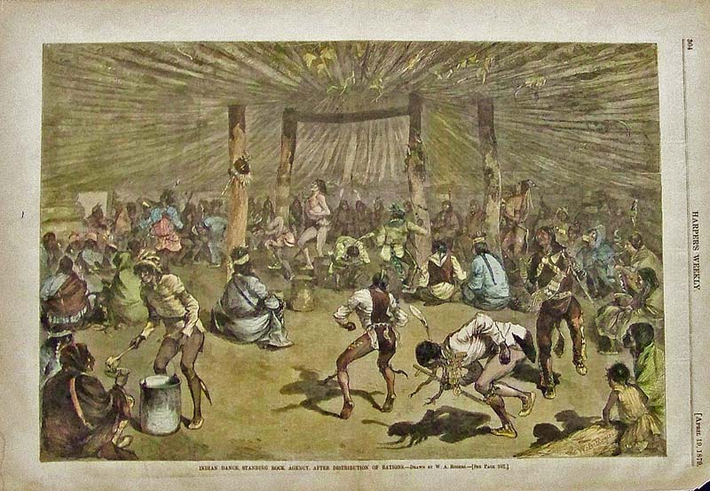
044SouthDakota: 1879 Harper's Weekly hand colored wood engraving showing Indian Dance, Standing Rock Agency, After Distribution of Rations. Drawn by W.A. Rogers. 16 x 11 in. $50 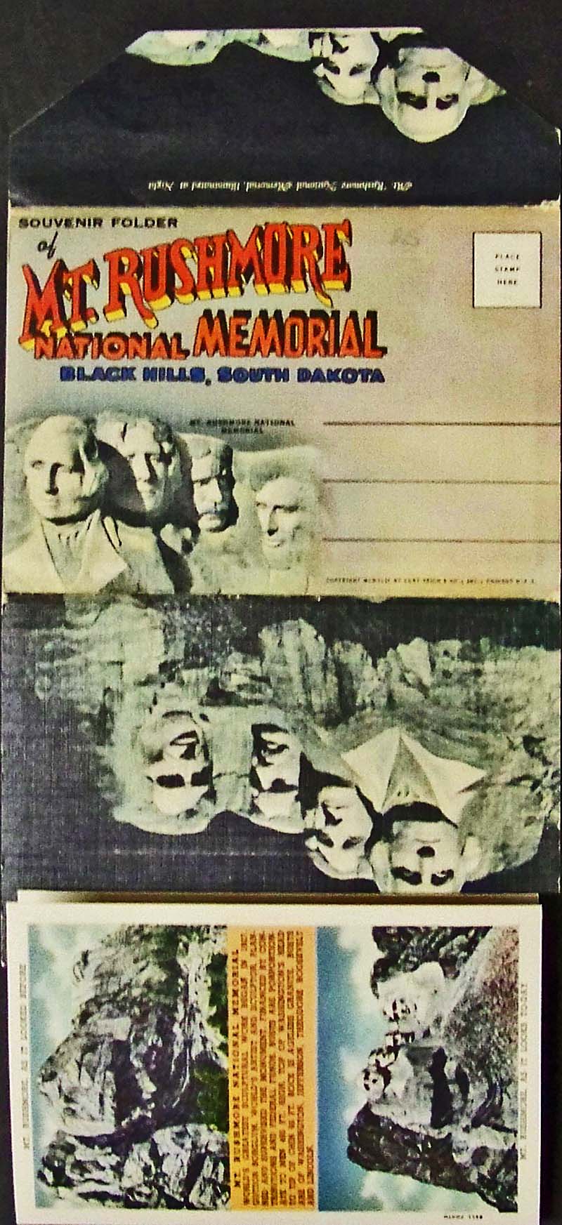
045SouthDakota: C.1949 Mt. Rushmore National Memorial Souvenir Folio for the Black Hills, South Dakota. Eighteen views and images for the memorial is included in the folio. Measured like image shown: 11 x 6 in. $20 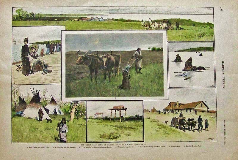
046SouthDakota: 1889Harper's Weekly hand colored wood engravings showing The Great Salt Lake of Dakota. Drawn by H.F. Farny. 16-1/2 x 11-1/2 in. $50 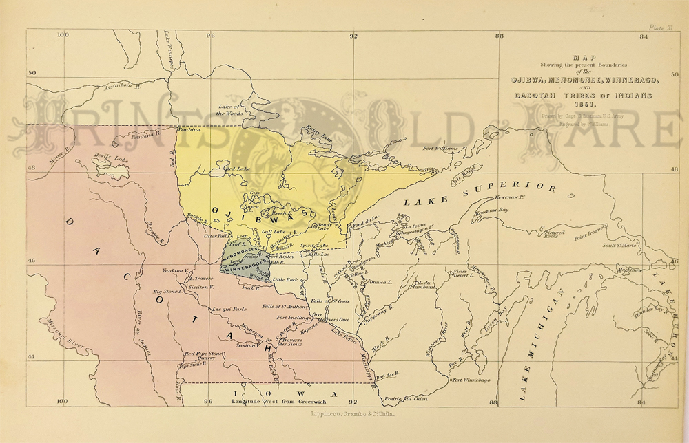 224Minnesota: Dacotah and Ojibwa boundary. Also, Menomonee and Winnebago. c.1850 by Seth Eastman from Schoolcraft’s History. Hand colored engraving. 9 x 13 $90 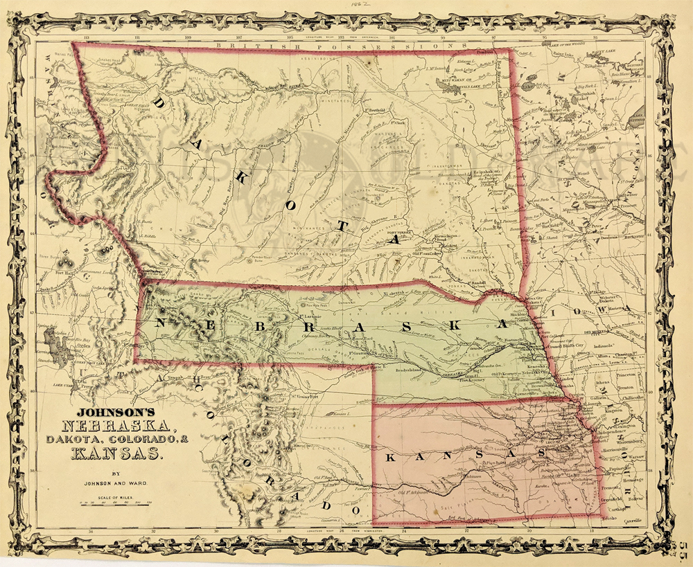 213Nebraska: 1862 Johnson's Nebraska, Dakota, Colorado, & Kansas. Showing an early configuration of the region, Nebraska extends as far as Salt Lake City. Northern half of the region is shown as part as the Dakota Territory, one year before the Idaho Territory was broken off. Other details include rivers, towns, forts, Indian tribes and trails. Hand colored, lithograph. 12 1/2 x 15 3/8 in. $300
|
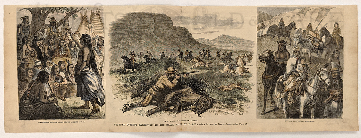 215sd: Custer’s Expedition to the Black Hills of Dakota 1874. (2 years before the big battle.) 3 vignettes Comanche's & Apaches – Council of War, a scout being surrounded by Apaches and a party of Cheyenne. Hand colored wood engraving. 7 x 22 in. $60
|
|||||||||
| Order Form | |||||||||||
| Back to Homepage | |||||||||||