 |
|||
|
Sweden This
is a Small Selection of our Huge Inventory of |
|||
|---|---|---|---|
|
home |
|||
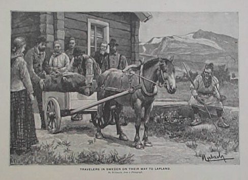
001swe: 1892 Swedish Travelers. Engraving published as an illustration to a book in 1892 shows travelers in Sweden on their way to Lapland. 8 1/2x11 in. $30 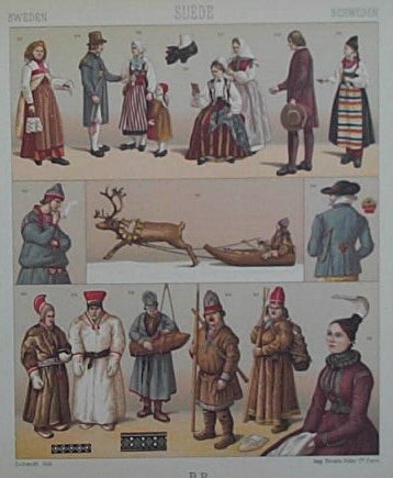 002swe: 1860 Swedish Modes of Dress. Color antique engraving was published in a German costume design book in 1860. It shows various modes of dress worn in Sweden. 7x8 in. $30 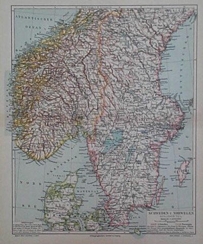 003swe: 1896 Map of Sweden and Norway. Original hand-colored map published in 1896 by the Leipzig Institute shows Sweden and Norway. Map shows old geographical details, waterways, towns and provinces. 9x12 in. $30 |
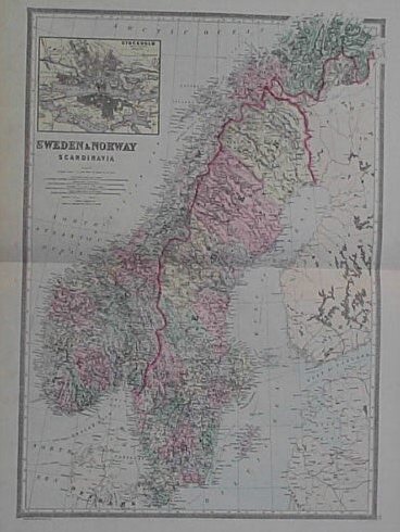
004swe: 1884 Map of Sweden and Norway. Original hand-colored map published in 1884 by the Bradley Brothers shows the areas of Sweden and Norway. Beautiful map shows geographical details, towns, provinces, capitals, waterways. Map shows inset of Stockholm. 19x24 in. $80 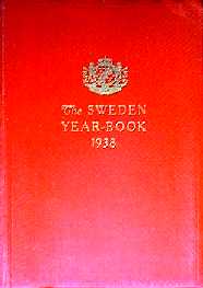 005swe: 1938 Sweden Yearbook. Softcover book with red cloth binding. Illustrated with sepia toned portraits of notables, black & white photos, color plates of flags and decorations. Color map of Sweden on front endpaper. 380 pages. $25 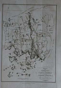 200swe: Carte des Paroisses de Carl Gustaf et de Neder Torneá. Published November 17, 1817 by T. Cadell and W. Davies, Strand, London. Shows the north part of the Bothnia Gulf, Land segment between Sweden and Finland. Torniojoki now makes a frontier between Sweden and Finland. In the 18th century when Rossia took Finlondia from Sweden, this frontier became the frontierline between both the powers, Rusia and Sweden. 10x14 in. $75 |

201swe: 1748 A Chart of the Baltic Sea, Gulf of Finland and Bothnia with The Sound, Drawn from the best maps and charts By T. Jefferys, Geographer to his Royal Highness the Prince of Wales. Denmark and southern parts of Norway, Sweden and Finland, southern coasts of Baltic Sea and Gulf of Finland are shown. size: 10.5x10 in. $100 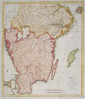 202swe: 1740 Map of Southern Sweden, by Kitchin. Hand colored, engraved map of the southern tip of Sweden, published by Thomas Kitchin in 1740. Title is "Carte des Provinces Meridionales de Suede." Cities, towns and geographical features are shown. Excellent condition. 17x20 in. $250 |
|
| Order Form | |||
| Back to Foreign Countries & Continents , Back to Homepage | |||
| ©2020 Prints Old & Rare | |||