|
|||||||||||
This is a small selection of our inventory of antique West Virginia maps and prints. Additional inventory is available. Contact us with your request. 1-800-879-6277
|
|||||||||||
|---|---|---|---|---|---|---|---|---|---|---|---|
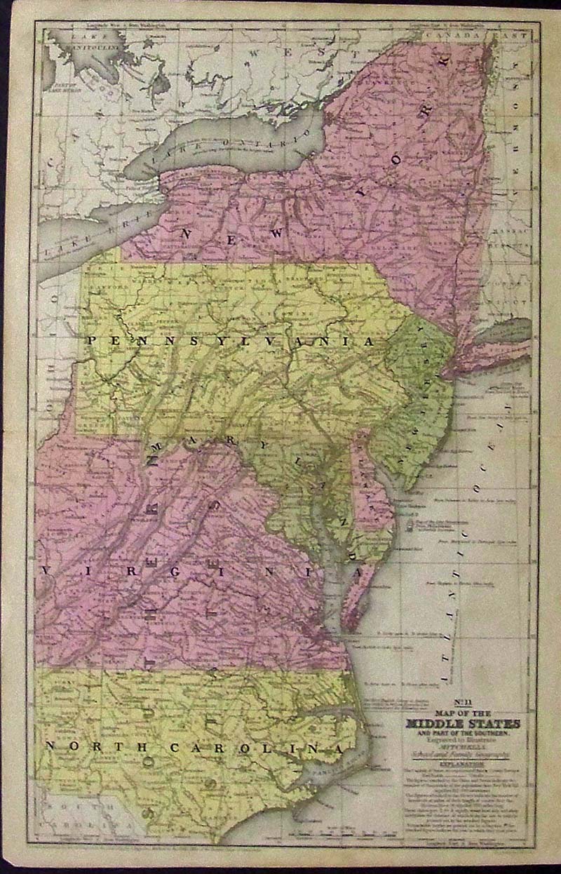 001wv: 1839 Rare hand colored engraved Map of the Middle States, engraved to Illustrate Mitchell's School and Family Geography. This map is a pre-Civil War when West Virginia was still part of Virginia. Map also shows the older New York, Pennsylvania, North Carolina, Lake Ontario, Lake Erie and was Entered According to Act of Congress by S. Augustus Mitchell in the Clerk's Office of the District Court of Connecticut. 17-1/2 x 11-1/2 in. $180 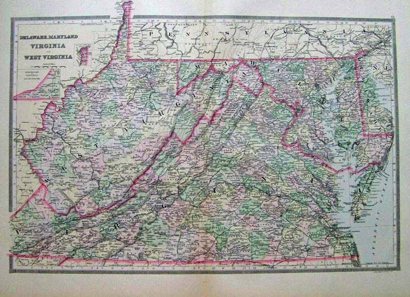
108Delaware: 1889 Bradley color lithograhed map showing Delaware, Maryland, Virginia and West Virginia. Featured in Bradley's Atlas of the World for Commercial and Library Reference. Entered according to Act of Congress in the Clerk's Office of the Librarian Congress at Washington. 26 x 19 in. $240 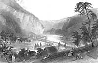
005wv: 1838 Barlett Harper's Ferry view. West Virginia, view of the town from the Potomac side. Excellent old hand colored steel engraving. 12-1/2x9 in. $50 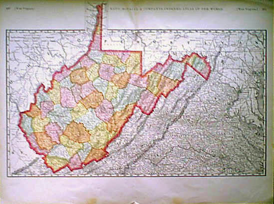 006wv: 1898 Large West Virginia Map. Large scale greatly detailed map by Rand McNally. Printed in color, also shows western parts of Virginia. 28x21 in. $80 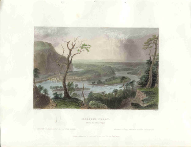 007wv: 1838 Bartlett Harper's Ferry WV. River view of this West Virginia town. Beautifully hand colored steel engraving of the city where John Brown later fired the arsenal. This excellent view from the Blue Ridge. 12-1/2x9 in. $50  009wv: 1873 Bedford West Virginia. "Natural Towers." Large limestone formations in the area well known for caves and rock formations. Hand colored engraving from Picturesque America. 13x9-1/2 in. $40 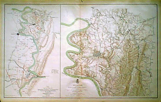
016wv: Civil War Harper's Ferry and Antietam map. Two maps on one page. Color lithograph produced by the U.S. Government after the War. 29x18 in. $80 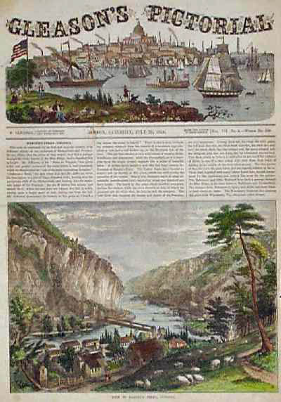
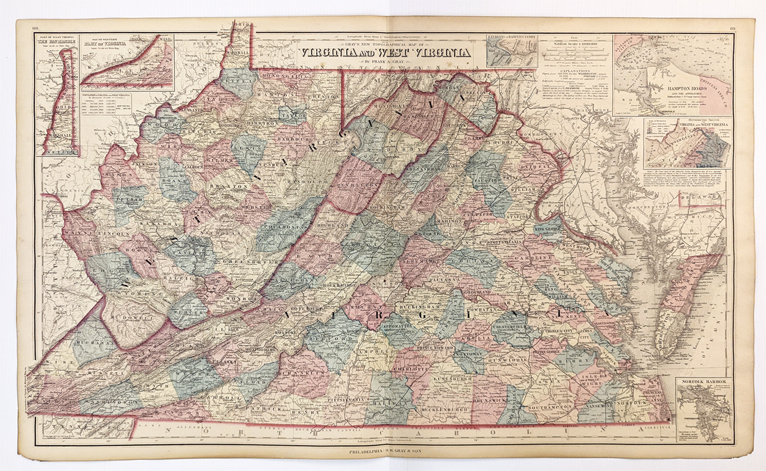
100wv: 1854 Harper's Ferry View, Article. Beautifully hand colored, engraved view of Harper's Ferry from Gleason's Pictorial. A short article above the image describes the town and the beautiful landscape that surrounds it. 11x16 in. $40  102wv: 1863 Civil War West Virginia View. Hand colored engraving from Harper's Weekly, titled, "The Army of the Potomac: General Birney's Camp at Warrenton Sulphur Springs, Virginia." Contains three views of the army's encampment, the sulfur springs, and the general's headquarters. 11x16 in. $50  110va: Rare Colton 1855 hand colored engraved map of Virginia & West Virginia, with insets of Richmond & Norfolk in top right. 17-1/2 x 14 in. $250 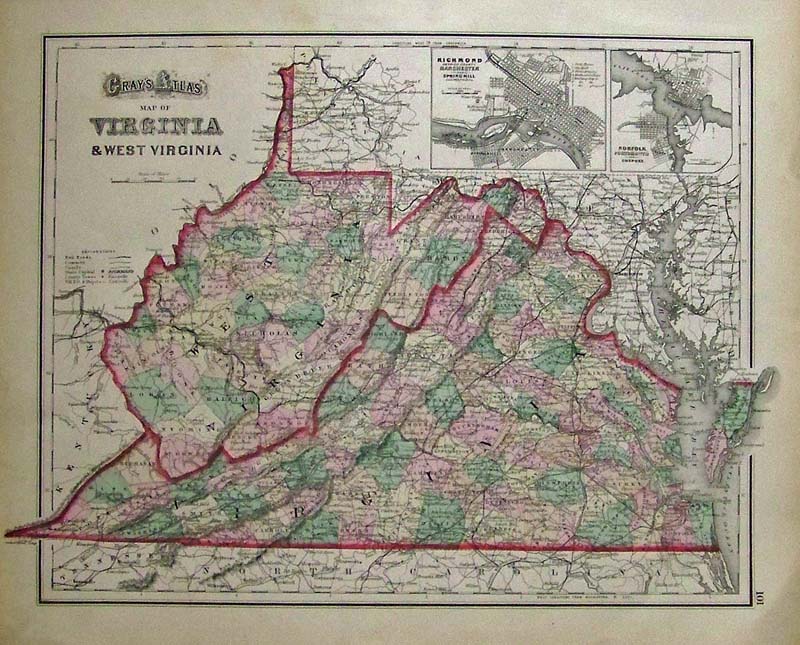 113va: C.1855 Gray's Atlas Map of Virginia & West Virginia. Color map showing insets of Richmond, Norfolk along with an Explanation showing the railroads, common canals, State Capitol in Richmond, depots, and County towns. 17 x 13-1/3 in. $150 |
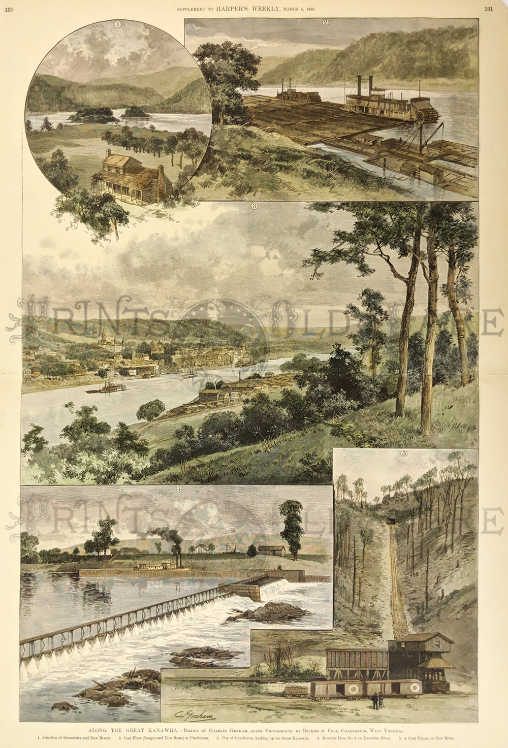 105wv: 1890 Charleston West Virginia Coal Scenes. Impressive, hand colored engraving from Harper's Weekly, titled "Along the Great Kanawha." Contains five views of scenery along the river: 1) Junction of Greenbriar and New Rivers; 2) Coal Fleet (Barges and Tow-Boats) at Charleston; 3) City of Charleston, Looking Up the Great Kanawha; 4) Movable Dam No. 6 on Kanawha River; and 5) A Coal Tipple on New River. A split on the right side of the center horizontal crease has been repaired with archival tape, and there is no image loss. Otherwise, condition is excellent. 16x22 in. $120 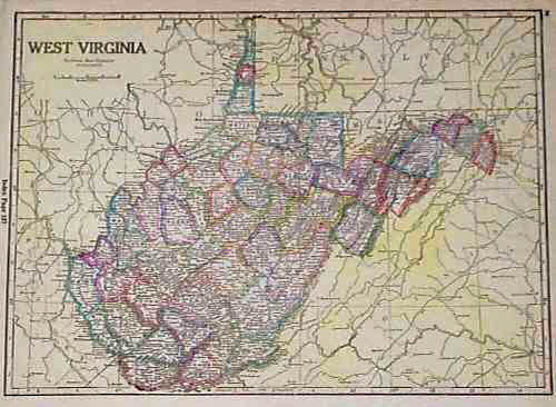 106wv: 1895 West Virginia Map. Nice map of the state, published circa 1895 by the National Map Company. Each county is colored separately. Cities, towns, railroad lines and geographical features are shown. 11x15 in. $30 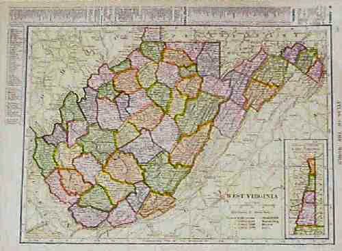 107wv: 1904 West Virginia Map. Color map of West Virginia by the C.S. Hammond Co. Shows cities, towns, railroad lines and geographical features. A key in the top and left margins gives locations of counties, cities and towns. 10x13 in. $30 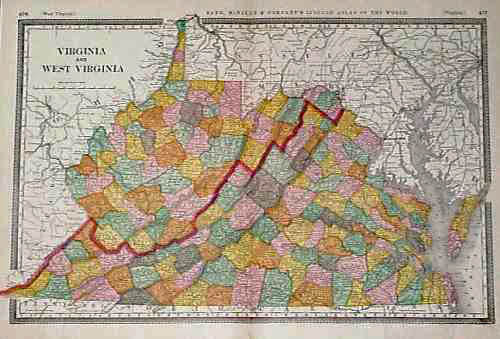 108wv: 1887 Map of Virginia, West Virginia. Attractive map, with each county colored separately. Shows cities, towns, railroad lines and geographical features. Published in 1887 by the Rand McNally company. 15x21 in. $40  110wv: 1889 West Virginia Map. Color map of the state, published by the Rand McNally Company. Shows cities, towns, railroads and geographical features. The name of each mountain chain in the state is prominently marked. 9x12 in. $40 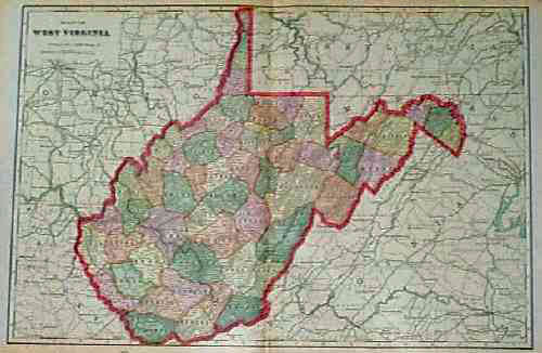
111wv: 1901 West Virginia Map by George Cram. Nice, colorful map, with even very small towns marked in detail. Also shows railroad lines and geographical features. 14x22 in. $40 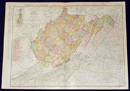 113wv: 1913 West Virginia Railroad Map. Color map from Rand McNally's 1913 Commercial Atlas of America. Shows the locations and names of each railroad line in the state. Also shows cities, towns and geographical features. 20x27 in. $80 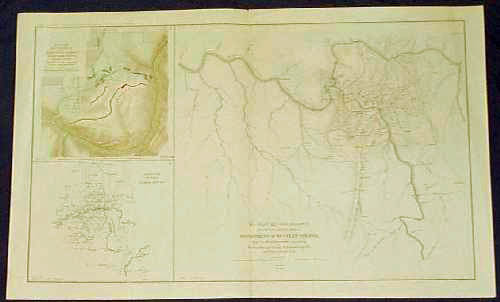 114wv: Civil War Map of West Virginia Localities. Sheet from the Atlas to Accompany the Official Records of the Union and Confederate Armies, published by the United States government in 1895. Contains three separate maps: 1) Battle Field of Carnifix Ferry, Gauley River, West VA; 2) Military Reconnaissance, Vicinity of Gauley Bridge, Dept. of Western VA; and 3) Sketch of the Country About Somerset, KY. 18x30 in. $80 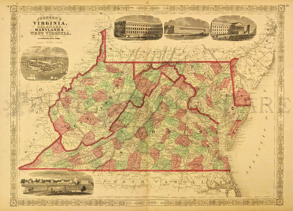 252va: Johnson's 1866 Virginia, Delaware, Maryland and West Virgina Map. Shows various cities, towns, rivers and assortment of additional topographical details. 5 Vignettes showing Fortress Monore, University of Virgina, General Post Office, Treasury Buildings and a Patent Office. 16 x 26 1/2 in. $100 |
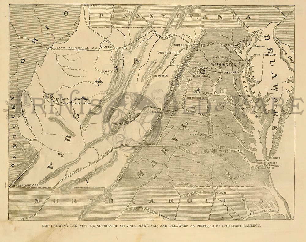 248va: "Map Showing The New Boundaries of Virginia, Maryland, and Delaware as Proposed by Secretary Cameron." Interesting map showing a federal government proposal to redraw the borders of Maryland, Virginia, Delaware, and DC. The reason: To spite Virginia for the Civil War and better protect the capital from attack. 1861 Harper's Weekly. Wood engraving. 7 x 10 in. $60 
115wv: 1901 Map- Virginia & West Virginia. Old color engraving of Virginia & West Virginia, with counties by original color. Key with county and city locations. Very nice. 22x15 in. $40  116wv: 1901 Map of Western Virginia and West Virginia. Beautiful map from the 1901 first edition of George Cram's folio-size world atlas. Color coded lines on the map show the names and locations of railroads throughout the region. State and county borders are outlined in yellow. Cities, towns and geographical features are all shown. This map would look great in a frame! 18x27 in. $100 
117wv: 1901 Map of eastern Virginia and West Virginia which was featured in the first edition of George Cram's folio-sized world atlas. Map shows all the names and locations of all the cities, counties, railroads and geographical features. 27 x 18 in. $100 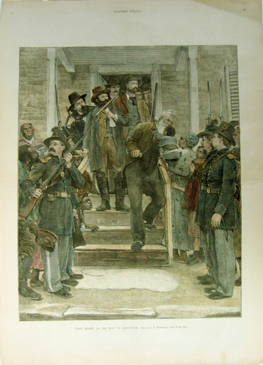 120wv: 1885 Picture of John Brown on his way to being executed. Hand colored engraved image titled, "John Brown on His Way to Execution," drawn by T. Hovenden from Harper's Weekly. 22 x 16in. $150 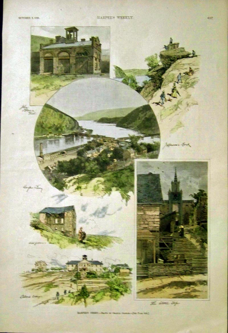 121wv: 1886 Hand colored wood engraving showing Harper's Ferry Vignettes which include John Brown's Fort, drawn by Charles Graham which were featured in Harper's Weekly. 16 x 11 in. $50
|
|||||||||
| Order Form | |||||||||||
| Back to Homepage | |||||||||||