|
|||||||||||
This is a small selection of our inventory of antique World Maps. Additional inventory is available. Contact us with your request. 1-800-879-6277
|
|||||||||||
|---|---|---|---|---|---|---|---|---|---|---|---|
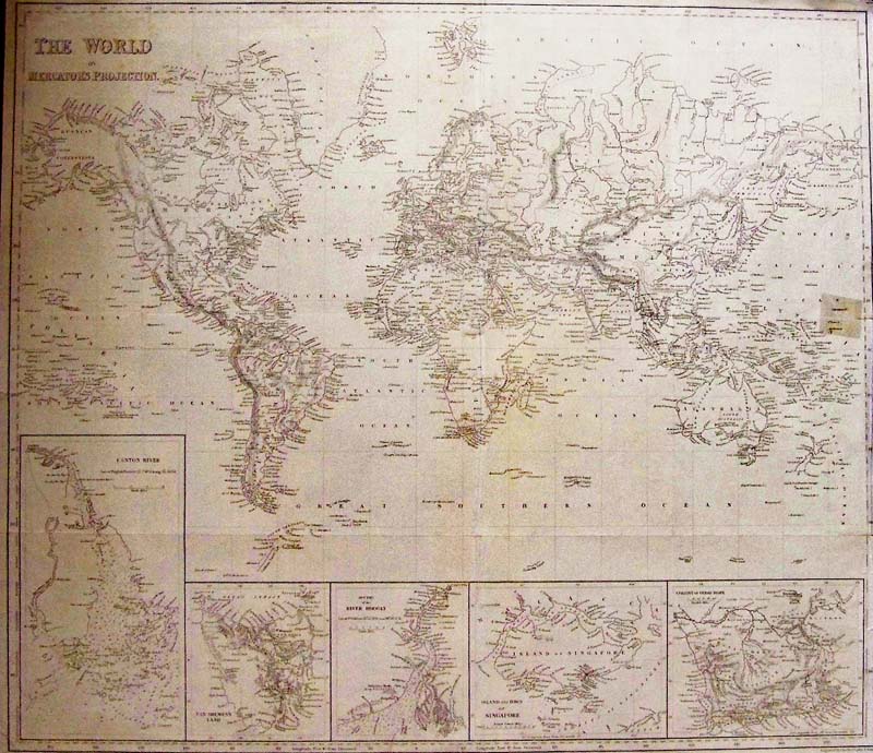 204wld: The World on Mercator’s Projection, and Texas as a Republic, Harper Brothers, 1847 - A large black and white engraved map of the world with five detailed insets of Australia, India, Singapore and South Africa. The map also shows Alaska as Russian Possesions, Northern Canada as British Possessions and Texas as a Republic. Insets are: Canton River (Macau & Hong Kong); Van Diemen's Land (Tasmania); River Hoogly (Calcutta); Island and town of Singapore; Colony of Good Hope. Engraved by Charles Copley New York. Condition: Good very small margins, a small repair to right margin barely into image, multiple folds throughout. Size 21.5 x 18.5 image $295
|
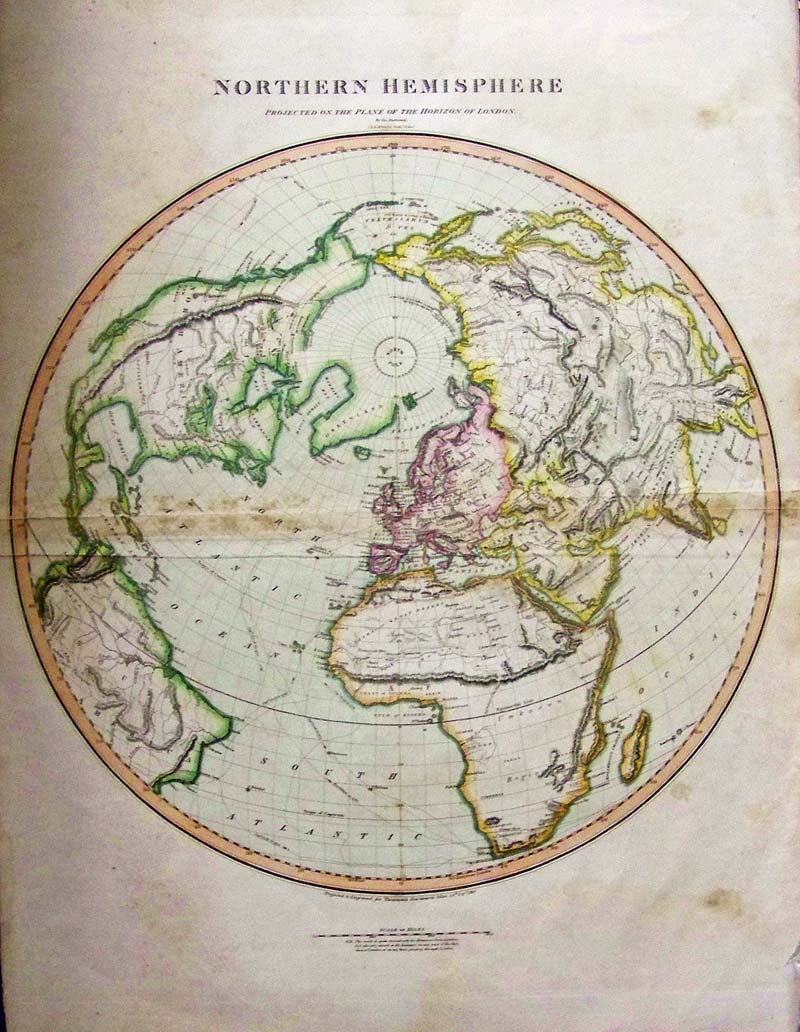 205wld: Northern Hemisphere, Projected on the Plane of the Horizon London, Buchanan and Thompson 1816 - A large and beautiful rare copper engraved hand colored 1816 map by Edinburgh cartographer John Thomson depicting the Northern Hemisphere projected on the plane of the horizon of London. It covers all of North America, Europe, Asia and Africa as well as the northern parts of South America. Impressive detail encompasses both political and geographic features. The routes of Captain Cook are noted throughout in his voyages 1772-1776. The map also notes the Bherings (Bering) Island off the Kamchatka Peninsula with a note reading 'Where he died in 1741.' In Africa, the mythical Mountains of Kong are shown extending eastward to join with the Mountains of the Moon – mythical source of the Nile River. Exhibits a general lack of information regarding the Arctic and connects Greenland with the mainland. Seems to leave the possibility of a Northeast, though not a Northwest, passage open. This map was engraved by J. and G. Menzies and published by Baldwin and Cradock in Thomson's New General Atlas. Condition: Fair, double fold in middle with staining along folds, slight tears on edges of folds, some browning along edges, and water stains outside image. size 19 x 21 image $195 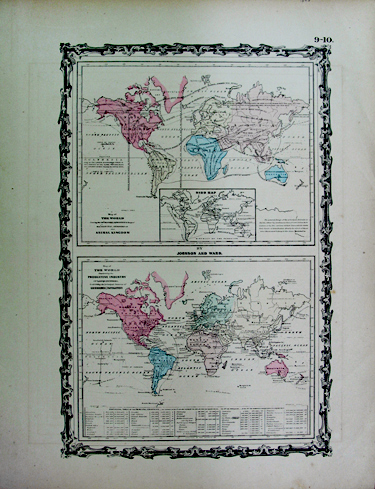
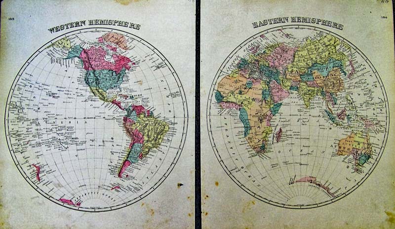
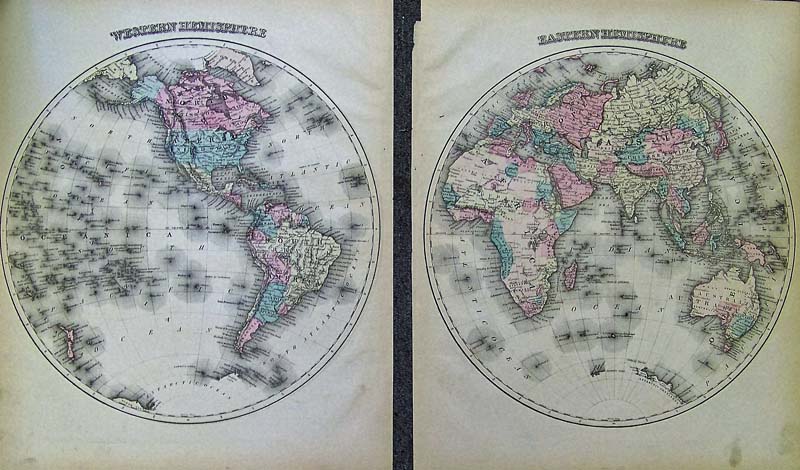
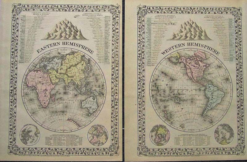
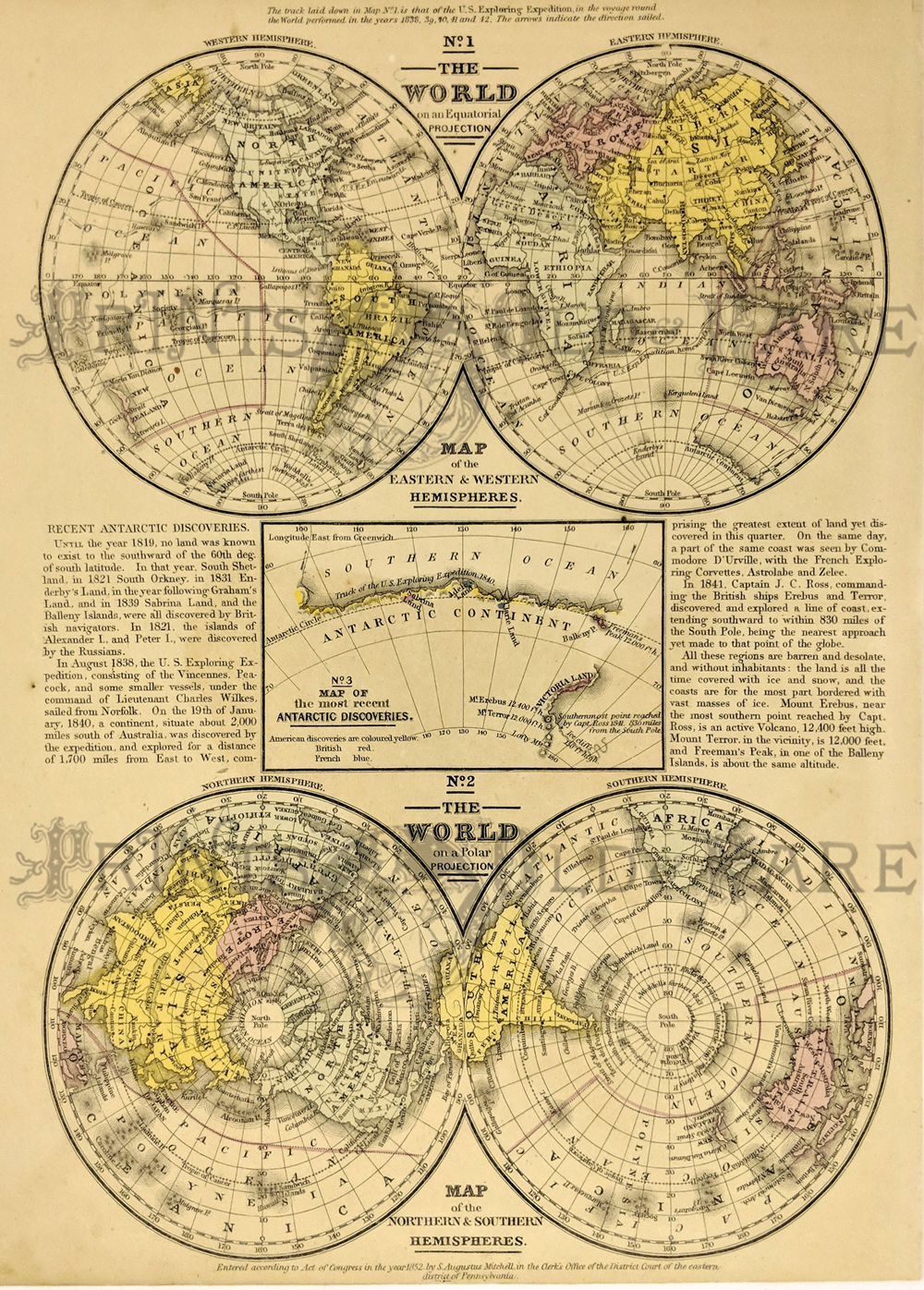
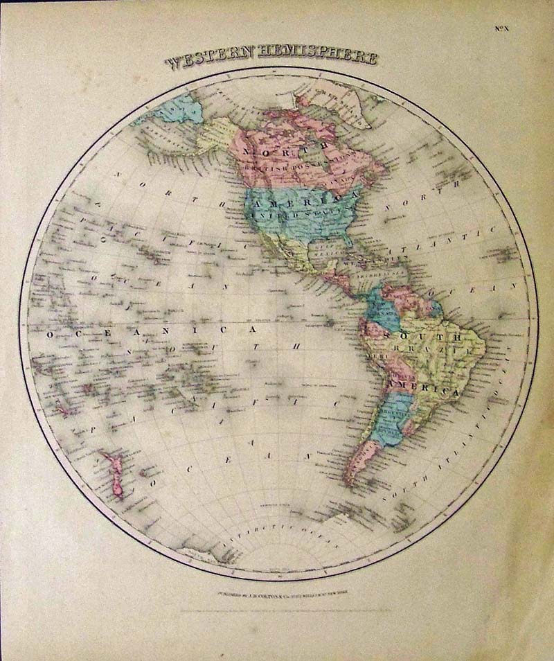
311wld: Johnson and Ward 1863 Map of the World Top map details the geographical distribution of the principal members of the animal kingdom, the bottom map illutrates the productive industry of various countries 18" x 13.5" $25 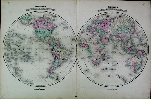 314wld: Mitchell 1881 Western Hemisphere/Eastern Hemisphere Set of hemisphere maps detailing the comparative lengths of rivers and heights of principal mountains in each area. Hand Colored. Decorative grape and leaves border 15" x 11.5" ea. $90
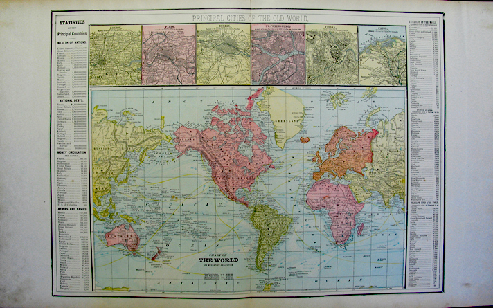
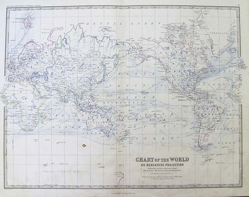
316wld: 1896 Chart of the World on Mercator's Projection Features principal cities or the old world; statistics of the principal countries 29" x 18" $35 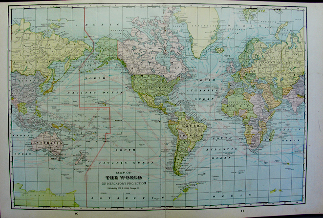
317wld: Published by Geo. F. Cram, Chicago IL 1896 Map of The World on Mercator's projection 22" x 14.5" $25
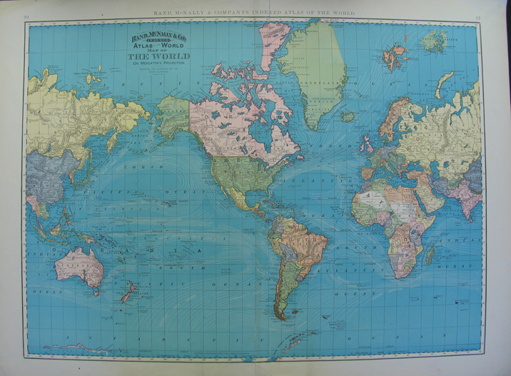
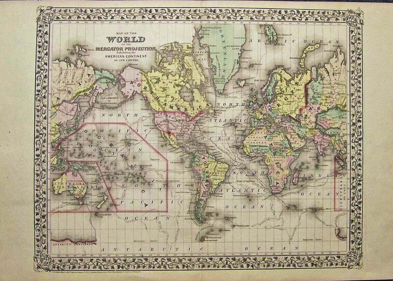 323wld: Map of the World on the Mercator Projection Mitchell 1871 - A very attractive, engraved and hand colored map of the World on Mercator Projection, by Mitchell, created in 1860 and published in 1862 and 1871. North and South America are centrally located on this map. Major shipping and exploration routes, including Captain Cook's voyages of exploration are shown in detail, the map has very wide side margins and a beautiful margin design of leaves. Condition: Very good some light aging color with a light fold in the middle. size 18 x 14 image $75
|
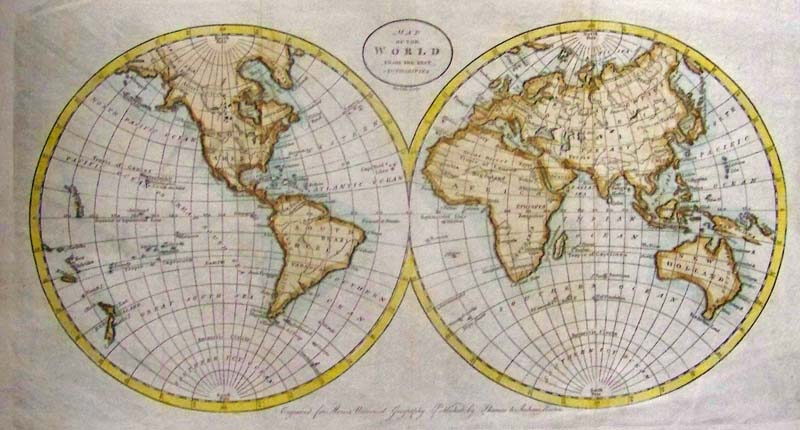
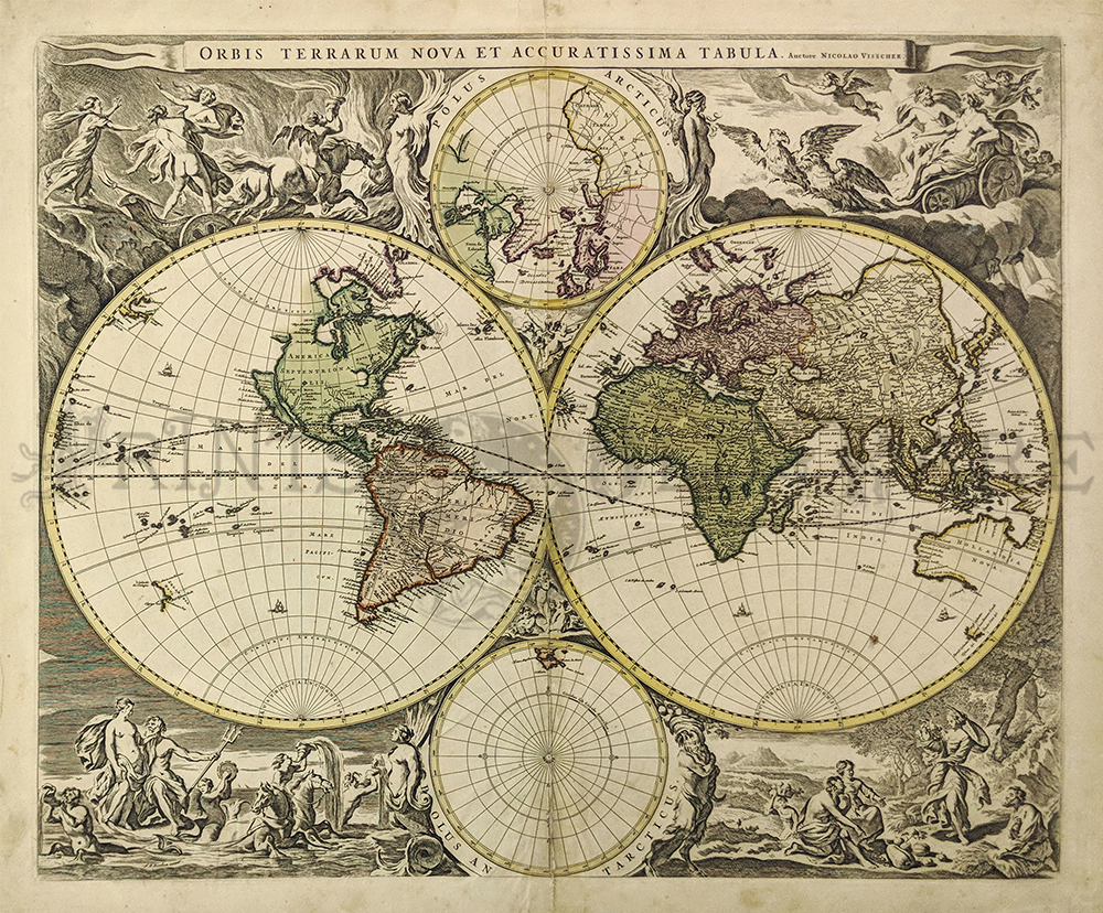 118rare: 1658 Niolao Visscher, Auctore Orbis Terrarum Nova et Accuratissima. Amsterdam; after 1658. Copper engraved double hemisphere world map, hand colored. Very good overall condition with a small bit of damage in the middle center. Measures 21 1/2 x 18 1/4" plus margins. $6000 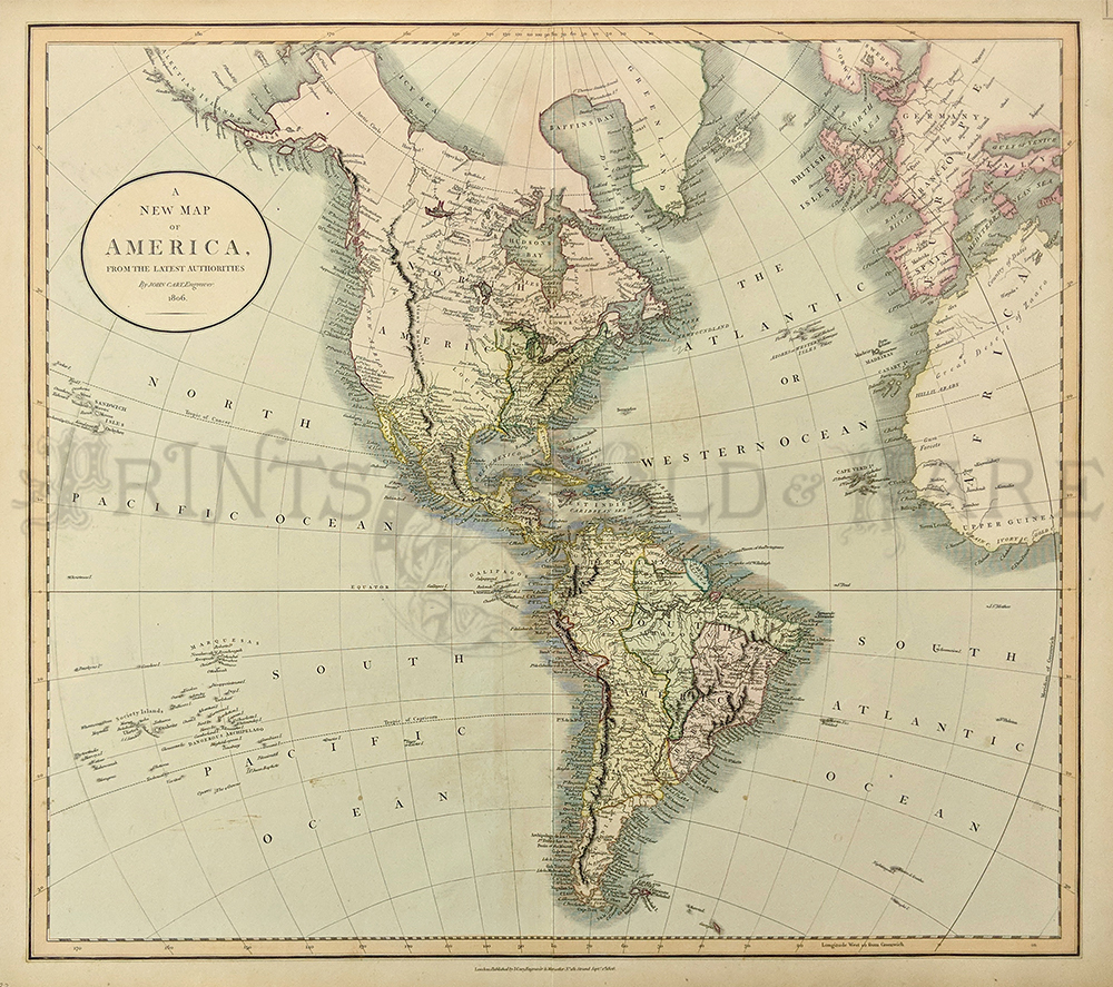
119rare: 1806 John Cary A New Map of America From the Latest Authorities. Published by J. Cary, engraver and map seller, London. Lovely water colored copperplate engraving on hand made paper. Excellent condition. 20 1/2 x 18" plus margins. $800 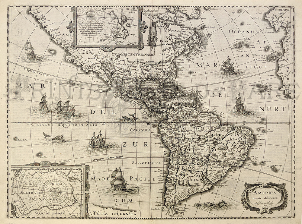
120rare: 1631 Hondius America Noviter Delineata. Very decorative map of the Americas published in Amsterdam. Showing sea creatures in sailing ships in both the Atlantic and Pacific Oceans. Insets showing the North and South Poles. Copperplate engraving on handmade hand laid rag. Excellent condition, printing on reverse, Measuring 19 1/2 x 15" plus margins. $4500
|
|||||||||
| Order Form | |||||||||||
| Back to Homepage | |||||||||||