 
|
|||||||||||
This is a small selection of our inventory of antique Wyoming maps and prints. Additional inventory is available. Contact us with your request. 1-800-879-6277
|
|||||||||||
|---|---|---|---|---|---|---|---|---|---|---|---|
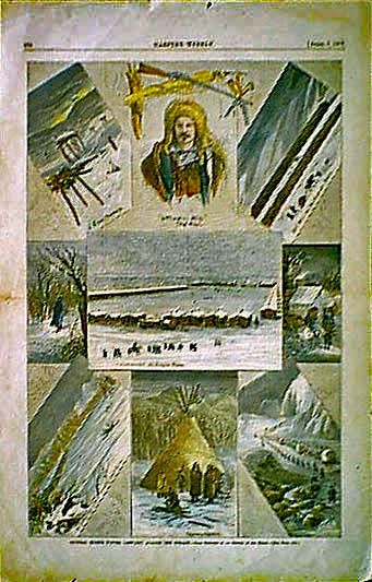 001wy: 1877 Wyoming. Nine hand colored Western engravings of "General Miles' winter campaign against the Indians." Harper's. 11x16 in. $60 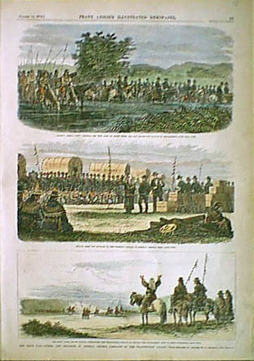 002wy: 1876 Scarce Yellowstone Valley views. General Crook's campaigan against the Sioux. Hand colored antique engravings (Leslie's). Two views on one page. 11-1/2x16-1/2 in. $60 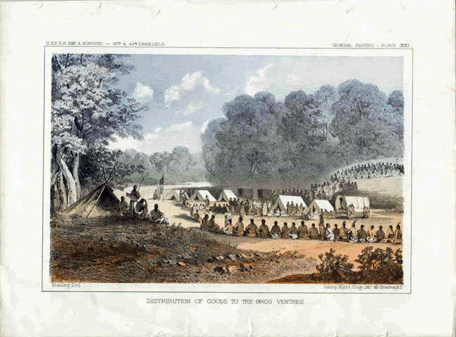 005wy: 1876 1855 Wyoming Indians. Gros Ventres at encampment receiving goods. One of the very best of the color litho views by the U.S. Government. Railroad exploring expedition. 11-1/2x8-1/2 in. $60  014wy: 1855 Teton Valley Wyoming. Antique color lithograph by U.S. Government from railroad route exploring expedition. 11x9 in. $60 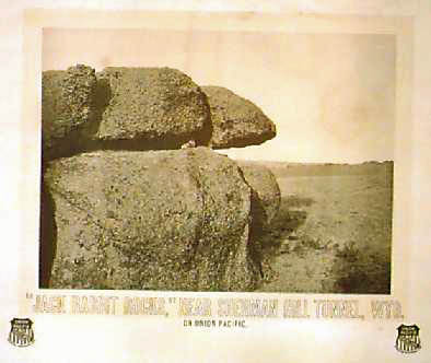 015wy: WYOMING - UPRR - STATION PHOTO.Original photo print of "Jack Rabbit Rocks, near Sherman Hill Tunnel, Wyoming." On Union Pacific. Framed in original oak frame with brass plaque engraved "Jack Rabbit Rocks" with the Union Pacific seal. Some moisture damage to the picture, but not distracting from the overall visual appeal. A great historical piece. Frame size 30" x 26", print size 26" x 22". $375 Check for availability 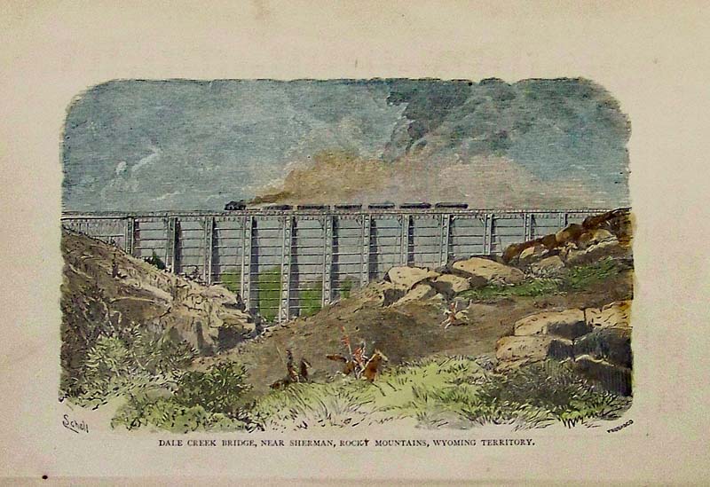 016wy: 1874 Wyoming Territory Railroad Bridge. Hand colored engraved view of train crossing Dale Creek near Sherman Wyoming. 8-1/2x5-1/2 in. $30 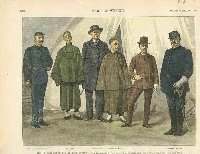 022wy: 1885 Chinese Commission at Rock Springs. Hand colored original engraving of Commision members who investigated trouble at the mining center. Harper's. 10-1/2x8-1/2 in. $30 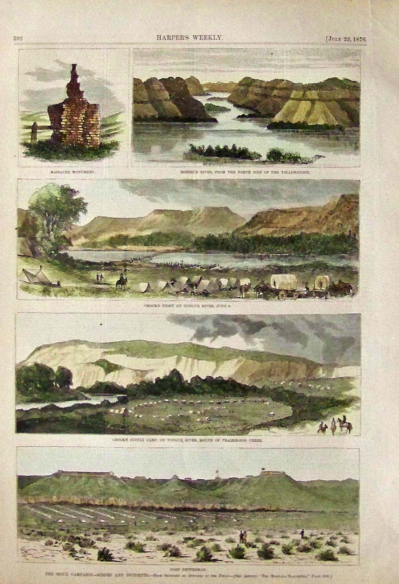 023wy: 1876 Sioux Campaign in Wyoming and Montana. Several hand colored antique views on one page, including Rosebud and Tongue Rivers, Fort Fetterman and General Crook's Supply Camp. Full original page Harper's Weekly. 11x16 in. $80  030wy: 1883 Geysers of the Upper Basin. Hand colored antique engravings on one page showing the splendor of Yellowstone. Original antique page from Harper's Weekly. 16x11 in. $60 Black & White: $50 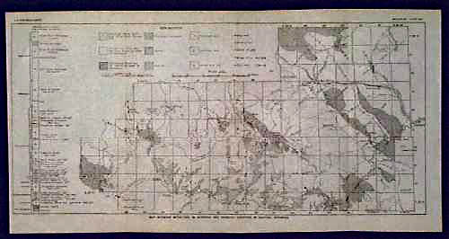 103wy: 1900 Geological Map of Central Wyoming. Title of this item is "Map Showing Anticlines in Natrona and Fremont Counties in Central Wyoming." Different patterns on the map indicate different types of bedrock. Published circa 1900 by the U.S. Geological Survey. 9x18 in. $40 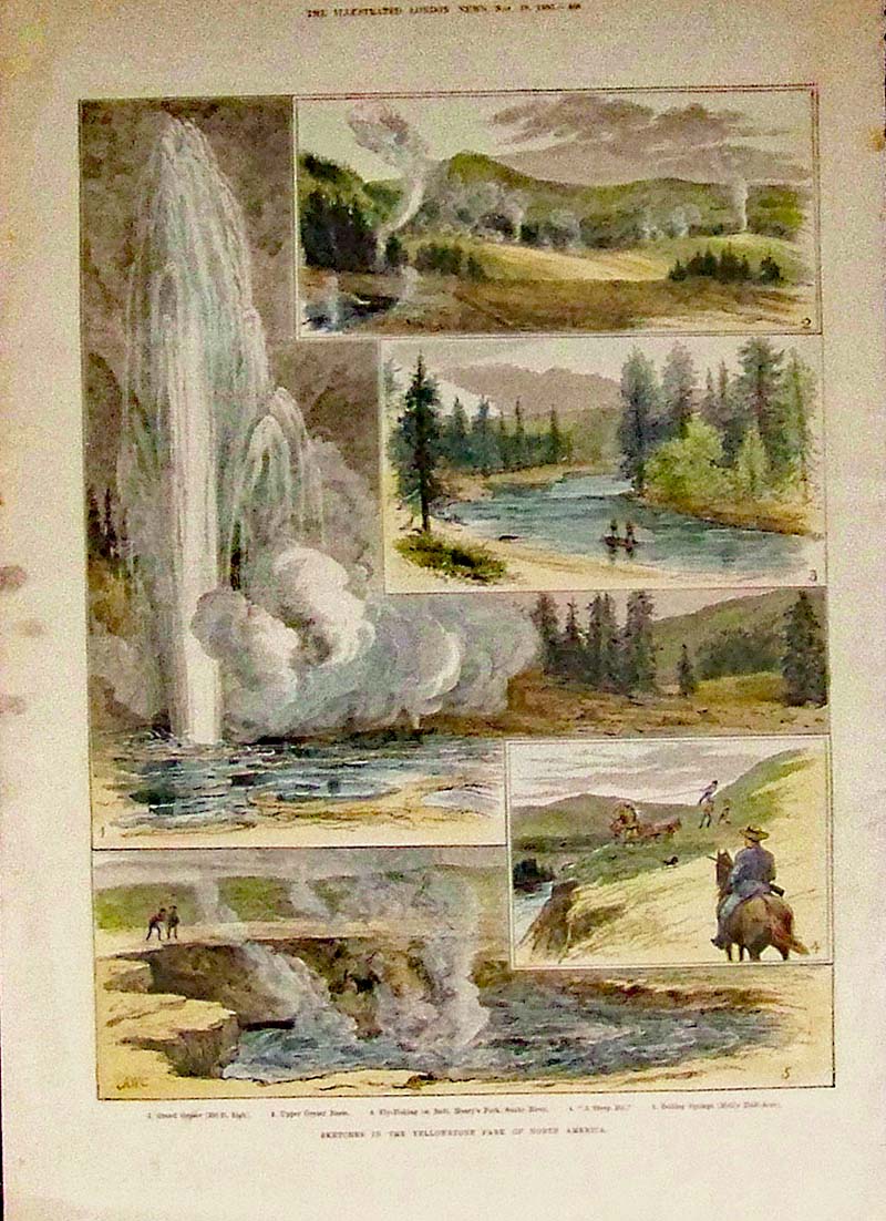 116wy: 1883 Sketches In the Yellowstone Park of North America. Five wood engravings shown on one page of various scenes in Yellowstone Park, published in The Illustrated London News on November 10, 1883. 10.5x15in. Black & White is: $60 Color is: $80 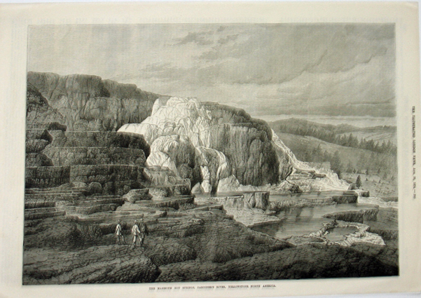 117wy: 1874 The Mammoth Hot Springs, Gardiner's River, Yellowstone, North America. Wood engraving published in The Illustrated London News. 11x15.5in. $60 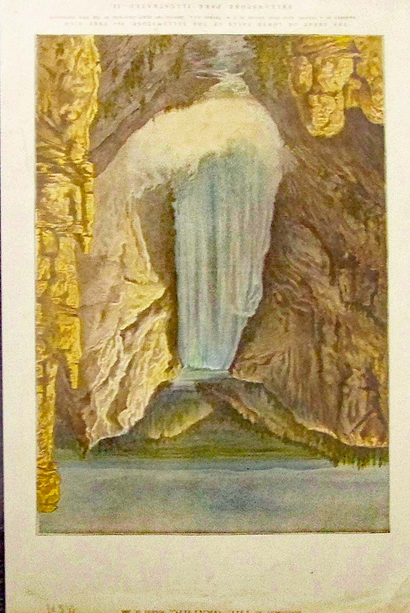 118wy: 1888 The Great Or Lower Falls Of the Yellowstone, 360 Feet High from the Yellowstone Park Illustrated issue, which shows a facsimile of A Drawing Made From Nature By T.H. Thomas, R.C.A., Showing the Exact Colouring Of the Rock Formations. Lithograph published as a Supplement to The Graphic. 10x15.5in. $80 |
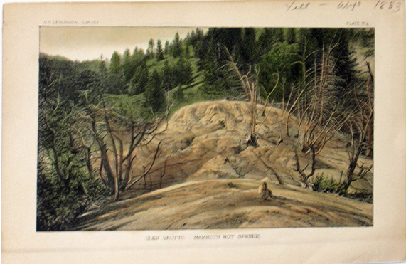 120wy: 1883 Glen Grotto, Mammoth Hot Springs, U.S. Geological Survey, Plate VI a. Lithograph depicting a scene from Glen Grotto, with forest in background. 5.5x9in. $30 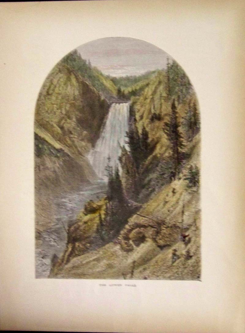 129wy: 1872 Hand colored wood engraving featured in Picturesque America showing The Lower Falls. 12-1/2 x 9-1/2 in. $40 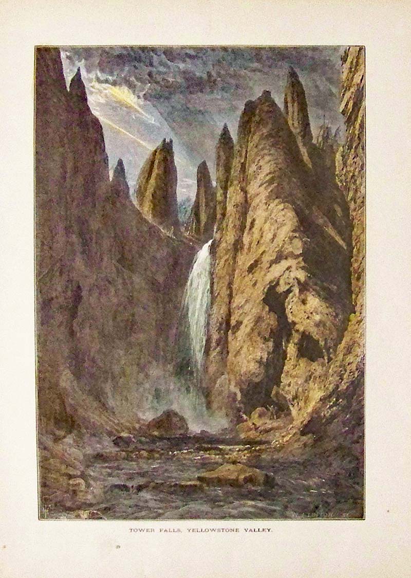 130wy: 1873 Hand colored wood engraving featured in Picturesque America showing Tower Falls, Yellowstone Valley. 12-1/2 x 9-1/2 in. $40 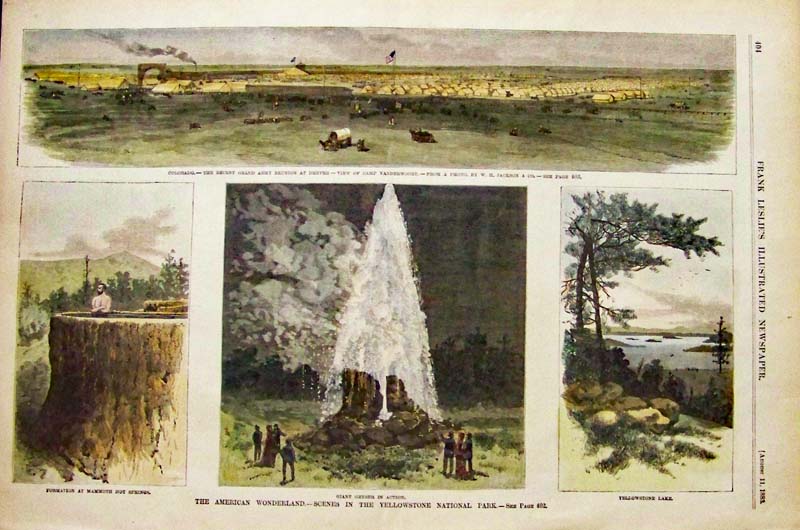 131wy: 1883 Hand colored wood engraving featured in Frank Leslie's Illustrated Newspaper showing, "The American Wonderland. -- Scenes in the Yellowstone National Park." Three engraved scenes are depicted of historic locations in Yellowstone National Park. 16 x 11 in. $50 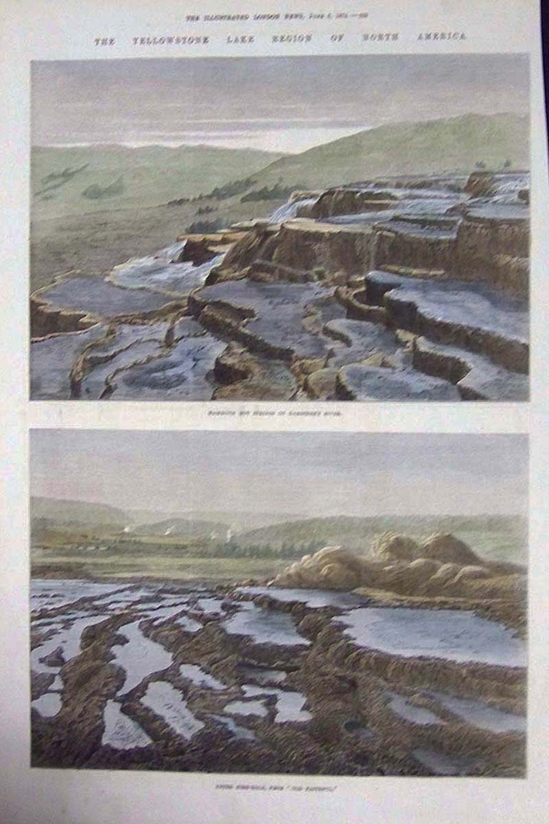 132wy: 1874 Hand colored wood engraving featured in The Illustrated London News showing Mammoth Hot Springs on Gardiner's River in upper engraving and Upper Fire-Hole, From "Old Faithful," in lower engraving. 16 x 10-1/2 in. $40 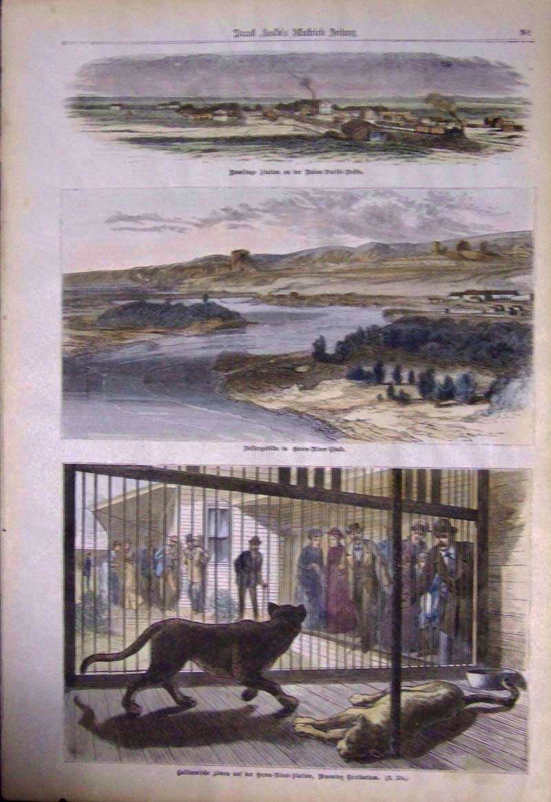 133wy: Hand colored wood engraving featured in the German issue of Frank Leslie's Illustrated Newspaper. Bottom engraving shows views of Rawlings Station and Green River Station with German text. 16 x 11 in. $50  134wy: 1880 Hand colored wood engraving featured in Frank Leslie's Illustrated Newspaper showing the Dakota Territory. -- Sitting Bull Indians Crossing the Yellowstone River, Near Fort Keogh, To Surrender to General Miles. From a Sketch by Holtes. 11 x 6 in. $40 
135wy: 1876 Wyoming Territory - Scenes and Incidents in Central Sioux Campaign. Featured in Frank Leslie's Illustrated Newspaper. 16 x 11 in. $50 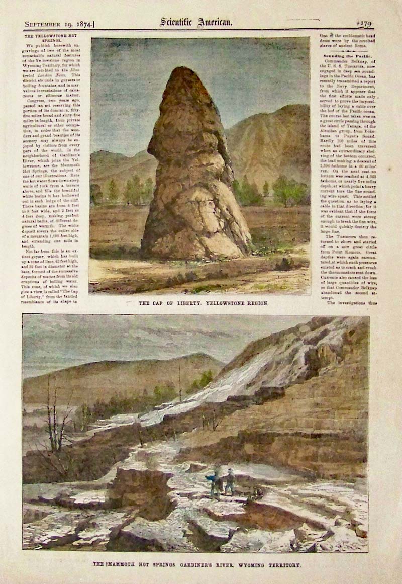 136wy: 1874 Hand colored wood engraving featured in Scientific American showing "The Cap of Liberty, Yellowstone Region" in top engraving and "The Mammoth Hot Springs Gardiner's River, Wyoming Territory" in bottom engraving. 16 x 11 in. $40  138wy: 1903 Double-page color half-tones featured in Leslie's Weekly showing views and important people having involvement with the Reduction Works of the North American Copper Company, At Grand Encampment, Wyoming. Title of article is, "Building a Town While You Wait." 21-1/2 x 16 in. $90 |
 209ys: Panoramic Views. 1878 U.S. Geological and Geographical Survey of the Territories. 4 Vignettes showing The East Gallatin Range from the South East, Yellowstone River from Sepulchre Mt., Volcanic Tertiary Mountains, Mt. Evarts from Mammoth Hot Springs. Original folds as issued. 26 1/2 x 37 1/4 in. $300 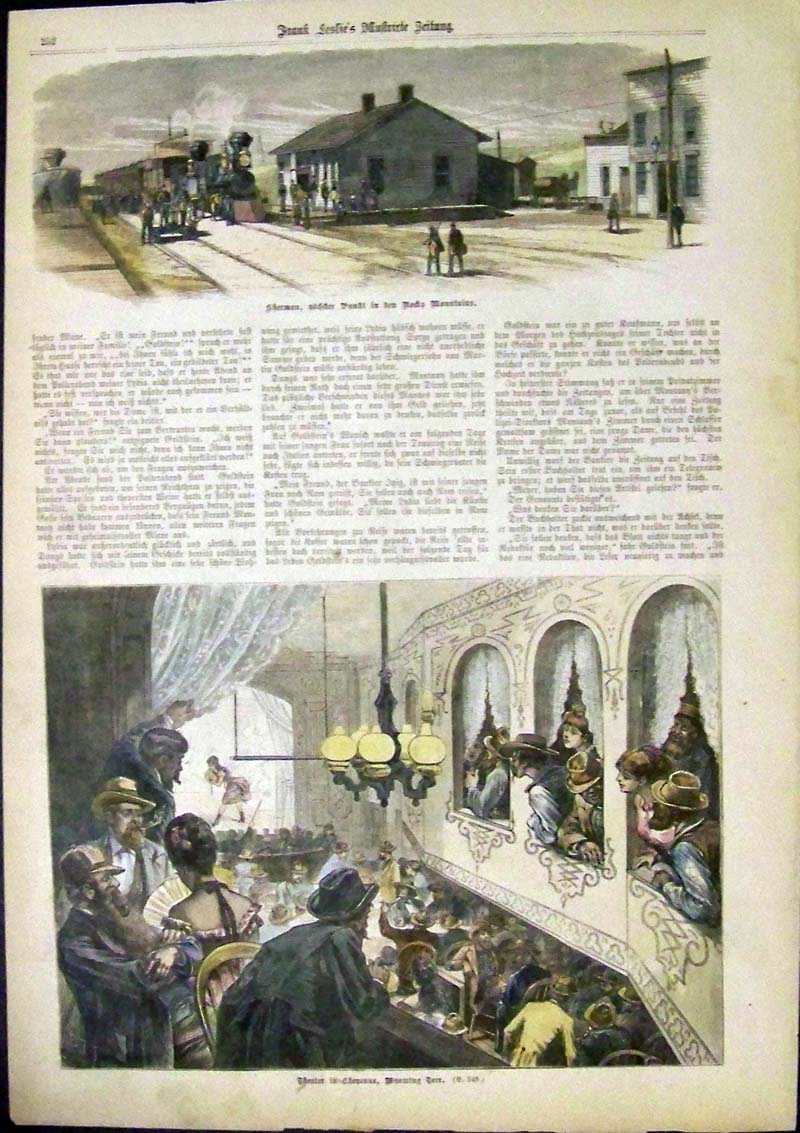 139wy: Hand colored wood engraving in the German issue of Frank Leslie's Illustrated Newspaper shows the Theater in Cheyenne, Wyoming Territory in bottom engraving. 16 x 11 in. $60 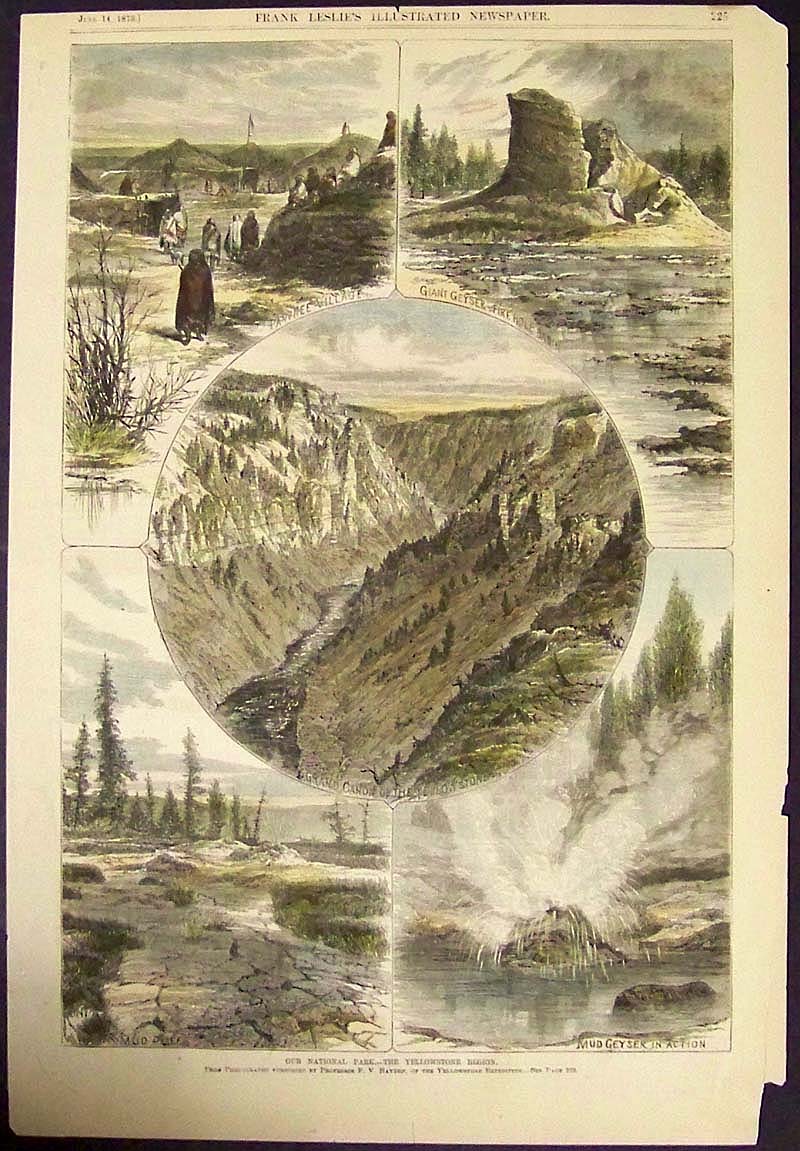 140wy: 1873 Hand colored wood engraving featured in Frank Leslie's Illustrated Newspaper titled, "Our National Park -- The Yellowstone Region." Five views of the Yellowstone Region are shown. 15-1/2 x 10-1/2 in. $60  141wy: 1876 Hand colored wood engraving featured in Frank Leslie's Illustrated Newspaper showing the "Wyoming Territory -- The Sioux War -- A Crow Warrior in General Crook's Command "Crying For Scalps," June 15th." 16 x 11 in. $60 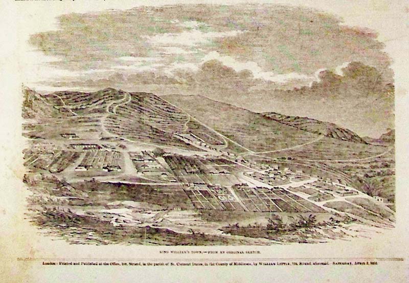 142wy: 1853 Wood engraving featured in The Illustrated London News showing "King William's Town, -- From An Original Sketch." 16 x 10-1/2 in. $40 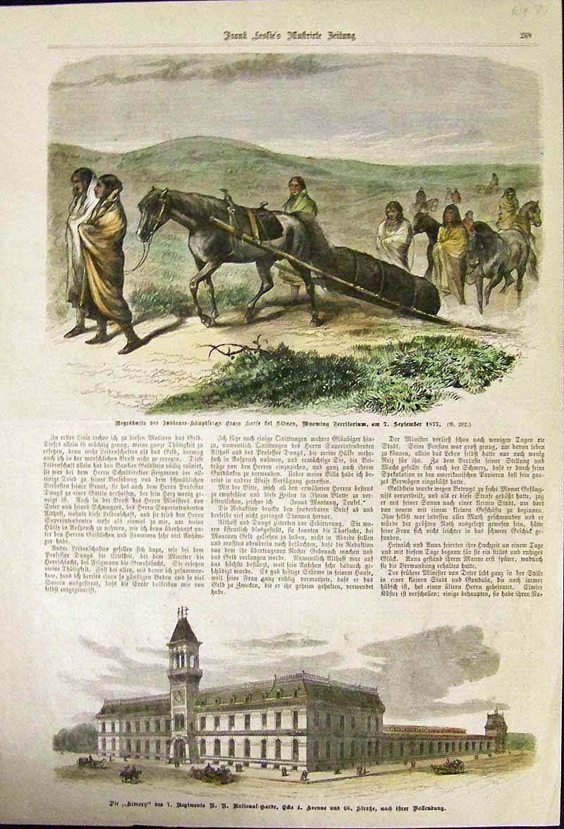 144wy: 1877 Hand colored wood engraving featured in the German Issue of Frank Leslie's Illustrated Newspaper showing Indians in Wyoming Territory in top engraving. 16 x 11 in. $30 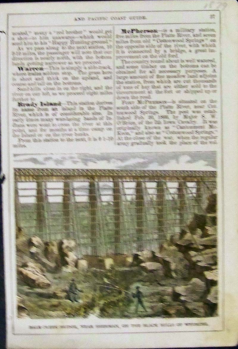 145wy: 1879 Hand colored wood engraving showing Dale Creek Bridge, Near Sherman, On the Black Hills of Wyoming. Image is shown with text on both sides of page. 7-1/2 x 5 in. $30 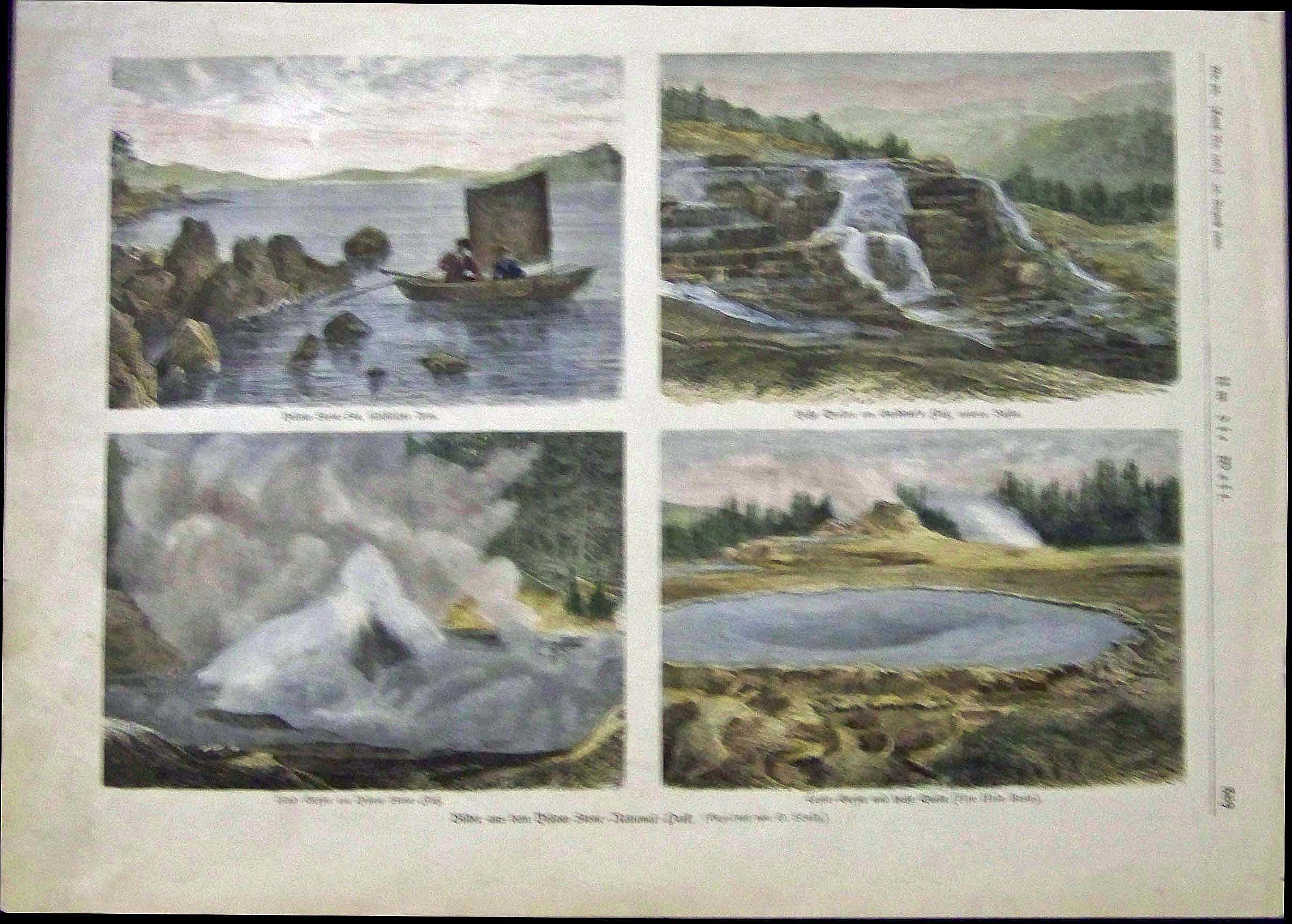 146wy: 1883 Hand colored wood engravings featured in the German issue Um die Welt showing four views in Yellowstone National Park. 15 x 11 in. $50 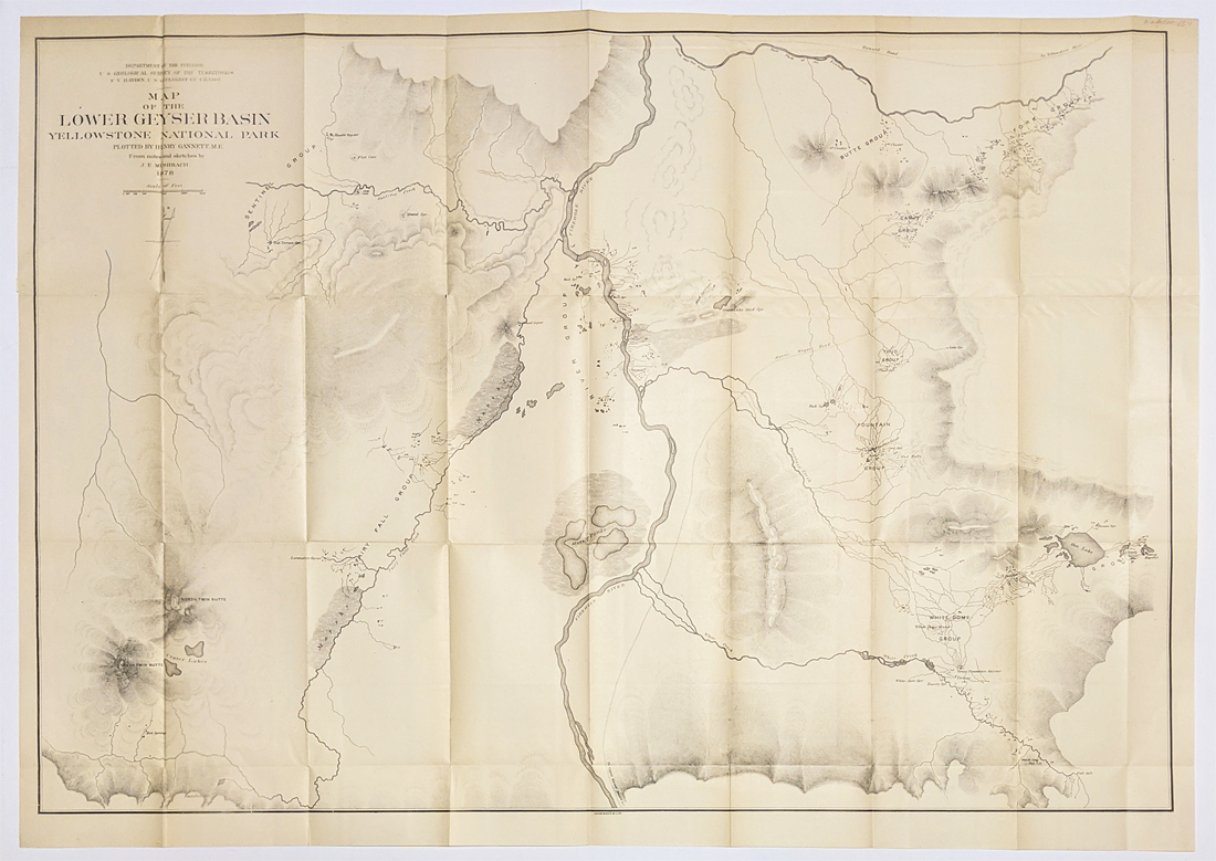 150wy: Yellowstone USGS 1978 Egeria Springs – Firehole River between the upper and lower Geyser Basins by Henry Gannet and J.E. Mushbach. Hayden Expedition lithograph. Size: 25 ½ x 36 ¼ in. $150 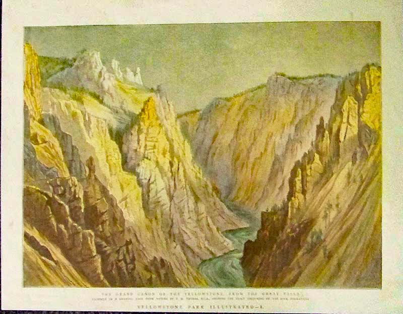 119wy: 1888 The Grand Canon Of the Yellowstone, From The Great Falls from the Yellowstone Park Illustrated issue, which shows a facsimile of A Drawing Made From Nature By T.H. Thomas, R.C.A., Showing the Exact Colouring Of the Rock Formations. Lithograph published as a Supplement to The Graphic. 11x13.5in. $80 |
|||||||||
| Order Form | |||||||||||
| Back to Homepage | |||||||||||