 
|
|||||||||||
This is a small selection of our inventory of antique Asian maps and prints. Additional inventory is available. Contact us with your request. 1-800-879-6277
|
|||||||||||
|---|---|---|---|---|---|---|---|---|---|---|---|
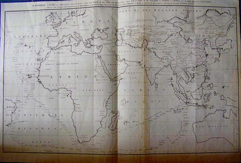 000asia: An Exploration Chart of Eastern Hemisphere and General Chart on Mercator Projection to Shew the Track of the Lion and Hindostan from England to the Gulf of Pekin or China, Nichol 1796 - and of their return to England, with the daily statement of the barometer and thermometer as observed at noon; containing also the limits of the Chinese Empire, as extended by the conquests of the present Emperor Tchien-Lung.) An extremely large double folio black and white engraved chart of the voyage of the Houghton diplomatic embassy to China undertaken by command of King George III. Details the size of the Chinese Empire and its river systems and indigenous peoples (including India), etc. Australia is called New Holland. Very rare and important African and Asian map with extremely detailed notations on China and Asia. Condition: Good, several folds, one with discoloration, small side margins, small tear bottom right fold not into image, some browning on edges. size 37 x 22.5 image $800 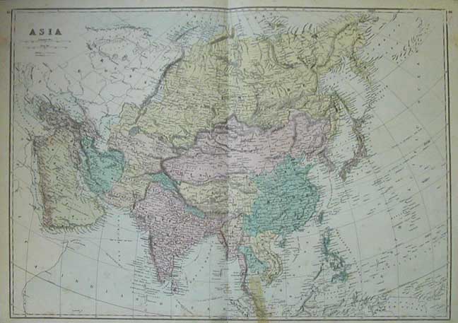
002asia: 1875 Asia Map. Nice looking hand colored antique map. Small mend near bottom. 26-1/2x19-1/2 in. $80 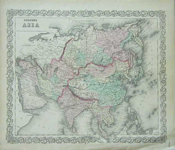
003asia: 1856 Antique Asia Map. Beautiful hand colored Asia Map by Colton. Very frameable with nice border. 17-1/2x14-1/2 in. $80 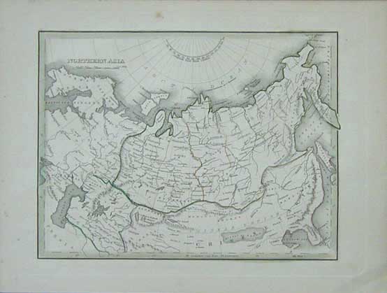
004asia: 1835 Old Northern Asia Map. Antique map with outline color. Shows northern China, Russia and Scandinavia. 12x10 in. $80 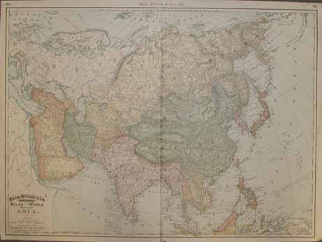
005asia: 1892 Large Asia Map. Color litho map by Rand McNally. Very detailed. 26-1/2x20-1/2 in. $60 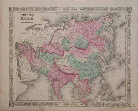
006asia: 1864 Johnson's Asia Map. Vivid original hand coloring and an attractive border make this antique Asia Map very frameable. 17-1/2x14 in. $80 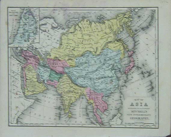
007asia: 1872 Mitchell Map of Asia. Great hand colored antique engraved map. Inset of Palestine. 11.5x9 in. $80 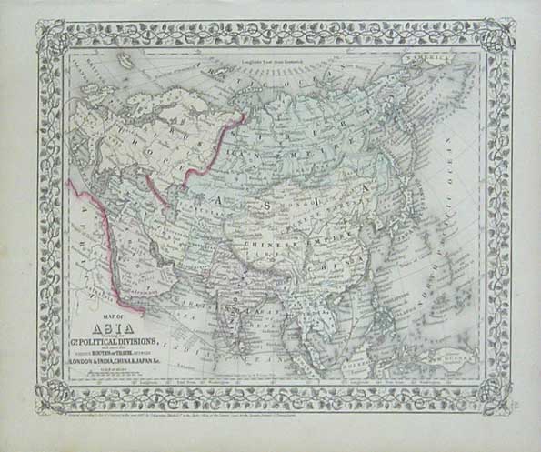
008asia: 1867 Map of Asia. Antique Mitchell map shows political division, as well as routes of travel between London and India, China, Japan, etc. Beautiful map with attractive border. 15x12-1/2 in. $80 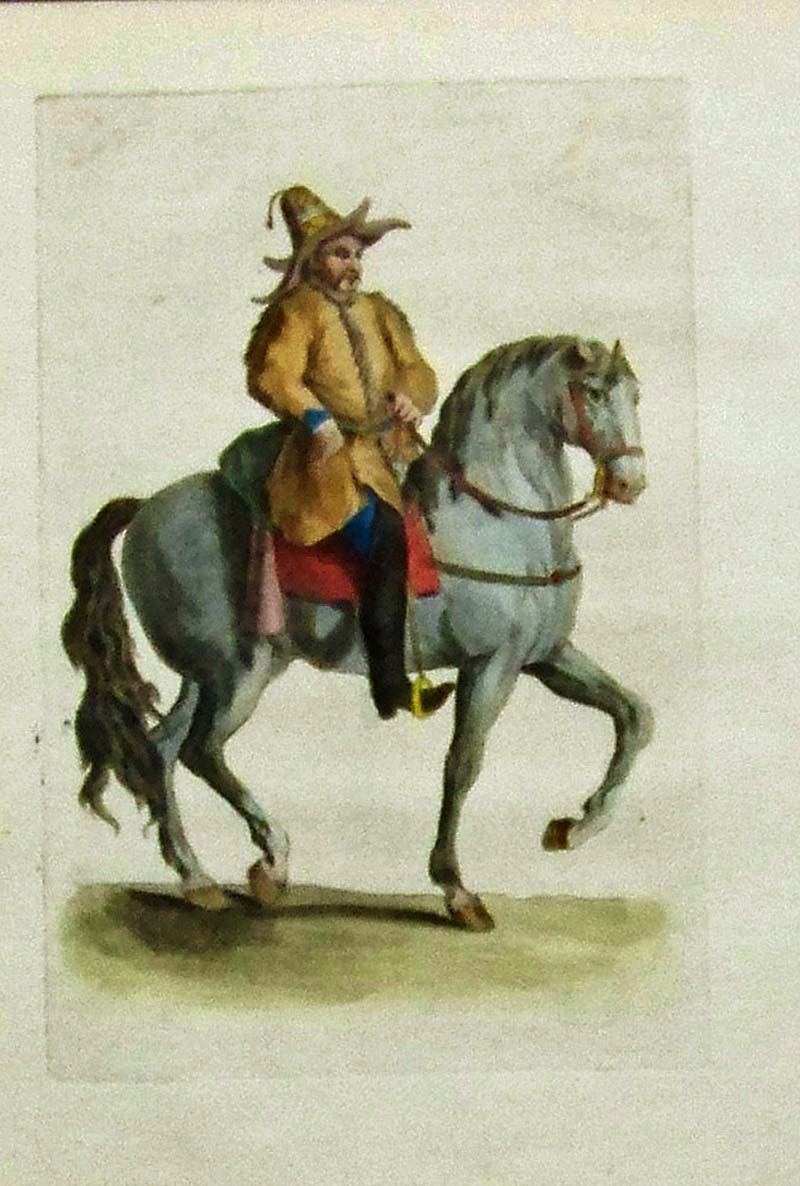 010asia: C.1800 Hand colored copper-engraved image showingan Asian man atop his horse. 8-1/2 x 6 in. $45 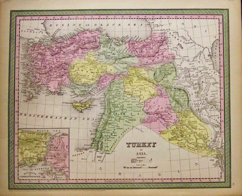
099asia: 1850 Rare colored map of Turkey in Asia with inset of the Environs of Constantinople. 17 x 14 in. $140 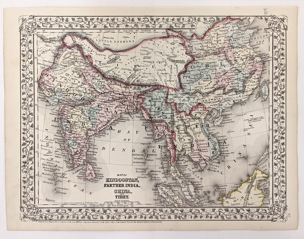
100asia: 1867 Mitchell Map: Tibet, China, India, etc. Engraved map, with original hand coloring, published by S. Augustus Mitchell in 1867. Title is "Map of Hindoostan, Farther India, China and Tibet." Tibet is clearly shown as a separate country to the west of China. Entire image is surrounded by a decorative border. 12x15 in. $50 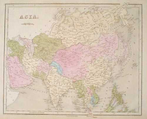 101asia: 1838 Bradford Map of Asia. Fascinating map, with original hand coloring, from T.G. Bradford's famous world atlas of 1838. This map is from the 1846 printing of the atlas, and the phrase "corrected to 1846" appears below the bottom border. Each country is colored separately. Cities and geographical features are shown throughout the continent. 13x17 in. $300 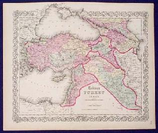
200asia: Old, RARE Map of Turkey in Asia. Interesting, engraved map of Turkey in Asia, with original hand coloring, from J.H. Colton's 1855 world atlas. Also included in this map are the Caucasian provinces of Russia. Cities, towns, major roads and geographical features are all shown. The entire map image is surrounded by a decorative border. 14x17 in. $80 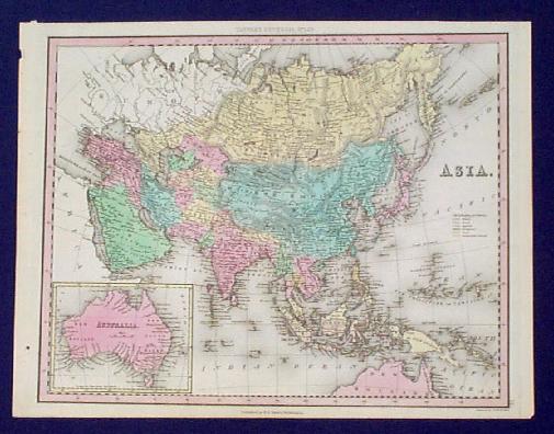
201asia: 1833 Tanner Map of Asia. This beautiful, copper-engraved map of Asia is from Henry Tanner's Universal Atlas of 1833. Each country on the continent is separately colored with original hand coloring. The Philippines and other South Pacific islands are shown as well. Islands under colonial control are color coded by the European countries that owned them. In the bottom left corner, there is a small inset map of Australia. This map is in excellent condition. There is a small dark spot in the lower left margin, but the image is not affected. Image size is 11x14 in., and paper size is 12x15.5 in. $120 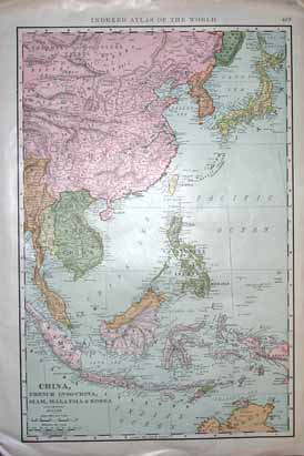
202asia: Map of China, French Indo-China, Siam, Malaysia and Korea. Published by Rand, McNally & Co. in 1902, map also shows Japan and a part of Australia. 14x21 in. $80 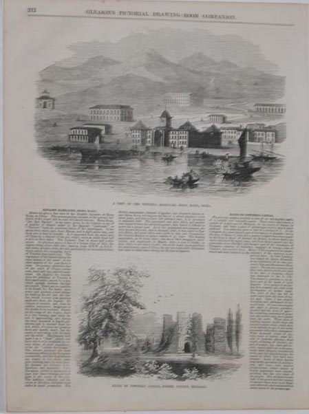 203asia: A View Of The Victoria Barracks, Hong Kong, China AND Ruins Of Cowdray Castle, Sussex County, England - Two wood engravings featured on one page of Gleason's Pictorial Drawing-Room Companion. 11x16in. $40 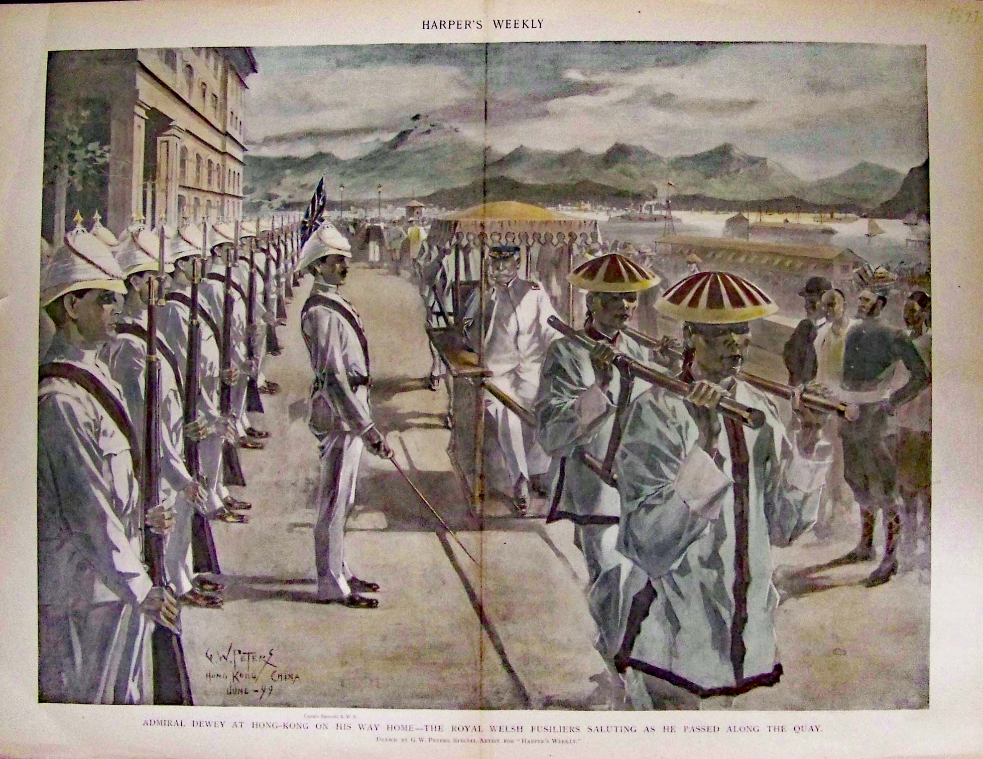 204asia: 1899 Admiral Dewey At Hong-Kong On His Way Home - The Royal Welsh Fusiliers Saluting As He Passed Along The Quay - Hand colored hand-tone, published in Harper's Weekly. 16x22in. $120 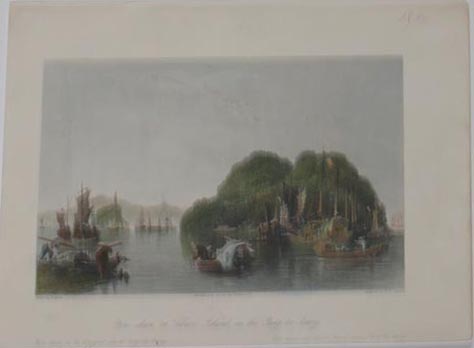 205asia: 1840 Yin-Shan, Or Silver Island, on the Yang-tse-Keang - Hand colored steel engraving depicting Silver Island with lots of boats in foreground. Drawn by T. Allom and Engraved by W.H. Capone. 7.5x10in. $60 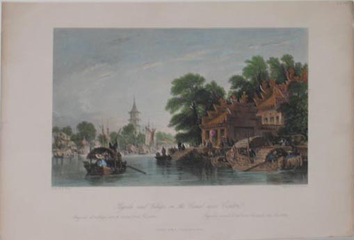 206asia: 1840 Pagoda and Village, On the Canal near Canton - Hand colored steel engraving depicting the pagoda on right with boats and village on left. Drawn by T. Allom and Engraved by W.H. Capone. 7.5x11in. $60 |
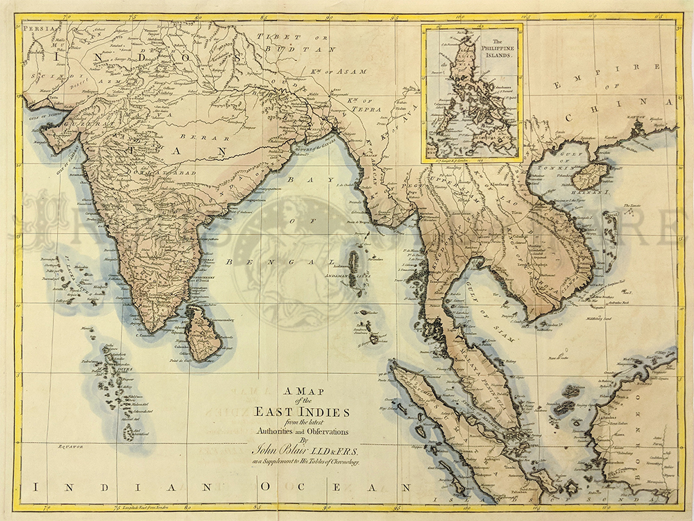
134rare: c. 1768 John Blair, A Map of the East Indies from the latest Authorities. Highly detailed topographical map with inset of the Philippine Islands. Excellent condition with minor repair on original fold. 22 x 16.25" plus margins. $800 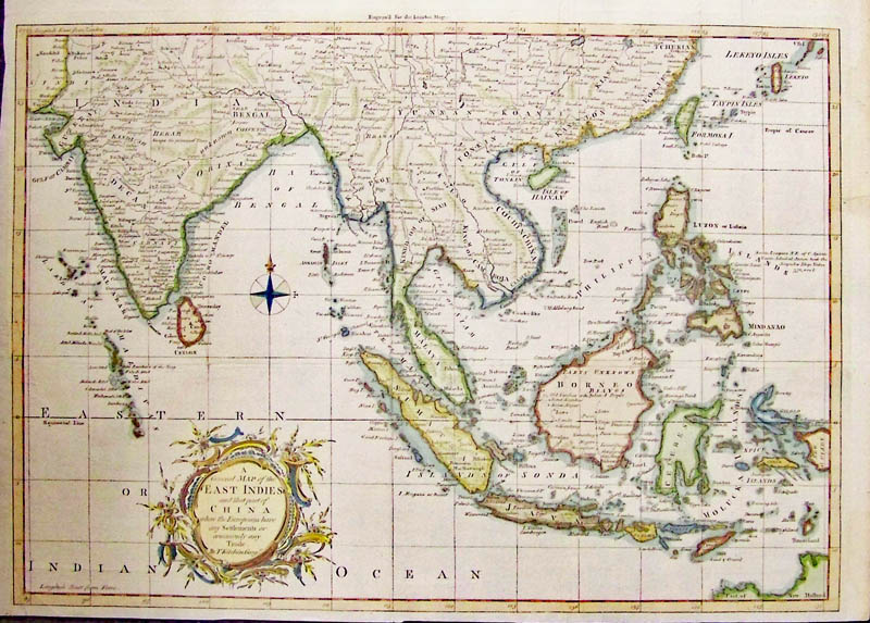
012asia: A rare General Map of the East Indies and that part of China T Kitchin, George, circa 1761 - Very attractive engraved, rare and hand colored map of the East Indies engraved for London Magazine showing where Europeans have any Settlements or commonly trade. This is a rare map and George Kitchin was a prolific map maker during this time. Nice details of the coasts, Borneo, Celebes, Sumatra India, Spice Islands, China, and the Philippines with Luzon, no Vietnam, Korea or Japan. Wonderful title cartouche and design with good margins and compass with Fleur de lee. Condition: Excellent slight fold as issued otherwise good normal aging color. size, 16.5 x 11.5 image. $300 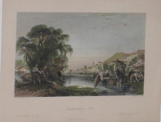 207asia: 1840 Transplanting Rice - Hand colored steel engraving depicting Chinese people transplanting rice plants. Drawn by T. Allom and Engraved by T.A. Prior. 7.5x9.5in. $60 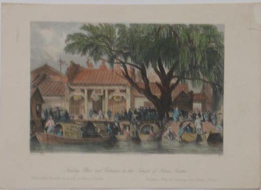 208asia: 1840 Landing Place and Entrance To the Temple of Honan, Canton - Hand colored steel engraving depicting people gathered around the Temple of Honan. Drawn by T. Allom and Engraved by C.T. Dixon. 7.5x10in. $60 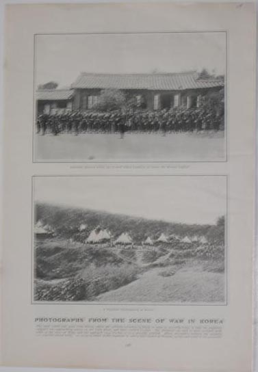 209asia: 1904 From the Scene of War In Korea. Top half-tone depicting American Marines before the United States Legation at Seoul, The Korean Capital and bottom half-tone depicting A Japanese Encampment in Korea. 9.5x14in. $40 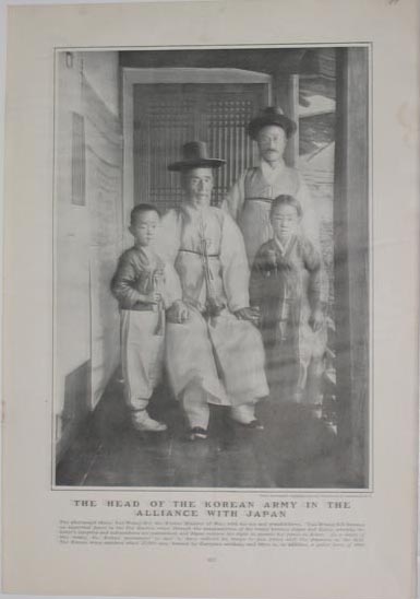 210asia: 1904 The Head Of the Korean Army In the Alliance With Japan - Half-tone depicting the Head of the Korean Army posing with his family. From stereograph copyright 1904, by Underwood & Underwood, N.Y. 9.5x13.5in. $50 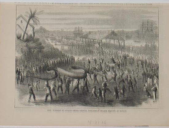 212asia: 1866 Idol Worship in Cochin China - Annual Procession Of the Dragon At Saigon. Wood engraving. 8.5x11in. $50 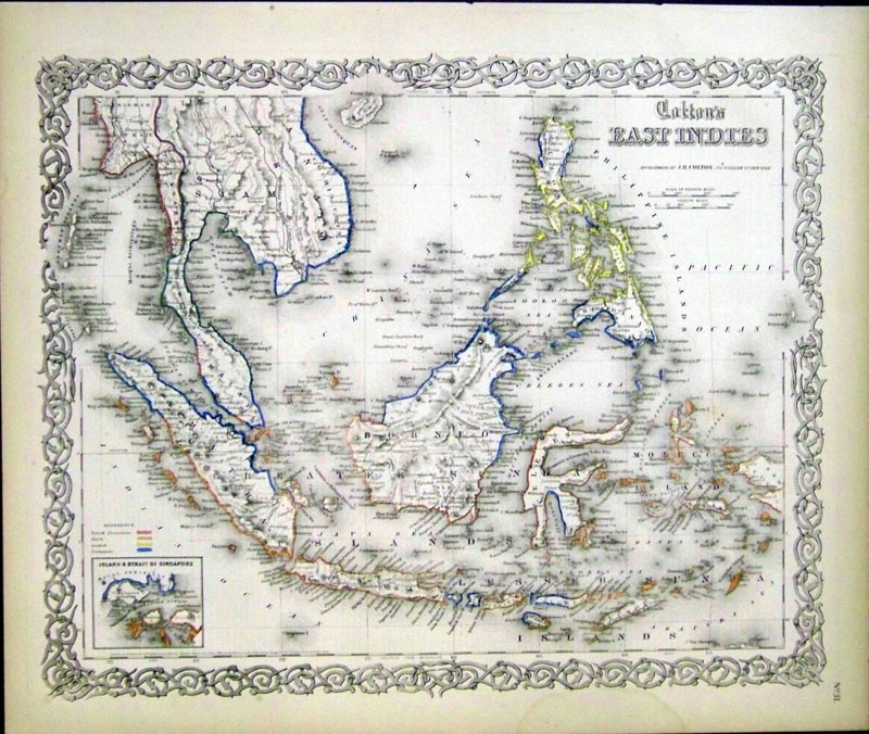 213asia: 1855 Hand colored Colton's East Indies Map, published by J.H. Colton, which includes a small inset on bottom left corner of the Island & Strait of Singapore. Decorative border surrounds map. Colored reference keys are near inset showing the border outlines of each place. 17-1/2 x 14-1/2 in. $175 SOLD 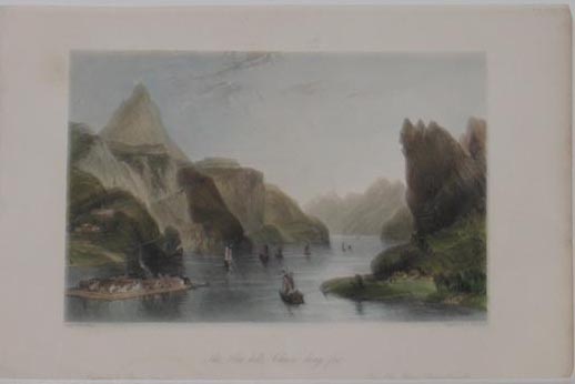 214asia: 1840 The Hea Hills, Chaou-King-Foo - Hand colored steel engraving depicting boats on an inlet of water between the Hea Hills. Drawn by T. Allom and Engraved by E. Brundard. 7x11in. $60 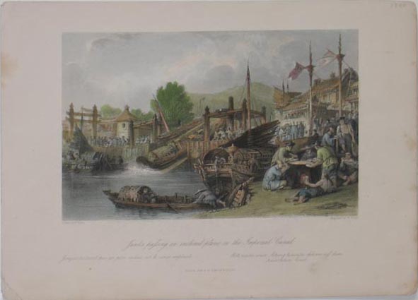 215asia: 1840 Junks passing an Inclined Plane On the Imperial Canal - Hand colored steel engraving depicting people eating rice on right and other people engaged in various activities on the Imperial Canal. Drawn by T. Allom and Engraved by W. Floyd. 8x10.5in. $60  216asia: 1840 Destroying the Chrysalides and Reeling the Cocoons - Hand colored steel engraving depicting women spinning yard from the cocoons of the chrysalides. Drawn by T. Alloms and Engraved by J. Davies. 7.5x10in. $60 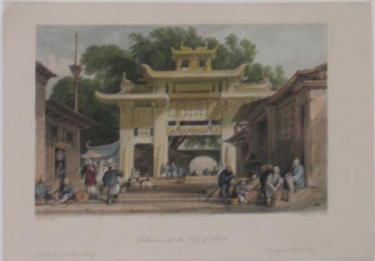 217asia: 1840 Entrance Into the City of Amoy, From A Sketch on the Spot by Lieut. White, Royal Marines. Hand colored steel engraving depicting people near the entrance into the City of Amoy. Drawn by T. Allom and Engraved by S. Fisher. 7x9.5in. $60 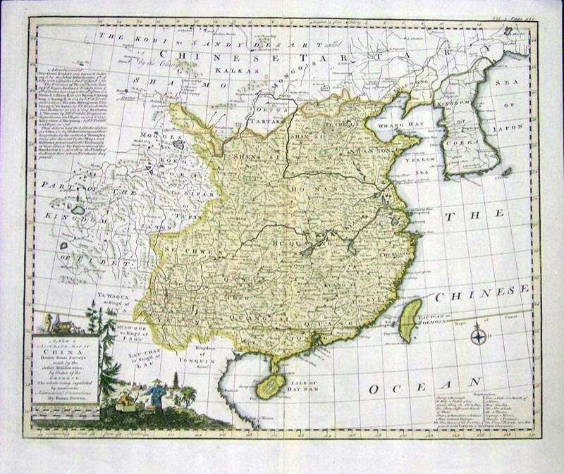 218asia: 1748 Hand colored copper engraved "A New Accurate Map of China, Drawn from Surveys made by the Jesuit Missionaries by Order of the Emporer, The whole being regulated by numerous Astronomical Observations by Eman Bowen." Map also shows the Kingdom of Corea, as well as an Explanation Key on bottom right corner. A separate page of the Geographical Description is also included. 18 x 15-1/2 $450 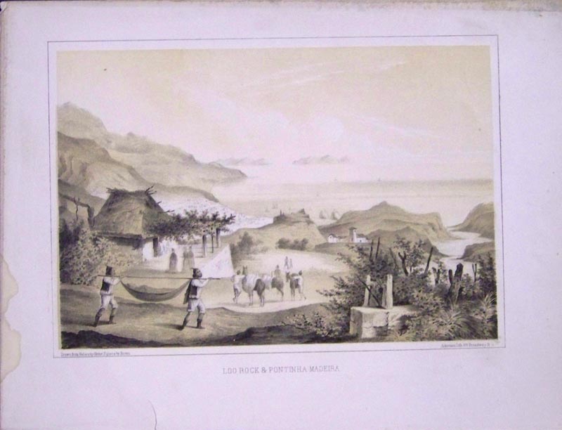 219asia: 1856 Loo Rock & Pontinha Madeira Perry Expedition lithograph, drawn from nature by Heine.Figures by Brown. Ackerman Lithograph, New York. 11 x 8-1/2 in. $50  220asia: 1906 halftones which were featured in Leslie's Weekly titled, "Peculiar and Novel Sights in the Streets of Seoul." Each halftone featured portrays "Typical Pictures of the Curious and Picturesque Open-Air Life of the Korean Capital.". 15-1/2 x 11 in. $50  221asia: 1859 Wood engraving which was featured in The Illustrated London News and shows, "Manners and Customs of the Chinese in 1859 -- Funeral at Hong-Kong." Scene shows Mourners Walking Round the Coffin and Tables with Meat-Offerings To the Gods. 15-1/2 x 10-1/2 in. $40  222asia: 1899 Color map of the Empires of China, Japan and Korea, with an inset on bottom left corner of Hong Kong and Vicinity. Copyright in 1899 by J. Martin Miller, Chicago, Illinois. 16 x 11 in. $40  223asia: 1858 Wood engraving with text on bottom of page featured in Harper's Weekly titled, "Anglo-American Monument at Hong-Kong." Page size is 15-1/2 x 11 in. $20 |
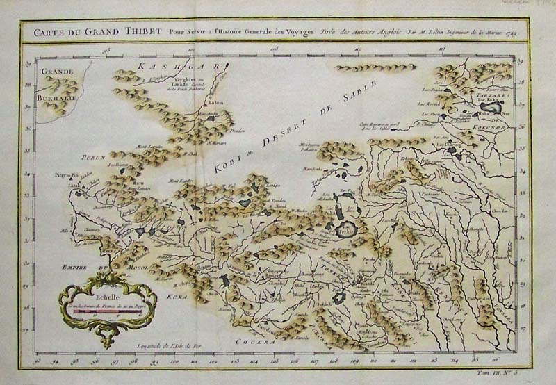
240asia: c.1741 Bellin hand colored copper engraved Carte Du Grand Thibet in fine condition with good margins. 12 x 8-1/2 in. $200 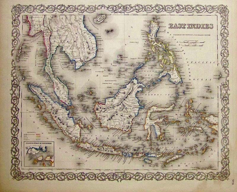
241asia: 1855 J.H. Colton original hand colored engraved map showing the East Indies, featuring a small inset of the Island and Strait of Singapore. Colton was among the earliest map makers with very accurate maps. 17 1/2 x 14 1/2 in. $80 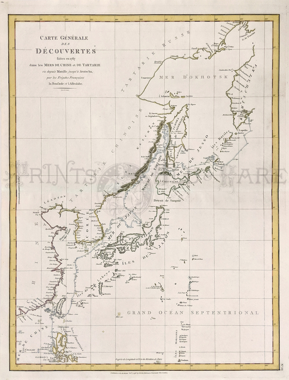 243asia: La Perouse – Japan, Korea, China, Kamchatka. Shows route of Astrolabe in 1787. Copper engraving. 16 1/2 x 21 1/4 in. $475 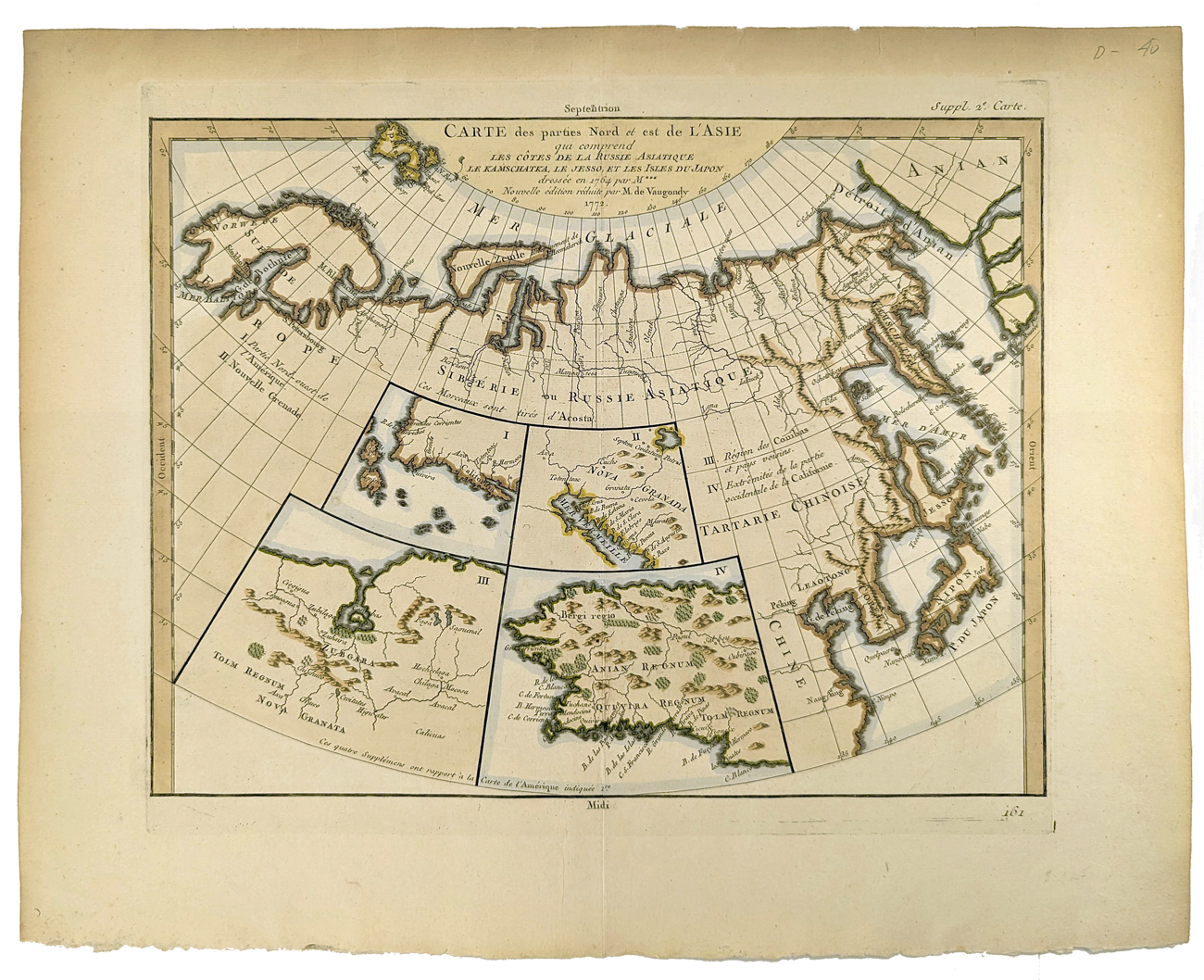 244asia: Carte des parties Nord et est dl l'Asie. Five maps on one sheet, showing Northern Russia territories in Europe and Asia, including the western coastline from Siberia, with Japan and Korea. Map also shows Bering Straits (Detroit d'Anian) and Hokaido called Jesso. Inset map of California and Alaska. Very good condition. Wide margins. 15 5/8 x 18 3/4 in. $250 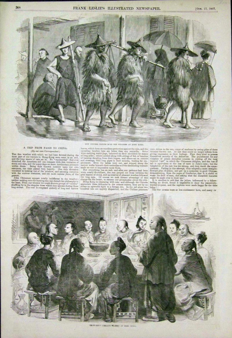 224asia: 1857 Wood engravings with text featured in Frank Leslie's Illustrated Newspaper showing on top, "How Chinese Coolies Mind the Weather at Hong Kong;" and bottom, "Chow-Chow (Chinese Supper) at Hong Kong." 15-1/2 x 10-1/2 in. $50 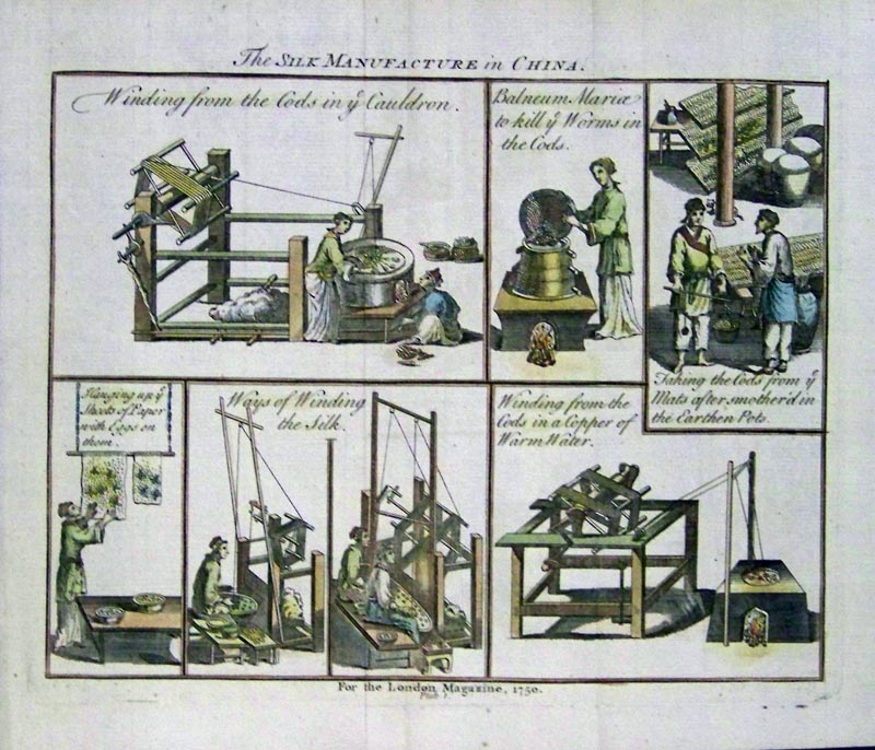 225asia: 1750 Hand colored copper engraving For the London Magazine, Plate 1, titled, "The Silk Manufacture in China." Six scenes in all show the process of manufacturing silk. 9 x 8 in. $50 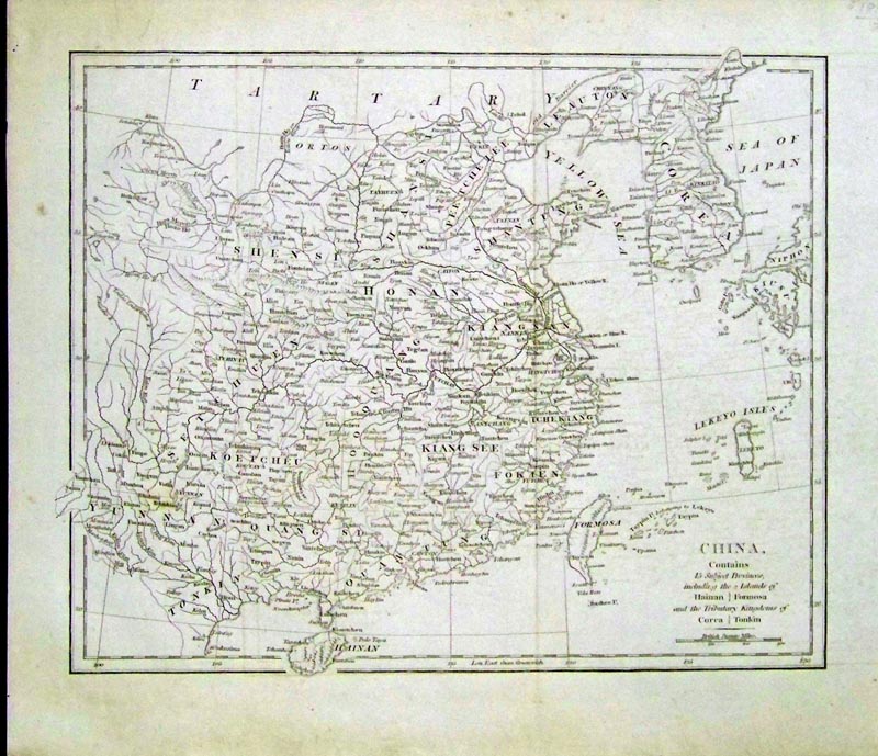 227asia: C. 1810 Copper engraved map of "China, which contains 15 Subject Provinces, including the 2 Islands of Hainan and Formosa, and the Tributary Kingdoms of Corea and Tonkin." 12 x 10-1/2 in. $50 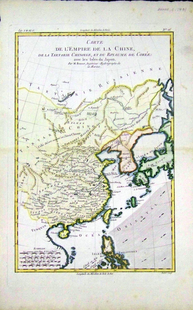 228asia: 1781 Hand colored copper engraved map titled, "Carte De L'Empire De La Chine, De La Tartarie Chinoise, Et Du Royaume De Coree: avec les Isles du Japon. Par M. Bonne, Ingenieur - Hydrographe de la Marine." 16 x 10-1/4 in. $240 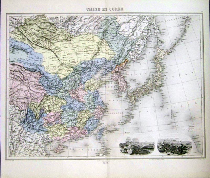 229asia: 1812 Hand colored engraved map of, "Chine Et Coree." Two vignettes of Peking and Tokio on bottom right corner. 17-1/2 x 15-1/2 in. $80 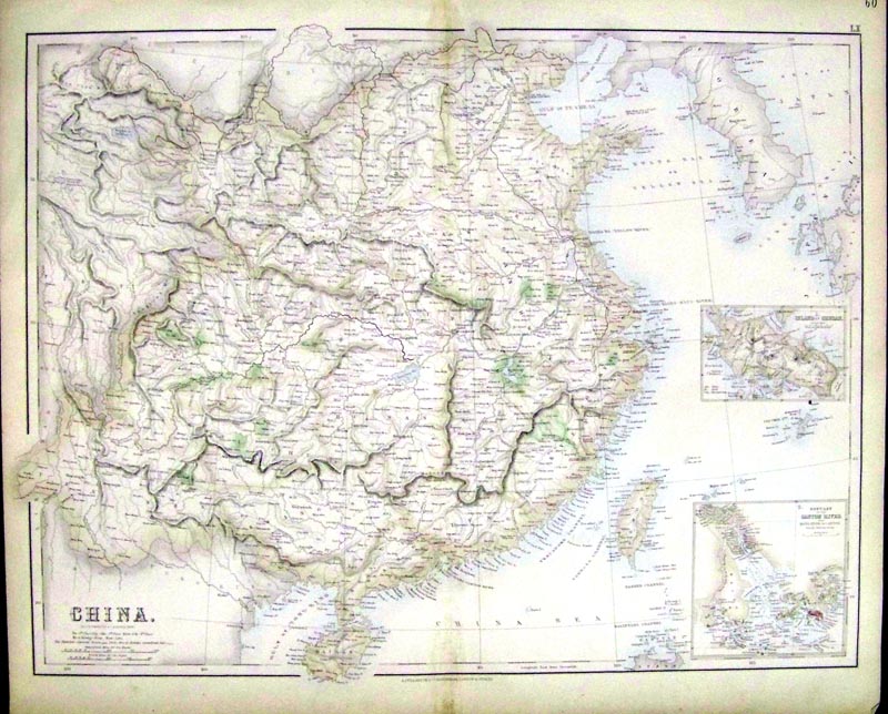 230asia: 1858 Hand colored engraved map of China by G.H. Swanston & J. Bartholomew. Insets of the Island of Chusan and the Estuary of the Canton River from Hong Kong to Canton are on bottom right hand corner of map. 22 x 18 in. $120 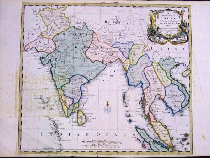 232asia: 1773 Hand colored copper engraved map titled, "A General Map of India, Including the Empire of Hindostan with the Kingdom of Bengal and its other dependencies, 1773." Thomas Kitchin, Engraver. Map shows Cambodia and Burma, Thailand, Laos, Vietnam and Southeast Asia. Map also has a beautiful natural history cartouche. Some light foxing on left side. 18 x 14 in. $385 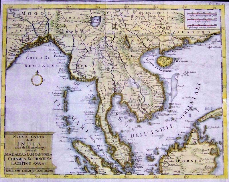
233asia: C.1750 Hand colored copper engraved map titled, "Nvoua Carta dell' India di la' del Fiume Ganges overo di Malacca Siam Cambodia Chiampa Kochinchina Laos Pegu Ava & c." Map shows Indochina and Southeast Asia with the Bay of Bengal, Singapore, Sumatra, Borneo, and other cities. Map published in Amsterdam by Isac Tirion. 14-1/2 x 11 in. $275 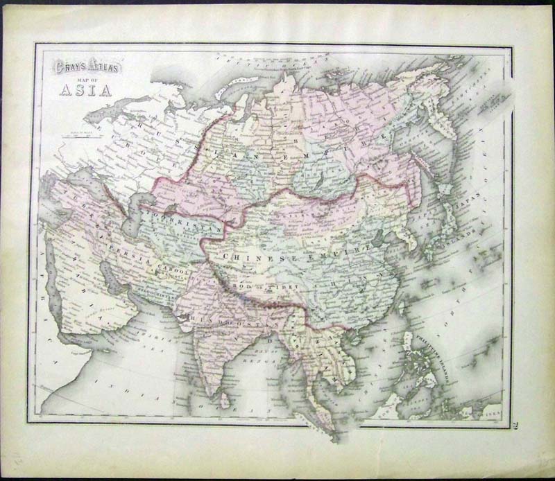
235asia: 1873 Colored steel-engraved Gray's Atlas, Map of Asia showing red-outlined Chinese Empire, part of the Russian Empire and Toorkistan. 17 x 14-1/2 in. $75 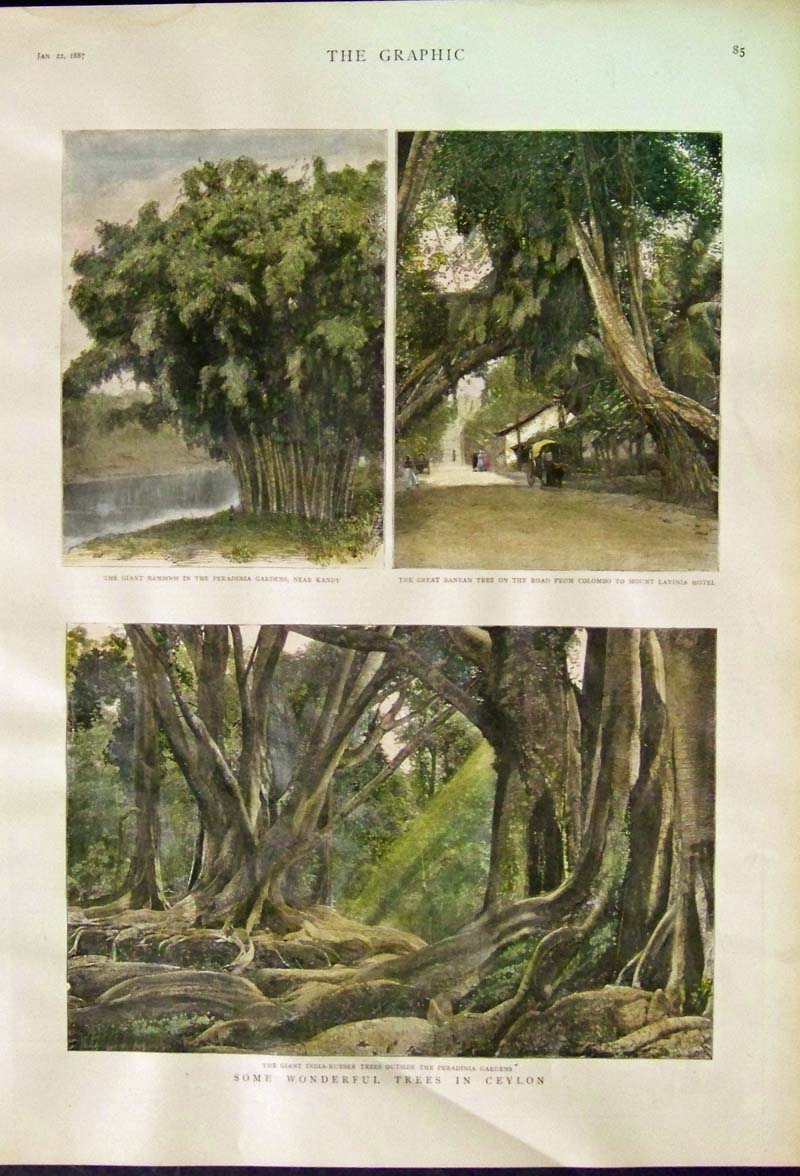
236asia: 1887 Hand colored wood engraving featured in The Graphic titled, "Some Wonderful Trees in Ceylon." The trees featured are the Giant Bamboos, the Great Banyan, and the Giant India-Rubber trees. 16 x 11-1/2 in. $50 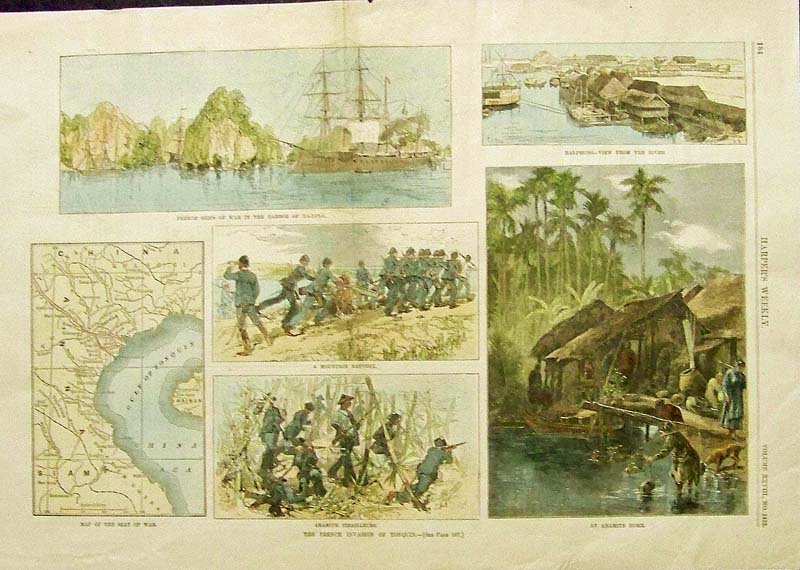
237asia: 1884 Hand colored wood engravings titled, "The French Invasion of Tonquin," (Vietnam) which was featured in Harper's Weekly. Among scenes shown are French Ships of War in the Harbor of Ha-Long and Map of the Sea of War. 16 x 11 in. $40 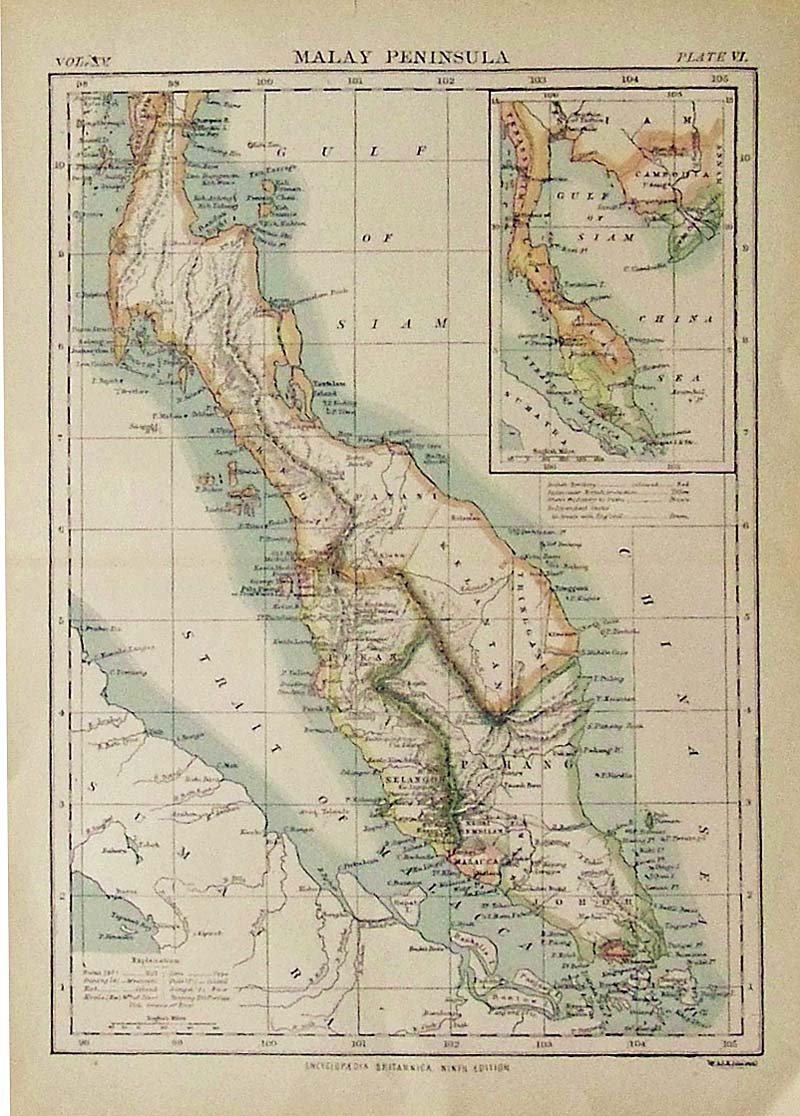
238asia: C.1890 Color map of the Malay Peninsula, Plate VI which was featured in the Encyclopedia Britannica, Ninth Edition. 13 x 9-1/2 in. $30 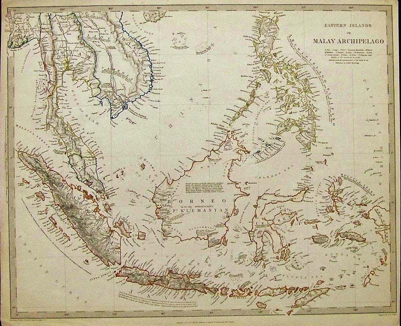
239asia: 1846 Outline colored steel engraving of the Eastern Islands or Malay Archipelago, published by Baldwin & Craddock, London. 16 x 13-1/2 in. $160 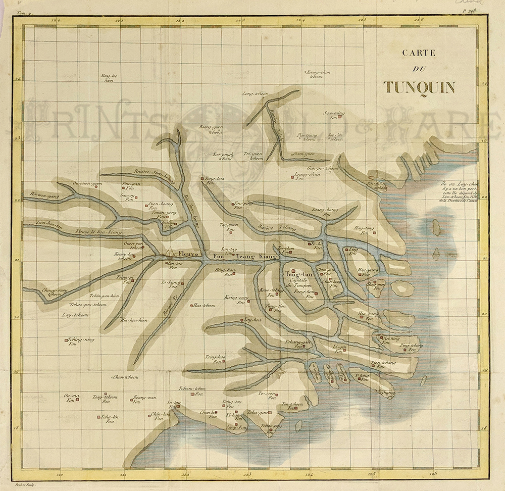 136rare: c.1780 North Vietnam. Engraved by Canu, Map of Tunquin, Where the Vietnam War started. Shows the many rivers around the capital Hanoi, in North Vietnam, compiled by several reports of early French Jesuit explorers. Watercolor copperplate engraving on handmade paper. Very good condition. Measuring 14 x 14" plus margins. $450 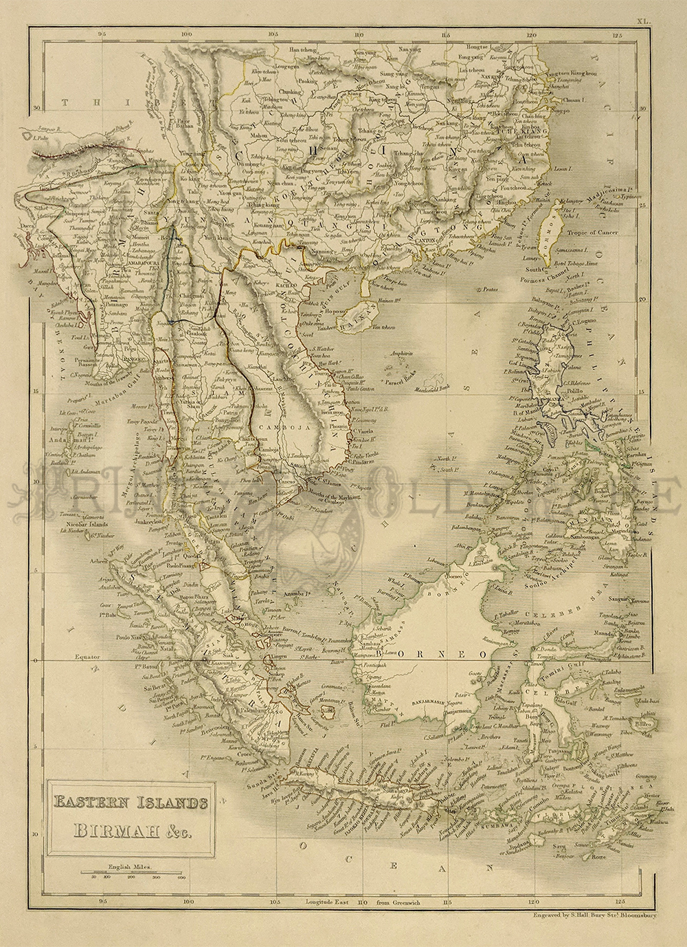
138rare: 1854 Sidney Hall map from Black's Atlas showing the East Indian Islands of Burma, Borneo, Philippines, Southeast China, etc. Water colored steel plate engraving. Very good condition. Measuring 10 1/2 x 15" plus margins. $300. |
|||||||||
| Order Form | |||||||||||
| Back to Homepage | |||||||||||