 
|
|||||||||||
This is a small selection of our inventory of antique Central America maps and prints. Additional inventory is available. Contact us with your request. 1-800-879-6277
|
|||||||||||
|---|---|---|---|---|---|---|---|---|---|---|---|
 002cam: 1897 Central America Map. Very attractive antique Century map, printed in color. Inset of Lake Nicaragua shows route of Nicaragua Canal. 16x12 in. $40 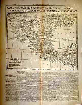
003cam: 1911 Large Central America Map. By Rand McNally. Printed in color, with insets of Panama Canal Zone. 28x21 in. $80 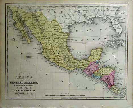 004cam: 1861 Mitchells map. This old, beautifully hand colored map shows Central America and Mexico. 9.5x12 in. $50 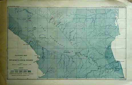 007cam: 1902 Antique Nicaragua Map. Large scale map shows rainfall for the proposed Canal region. 17-1/2x11 in. $40 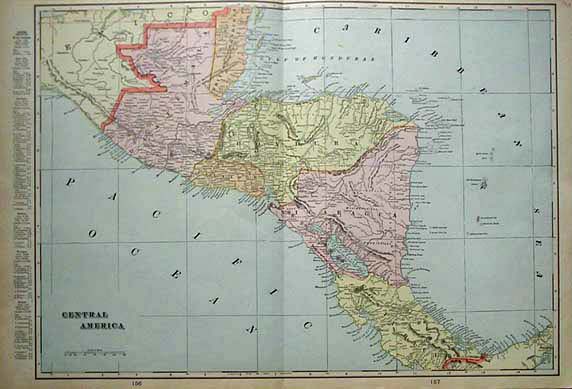 009cam: 1901 Central America Map. Great turn of the 19th Century map by Cram. Printed in litho color, lists chief cities and populations for each country. 21-1/4x14 in. $40 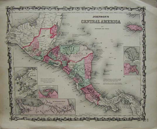
010cam: 1861 Central America Map. Original hand-color antique map by Johnson. Attractive border. Insets of Panama and Nicaragua. 18x14 in. $80 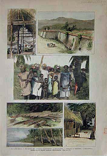 012cam: Beatuiful hand colored engravings from Frank Leslie's Illustrated Newspaper from 1886. Six scenes from Honduras, Central America. Text in German. 16x11 in. $60 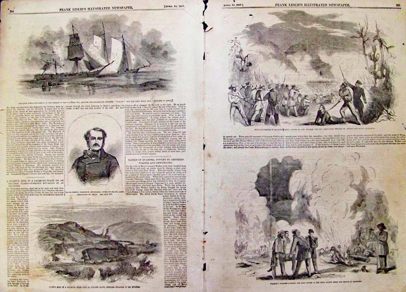 013cam: Nicaragua - The Notorious General Walker -- Battle of Quarisma. 1857 Wood engraving showing four views of the battle plus portrait of Frederick Henningsen. 22 x 16 in. $80 
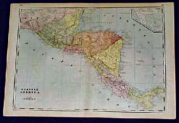
100cam: 1915 Map of Central America. Color map of the Central American isthmus, from Guatemala to Panama. Belize is labeled as British Honduras. Cities and geographical features are shown throughout the area. In Guatemala and El Salvador, the names of individual departments are listed. 11x14 in. $50 |
 101cam: 1891 Map of Central America. Large, colorful map of Central America from an 1891 world atlas. Panama is labeled as "Veragua." Belize is called "British Honduras," and the shape of Guatemala is quite different than today. An area of land in southeastern Honduras is colored separately, and labeled as "Land of the Honduras Commercial Co." Cities, towns and geographical features are shown throughout the region. The names of Indian tribes are shown in the areas where they lived. 17x25 in. $80 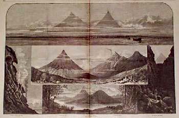 103cam: 1860 Central America Volcano Views. Large engraving from Harper's Weekly, titled "The Fire Mountains of Central America." Contains five individual scenes of impressive Central American volcanoes, each with its own caption: 1) Crater of Volcano del Fuego; 2) Volcano del Agua; 3) Valley of Antigua, Lake and Volcano of Atitlan; 4) Volcano del Fuego; and 5) The Road to the Crater. 16x22 in. $50 
107cam: 1955 El Salvador Government Poster. Interesting color poster, featuring the official seal of the Republic of El Salvador. It appears to have been printed by the Salvadoran government, but its exact origin is unknown. In the lower right corner are the words "Secretaria de Informacion de la Presidencia de la Republica, 1955." The entire image is surrounded by a decorative design. 14x19 in. $50  108cam: Costa Rica - 1852 Hand colored Sketch of the Golfito in Golfo Dulce lithograph by Mr. Delaplin, Commanding the French Corvette, La Brillante, May 1852. Drawn by Arthur de Witzleben. Lithograph by J. Bien, N.Y. 24 x 21 in. $150 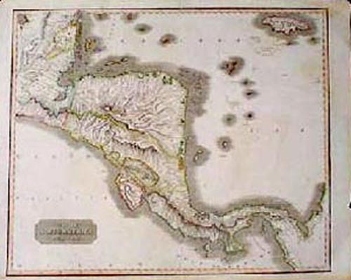
200cam: RARE Antique Map of Central America. Beautiful, engraved map of Central America, showing the area between the Yucatan Peninsula and the coast of South America. Published in Thomson's New General Atlas of 1816. Title of the map is "Spanish North America, Southern Part." Geographical features are shown in considerable detail. Cities and towns are also shown. Provinces are individually colored with original outline hand coloring. Very attractive map, which would look great in a frame! Perfect for anyone with an interest in colonial Central America just before independence was declared. Condition is very good. There is one tear (approx. 3 inches) on the bottom edge, which has been repaired on the back with archival tape. There is no image loss. 21x27 in. $300 SOLD 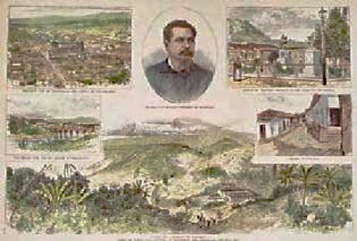 201cam: Antique Views in Honduras Central America. Six hand-colored, engraved images on one page from Harper's Weekly of July 28, 1888. Title is "Views of Town and Country in Honduras." Image titles are as follows: 1) Bird's-Eye View of Tegucigalpa, the Capital of the Republic; 2) General Luis Bogran, President of Honduras; 3) Statue of Francisco Morazan, in the Plaza of Tegucigalpa; 4) Street in Yuscaran; 5) Pueblo and Mineral of Yuscaran; and 6) Old Bridge over the Rio Grande at Tegucigalpa. 11x16 in. $80 Black & White: $50 |
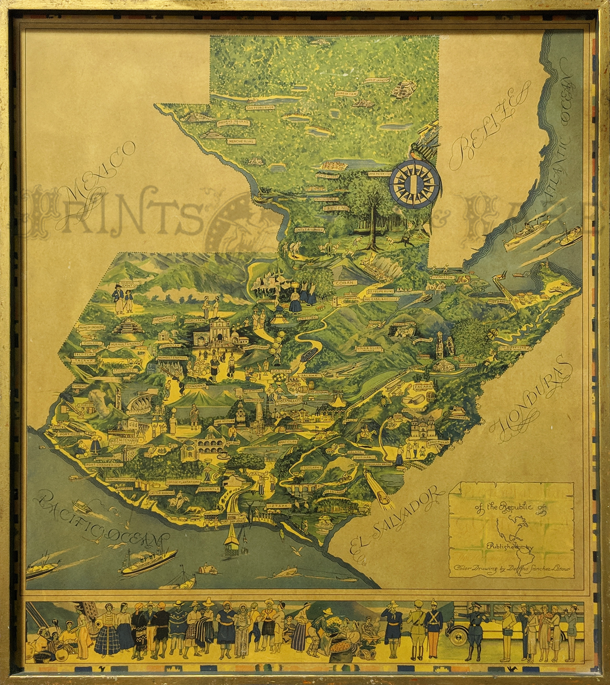 208cam: Guatemala Pictorial Map 1930s. Rare. Map by Delfino Sanchez Latour, Published by The National Tourist Committee. Mounted and framed. Bottom border shows people of Guatemala. Printed in color. 40 1/2 x 35 in. $350 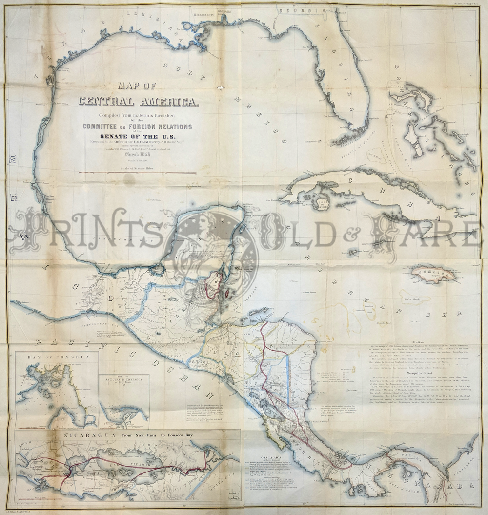 209cam: Map of Central America complied from materials furnished by the Committee on Foreign Relations of the Senate. 1856. Originally folded. Outline color. Inset shows proposed route for Nicaragua, Canal, Bay of Fonseca, and San Juan. 45 x 44 in. $425 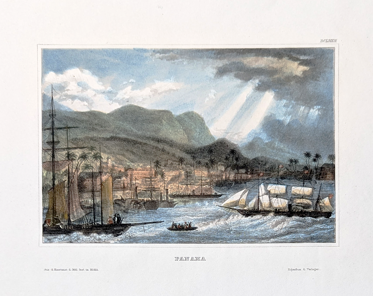 211CentralAmerica: Panama c.1850. City View. Hand colored, steel engraving. Harbor scene. 4 3/4" x 6 1/4" in. $75 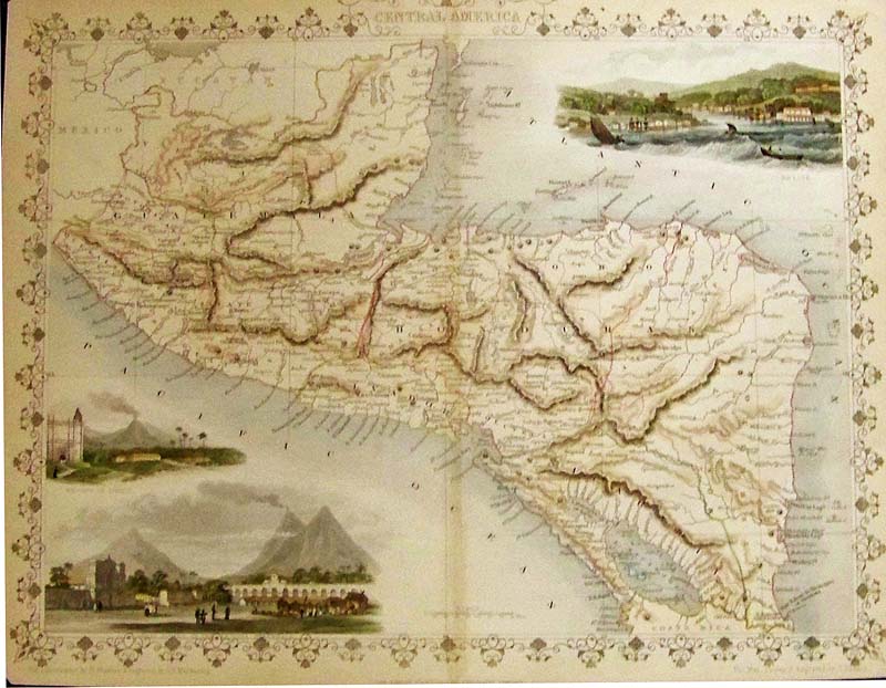 207cam: Central America, Rapkin, 1851 - A very decorative original hand colored engraved map of 'Central America' including Guatemala, Belize, Honduras, El Salvador and Nicaragua, which was engraved by J. Rapkin, vignettes by H. Winkles & G. R. Mainwaring and published in John Tallis & co.'s The Illustrated Atlas London & New York: c.1851. This map was typical of the many fine ones which appeared in this work with its decorative border and attractive vignettes. Illustrated are views of 'Belise' (Belize City), the volcano of 'Isalco' (Izalco) and the Great Square of the Antigua, Guatemala. Condition: Very good normal browning on the edges, small margin, some corners slightly missing and a fold in the middle. size 12 x 9 image $150 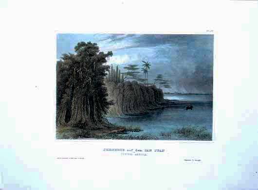
203cam: Beautifully hand colored steel engraving. Published by Herrmann J Meyer in Meyer's Universum c 1850. Picture titled, Szenerie auf dem San Juan in Central America. 7.5x10 in. $75 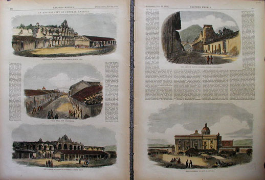 204cam: An Ancient City of Central America. Two pages of hand colored engravings from the July 22, 1871 Supplement of Harper's Weekly. Left page shows, The Palace at Antigua Guatemala - North View; Calle Real, New Guatemala; The Palace at Antigua Guatemala - South View. Right page shows, The Arch of Santa Catarina, Antigua Guatemala; and The Cathedral of New Guatemala. 16x22 in. $100 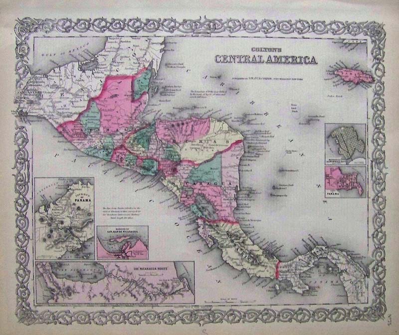 206cam: Central America Colton 1855. Very attractive engraved map with original color by G. W and C. B. Colton before the creation of the Panama Canal. An important map with five insets: San Juan Harbor, Isthmus of Panama, Nicaragua Route, Panama and Manzilla Island or Navy Bay. Issued as page no. 55 in volume 1 of the first edition of George Washington Colton's 1855 Atlas of the World. Condition: Very good normal age browning and yellowing on margins. 15.5 X 12.5 image $100 |
|||||||||
| Order Form | |||||||||||
| Back to Homepage | |||||||||||