|
|||||||||||
This is a small selection of our inventory of antique Comparative maps. Additional inventory is available. Contact us with your request. 1-800-879-6277
|
|||||||||||
|---|---|---|---|---|---|---|---|---|---|---|---|
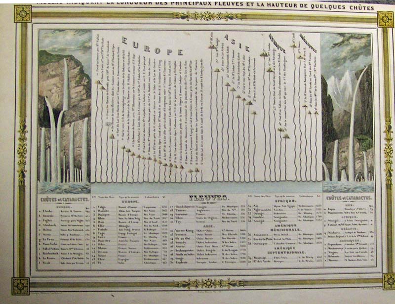
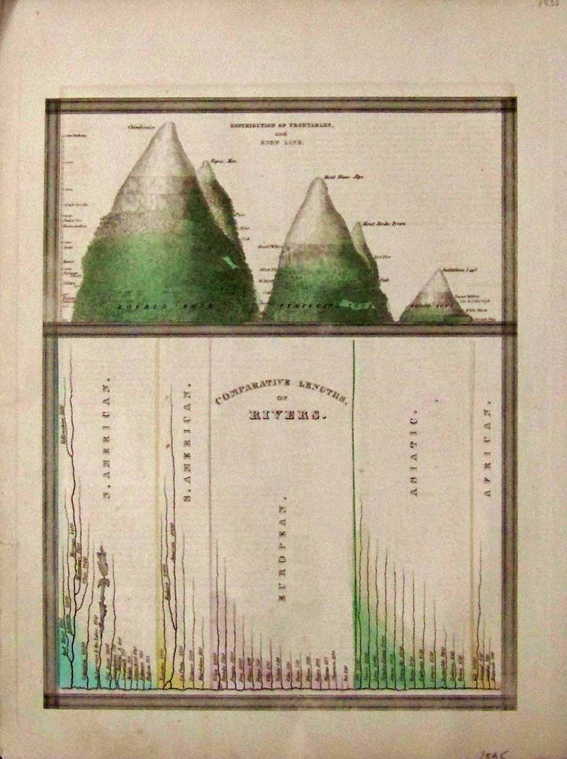 001cmaps: Comparative Lengths of Rivers, Bradford 1835 - An attractive hand colored comparative map showing the comparative lengths of the principal rivers in North and South America, Europe, Asia and Africa. A large inset in the top half of the map notes the comparative heights of mountains, snow level, and distribution of vegetation in each of the three zones (Frigid, Temperate and Torrid). The map details the world's great rivers in relative to one another and divided by continent. The rivers have been necessarily straightened to indicate their lengths. The Mississippi is considered, by far, to be the world's longest river. The length of the Nile is grossly underestimated - when this was made the source of the Nile had yet to be determined. The St. Lawrence River is drawn to include four of the five Great Lakes. The map was published as plate no. 15 in Thomas G. Bradford's 1835 Comprehensive Atlas Geographical, Historical and Commercial. Bradford's atlas, published in 1835 was an important work on many levels. Condition: Very good, wide margins normal aging color. size 9 x 11 image. $190 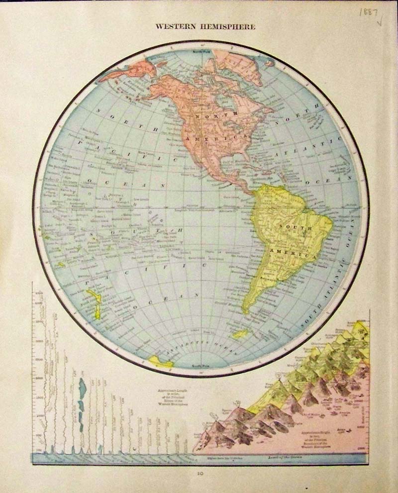
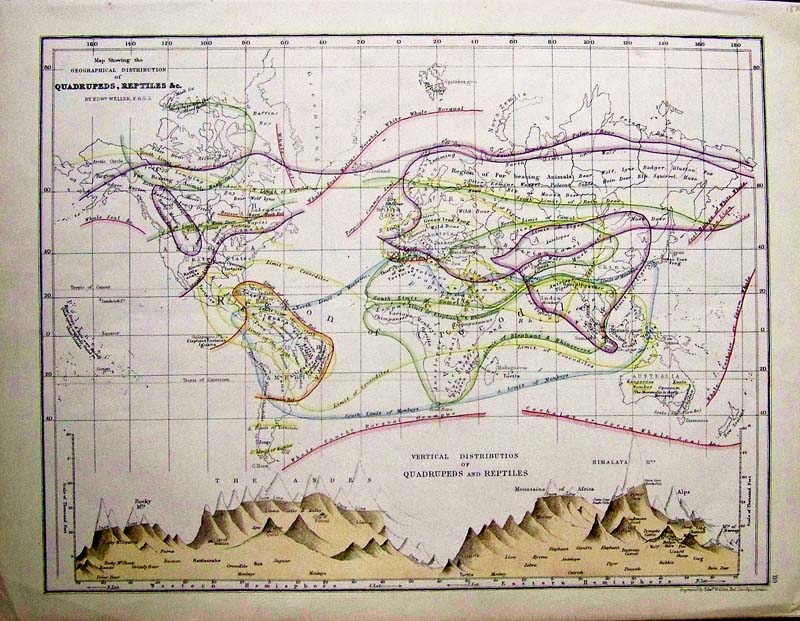
002cmaps: Western Hemisphere, with Length of Rivers and Mountain Heights, Cram 1887 - A small lithograph map with original color, issued by the George F. Cram Company is a wonderful example of Cram's cartographic style and expertise. This map is probably from Cram’s first world atlas, and shows approximate height in feet of principal mountains in the Western Hemisphere and length of rivers in miles. Special Note: George F. Cram (1842-1928), served in the U.S. Army during the American Civil War. After the war ended, Cram joined his uncle Rufus Blanchard's Evanston, Ill. map business in 1867. Two years later, he became sole proprietor of the firm and renamed it the George F. Cram Co. which became a leading map firm and first American firm to publish a world atlas. Condition: Very good, wide margins, no folds with nice pastel coloring some light browning on the edges. size 10 x 12.75 image. $40 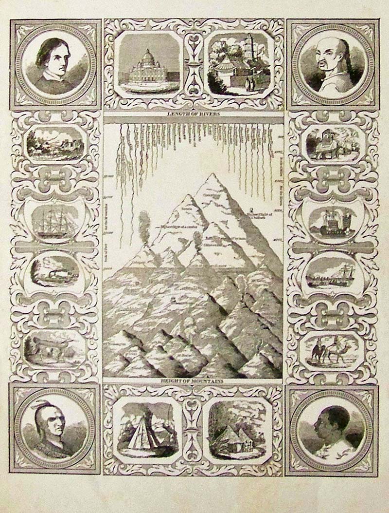
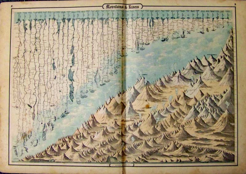
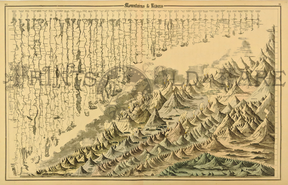
003cmaps: Length of Rivers and Heights of Mountains, Unknown 1884 - A small black and white steel engraving map with an extremely decorative border of vignettes including, Indian, Chinese, Settler and Slave heads on the corners. Between the heads are small vignettes of steam ships, sailing vessels, canoe portages, teepees, primitive huts, camel riding, and the US Capital building. The center features mountains and rivers, several volcanoes are shown erupting, this is probably from an early history book engraver unknown. Condition: Good, some browning on margin edges, and yellowing in middle hardly noticeable. size 9.25 x 11.25. $70 |
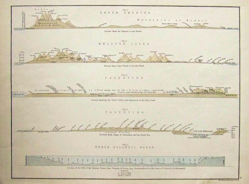 004cmaps: Comparative Section Map, Weller 1870 - Rare and unusual map showing cross sections of the elevations of South America, the British Isles, Palestine and the depth of the North Atlantic Ocean. Hand colored lithograph probably from Weller’s Crown Atlas of 1870, specific focus given to the Dead Sea, with a section of the sea bed from Valentia to Trinity Bay Newfoundland. Condition: Excellent some browning on margin edges but image very good throughout. size 16.5 x 13 image. $200
|
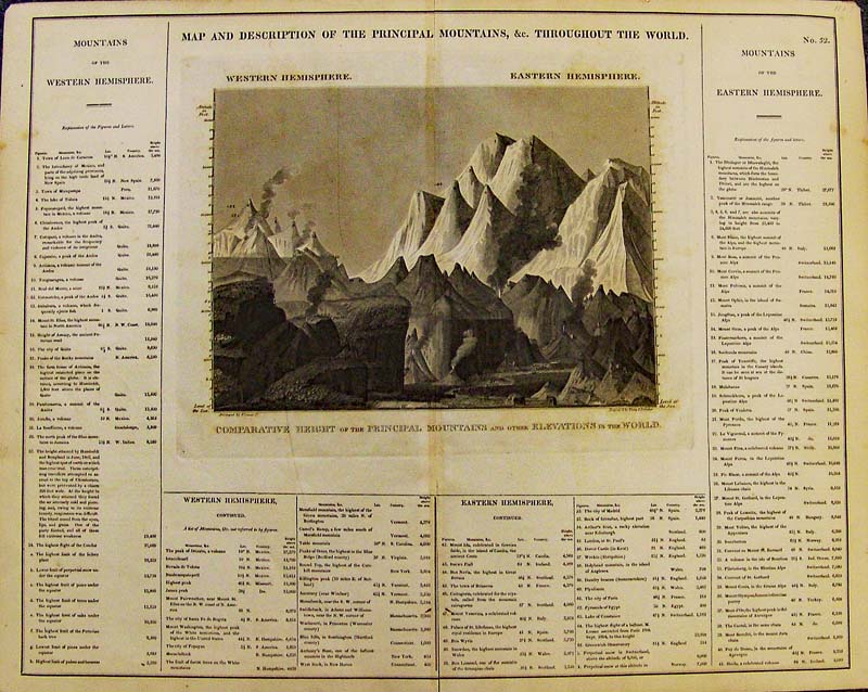
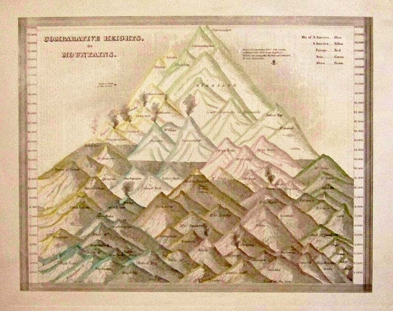 009cmaps: Comparative Heights of Mountains, Bradford 1835 - A handsome and small engraved map with original color, the map is one of the earliest obtainable comparative mountain charts published in the United States by Bradford. Chamoulari and Dhawalghiri are the tallest listed mountains. The mountains are color coded to show North America in Blue, South America in Yellow, Europe in Red, Asia in Green and African Brown. Condition: Very good, wide margins, no folds, normal browning on margin edges. size 10 x 8 image. $190
|
|||||||||
| Order Form | |||||||||||
| Back to Homepage | |||||||||||