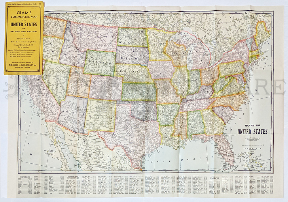
001fpm:
Cram's Commerical Map of the United States with 1940 Federal Census
Populations. Printed in Color. 32 x 22 in. $75
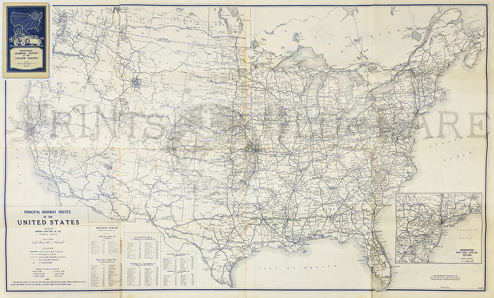
002fpm:
Principal Highway Routes of the United States. 1930 General Drafting
Co. Shows road surfaces and route numbers. Relief map Texas and
Transcontinental Tour.
27 x 16 in. $85
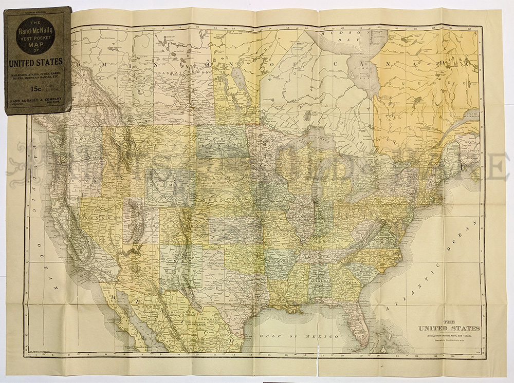
003fpm:
1915 Vest pocket map of United States. Rand McNally - Shows Railroads,
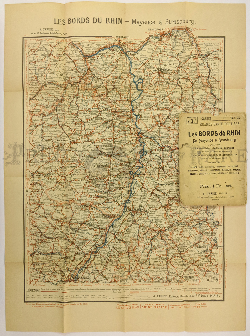
States, Cities, Lakes, Rivers, Mountain Ranges, etc.
14 x 21 in. $85
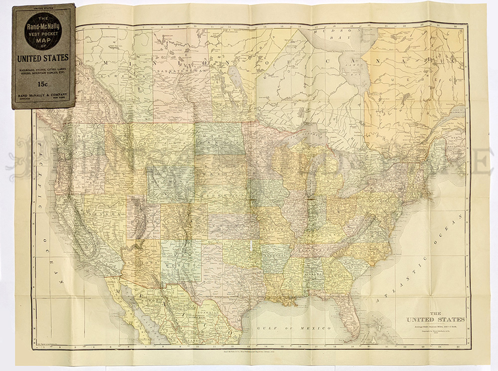
004fpm:
1916 Vest pocket map of United States. Rand McNally - Shows Railroads,
States, Cities, Lakes, Rivers, Mountain Ranges, etc.
14 x 21 in. $85
005fpm:
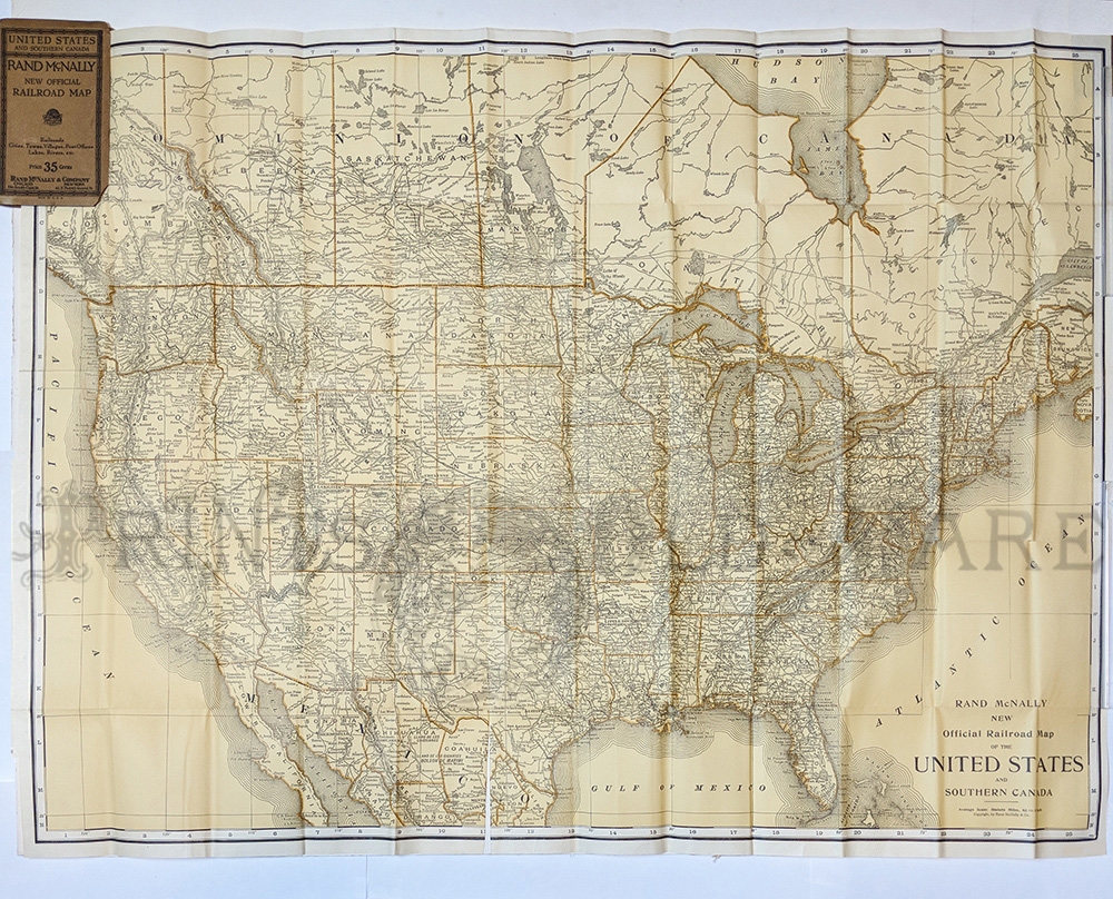
1910 Rand McNally New Official Railroad Map of the United States
& So. Canada. In original folded state.
27 1/2 x 37 1/2 in. $175
006fpm:
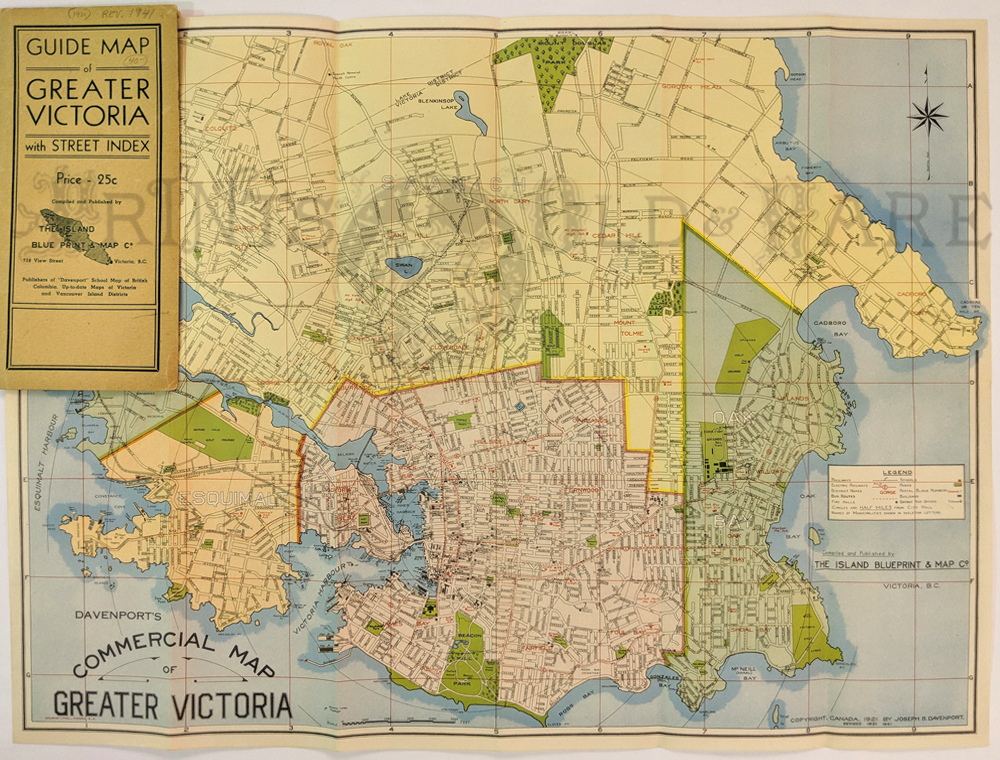
Greater Victoria – Davenports Commercial. Map by Island Blue Print and
Map Co. 1929 (rev. to 1941) Separate pullout for street index. Shows
electric railways, street names, bus routes, fire halls, schools,
district names, post offices.
14 x 19 in. $80

261ny:
1896 Original cover with folded bicycle map by Bailey &
Kibling's. Map is titled, "Bicycle and Tourist Map of Chautauqua
County, N.Y. Copyright April 14, 1896 by C.B. Bailey and F.G. Kibling.
Small box on left reads, "The Jamestown Engraving Company Cuts for
Electro Photo Engravers." Fold creases still visible with small light
brown spots near cover attachment.
21-1/2 x 19 in. $200
|
008fpm:
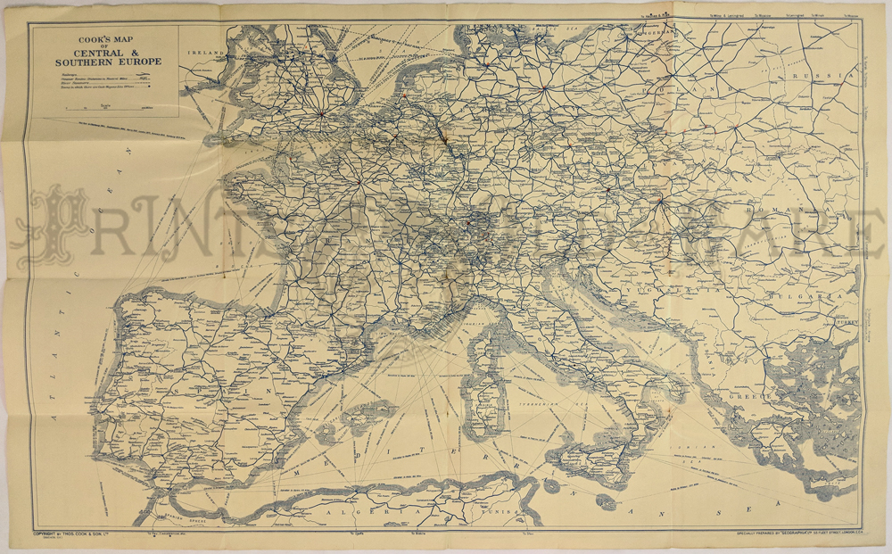
Central Europe Pre WWII (1936) THOS. COOK & SON. Shows
steamships, river steamers, roads, cities. Ads verso.
28 x 19 in. $35
009fpm:
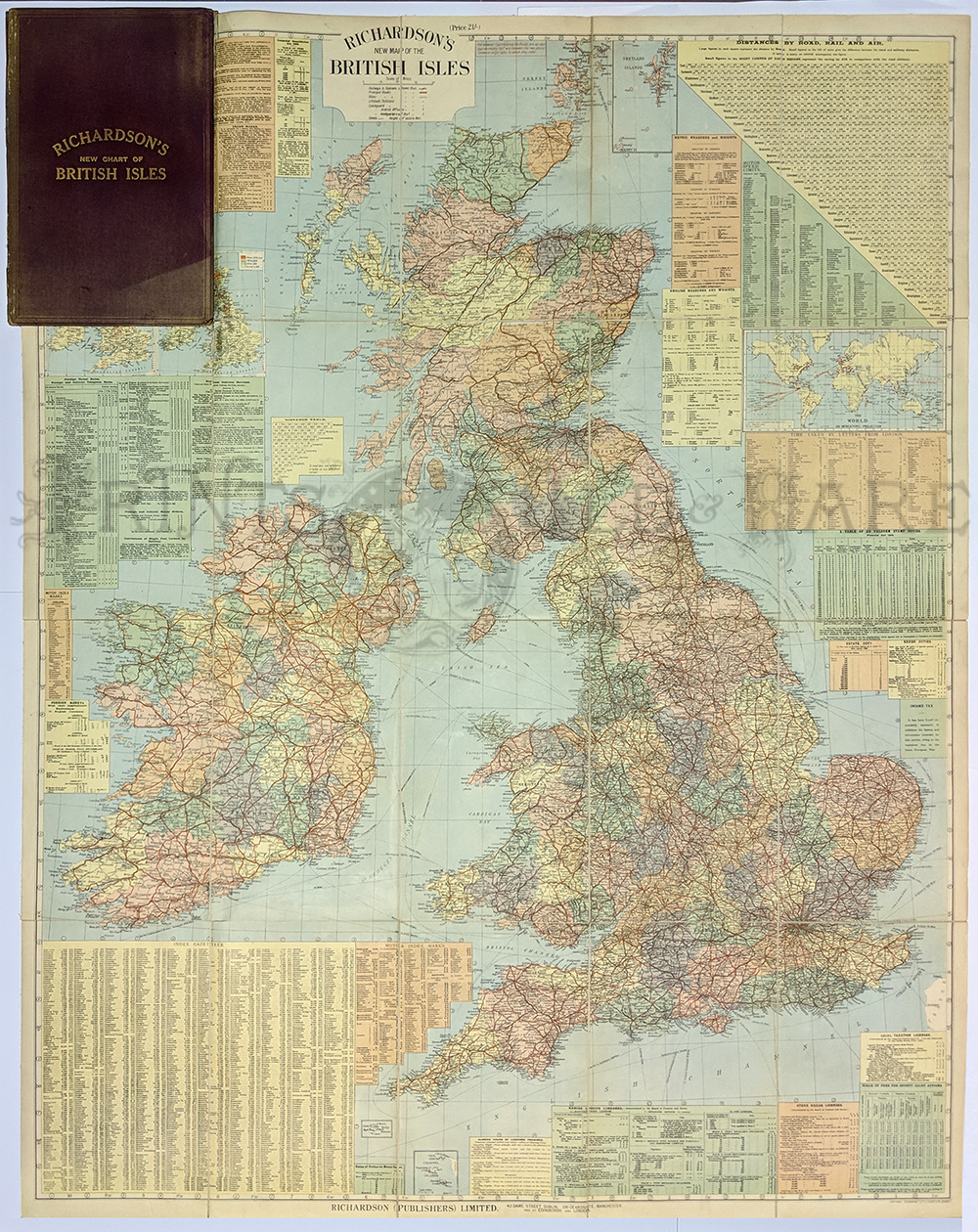
UNITED KINGDOM, folding colour map showing railways, steamship routes,
ports, rivers, canals, main roads, distances between towns and
rainfall. Measures 123 x 98cm. Cloth-backed with additional inset maps,
motoring information, etc. First Edition 26 x 21cm. Published by
Richardson 1918. Bound with maroon boards, spine reinforced.
48 x 38 in. $49
010fpm:
Tourists, Auto, Bicycle Map. Rhine River. Les Bords Du Rhin - Mayence a
Strasbourg. c1915. In original paper case.
23 x 16 in. $45

289California:
1940 Commercial and School Map of California by Thomas Bros. Folded map
consists of 16 panels laid down on linen. Shows tables of Highway
mileage, Townships, and 1940’s population. Insets of San Francisco,
Oakland, Los Angeles and vicinity.
65 x 45 in. $250
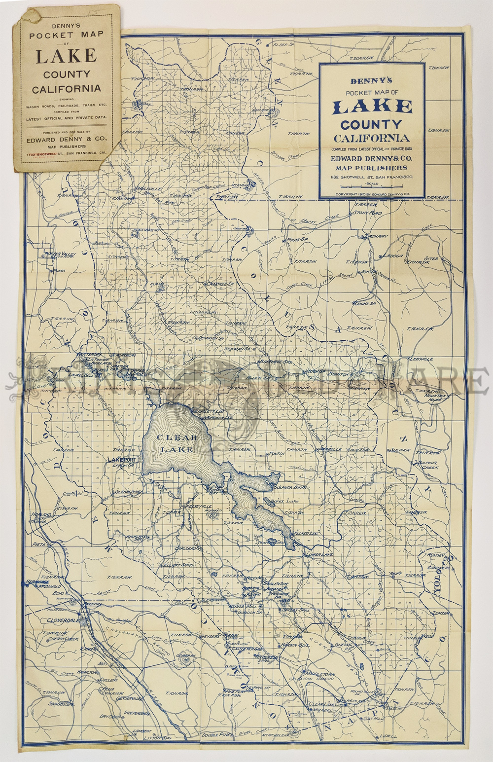
000California:
Denny’s Pocket Map of Lake County California, 1920 - A large folding
blue-line pocket map of Lake County, California, blue on white
background, very detailed map of the county by Edward Denny and Co. The
title on the wrapper reads "Denny's Map - Lake County California...
Published by Edward Denny, rare map only a few copies at U.C. Berkeley
and U.C. Davis.
Condition: Very good, size 17 x 22¾ image,
folding into stiff paper wrappers to a 7x4¼" pocket. $200
SOLD
|
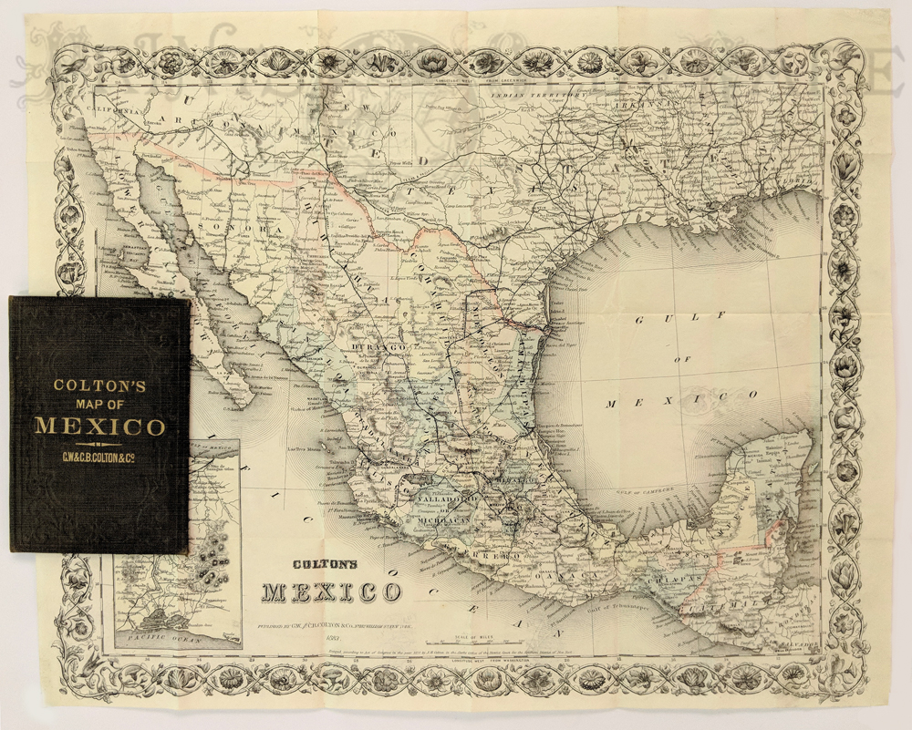
011fpm:
Colton’s Mexico. New York: G.W. & C.B. Colton & Co.,
1883. Separately issued map on banknote paper, folding into original
covers. Lithograph. Hand colored. Excellent condition.
12 1/2 x 15 1/4 in. $650
013fpm:
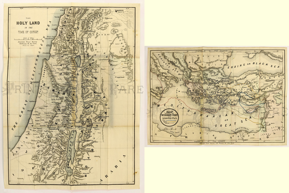
Holyland in the Time of Christ & Map. Showing the Missionary
Tours of St. Paul published by American Tract Society NY. C1850. Hand
colored engraving.
18 1/2 x 13 in. $125
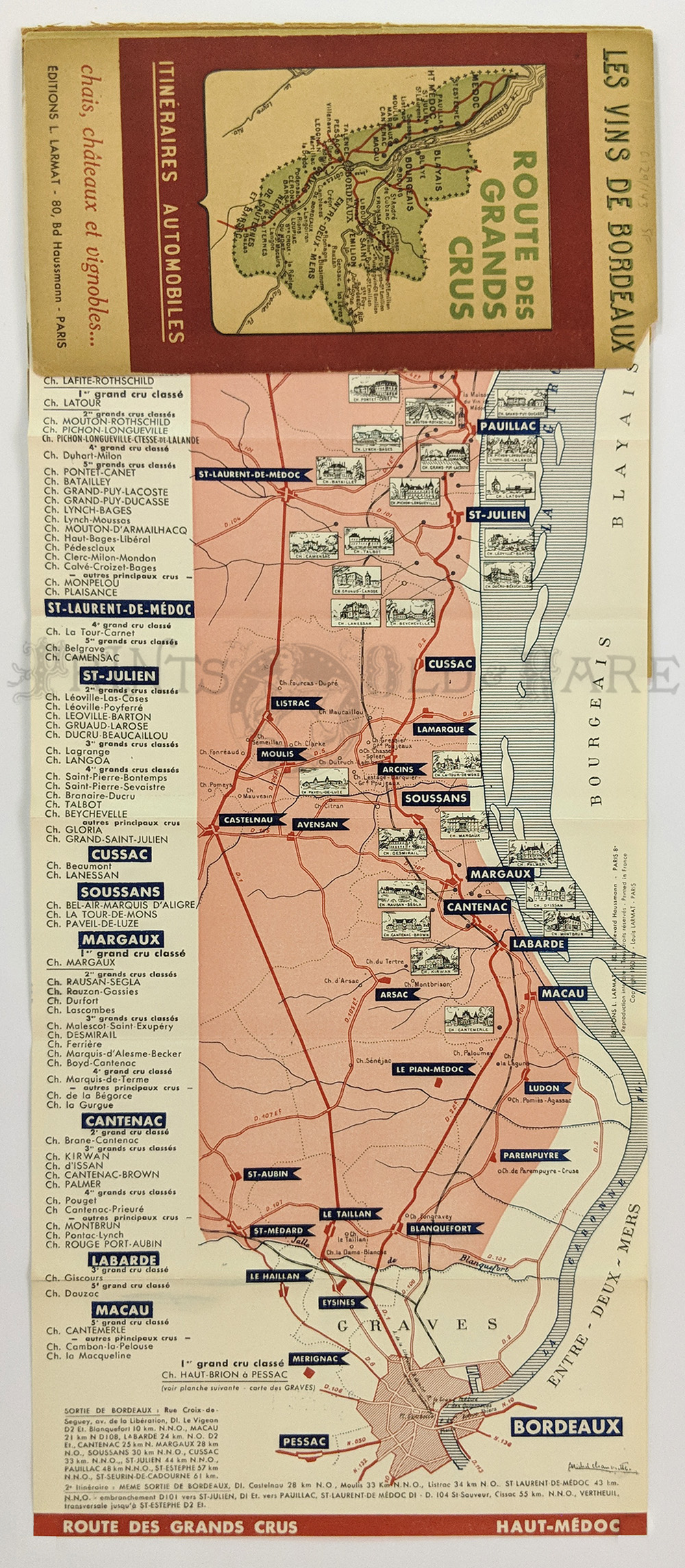
014fpm:
Wine Region: Les Vines de Bordeaux. 3 fold out maps of “Route des Grand
Crus.” Haut-Medoc, Graves – Cerons, St. Emilion, one of the most
celebrated wine routes in Europe. c. late 40s-50s. Maps are fine covers
split at spine, wine label inside cover.
19 1/8 x 8 in. $75
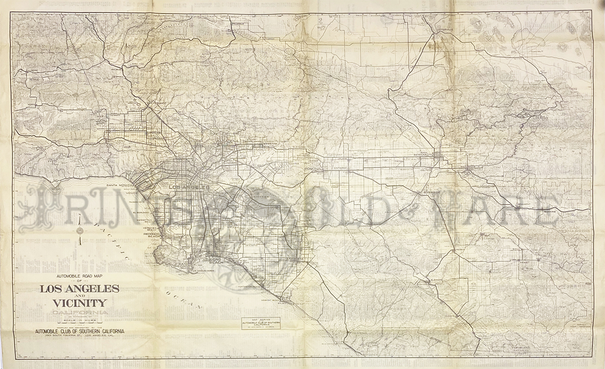
137los:
Automobile Road Map of Los Angeles and Vicinity. c.1940s. Large
detailed map showing cities, highways, streets, parks, and places of
interest. Published by the Automobile Club of Southern California.
27 1/5 x 44 in. $250
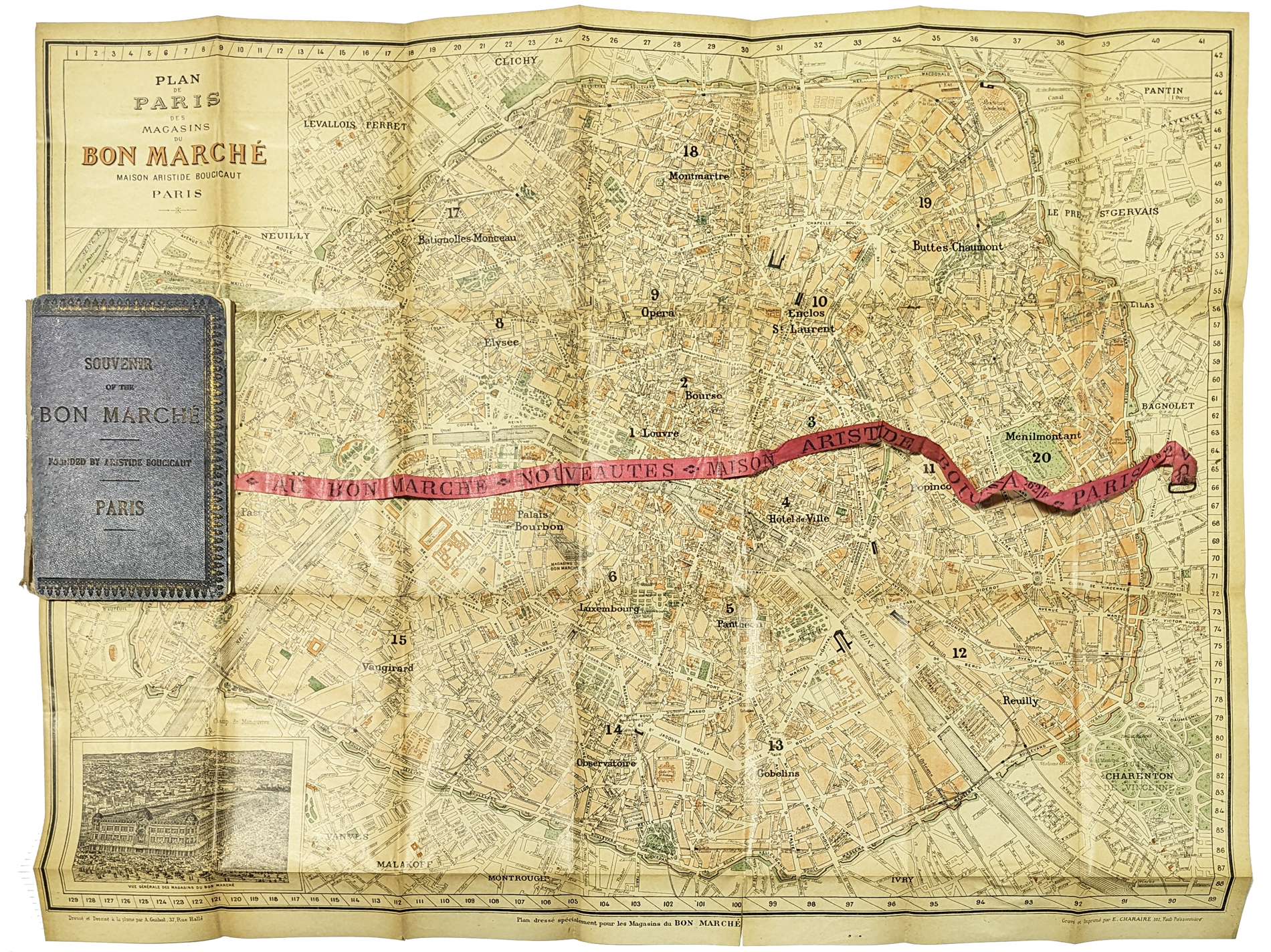
225paris:
Paris – Folding pocket map 1896. A 36-page promotional booklet for the
Bon Marche department store in Paris, France. Used for reference in the
creation of the Ashville, North Carolina, Done Marche department store,
created and owned by the Lipinsky family. The elegant booklet contains
a description of the Bon Marche administrative practice including
personnel guidelines; a ribbon-map that can be used to estimate
distance and to locate “instantly any street” and environ; and a
comprehensive list of Paris, its streets, squares, etc. **Minor
tears/rips on folds. Back booklet cover is loose.
21 5/8 x 27 in. $350
|
|