 
|
|||||||||||
This is a small selection of our inventory of antique Georgia maps and prints. Additional inventory is available. Contact us with your request. 1-800-879-6277
|
|||||||||||
|---|---|---|---|---|---|---|---|---|---|---|---|
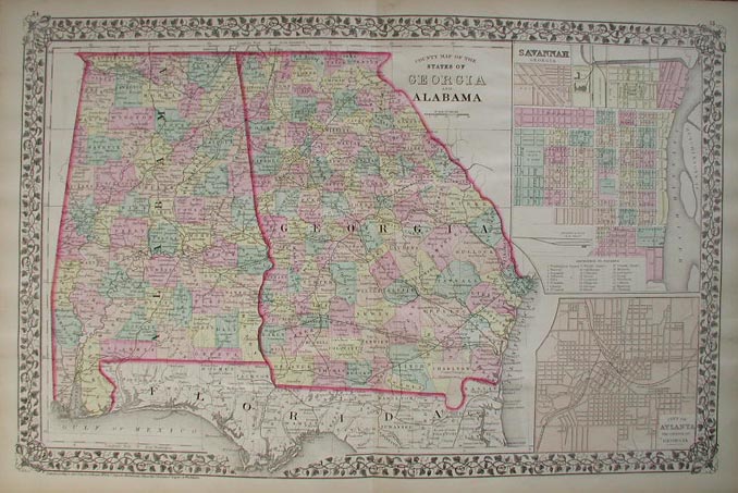 001ga: 1876 Mitchell's original hand colored County Map of the States of Georgia and Alabama, with insets on right of Savannah, Georgia and the City of Atlanta, the Capitol of Georgia. Entered according to Act of congress in the Office of the Librarian of Congress at Washington. 23 x 15 in. $150 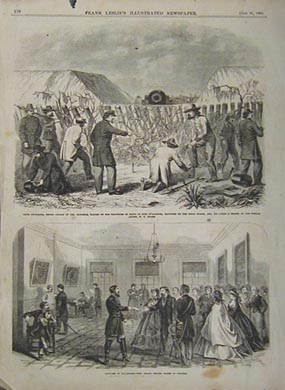 002ga: 1866 Savannah Civil War. Two rare views on one page. Leslie's engravings. 11x16 in. $30 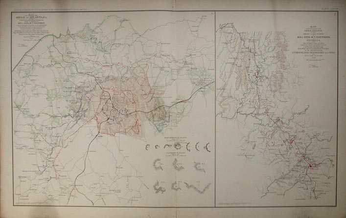 003ga: Two Civil War maps on one page by the U.S. Government. Left side is Illustrating the Siege of Atlanta, Ga. Right hand side shows the Operations of the Army under Com'd Maj. Gen. W.T. Sherman in Georgia. Shows many forts, greatly detailed. 18x29 in. $80 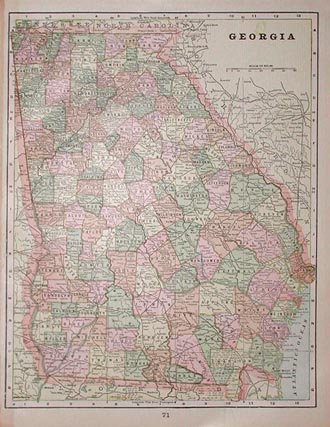 009ga: 1895 hand colored map of Georgia. Published by Cram in 1895, map shows roadways, rivers, and each county is colored individually. 11x14.5 in. $30 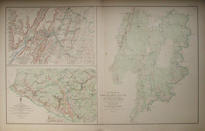 011ga: Civil War Atlas map. Three parts, showing, Army Movements around Chattanooga, Tenn.; The Battle-Field of Cold Harbor, Va.; and Battle-Field of Chickamauga, Ga. Printed by the U.S. Government following the war. 18x29 in. $80 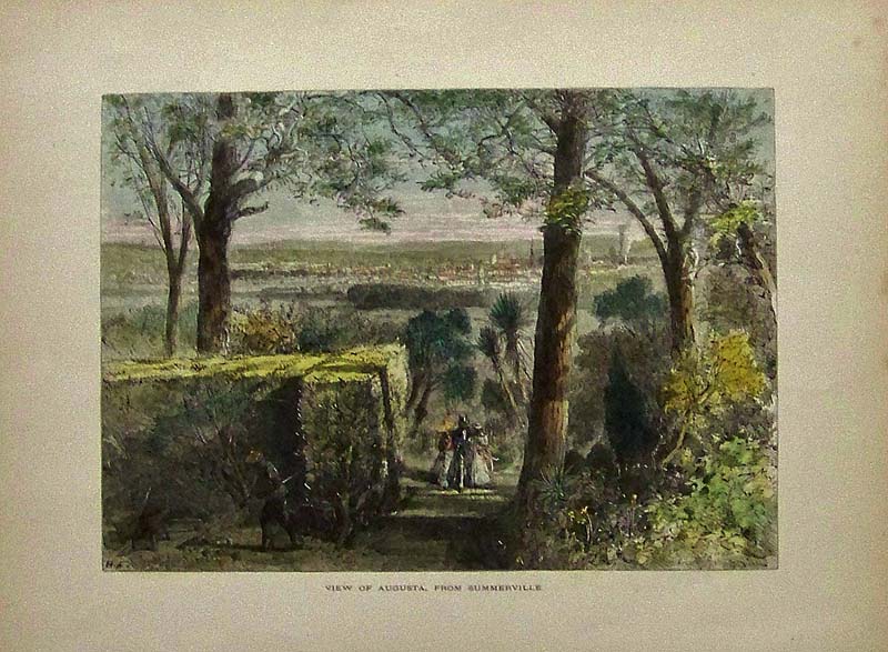 015ga: 1873 Hand colored wood engraved view of Augusta, From Summerville. Featured in Picturesque America. 12 x 9 in. $40 SOLD 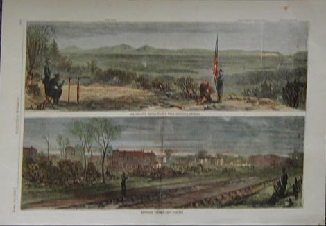 016ga: 1864 Civil War views of Ringold, Georgia. Hand colored engraving from Harper's Pictorial History of the Civil War. 11x16 in. $60 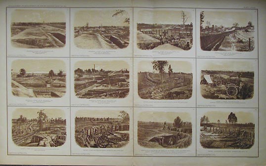 018ga: Civil War Atlanta. Twelve sepia views on one large page. Printed by U.S. Government after the War. 34x20 in. $80 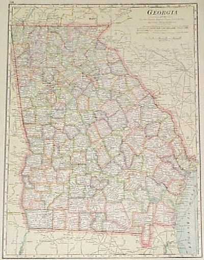 101ga: 1910 Map of Georgia. Detailed map of the state, with each county colored separately, published by George F. Cram in 1910. Cities, towns, railroad lines, electric power lines and geographical features are all shown. 12x15 in. $40  102ga: Civil War Map: Georgia, South Carolina. This is a map from the Atlas to Accompany the Official Records of the Union and Confederate Armies, published by the United States government in 1895. It covers an area from central Georgia to central South Carolina, with Atlanta on the far left and Augusta in the middle. The map is extremely detailed, showing roads, railroad lines and even the smallest villages. Geographical features are shown in detail as well. 18x30 in. $80 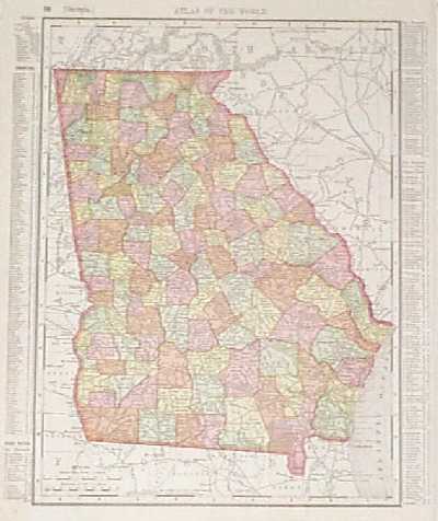 107ga: 1895 Map of Georgia. Colorful map of the state, from the 1895 Rand McNally Atlas of the World. Cities, towns, railroad lines and geographical features are all shown. In the left and right margins, there are keys showing the locations of counties, cities and towns. 21x27 in. $80 SOLD 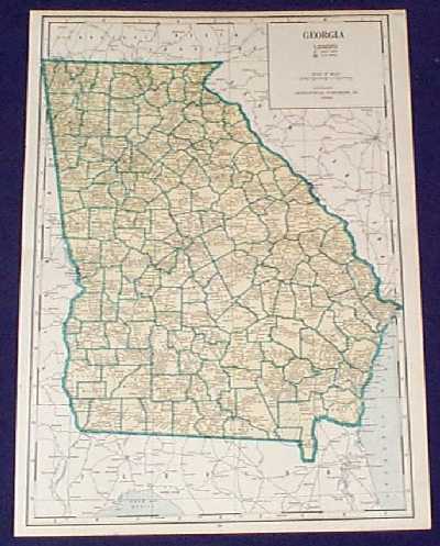 108ga: 1934 Map of Georgia. Interesting map, printed in 1934 by the Geographical Publishing Co. Each county is outlined in green. Cities, towns, railroad lines, rivers and swamp land are all marked. 16x22 in. $40 SOLD 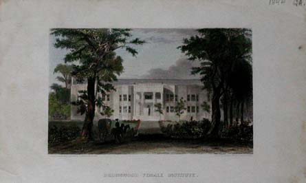 209univ: 1844 steel engraving of the Brownwood Female Institute in Georgia. This is in excellent condition 4.5x6 in. $40 View More College and University Prints Here |
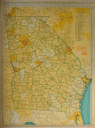 203ga: Large colorful map of Georgia. Published in 1940 by Rand McNally. Detailed map includes population by county and Georgia railroad lines. Very nice map, would look great in a frame. 20.5 x 27.5 in. $80 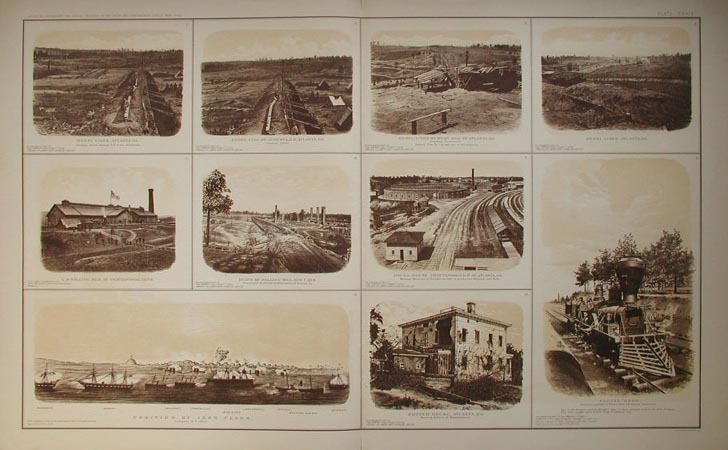 206ga: Beautiful sepia tone views of Atlanta, GA., from the U.S. government's official atlas of Civil War records. Printed from photographs taken during the Civil War. 29.5 x 18.5 in. $80 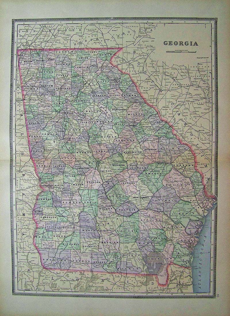 112Georgia: 1891 Bradley color lithographed map of Georgia, showing in detail all the cities and thoroughfares. 26 x 19 in. $60 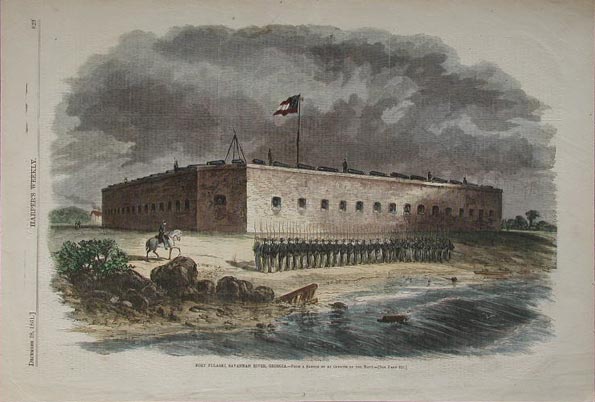 208ga: Beautiful hand colored wood engraving from the December 28, 1861 issue of Harper's Weekly. Fort Pulaski, Savannah River, Georgia. From a sketch by an Officer of the Navy. 11 x 16 in. $50 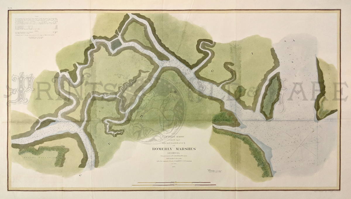 218ga: U.S. Coast Survey Chart. Reconnaissance of Romerly Marshes, Georgia. Published in 1855, this hand colored chart includes water depth and tide information. 30 x 18.5 in. $150 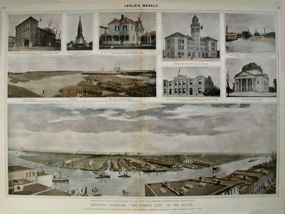 219ga: Historic Savannah - "The Forest City" of the South. Published c1900 in Leslie's Weekly, this hand colored half tone shows several views of the city of Savannah. Includes a birds-eye view of proposed terminals of Georgia and Alabama Railway, now Constructing on Hutchinson's Island, Opposite Savannah. 20.5 x 15 in. $150 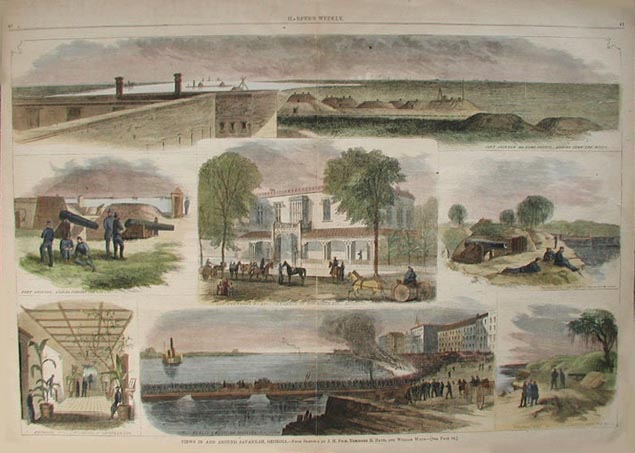 220ga: Views in and Around Savannah, Georgia. Several beautiful hand colored wood engravings from the January 21, 1865 issue of Harper's Weekly. Images include Fort Jackson, General Sherman's Headquarters, and Thunderbolt Battery. 22 x 16 in. $150 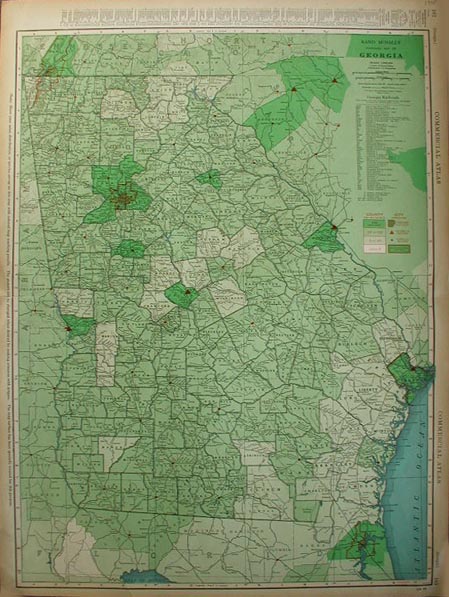 221ga: Large colorful map of Georgia. Published in 1935 by Rand McNally. Detailed map includes population by county and Georgia railroad lines. Very nice map, would look great in a frame. 20.5 x 27.5 in. $80 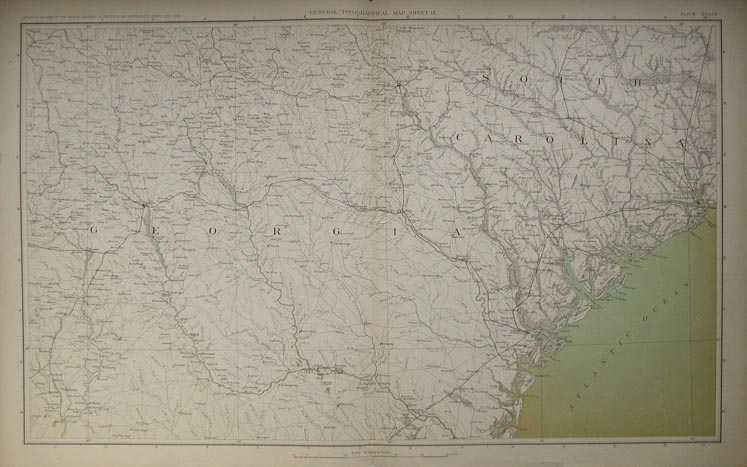 223ga: Civil War Map of Georgia and South Carolina. This is a map from the Atlas to Accompany the Official Records of the Union and Confederate Armies, published by the United States government in 1895. The map is extremely detailed, showing roads, railroad lines, and geographical features. 18x29 in. $80 SOLD 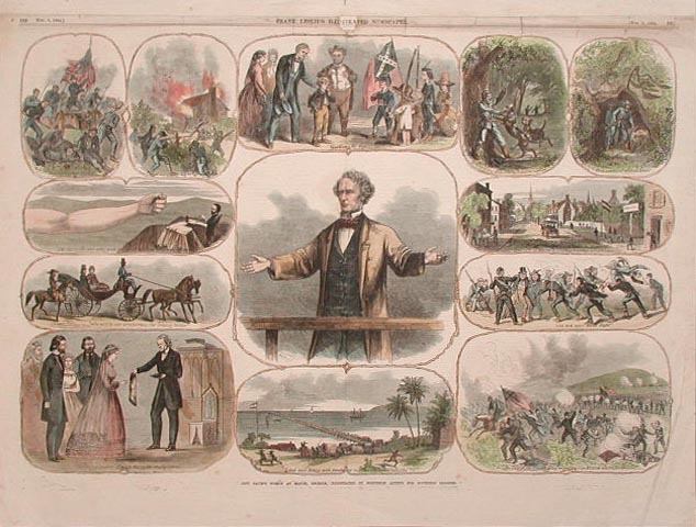 225ga: Jefferson Davis's Speech at Macon, Georgia, Illustrated by Northern Artists for Southern Readers. From the November 5, 1864 issue of Frank Leslie's Illustrated Newspaper. Heading at the top of the page has been archivally repaired. 22x16 in. $160 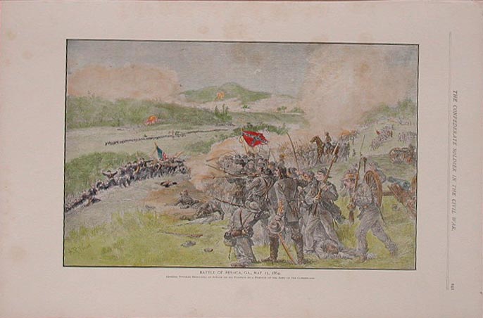 226ga: Hand colored half tone from The Confederate Soldier in the Civil War. Battle of Resaca, Ga., May 15, 1864. General Hindman Repulsing an Attack on his Position by a Portion of the Army of the Cumberland. 16x11.5 in. $50 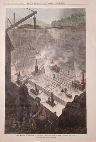 227ga: The Marble Industries of Georgia - Interior View of the Quarries at Tate. Hand colored wood engraving from the September 29, 1888 supplement to Frank Leslie's Illustrated Newspaper. 11x16 in. $60 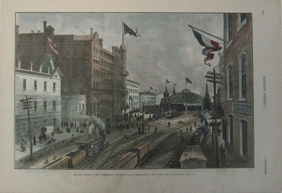 230ga: 1887 Picture of the Commercial Centre in Atlanta, Georgia. Hand colored engraved image titled, "Atlanta, Georgia-The Commercial Centre," drawn by Horace Bradley from Harper's Weekly. Shows scene of the Commercial Centre in Atlanta, Georgia. 11 x 16in. $80 SOLD 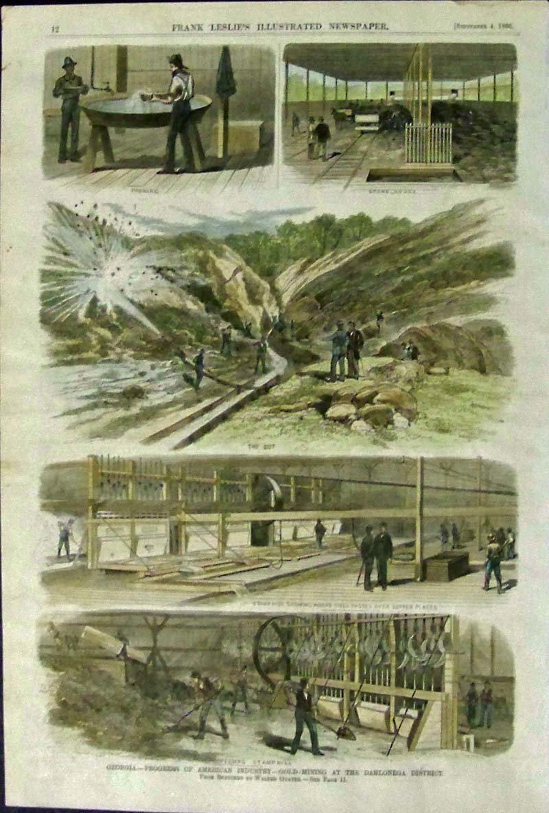 234ga: 1880 Rare Hand colored wood engraving featured in Frank Leslie's Illustrated Newspaper showing gold mining in the Dahlonega District. Title of images is, "Georgia -- Progress of American Industry -- Gold-Mining At the Dahlonega District." From Sketches by Walter Goater. 16 x 11 in. $175 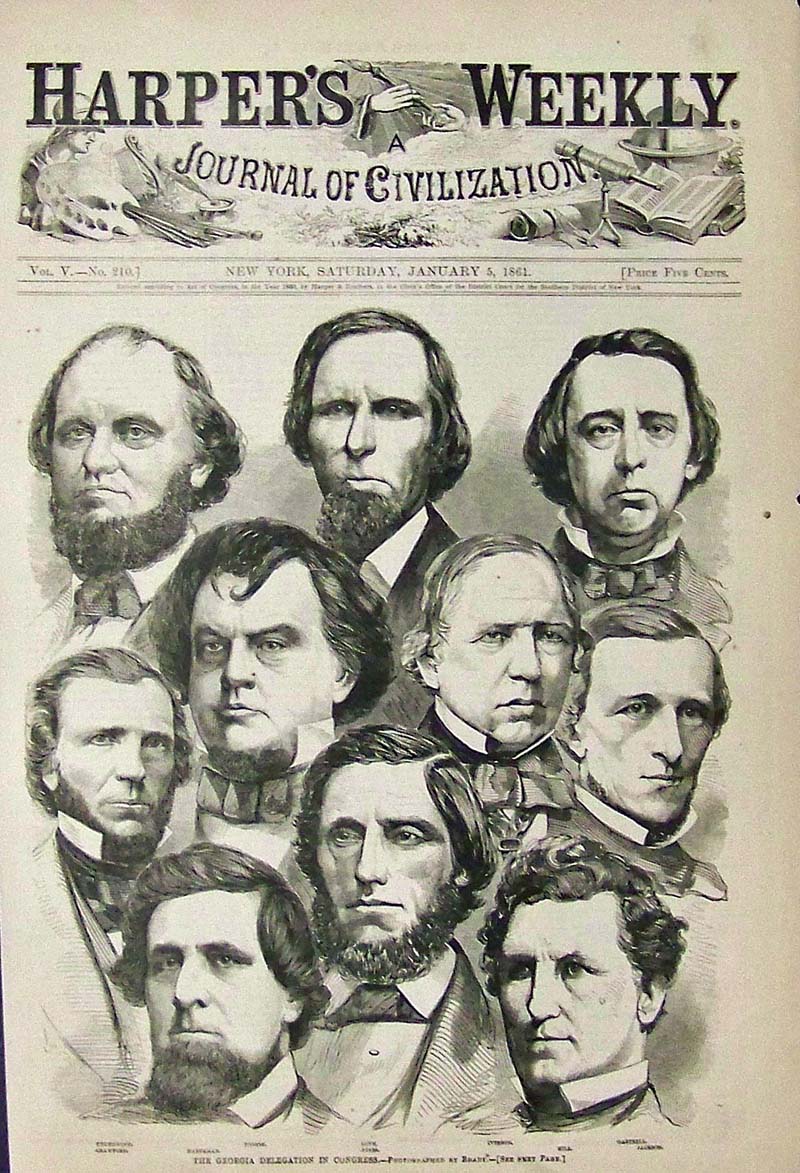 235ga: 1861 Winslow Homer wood engraving titled, "The Georgia Delegation in Congress." This was at the start of the Civil War. Featured in Harper's Weekly, A Journal of Civilization. 15-1/2 x 10-1/2 in. $50 |
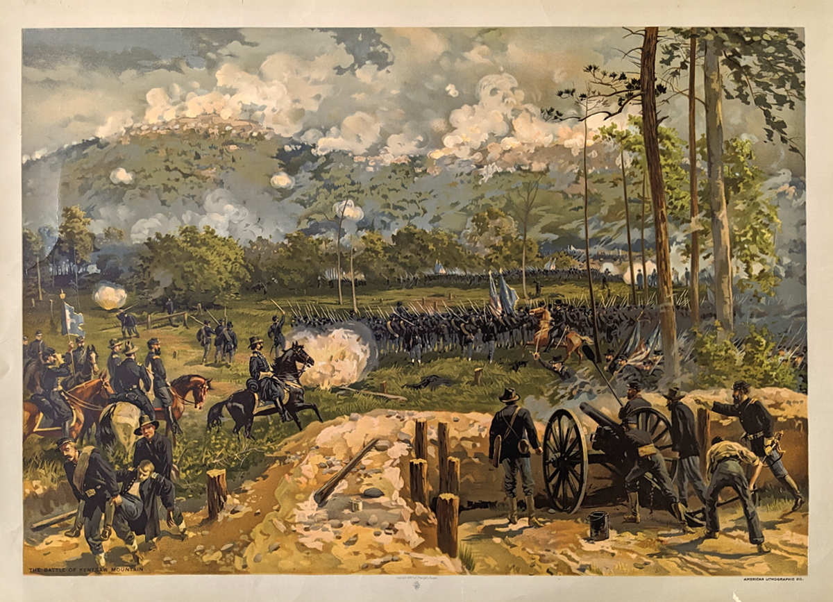 236Georgia: C.1890 Prang chromolithograph showing The Battle of Kenesaw Mountain. Published by American Lithographic Co. 23-1/2 x 17 in. $300 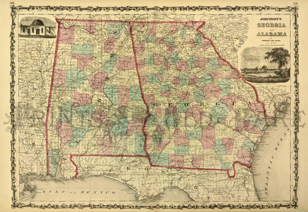 248Georgia: 1861 Johnson's Georgia and Alabama Map. Showing the counties, cities, towns and roads. 2 vignettes of Tuscaloosa Observatory and Rice-Mill on Savannah River upper left and right side. 18 x 27 in. $150  249Georgia: A New Map Map of Georgia with its roads and distances published by H.S. Tanner. 1839. Scarce Tanner map showing the counties, towns, canals, roads and railroads. Key lists Steam Boat Routes distances. Hand colored, litograph. *Minor foxing. 13 3/4 x 17 1/4 in. $480 Check for availability 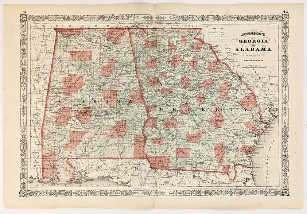 254Georgia: 1863 Johnson's Map of Georgia and Alabama. Showing cities, railroads, roads, ferries, important places, captials and topographical info. Hand colored, lithograph. 17 1/2 x 24 5/8 in. $120 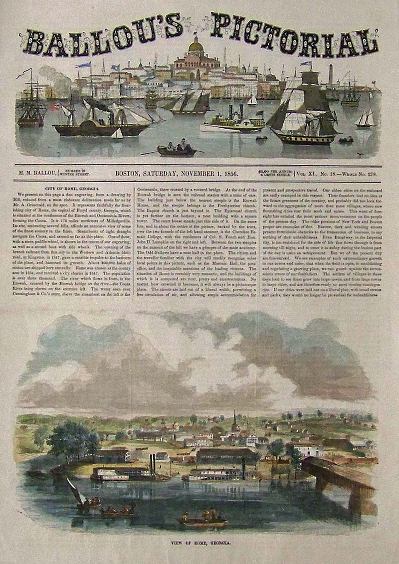
240Georgia: 1856 Ballou's Pictorial hand colored wood engraving showing a View of Rome, Georgia. 15 x 10-1/2 in. $50 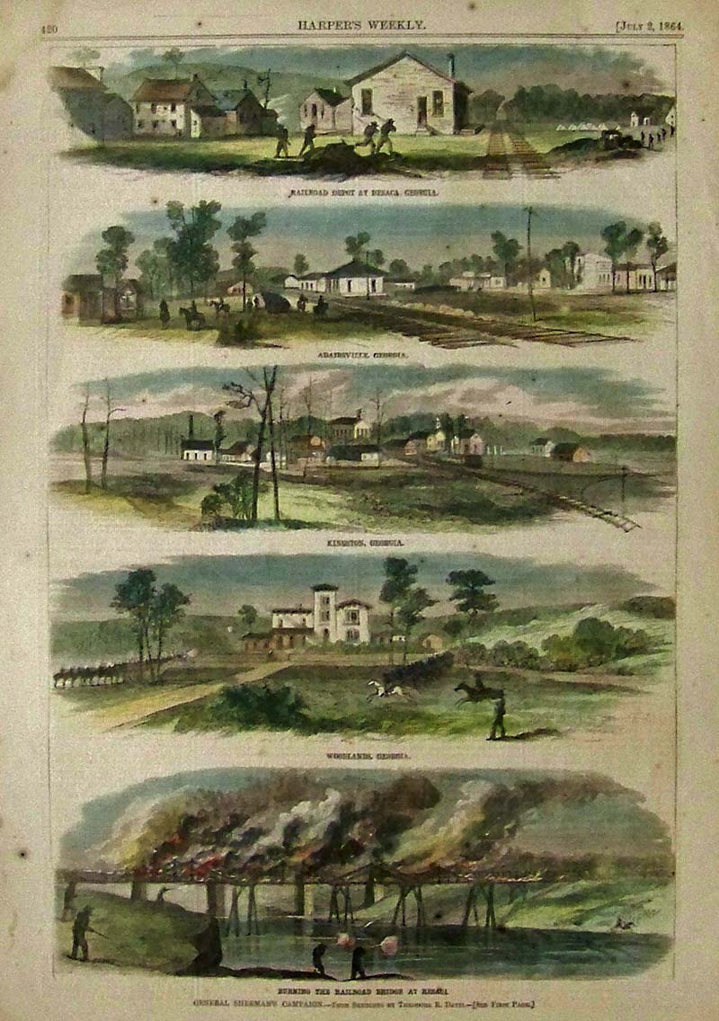
241Georgia: 1864 Harper's Weekly hand colored wood engraving showing five scenes related to General Sherman's Campaign. Sketches by Theodore R. Davis. Top acene shows the Railroad Depot at Resaca, Georgia. Second image shows Adairsville, Georgia. Third image from top shows Kingston, Georgia. Fouth image shows Woodlands, Georgia; and bottom image shows Burning the Railroad Bridge at Resaca. 15-1/2 x 11 in. $100 
242Georgia: 1865 Harper's Weekly wood engraving showing the Grounds at Andersonville, Georgia, where fourteen-thousand Union soldiers who died in Andersonville Prison are buried. 16 x 11 in. $40 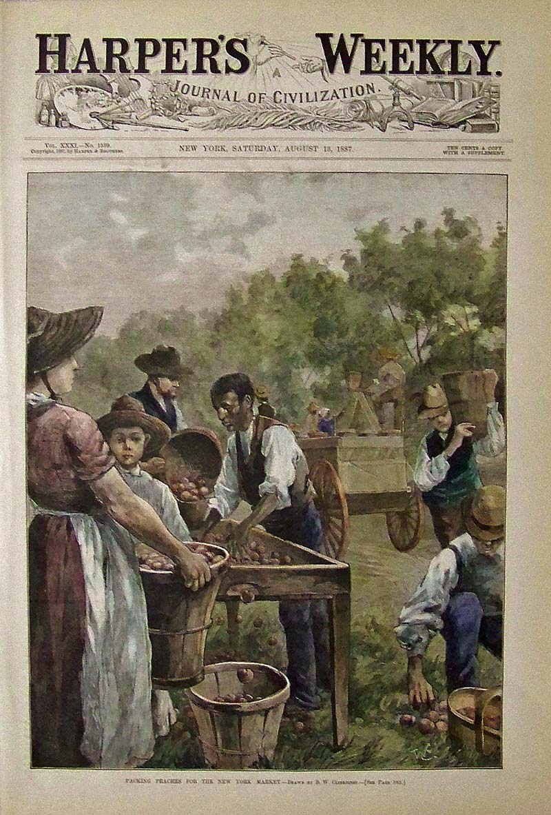
243Georgia: 1887 Hand colored wood engraving showing people packing peaches for the New York Market. Drawn by B.W. Clinedinst. 16 x 11 in. $70 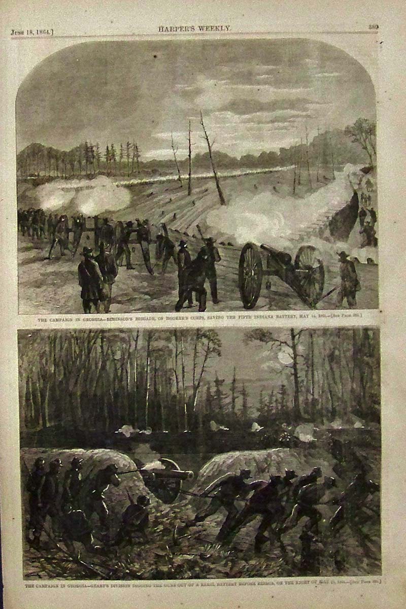
244Georgia: 1864 Harper's Weekly wood engravings showing two scenes from the Campaign in Georgia. Top image shows Robinson's Brigade, of Hookers Corps, saving the Fifth Indiana Battery on May 14, 1864. Bottom image shows Geary's Division digging the guns out of a Rebel Battery before Resaca, on the Night of May, 15, 1864. 16 x 10-1/2 in. $40 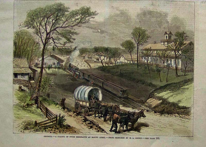
245Georgia: 1880 hand colored wood engraving titled, "Georgia, -- A Colony of Swiss Emigrants at Mount Airey." From Sketches by H.A. Ogden. 11 x 8 in. $40 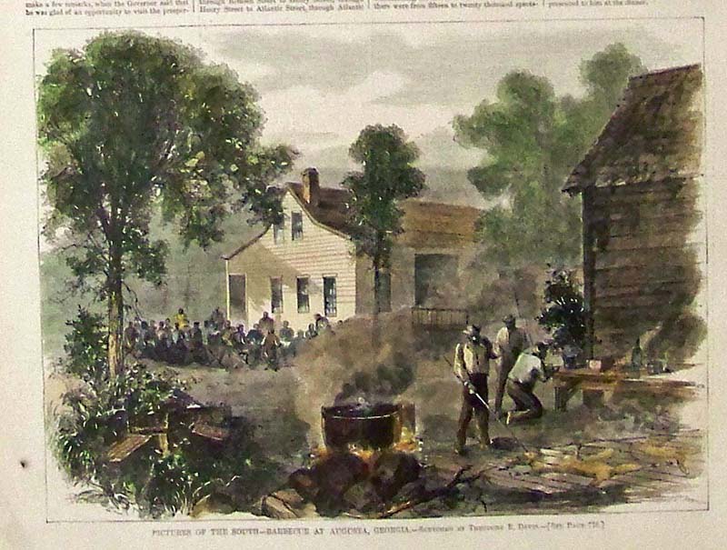
246Georgia: 1866 Harper's Weekly half-page hand colored wood engraving showing an image titled, "Pictures of the South -- Barbecue at Agusta, Georgia." Sketched by Theodore R. Davis. 10-1/2 x 8-1/4 in. $30 |
|||||||||
| Order Form | |||||||||||
| Back to Homepage | |||||||||||