 
|
|||||||||||
This is a small selection of our inventory of antique Illinois maps and prints. Additional inventory is available. Contact us with your request. 1-800-879-6277
|
|||||||||||
|---|---|---|---|---|---|---|---|---|---|---|---|
ALSO SEE:
 click here to view Great Lakes Charts 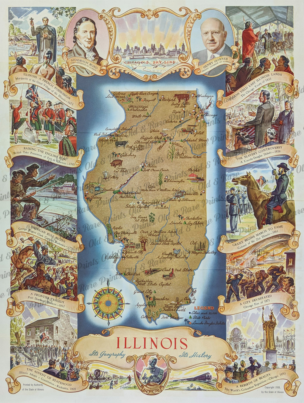 000il: 1938 Colorful Illinois -- Its Geography - Its History - Map Poster showing Illinois' history and landmarks through the years with map and Legend in center. Printed by the State of Illinois. Chicago's Skyline image on top. 21-1/2 x 17 in. $150 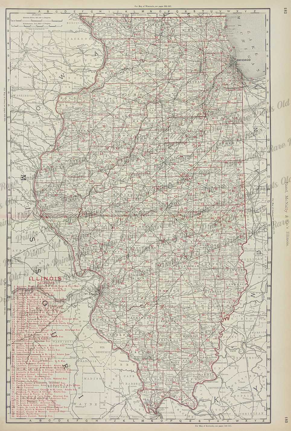
003Illinois: 1898 Color outlined Illinois Railroads map published by Rand, McNally & Company. Detailed railroads key is on bottom left side of map. 27 x 20-1/2 in. $100 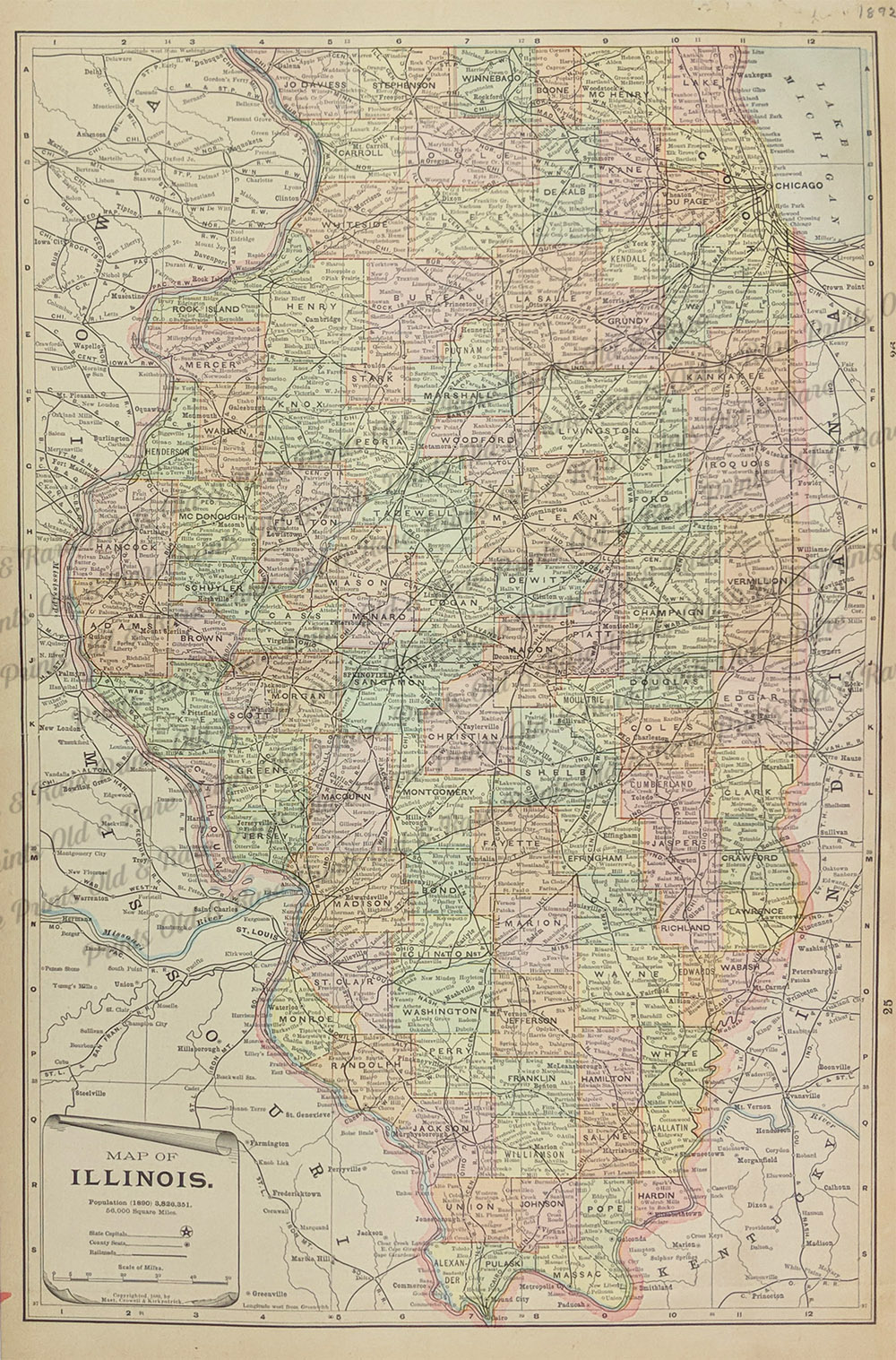 004il: 1892 Illinois Lithographic Colored Map. Good detail in this old map. 13-1/2 x 22 in. $30 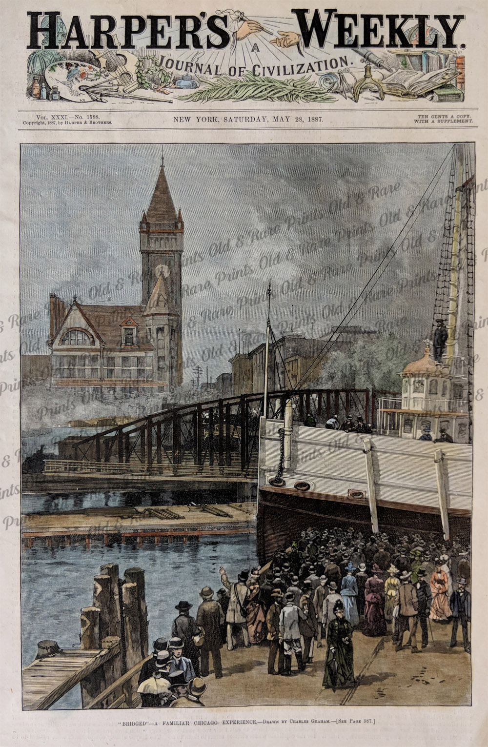 016il: 1887 Chicago Great antique hand colored engraving of the jam-up at the crossing of the river. A great picture of life in the early city. 11 x 16 in. $60 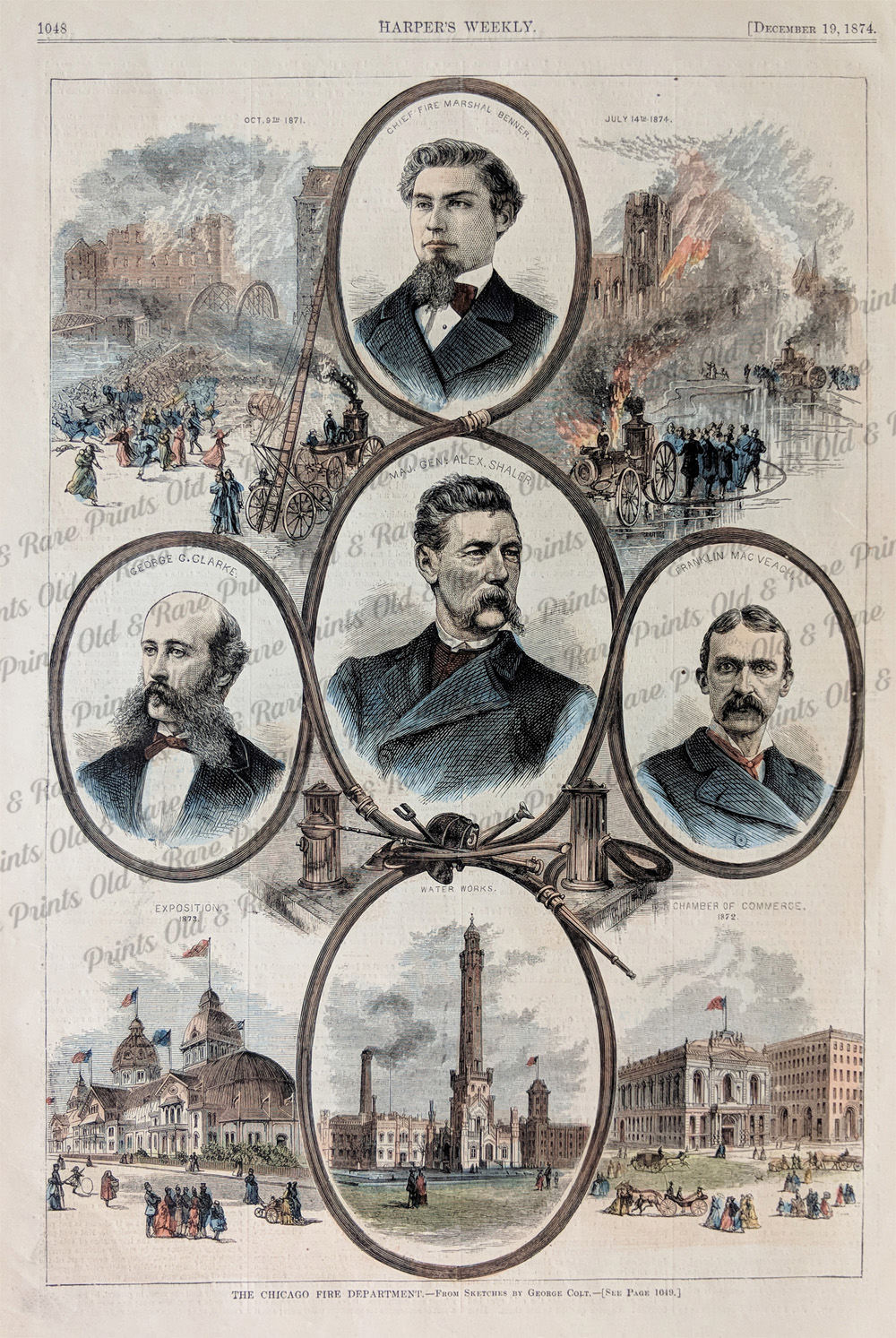 017il: 1874 Chicago Hand colored antique engraving of the Chicago fire department. Nine views and portraits on one page. Harper's. 11 x 16 in. $60  020il: 1850 Illinois Map. Original hand colored map by Cowperthwait. Attractive border. 14x16-1/2 in. $175 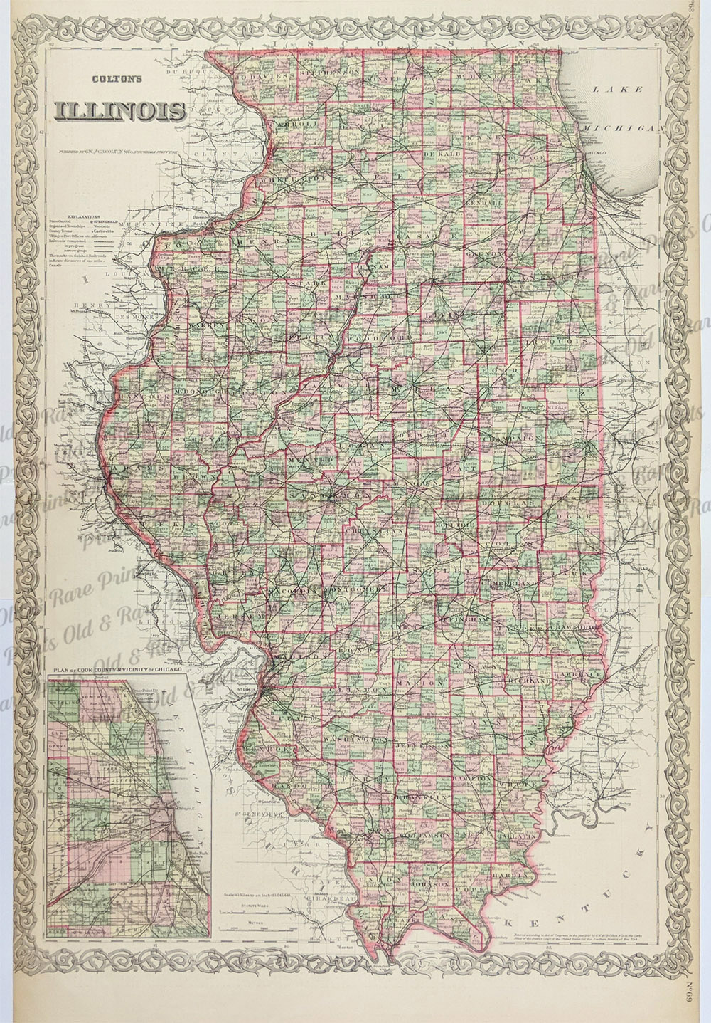 022il: 1884 Rare Colton's Illinois map with inset of Plan of Cook County & Vicinity of Chicago on left. 28 x 17-1/2 in.$200 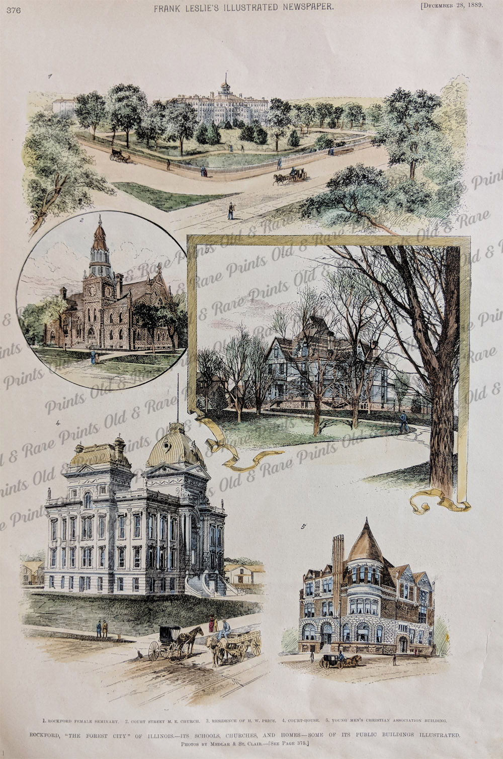 023il: 1889 Rockford, "The Forest City" of Illinois. Its Schools, Churches, and Homes- Some of its public buildings illustrated. Five handcolored engravings showing: Rockford female seminary, court street M.E. Church, residence of H.W. Price, Court House, young men's Christian Association Building. *Also available in Black & White 11x16 in. $60 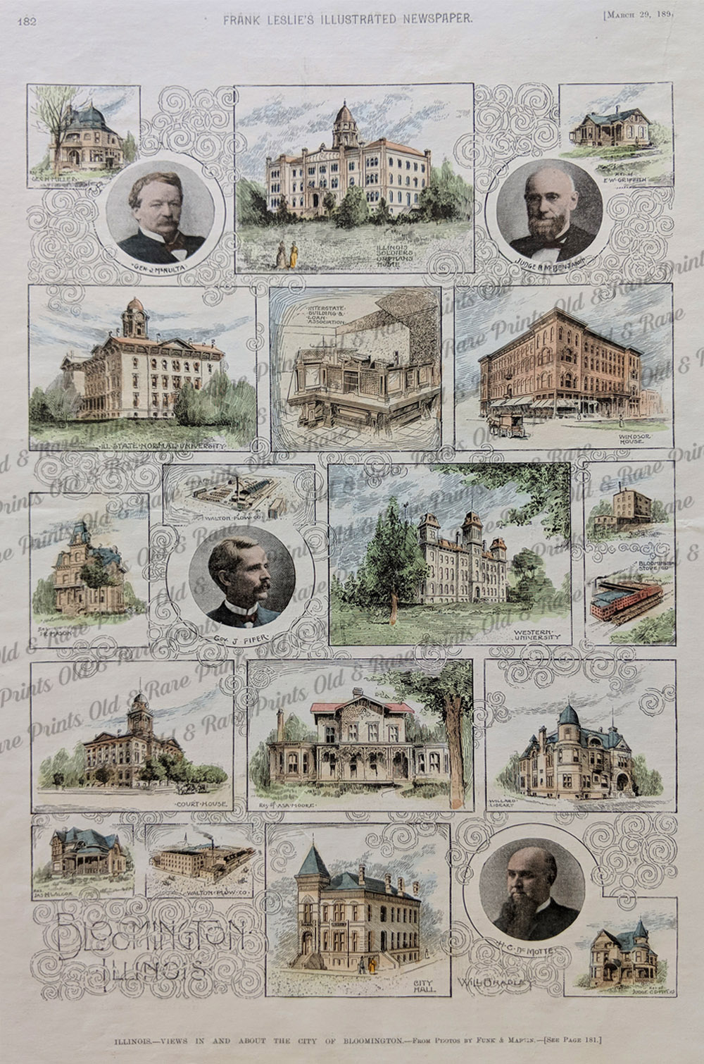 026il: Illinois- views in and About the City of Bloomington. This hand colored rare engraving shows 23 views: residence of Geo H. Miller, General J. McNulta, Illinois Soleirs Orphans Home, Judge R.M Benjamin, residence fo E.E. Griffith, Illinois State Normal University, Interstate Building and Loan Association, Windsor House, residence of J.R. Mason, Governor J. Fifer, Walton Plow Co., Western University, Bloomington Stove Co., Zenith Roller Hill, court house, residence of ASA Moore, Willard Library, residence of Jas H. Wicox, Walton Plow Co., City Hall, H.C. DeMotte, and residence of Judge C.D. Meyers. 11x16 in. $80  027il: 1870 Hand colored ATlas of Illinois Counties of Jo Daviess, Stephenson, Carroll and Rock Island. Published by Warner & Beers. 18-1/2 x 15-1/2 in. $120  028il: 1881 Large Mitchell Map of Illinois. Hand colored, steel engraved map also shows a large inset of Springfield. 23 x 15 in. $125  029il: 1855 Colton's Map of the City of St. Louis and the City of Chicago, side by side. 17-1/2 x 14-1/2 in. $100  132Illinois: 1855 J. H. Colton original hand colored engraved map showing Illinois, with inset on bottom showing the Vicinity of Chicago. Colton was among the earliest map makers with very accurate maps depicting cities and states in the United States. 17-1/2 x 14-1/2 in. $150  133Illinois: 1886 Bradley's Atlas of the World's hand colored map of Illinois, with inset of downtown Chicago. 26 x 19 in. $100 |
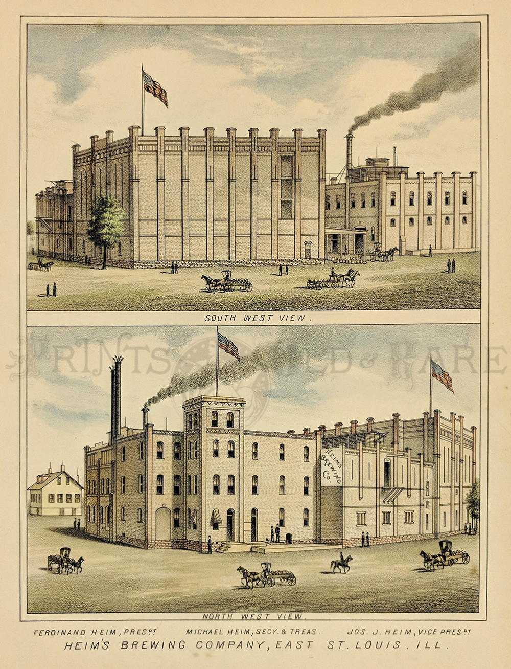 033alco: Beer-Making - Heim’s Brewery. East St. Louis, ILL. 1881 Handcolored lithograph. Front and back views. 11 x 8 1/2 in. $80 Also available in b/w $60 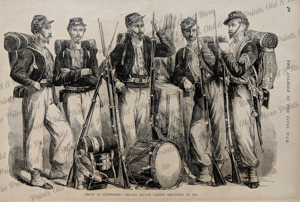 100il: Civil War Soldiers from Chicago Illinois. Woodcut engraving drawn during the Civil War, and published in Frank Leslie's Civil War retrospective during the late 1800s. Title is "Group of Ellsworth's Chicago Zouave Cadets, Organized in 1860." Shows five men wearing their field uniforms, each holding a rifle with bayonet. 11x16 in. $30  103il: 1883 Chicago Streets and River Views. Four lithographed views of Chicago scenery: 1) The Pullman building; 2) the Insurance Exchange building; 3) Chicago River by the Wells St. Bridge; and 4) Chicago River by the Kinzie St. Bridge. 6x9 in. $40 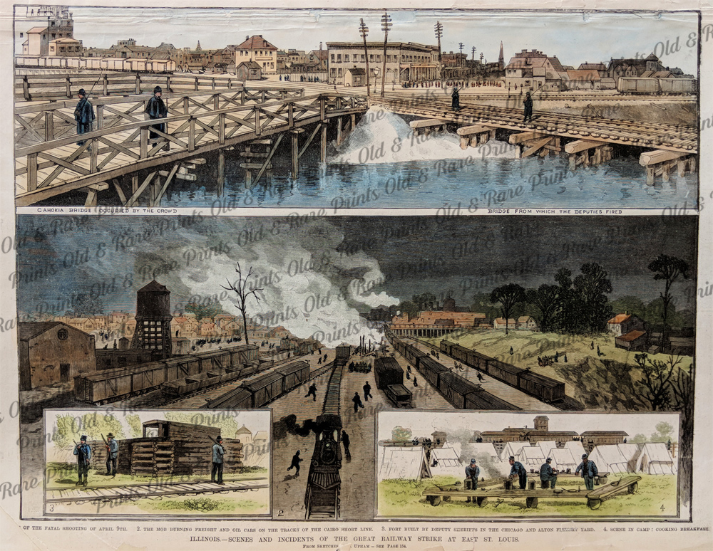 105il: 1886 East St. Louis Illinois Railroad Strike. Hand colored engraving from Frank Leslie's Illustrated Newspaper, titled "Illinois: Scenes and Incidents of the Great Railway Strike at East St. Louis." Shows views of the strikers burning freight cars, and troops camping by the railroad yards. Repairs have been made to the corners and margins of this print, but the image is in very good condition. The top margin has been extended to facilitate framing. 11x16 in. $60 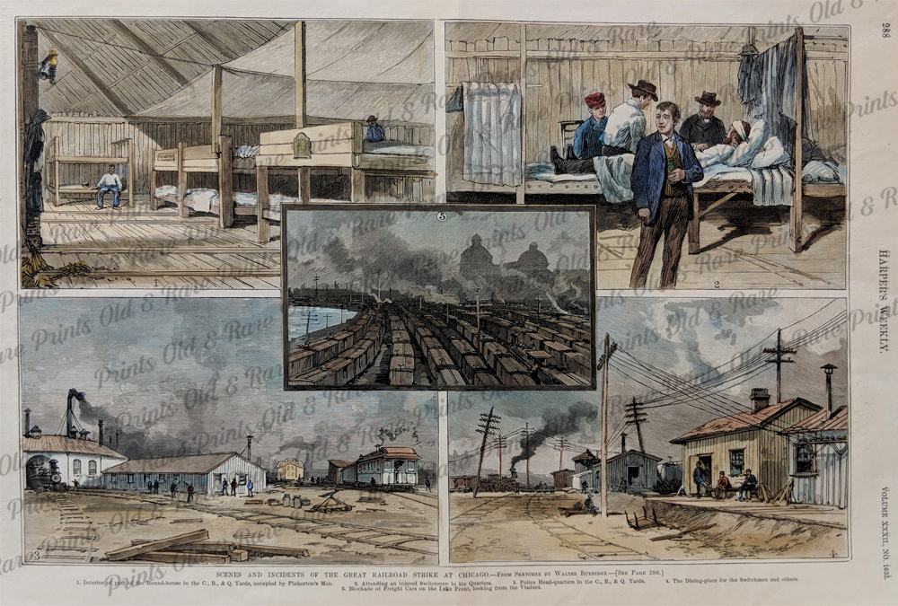 106il: 1888 Railroad Strike in Chicago Illinois. Hand colored engraving from Harper's Weekly, titled "Scenes and Incidents of the Great Railroad Strike at Chicago." Contains views of freight cars being blockaded by strikers, and images of the police and Pinkerton guards who opposed the workers. 11x16 in. $60  122il: 1894 Pictures of the Chicago Sky-Scrapers. Hand colored engraved image titled, "The Chicago Sky-Scrapers Again.-Specimens of the Crop of 1893, Hartford Deposit Company Building, Y.M.C. Association Building, Entrance-Stock Exchange, Columbus-Memorial Building, New York Life Insurance Company, Champlain Building Under Contruction, Monadnock Block, Old Colony Building and Security Building," drawn by E.J. Meeker from Frank Leslie's Weekly. Shows scenes of Chicago Sky-Scrapers. 11 x 16in. $60 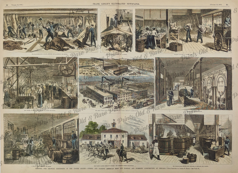 124il: 1878 Pictures of the Curing and Beef Packing Industry in Chicago. Hand colored engraved image titled, "Illinois.-The Growing Industries of the United States-Curing and Packing American Beef for Foreign and Domestic Consumption, at Chicago, The Slaughter House-Killing, Skinning and Quartering the Beeves, Killing Animals by the Use of Spears, Workers Engaged in Cutting Beef, The Process of Making Cans for Use in Packing the Meats, The Great Union Cattle-Yards, Chicago.-Wilson Packing Company's Packing House, Engine-Room and Tank-House, A Cellar View-The Barreling Meat, The Wilson Packing Company's Stables-for Norman Houses Exclusively and The Cooking-Room, Showing How the Meat is Prepared for Packing," from Frank Leslie's Illustrated Newspaper. Shows scenes of the Curing and Beef Packing Industry in Chicago. 22 x 16 in. $200 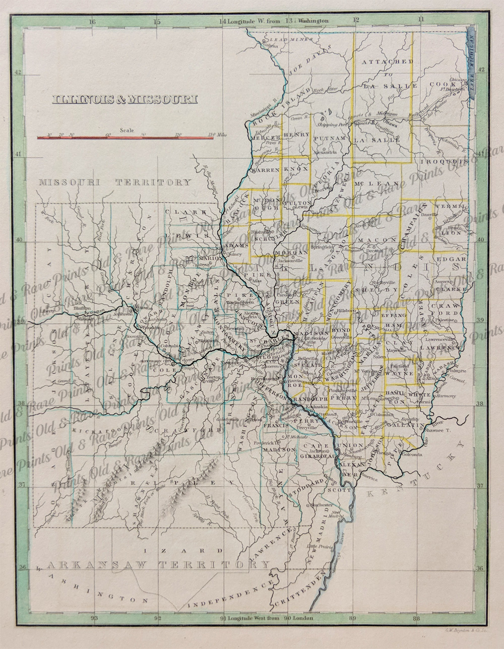 126il: 1835 Elegant Map of Illinois and Missouri. Intricate hand colored map titled, "Illinois and Missouri," from Bradford's 1835 world atlas. Hand colored, engraved map shows railroads, canals, cities, counties and mountains. 12 x 10 in. $150  127il: 1845 Lithographed hand colored Diagram of the State of Illinois map from the Surveyor's office in St. Louis which shows the districts in different colors. The several Land Districts are bounded by dotted lines except along navigable streams. F..R. Conway, Surveyor of the Public Lands in the States of Illinois and Missouri. 24 x 12-1/2 in. $255 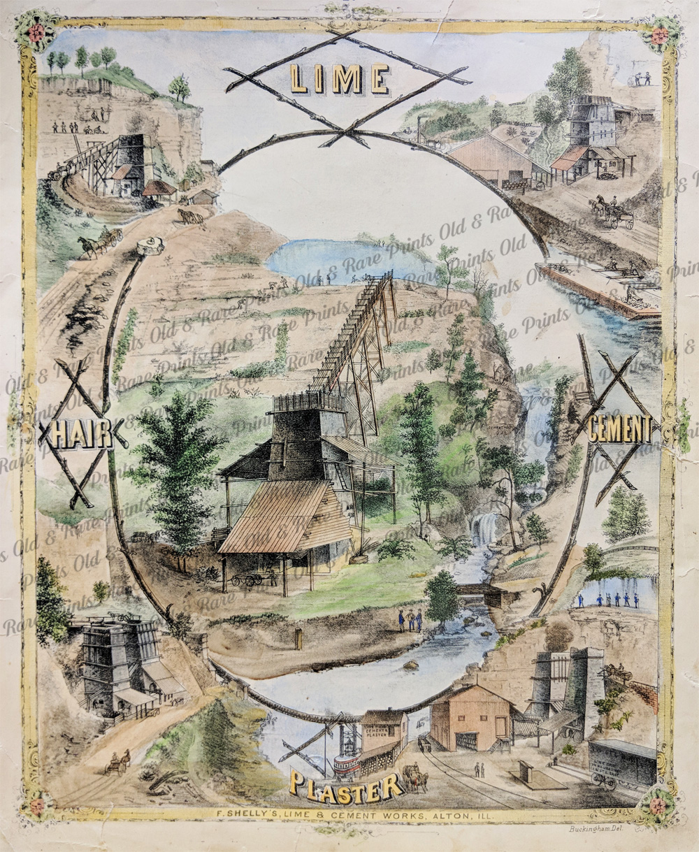 128il: 1875 Hand colored lithograph showing Lime Plaster from F. Shelly's Lime & Cement Works in Alton, Illinois. Center image is enclosed in a lithographed log frame showing the main building and other buildings in the Lime and Cement Works are displayed just inside the outer border. 17-1/2 x 14 in. $125  130il: 1849 Very rare hand colored steel engraving of this beautiful Mississippi River town identified as "Im Staate Wisconsin" and titled, "Galena." German engraving by Herrmann J. Meyer. 9 x 6 in. $125  134il: 1865 Harper's Weekly. Lieutenant -General Grant's Reception at Galena, Illinois. 10 x 14.5 in. $50 |
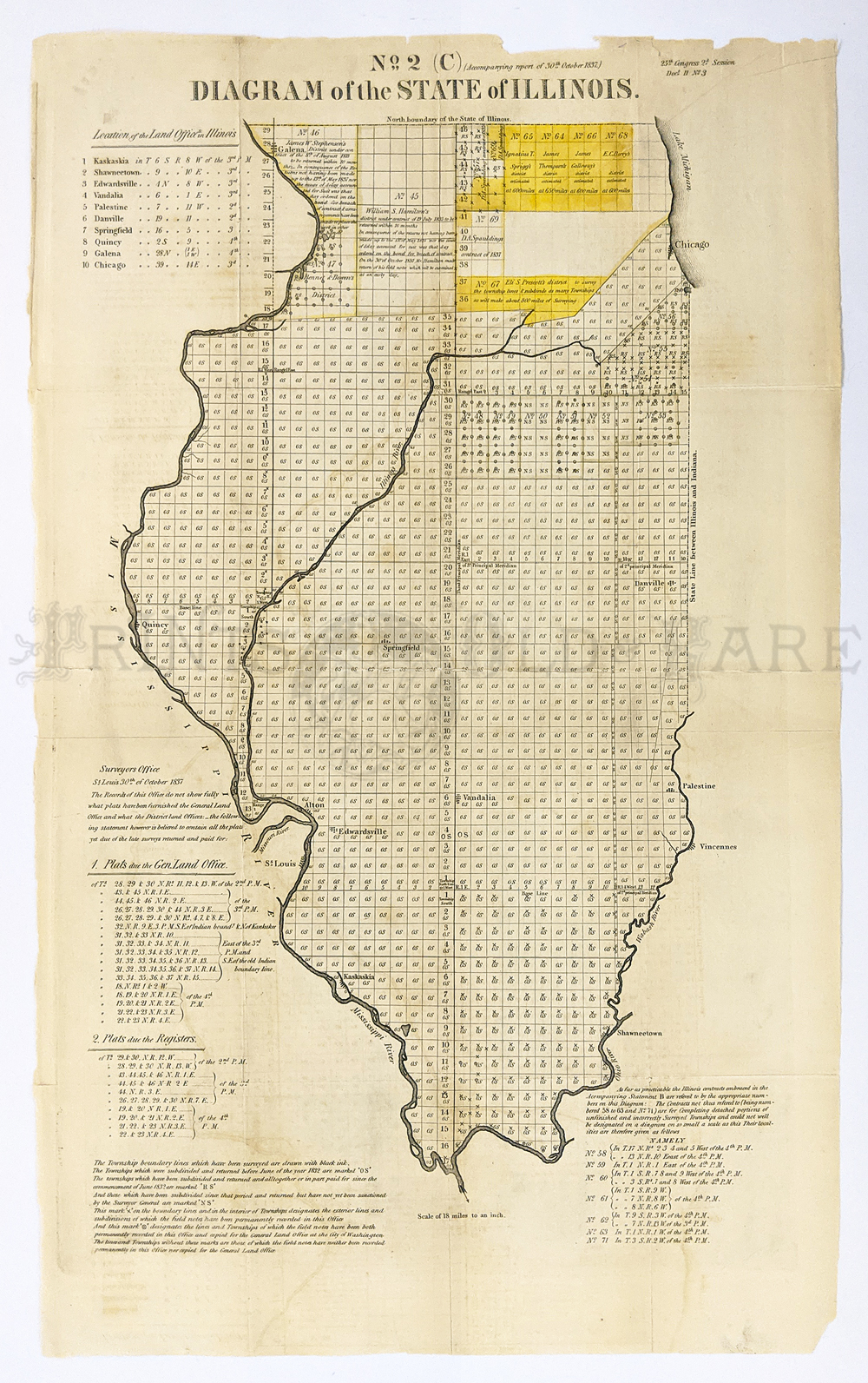 153il: Diagram of the State of Illinois. General Land Office. Map showing township grid for the state. 14 x 24 in. $250 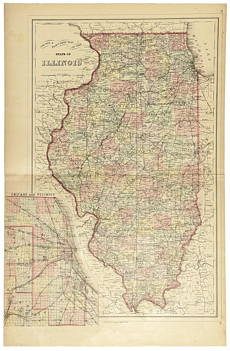 154il: County & Township map of the State of Illinois. 1884 Mitchell. Inset of Chicago and vicinity. Hand colored, lithograph. 15 1/4 x 23 1/2 in. $100  135il: 1890 "The Gem City" Illinois - Showing the Parks, Streets, Churches, Drives, and Levees of Quincy. 15 1/2 x 10 1/4 in. $80 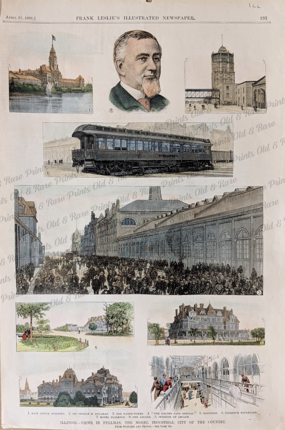 136il: 1889 Frank Leslie's Illustrated Newspaper. Illinois - Views in Pullman, The Model Industrial City of The County. 15 x 10 in. $80 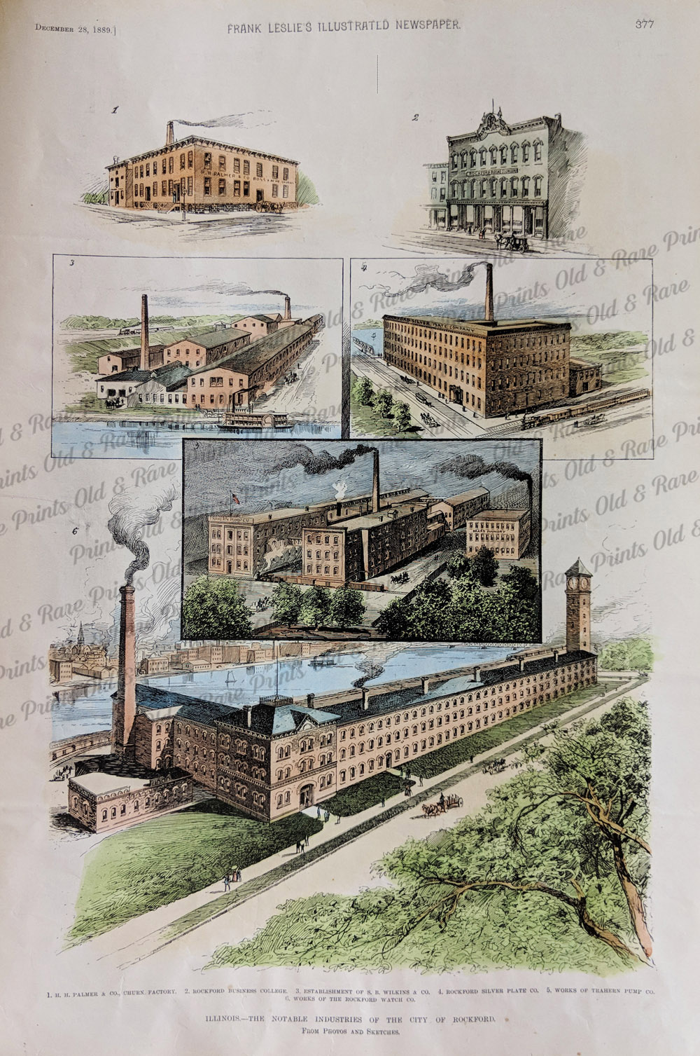 138il: 1889 Frank Leslie's Illustrated Newspaper. The Notable Industries of The City of Rockford. 15 1/2 x 110 1/2 in. $80 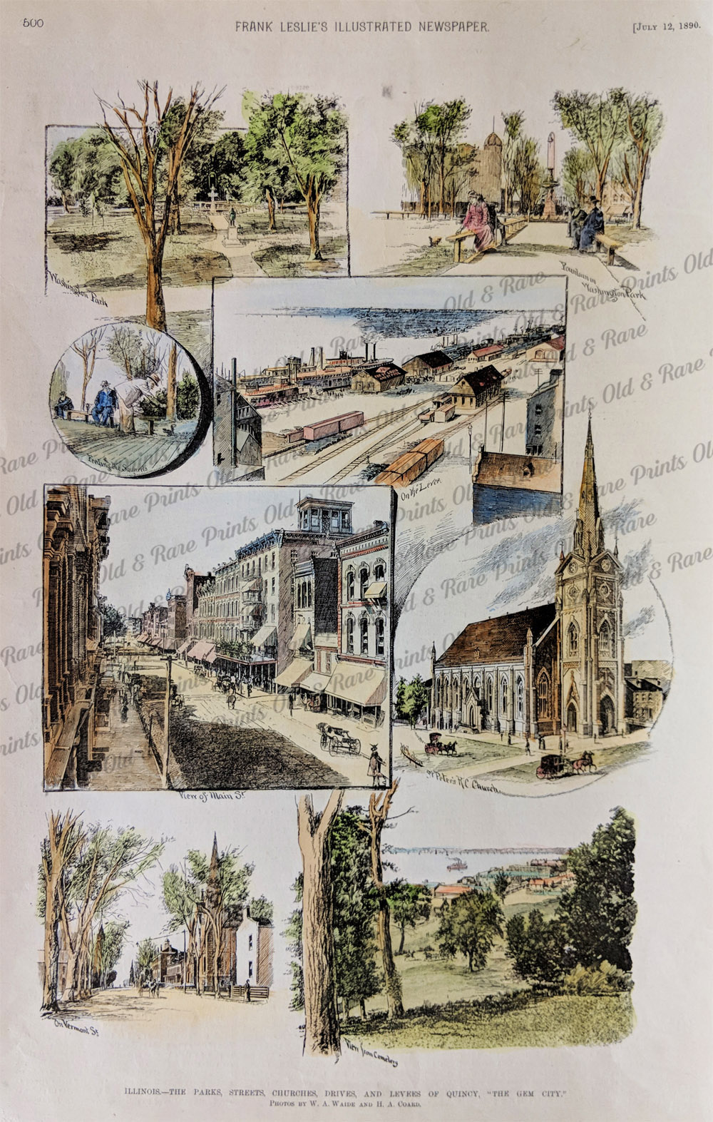 139il: 1886 Frank Leslie's Illustrated Newspaper. The Government Arsenal & Military Headquaters at Rock Island. 11 x 16.5 in. $80  140il: 1882 Frank Leslie's Illustrated Newspaper. HQ of the Mississippi Fleet, Cairo, IL. 16 x 11 in. $80 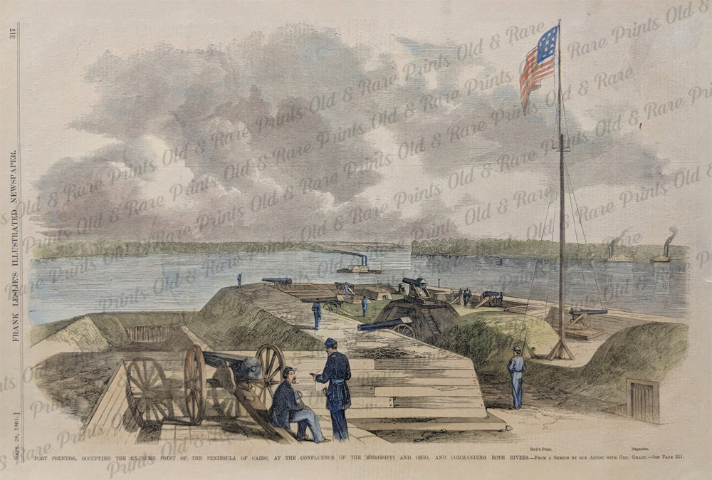 141il: 1861 Frank Leslie's Illustrated Newspaper. Fort Prentiss, Occupying The Extreme Point of the Peninsula of Cairo. 16 x 11 in. $60  142il: 1862 The Illustrated London News "The War in America" - General Pope's Division at the Levee, Cairo. 16 x 11 in. $60 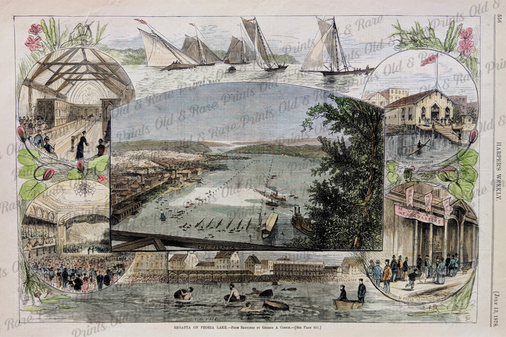 143il: 1878 Harper's Weekly - Regatta On Peoria Lake from sketches by George A. Coffin. 15 x 10 in. $60 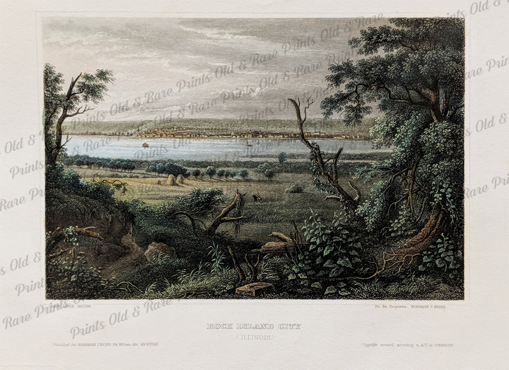 144il: Rock Island City, Illinois. A hand colored steel engraved view of Rock Island. Printed by Hermann J. Meyer. 7 1/2 x 5 1/2 in. $75 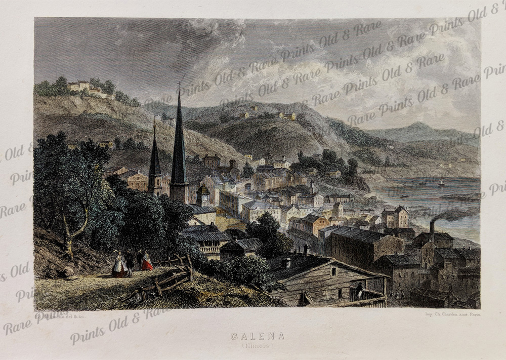 145il: Galena Illinois Panoramic View. Hand Colored Steel Engraved View of Galena Printed in 1852 7 1/2 x 5 1/2 in. $75  146il: 1Illinois Land District Map. Published in 1840 Showing Land Districts and Boundry lines. 11 1/2 x 8 in. $80 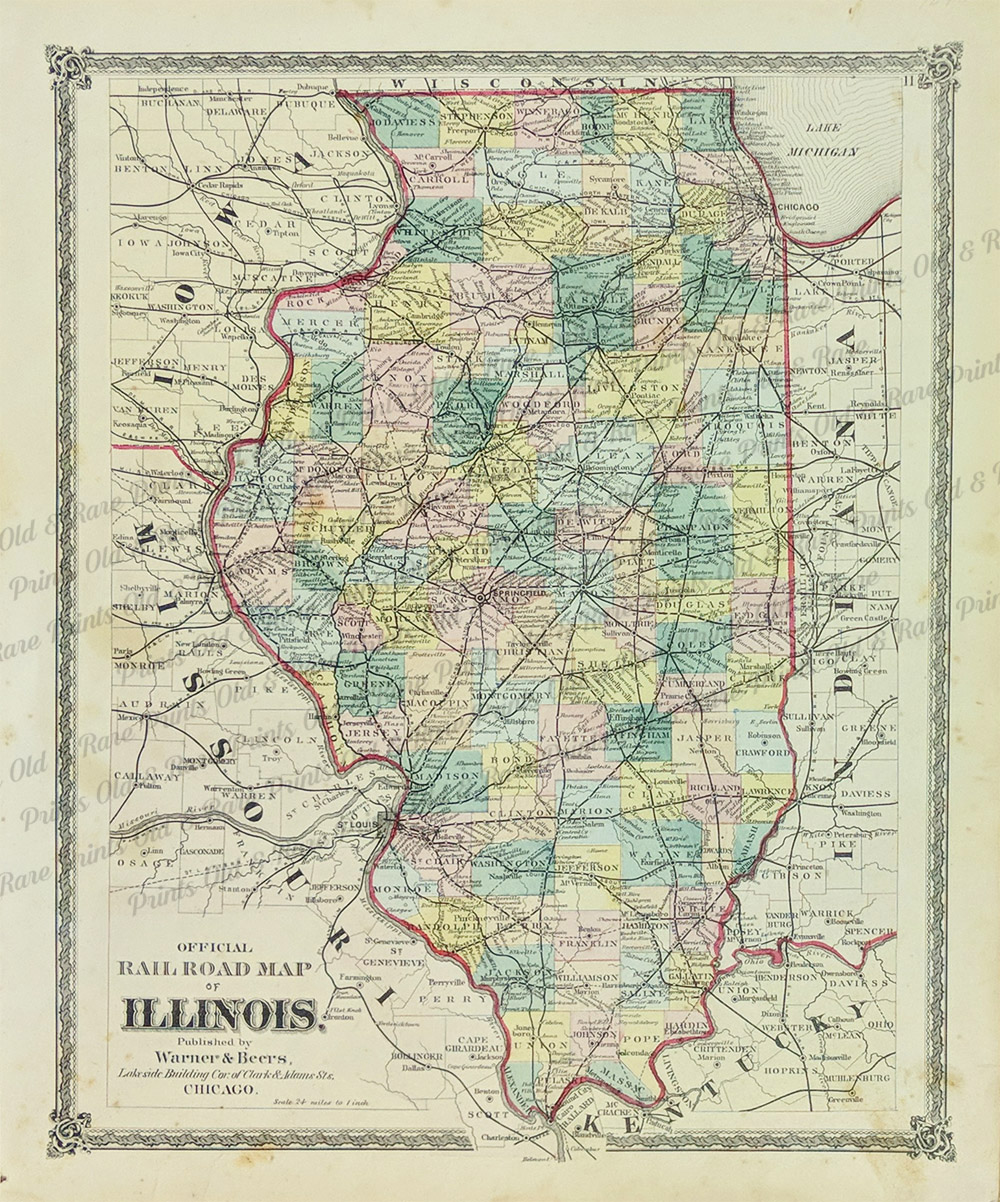 147il: Illinois Railroad Map. Published by Warner & Beers in 1870. Showing early Railroad lines and their stops. In Great condition. 14 x 17.5 in. $140 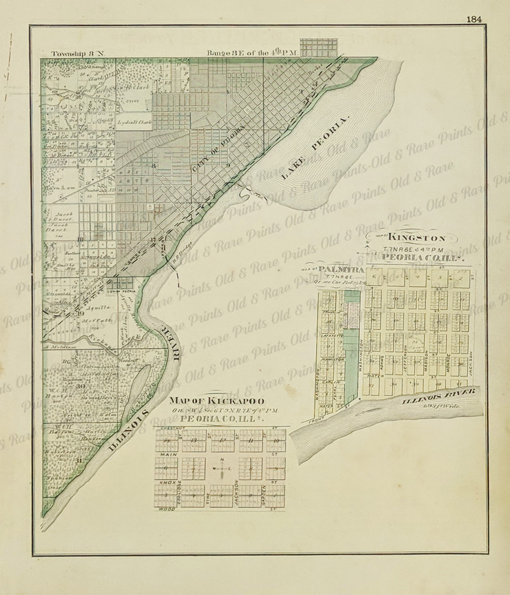 148il: Peoria Township Map. 1875 map showing the city of Peoria and Lake Peoria with insets of Kickapoo, Palmyra, and Kingston. 15 x 12 1/2 in. $90 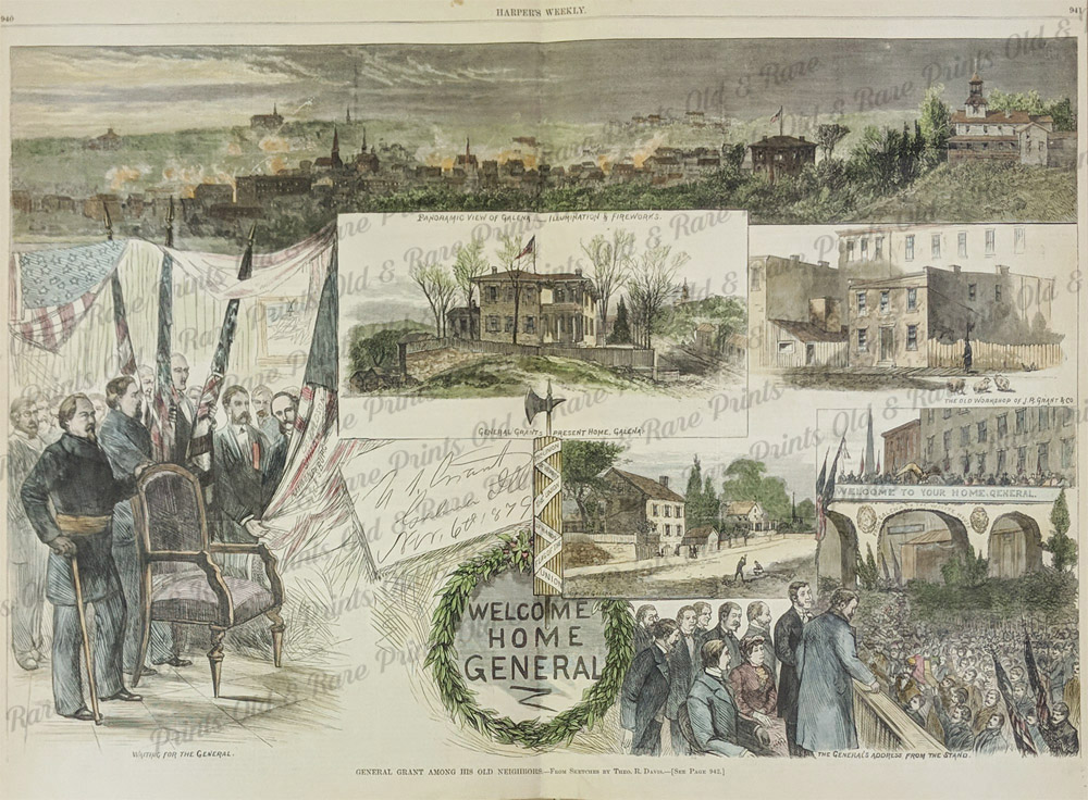 149il: Galena Illinois Welcomes Grant. Hand Colored Wood Engraving Printed in 1879 by Harper's Weekly. 15.5 x 22 in. $50 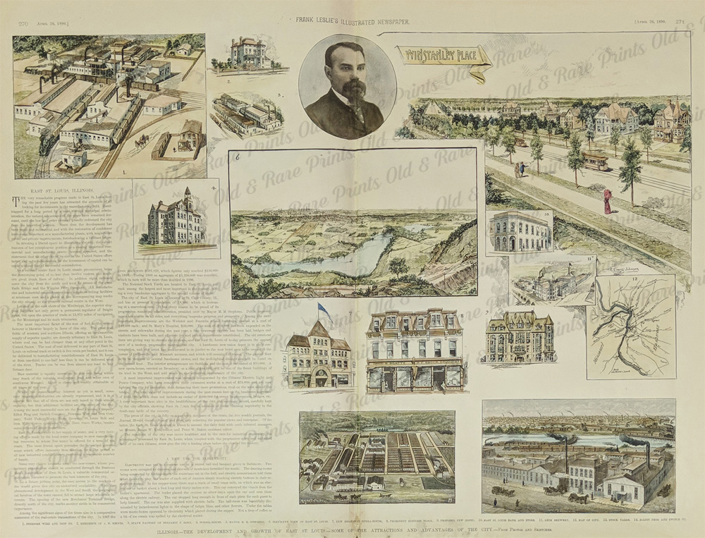 150il: East St. Louis, Illinois. A rare hand colored piece showing the progress of East St. Louis in 1890 16 x 22 in. $120  151il: 1890 Frank Leslie's Illustrated Newspaper. Recent Architecture in Bloomington, IL. 15 1/2 x 10 in. $80 Also see: Chicago, IL |
|||||||||
| Order Form | |||||||||||
| Back to Homepage | |||||||||||