|
|||||||||||
This is a small selection of our inventory of antique Indiana maps and prints. Additional inventory is available. Contact us with your request. 1-800-879-6277
|
|||||||||||
|---|---|---|---|---|---|---|---|---|---|---|---|

004post: Michigan City, Indiana - Full-Fledged Diamond Rodeo and Wild West Show - This colorful 1957 poster was published for a benefit for the Fire Fighters Benefit Fund. 22 x 14 in. $80 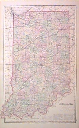
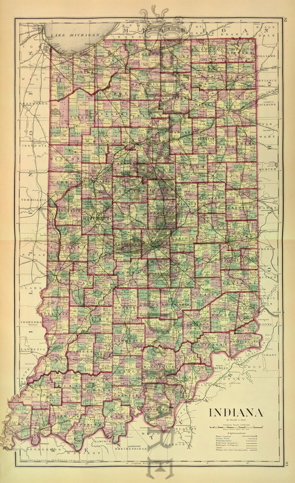
001in: 1882 Gray's map of Indiana. One of the most attractive and interesting 19th century hand colored maps. 27x17-1/2 in. $100 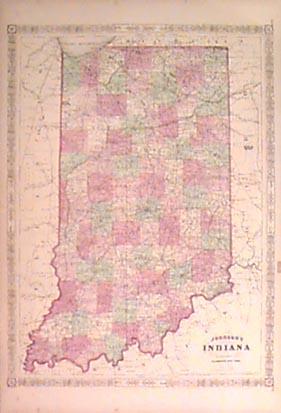 002in: 1864 Johnson's map of Indiana. Large hand colored. 26x18 in. $90 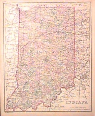
003in: 1874 Bradley map. Antique hand colored. 12x15 in. $60 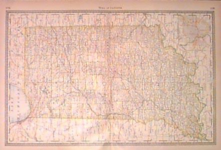
004in: 1883 Crams lithographic colored map of Indiana. Great detail, good size. 14-1/2x21-1/2 in. $40  005in: Wabash College in Crawfordsville, Indiana and Notre Dame University in Notre Dame, Indiana. Two hand colored half-tone engravings, along with text on the square miles and population in Indiana. 14 x 10-1/2 in. $40 Black & White: $30 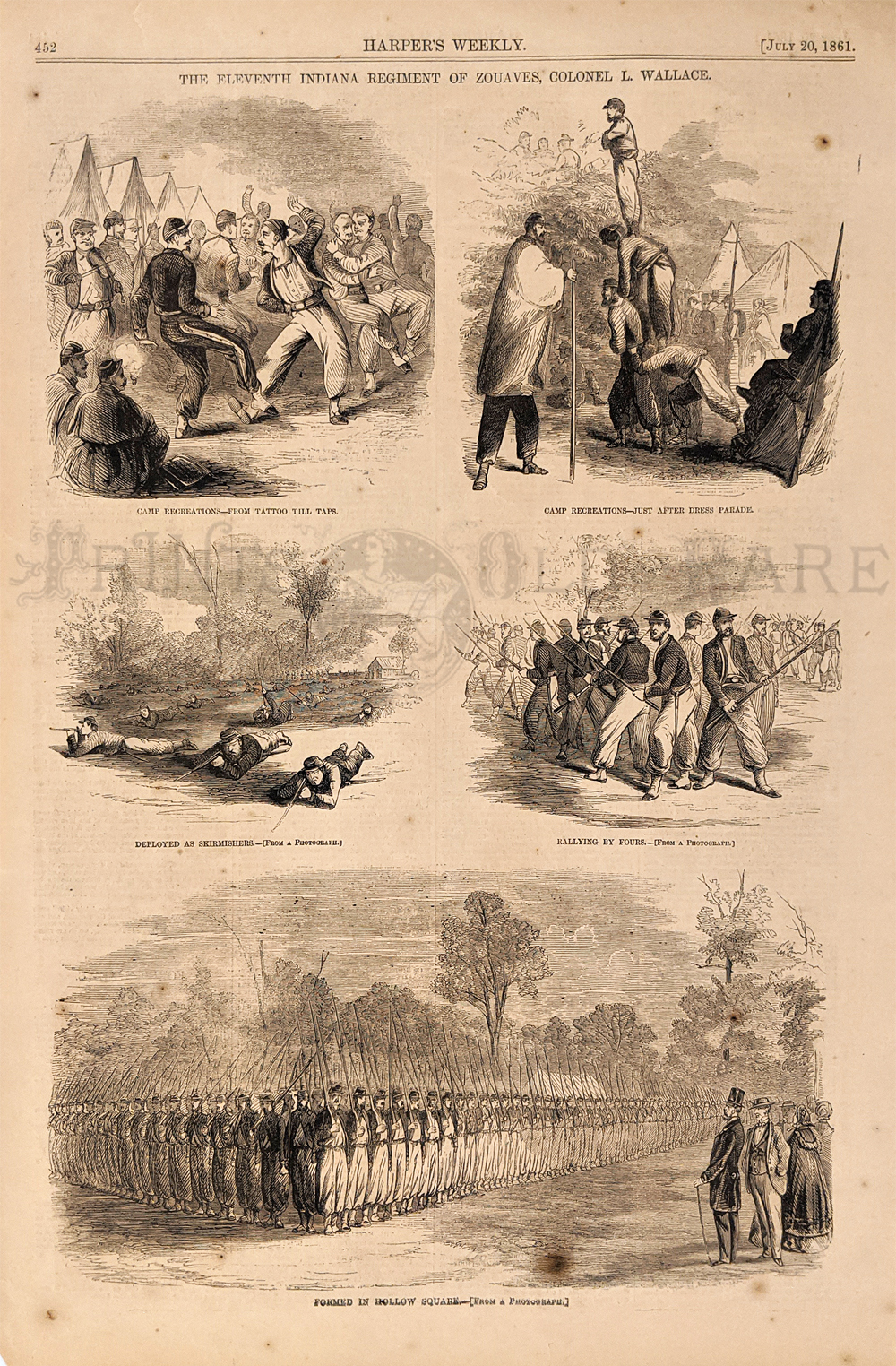 012in: 11th Indiana Regiment 1861. Zouaves under Colonel L. Wallace. 5 vignettes showing recreation, rallying and formation. Wood engraving. 10 ½ x 15 ½ in. $30 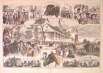
022in: 1867 Indiana State Fair views. Many fine hand colored engraved scenes from the fair in Terre Haute on a large 2-page original Harper's spread. 22x16 in. $80 Click here to view more College and University Prints 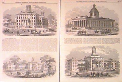 028in: 1854 Indianapolis Buildings. Four fine black & white engraved views on two pages of some of the most impressive buildings in the city. Includes descriptive text. 22x16 in. $60 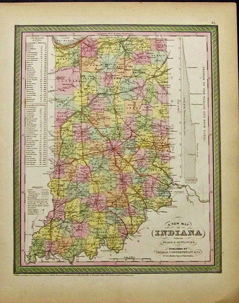 029Indiana: 1850 Cowperthwait A New Map of Indiana with its Roads and Distances which also shows the Steamboat routes and a profile of the Wabash and Erie Canal. Hand colored. 17 x 13-1/2 in. $200 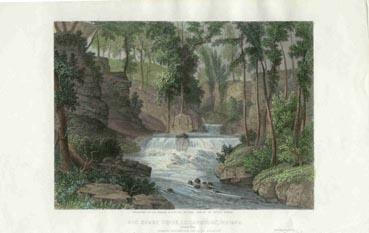 030in: 1860 Big Snake Creek View. Scarce hand colored steel engraving of the creek, near Logansport. Very attractive. 10x6-1/4 in. $40 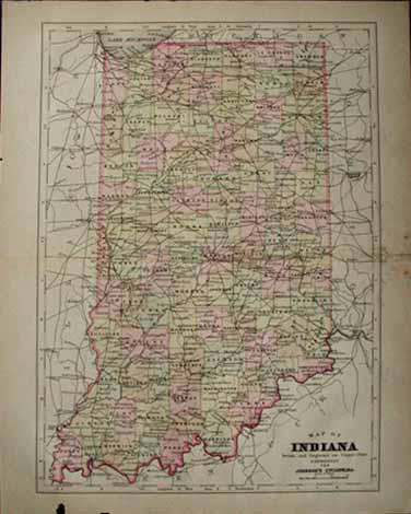 033in: 1890 Indiana Map. Good color shows Railroad network. Hand colored copper engraving. 10.5x13.5 in. $40  034in: c.1880 Civil War Southern Indiana Map. Color litho map published by U.S. Government after the war. Shows Indianapolis in the north, to Mid-Kentucky in the south. 29-1/2x18-1/2 in. $80 |
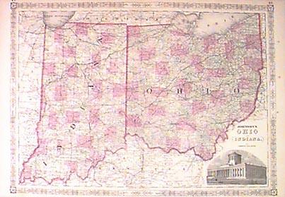 035in: 1864 Johnson Indiana & Ohio Map. Original hand colored engraved antique map by Johnson. Counties differentiated by color. Great detail with attractive border. 26x18 in. $90 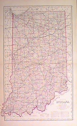 036in: 1882 Map of Indiana. Very handsome large hand colored antique map. Good detail, very frameable. 17-1/2x28 in. $90 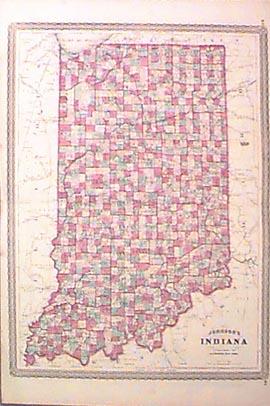
037in: 1864 Indiana Township Map. All townships hand watercolored in various colors throughout the state. Great detail, with nice border. 18x26 in. $90 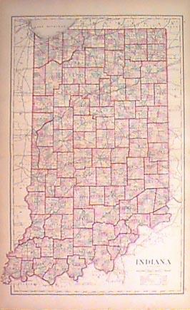
038in: 1875 County Map of Indiana. Very attractive original hand colored genuine antique map, by Gray. Shows railroad routes. 17-1/2x28 in. $110 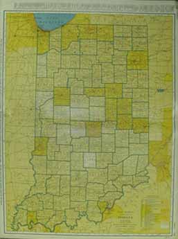
039in: 1940 Indiana Railroad Map. Colorful large old map shows dozens of railroads, plus population by county. 20-1/2x27-1/2 in. $80 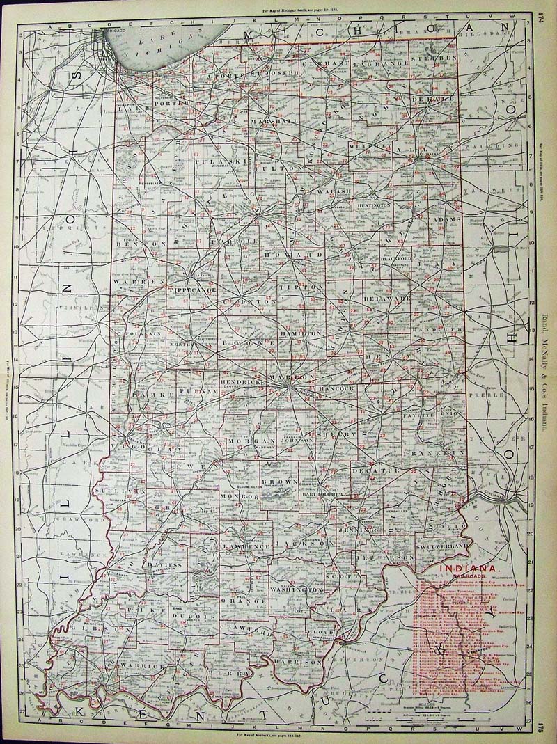
045Indiana: 1894 Color Railroads Map of Indiana, published by Rand, McNally & Company. Railroads Key is on bottom right of this very detailed map. 27 x 20-1/2 in. $160 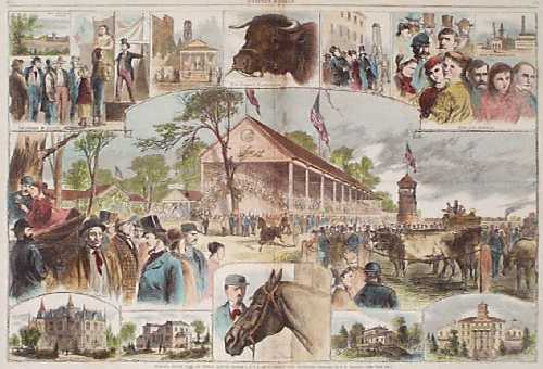
201in: 1867 Scenes at the Indiana State Fair. Hand-colored engraving from the Nov. 2, 1867 issue of Harper's Weekly, titled "Indiana State Fair at Terre Haute, Oct. 1,2,3,4, and 5. Among the Hoosiers." Contains many small scenes of the visitors and participants at the fair. Several professional repairs made to center crease, barely noticeable. Overall fine condition. 16x22 in. $80 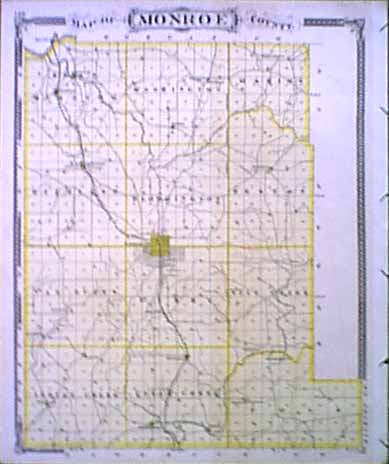 202in: 1876 Map of Bloomington Indiana and area entitled: Map of Monroe County. This map shows the towns, railroads, and post offices. size: 13.5x17 in. $50 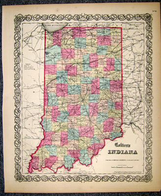 203in: 1855 Colton Map of Indiana. Beautifully engraved, hand-colored map from the 1st edition of Colton's world atlas, printed in 1855. The state is divided into counties, with every county colored separately. Names of all counties are given, and the locations of rivers, railroad lines and major cities are shown as well. Entire map is surrounded by a decorative border. 16x18 in. $200 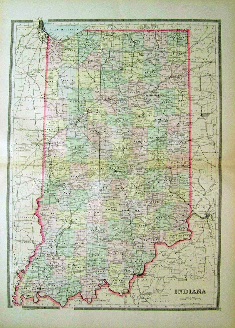 204Indiana: 1891 Bradley color lithographed map of Indiana, showing lots detail. 26 x 19 in. $60  206in: 1888 Images of Indianapolis' Buildings and Architecture. Elegantly hand colored engraved images titled, "The City of Indianapolis," from Harper's Weekly. Shows different scenes of Indianapolis' Buildings and Architecture. 22 x 16in. $150
|
 220Indiana: 1875 Gray's New Map of Indiana. Large double page map showing Counties, Cities, Towns, Railroads, Rivers, Canals and Creeks. Hand colored, lithograph. Very good condition. 16 x 27 in. $100 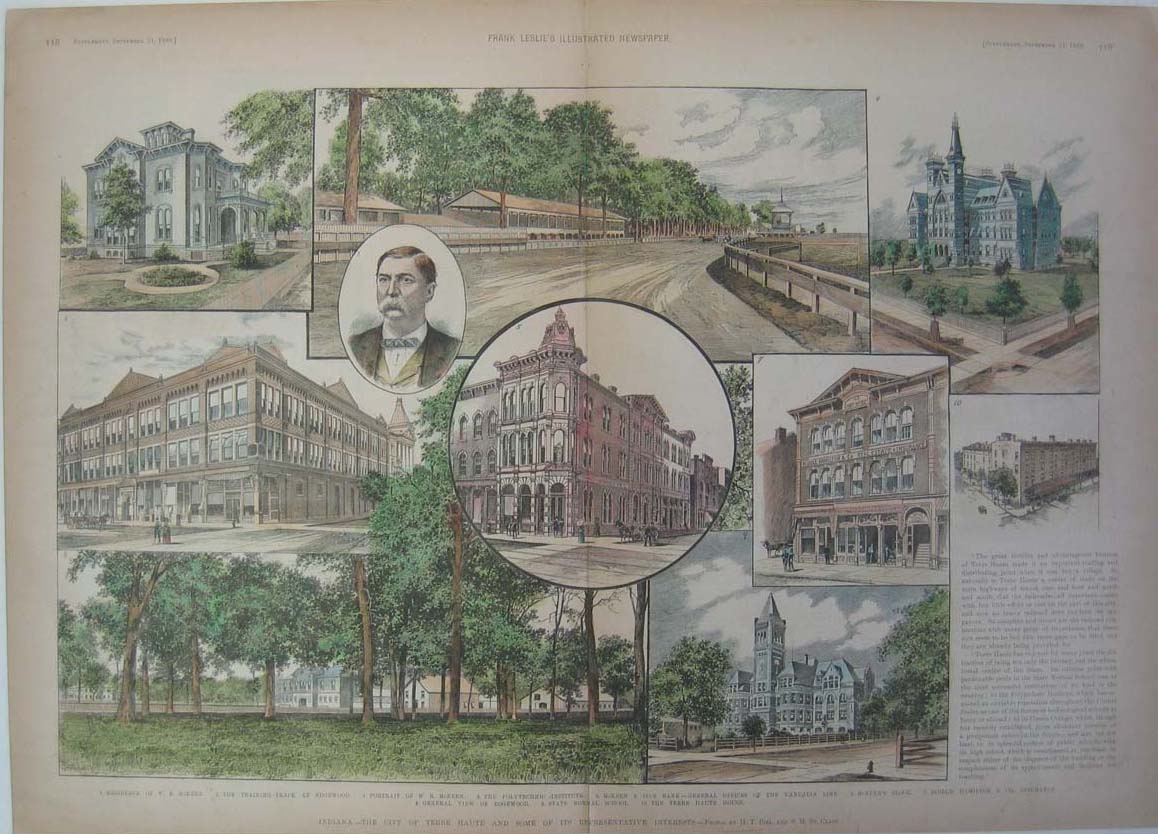 208in: 1888 Images of Terre Haute, Indiana's Buildings and Architecture. Elegantly hand colored engraved images titled, "Indiana-The City of Terre Haute and Some of the Representative Interests," from Frank Leslie's Illustrated Newspaper. Shows different scenes of Terre Haute's Buildings and Architecture. 22 x 16in. $ 150 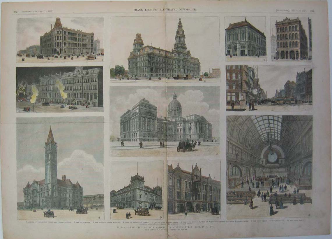 209in: 1889 Pictures of Indianapolis, Indiana's Buildings and Architecture. Elegantly hand colored engraved images titled, "Indiana-The City of Indianapolis, Its Streets, Public Buildings, Etc.," drawn by C. Bunnell from Frank Leslie's Illustrated Newspaper. Shows different scenes of Indianapolis, Indiana's Buildings and Architecture. 22 x 16in. $150 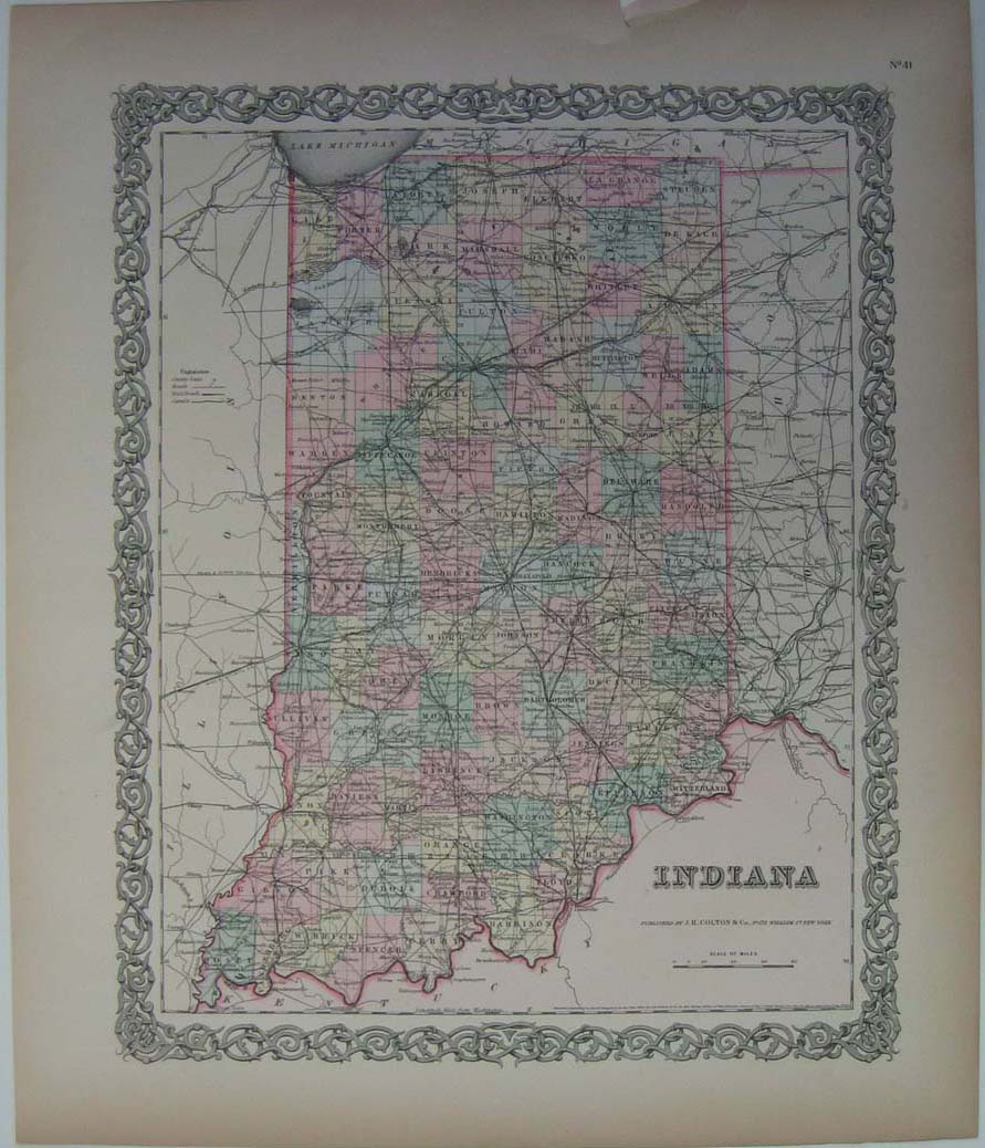
211in: 1855 Gorgeous county map of Indiana. Very attractive original hand colored genuine antique map which shows railroad routes and different counties. Published by J.H. Colton & co. 17 x 14 in. $200 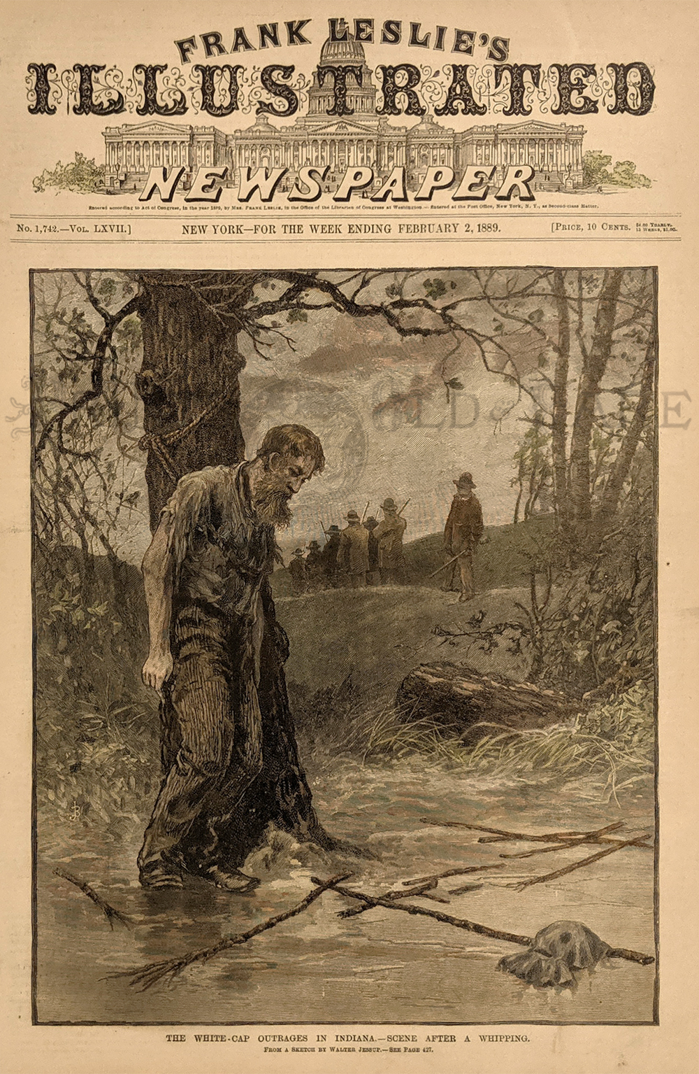 215in: 1889 Hand colored wood engraving featured in Frank Leslie's Illustrated Newspaper which is titled, "The White-Cap Outrages in Indiana -- Scene After A Whipping." Drawn from a sketch by Walter Jessup. Image shows a man tied to a tree after he was whipped by the White Cappers. 16 x 11 in. $60 
216in: 1875 Hand colored wood engraving featured in Harper's Weekly captioned, "The Day Ridge Robbers -- The Thieves Firing On Mr. Van Brunt." From sketches by Theo R. Davis. Seven engraved scenes and two engraved busts of J. Holmes Van Brunt and Alvord H. Van Brunt. 16 x 11 in. $40 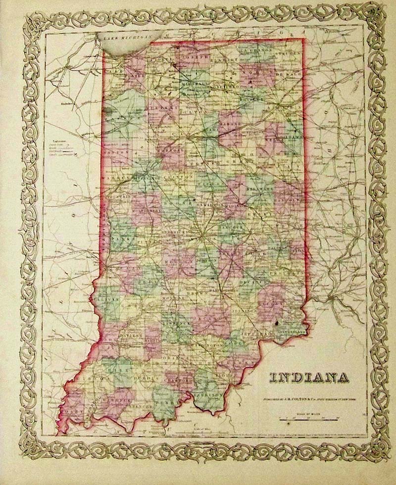
219Indiana: 1855 J. H. Colton original hand colored engraved map showing the state of Indiana. Colton was among the earliest map makers with very accurate maps depicting cities and states in the United States. 17-1/2 x 14-1/2 in. $200 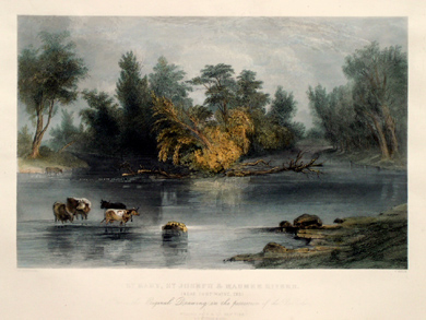 011amla: "St. Mary, St. Joseph and Maumee Rivers, Near Fort Wayne, Indiana." Published in 1869 by William Pate & Co. New York. Original descriptive text also included. 12 1/2 x 16 1/4 in. $225 b/w also available 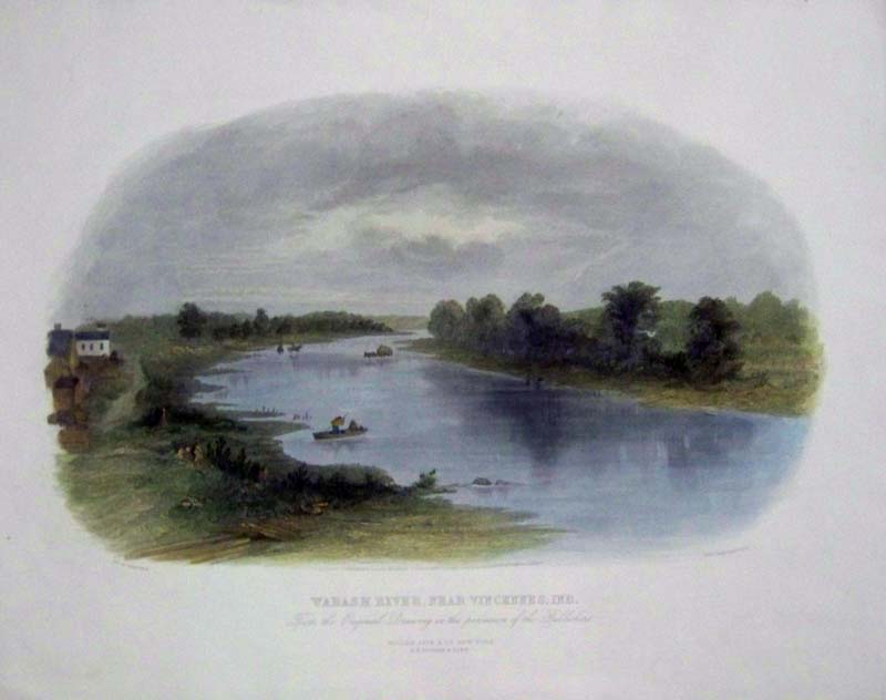 020amla: 1869 Steel engraving by Robert Hinshelwood. Artist is William Momberger. Published by William Pate & Co., New York; G.P. Putnam & Sons. Title is, "Wabash River, Near Vincennes, Ind." -- From the Original Drawing in the Possession of the Publishers. 16 x 13 in. $250 |
|||||||||
| Order Form | |||||||||||
| Back to Homepage | |||||||||||