 
|
|||||||||||
This is a small selection of our inventory of antique Indianapolis,IN maps and prints. Additional inventory is available. Contact us with your request. 1-800-879-6277
|
|||||||||||
|---|---|---|---|---|---|---|---|---|---|---|---|
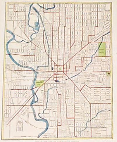 002indy: 1921 Antique Indianpolis Map. Hand colored vintage map, great detail. 10-1/2x13 in. $40 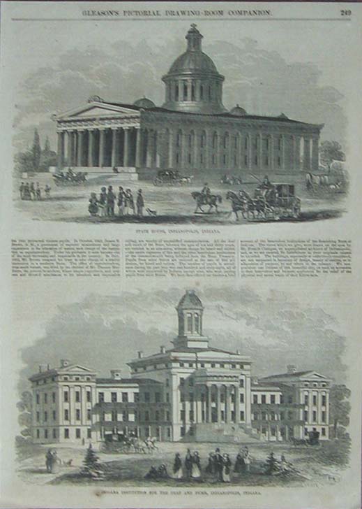 003indy: 1854 Two views of Indianapolis, Indiana. This black and white antique engraving shows a view of the State House and the Indiana Institution For the Deaf and Dumb. size: 10.5 x 15.5 in. $30 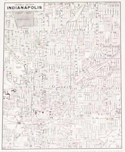 008indy: 1945 Indianapolis Map. Detailed black & white map of Central Indianapolis. Cram's. 11x14 in. $20 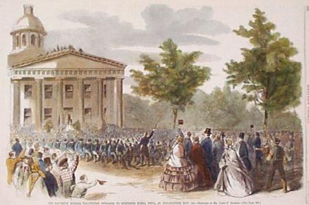 009indy: 1861 Civil War Volunteers, Indianapolis. Eleventh Indian Volunteers swearing to remember Buena Vista, at Indianapolis, May 1861. Hand colored original engraving from Harper's. 16x11 in. $50 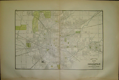 010indy: 1906 Cram map of Indianapolis. Large hand colored map showing the city boundaries as well as surrounding areas. Street names as well as railroad routes are shown. Riverside Park is predominantly shown along the White River. There are some water stains along the lower margin which could be covered with matting. 18x27 in. $80 |
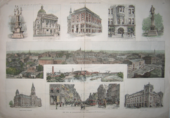 011indy: 1888 The City Of Indianapolis - From Photographs by J.W. Taylor, Chicago. Hand colored wood engravings published in a Supplement to Harper's Weekly on August 11, 1888. Ten different views of places and scenes in Indianapolis. 16x22in. $150 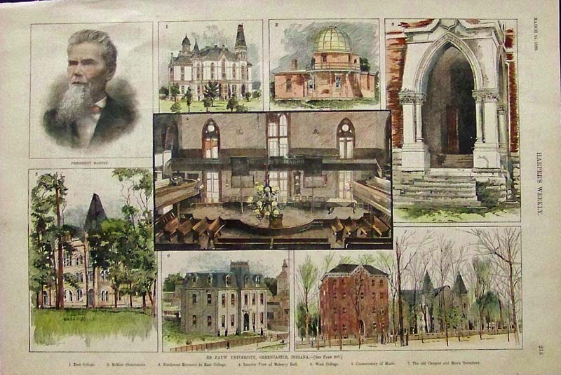 012Indianapolis: 1888 Hand colored wood engraving ahowing views and buildings of "De Pauw University, Indiana." 15-1/2 x 10-1/2 in. $40 SOLD 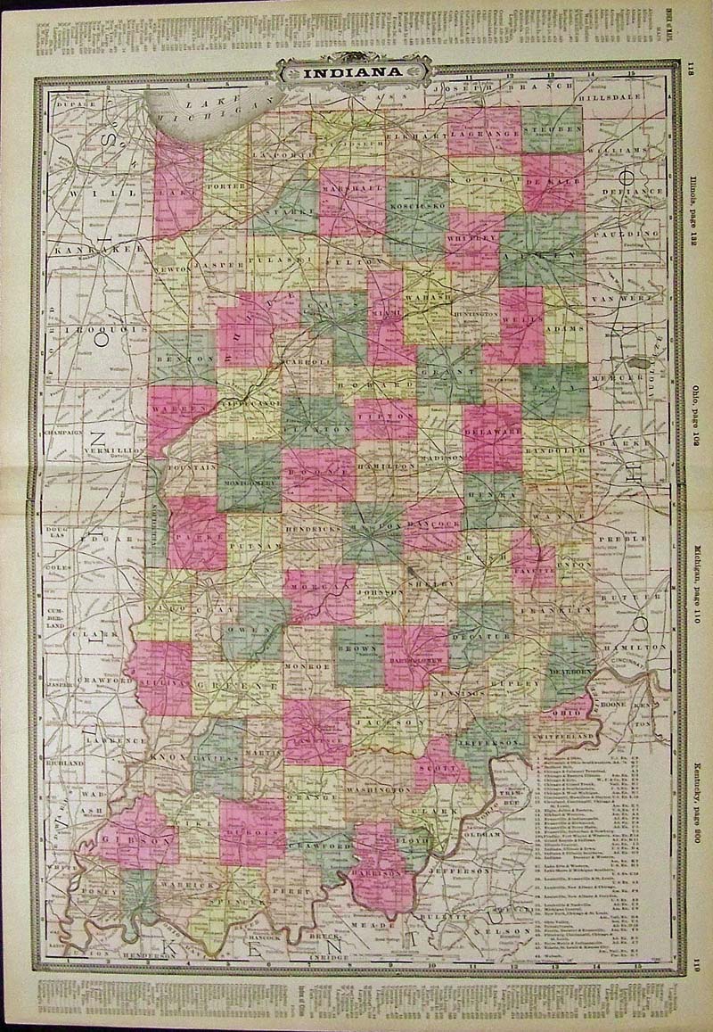 014Indianapolis: Color map of Indiana. 25 x 17-1/2 in. $80 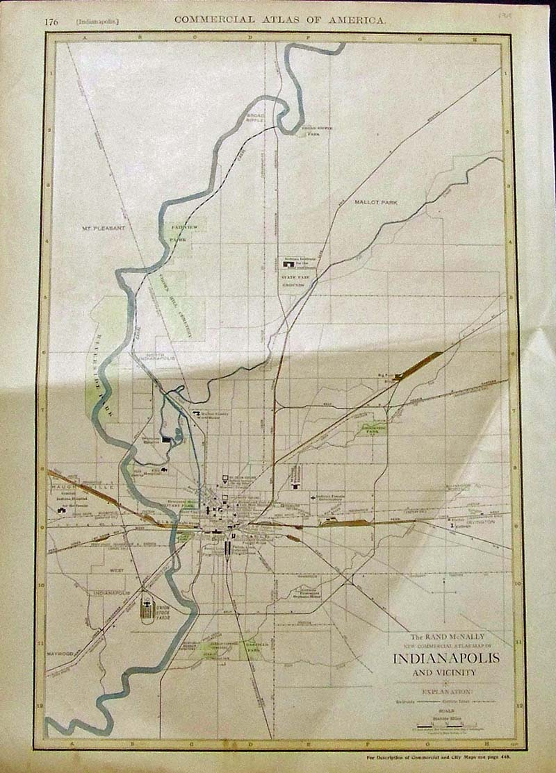 015Indianapolis: 1918 Color Rand McNally New Commercial Atlas Map of Indianapolis and Vicinity. Featured in the Commercial ATlas of America. 20-1/2 x 15 in. $80 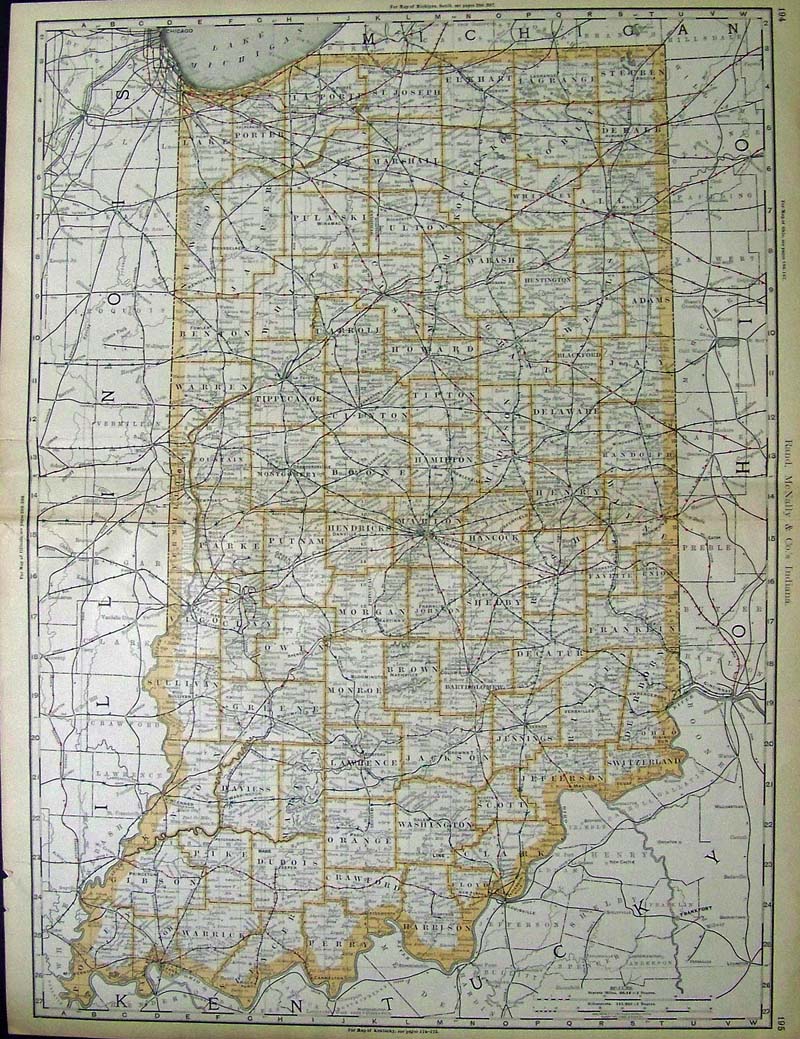 016Indianapolis: 1888 map of Indiana which shows all stops. Published by Rand, McNally & Co. 27 x 20-1/2 in. $300 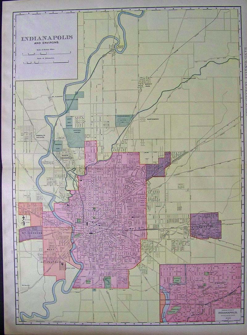 017Indianapolis: 1902 Color Indexed Atlas of the World showing the map of Indianapolis and Environs with small inset of the Business Portion of Indianapolis on bottom right. Published by Rand, McNally & Co. 28 x 21 in. $80 |
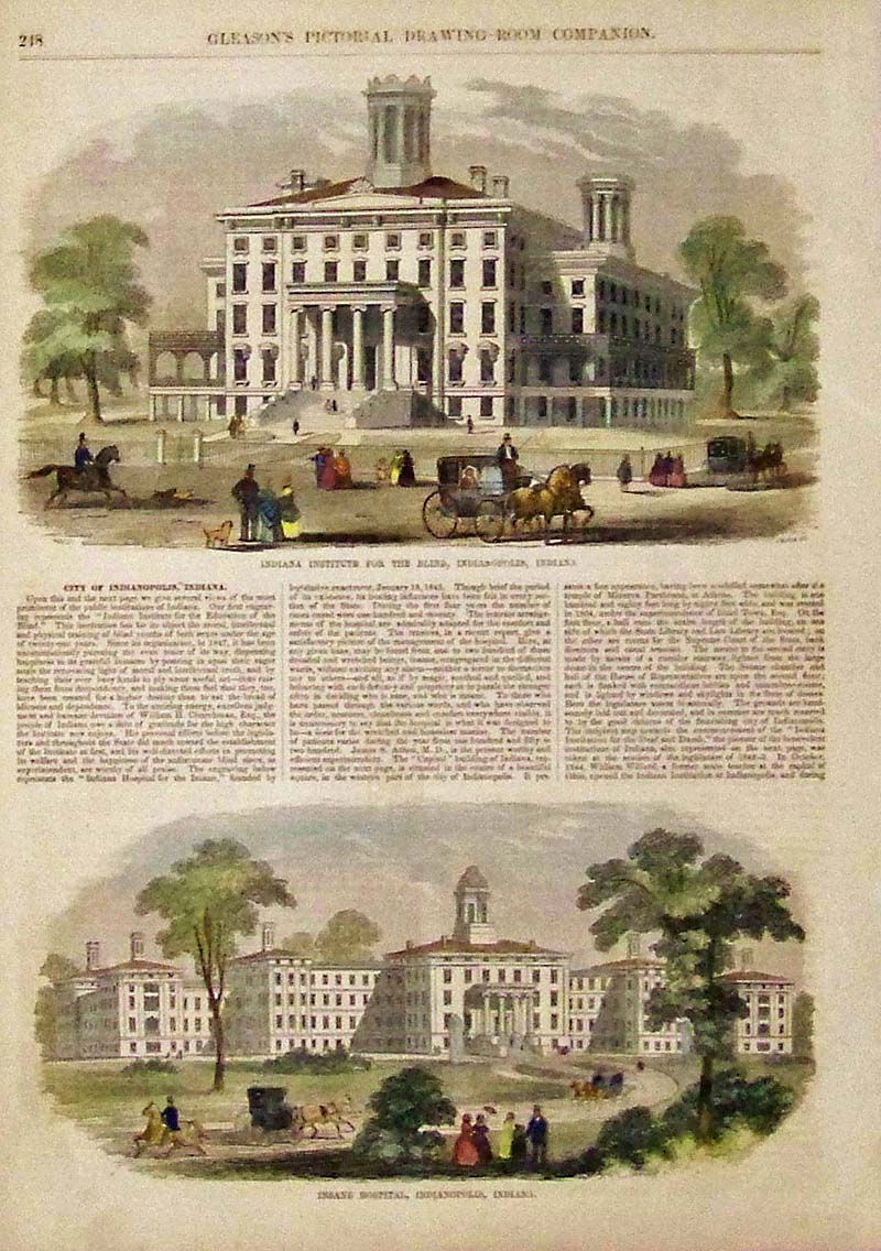 018Indianapolis: Hand colored wood engraving featured in Gleason's Pictorial Drawing-Room Companion showing the Indiana Institute for the Blind in Indianapolis, Indiana in upper image and bottom image shows the Insane Hospital, Indianapolis, Indiana. 15 x 10-1/2 in. $50  019Indianapolis: Hand colored Civil War wood engraving featured in The Soldier In Our Civil War titled, "Colonel Lewis Wallace and Staff -- Zouave Regiment, Eleventh Indiana Volunteers." 16-1/2 x 11 in. $30 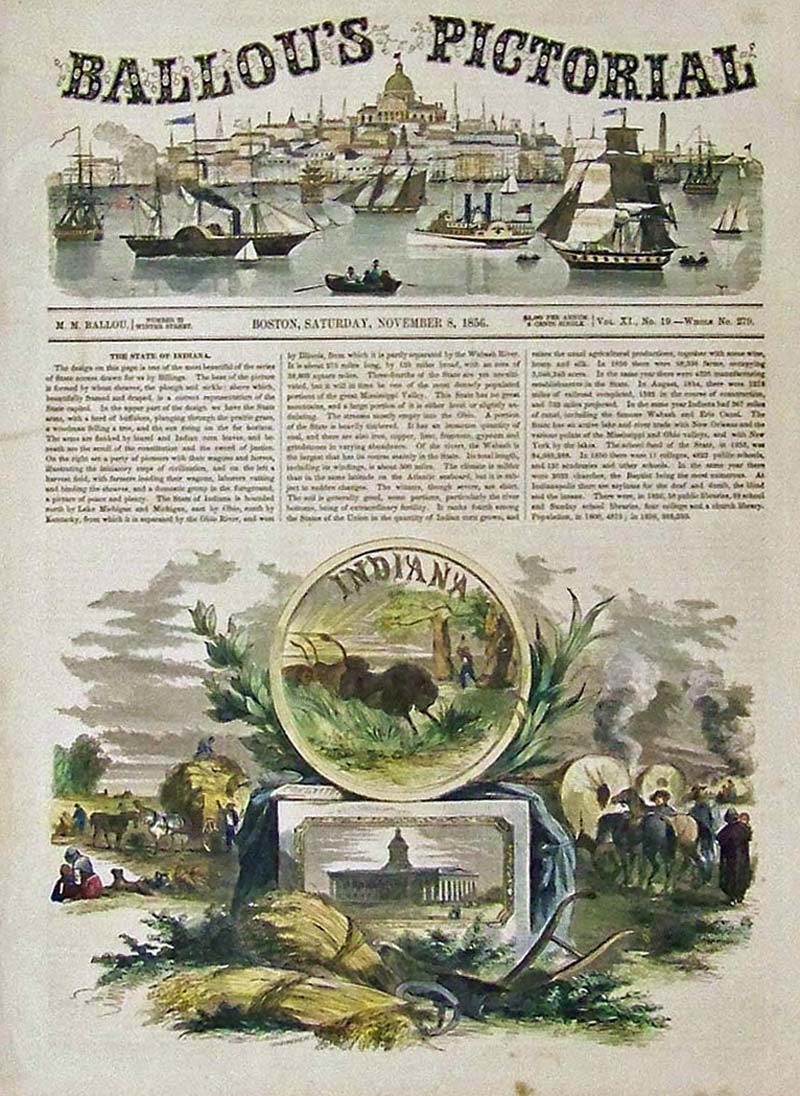 020Indianapolis: 1856 Hand colored wood engraving featured in Ballou's Pictorial showing text for The State of Indiana and images related to Indiana. 15 x 11 in. $50  021Indianapolis: 1888 Harper's Weekly wood engraving showing General Benjamin Harrison of Indiana, the Nominee of the Republican National Convention for President of the United States. 16 x 11 in. $60 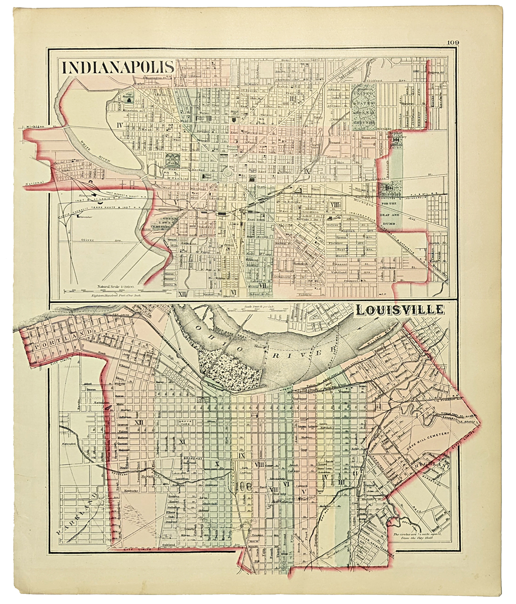 043Louisville: 1877 Gray's Map of Louisville. Showing streets, rivers, railroad, cemeteries, canals, etc. Hand colored, lithograph. Top map of Indianapolis. 14 1/4 x 17 1/4 in. $80 |
|||||||||
| Order Form | |||||||||||
| Back to Homepage | |||||||||||