 
|
|||||||||||
This is a small selection of our inventory of antique Italy maps and prints. Additional inventory is available. Contact us with your request. 1-800-879-6277
|
|||||||||||
|---|---|---|---|---|---|---|---|---|---|---|---|
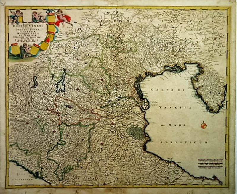 248Italy: Dominii Veneti in Italia 1680 DeWit - A wonderful copper engraved and original hand colored map of Northern Italy, the Adriatic Sea, Southern Germany and Istria with Venice at the center. This map is from DeWit’s Composite Atlas and is extremely detailed with great attention given to the shoreline and islands especially Venice and the Gulf of Trieste. Rare early proof state of De Wit's map of the Dominion of Venice, extending from Stato di Milano and Genoa to Istria. This is a very rare early proof state the Venetian State map with at least 4 states, this early state, with the coats of arms unfinished and no shading around the cherubs at the top, a second early state with shading around the cherubs, but no coats of arms, a third state with the coats of arms completed and a late state by Covens & Mortier. Condition: Good, foxing throughout small margins with smudges on margin edges, two small missing pin point pieces missing along center fold. size 24 x 19.5 image $1,100 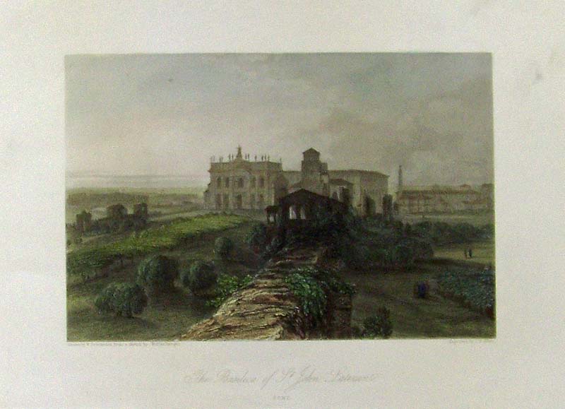
001Italy: 1866 The Basilica of St. John Lateran in Rome.(San Giovanni in Laterano). The basilica of Saint John Lateran was built under Pope Melchiade. It is the most ancient church in Rome. This is a hand colored steel engraving published by Blackie & Son, Glasgow, Edinburgh and London. 13 x 9 in. $50 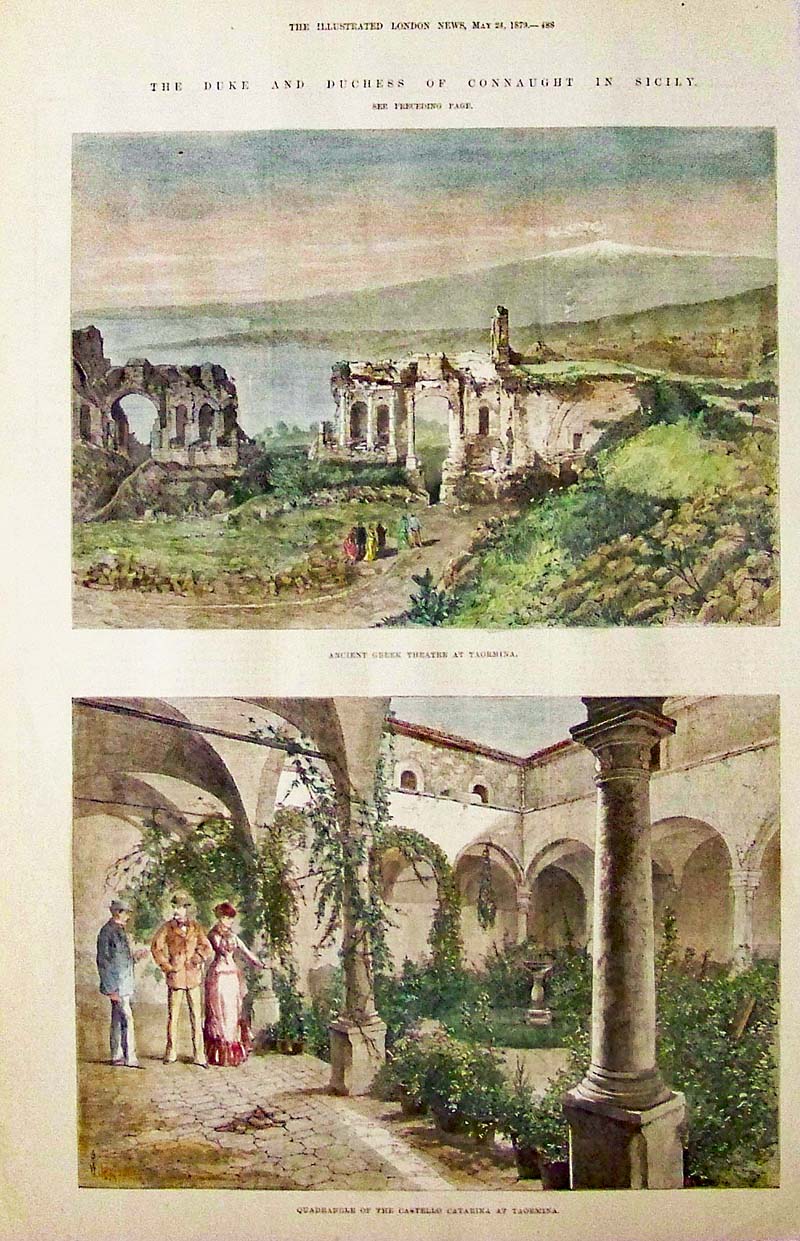
005Italy: 1879 Taormina, Sicily - Hand colored wood engraving showing early views of Ancient Greek Theatre in top engraving and the Quadrangle of the Castello Catarina in bottom image. Featured in The Illustrated London News. 16 x 10 in. $60 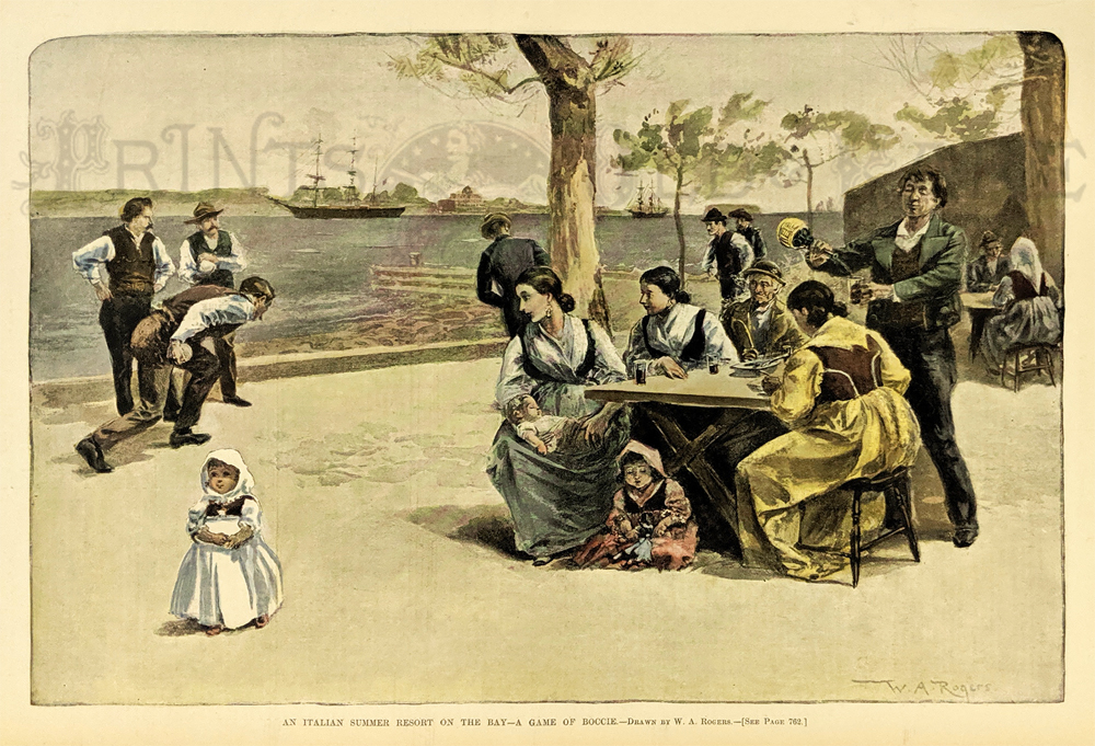 006it: 1895 ITALIAN RESORT VIEW - BOCCI BALL. "An Italian Summer Resort on the Bay - A Game of Boccie." Drawn by W.A. Rogers. Authentic professionally hand-watercolored litho view from original Harper's Weekly, 1895. A genuine antique print produced in 1895, NOT a reproduction! 15" x 11" $50 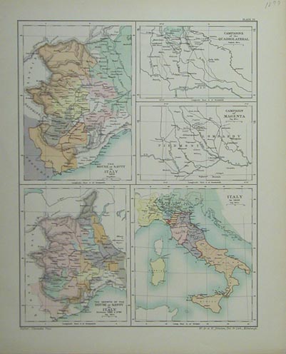 009it: 1899 Italy Historic Growth Map. Five maps on one page show the growth of the country from 1418 House of Savoy, to the whole country in 1859. Published by Johnson Edinburgh. 11-1/2x14-1/2 in. $60 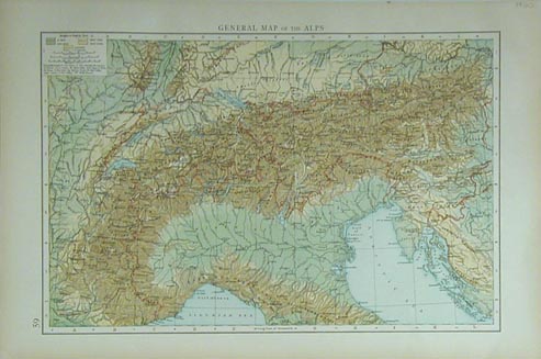 014it: 1900 Map of the Alps. Printed in color, shows good detail and elevations. 17x11 in. $40 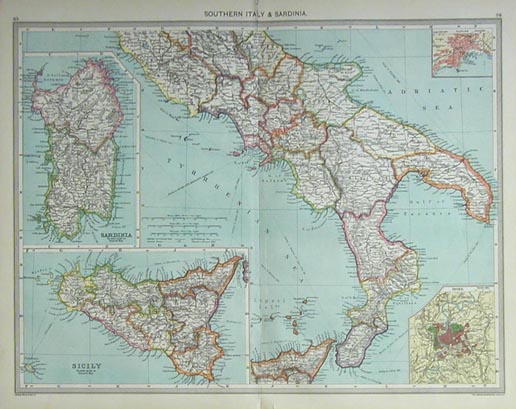 025it: 1914 Southern Italy and Sardinia Map. Printed in color. Insets of Sicitly, Sardinia, Naples and Rome. 20x15-1/2 in. $50 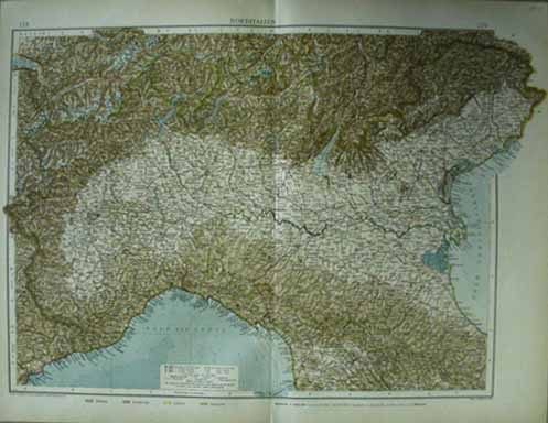 028it: 1913 Northern Italy Map. Greatly detailed German map, printed in vivid color. 21x17 in. $50  029it: 1872 Vatican view. Excellent French engraved black & white view of the entrance to the Vatica, from Le Monde Illustre. 10-1/2x15 in. $30 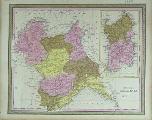 033it: 1843 Kingdom of Sardinia. Includes Piedmont, Nice, Genoa, Coni, Savoy, Aosta etc., plus an inset of the Island of Sardinia. Beautiful original color and excellent margins on this scarce map. 17-1/2x13-1/2 in. $120 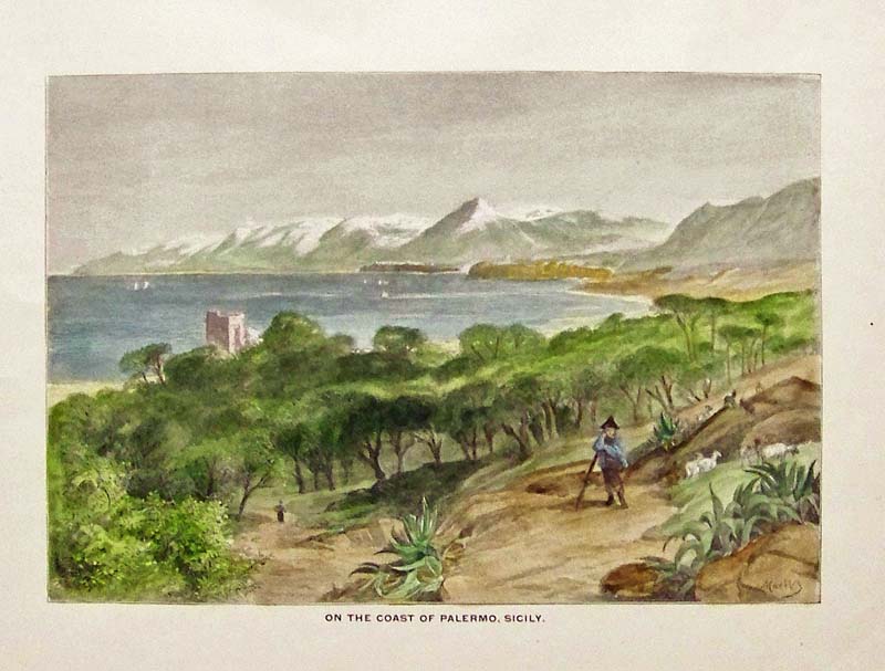 100it: 1892 View of Sicilian Coast. Fine color engraving shows the beautiful coast of Palermo, Sicily. Print published as an illustration to a book. 8x11 in. $60 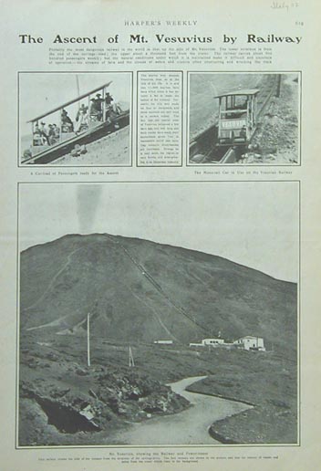 107it: 1902 Views of Mount Vesuvius. Print shows the ascent of Mount Vesuvius, a live volcano, by railway. The lower image shows lava streams and a column of smoke. 11x16 in. $30  109it: 1859 Market Scene by the Lake. Handsome wood engraving titled, "Giorno di Mercato Luino, Lago Maggiore" shows a market scene by a major lake. Published in an 1859 issue of The Illustrated London News. 11x16 in. $30 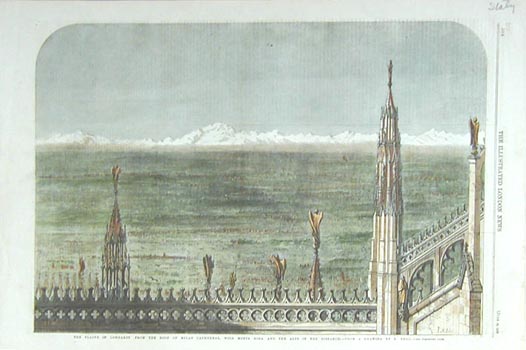 110it: 1859 View of Lombardy from Milan Cathedral. Richly colored, wood engraving shows the plains of Lombardy from the roof of Milan cathedral, with Monte Rosa and the Alps in the distance. Published in an 1859 issue of The Illustrated London News. 11x16 in. $40 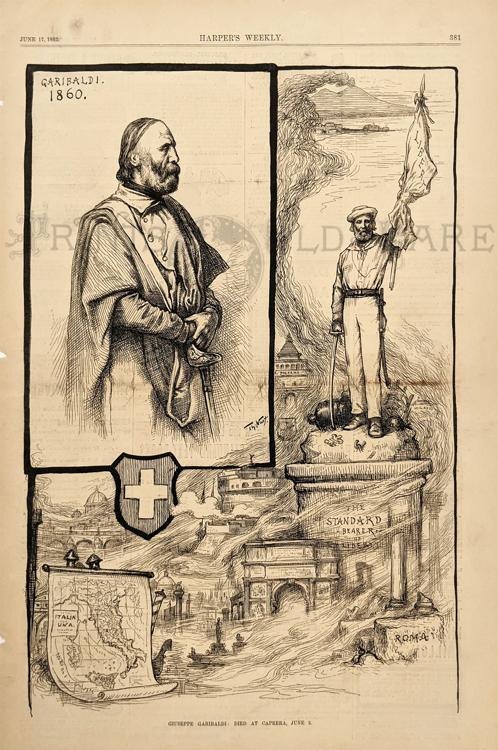
Giuseppe Garbaldi084fpeo: Giuseppe Garbaldi 1882. Italy was united under his leadership. Drawn by Thomas Nast. Wood engraving.10 ¾ x 16 in. $25 |
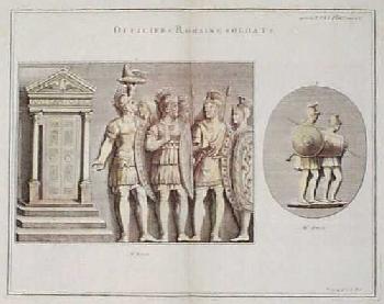 115it: 1724 Print: Roman Soldiers. Beautiful, hand colored copper engraving from a 1724 French book on ancient history. Contains two images: 1) a group of soldiers standing in front of a doorway; and 2) two soldiers with shields and spears. Printed on hand laid paper. 17x19 in. $120 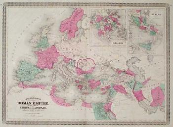 118it: 1868 Map of the Roman Empire. Hand colored, engraved map of the Roman Empire at the time of Christ, published in 1868 by the A.J. Johnson company. Includes small inset maps of Greece and Italy. 18x27 in. $75 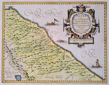 203it: 1690 Cluver Map: Adriatic Coast of Italy. Very decorative, engraved map of Italy's central Adriatic coast, published circa 1690 by Philipp Cluver. Title is "Piceni, et Vestinorum, Pelignorum, Marrucinorum ac Frentanorum agri descriptio." Hand colored. Two ships and a sea monster are shown off shore. Title is surrounded by an elaborate cartouche. Excellent condition. 14x17 in. $450 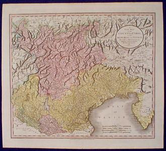 205it: 1799 Cary Map: Tyrol, Venice, Mantua Italy. Attractive, engraved map of Italy's northern regions, published in 1799 by John Cary. Title is "A New Map of the County of Tyrol, and the Republic of Venice: Duchy of Mantua Etc. Etc." Extremely detailed, with cities, towns and geographical features shown. Excellent condition. 21x22 in. $350 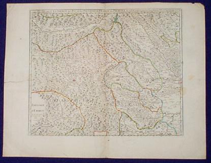 206it: 1734 Northwest Italy Map by Placide. Detailed, engraved map of Northwestern Italy, showing the source of the Po River. Nice original outline hand coloring. Drawn by P. Placide, and published in 1734. Map title is "La Source du Po, et les Passages de France en Piemont." The city of Turin is on the far right side, next to the map border. A tear in the left margin extends approx. ½ inch into the left map border. It has been expertly repaired with no image loss. There is a light vertical crease to the left of the center fold. Overall very good condition. 19x25 in. $350 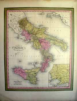 210it: Kingdom of Naples or The Two Sicilies. Color engraving from 1850, published by Mitchell. Inset on lower right corner of the Environs of Naples. Beautiful border surrounding map. 13.5x17.5 in. $90 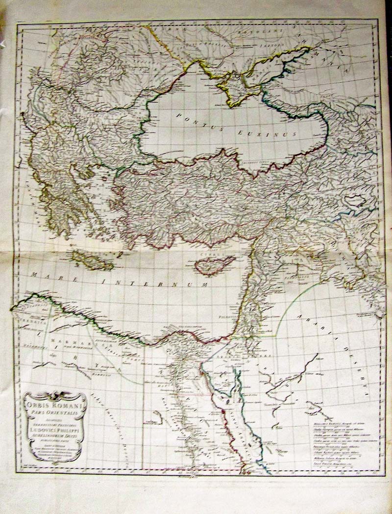
119Italy: Orbis Romani Pars Orientalis, D’Anville 1764 - A wonderfully engraved and original hand colored map of the Roman Empire drawn by Jean Babtiste D’Anville, Orbis Romani Pars Occidentalis [and] Orbis Romani Pars Orientalis), Laurie & Whittle, London, 1794. This map shows the extent of the Roman Empire in Europe from Macedonia east to Greece, Turkey and the Arabian Penninsula, and contains very good detail of towns, cities, rivers and topography. The title cartouches indicate this map was drawn in 1764 by d’Anville, and were published by Laurie & Whittle in 1794. Condition: Very good with original color on watermarked paper with offsetting, light toning, and one long centerfold separations small tear bottom right margin and small right margin, normal aging and browning. size 21.5 x 27 image $600 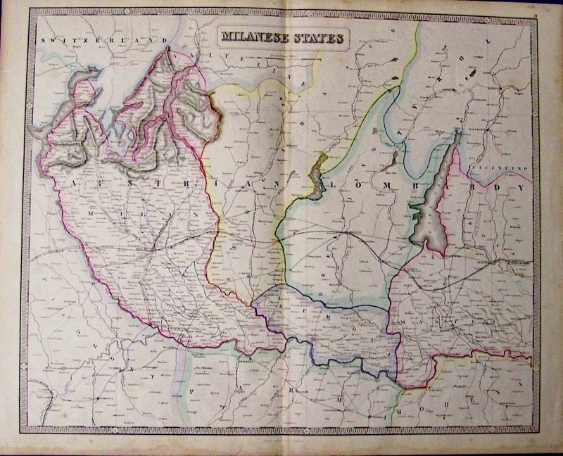 249Italy: Milanese States, 1852 Philips and Son - A large lithographed map with original pastel color of Northern Italy, a companion to the map of “Tuscany and States of the Church,” by Phillips. A very decorative map detailing the area of Milano, Brecia, Cremona, Mantua and Verona Italy. Milan is shown as the central hub of the region, the Italian Alps are nicely shown with hachures along with Lake Como and Lake Maggiore, most roads and railroads are detailed along with a large Lake Garda to the East. Condition: Very good, folded in middle browning and watermarks on the edges and some light foxing on image. size 50 x 59 image $180 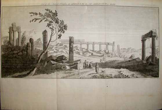 213it: Roman ruins in Sicily. The title reads, One of the Ancient Temples at Gergenti, the Old Agrigentum, in Sicily. Authentic copper engraving from 1738. 14x21 in. $75 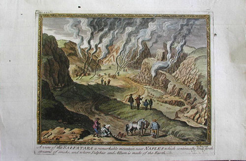 215it: Beautiful hand colored copper engraving printed in the early 1700's. Image captioned, A view of the Salfatara, a remarkable mountain near Naples which continually fends forth streams of smoke, and where Sulphur and Allum is made of the Earth. 13x9 in. $100 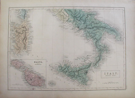 216it: Beautiful hand colored map titled, Italy, South Part. Published in 1854 by A & C Black. Inset in lower left corner shows Malta and its Dependencies. 17x12.5 in. $80 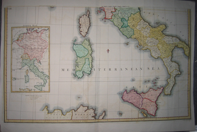 219it: 1800 Map (of the countries surrounding the) Mediterranean Sea with an inset on left side of an Index Map of Germany, Switzerland and Italy. Map published by John Stockdale Piccadilly on March 12, 1800. Map in very good condition with reinforced borders. 22.5x34.5in. $300 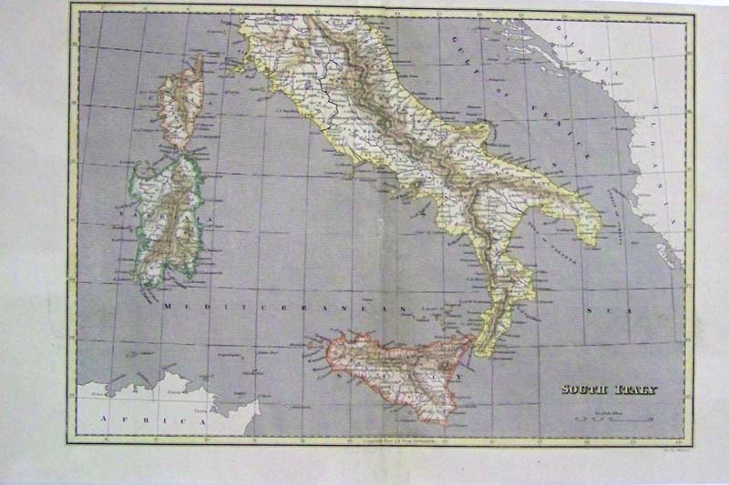 221it: South Italy hand colored engraved map c.1830 showing lower Italy, Sicily, Sardinia, Corsica, North Coast of Africa, Dalmatia and Albania framed by a lined border. 16 x 10 in. $50  027vf: 1878 Garibaldi, Italian Patriot. Artist is Theobald Chartran. 15 x 10 in. $60 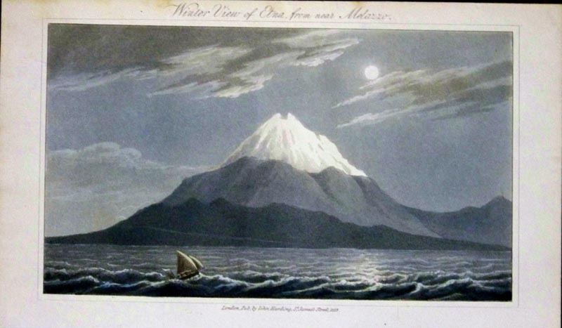 011ndis: C.1828 Aquatint showing the Winter View of Mt. Etna from Near Melazzo, Sicily. Published in London by John Harding. 8-1/2 x 5 in. $50 |
 253it: Bridge of Varus. 1798. Aquatinit engraving by James Merigot. London. “A Select Collection of Views and Ruins in Rome.” 6 x 9 in. $60 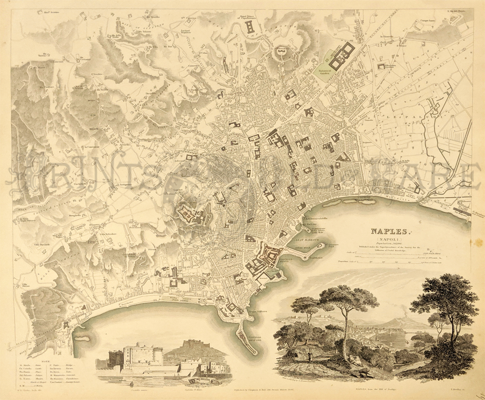 255it: Naples 1832 – SDUK Map (Society for Diffuser of Useful Knowledge) Incredible detailed engraved map with insets the city with a distant view of Mt. Eta, Castella Nuovo and St. Elmo. 13 5/8 x 16 in. $175 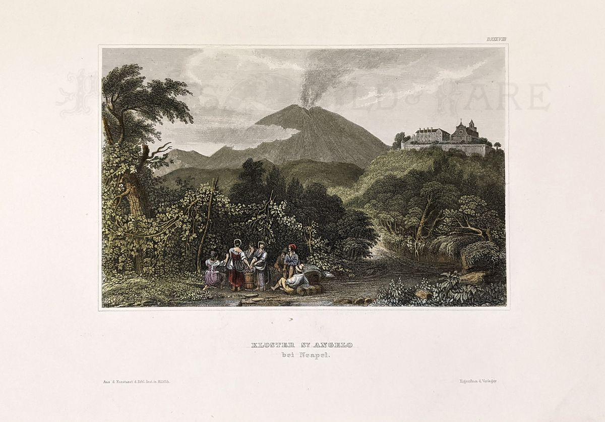 256it: Naples 1858 "Kloster St. Angelo bei Neapel." Hand colored, steel engraving of area around Naples. 7 1/4 x 10 1/4 in. $45 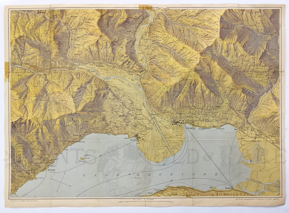 257it: Locarno c.1920s. Topographical map of Lake Maggiore region by Kummerly and Frey. This handsome frameable map shows area towns, ferry routes, and roads. Originally folded. 19 1/2 x 27 in. $150 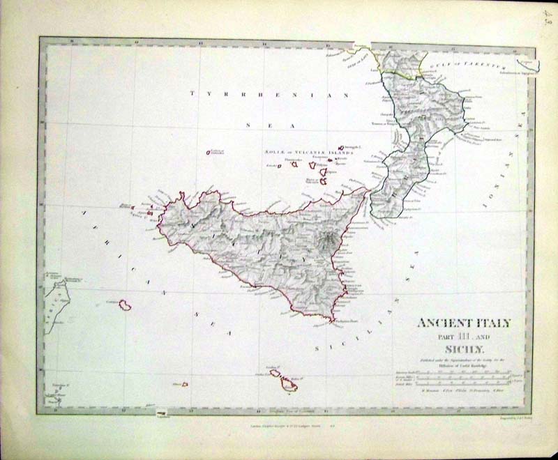 222it: C.1844 Acient Italy, Part III and Sicily, outlined in color, Published under the Superintendence of the Society for the Diffusion of Useful Knowledge (SDUK) c.1850. Map shows the volcanic islands in that region. 17 x 14 in. $95 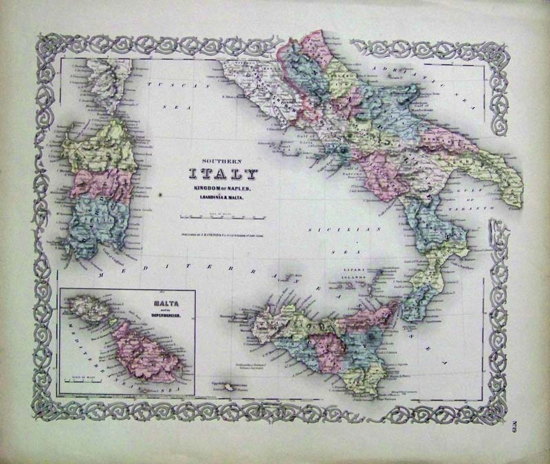 223it: 1855 Hand colored engraved map of Southern Italy, including Kingdom of Naples, Sardenia and inset of Malta and its Dependencies.Published by J.H. Colton & Co. 18-1/2 x 16 in. $75 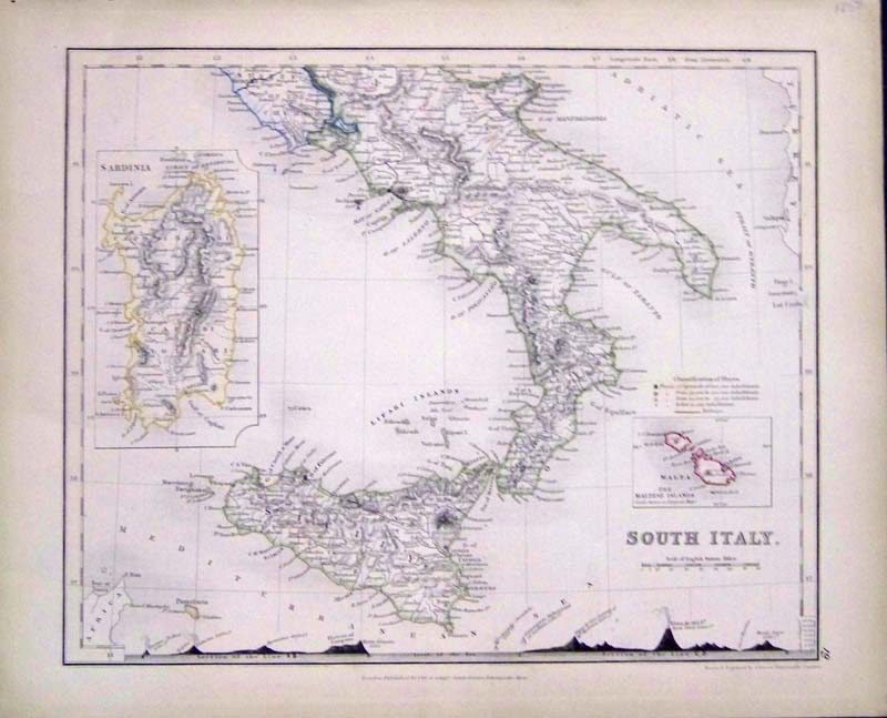 224it: 1850 Hand colored engraved map of South Italy, with insets of Sardinia and Malta. Published by Orr and Group. Comparison of volcanic eruptions depicted on bottom border. 12 x 10 in. $100 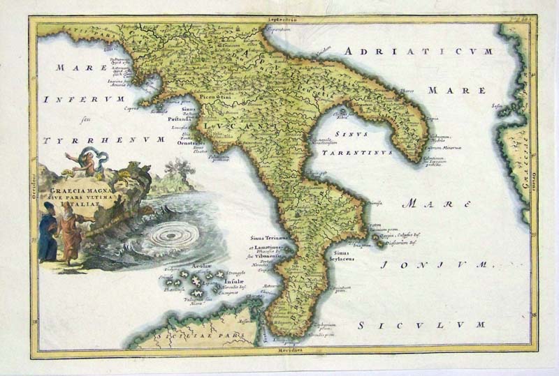 225it: 1740 Copper engraved Graecia Magna Sive Pars Vltima I Italiae "Boot of Italy" historical map showing Italy as part of Greece. A Cartouche of Siren is shown on left side of map. 13 x 9 in. $200 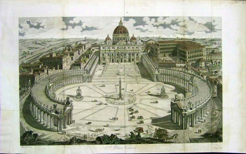 227it: 1802 Gently hand tinted copper engraving showing the magnificent view of the Square in front of St. Peter's Church, After Piranesi View. 17 x 10-1/2 in. $100  228it: c.1875 Gently hand colored fine steel engraving published by D. Appleton & Co. Title is, "The Arch of Titus - Rome." 14 x 10 in. $60 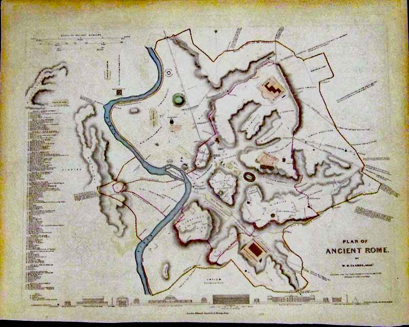 231it: 1830 Lightly hand colored steel engraving map titled, "Plan of Ancient Rome, By W.B. Clarke, Archt. Published under the Superintendence of the Society for the Diffusion of Useful Knowledge (S.D.U.K.); Published by Chapman & Hall, London. A comparison of heights of prominent buildings is on bottom border. A key identifying important locations is on lefthand side. Map is in fine condition. 16 x 13 in. $--- SOLD 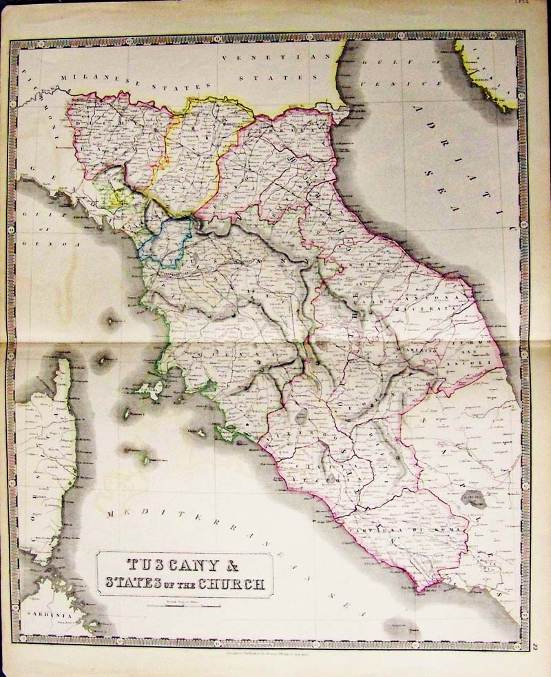 250Italy: Tuscany and States of the Church, Phillips and Sons 1852 - A large hand colored lithograph map of Tuscany, original pastel colors depict the “States of the Church” below the Milanese and Venetian states. The map is very detailed and shows rail lines, villages and towns, rivers, mountains and lakes of the region. Sardinia and Corsica are bottom left, below Gulf of Genoa, Adriatic Sea far upper right with the tip of Istria, no Croatia. Condition: Very good, but some water marks inside image, folded in the middle and small margins on edges with attractive border and on small tear lower right margin. size 19.5 x 26.5 image $200 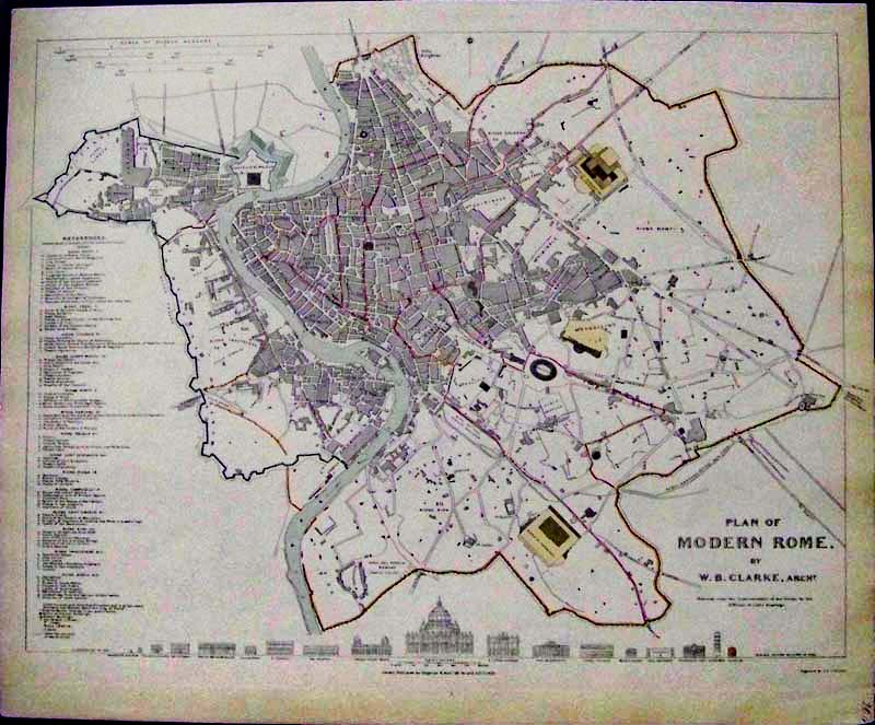 236it: 1830 Lightly hand colored steel engraved Plan of Modern Rome, By W.B. Clarke, Archt. Published under the Superintendence of the Society for the Diffusion of Useful Knowledge (S.D.U.K.). Fine condition map published by Chapman & Hall, London. Comparison of heights of prominent buildings on bottom border and Key to important locations on left side. 16 x 13-1/2 in. $--- SOLD 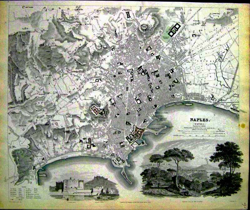 237it: 1835 Lightly hand colored steel engraved map of Naples (Napoli), Italy, published under the Superintendence of the Society for the Diffusion of Useful Knowledge (S.D.U.K.). Fine condition map embellished with vignettes showing Mt. Etna, Castello and Nuovo. Published by Chapman & Hall, London. 16 x 13-1/2 in. $--- SOLD 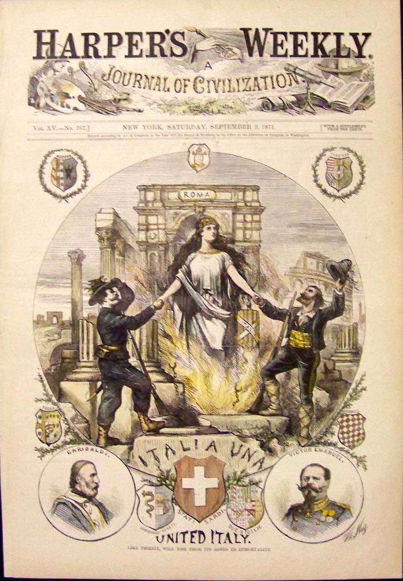 244it: 1871 Hand colored wood engraving by Thomas Nast featured in Harper's Weekly, A Journal of Civilization titled, "Like Phoenix, Will Rise From Its Ashes To Immortality." Engraving shows the Goddess of Roma, Italy along with the Uniter, Garibaldi, as well as Victor Emanuel celebrating Italy's unification. 16 x 11 in. $60 Uncolored: $50 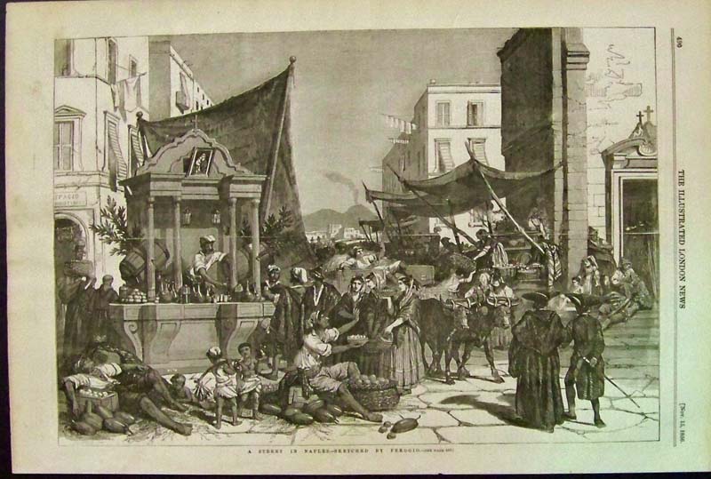 246it: 1856 Naples -- Street Scene after Ferogio which was featured in The Illustrated London News and is in fine condition. 16 x 10-1/2 in. $40 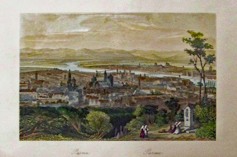
251it: Parma, Italy - A bird's-eye view. Hand colored steel engraving showing Parma, Italy where parmesan cheese originated. 10 x 6-1/2 in. $60 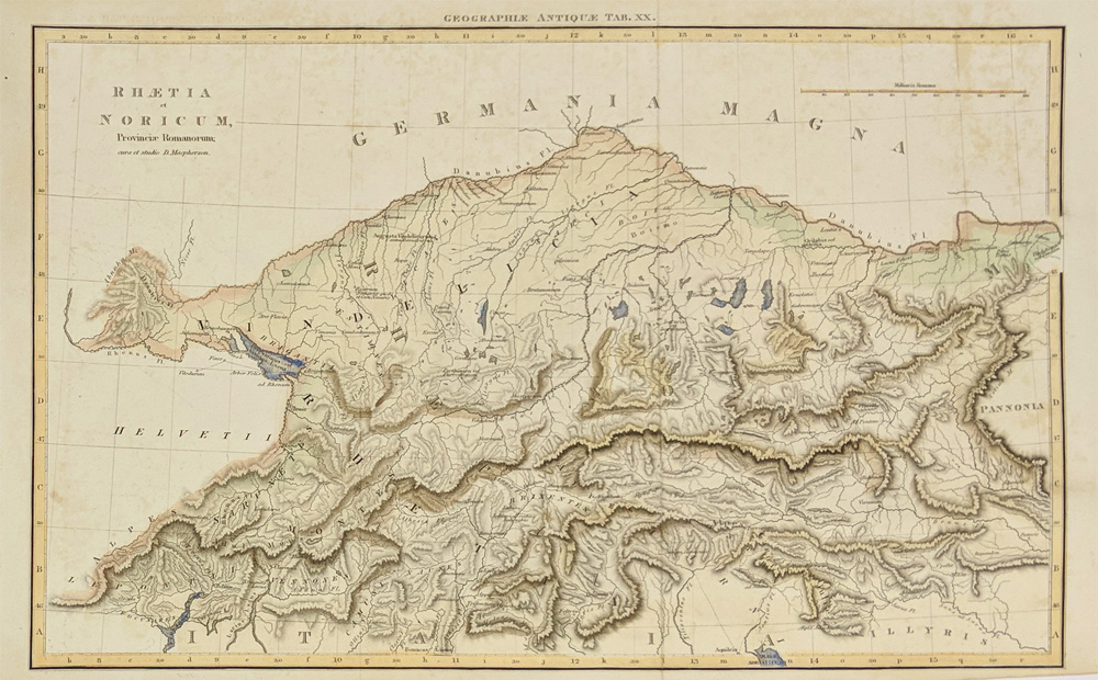 252it: 1820 S. Bavaria, W. Austria, and N. Italy. Roman Province, Rhetia ct Noricum. Aeps ridges as well as Roman roads & routes. Water colored, Steel engraving. 16 x 10 in. $90 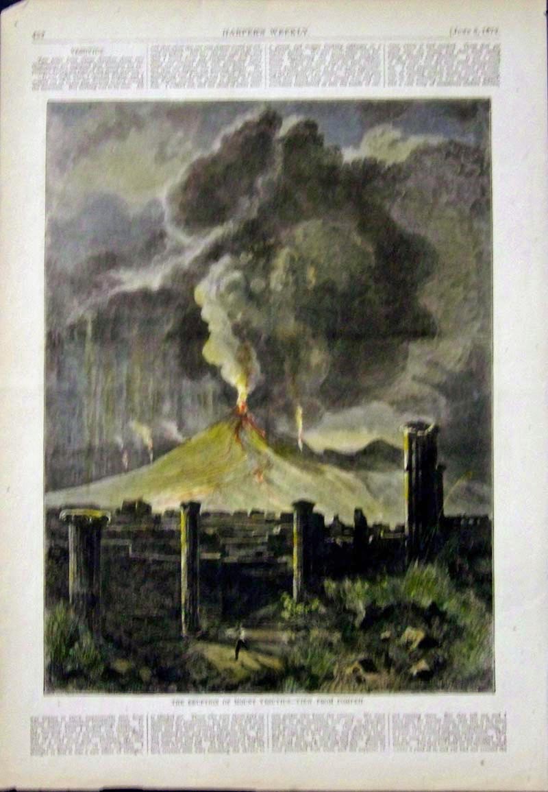 015ndis: 1872 Hand colored wood engraving with text from Harper's Weekly showing "The Eruption of Mount Vesuvius -- View From Pompeii." 15-1/2 x 11 in. $50 |
|||||||||
| Order Form | |||||||||||
| Back to Homepage | |||||||||||