|
|||||||||||
This is a small selection of our inventory of antique Low Countries maps and prints. Additional inventory is available. Contact us with your request. 1-800-879-6277
|
|||||||||||
|---|---|---|---|---|---|---|---|---|---|---|---|
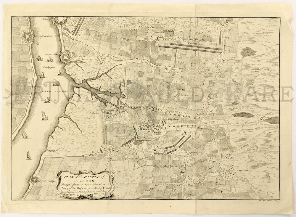 000low: Plan of the Battle of Eckeren, Netherlands, 1750, Rapin-Thoyras - An engraved and highly-detailed, regional black and white map, showing Fort St. Philip, F. de la Croix, F. Liefkenshock and Lillo, beyond the river and towns, farms and roads, by Paul Rapin. A number of ships in the River Scheld depicts the French attack of June 30, 1703. The map has a large title cartouche from Tindal's Continuation of Rapin's History. Condition: Very good, two vertical folds, some water staining on lower left margin. size, 18.5 x 14 image. $120 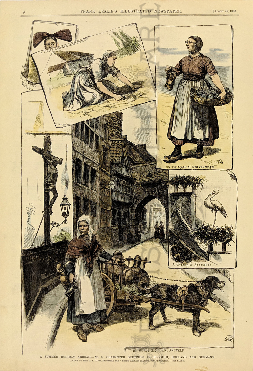
005low: 1883 Characters in Holland, Belgium, Germany. Hand colored engraving from Frank Leslie's Illustrated Newspaper, showing typical women in the Low Countries. 11x16 in. $50 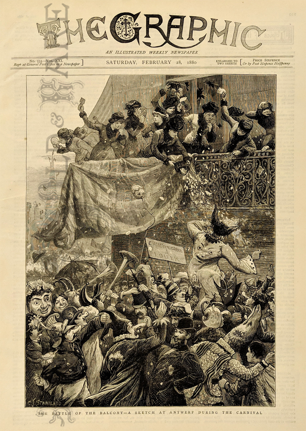
006low: 1880 Carnival Scene in Antwerp Belgium. Engraved image from The Graphic, titled "The Battle of the Balcony: A Sketch at Antwerp During the Carnival." Shows a crowd dressed in masks and costumes, celebrating Carnival in the streets of Antwerp. 11x16 in. $30  208low: Plan of Hulst with its Forts and Outworks, Holland, War of Spanish Succession, 1729 - Very nice and colored engraving of by Van Holst Dumont Holland with details of the area including forts and outworks. The map features a very large and decorative legend naming specific forts and the direction of cannon fire, cuts made by French and Dutch armies and a sluice. Condition: Excellent, two light vertical folds small left and right margins. size 18 x 14 image. $220 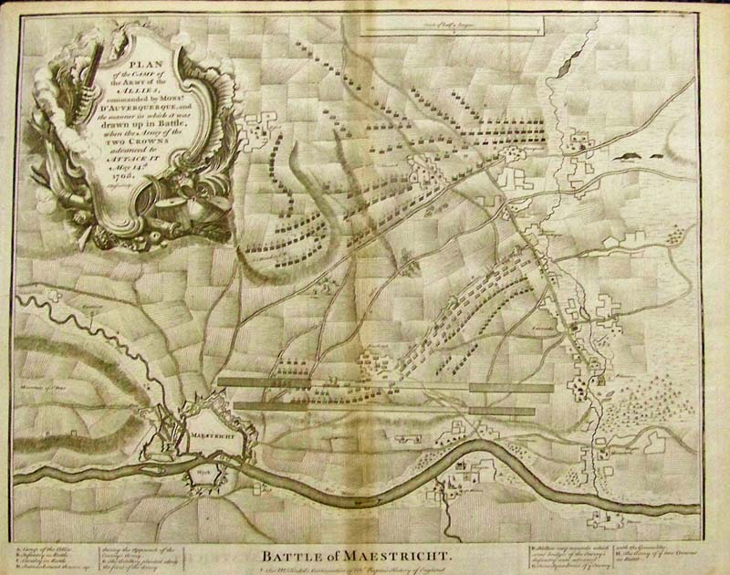 213low: Battle of Maestricht, 1732 An engraved black and white map of the battlefield of the Battle of Maestricht in Belgium from Paul de Rapin's, The maps listed represent battles that took place during the War of Spanish Succession (1701-1713) concluded by the Treaties of Utrecht. Condition: Good, small top and left margins shaded water mark down the middle. size 18.5 x 14 image $250 |
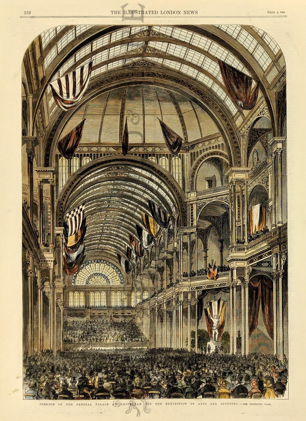
008low: 1864: Crystal Palace in Amsterdam. Beautifully hand colored old engraving from the Illustrated London News, titled "Opening of the Crystal Palace at Amsterdam for the Exhibition of Arts and Industry." Shows the large, open interior of the building, filled with people for the celebration. 11x16 in. $50 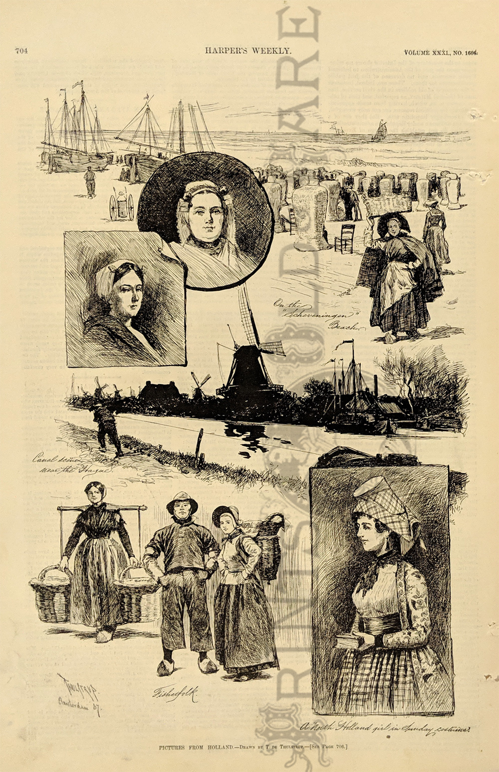
009low: 1887 Scenes in Holland. Interesting compilation of engraved images from Harper's Weekly, titled "Pictures from Holland." Shows typical people and scenery from various parts of the country. There are several small holes in the right margin, but the image is not affected. 11x16 in. $30 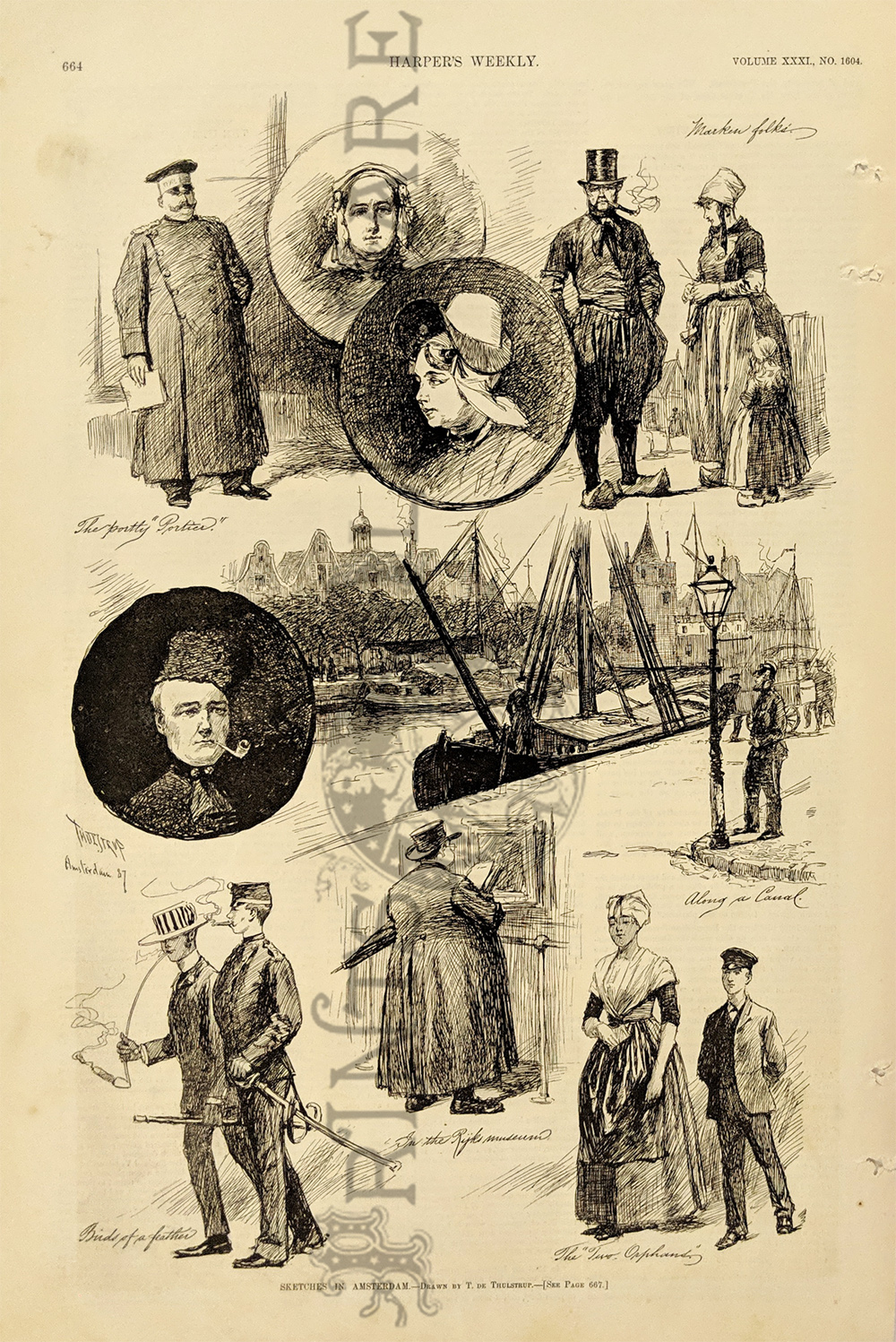 010low: 1887 Amsterdam Scenes. Compilation of engraved images from Harper's Weekly, titled "Sketches in Amsterdam." Shows views of men and women in the city, as well as a scene along one of the canals. There are several small holes in the right margin, but the image is not affected. 11x16 in. $30  012low: 1735 Hand color steel engraved, "Map of Flanders and other Provinces of the Netherlands with part of England, Holland, France &c., exhibiting a full view of ye Seat of War nth. The Towns & Rivers mentioned in ye Actions & Encampments." Claude Dubose. This large and decorative map shows the regions from Normandie through Flanders into part of The Netherlands above Rotterdam and extends east to Germany. The Legend locates fortified towns, gentlemen's homes, forts, abbeys, universities, and much more very interesting places. 23 x 20 in. $225 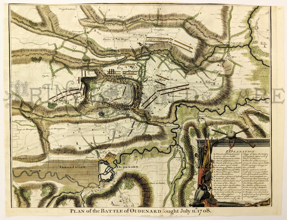
201low: 1745 Belgium Battlefield Map by Basire. Decorative, engraved map, titled "Plan of the Battle of Oudenard, fought July 11, 1708." Drawn by J. Basire, and published in 1745. Shows troop movements and fortifications throughout the area. A key in the lower right corner explains the many symbols on the battlefield. Top margin has been cropped onto the map border, but the image is intact. Small text beneath the title in the bottom margin is cropped as well. 15x20 in. $250 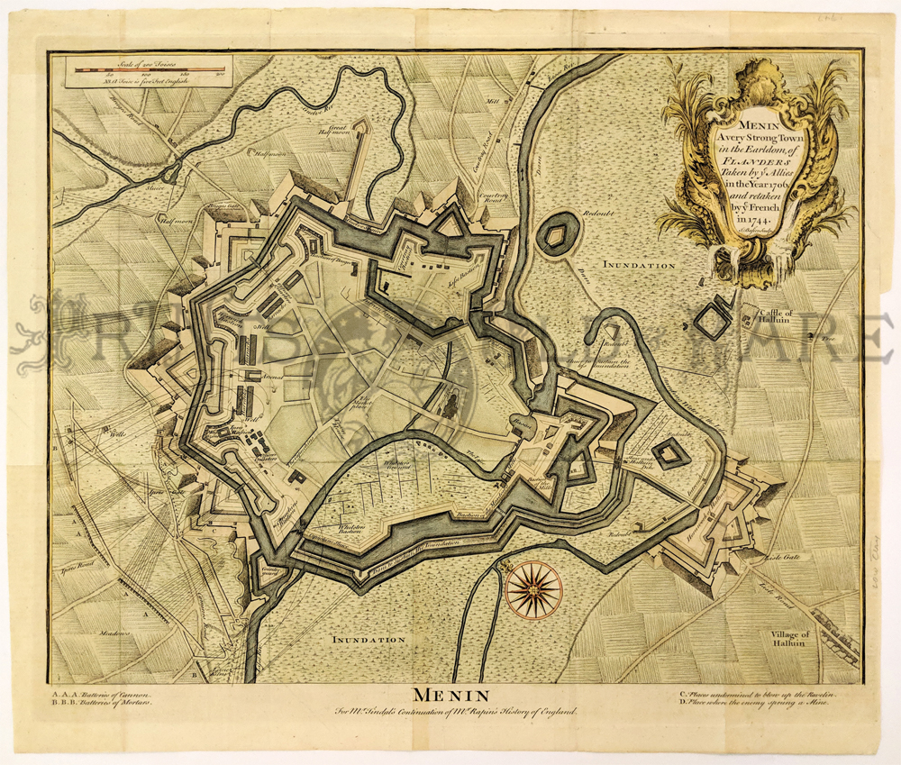 202low: 1747 Map: City of Menin, Belgium. Beautiful, decorative map of the city of Menin, a fortified Belgian town near the French border. Drawn by J. Basire, and printed in 1747. Title is "Menin, a Very Strong Town in the Earldom of Flanders Taken by ye Allies in the year 1706 and retaken by ye French in 1744." The 1706 battle referred to in the title was during the War of Spanish Succession. Map is hand colored, in excellent condition. 17x20 in. $350 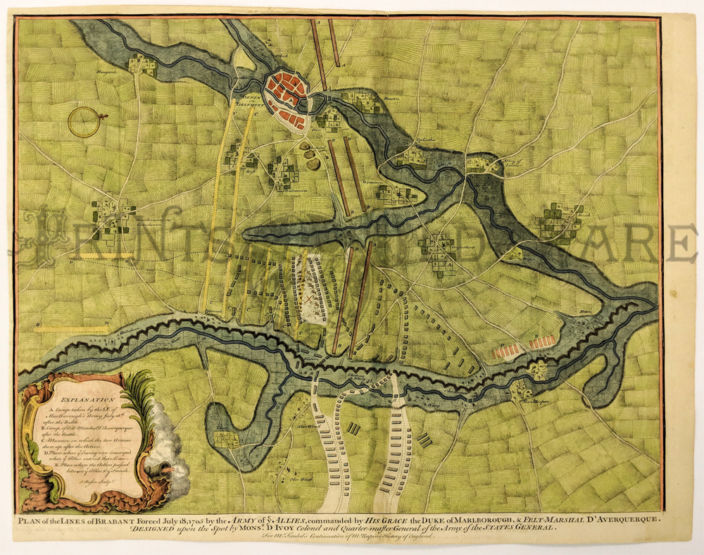
203low: 1747 Basire Map of Belgium Battlefield. Decorative, hand-colored map, titled, "Plan of the Lines of Brabant Forced July 18, 1705 by the Army of ye Allies, Commanded by His Grace, the Duke of Marlborough?." Map was drawn by J. Basire, and published in 1747. The battle shown occurred during the War of Spanish Succession. An explanation in the lower left corner describes the locations and movements of troops. Very good condition. 15x20 in. $300 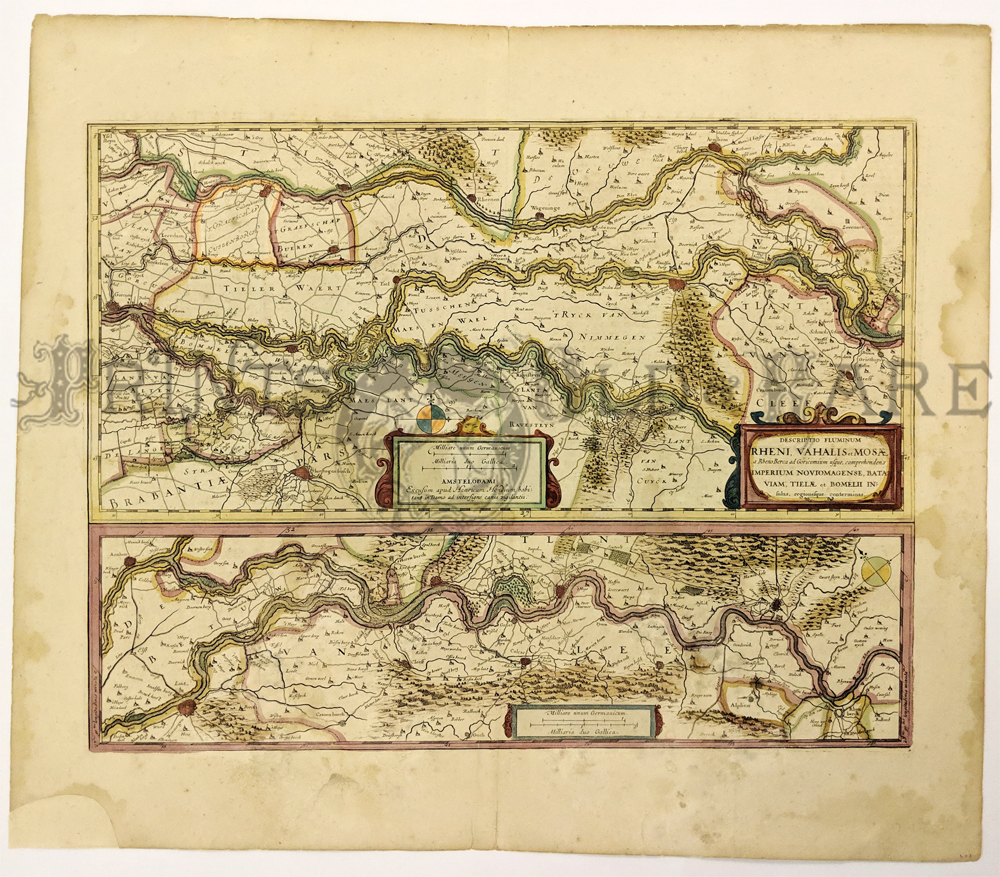
204low: 1606 Hondius Map: Netherlands Rivers. Beautiful, hand-colored double map, published circa 1606 by Heinrich Hondius. Title is "Descriptio Fluminum Rheni, Vahalis et Mosae?." Top image shows the Rhine, Vahl and Masa Rivers near their entrance to the sea. Bottom shows the Rhine River before it splits into the Rhine and Val Rivers. Forests are drawn as groups of individual trees. Fortified cities are shown with walls around them. Map title and mileage scales are surrounded by decorative designs. Small piece missing from bottom left corner of the margin has been professionally replaced (image not affected). There is some light staining in the margins, but the image is clean and clear. 19x23 in. $550 |
|
|||||||||
| Order Form | |||||||||||
| Back to Homepage | |||||||||||
