|
|||||||||||
This is a small selection of our inventory of antique Maryland with Baltimore maps and prints. Additional inventory is available. Contact us with your request. 1-800-879-6277
|
|||||||||||
|---|---|---|---|---|---|---|---|---|---|---|---|
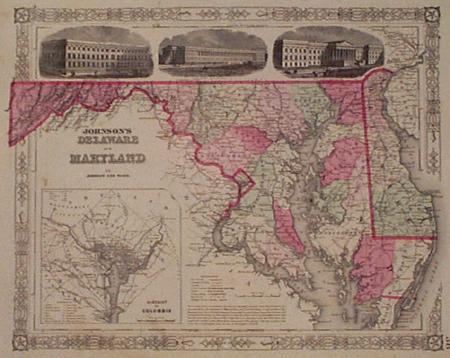
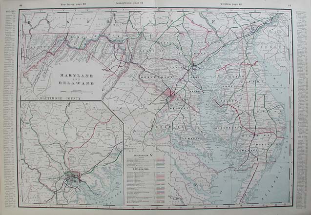
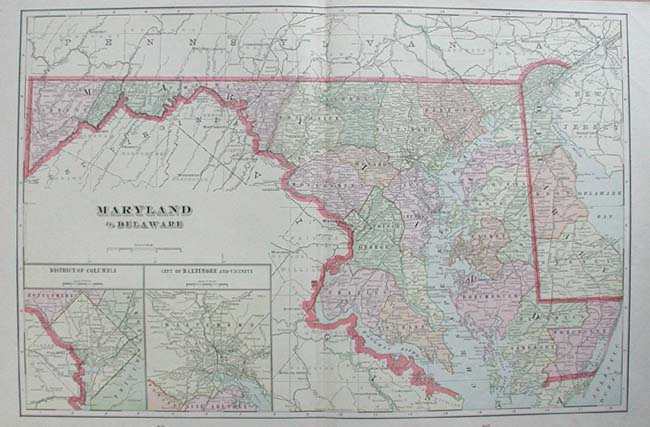
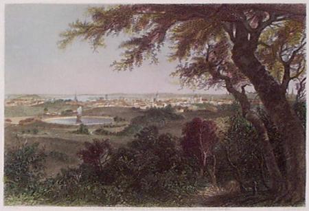
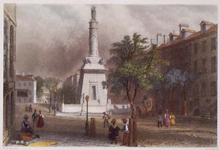
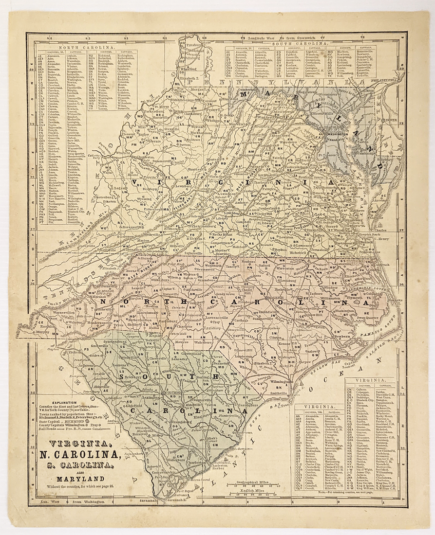
001md: 1864 Johnson Map of Maryland and Delaware. Inset of District of Columbia and 3 government buildings. Original color. 17-1/2x14 in. $120 Check for availability 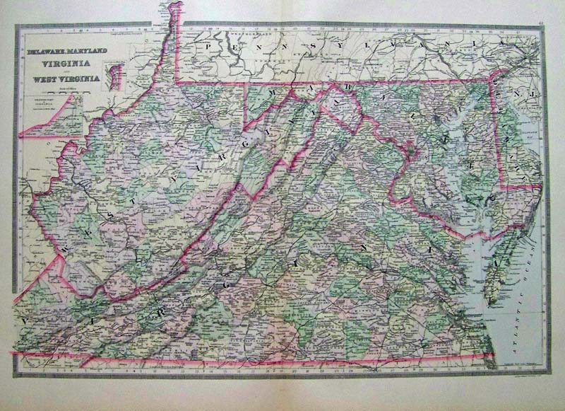 108Delaware: 1889 Bradley color lithograhed map showing Delaware, Maryland, Virginia and West Virginia. Featured in Bradley's Atlas of the World for Commercial and Library Reference. Entered according to Act of Congress in the Clerk's Office of the Librarian Congress at Washington. 26 x 19 in. $240 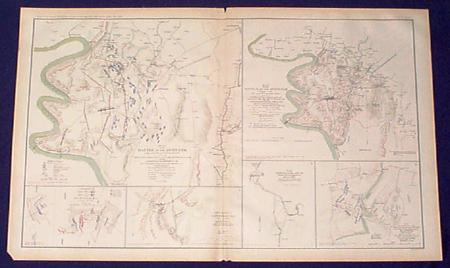 003md: Civil War Maps of the Antietam Maryland. Large litho page published by US Government after the War. Shows old Confederate and Union lines, forts etc. 29x18 in. $80 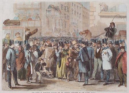 004md: 1861 Rare Baltimore view. "Waiting for Mr. Lincoln, President of the United States." Hand colored engraving from London Illustrated. 16x11-1/2 in. $60 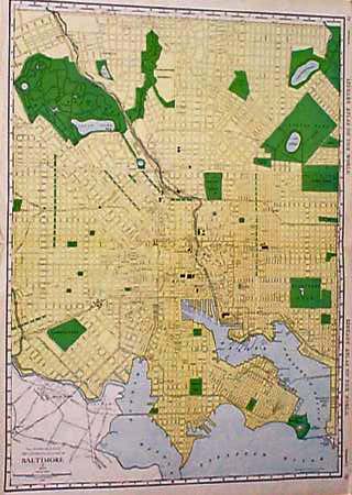 005md: 1912 Large Baltimore Map. Large scale, major buildings shown. Litho color by Rand McNally. 28x20-1/2 in. $60 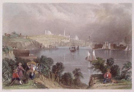 007md: 1838 Bartlett Baltimore view. Hand colored steel engraving. Very attractive. 11x9 in. $60 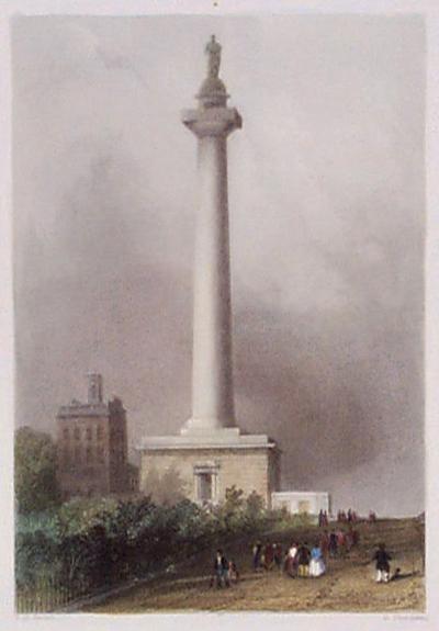 010md: 1838 Washington Monument Baltimore. Bartlett hand colored steel engraving. 6-1/2x10-1/2 in. $60 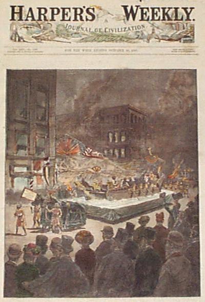 012md: 1881 Baltimore Oriole Celebration. Beautiful night-time parade float view. Hand colored Harper's front page engraving. 11-1/2x16 in. $80 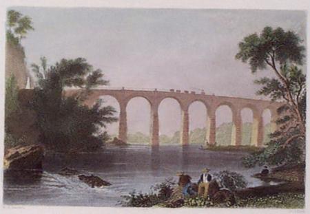 016md: 1838 B&O Railroad Viaduct Baltimore. Bartlett hand colored steel engraving. 11x8-1/2 in. $50 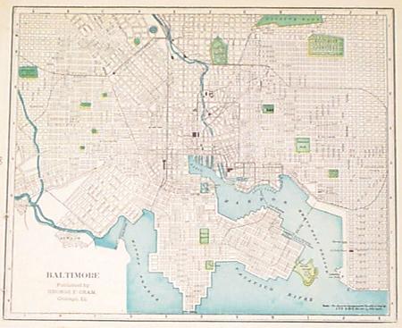 019md: 1900 Baltimore Map. Litho color by Cram. 10-1/2x11 in. $30 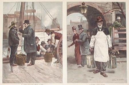 020md: 1889 Maryland Oyster Business. Two nicely hand colored engraved views on one Harper's page. 16x11 in. $60 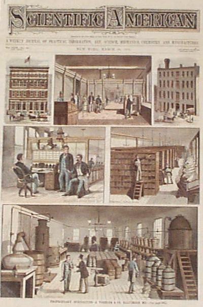 022md: 1881 Baltimore Business views. Proprietary Specialties. Several hand colored scenes. Two pages Scientific American, including front page. 11-1/2x16 in. $60 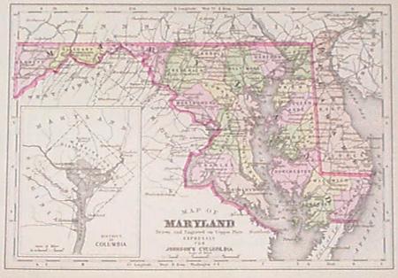 024md: 1896 Johnson's Maryland Map. With inset of Washington DC. Original color, nice looking. 11x8 in. $80 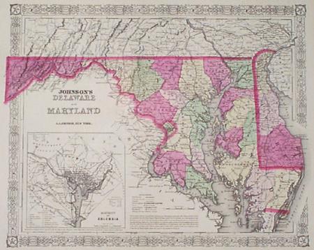 025md: 1867 Johnson Map of Maryland & Delaware. This beautiful map, with original hand coloring, was published in 1867 by A.J. Johnson. The map shows all of Maryland and Delaware, and there is a small inset map of Washington DC in the lower left corner. Cities, towns, geographical features, major roads and railroad lines are all shown in detail. Map size is 14x18 in. $80 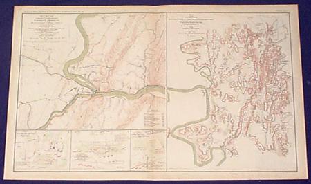 032md: c.1880 Maryland Civil War Map. Map produced c.1880 from 1863 map accompanying report of Major General G.G. Meade on the Battle of Gettysburg. Shows vicinity of Hagerstown, Funkstown, Williamsport and Falling Waters. On same page, composite of 1863 map of Harper's Ferry. Printed in color. 29x18 in. $80 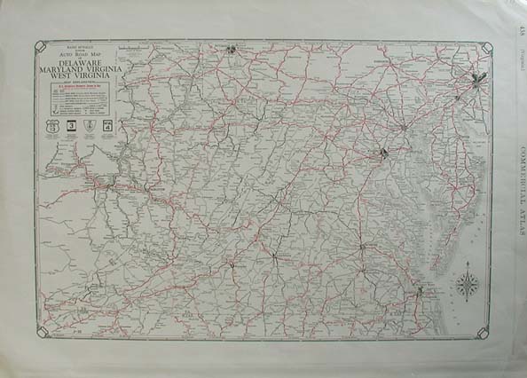 033md: Rand McNally Junior Auto Road Map of Delaware, Maryland, Virginia, and West Virginia. Printed in 1929, this nice map shows Interstate Highways, Paved Roads, Improved Roads, Graded Roads, Dirt Roads and Roads Under Construction. 20.5x14.5 in. $60 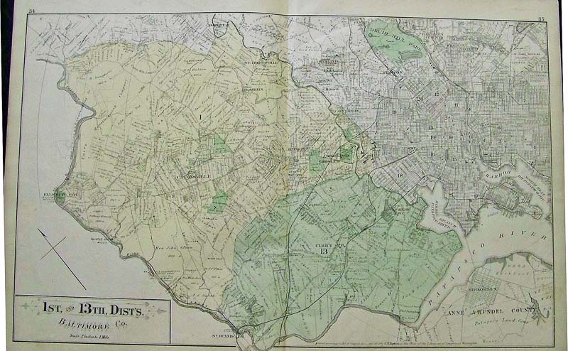 035Maryland: 1878 Hand colored lithographed map showing the 1st. and 13th. Dists., Baltimore Co. Entered according to Act of Congress in the year 1878 by G.M. Hopkins, in the Office of the Librarian of Congress at Washington. 26 x 17-1/2 in. $200 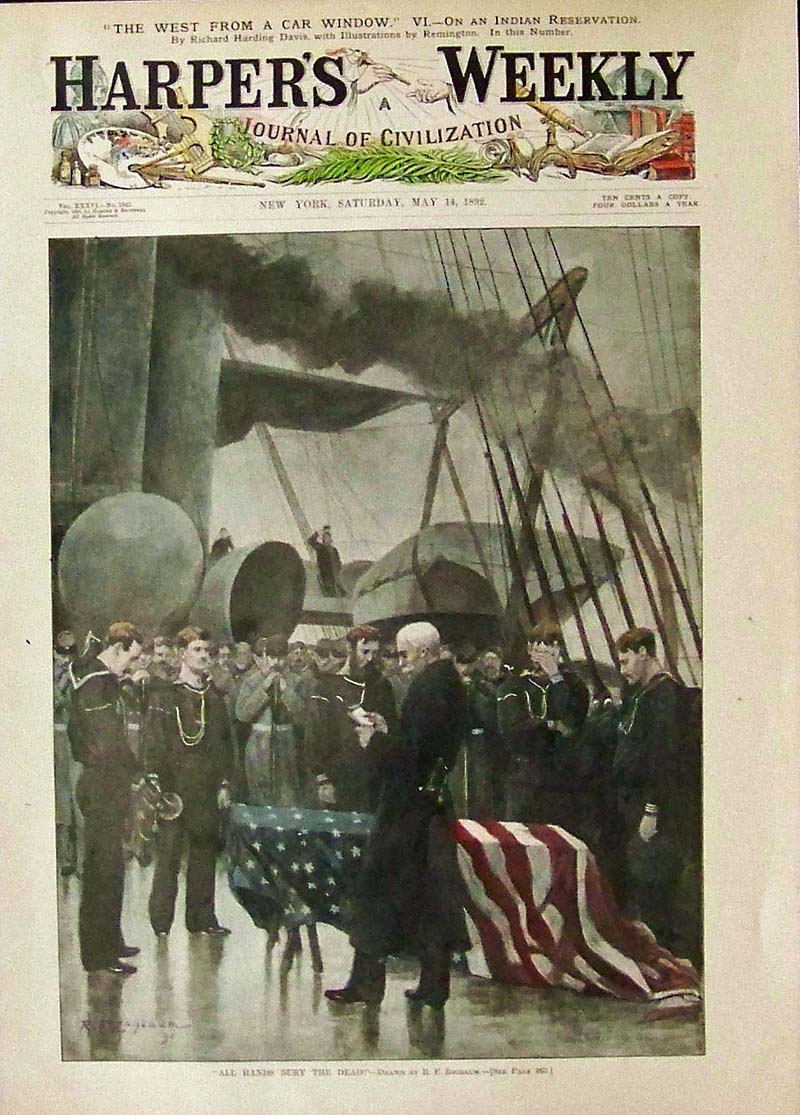
036Maryland: 1892 Hand colored half-tone from Harper's Weekly, A Journal of Civilization titled, "All Hands Bury the Dead!" Drawn by R.F. Zogbaum. 15-1/2 x 11 in. $60 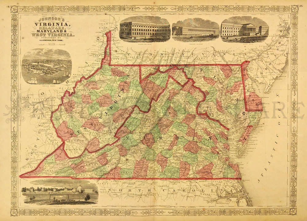 252va: Johnson's 1866 Virginia, Delaware, Maryland and West Virgina Map. Shows various cities, towns, rivers and assortment of additional topographical details. 5 Vignettes showing Fortress Monore, University of Virgina, General Post Office, Treasury Buildings and a Patent Office. 16 x 26 1/2 in. $100 |
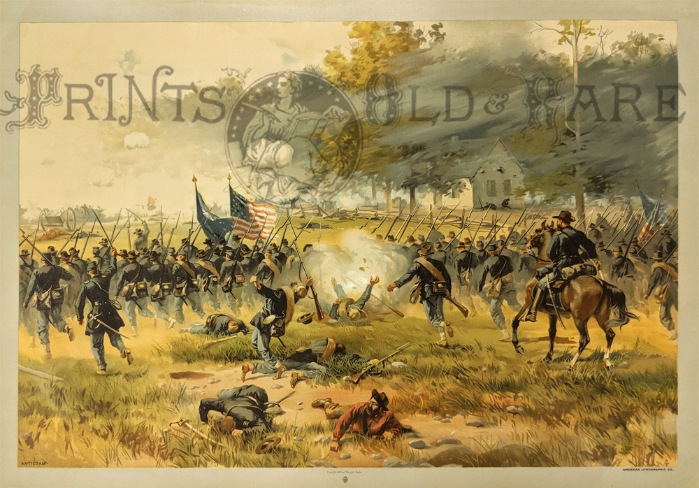
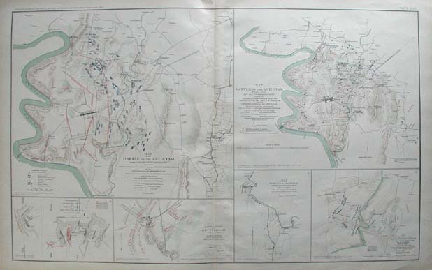
058Maryland: Civil War: The Battle of Antietam, September 18th 1862. American Lithographic Co. 17 x 24 in. $400 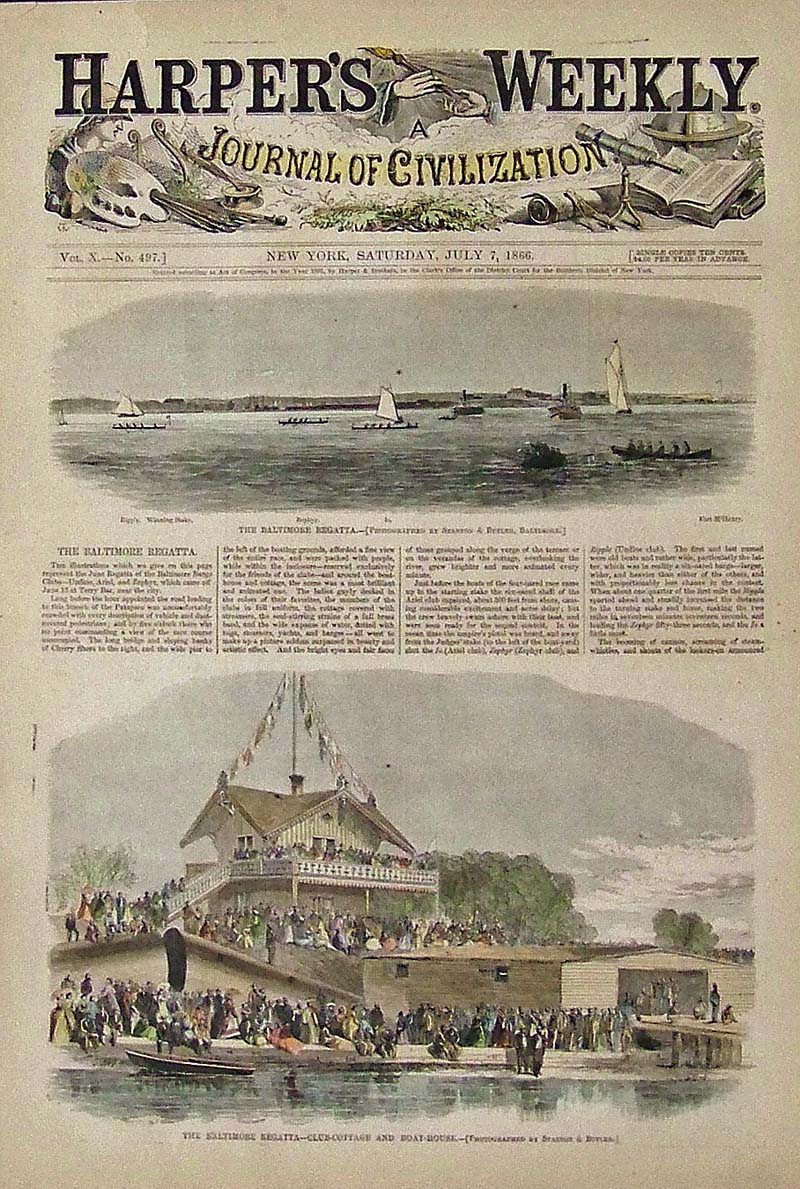 037Maryland: 1866 Hand colored wood engraving featured in Harper's Weekly, A Journal of Civilization titled, "The Baltimore Regatta -- Club-Cottage and Boat-House."Upper image shows a view of the Baltimore Regatta. 15-1/2 x 11 in. $50 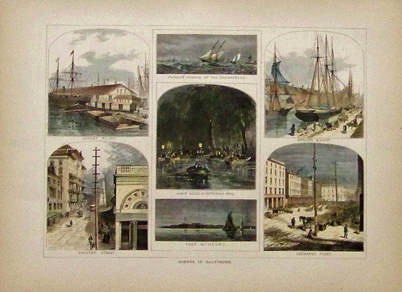
038Maryland: From Picturesque America, these are hand colored wood engraved, "Scenes in Baltimore." Among the scenes shown are Calvert Street, Pungies Coming Up the Chesapeake, Spear's Wharf and Fort McHenry. 12-1/2 x 9-1/2 in. $50 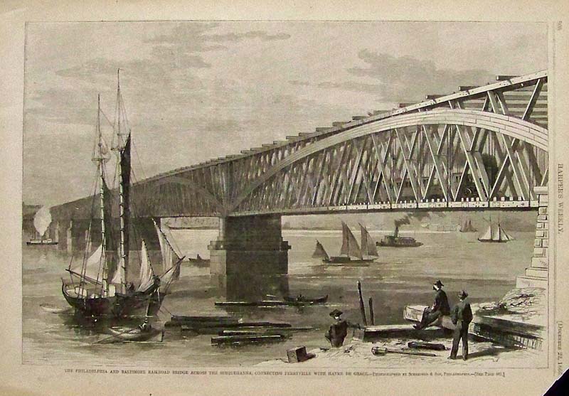
039Maryland: 1866 Wood engraving featured in Harper's Weekly titled, "The Philadelphia and Baltimore Railroad Bridge Across the Susquehanna, Connecting Perryville with Havre de Grace." Top of right corner margin missing but doesn't affect engraving. 15-1/2 x 11 in. $40 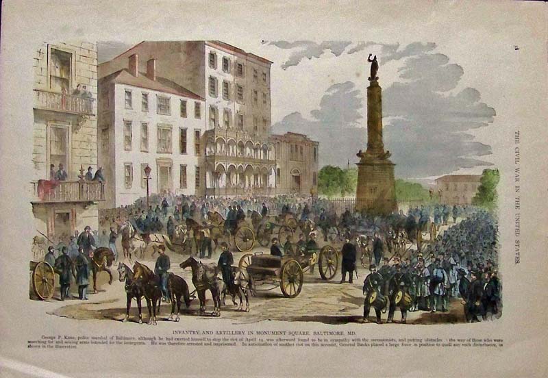
040Maryland: Hand colored wood engraving titled, "Infantry and Artillery in Monument Square, Baltimore, MD." Featured in The Civil War in the United States. 16-1/2 x 11-1/2 in. $40 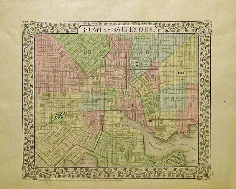
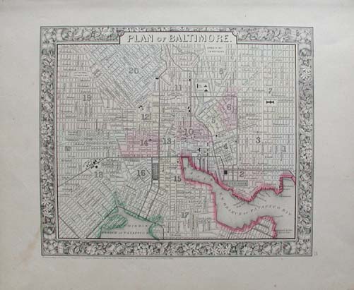
041Maryland: 1882 Hand colored Mitchell map showing the Plan of Baltimore in an ornate ivy border. 15 x 12 in. $120 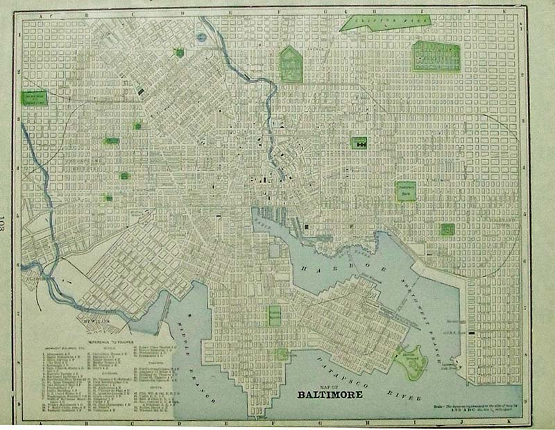
042Maryland: 1898 Color Map of Baltimore with a Reference to Figures key on bottom left. 14-1/2 x 11 in. $60 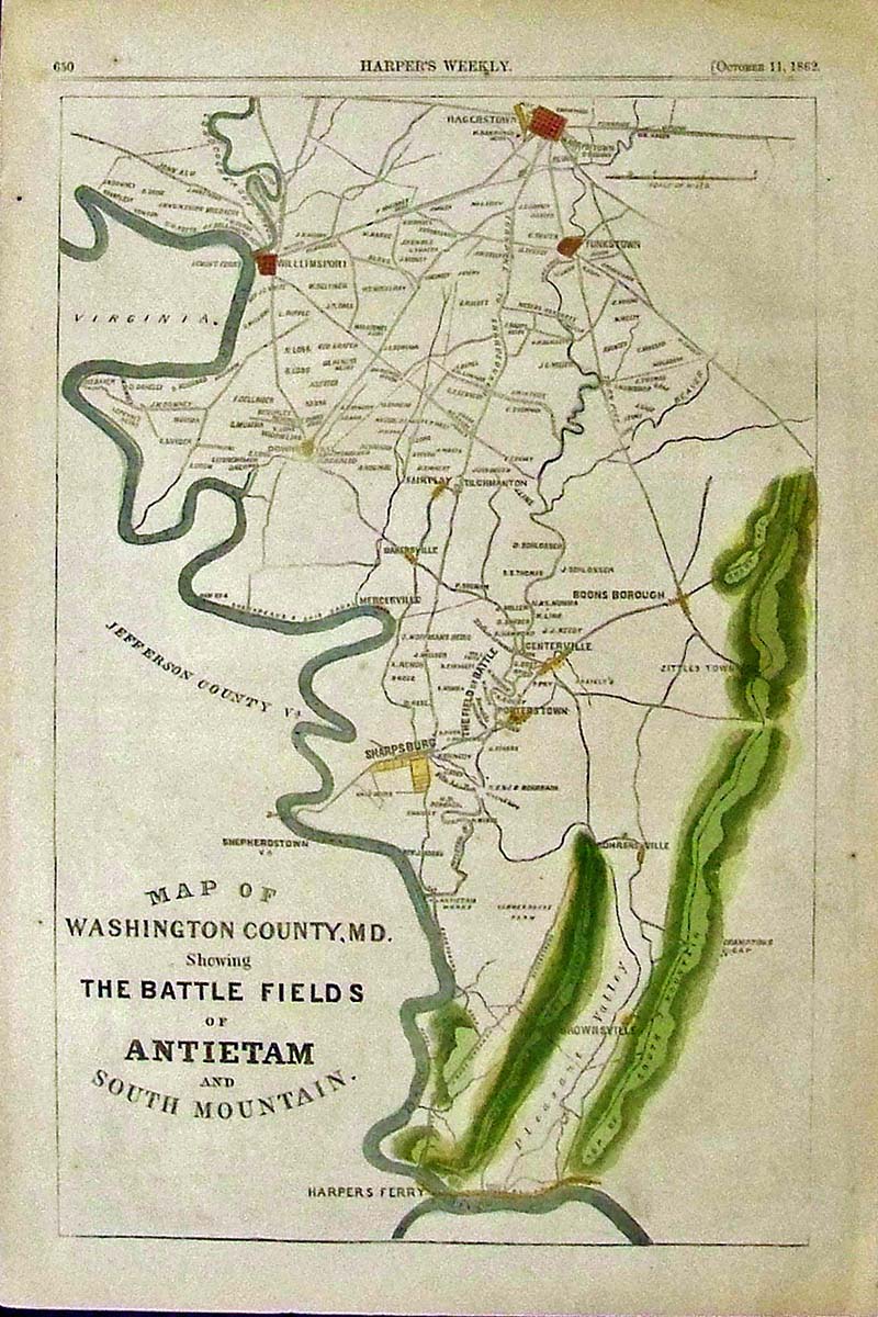
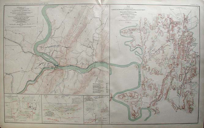
043Maryland: 1862 Harper's Weekly hand colored wood engraved Map of Washington County, MD. Showing The Battle Fields of Antietam and South Mountain.Harpers Ferry is shown on bottom section of map. 16 x 11 in. $50 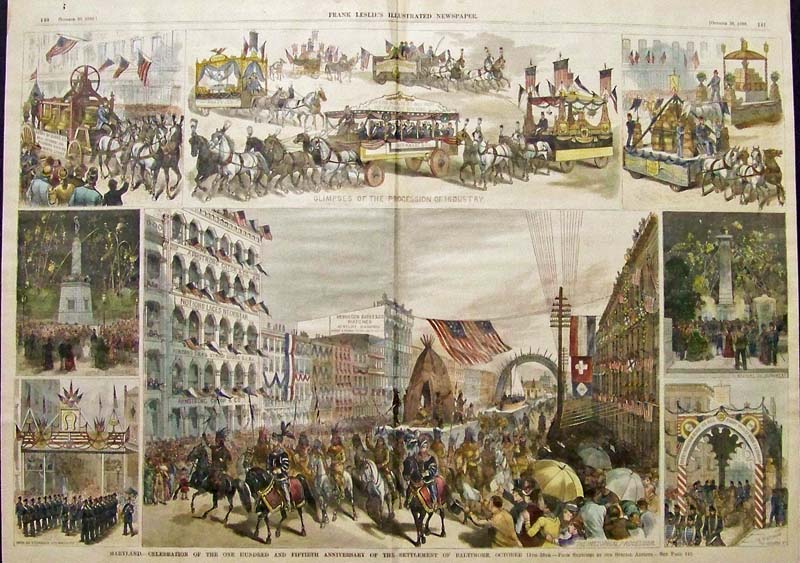
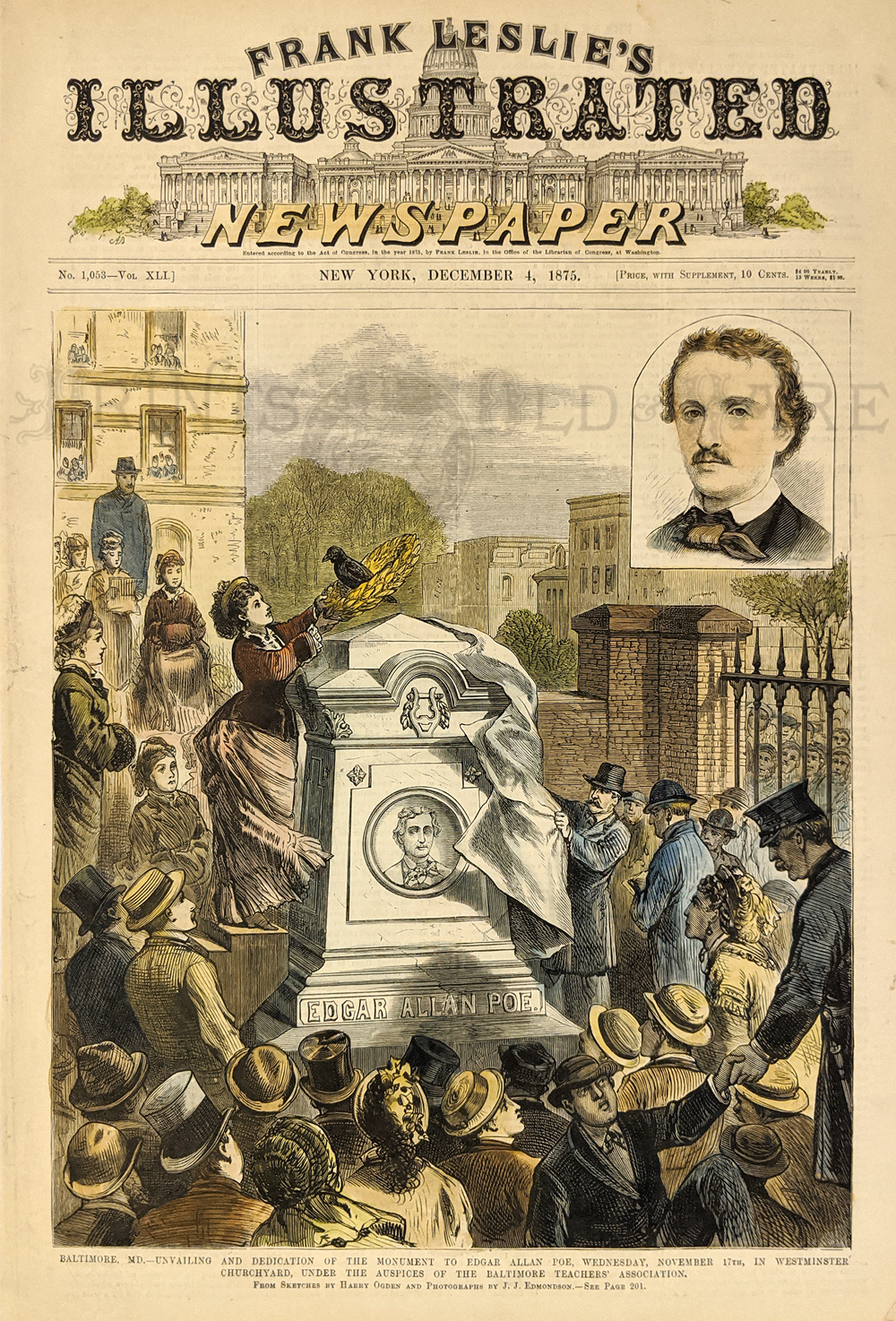
044Maryland: 1880 Hand colored wood engraving titled, "Maryland, -- Celebration of the One Hundred and Fiftieth Anniversary of the Settlement of Baltimore, October 11th - 16th." Featured in Frank Leslie's Illustrated Newspaper. 22 x 16 in. $150 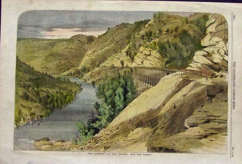
045Maryland: 1861 Hand colored wood engraving titled, "The Baltimore and Ohio Railway: Tray Run Viaduct." Featured in The Illustrated London News. 16 x 11 in. $60 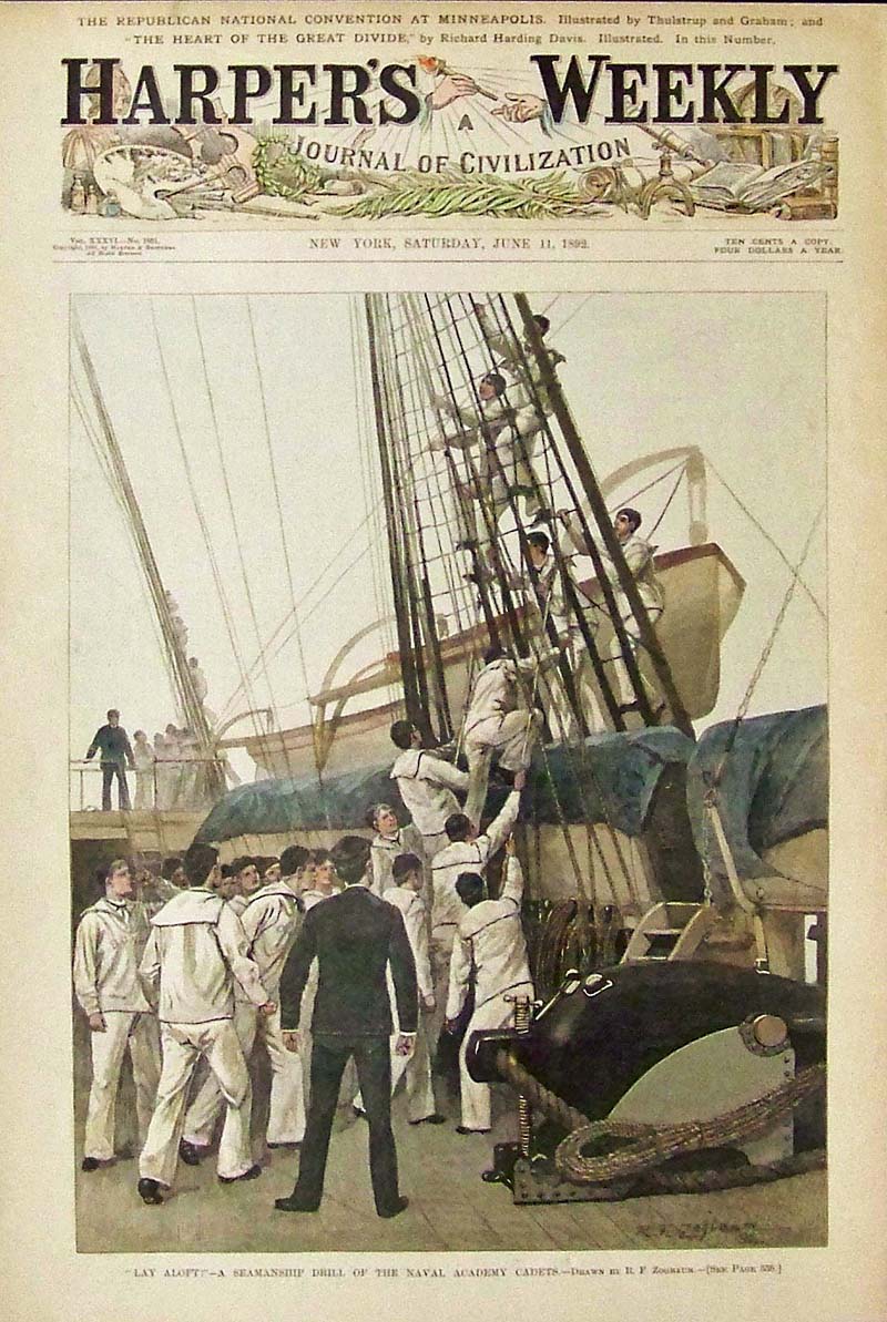
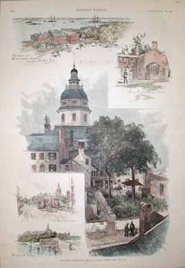
046Maryland: 1892 Hand colored wood engraving titled, "Lay Aloft! -- A Seamanship Drill of the Naval Academy Cadets." Drawn by R.F. Zogbaum. featured in Harper's Weekly, A Journal of Civilization. 15-1/2 x 10-1/2 in. $60 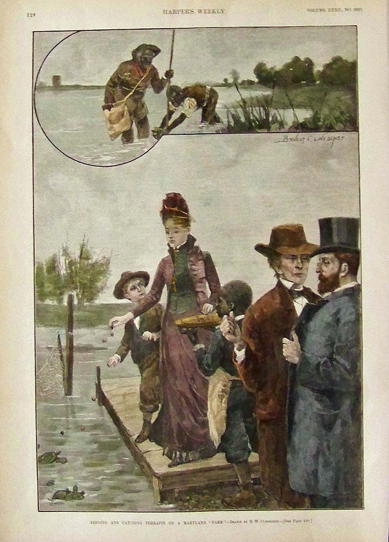
047Maryland: 1888 Hand colored wood engraving from Harper's Weekly titled, "Feeding and Catching Terrapin On A Maryland 'Farm.'" Drawn by B.W. Clinedinst. (Those poor turtles didn't know what was coming to them!) 15-1/2 x 11 in. $60 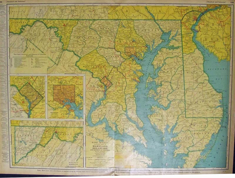
049Maryland: 1950 Color Rand McNally Standard Map of Maryland, Delaware, and District of Columbia. Bottom left has insets of the Western Part of Maryland, Baltimore and Vicinity, and Washington and Vicinity. 27-1/2 x 20-1/2 in. $150 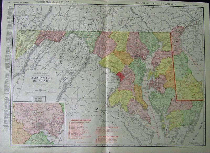
050Maryland: 1913 Color Rand McNally New Commercial Atlas Map of Maryland and Delaware, with inset of Baltimore and Environs on bottom left corner. Map shows the Maryland Railroads, as well as the Delaware Railroads and Dist. of Columbia Railroads, along with the Steamship Lines. A Key to the Principal Cities is outside left border. 28 x 20-1/2 in. $150 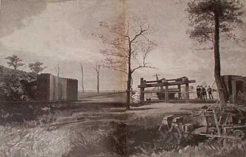 102md: 1890 United States Proving Grounds, Annapolis. This wood-engraved print is from an 1890 issue of Once A Week. It shows Admiral Kimberly and experts testing their firepower on armor plates. 16x22 in. $60 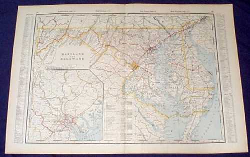
105md: 1901 Map of Maryland and Delaware. Beautiful map from the 1901 first edition of George Cram's folio-size world atlas. Color coded lines on the map show the names and locations of railroads throughout both states. State and county borders are outlined in yellow. Cities, towns and geographical features are all shown. Included is an inset map of Baltimore County, MD. This map would look great in a frame! 18x27 in. $100 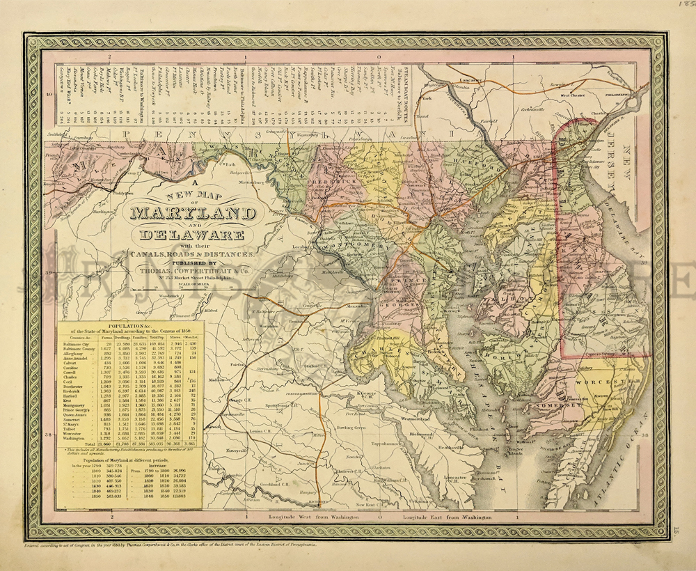 054Delaware: 1850 A New Map of Maryland and Delaware, Cowperthwait - An attractive map original hand colored and excellent example of S. A. Mitchell's 1850 map of Maryland and Delaware full of details of the times. Centered on Washington D.C., this map extends eastward from Maryland to New Jersey and the Delaware Bay. The Chesapeake Bay is rendered in full. In the upper left quadrant of the map, a table details various lists of steamboat routes. In the lower left quadrant data from the census of 1850 is presented in tabular form. The whole is engraved and colored in Mitchell's distinctive style with green border work and vivid pastels. Political and topographical features are noted and color coded with elevation rendered by hachure and main railway routes highlighted in orange. This map was prepared by S. A. Mitchell for publication by the Philadelphia firm of Thomas Cowperthwait & Co. as plate no. 15 in the 1854 edition of Mitchell's New General Atlas. Condition: Very Good, some yellowing on outside margins with minimal mottling. size 14.5 x 11.5 image. $150 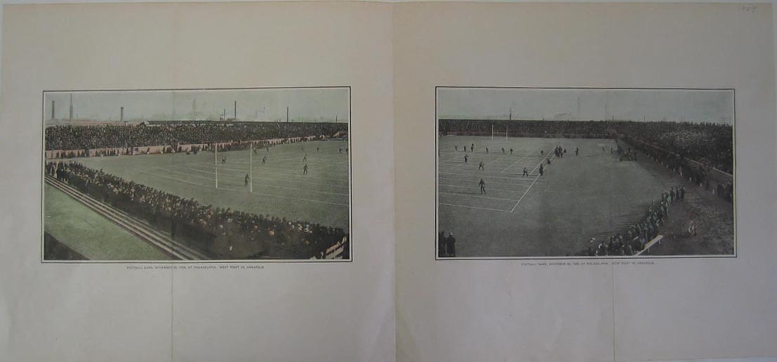 1119md: 1904 (Two different pictures of): Football game, November 28, 1903 at Philadelphia. West Point Vs. Annapolis. Hand-colored half-tone photographs. 23.5x11in. $40 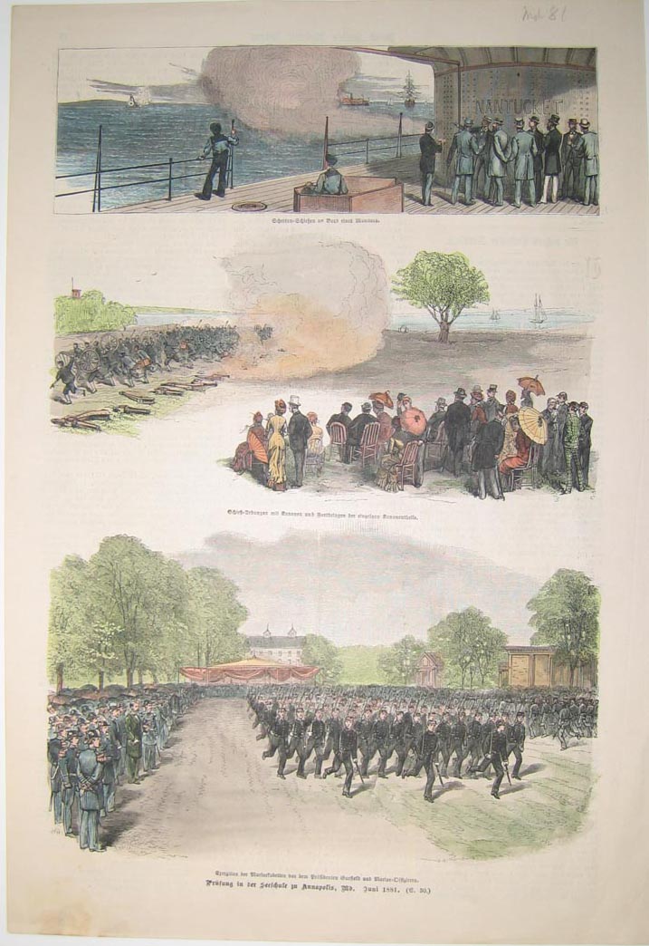
1120md: 1881 Hand-colored half-tone of three German scenes depicting soldiers on display. Printed in June, 1881. 11x16in. $60 |
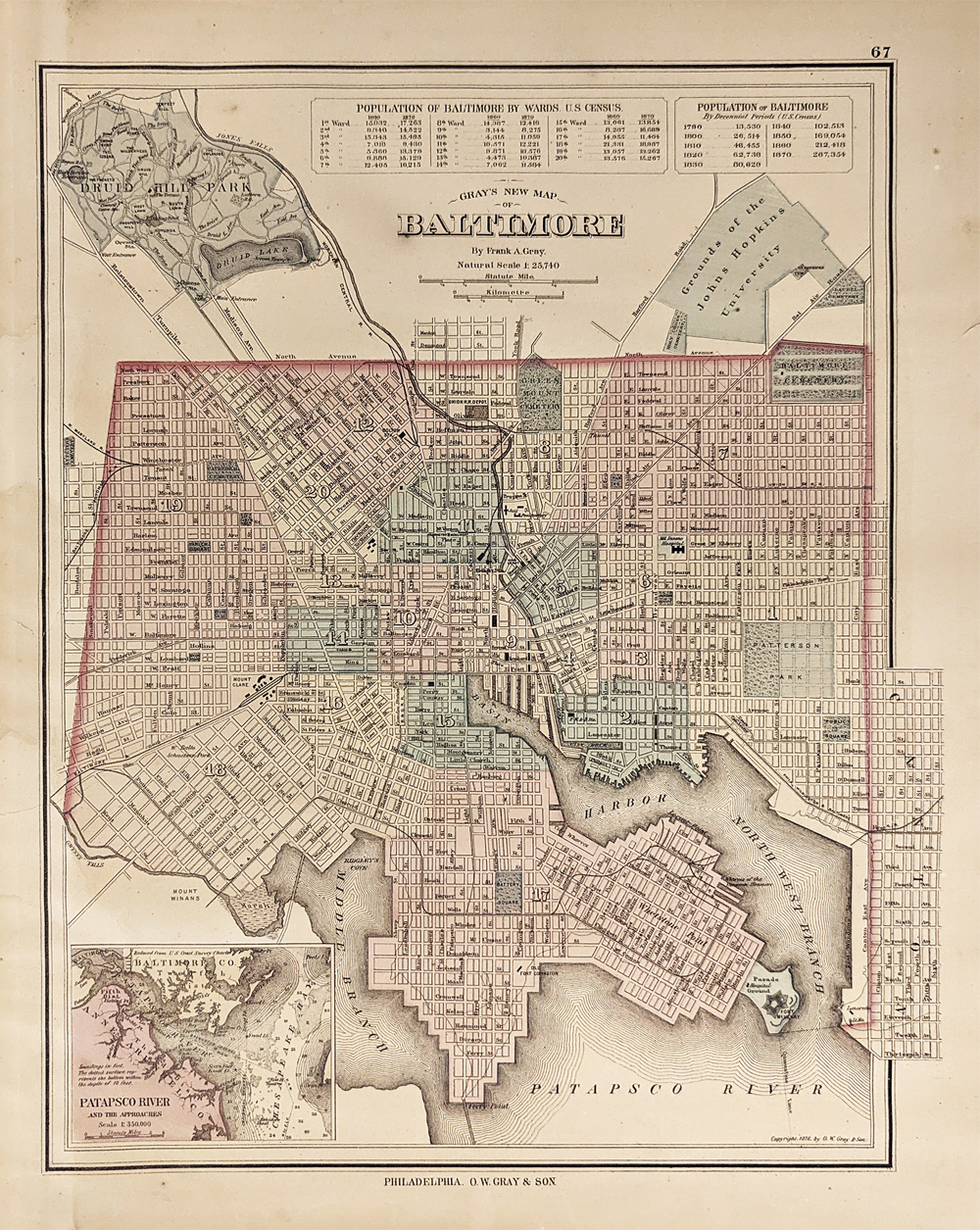
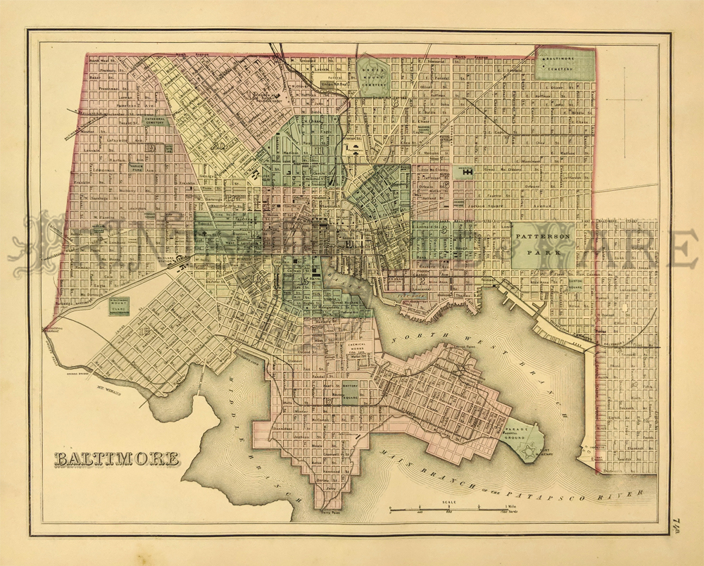 215md: Plan of the City of Baltimore, MD by Gray. Shows Railroad Lines, Streets, Town Squares, Cemeteries, and Important Buildings. 1875. Hand colored, Lithograph. 13 x 15 in. $150 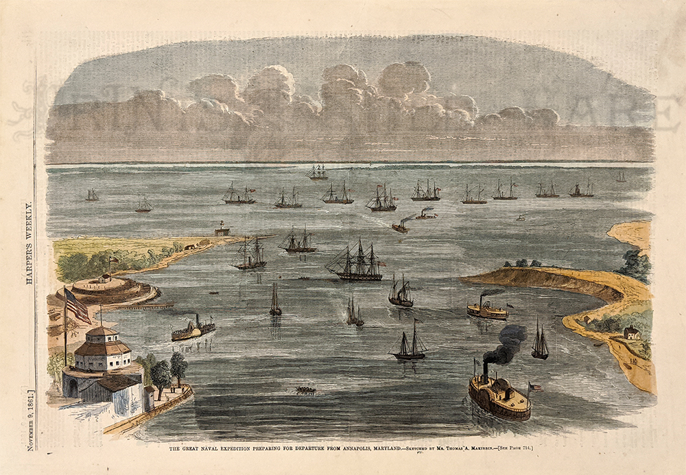 218md: Annapolis Harbor 1861. Great Naval Expedition of Civil War. Hand colored, wood engraving. 11x 15 7/8 in. $50
|
|||||||||
| Order Form | |||||||||||
| Back to Homepage | |||||||||||