 
|
|||||||||||
This is a small selection of our inventory of antique Missouri maps and prints. Additional inventory is available. Contact us with your request. 1-800-879-6277
|
|||||||||||
|---|---|---|---|---|---|---|---|---|---|---|---|
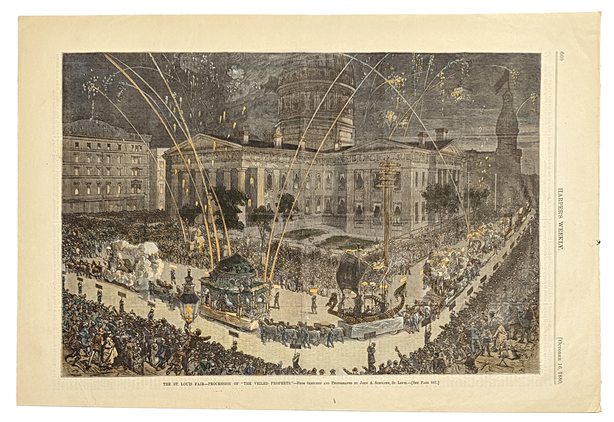 001mo: 1880 St. Louis Fair - Veiled Prophets. Hand colored antique engraving of parade passing the City Hall. Harper's. 11x16 in. $60 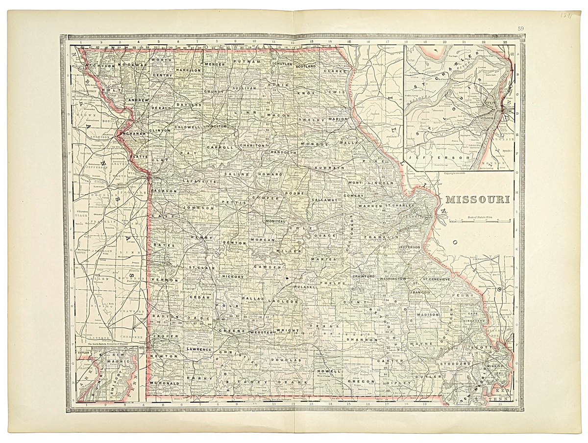 002Missouri: 1891 Bradley color lithographed map of Missouri, with insets of New Madrid on bottom left and St. Louis on top right. All the counties are shown. 26 x 19 in. $60 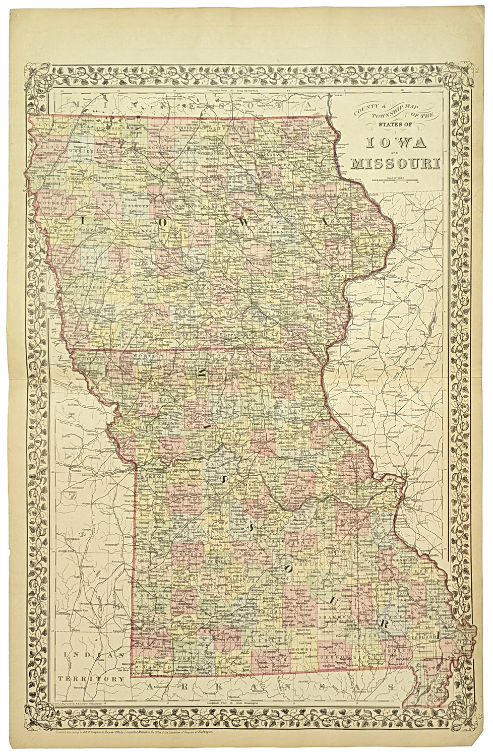 008mo: 1881 Large Mitchell Map of lowa and Missouri. Shows county, townships, railroads, etc. Hand colored, lithograph. 15 x 23 1/2 in. $120 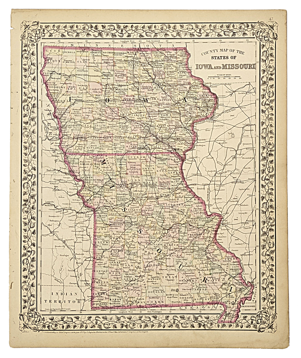
010mo: 1871 Missouri and Iowa Map. Original color by Mitchell. Attractive border, nice looking old map. 12-1/2x15-1/2 in. $80 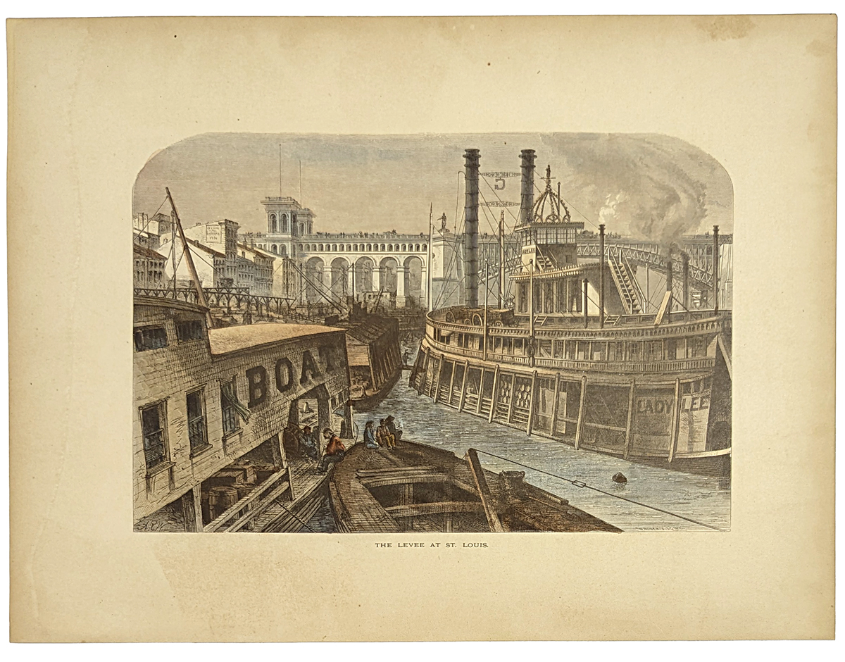 011mo: 1873 St. Louis Levee. Hand colored engraving shows River Boats. 9-1/2x12-1/2 in. $40  014mo: This large print is from the September 15, 1888 issue of Harper's Weekly. It contains ten small views of buildings and important locations in Kansas City, as well as a larger bird's eye view of the city. 16x22 in. $100 Check for availability 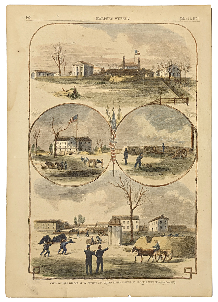 015mo: 1861 St. Louis Civil War views. Four hand colored engravings of Fortifications Protecting the US Arsenal. Harper's. 11x16 in. $60 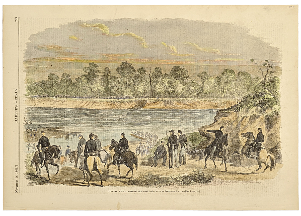 016mo: 1861 Osage River Civil War. Union troops crossing the River. Hand colored engraving. 11x15-1/2 in. $50 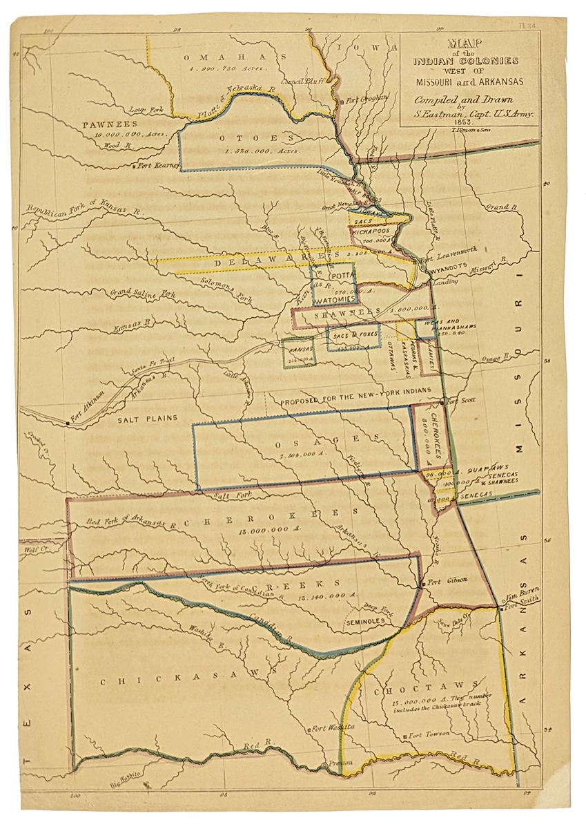 017mo: 1853 Eastman color Map of the Indian Colonies West of Missouri and Arkansas. 11 1/2 x 8 in. $250 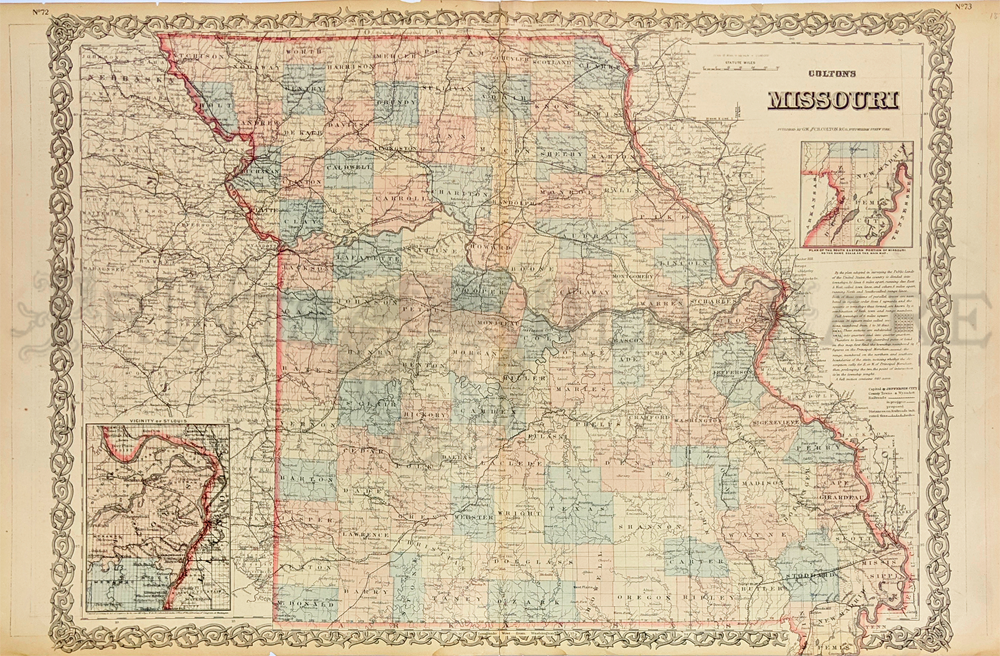
018mo: Colton's hand colored engraved map of Missouri which has the Vicinity of St. Louis inset bottom left and top right, a smaller inset of the Plan of the South Eastern Portion of Missouri. 28 x 17-1/2 in. $150 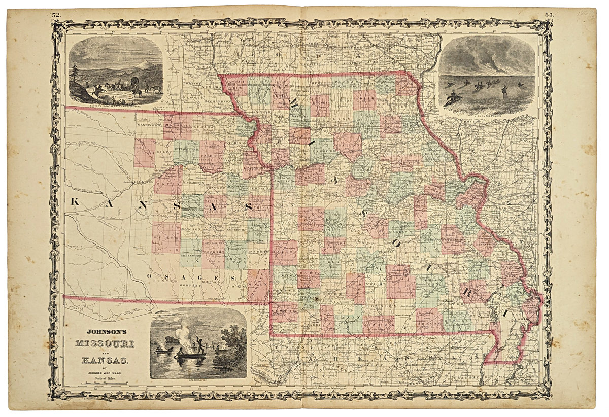 019mo: 1862 Johnson's Map of Missouri and Kansas. Original hand coloring. Three inset views of early history. 27x18 in. $60 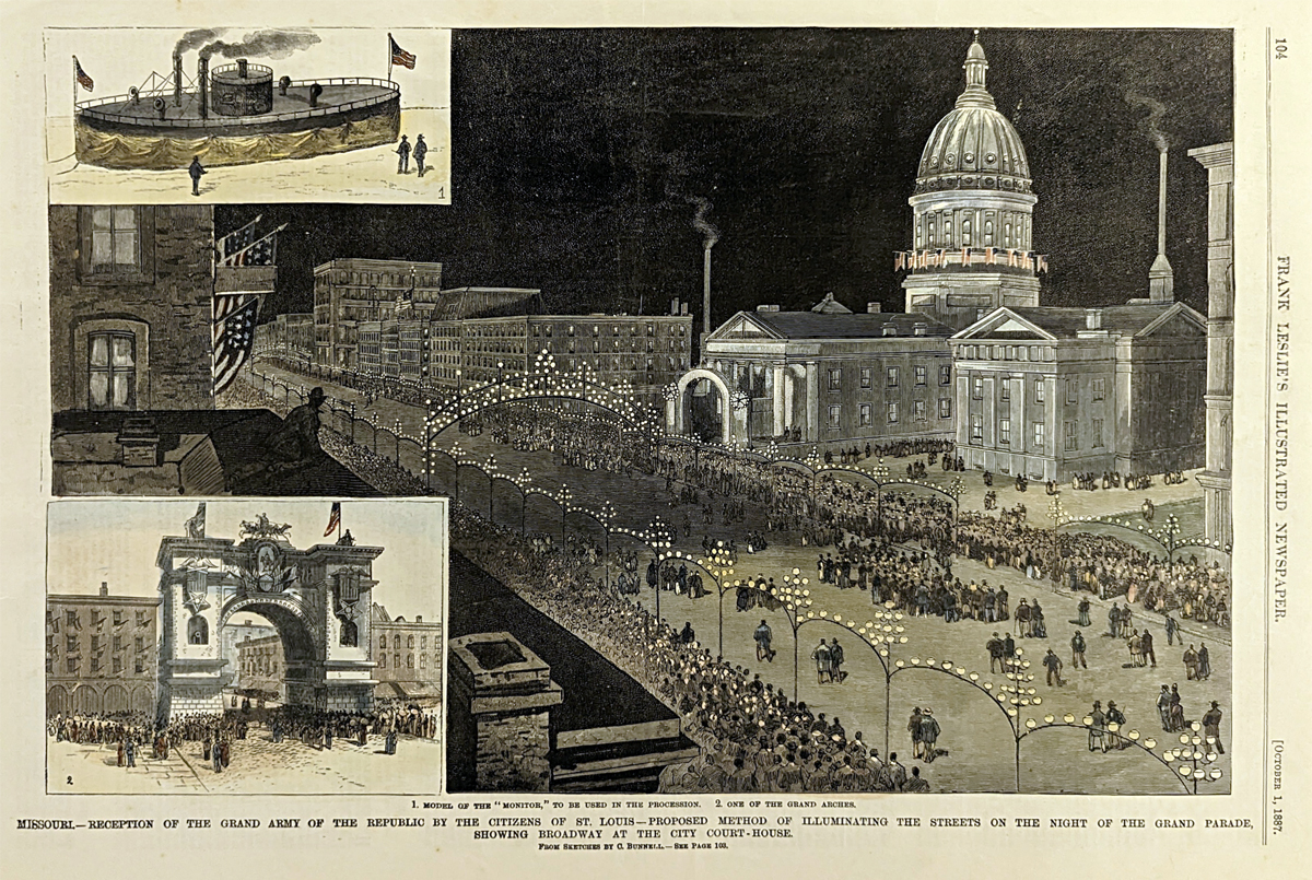 020mo: 1887 Missouri- Reception of the Grand Army of the Republic by the Citizens of St. Louis. Proposed Method of Illuminating the Streets on the Night of the Grand Parade, Showing Broadway at the City Court House. Two hand colored engraved insets at left show: model of the "Monitor," to be used in the procession, one of the grand arches. This genuine antique print is from the October, 1887 edition of Frank Leslie's Illustrated Newspaper. size: 11x16 in. $60 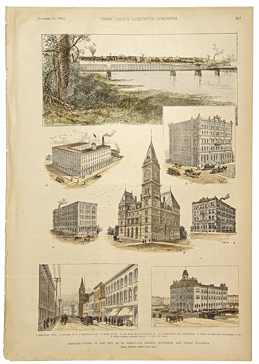 021mo: 1889 Missouri- Views in the City of St. Joseph- It's Streets, Industries, and Public Buildings. Eight hand colored engraved views showing: brid's eye view, factory of R.L. M'Donald & Co., Store of Do, the Wood Manufacturing Co., Custom-House and Post Office, stroe of Brittain, Richardson & Co., Third Street ( looking south)and the City Hall. This genuine antique print is from the November, 1889 edition of Frank Leslie's Illustrated. size: 11x16 in. $80  022Missouri: 1898 Color Missouri Railroads Map, published by Rand, McNally & Company. Inset of South-East Corner Extension and large red Railroads Key top right of map. 27-1/2 x 20-1/2 in. $160 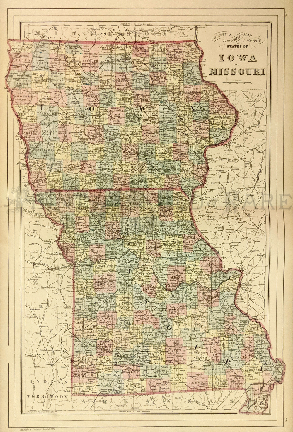 010ia: 1884 Hand colored Bradley Map of Iowa and Missouri. Shows counties and townships. 15x23 in. $60 |
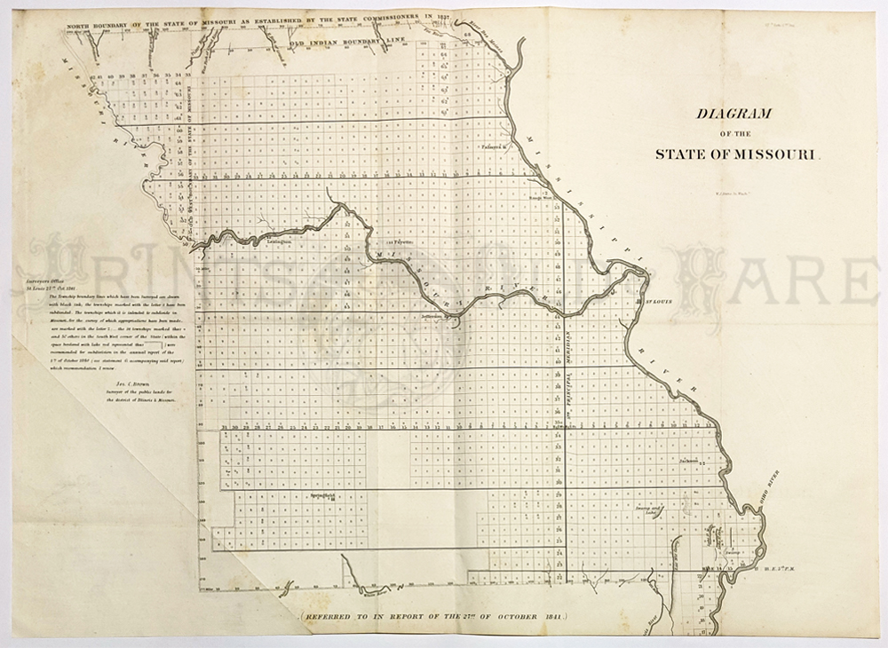 101mo: 1841 Survey Map of Missouri. Interesting map of Missouri, published by the US Surveyor General's office. The entire state is overlaid with a grid pattern. Letters in each square of the grid indicate the progress that had been made in surveying that area. Cities, towns and geographical features are all shown. Indian boundary lines are shown as well. Locations of coal and lead mines are marked throughout the state. This map is in very good condition, with no tears or stains. 18 x 24 in. $150  103mo: 1881 History of Jackson County, Missouri. History of the County, its cities & towns. Union Historical Co., Kansas City, MO. 1006 pages. This is the original edition - rebound, map incomplete, otherwise good condition. With all lithographic portraits and the litho frontispiece of the Custom House in Kansas City and the Court House in Independence. $300 Check for availability 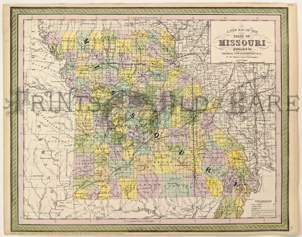 104Missouri: A New Map of the State of Missouri, Cowperthwait 1850 A handsome engraved map of Missouri, hand (pastel) colored by counties and showing towns, roads, railroads, proposed rail lines, rail lines under construction, canals, steamship lines, etc. Includes township surveys and a host of other interesting details. Just west of Missouri is Indian Territory, including over a dozen early Indian Reservations. Published by Thomas Cowperthwait, 253 Market Street Philadelphia, 1853. Condition: Good small bottom margin, light aging tones on margin edges. size 17 x 14 image. $200 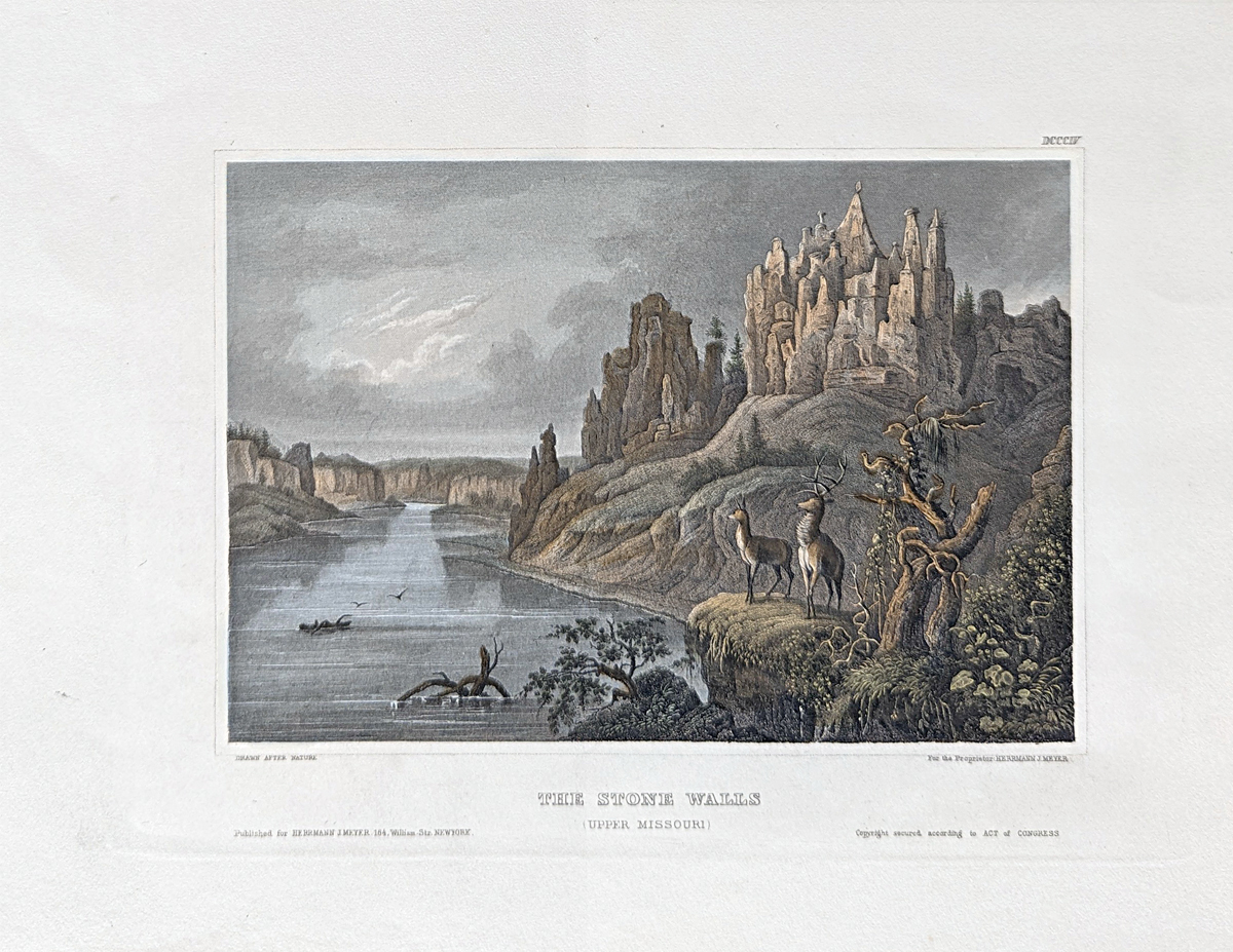 105mo: Hand colored steel engraving. Published by Herrmann J Meyer in Meyer's Universum c 1850. Picture titled, The Stone Walls (Upper Missouri). 7.5x10 in. $60 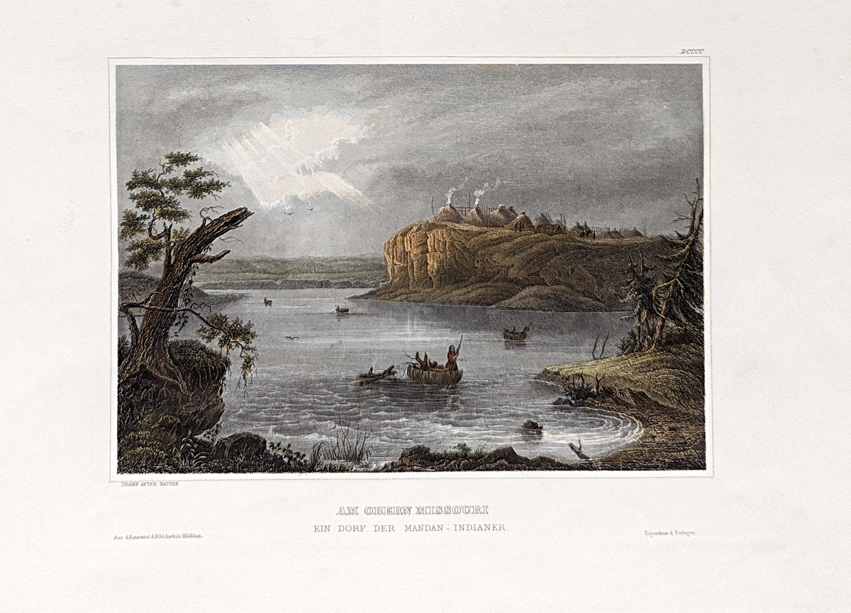 106mo: Hand colored steel engraving. Published by Herrmann J Meyer in Meyer's Universum c 1850. Picture titled, Am Obern Missouri Ein Dorf Der Mandan - Indianer. 7.5x10 in. $60 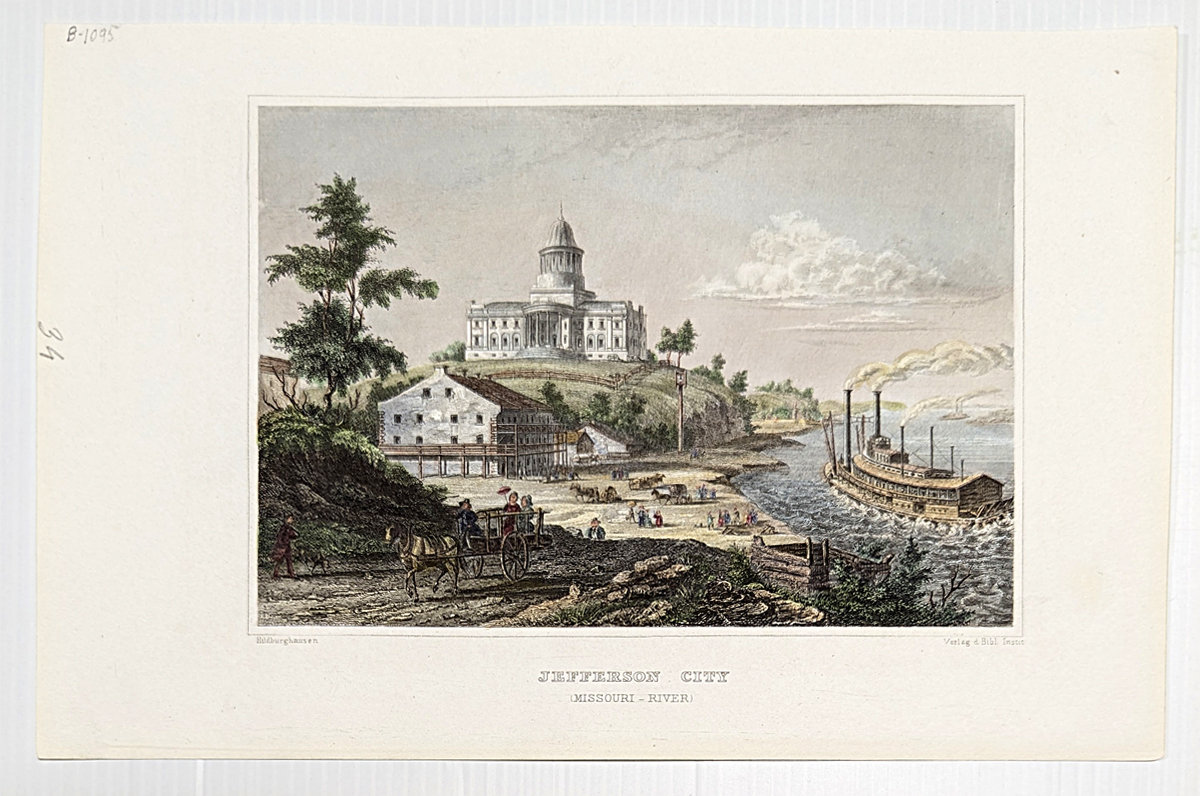 107mo: Hand colored steel engraving. Published by Herrmann J Meyer in Meyer's Universum c 1850. Picture titled, Jefferson City (Missouri - River). 7.5x10 in. $60 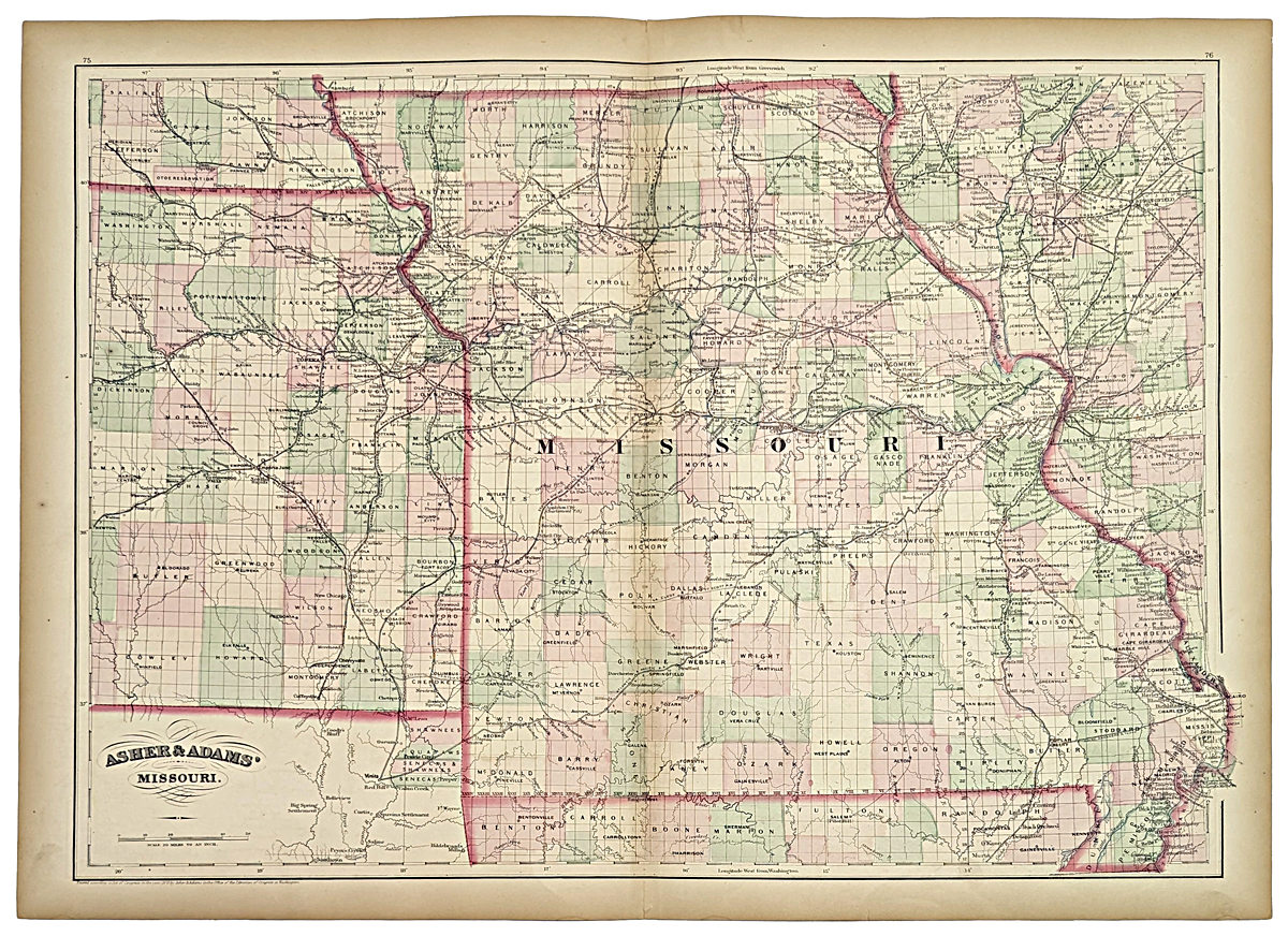 108mo: 1872 map of Missouri. Published by Asher & Adams in the New Statistical and Topographical Atlas of the United States. Original hand coloring. 17.5x24.5 in. $100 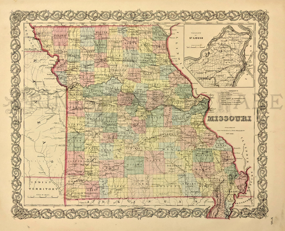 109mo: Hand colored map of Missouri. Map published by J.H. Colton & Co. in 1855. Inset in upper right corner of the City of St. Louis. Decorative border surrounds the map. 17-1/2 x 14-1/2 in. $150 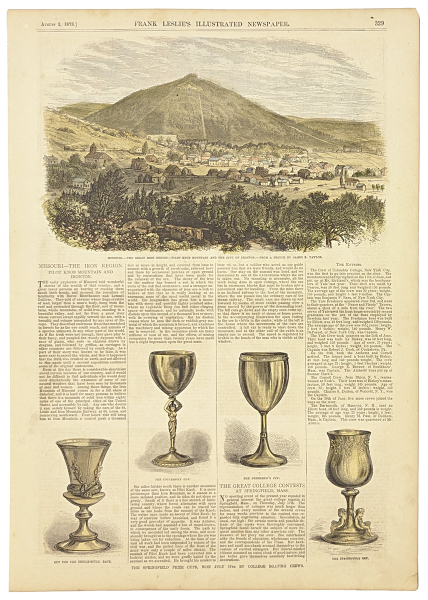 110mo: 1878 Picture of The Great Iron Region. Beautifully hand colored engraved image titled, "Missouri-The Great Iron Region-Pilot Knob Mountain and the City of Ironton," drawn by James Taylor from Frank Leslie's Illustrated Newspaper. Shows scenic view of the Great Iron Region. 11 x 16in. $40 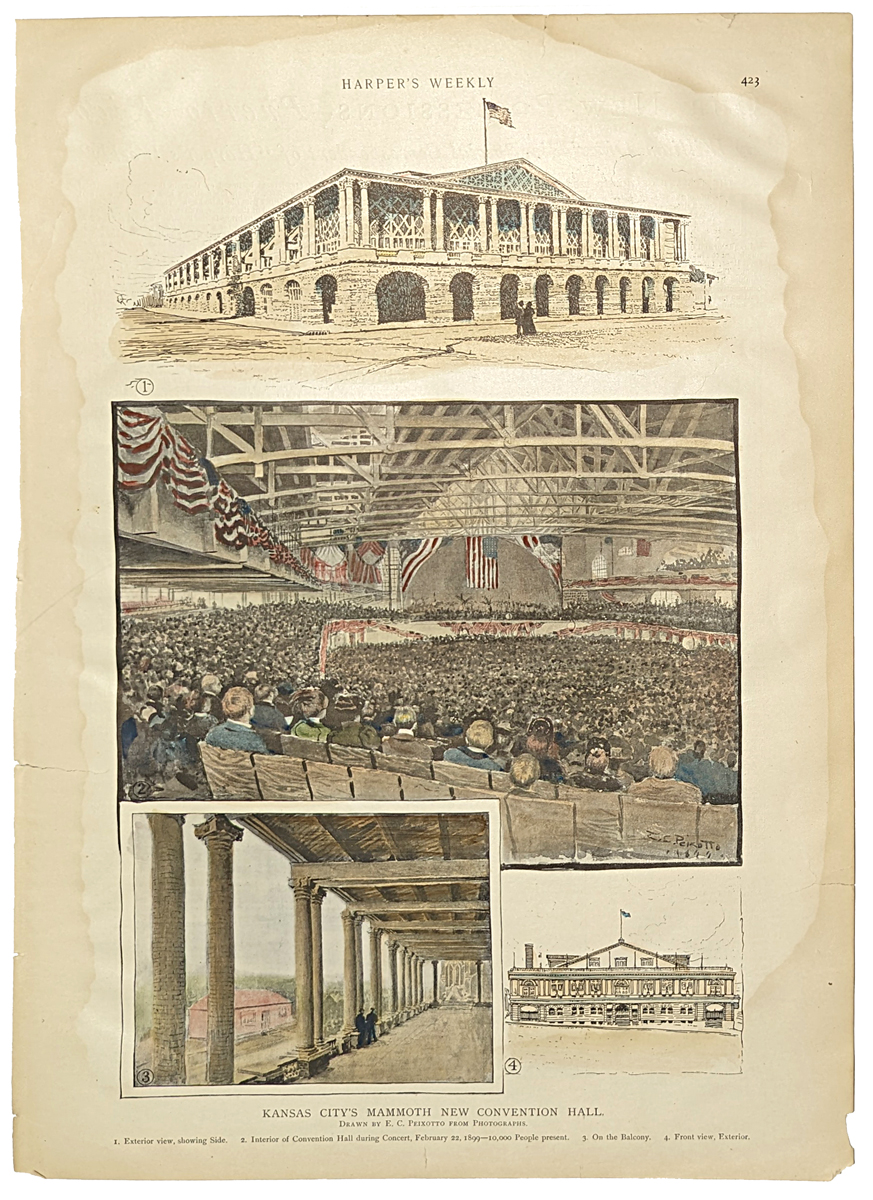 111mo: 1890 Hand colored half-tone titled, "Kansas City's Mammoth New Convention Hall." Slight water damage on border not affecting images. Featured in Harper's Weekly. 16 x 11 in. $50 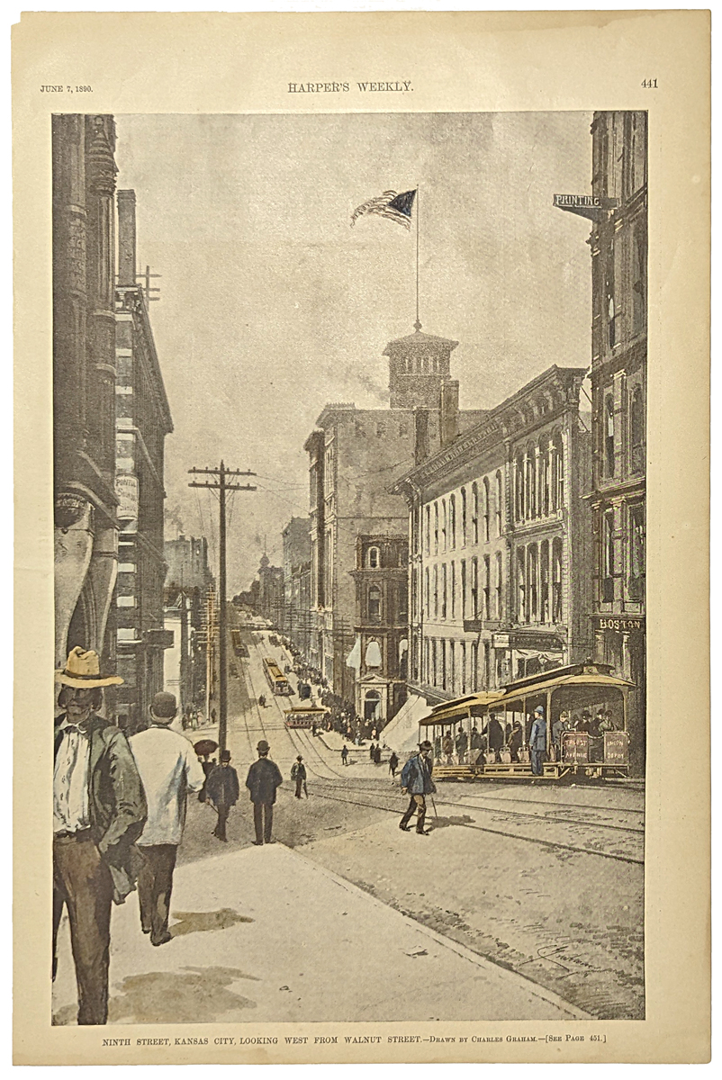 112mo: 1889 Hand colored half-tone titled, "Ninth Street, Kansas City. Looking West from Walnut Street." Drawn by Charles Graham. 16 x 11 in. $50 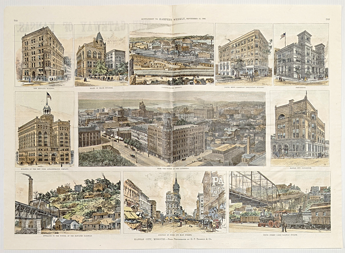 113mo: 1888 Hand color double-page wood engraving titled, "Kansas City, Missouri," from photographs by D.P. Thomson & Co. Ten views surrounding a larger view of places inside the city. From Harper's Weekly. 22 x 16 in. $150 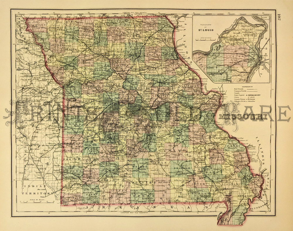 115mo: Missouri Map published by Gray’s Atlas of the United States. Detailed map showing color coded Counties, Towns, Roads, Railroads, and Post Offices. Inset depicts the Plan of Vicinity of St. Louis. 1875. Hand colored, Lithograph. 13 x 15 in. $90 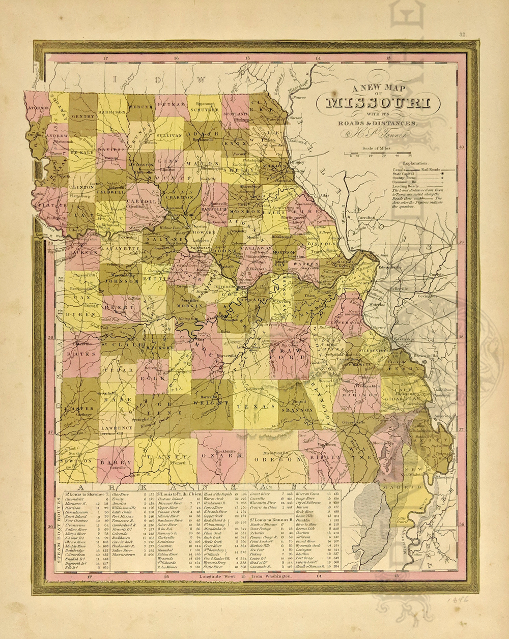 117mo: 1846 A New Map of Missouri with its Roads and Distances published by Henry S. Tanner. Detailed map showing the towns, mountains, rivers, roads, canals and political boundaries. Bottom table shows the distances by Steam boat from St. Louis and other cities. *These Tanner Atlas' were purchased by Mitchell then to Cowperthwait, making the map rare and most important. Hand colored, lithograph. 13 7/8 x 17 1/4 in. $160 |
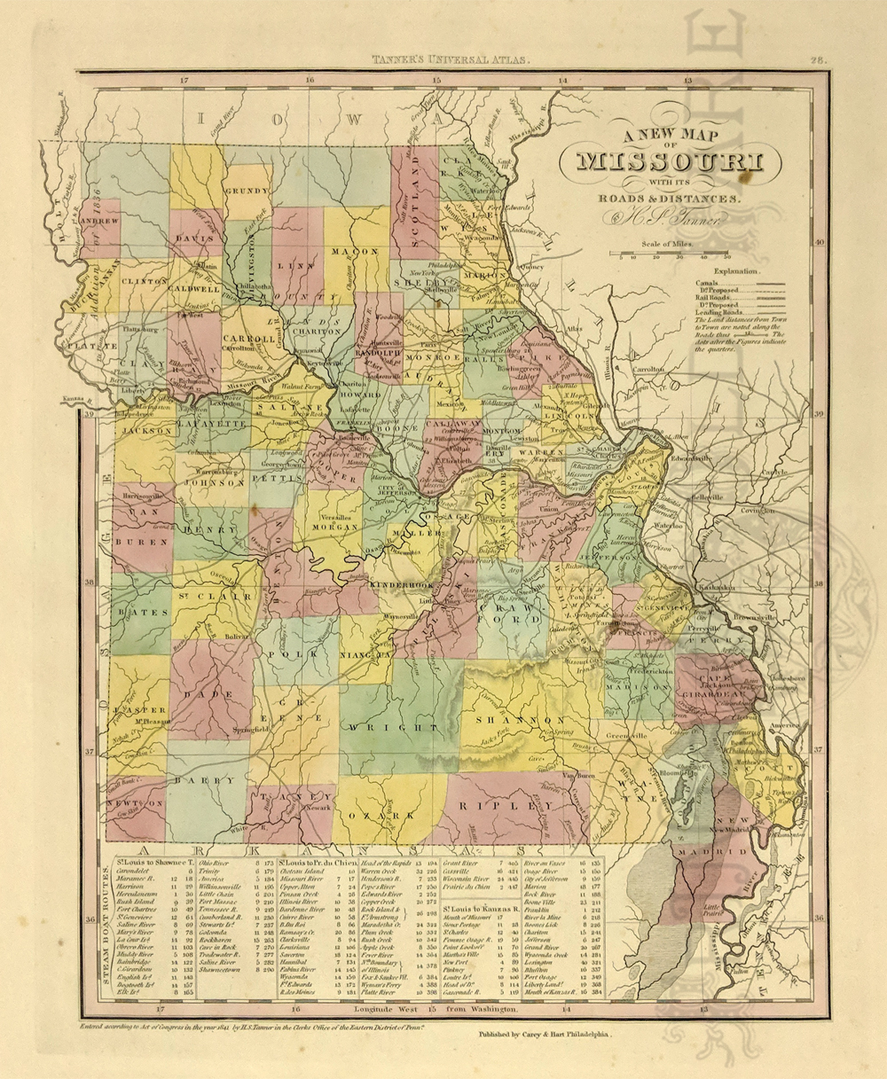 118mo: 1841 A New Map of Missouri with its Roads and Distances published by Henry S. Tanner. Detailed map showing the towns, mountains, rivers, roads, canals and political borders. Bottom table shows the distances by Steam boat from St. Louis to Shawnetown, Prairie du Chien and Mouth of the Kanzas River. Hand colored, lithograph. 13 7/8 x 17 1/4 in. $400  119mo: 1847 Mitchell Map of Missouri. Rare map detailing the counties, towns, mountains, rivers, roads, lakes, forts and post offices. Hand colored, lithograph. 13 1/8 x 16 1/8 in. $250 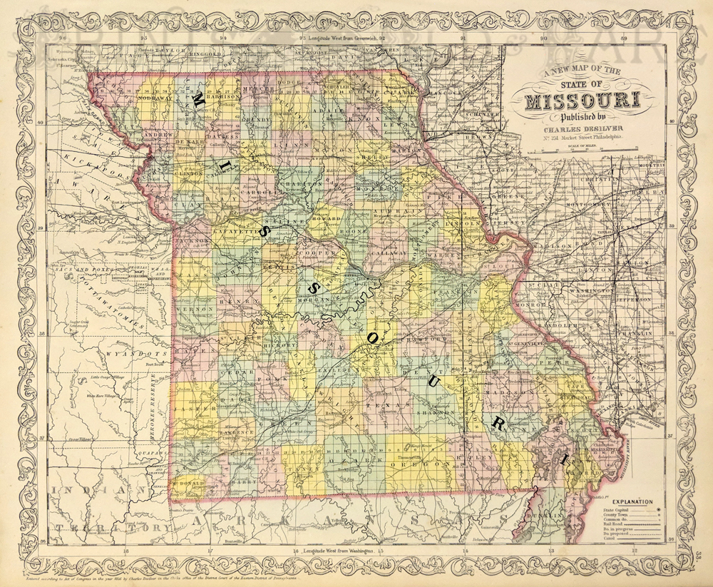 120mo: A New Map of the State of Missouri. Published by Charles Desilver. 1856. Showing the counties, towns, rivers, railroads, proposed railroads, canals and proposed canals. Hand colored, lithograph. 13 5/8 x 17 3/8 in. $250 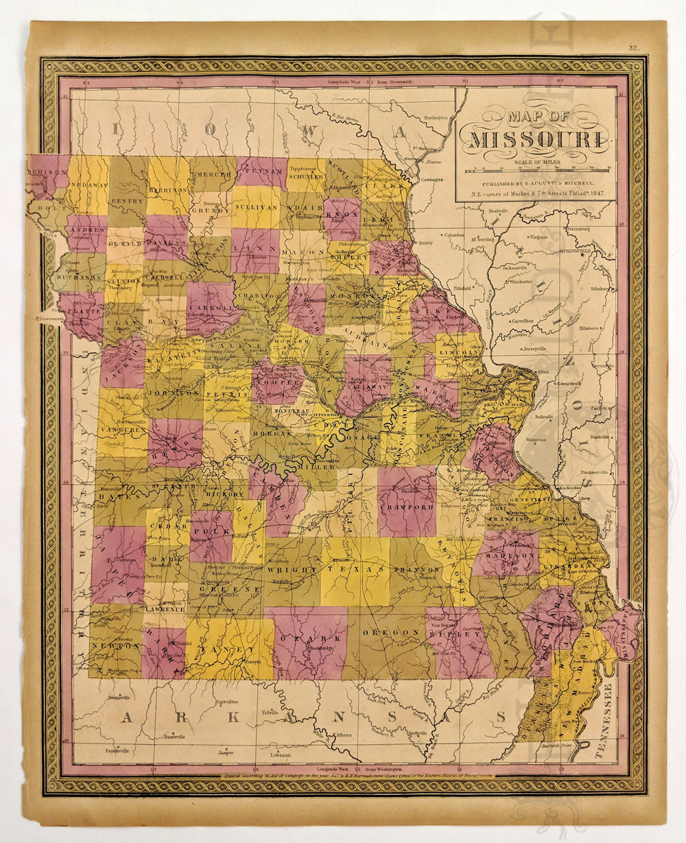 121mo: Map of Missouri published by S. Augustus Mitchell. 1847. Showing the counties, towns, lakes, mountains, post offices and forts. Hand colored, lithograph. 13 7/8 x 17 1/8 in. $200 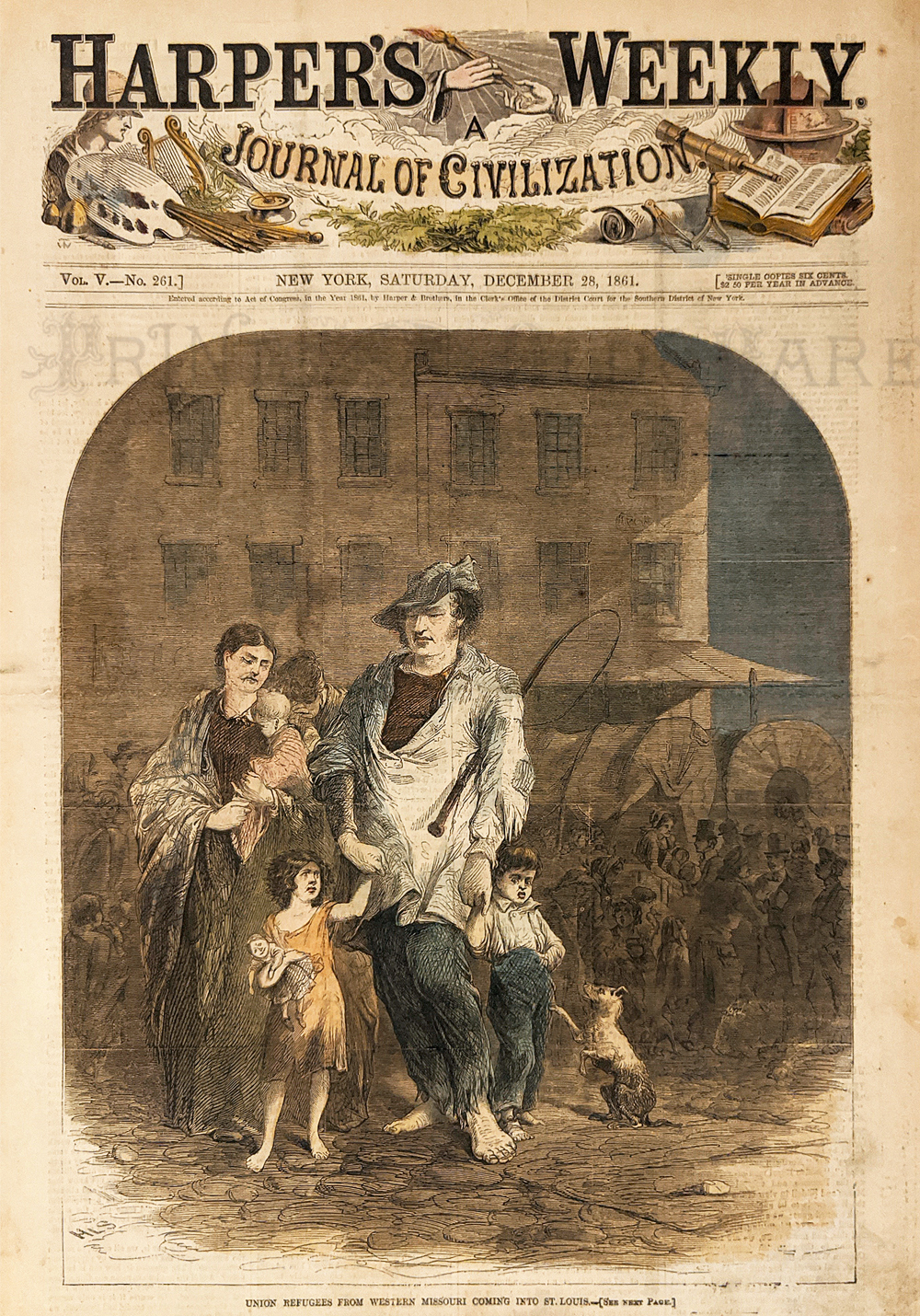 122mo: Civil War 1861. Union Refugees from Western Missouri being driving out because of Union supporters. Hand colored, wood engraving. 11 x 16 in. $50 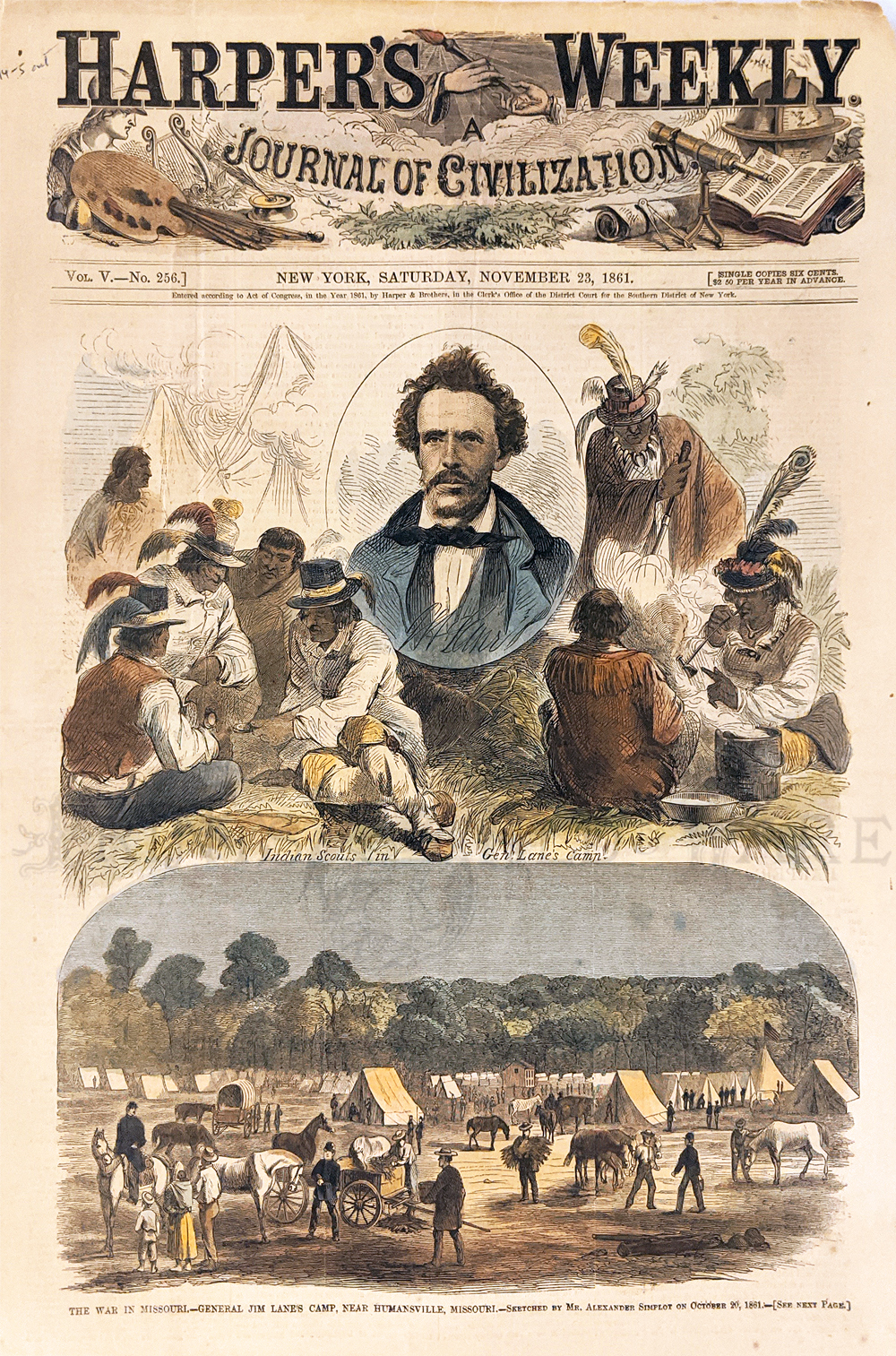 123mo: Civil War. Jim Lane – Colorful Civil War general and politician camp as Humansville with his large group of Indian Scouts, Delaware. Hand colored, wood engraving. 11 x 16 in. $60 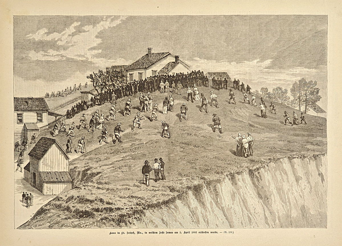 125mo: The house which Jesse James' was murdered on April 3, 1882. St. Joseph, Missouri. 1882 Frank Leslies' German edition. Wood engraving. 11x 15 3/4 in. $200 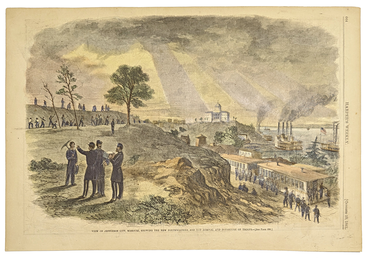 126Missouri: View of Jefferson City, Missouri, showing the new fortificaions, and the arrival and departure of troops. 1861 Harper's Weekly. Hand colored, wood engraving. 10 1/2 x 15 5/8 in. $60 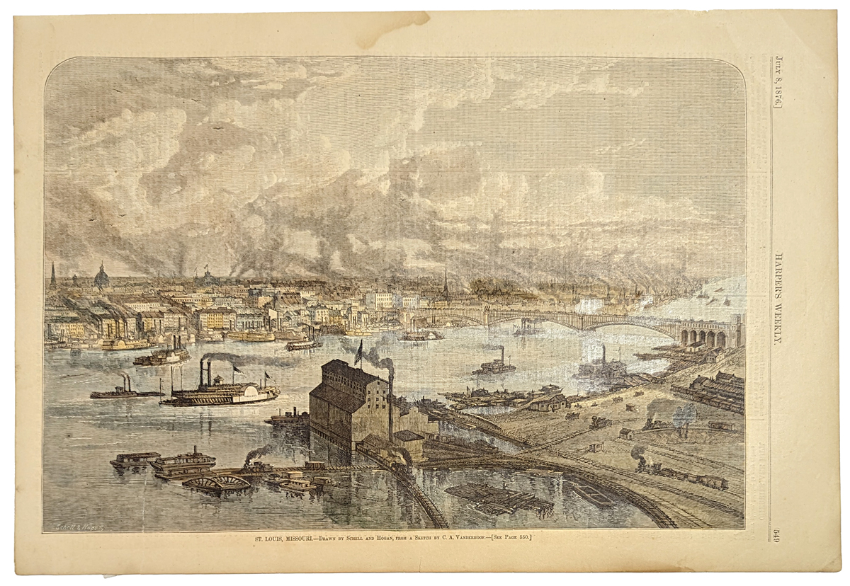 127Missouri: St. Louis, Missouri. Lovely birds eye view showing the bridge, railroads and steamboats. 1876 Harper's Weekly. Hand colored, wood engraving. 10 3/4 x 15 7/8 in. $100 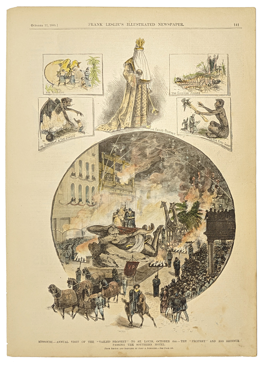 128Missouri: Missouri - Annual visit of the "Vailed Prophet" to St. Louis, October 6th - The "Prophet" and his retinue passing the southern hotel. 1885 Frank Leslies'. Hand colored, wood engraving. 11 x 15 3/4 in. $60 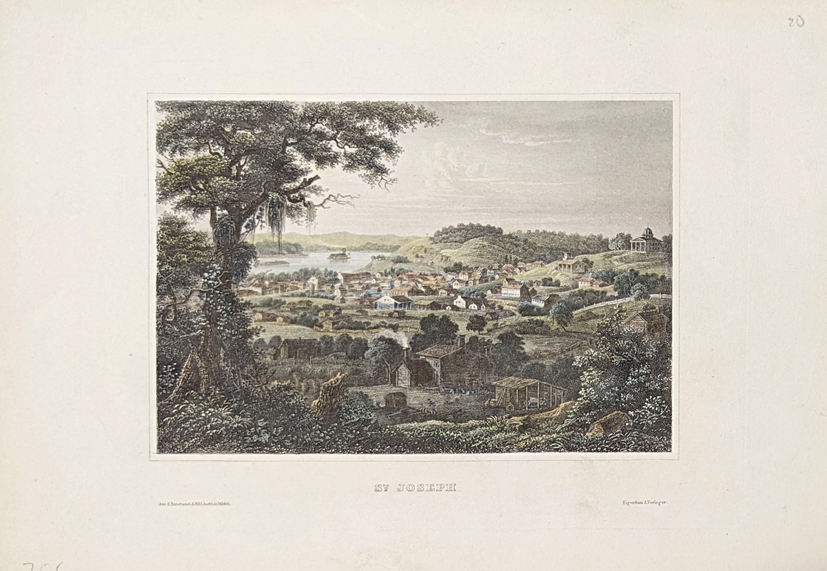 129Missouri: St. Joseph. Missouri River. 1850 Meyer. Hand colored, steel engraving. 7 1/4 x 10 1/4 in. w/ margins. $60 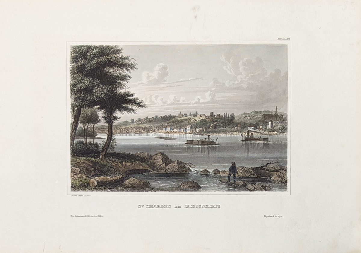 130Missouri: St. Charles on the Mississippi. 1850 Meyer. Hand colored, steel engraving. 7 1/8 x 10 3/8 in. w/ margins. $60 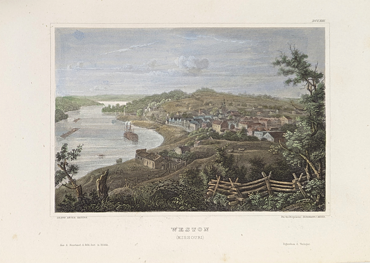 131Missouri: Weston (Missouri) - 1854 Meyer. Hand colored, steel engraving. 6 1/8 x 9 1/8 in. w/ margins. $60 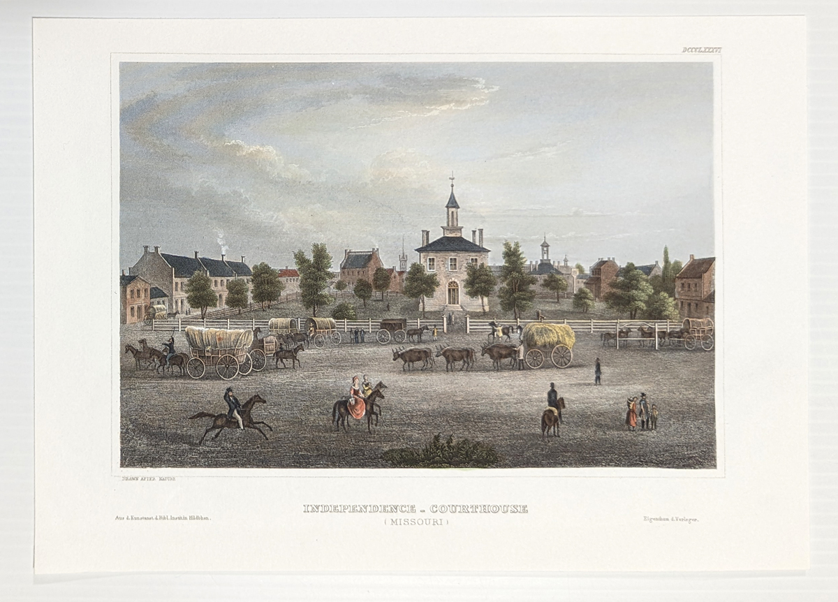 132Missouri: Independence - Courthouse (Missouri) - 1850 Meyer. Hand colored, steel engraving. 5 5/8 x 8 in. $60 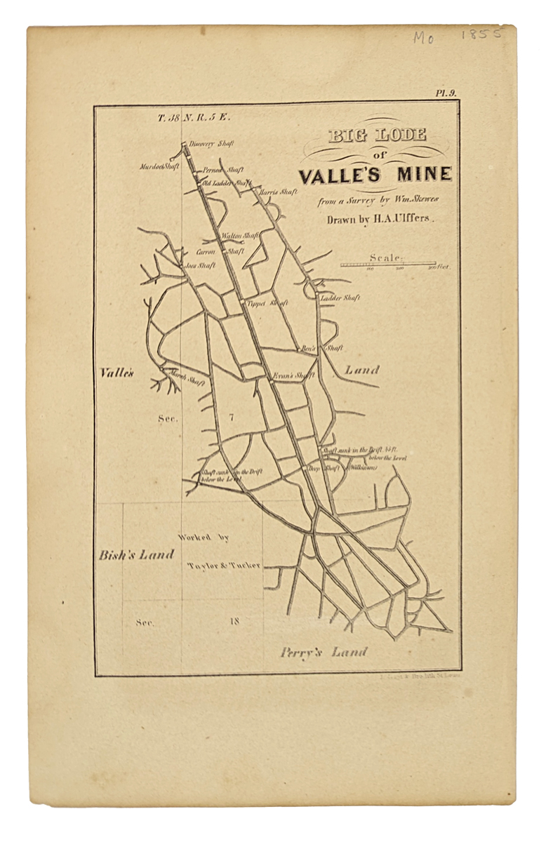 133Missouri: Big Lode of Valle's Mine. (Jefferson County) 1855. 6 x 9 5/8 in. $80 |
|||||||||
| Order Form | |||||||||||
| Back to Homepage | |||||||||||