|
|||||||||||
This is a small selection of our inventory of antique Montana maps and prints. Additional inventory is available. Contact us with your request. 1-800-879-6277
|
|||||||||||
|---|---|---|---|---|---|---|---|---|---|---|---|
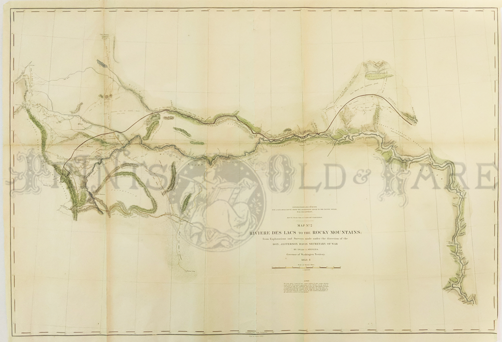 001Montana: Riviere Des Lacs to the Rocky Mountain. From Ft. Pierre to vicinity of Helena Montana. 1853 US Railroad Survey. Shows Missouri River and Camp areas. Lightly tinted lithograph. Water colored. Produced by War Dept. under Jefferson Davis and Isaac Stevens. 24 1/2 x 37 in. $300 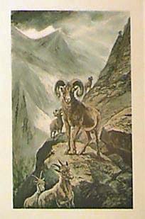
011mt: 1888 big Horn Sheep. Hand colored print (Montana). Fine view in the mountains. 12x18 in. $60 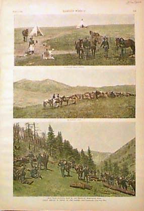
012mt: 1888 Indian Service of Troops, Montana border. Three hand colored views on one page. 10-1/2x16-1/2 in. $50 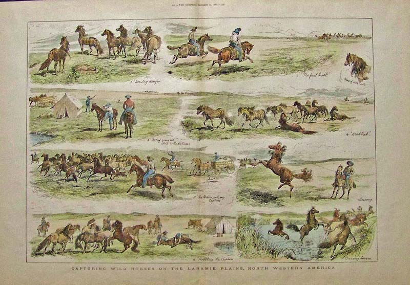 013Montana: 1887 The Graphic hand colored wood engraving titled, "Capturing Wild Horses on the Laramie Plains, North Western America." 22-1/2 x 16 in. $180 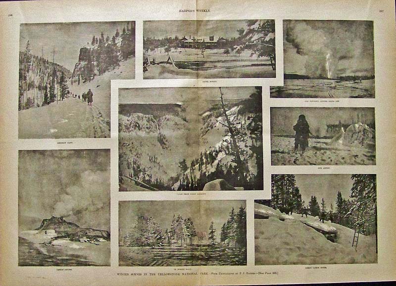
014Montana: 1887 Harper's Weekly half-tone images showing Winter Scenes in the Yellowstone NationalPark, taken from originalphotographs by F.J. Haynes. 22 x 16 in. $60 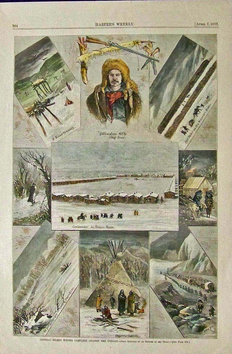
015Montana: 1877 Harper's Weekly hand colored wood engravings showing General Miles's Winter Campaign Against the Indians, from sketches by an Officer at the Front in that era. 16 x 11 in. $50 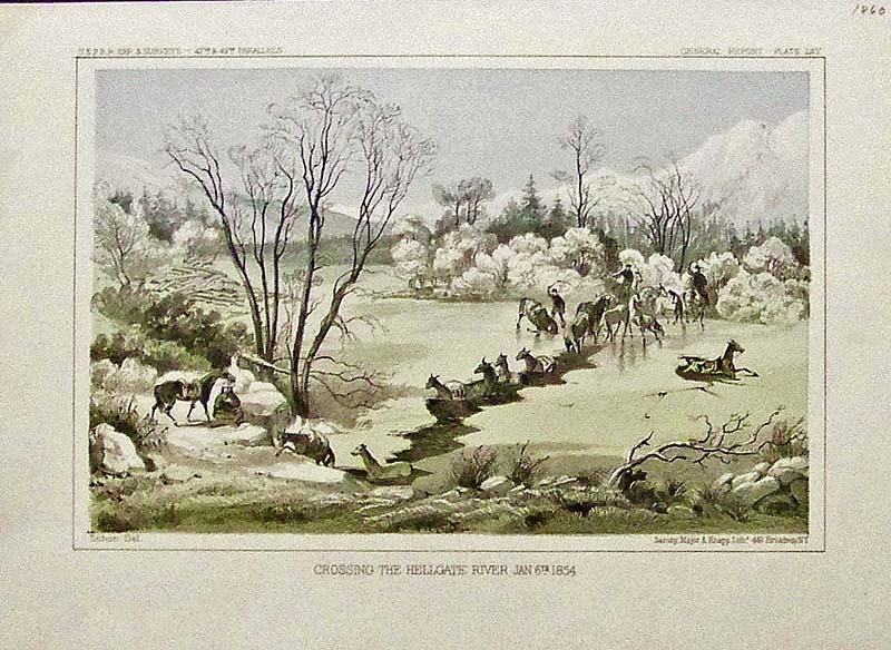
016Montana: 1860 USPRR General Report - Plate LXV hand colored lithograph titled, "Crossing the Hellgate River, Jan. 6th, 1854." Lithograph by Sarony, Major & Knapp. 11-1/2 x 8-1/2 in. $50 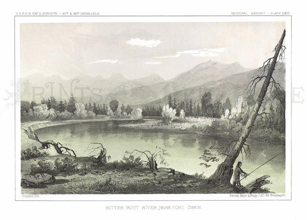
017Montana: 1855 USPRR Exp. & Surveys - 47th & 49th Parallels - General Report - Plate LXVI hand colored lithograph titled, "Bitter Root River, Near Fort Owen." Lithograph by Sarony, Major & Knapp. 11 x 8 in. $50 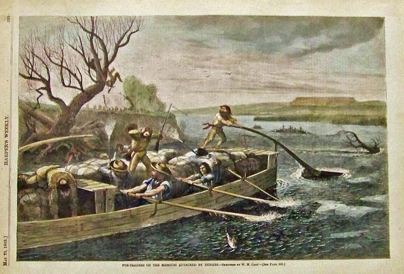
019Montana: 1868 Harper's Weekly hand colored wood engraving titled, "Fur-Traders on the Missouri Attacked by Indians." Sketched by W.M. Cary. 15-1/2 x 11 in. $80 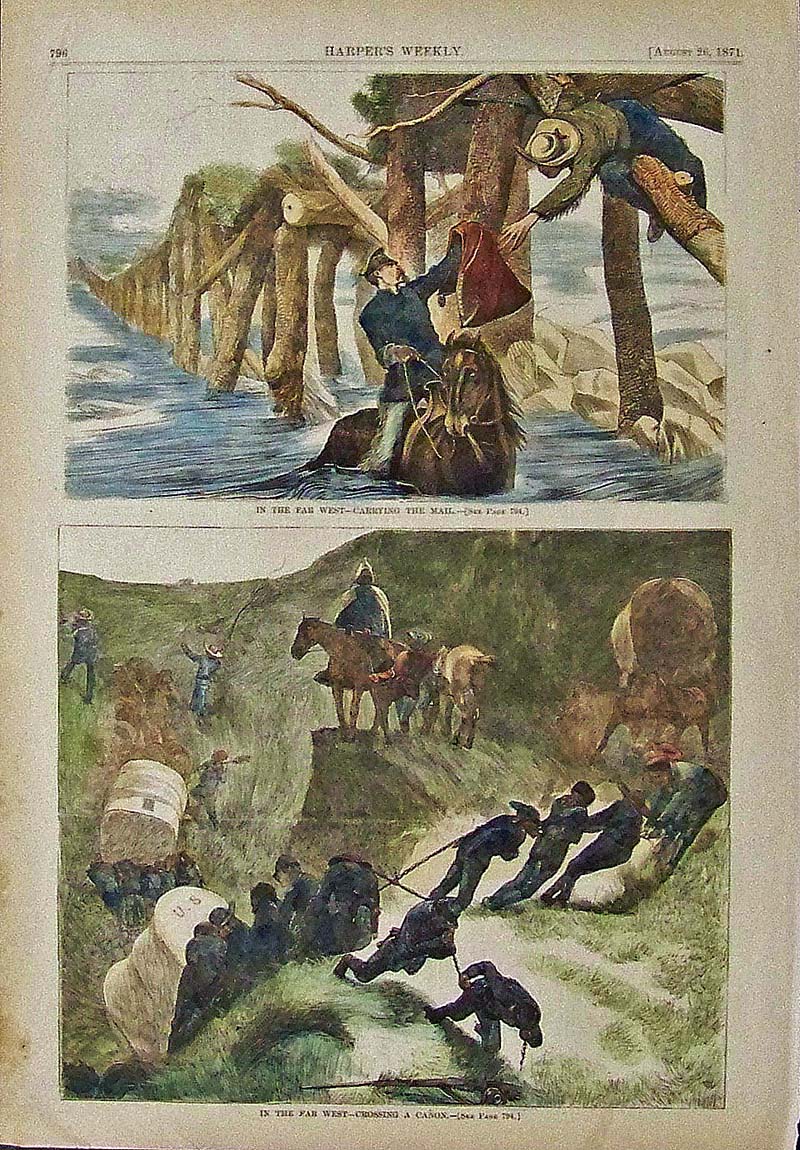
020Montana: 1871 Harper's Weekly hand colored wood engraving showing Carrying the Mail in the Far West in upper image and Crossing a Canon in the Far West in lower image. 15-1/2 x 11 in. $60 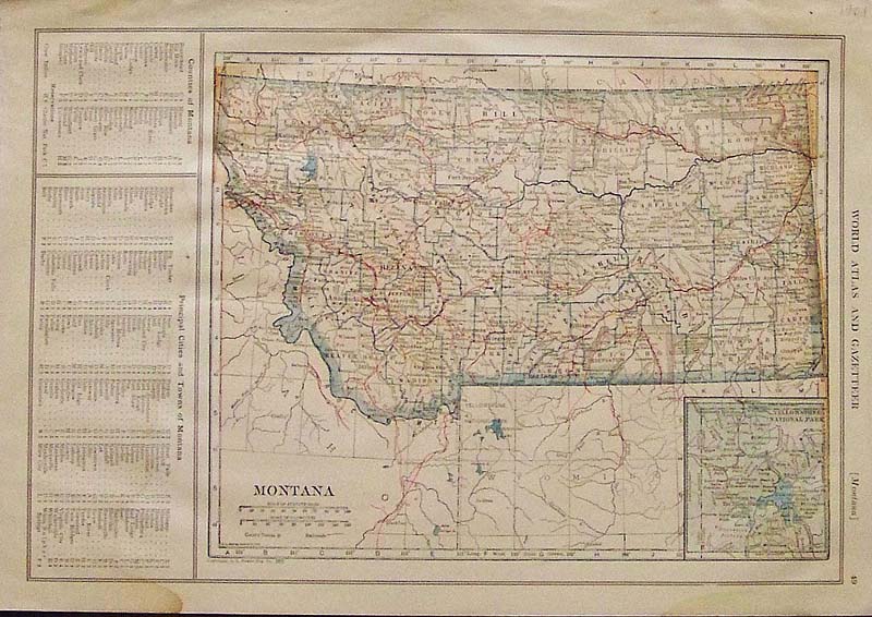
021Montana: 1921 Hand colored Montana map featured in the World Atlas and Gazetteer. Small inset of Yellowstone National Park on lower right and left side shows a guide to Montana Counties and its Principal Cities and Towns. 15 x 10-1/2 in. $30 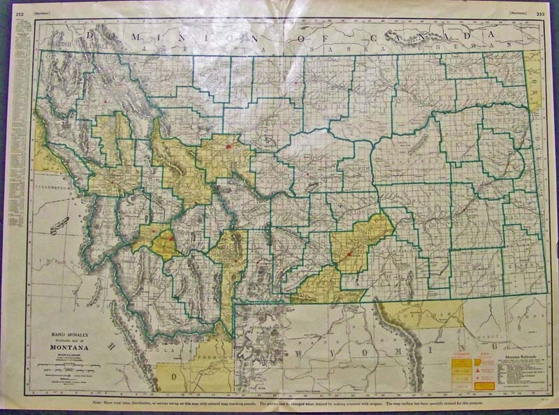 022Montana: Color Rand McNally Standard Map of Montana with guide to Cities on left border and Montana Railroads are shown on map with a Railroad key on bottom right. County and City population are shown bottom right as well. 27-1/2 x 20 in. $90 SOLD |
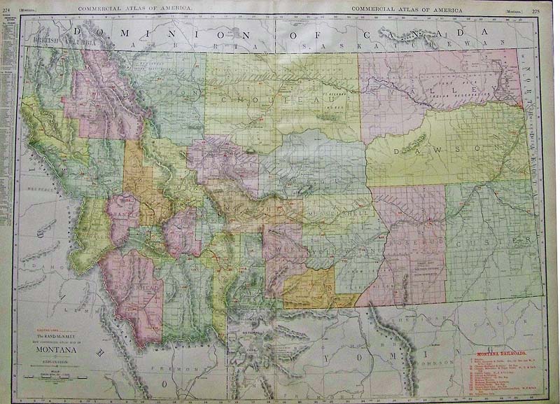
023Montana: 1912 Color Rand McNally New Commercial Atlas Map of Montana showing the Montana Railroads and electric lines Key to railroads is in bottom right of map and a Principal Cities guide is in left border. 28 x 20-1/2 in. $100 SOLD  028mt: 1853 Pelouse Falls. Beautiful color lithograph from an 1853 U.S. Government Railroad Survey report, showing the Pelouse Falls in Montana. Size: 6x9 in. $50 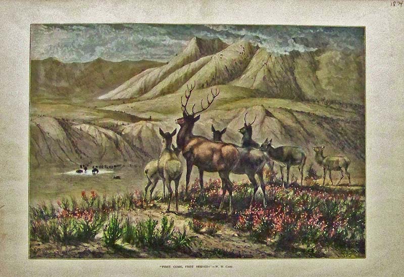 030mt: 1874 Hand colored wood engraving by W.M. Cary titled, "First Come, First Served!" 16 x 11 in. $100 
113mt: 1876 Sioux Indian War Scenes in Montana. Five hand colored, engraved images from the U.S. Army's campaign against the Sioux Indians. Each image has its own subtitle: 1) Massacre Monument; 2) Rosebud River, from the North Side of the Yellowstone; 3) Crook's Fight on Tongue River, June 9; 4) Crook's Supply Camp, on Tongue River, Mouth of Prairie Dog Creek; and 5) Fort Fetterman. 11x16 in. $50 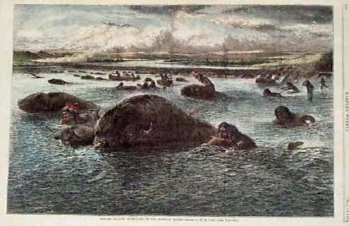 114mt: 1874: Indians Killing Buffalo in Montana. Beautifully hand colored scene from Harper's Weekly, titled "Indians Killing Buffaloes in the Missouri River." Shows Native Americans swimming across the river next to the buffalo, killing them in the water. 16x11 in. $60 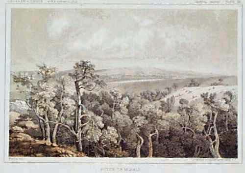
115mt: 1855 Montana View: Butte de Morale. Beautiful color lithograph from an 1855 US Government railroad survey report, showing the countryside around Butte de Morale. 8x11 in. $50 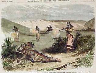
118mt: 1876 Montana Sioux Indian War Scene. Hand colored engraving from Leslie's Weekly, titled "Montana: the Sioux War. The Killing of a Sioux Warrior on the Morning After the Rosebud Battle, June 18th." A Native American man in traditional dress is shown being shot by Native Americans wearing US Army clothing. 8x11 in. $30 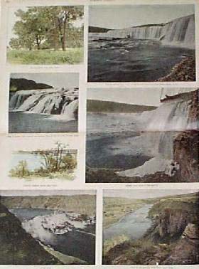
120mt: 1892 Great Falls Montana Views. Five hand tinted photographic views, and two engraved scenes, showing the area around Great Falls, Montana. Beautiful images of the falls and countryside around the Missouri River. 16x22 in. $100 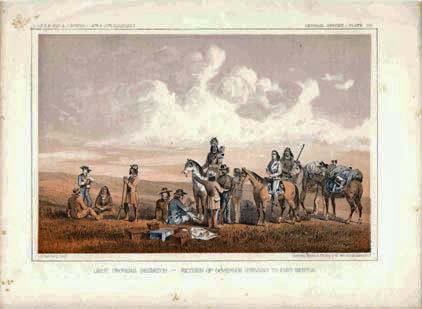 128mt: 1855 Lieut. Crovers Desptch- Return of Governor Stevens to Fort Benton. Railroad Survey litho view published by U.S. Government. 11-1/2x8-1/2 in. $50 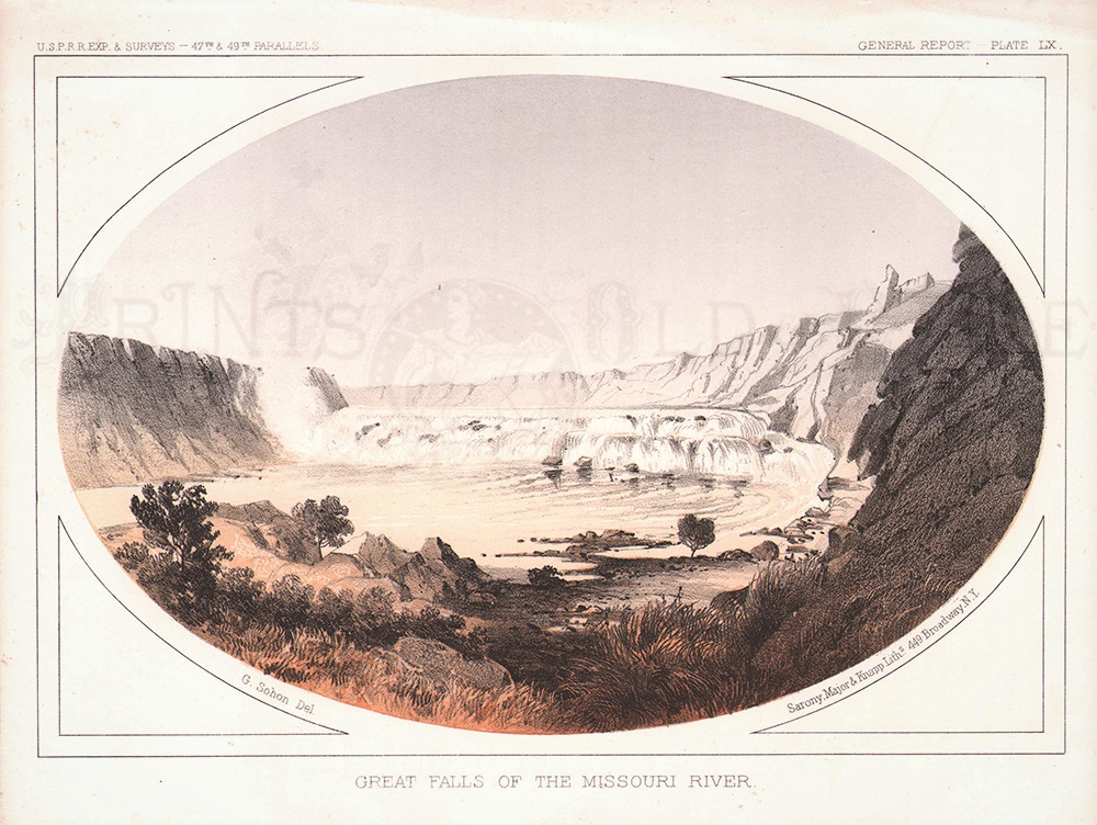 130mt: 1855 Great Falls, Missouri River Montana. Beautiful lithograph from a U.S. government railroad survey report. Title is "Great Falls of the Missouri River." Shows the falls as seen from a distance downstream. There is some light foxing on the image, but it is not visually distracting. 8x11 in. $60 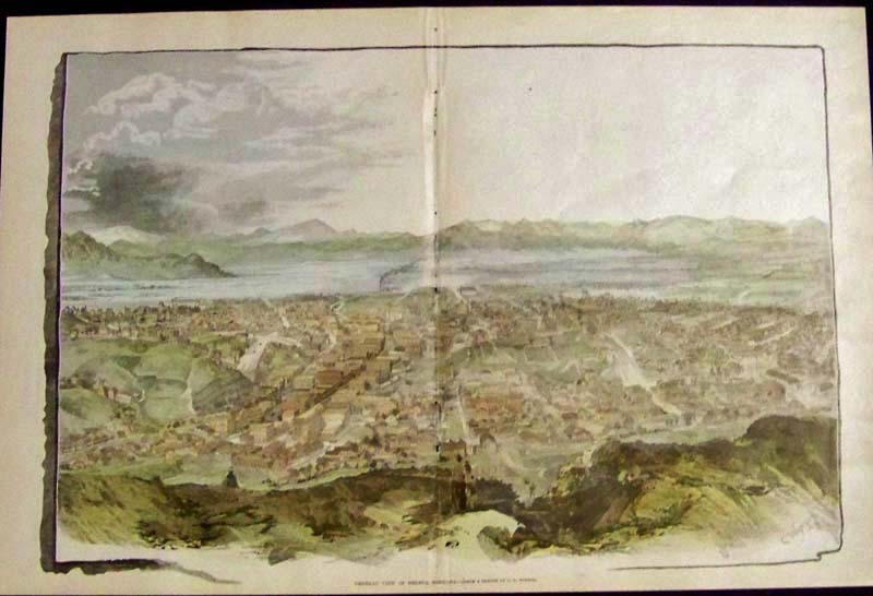 207mt: 1890 Rare double-page hand colored wood engraving titled, "General View of Helena, Montana," from a sketch by C.D. Winsor. Image shows a bird's-eye view of Helena, Montana. Page was featured in the Northwest Magazine in June of 1890. 20 x 13-1/2 in. $300 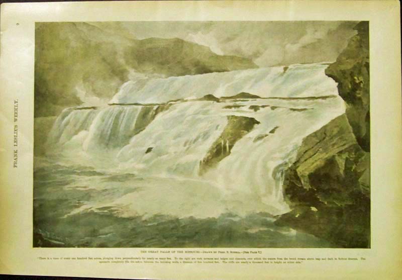 208mt: 1886 Hand colored half-tone engraving featured in Frank Leslie's Weekly by the artist Fred. B. Schell titled, "The Great Falls of the Missouri." 16 x 11 in. $90 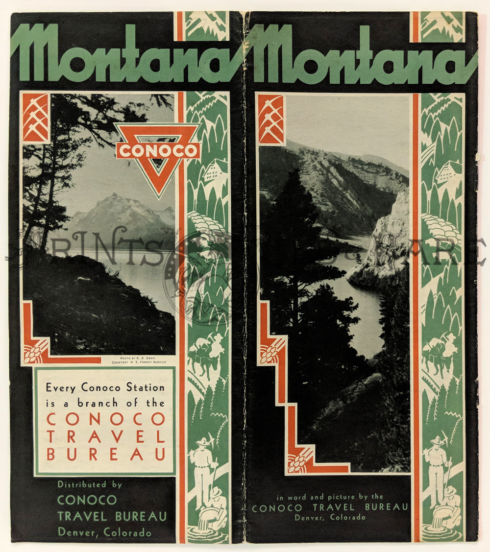 220mt: 1932 Montana Tourist Brochure by Conoco. Four-page brochure with photos and descriptions of interesting landmarks in the state of Montana. Published by the Conoco Travel Bureau in 1932. Also contains an index to points of interest in Montana, to be used with Conoco’s road map of the state. Very good condition. 8 x 9 in. $15 |
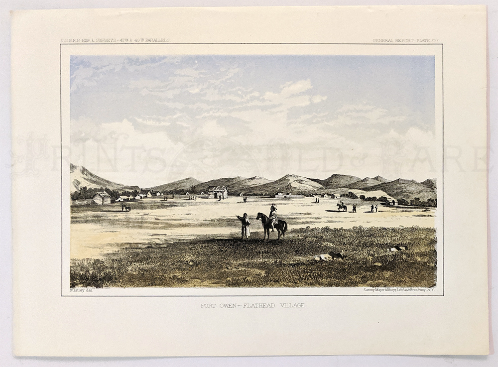 221mt: Ft. Owen, Flathead Village. 1855. USRR Survey - Created (South of Missoula) 8 1/2 x 11 1/2 in. $60 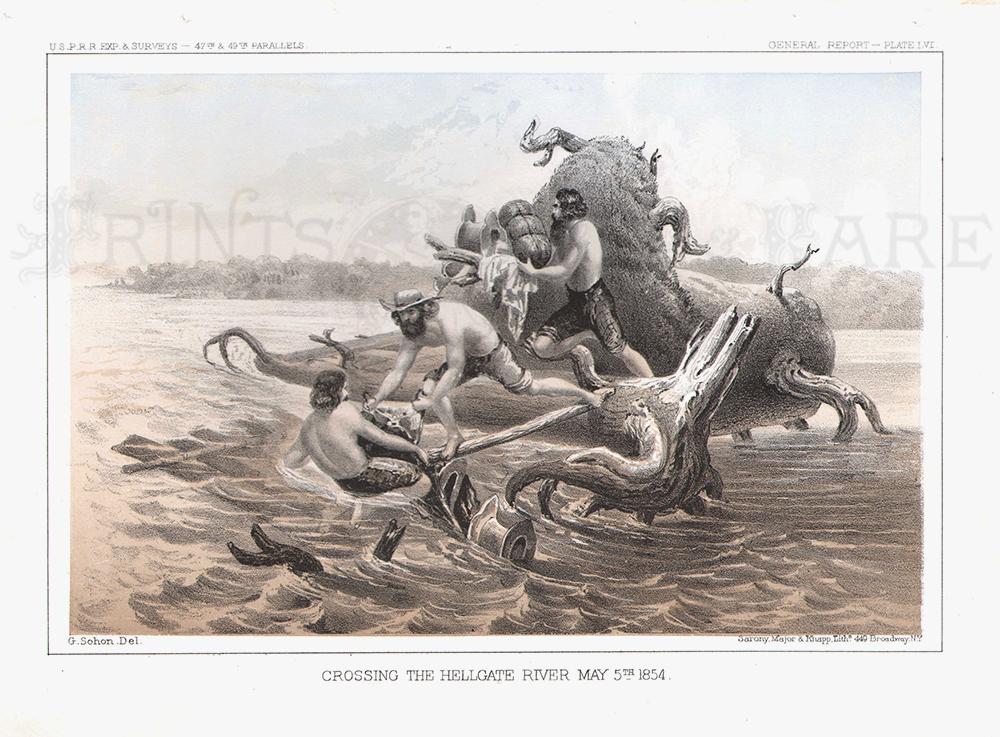 222mt: 1855 USPRR Exp. & Surveys - 47th & 49th Parallels - General Report - Plate LXVI hand colored lithograph titled, "Crossing The Hellgate River, May 5th, 1854." Lithograph by Sarony, Major & Knapp. 8 1/2 x 11 1/2 in. $60 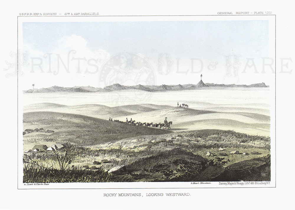 223mt: Rocky Mountains, Looking Westward. 1855. USPRR Survey. Plate LXIII. 8 1/2 x 11 1/2 in. $40 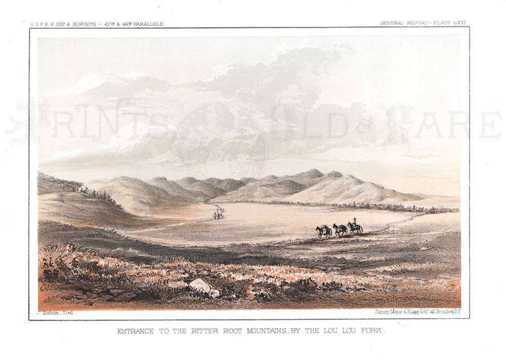 224mt: Entrance To The Bitter Root Mountains, By The Lou Lou Fork. 1855. USPRR Survey. Plate LVII. 8 1/2 x 11 1/2 in. $40 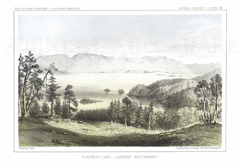 225mt: Flatehead Lake, Looking Southward. 1855. USPRR Survey. Plate IV. 8 1/2 x 11 1/2 in. $70 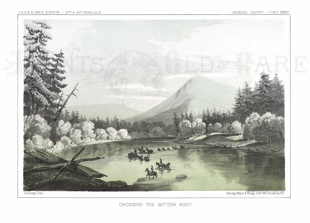 226mt: Crossing The Bitter Root. 1855 USPRR Survey. Plate XXIV. 8 1/2 x 11 1/2 in. $40 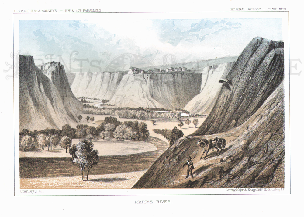 227mt: Marias River. 1855 USPRR Survey. Plate XXVI. 8 1/2 x 11 1/2 in. $40 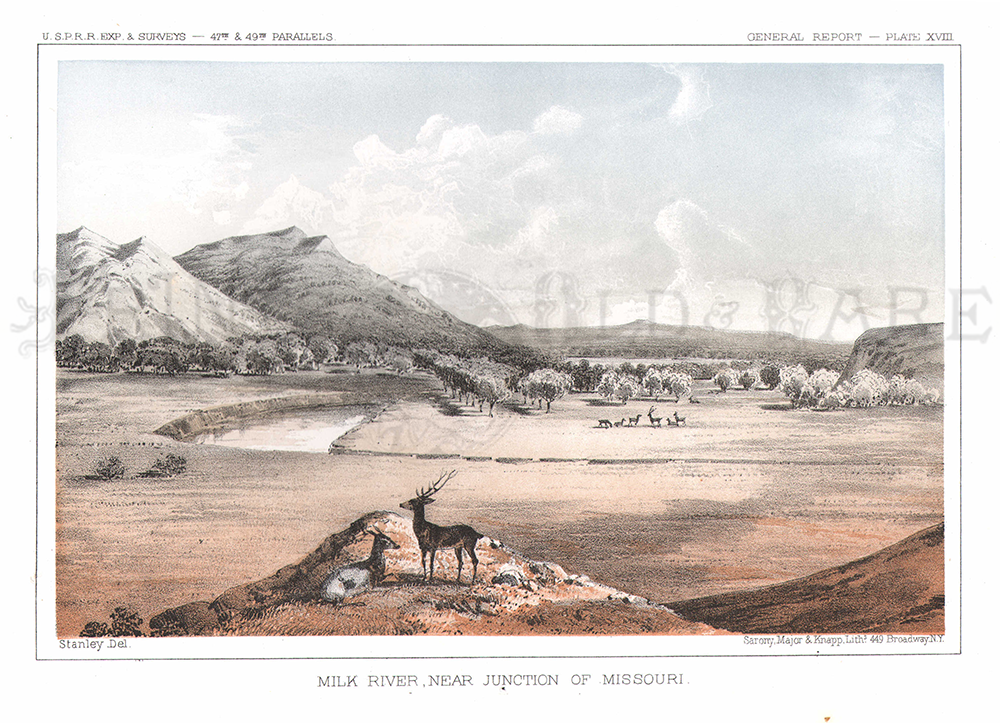 228mt: Milk River, Near Junction of Missouri. 1855 USPRR Survey. Plate XVIII. 8 1/2 x 11 1/2 in. $50 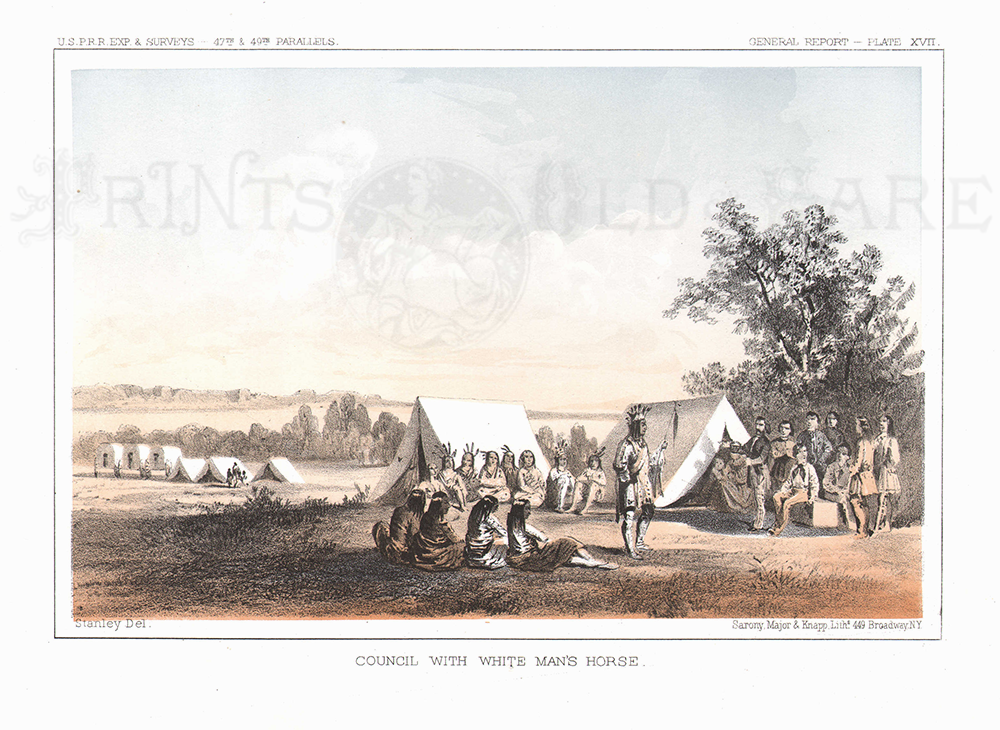 230mt: Council with White Man's Horse. 1855 USPRR Exp & Surveys. Plate XVII. 8 1/2 x 11 1/4 in. $50 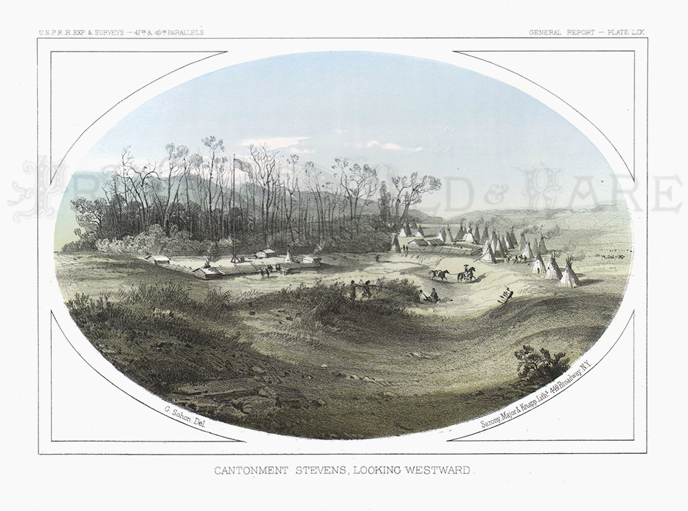 231mt: Cantonment Stevens, Looking Westward. 1855 USPRR Exp & Surveys. Plate LIX. 8 1/2 x 11 1/4 in. $40 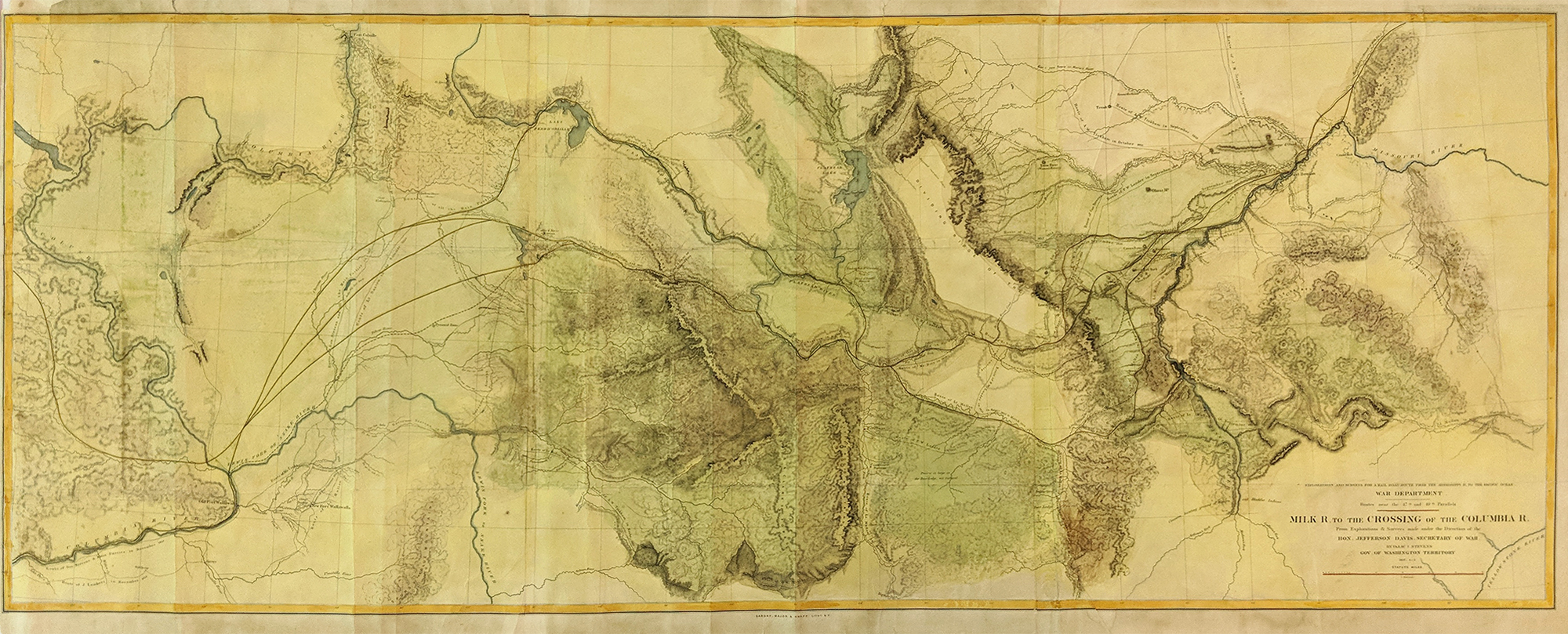 218mt: Milk River to Crossing of Columbia River. Large map from US Railroad Survey (1855) Expedition led by Gov. Stevens of Washington Territory. Shows rivers, routes, topography. Hand Colored lithograph - Orignally folded. 61 x 24 in. $400
|
|||||||||
| Order Form | |||||||||||
| Back to Homepage | |||||||||||